

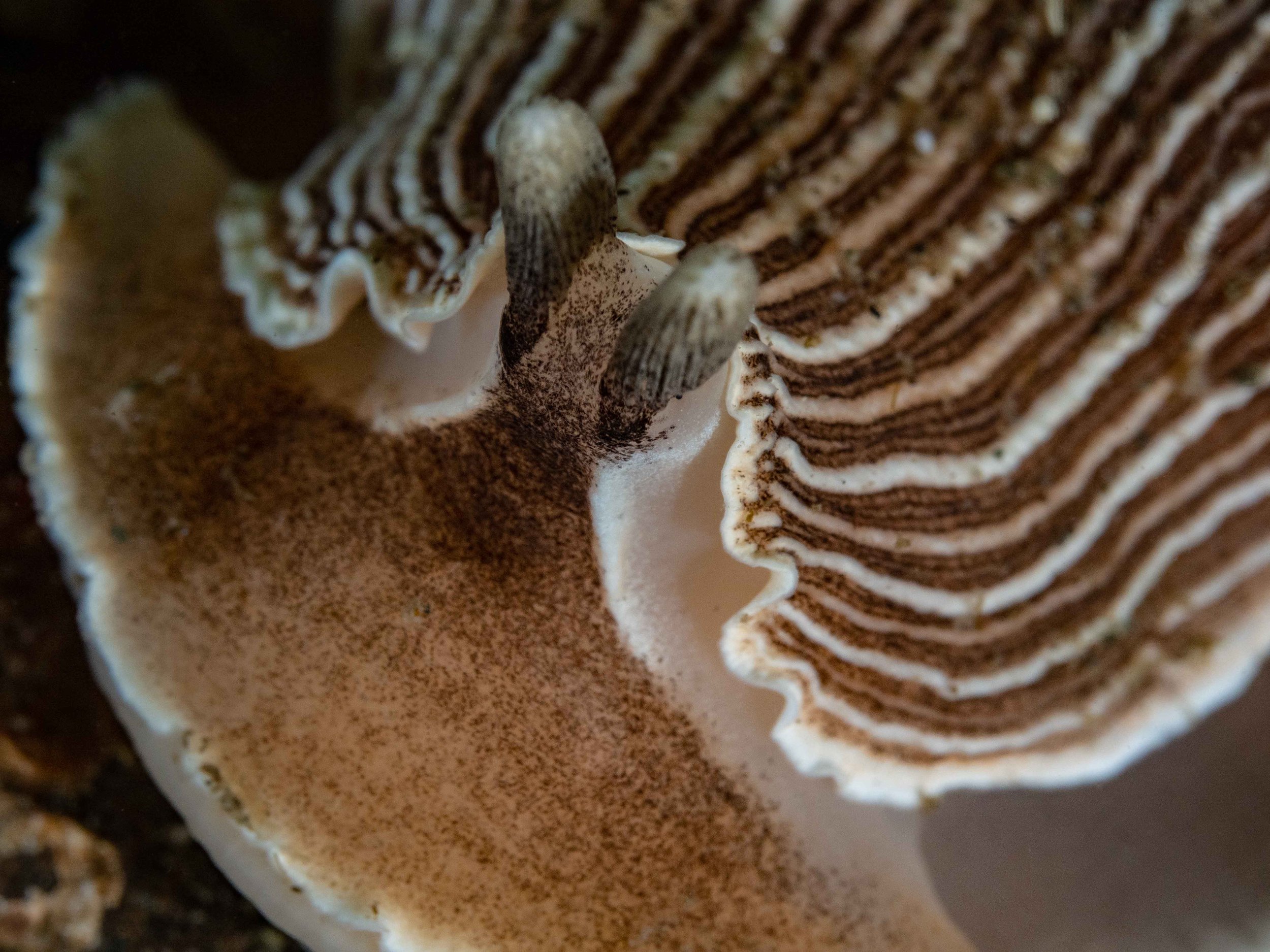
Underwater Wonders:The Vibrant World of Nudibranchs
With their brilliant colors and unique patterns, these vibrant sea slugs captivate divers and underwater photographers alike. Despite their small size, nudibranchs' diversity, intriguing behaviors, and ecological significance make every encounter unique
Story and Pictures by Thom Robbins
In the Pacific Northwest, divers can't help but talk about nudibranchs. With their brilliant colors and unique patterns, these vibrant sea slugs captivate divers and underwater photographers alike. Despite their small size, nudibranchs' diversity, intriguing behaviors, and ecological significance make every encounter unique. Observing their feeding habits or marveling at their colors and patterns turns an ordinary dive into an extraordinary experience. It's no wonder dive enthusiasts travel from around the world to places like the Salish Sea to see these mesmerizing creatures.

How to pronounce “Nudibranch”
The word nudibranch is pronounced “Noo-de-brank”, with the ‘ch’ making a ‘k’ sound. The name nudibranch comes from Latin and Greek. “Nudi” means naked in Latin, and “Brankia” means gills in Greek. This name suits them well since their gills are exposed on their backs.

Nudibranchs, or sea slugs, are marine gastropod mollusks with unique sensory systems. They belong to the Mollusk family, which includes snails, slugs, and octopuses, and are closely related to land-based slugs and snails. With their dazzling colors and intricate patterns, nudibranchs are some of the ocean's most visually striking creatures. They have long captured the imagination of both scientists and divers. With about 3,000 known species of nudibranchs worldwide, scientists believe many more remain undiscovered. Approximately 300 species have been documented in the Salish Sea. With their extraordinary colors and behaviors, nudibranchs are a fantastic example of evolution and still hold many mysteries.
Nudibranchs have been known to humans for thousands of years, but scientific classification began in the late 18th and early 19th centuries. The first recorded description was in 1691 by English naturalist John Ray, who described a species of "sea mouse." Recent advances in technology and imaging have made studying nudibranchs easier, revealing new insights into their biology and behavior. High-resolution microscopes and genetic analysis techniques help scientists examine their anatomy and evolutionary history in greater detail.
Nudibranchs are primarily found on the ocean floor, where they gracefully navigate using a broad, flat muscle on their underside called a foot. This muscular foot allows them to glide slowly over the substrate, often at a pace of just a few centimeters per minute. However, some species can swim short distances in the water column by undulating their foot muscle in rhythmic waves. This unique movement, though still relatively slow compared to other marine creatures, adds elegance and adaptability to these fascinating sea slugs as they explore the diverse habitats of the Salish Sea.
Nudibranchs are omnivorous and have oral tentacles near their mouths that act like hands to help them search for food. They also possess a set of curved teeth called a radula, similar to a toothed tongue. The radula allows them to scrape food off surfaces, munching on various organisms, including hydroids, seaweed, corals, algae, barnacles, fish eggs, sponges, anemones, and even other nudibranchs. While some species enjoy a diverse diet, others are picky eaters, consuming only one type of prey. Interestingly, some nudibranchs can even feed on other sea slugs, including those of their species. In this way, nudibranchs play a crucial role in the Salish Sea's food web, helping regulate other organisms' populations.
Nudibranchs have poor vision and can only discern light and dark, so they sense the world through two highly sensitive tentacles called rhinophores on their heads. Unfortunately, these rhinophores tend to stick out and serve as a lure for hungry fish. However, most nudibranchs can withdraw their rhinophores into a receptacle in their skin when they sense danger.
Nudibranchs also have symbiotic relationships with certain organisms in the Salish Sea—for example, some nudibranchs partner with zooxanthellae, a type of algae that lives inside their bodies. The nudibranch provides a safe and protected environment for the algae, and in return, the algae give the nudibranch energy through photosynthesis.
Gallery of nudis
Photos by Thom Robbins


The Lifecycle of a Nudibranch
Nudibranchs are hermaphrodites, possessing both male and female reproductive organs, allowing them to mate with any mature species member. Finding a suitable mate can be challenging as they must locate a partner of appropriate size, age, and species. Although mating is crucial for survival, nudibranch mating behavior is not fully understood.
Since nudibranchs do not roam far and have a short lifespan, ranging from one week to one year, their survival depends on mating whenever the opportunity arises. After a brief courtship, the mating ritual takes only a few minutes. Nudibranchs lay ribbon-like egg masses that hatch into free-swimming larvae, eventually settling on the seafloor as adults.
When two nudibranchs meet, they engage in a mating dance involving various physical interactions, which differ depending on the species.
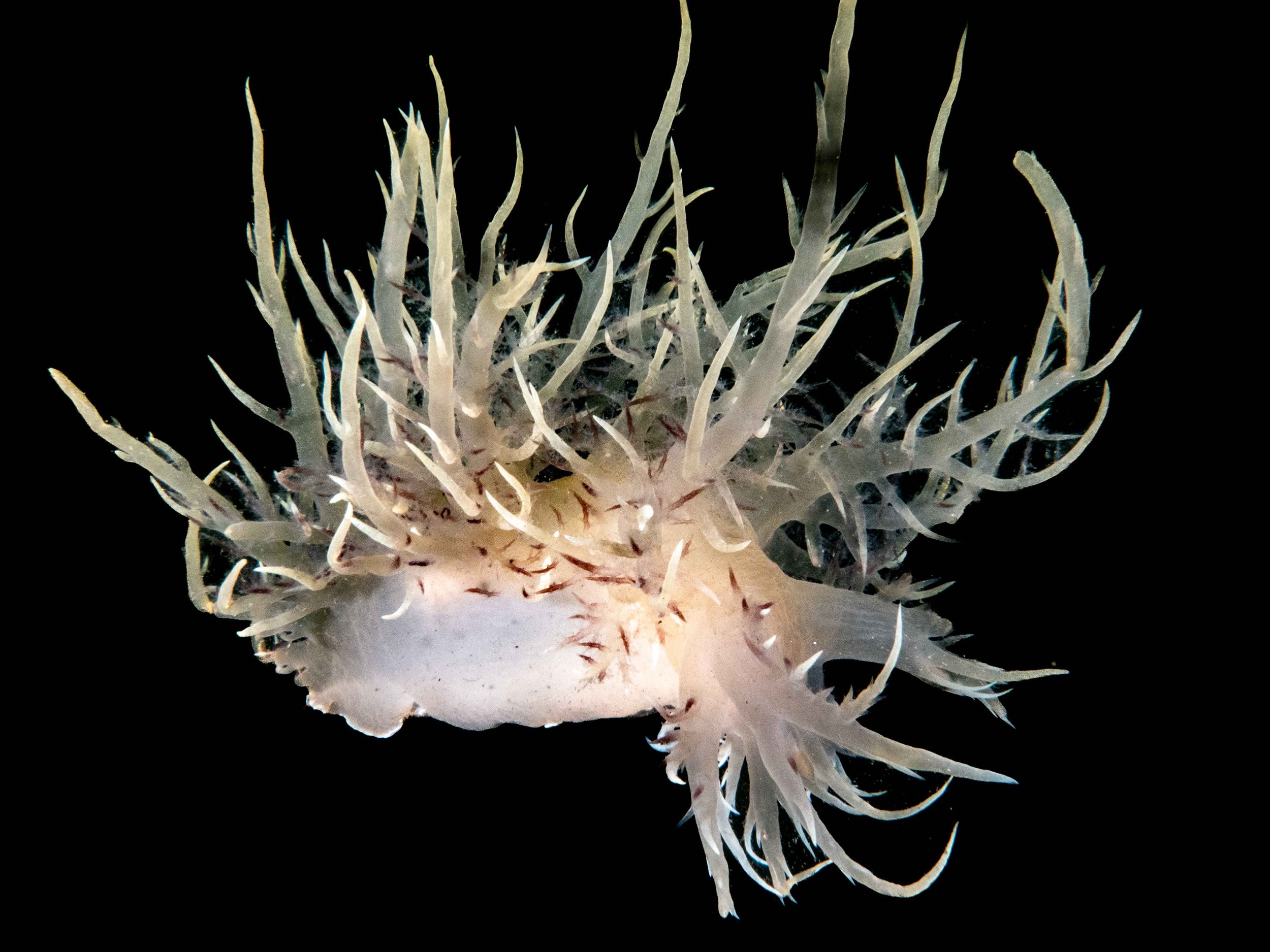
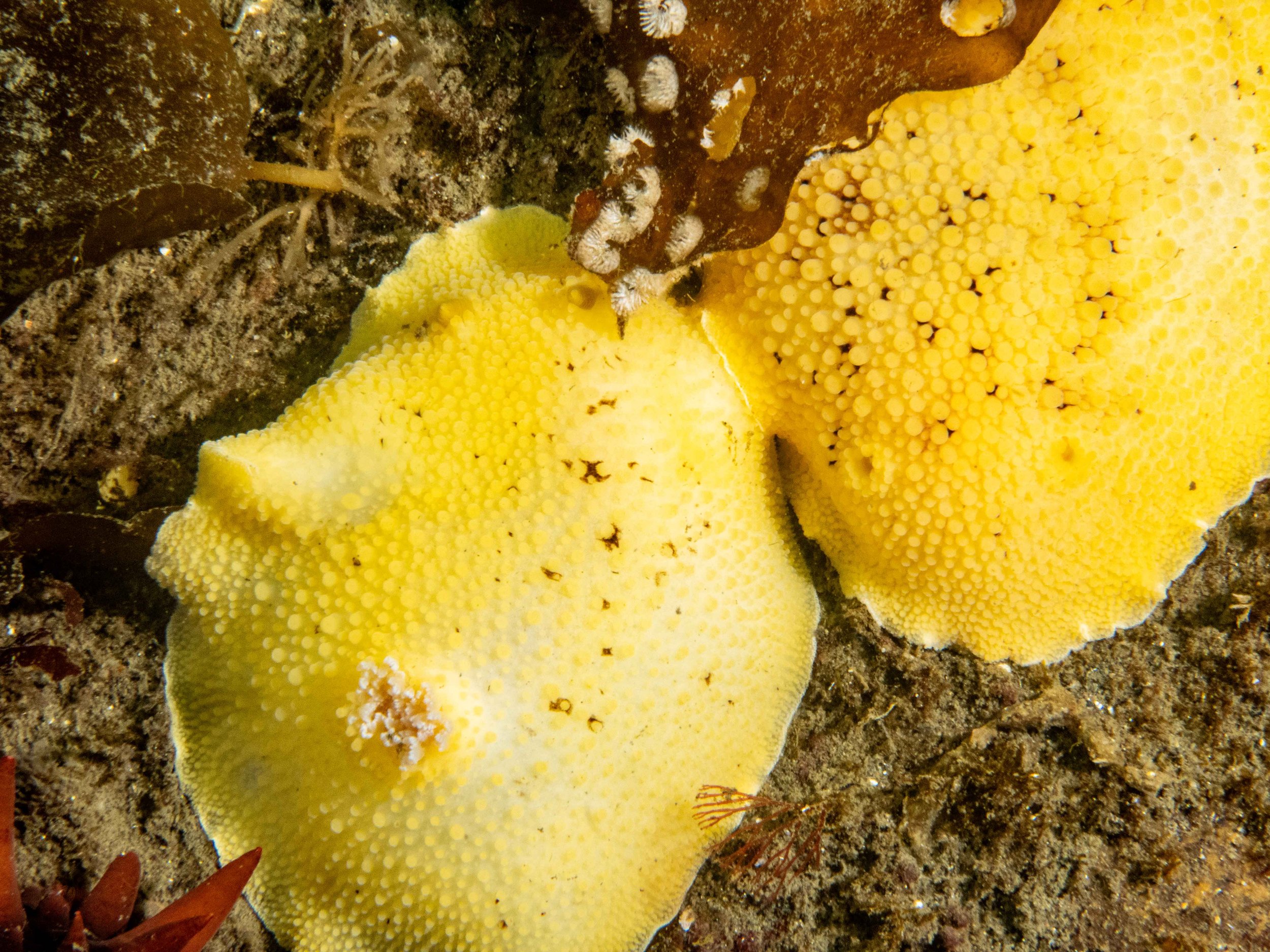
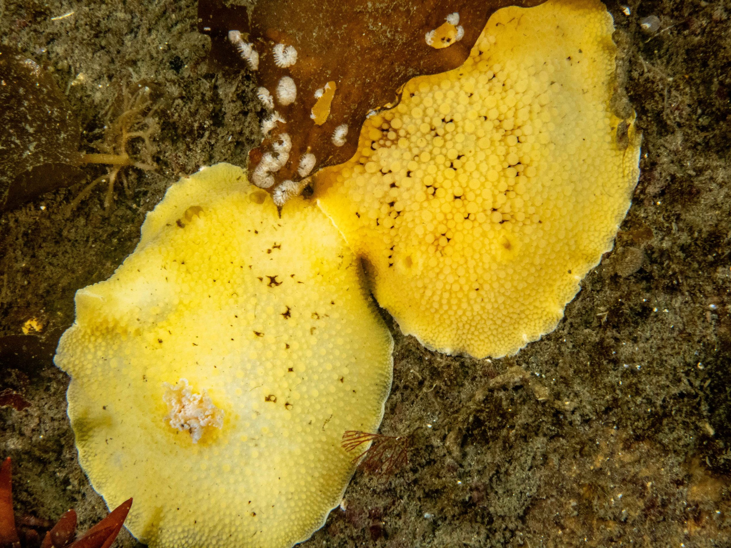
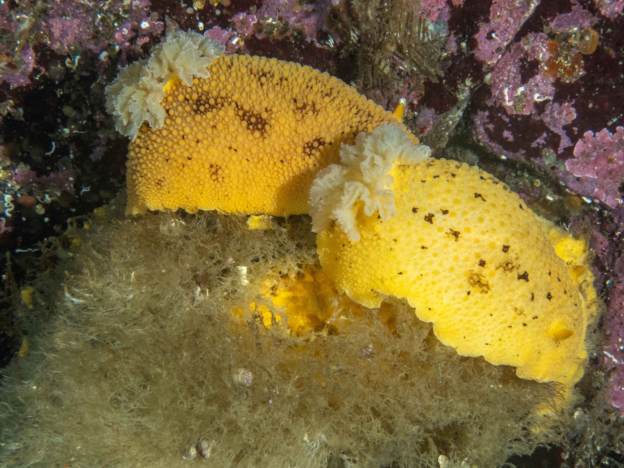
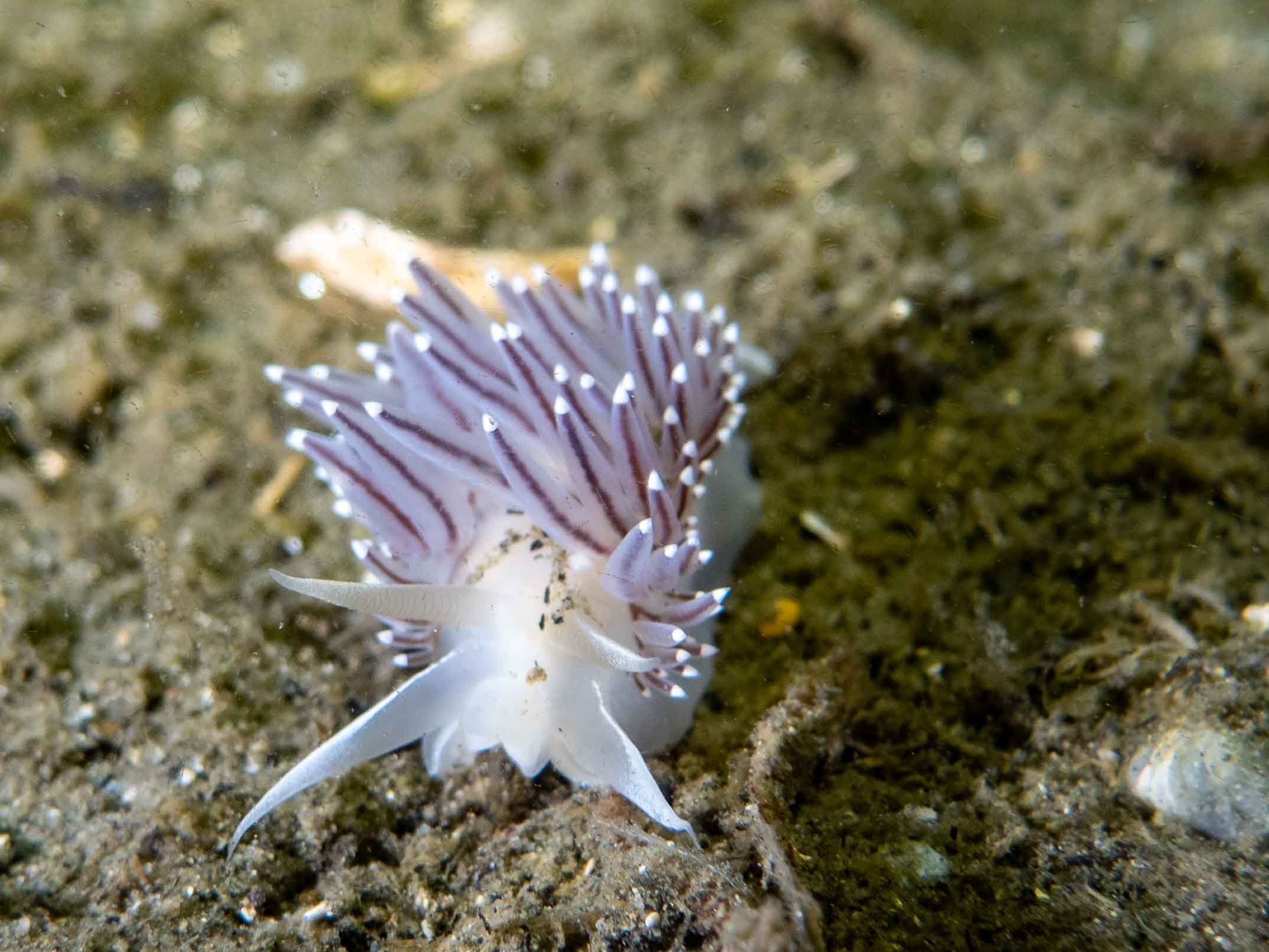
Several nudibranch species have interesting mating practices and reproductive strategies. For instance, the sea lemon nudibranch is known for its elaborate courtship dances, while the opalescent nudibranch has more solitary and secretive mating habits. The mating process finishes with one nudibranch inserting its penis into the other's genital opening to transfer sperm and fertilize the eggs.
The dance of the sea lemon nudibranch is a captivating display of intricate behaviors. It begins with the nudibranchs detecting chemical signals through their rhinophores and sensory organs. Once a potential mate is identified, they initiate a series of movements and interactions. Sea lemons may swim in circles around each other, using rhythmic body contractions to create water currents.
They align their bodies and exchange tactile touches using oral tentacles and rhinophores, including stroking or tapping each other. These interactions allow them to assess their potential mate's size, texture, and readiness and to exchange chemical cues through skin contact to determine compatibility and reproductive readiness. The sea lemon courtship can last several minutes or even hours. If they find a compatible mate, they align their bodies side by side and mate.
The opalescent nudibranch engages in a mesmerizing courtship behavior known as "chaining" or "following." It begins with one nudibranch following the slime trail left by another. The follower extends its oral tentacles to touch the rear end of the leading nudibranch, triggering a reciprocal response. This back-and-forth interaction can continue for quite some time.
During courtship, they may touch each other with their oral tentacles, antennae, and rhinophores, intertwining their bodies or forming a chain-like structure with multiple individuals. This behavior helps them assess each other's compatibility for mating by exchanging chemical cues through their slime trails, which convey information about reproductive state and readiness. This courtship dance allows them to determine species compatibility, identify potential mates, and ensure successful reproduction.
Nudibranchs also engage in chemical warfare during mating. They can produce and store toxic compounds from their food, such as sponges and algae, in specialized glands in their bodies. These toxins are a defense mechanism against predators and can also repel unwanted mating advances. If a nudibranch is not interested in mating, it can release a cloud of noxious chemicals to discourage further advances.
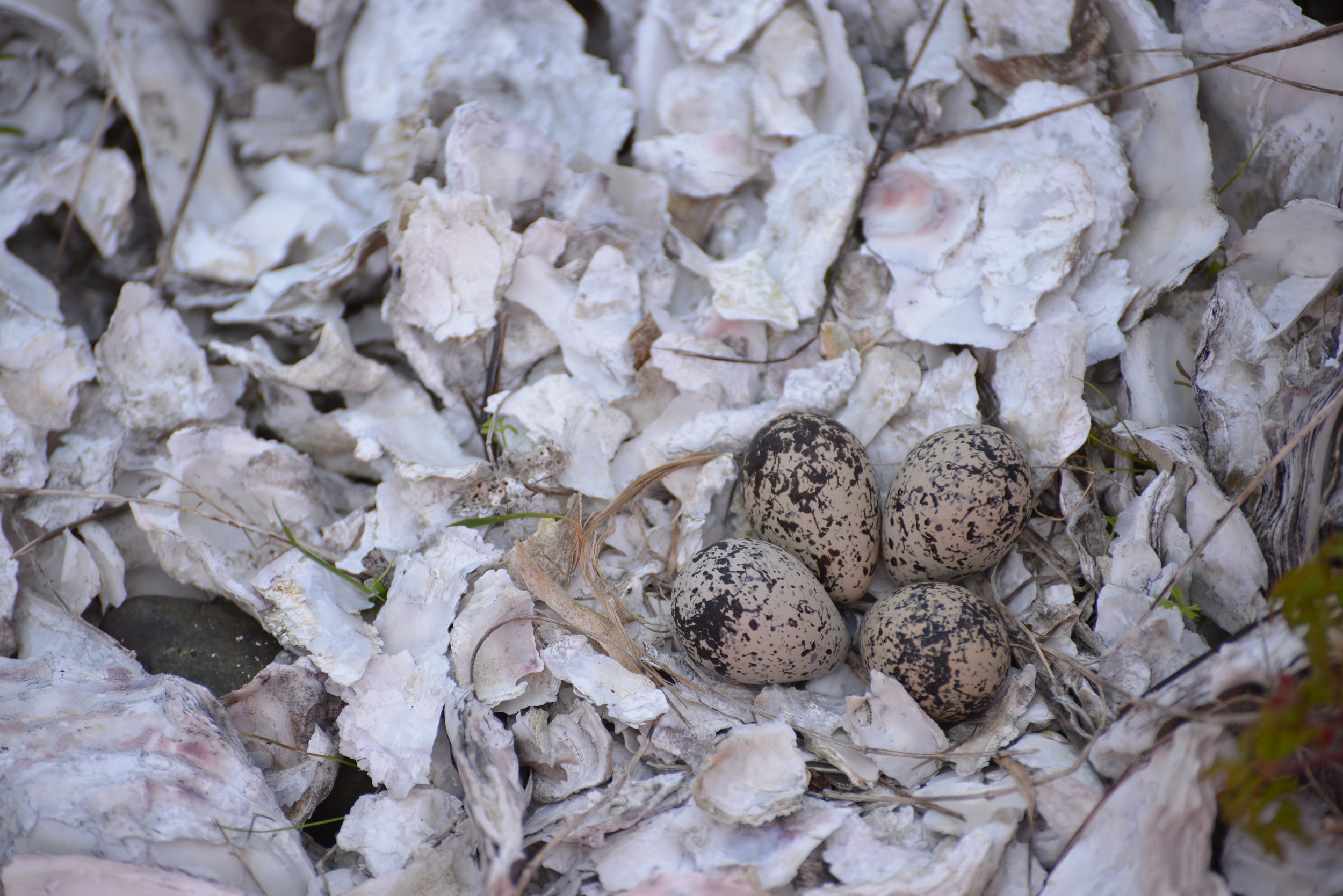
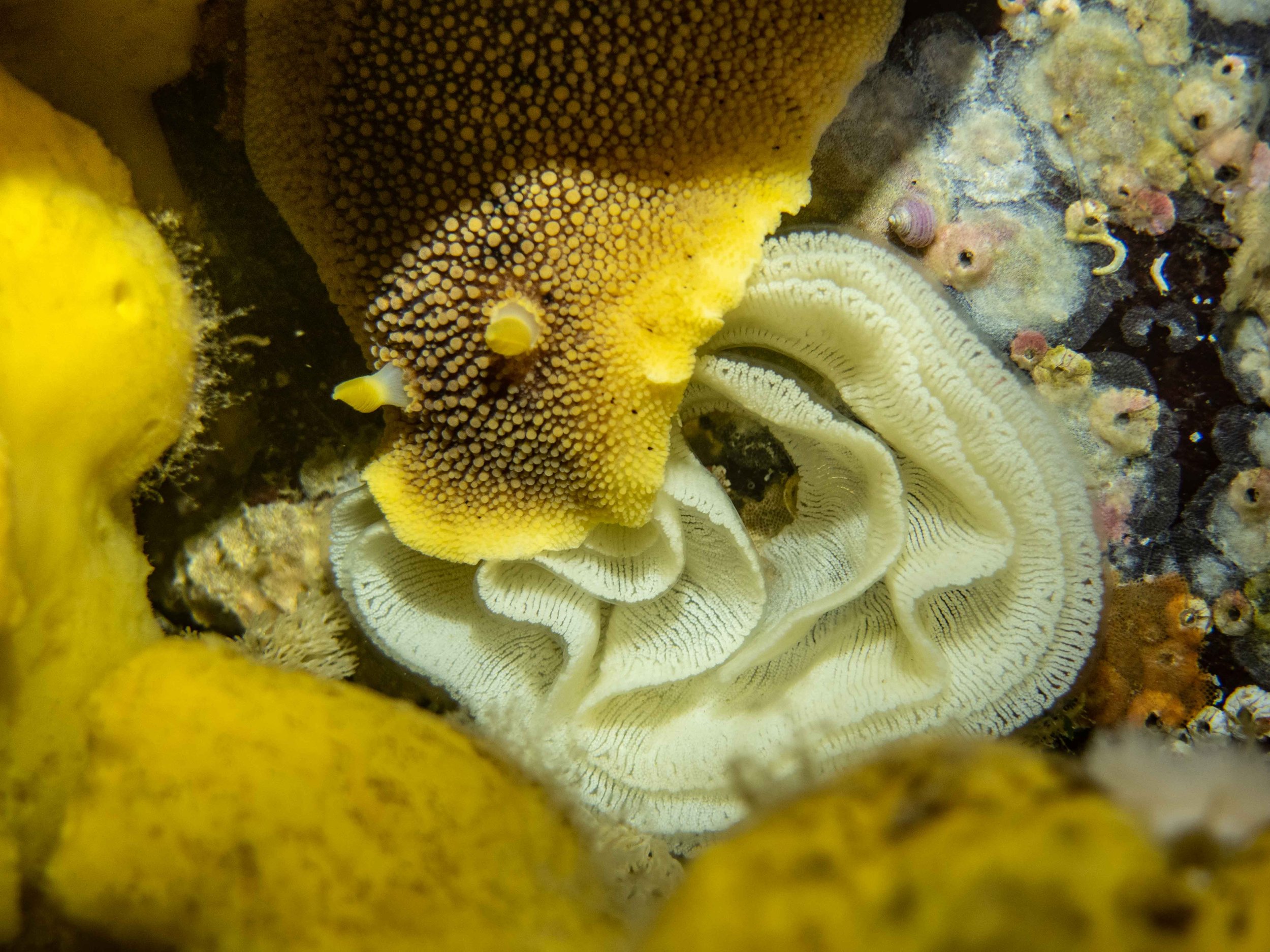
After mating, nudibranchs lay their eggs in long ribbons or strings sheathed in protective mucus. Although adults don’t care for the eggs, some species cover them with defensive chemicals to deter predators. Family size varies by species, with some laying just a few eggs and others depositing several hundred or even millions. The egg ribbon protects the developing eggs, and nudibranchs often lay them in locations that provide optimal conditions for growth and survival. The eggs hatch into tiny larvae that drift in ocean currents for several weeks before settling on a suitable substrate and developing into adult nudibranchs.
In our area, nudibranch eggs hatch in two ways: as tiny larvae with shells that swim and feed in the plankton or as miniature adults. The swimming larvae, known as veligers, must find the right food before they settle down and grow into small adults. The juvenile nudibranch feeds on tiny organisms like algae and small invertebrates for several weeks. As it grows, it will feed on larger prey such as sponges and hydroids. Nudibranchs have feeding mechanisms that set them apart from other mollusks. They have an oral hood that extends over their mouth, which they use to capture prey. This oral hood contains several rows of sharp teeth that can pierce the prey's outer layer and inject it with digestive enzymes.The time it takes for a nudibranch to grow to maturity can vary depending on the species, but it typically takes several months to a year. When the nudibranch reaches maturity, it begins to search for a mate.
Conclusion
Diving into the waters of tour area transforms the ordinary into extraordinary. As you descend, a serene quietness envelops you, like an explorer charting new frontiers. Camera in hand, navigate this alien landscape, like an astronaut on an oceanic planet. The vastness of the reef invites you to uncover its secrets. Glide along its surface, examine each nook and cranny with curiosity. Vivid marine life enchants, with each nudibranch a brilliant stroke from nature’s palette. In this underwater maze, the adventure takes an exciting turn. A nudibranch appears, its vibrant colors catching your attention. The incredible beauty of these creatures sharpens focus. Point, click, forever preserving your encounter with the dazzling nudibranch.
To learn more about diving locally to see nudibranchs, visit the Sund Rock Marine Preserve, or contact YSS Dive Charters . Both are located near Hoodsport on Hood Canal. You can also often view nudibranchs at very low tides around the docks and piers.
Author: Thom Robbins
Thom has been a diver for over thirty years and is never happier than underwater with his camera. He writes shoots, and teaches diving and photography. Thom lives in Shelton with his wife and mentor, Barb, son and two English Bulldogs. Learn more at thomrobbins.com.
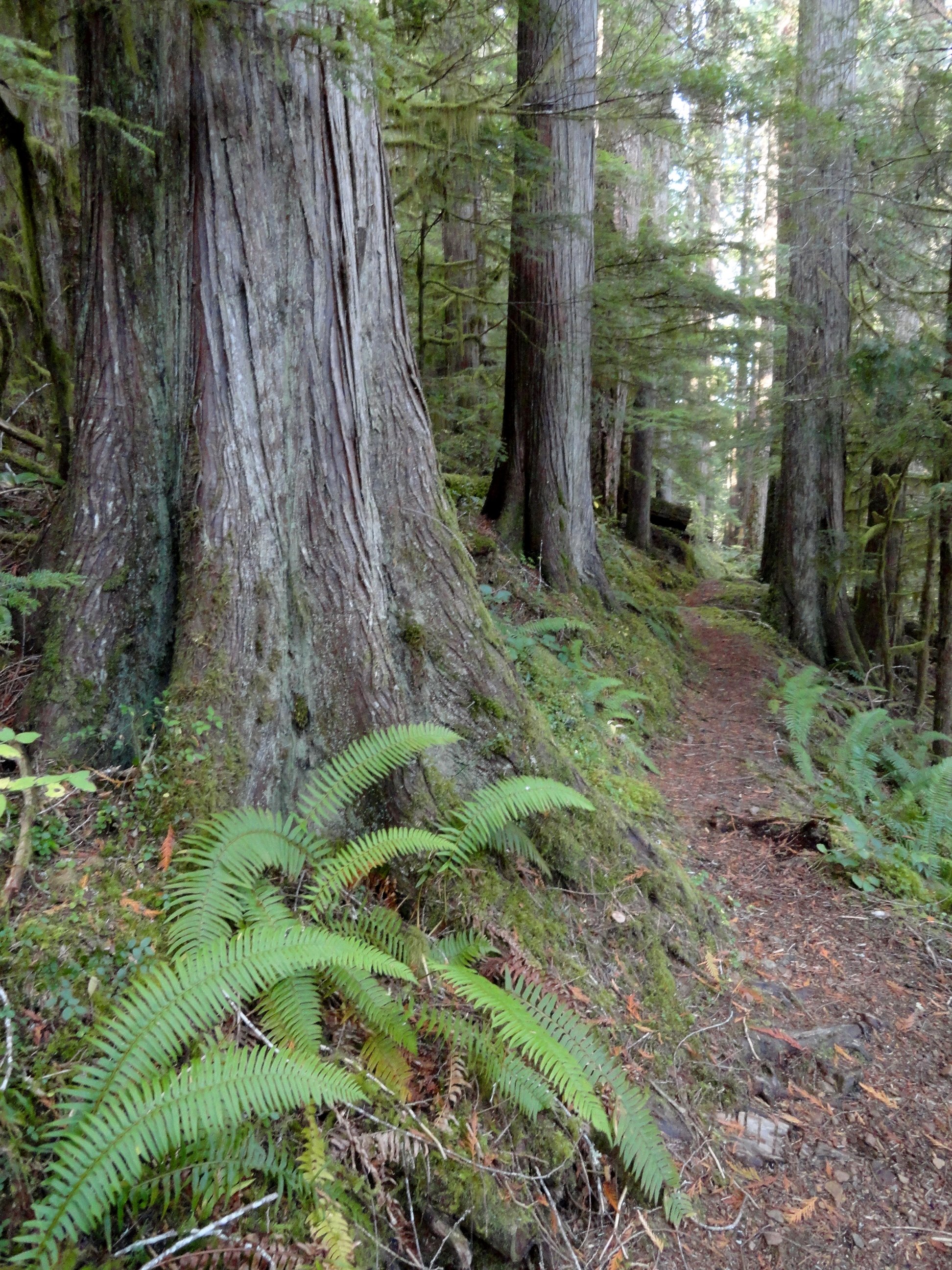
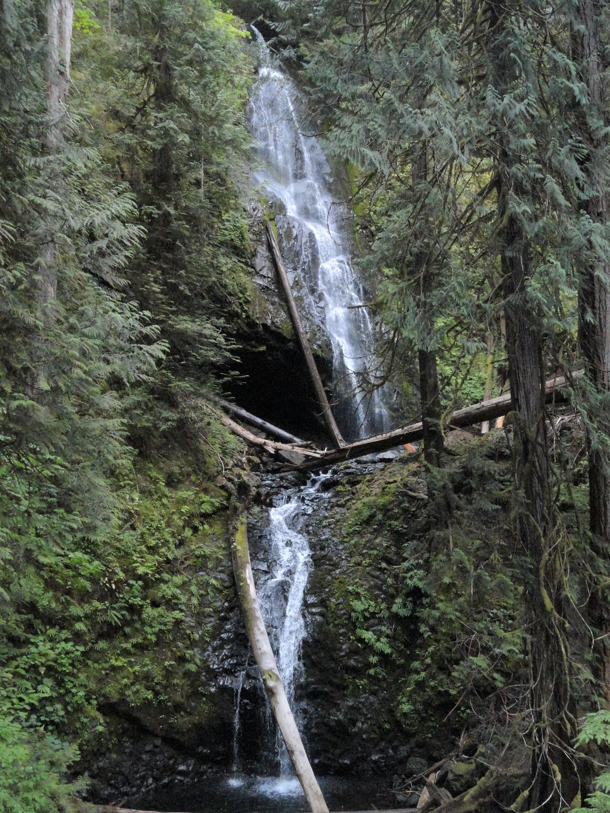
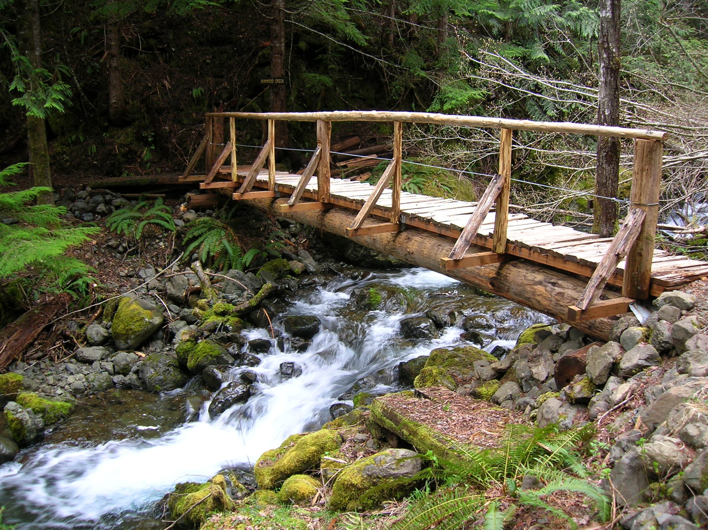
Copper Creek trail
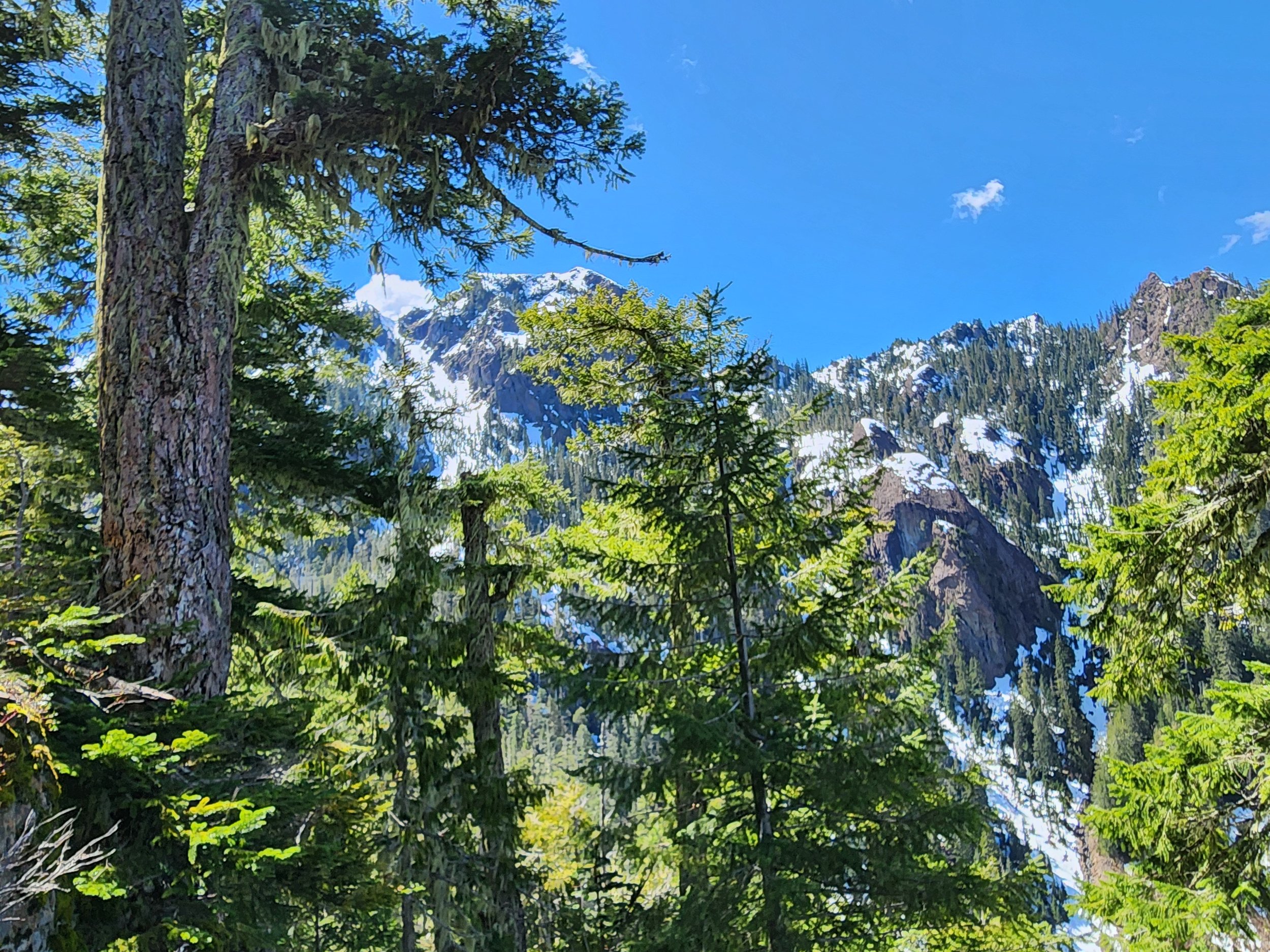
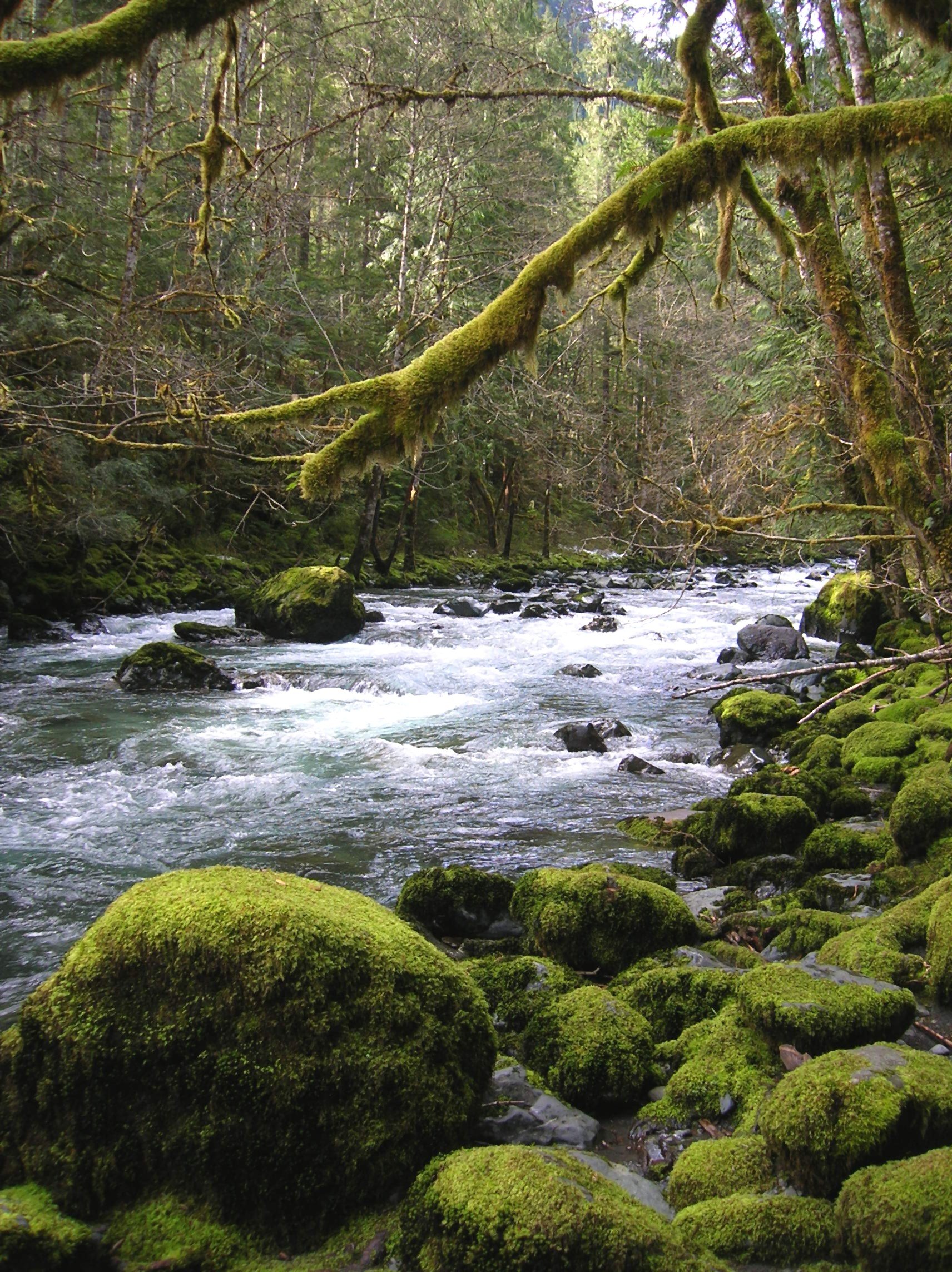
Tenacious hikers toil up steep slopes past the mines to a high shoulder on Lightning Peak. Views are limited, but the trailside cascading creek and surrounding towering primeval forest is striking. And if its solitude you seek, ye shall be rewarded.
Text and images Craig Romano
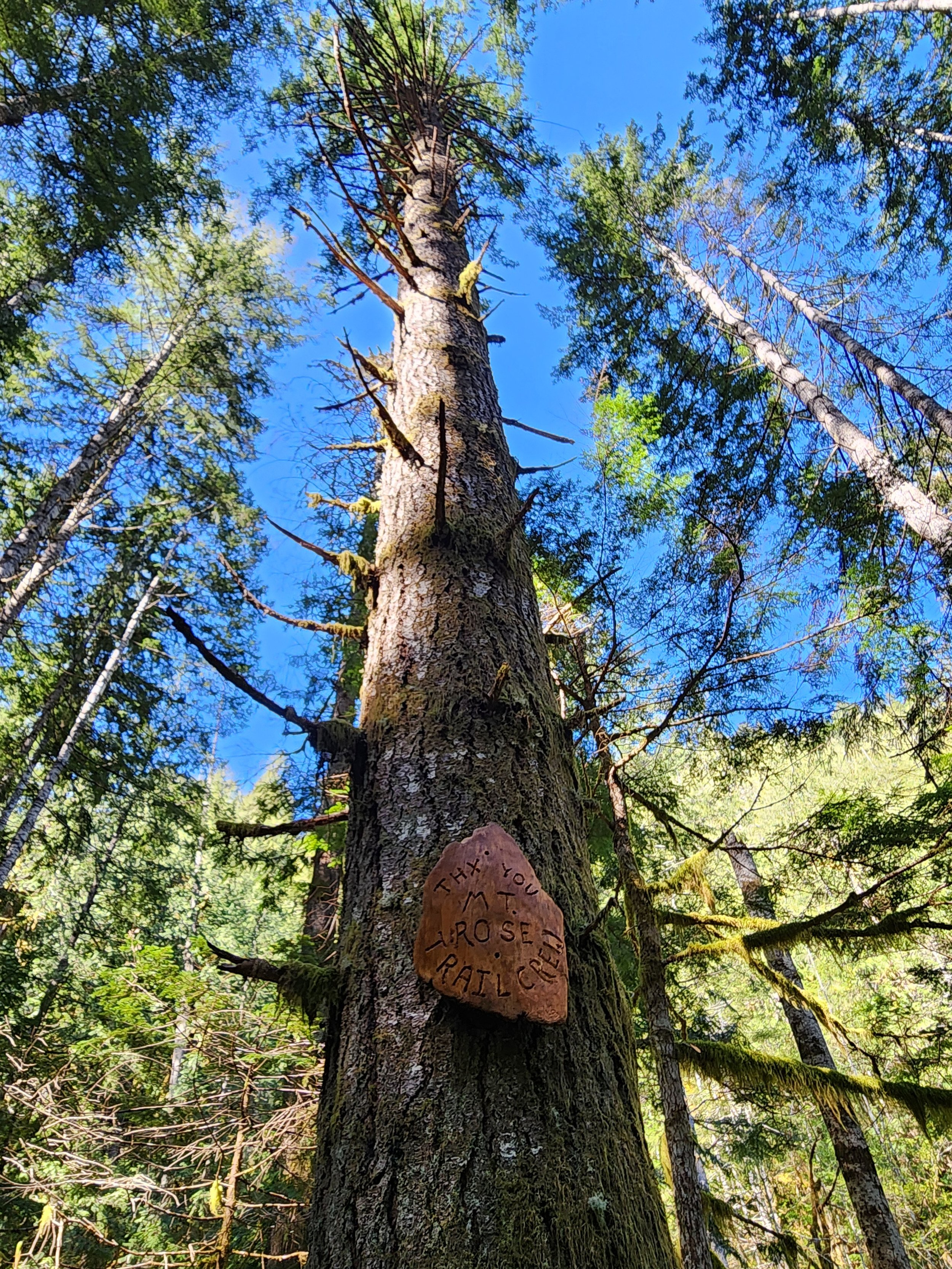
Copper Creek tumbles through a rugged area harboring several old mines. But it was mostly manganese, not copper that lured hardscrabble miners up this rough and tumble trail along Copper Creek to work several mines. After World War II the mines ceased operation and the trail to them was abandoned. But after the turn of the last century the volunteer Mount Rose Trail Crew reopened—reinforced—and extended this trail. Now tenacious hikers can toil up steep slopes past the mines to a high shoulder on Lightning Peak. Views are limited, but the trailside cascading creek and surrounding towering primeval forest is striking. And if its solitude you seek, ye shall be rewarded.


Hit the Trail
The Copper Creek Trail begins a short distance from where the North Fork Skokomish River flows into Lake Cushman. The lake which was once much smaller was dammed in 1924 to provide power to a booming Tacoma. Today the lake continues to provide hydro-electric energy and is well-known for its outdoor recreation offerings. But from 1880 until the 1940s this region was an active mining district with over 400 claims.

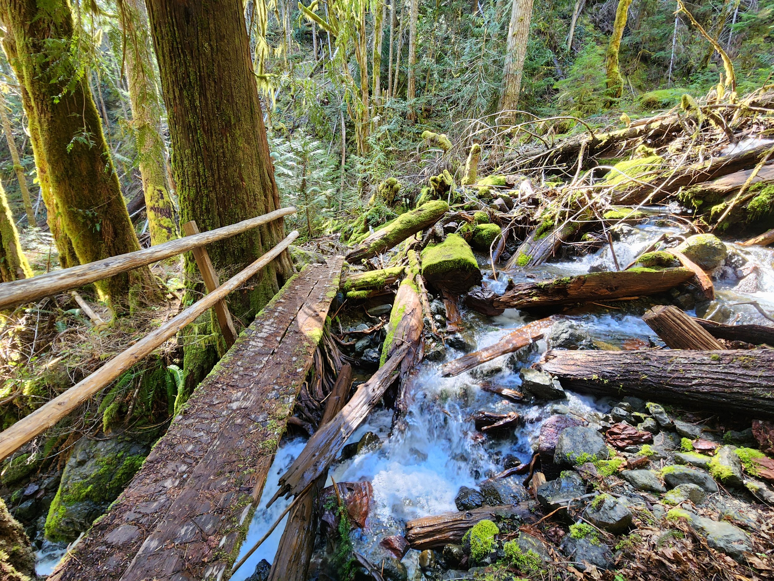
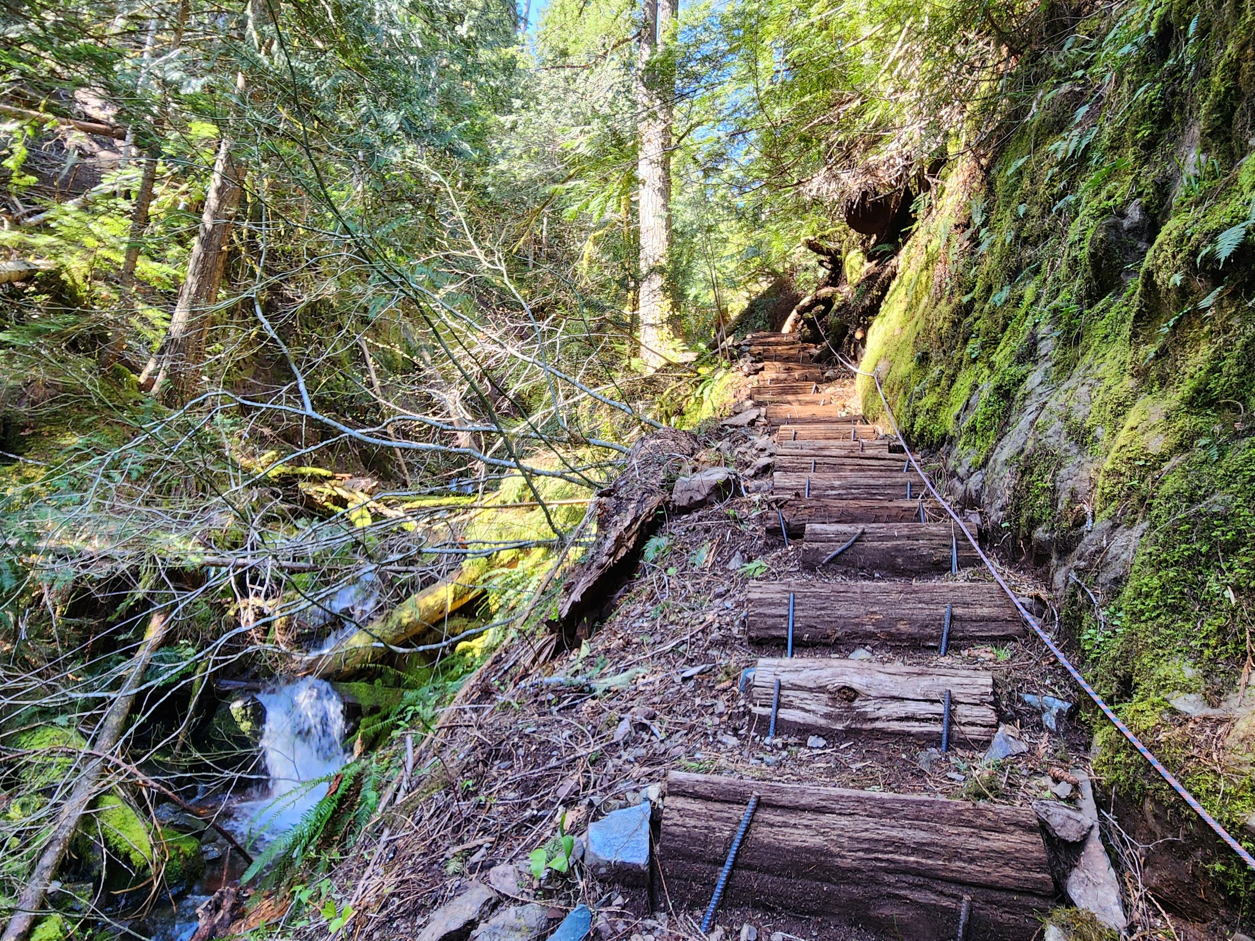
The Copper Creek Trail was originally built in 1915 by prospectors. After decades of abandonment, volunteers from the Mount Rose Trail Crew reopened it. They restored parts of the original tread as well as constructed new tread and pushed the trail beyond the old mines to a shoulder high on Lightening Peak. Like the original trail, this trail is steep—brutally steep in spots. And while it’s been greatly improved, it still contains some rough patches. It’s guaranteed to get your heart rate up and give your quads and hamstrings a good workout. The trail’s steepness, relative obscurity, and lack of sweeping views guarantees an uncrowded experience.Start climbing, entering a narrow and dark ravine.
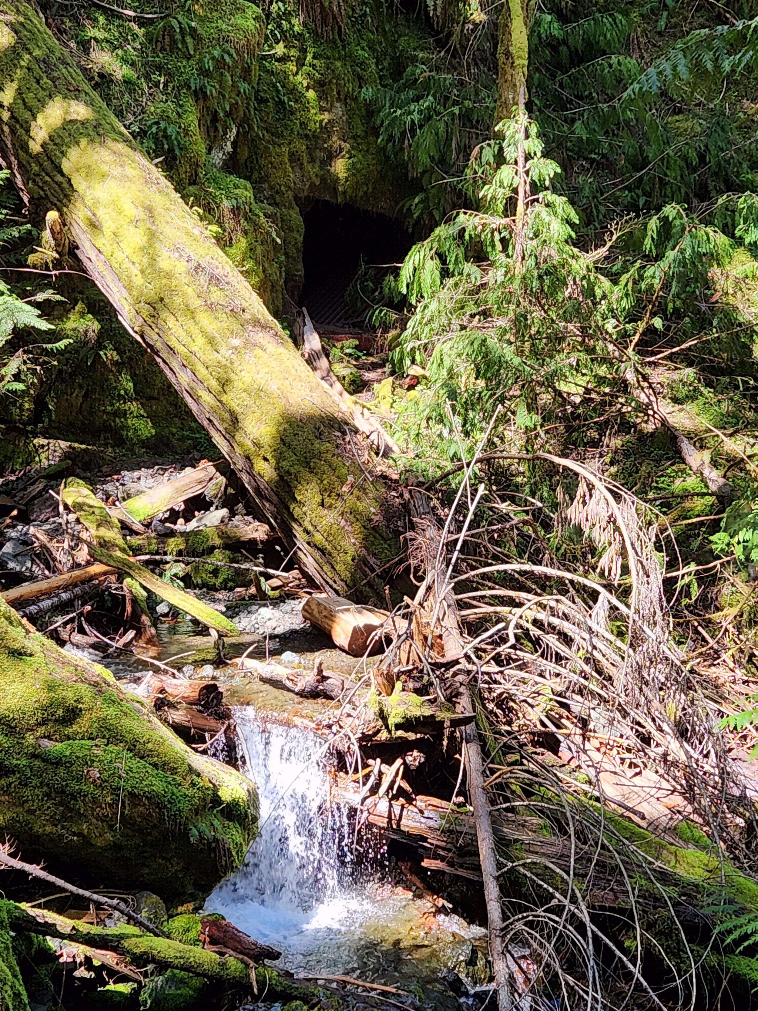
Witness large stumps, testaments of the primeval giants that grew here before loggers sent them off to the mills. The area’s steep and rugged terrain made logging difficult higher up the surrounding slopes. Impressive old-growth cedars and firs will greet you as you ascend higher. Cross the crashing waterway on a good bridge. Just downstream from the bridge scan the west side of the ravine wall to spot a shaft from the Brown Mule Mine. Another shaft is located farther downstream. Use caution if you wish to explore them. The mine began operation in 1915 and produced mainly manganese and silica. The mines were busy during World War I and then slowly ceased production.
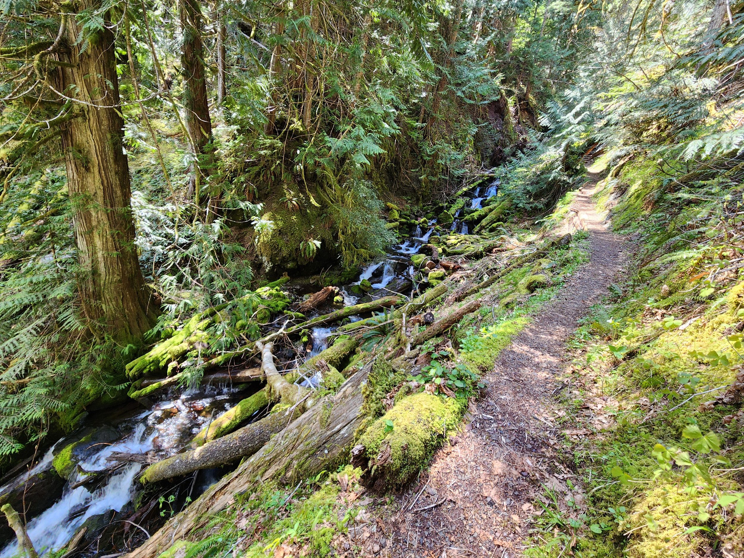
The trail now gets steeper and traverses a stretch prone to slides. Take a break at one of the trailside benches and admire a cascading tributary plummeting steep ravine walls from high above. Then continue working your way up an increasingly narrow ravine. Copper Creek crashes below your feet. The trail then gets insanely steep climbing above the creek via a series of tight switchbacks and steps.
The way eases in grade as it enters a grand forest of giant ancient cedars and Douglas-firs. At 1.4 miles, reach an easy to miss junction. Here a short trail leads left to the site of the Apex Mine. Manganese was the main metal mined here. A small amount of jacobsite was also extracted from this mine. The Apex Mine is the only known site in the country where this rare metal was mined. By and large though it was manganese, attracting most of the attention.
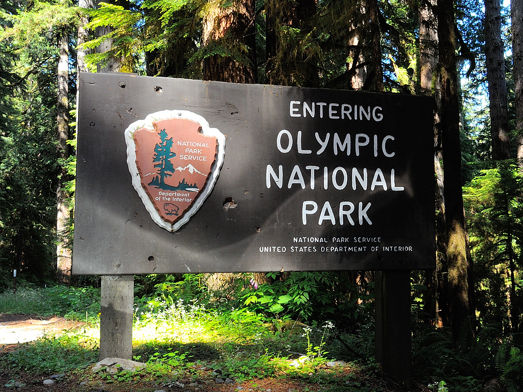
The entire Lake Cushman Mining District contains large concentrations of this metal which is important in steel production. During World War II operations were ramped up and pressure was put on Olympic National Park to allow access to many of the claims within the park. Attempts were made by business interests to allow for unrestricted mining within the national park. Several existing claims were allowed to continue years after the park was established. But park administrators held strong on the park’s original enabling act which didn’t allow for expanded and extended mining.
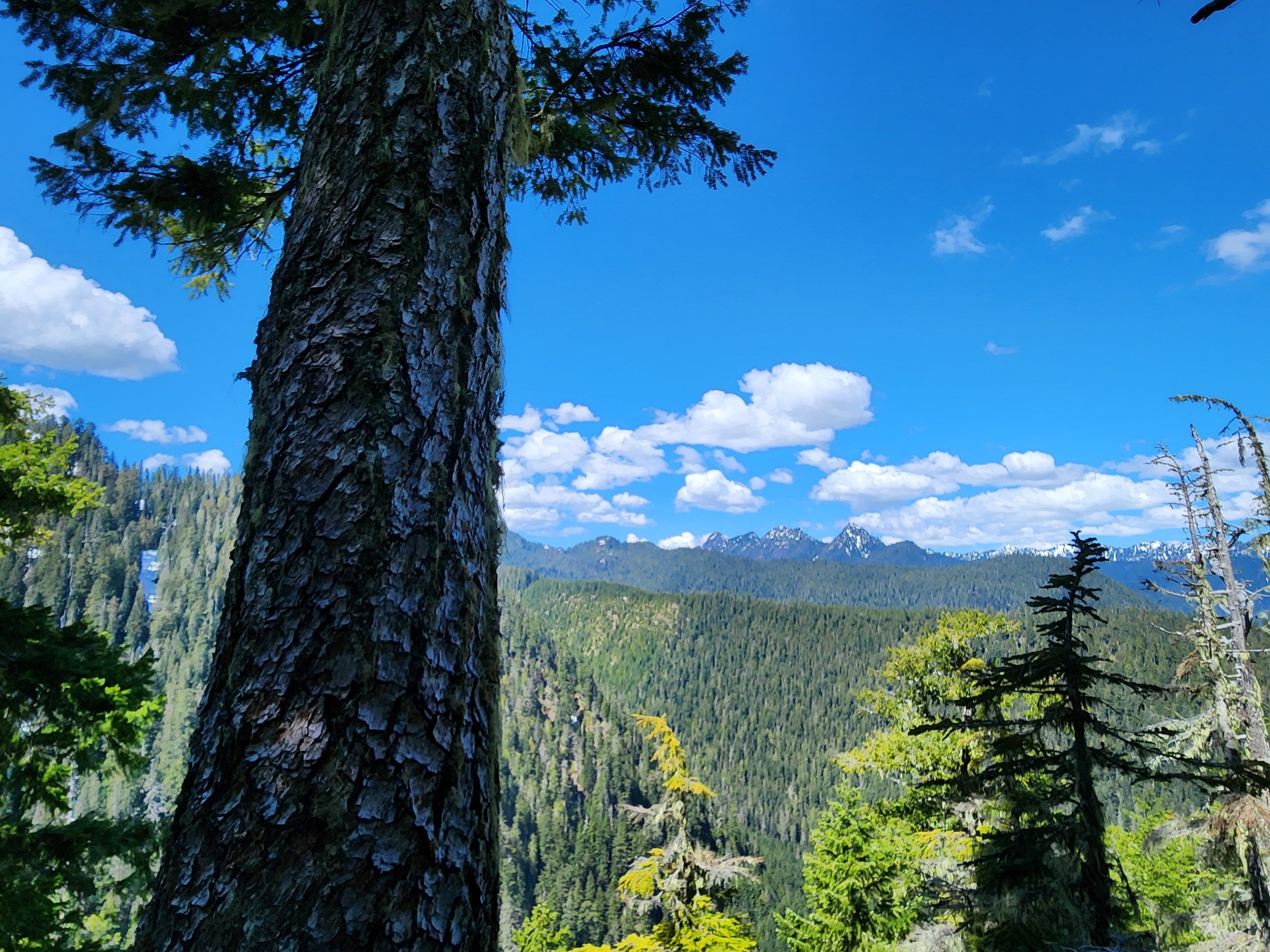
After checking out the old Apex site return to the main trail and continue steeply climbing, soon reaching another junction. Here the trail forms a loop. Head in either direction through primeval forest to attain a 3280-foot narrow shoulder of Lightning Peak. Views are limited on forested ridge, but you’ll be able get glimpses of the rugged Lightning Peak towering above and of shimmering Lake Cushman and the Elk Creek basin below. You’ll also be able to catch a decent view west to the Five Ridge Peaks and Wonder Mountain—some of the loneliest summits in the Olympics.
After closing the loop brace yourself for one knee-jarring descent. Trekking poles will definitely come in handy!
Feature author
Craig Romano
An award-winning author, photographer, ardent conservationist, Craig is also a NW trails and hiking expert. He hikes, runs, paddles, and bikes and has written about these passions for more than two dozen publications, including; Seattle Met, Backpacker, Paddler, Northwest Runner, AMC Outdoors, and Northwest Travel and Life. Craig writes weekly content for Hikeoftheweek.com and is the author of more than 25 books. Craig has been a regular columnist in Tracing the Fjord since 2019.

Mason County's Floating Water Festival......Hoodstock!
Hoodstock, Mason County's 3 day floating music and arts festival, is back with an exciting lineup for 2024. There will be vendors, food trucks, and more music! The festival supports local community initiatives and features diverse music genres, from folk to rock. Mark your calendars for August 15-17!
Hoodstock, Mason County's floating music festival, is back with an exciting lineup for 2024. The Carlile Family Band will kick off the event, followed by acts like Suped Up Fjord and the Lovely Colours. There will be vendors, food trucks, and more music at the Robin Hood stage, plus a special 21+ event in the evening. People travel from far to wide to attend, with various transportation options available. The festival supports local community initiatives and features diverse music genres, from folk to rock. Mark your calendars for August 15-17! Thanks to Terrence J Allison for the drone footage.

The Flywheel Gallery Opens In Hoodsport, WA.
A new gallery called the Flywheel has opened in Hoodsport Washington, fulfilling Jan Morris' lifelong dream of showcasing local artists and watercolor paintings. The gallery features works from regionally known artists, including Scott Fife and the late Howard Leggett. The Flywheel is a perfect spot to appreciate art and the natural surroundings of the Hood Canal.
A new gallery called the Flywheel has opened in Hoodsport Washington, fulfilling Jan Morris' lifelong dream of showcasing local artists and watercolor paintings. The gallery features works from regionally known artists, including Scott Fife and the late Howard Leggett. Visitors can enjoy drinks made with locally sourced ingredients from the Hardware Distillery while soaking in the area's scenic beauty. The Flywheel is a perfect spot to appreciate art and the natural surroundings of the Hood Canal.
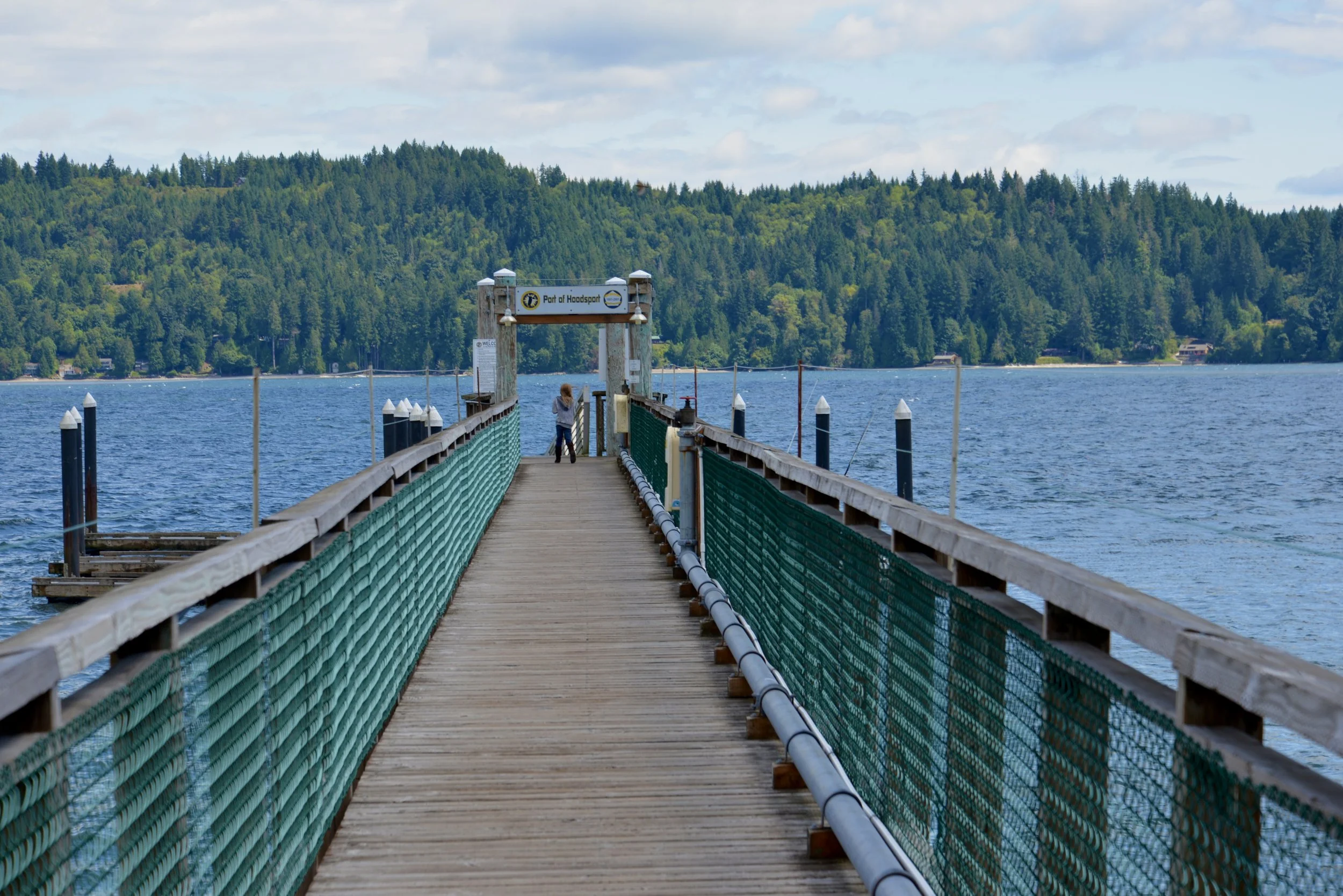
The Port Of Hoodsport Welcomes Divers, Disc Golfers and Visitors to the area
Port Of Hoodsport Commissioner Cody Morris talks about the Port of Hoodsport public dock, its recent updates, and future plans. After structural failures last winter, they secured emergency funding for repairs just in time for shrimp season. The dock is a popular spot for divers, fishermen, and visitors to downtown Hoodsport's shops and restaurants.
Port Of Hoodsport Commissioner Cody Morris talks about the Port of Hoodsport public dock, its recent updates, and future plans. They've been working on modernizing the dock to meet safety and environmental standards, replacing old materials, and making it more resilient to weather. After structural failures last winter, they secured emergency funding for repairs just in time for shrimp season. The dock is a popular spot for divers, fishermen, and visitors to downtown Hoodsport's shops and restaurants. Additionally, The Port of Hoodsport manages a disc golf course and a trail system up the Cushman Road.
If you had attended Fjordin Crossin in June, you may know that the Port has been working on modernizing the dock to meet safety and environmental standards, replacing old materials, and making it more resilient to weather. After structural failures last winter, they secured emergency funding for repairs just in time for shrimp season. The dock is a popular spot for divers, fishermen, and visitors to downtown Hoodsport's shops and restaurants.
"We are in negotiations with DNR to renew our lease," Cody Morris explained to Jeff, "and part of that stipulates that we need to modernize the material being used here. Our dock is quite old, and so it is very out of code, both for safety and environmental standards. So two of the main things we’re looking at is the materials."
Morris spoke regarding the winter dock closures, "we had some extreme structural failures, and for the safety, the port had to close it down and seek emergency funding from the state to hire a contractor to do the repairs. We were lucky that we were able to get repairs done just in the time of shrimp season. That’s definitely when this dock gets the most use. The second most use is during the salmon season."
Although the Port was able to make temporary repairs, Morris realizes there is still a lot of work to be done.
"As the dock is currently configured," he continued, "it kind of more or less has a self-destruct button. And that’s mostly from the fact that the dock itself doesn’t flex. It creates an insane amount of tension during the tidal changes, and those much gnarlier waters in the winter."
Regardless of the pending long term upgrades to the docks that will take some time and funds, Morris attests that the docks are an important asset to the Port of Hoodsport not just for the basic needs of accessibility but also for tourism. The local retail and restaurants in the area benefit greatly from the summer day traffic arriving by water.
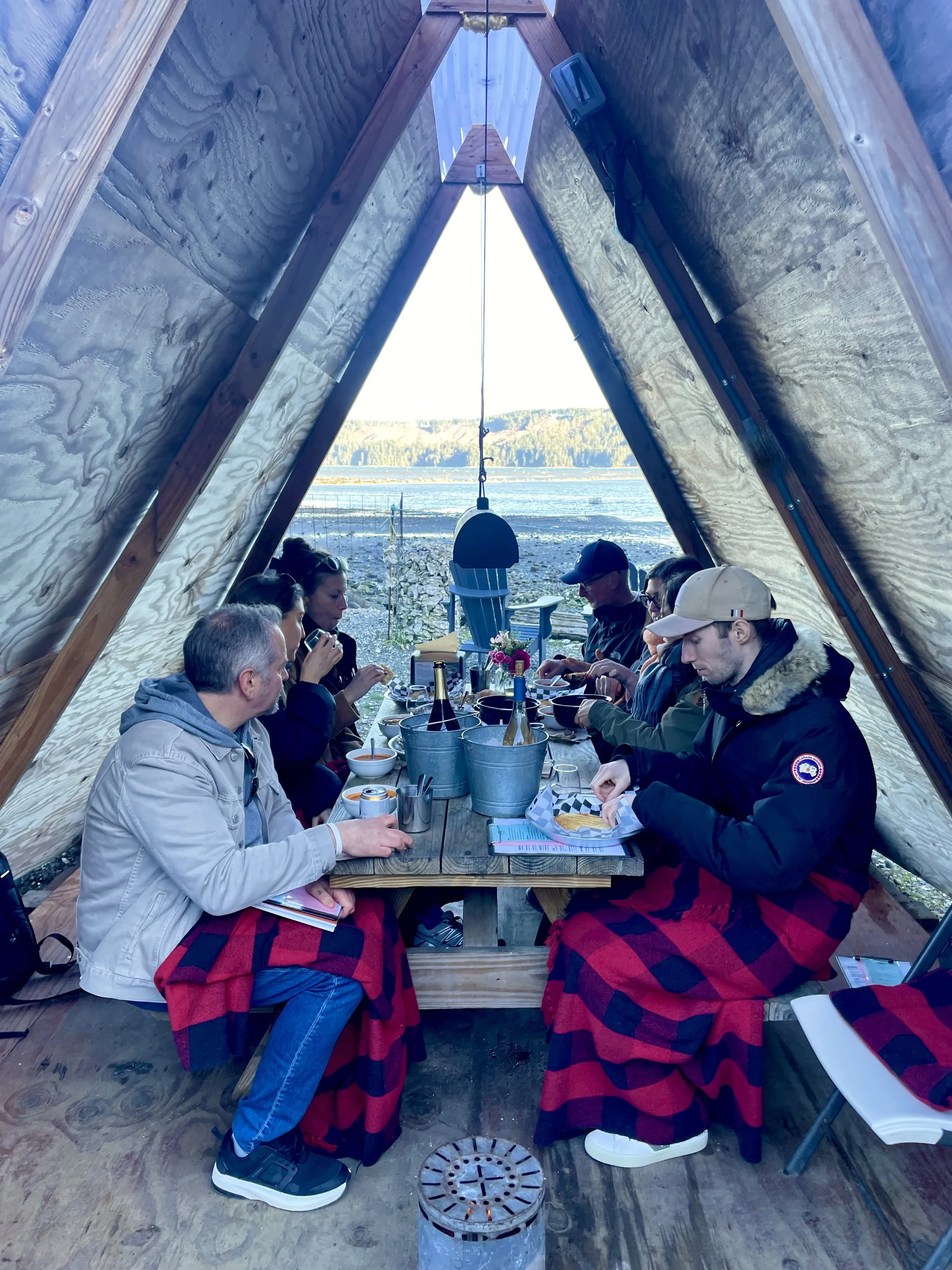
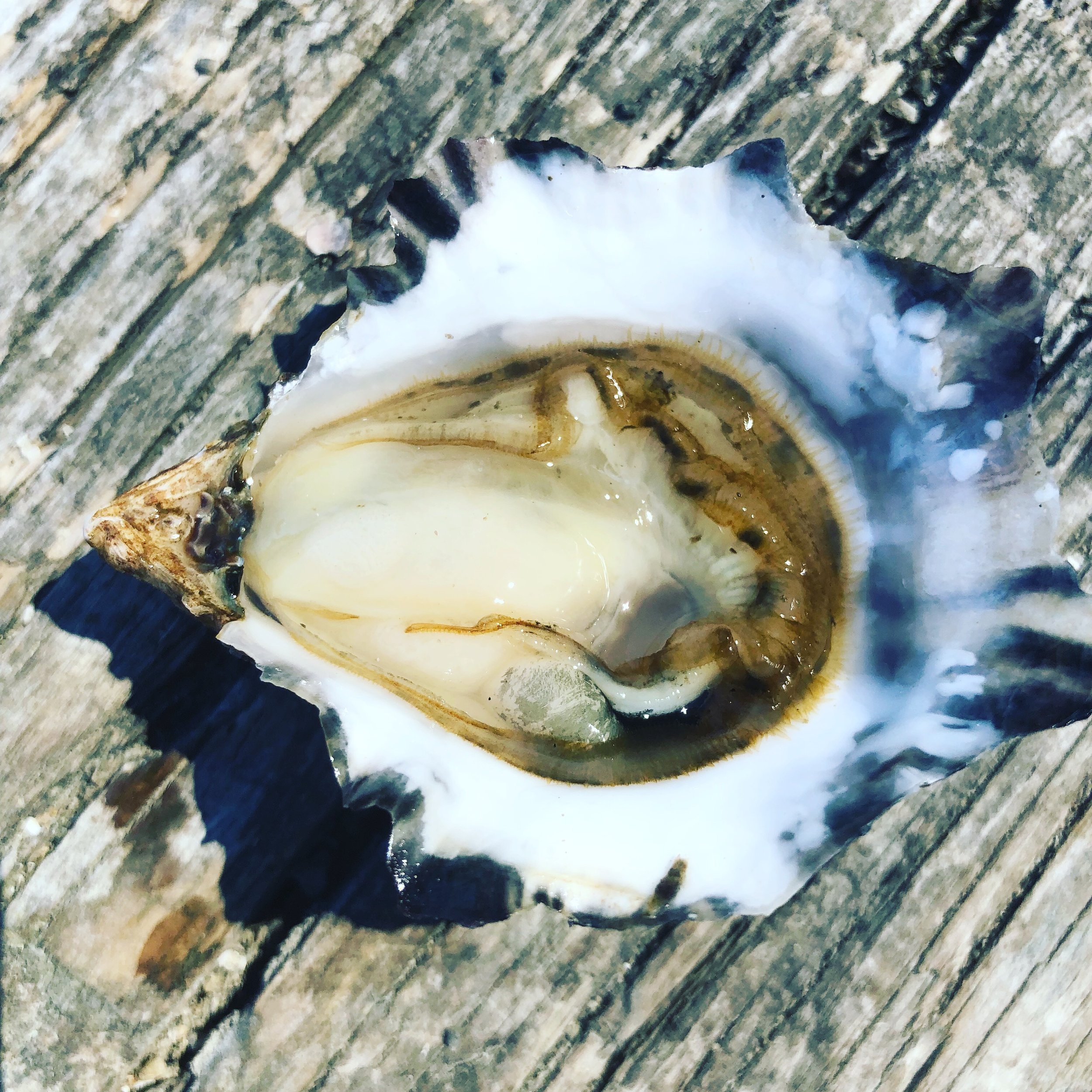
Must Stop On Hwy 101 - Hama Hama Oysters
Hama Hama Oysters continues to provide high quality food and views with this oyster farm and seafood store along the shores of the Hood Canal in Mason County, Washington. One of the popular attractions is the A-Frame seating option. Borne out of social distancing, this unique feature has become the must-try for anyone making the stop.
Hama Hama Oysters continues to provide high quality food and views with this oyster farm and seafood store along the shores of the Hood Canal in Mason County, Washington. One of the popular attractions is the A-Frame seating option. Borne out of COVID and social distancing, this unique feature has become the must-try for anyone making the stop. With fresh seafood and wine plus apparel, their Seafood Store has all the ingredients for a perfect meal from the waters of the Hood Canal.

2024 Grapeview Art & Water Festival, Last Saturday in July
The 29th annual Grapeview Art and Water Festival takes place on the last Saturday of July at Fair Harbor Marina. The festival offers a variety of food, live music, and numerous free activities for children, including a kid's activity zone with woodworking, crafts, and face painting. For adults, there’s a popular floating green for golf and an impressive display of art from local artists.
The 29th annual Grapeview Art and Water Festival takes place on the last Saturday of July at Fair Harbor Marina. The festival offers a variety of food, live music, and numerous free activities for children, including a kid's activity zone with woodworking, crafts, and face painting. For adults, there’s a popular floating green for golf and an impressive display of art from 51 artists. The festival is a beloved community event featuring a food court with local specialties and is highly praised for its family-friendly atmosphere and beautiful setting.

Ready, Set, Go Evacuation Tips For Homeowners/Renters in Mason County
As more people move to and rent out homes in the beautiful rural areas of Mason County, it's crucial to be aware of the significant wildfire risks we face. With the increasing heat and dryness, wildfires have become a real concern, especially for those living in the wildland-urban interface.
As more people move to and rent out homes in the beautiful rural areas of Mason County, it's crucial to be aware of the significant wildfire risks we face. With the increasing heat and dryness, wildfires have become a real concern, especially for those living in the wildland-urban interface. Matt Welander from West Mason Fire shared some tips with Explore Hood Canal.
Ready: Be Prepared
Start by gathering important documents, medications, and a list of contacts. Plan ahead by informing someone that you might need to stay with them if you need to evacuate
Set: Be Alert
When the alert level reaches a level two evacuation, it's time to load your car. Pack your medications and pet food, and make sure your go-bag is in the car. Be aware of fire apparatus and personnel entering your area. This is a clear signal that you should be ready to leave at a moment's notice.
Go: Act Early
When the evacuation order is given, the fire threat is imminent. Whether or not the fire reaches your home, leaving immediately is crucial for your safety and the firefighters'. Staying behind can hinder firefighting efforts and endanger lives. Although fire departments can't force you to leave, it is in your best interest to do so. Law enforcement will monitor evacuated areas, ensuring your belongings are protected.
Evacuating Pets and Larger Animals
Preparation is key for pet owners, particularly those with larger animals like horses. Start preparing your animals for evacuation early. If you can, trailer your horses to a friend's house during the "Ready" phase. This can prevent the added stress of trying to evacuate them during a crisis.
Special Considerations
If you have health issues such as COPD, emphysema, or bronchitis, or if you are elderly or less mobile, it's wise to evacuate early. Smoke can exacerbate health problems, making it much harder to evacuate safely later on. Leaving early ensures you aren't caught in a dangerous situation.

Muralist BriAnne Lesman Brightens Up Mason County With Her Work
BriAnne Lesman's first job was in 2015 at the El Sarape Cantina, and it's blossomed from there. Getting some input from the business owners helps her start the idea and after that, she's off and painting.
Drive around Mason County for a little bit and you'll start to notice murals on many of the buildings in the county. BriAnne Lesman's first job was in 2015 at the El Sarape Cantina, and it's blossomed from there. Getting some input from the business owners helps her start the idea and after that, she's off and painting. Different aspects of Mason County end up in her art, including the shellfish, foliage, and Sasquatch.

Wildfire Preparedness Tips for Campers in Mason County
Wildfires can pose a significant risk, and everyone must stay vigilant. Matt Welander from West Mason Fire discusses some essential tips for staying safe during your camping trips.
Wildfire Preparedness Tips for Campers in Mason County
As we welcome campers to Mason County this summer, it's crucial to remember that we are at heightened wildfire awareness. Wildfires can pose a significant risk, and everyone must stay vigilant. Matt Welander from West Mason Fire discusses some essential tips for staying safe during your camping trips.
Be Prepared: Ready, Set, Go!
When planning your camping trip, wildfire preparedness might not be top of mind, but it's essential. Matt emphasizes the importance of the "Ready, Set, Go" system, a three-level alert process designed to keep you safe:
Ready: When you arrive at your campsite, rake it out thoroughly to fireproof your area, like how you would your home. If there’s a fire nearby and you receive a "Ready" alert, start packing your belongings and know your exit routes.
Set: At this level, it's time to pack up your tent and load your car. Be prepared to leave the area quickly.
Go: Leave immediately if a "Go" alert is issued. If your tent is still up, leave it behind. Your safety is the priority.
Stay Sober and Alert
Always ensure you have a designated driver at your campsite during fire season. This is crucial for your safety and the safety of firefighters who may need to enter the area. Finding someone sober enough to drive if a fire breaks out unexpectedly is dangerous.
Nighttime Precautions and Communication
Fires can start at any time, including at night. If you’re camping in remote parts of the county with only one road in or out, having a paper map can be a lifesaver. It helps you understand your location and the quickest escape routes.
For communication, Matt recommends having a NOAA weather radio, which works even when cell phone service is unavailable. Most major media outlets on AM and FM radio will provide updates, so stay tuned to them for the latest information.
Know Your Surroundings
If you're camping in U.S. forests, make sure you know the road number and your exact location, such as the specific site at a campground like Browns Creek. This information is vital if you need to report a fire.
Enjoy and Stay Safe
Mason County offers incredible recreational opportunities, and we love having visitors enjoy our beautiful surroundings. However, your safety is our priority. Remember to:
Keep your campsite clean and fireproof.
Follow the "Ready, Set, Go" protocol.
Stay informed through reliable communication channels.
By following these guidelines, you can ensure a safe and enjoyable camping experience in Mason County.
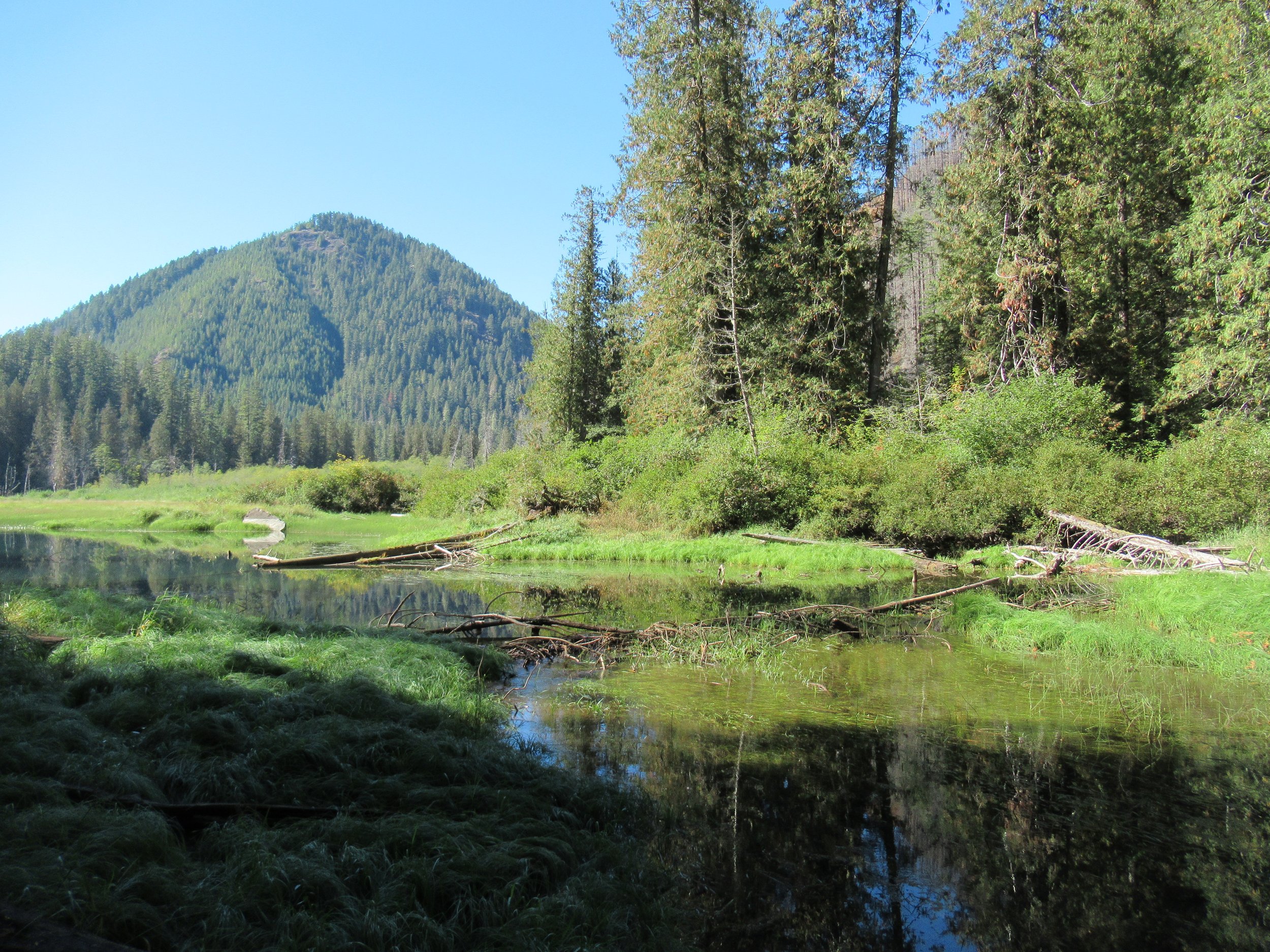
Elk Lakes Trail
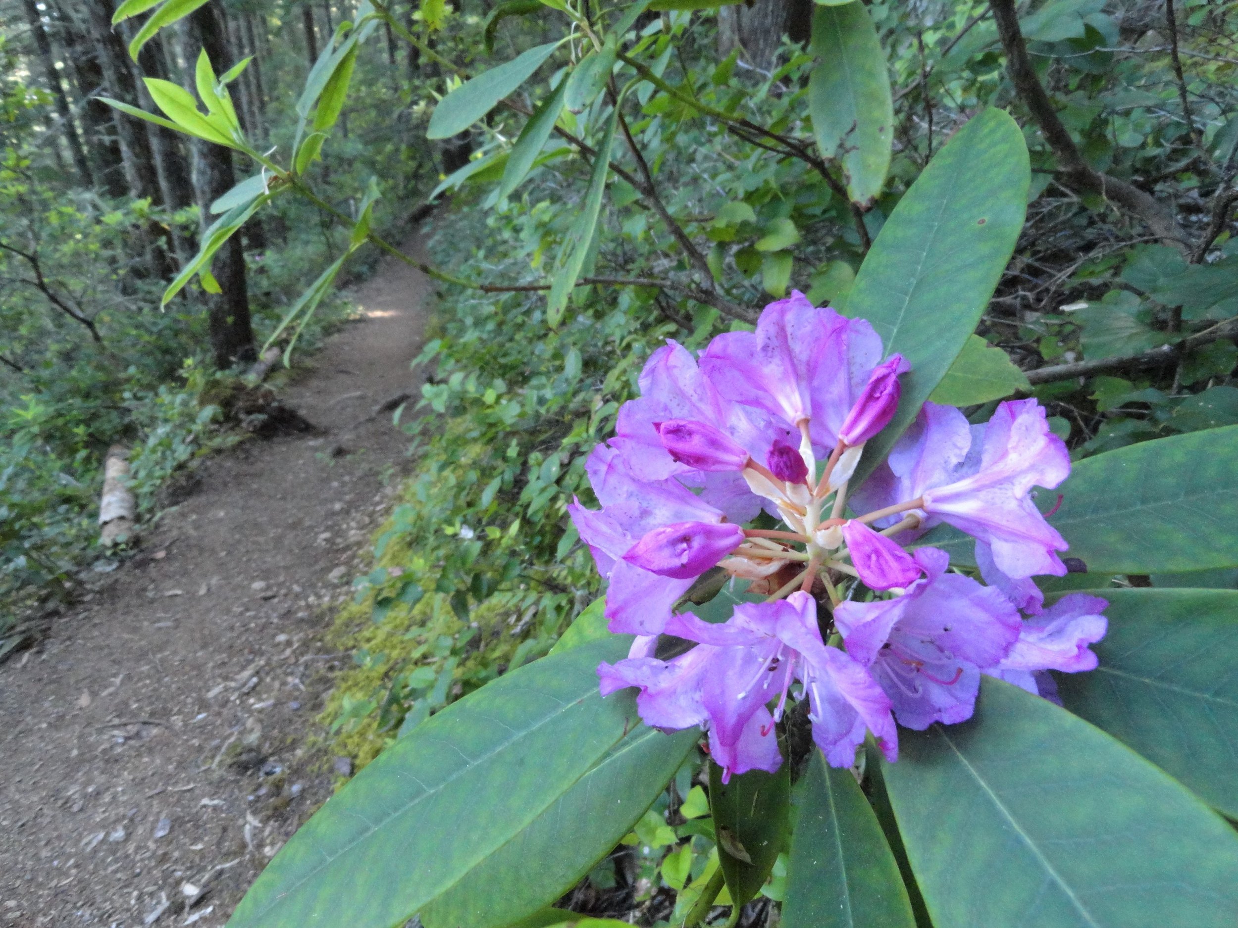
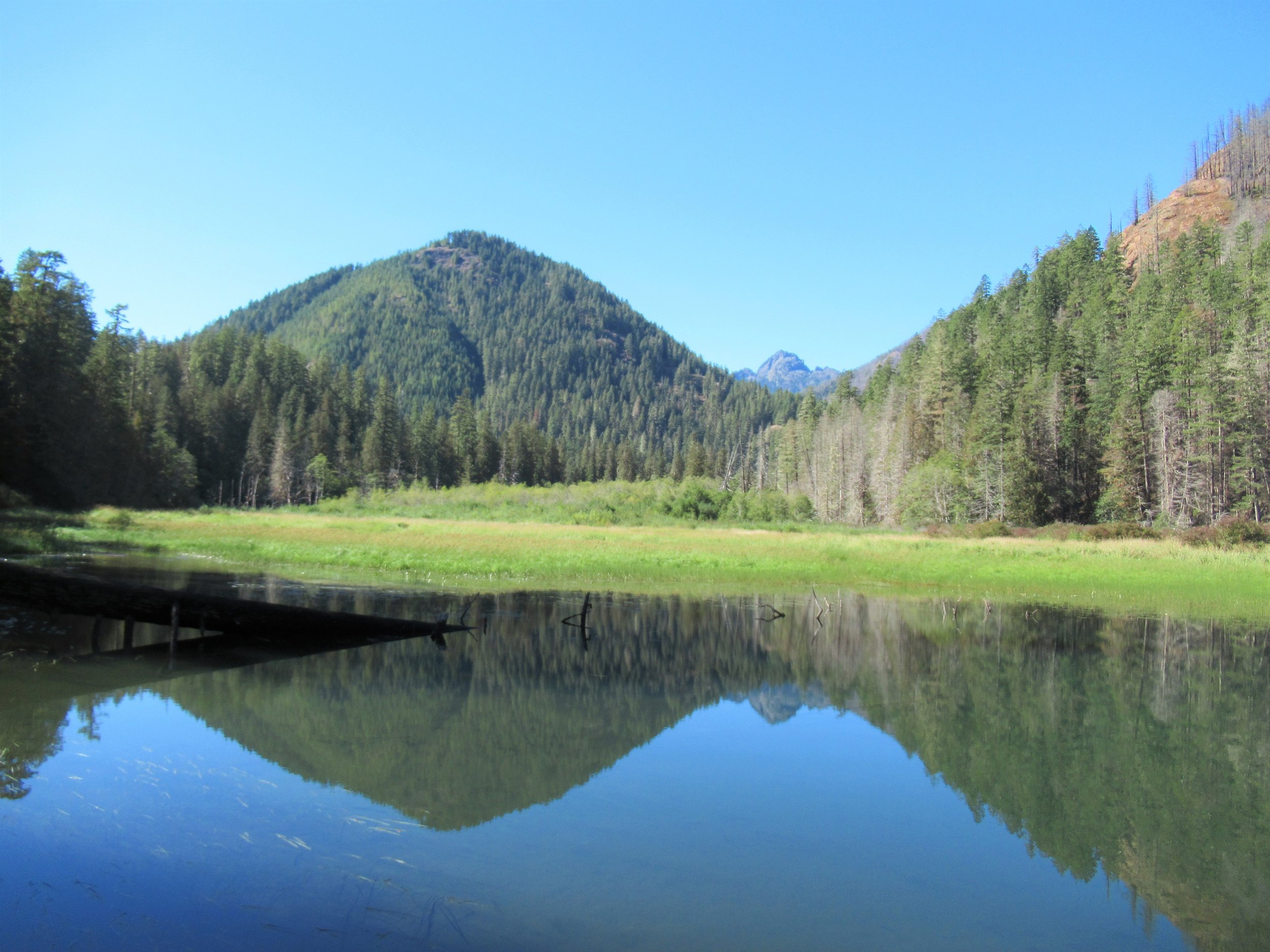
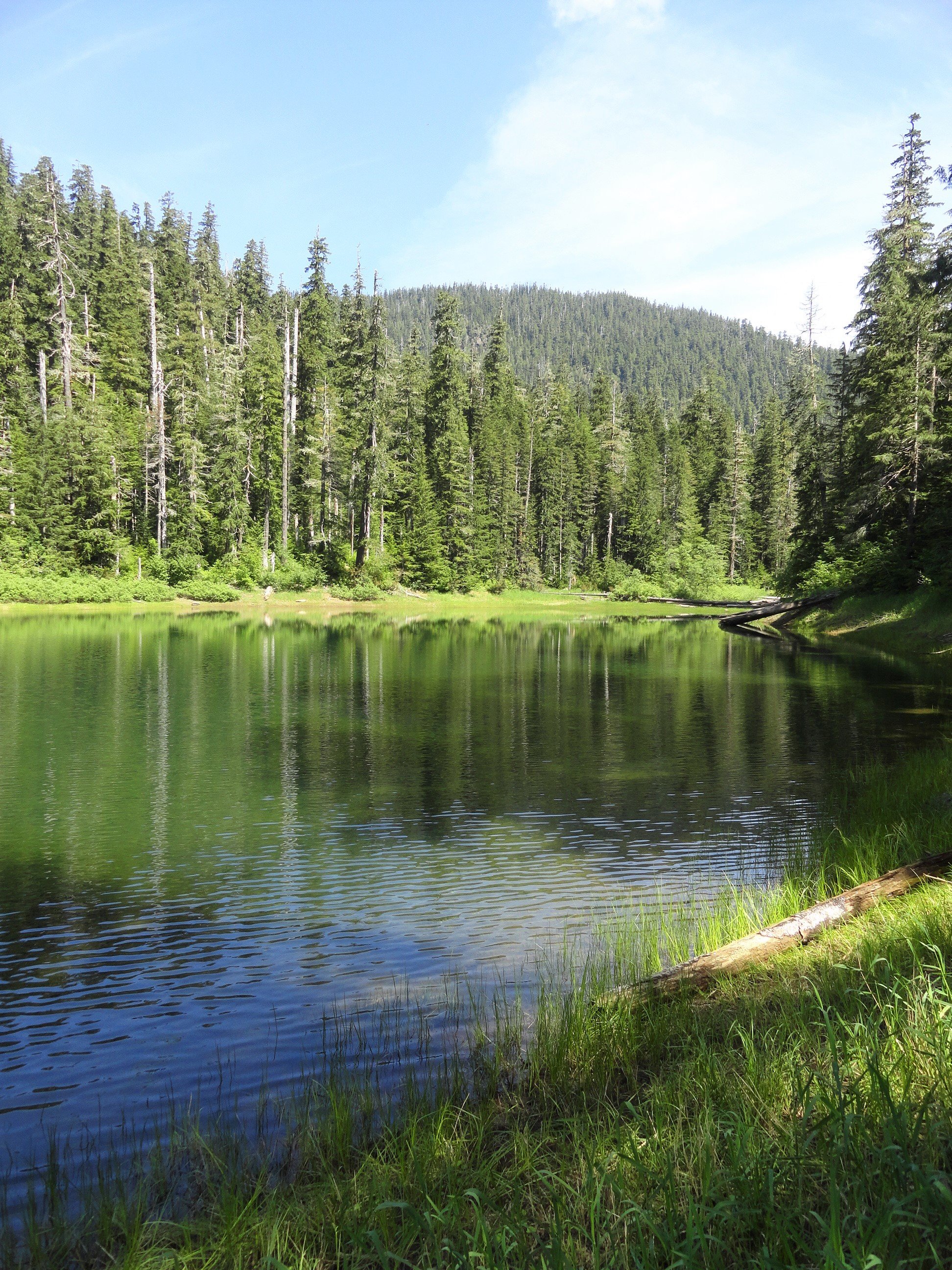
Named for one of the Olympic Peninsula’s most majestic animals, the two small Elk Lakes located within the Hamma Hamma River Valley offer quiet wanderings and a chance to see their namesake. The Elk Lakes offer a great alternative to the nearby oft-crowded Lena Lakes. While this hike is short, the lake’s tranquil shoreline and surrounding old-growth forest invite lingering. Bird watching is good as well as fishing for rainbow trout. Rhododendrons add colorful bouquets to the forest in spring, while maples and cottonwoods brighten the forest with golden touches come autumn.
By Craig Romano, Guide book author and guest columnist
Named for one of the Olympic Peninsula’s most majestic animals, the two small Elk Lakes located within the Hamma Hamma River Valley offer quiet wanderings and a chance to see their namesake. The Elk Lakes offer a great alternative to the nearby oft-crowded Lena Lakes. While this hike is short, the lake’s tranquil shoreline and surrounding old-growth forest invite lingering. Bird watching is good as well as fishing for rainbow trout. Rhododendrons add colorful bouquets to the forest in spring, while maples and cottonwoods brighten the forest with golden touches come autumn.
Hit the Trail
You can easily reach the lakes from a short spur off of Forest Road 2480. But I prefer hiking to the lakes following along a remnant of an old trail along Jefferson Creek. This gives you a longer and varied hike and a better appreciation for the area’s rugged landscape and how human activity has greatly impacted it. Reaching the trailhead for this approach however is via a rough road that only high clearance vehicles can negotiate. If that is not an option, you can always park at the beginning of the road and walk FR 2421 for 1.6 miles to the trailhead. The road traverses a recent cut offering excellent views of the Hamma Hamma Valley, making the extra mileage interesting.

The trail begins at a bend in the road and heads into a forest that was recently burned. In the early part of the last century the entire Jefferson Creek Valley was draped in old-growth forest. After World War II and up to the 1990s the area was intensively logged leaving only remnant stands of old-growth forest and just a small stretch of was once a long trail in the Eastern Olympics. But what survived made a delightful short hike in an area often overlooked by many hikers opting instead for the nearby Lena Lakes.
The beautiful old-growth forest remaining around the Elk Lakes almost entirely went up in flames in the Maple Fire of 2018. A group of timber poachers harvesting mature big-leaf maples in the area set the area ablaze when they set fire to a wasp nest in the base of a tree. The fire quickly spread torching 3300 acres and costing $4.5 million to combat. Two of the poachers were ultimately caught, brought to trial and given prison terms. Timber poaching remains a serious problem on the Olympic Peninsula. The Forest Service lacks the staff and resources to address it.
While the fire did some damage to the Elk Lake area, thankfully many of the older trees survived. Unfortunately the fire took a major toll on nearby Jefferson Ridge rendering the trail to its old lookout site nearly impassable now. Such a shame as that trail too offered a quiet alternative to many of the area’s nearby crowded trails.

Head up the trail traversing a dry hillside, several hundred feet above roaring Jefferson Creek. Born in the snowfields of Mount Ellinor and her rugged neighbors; the creek crashes through a steep and narrow canyon here before reaching the Hamma Hamma River. Pass through a mosaic burn on an up and down course before reaching cool old-growth forest.
The way then soon reaches a junction. Heading left will bring you to the upper trailhead. But for this suggested hike, you’ll be returning from that direction, so continue hiking straight through a grove of monster cedars coming to Elk Lake. Depending on the season the lake may be a wet grassy swale or a pretty reflecting pool. Regardless of water level, plenty of birdlife will be present.
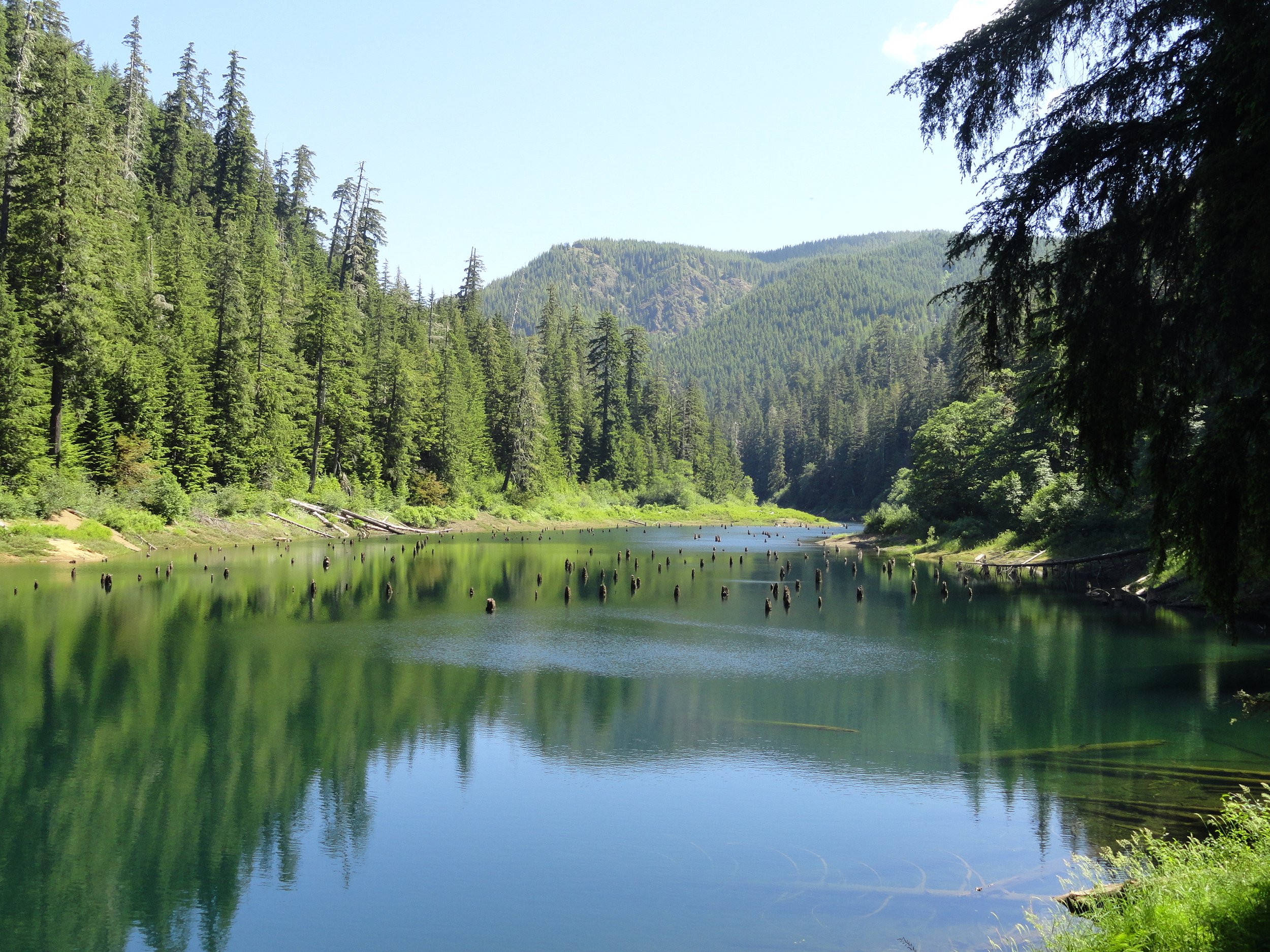
Continue along the western shore before wandering along Jefferson Creek through more impressive old growth. The trail then terminates on FR 2401. You can retrace your steps, but I prefer making a loop by following the road left for 0.8 mile to another trail just after crossing Cedar Creek. But before heading down that trail back to Elk Lake, head right 0.2 mile on an oft overlooked and slightly brushy trail to pretty little Upper Elk Lake. This placid body of water offers beautiful reflections of nearby ridges and the surrounding forest.
Once you visit the Upper Lake pick up the trail near Cedar Creek and slightly descend to Elk Lake now hiking along its eastern shoreline. Pass some more big trees and come to a great shoreline area for casting a line or just admiring the area’s beauty. Then reach another junction.
The way right climbs and soon reaches the main trailhead on FR 2401. Continue left, soon crossing Jefferson Creek on large rocks. In spring and other periods of high water this may be difficult forcing you to retreat the way you came for a longer than anticipated hike. Just beyond the crossing reach a familiar junction. Here head right above the crashing creek retuning to your start.
The details
Distance: 4.5 miles roundtrip
Elevation Gain: 700 feet
High Point: 1200 feet
Difficulty: moderate
Snow free: year round Trailhead Pass Needed: None
Notes: Road to Lower Trailhead (Elk Branch) is extremely rough requiring a high clearance vehicle.
GPS waypoints: Lower Trailhead: N47 34.759 W123 07.222
Main Trailhead: N47 34.267 W123 08.008
Features: kid-friendly, dog friendly, old-growth, rhododendrons, bird-watching, fishingLand Agency Contact: Olympic National Forest, Hood Canal Ranger District, Quilcene, (360) 765-2200, fs.usda.gov/olympic
Recommended Guidebook: Day Hiking Olympic Peninsula 2nd edition (Craig Romano, Mountaineers Books)
Trailhead directions: From Hoodsport travel north on US 101 north for 13.7 miles turning left at milepost 318 onto FR 25 (Hamma Hamma River Road). Then continue west for 6.4 miles and turn left onto FR 2480. Cross the Hamma Hamma River and in 0.2 mile turn right onto unsigned FR 2421 for the Lower Trailhead (high clearance only). Follow this rough road 1.6 miles to a pullout on your left where the road makes a sharp turn right. This is the trailhead. For the Main Trailhead, pass the FR 2421 junction and continue on FR 2480 for 3 more miles. Then turn right onto FR 2401, and proceed 2.5 miles to a spur on your right leading 0.1 to the Main Trailhead. The spur is steep and can be rough. You can park alongside FR 2401 and walk the spur to the trailhead.

Three Months of Epic Summer Music Festivals On Hood Canal
Looking for live music events this summer? Look no further than Hood Canal. June through August the rhythms are strong in the shadow of the Olympic Mountain range with tunes to suit every taste!

Summers on Hood Canal are perfect for leisurely days relaxing on the beach surrounded by oyster banks or venturing into the Olympics for some forest bathing and to search for hidden swimming spots. Yet, if you find yourself craving a change of pace from nature in the coming months, be sure to check out the event schedule. Regardless of your musical preferences, there will undoubtedly be a weekend that will have you tapping your toes – all within minutes of the cedars and seals!
Beginning this June, Mason County comes alive with a vibrant music scene. From local talent to emerging artists and well-known bands, the music genres ranges from Bluegrass and Country to Reggae and Rock.
Start Planning Now.
We’ve outlined below the highlights of some of these great events happening June through September in our area. Don’t miss all the other great weekly music events hosted year round in the area including Hama Hama’s Music From the Shellpile (dates TBA), Hood Canalé’s live outdoor music events and so many more! Click here for local music venues
Be sure to book your accommodations now for the perfect weekend mix of music and scenery –– start making plans now!
Save the DateS for the 2024 Line up!

Bryan Martin
June 29 | Shelton, WA
The Rev Country Music Festival (PASSED)
County music fans won’t want to miss this line up of rising stars at the first annual REV Country Music Festival held at the Ridge Motorsports Park in Shelton, WA. Held in conjunction with one of the largest and fastest superbike racing events in the Northwest, MotoAmerica.
The REV Country Music Festival takes place Saturday, June 29, doors open at 4:30 PM with show times from 5:30 - 9:00 PM. A stand-alone event, the Ridge has invited four bands for one night only: Bryan Martin, Restless Road, Ashland Craft, and Mae Estes.

JULY 12-14 | Shelton, WA
19th Annual BLUEGRASS FROM THE FOREST
Filling a 15 acre forest-lined park with music, workshops and campers, Bluegrass from the Forest has become a staple on the Northwest Bluegrass circuit. Hosted by the local Kristmas Town Kiwanis, with the goal to help local youth, along with workshops and “tastings” between band sets, the festival hosts two stages, food, drink, vendors, and plenty of level tent and RV sites on the grass. Geared towards both families and individuals of all ages, the Chick Rose Kids School of Bluegrass is offered through the Festival weekend for no additional charge. Beginning on the Saturday morning youth are divided into groups according to their musical ability, they are coached by advanced musicians to create a special performance Saturday on the main stage.
The Festival’s program features four major concerts throughout the three days highlighting top talent throughout the nation. The music ranges from traditional bluegrass to the more progressive styles. During the downtimes the event features a variety of instrument and vocal workshops.
Saturday night features the famous "midnight hot-dogs" after the country dance. All the campfire jamming halts momentarily as the pickers and their families join the musicians for a midnight feast in the main tent.
2024 Band Line Up

Northwest Bluegrass fans know Jacob Jolliff for his fantastic mandolin since he was a teenager. At college Jolliff studied jazz, Celtic and other intricate musical forms that influenced his musical versatility. In 2012 he won the National Mandolin Championship in Kansas. Jacob played and recorded with Yonder Mountain String Band for five years. These days, his main focus is The Jacob Jolliff Band. The band has produced two albums and are traveling from New York to headline at Bluegrass from the Forest.
Widely recognized as one of the most exciting young bands in acoustic music, Crying Uncle Band from California plays a unique mix of bluegrass, jazz, and modern originals. They are the recipient of the 2023 International Bluegrass Music Association’s Momentum Band of the Year award.
From Vancouver, BC, The Lonesome Town Painters Band has a sound that harkens back to the raw and ragged edge of the genre. While they draw from the golden era, it’s their original songs that show just how far they have come.
Known to roots music fans for their soulful harmonies, Caleb & Reeb play driving dance tunes, classic original songs and commitment to the raw truth of rural American music, these two have helped inspire the remarkable growth of the old time community in the Northwest.
Heartbreak Pass from Idaho have long been known as one of the best vocalists and bass bands in the inland Northwest bluegrass scene. Ms Bonnie is the ‘Rock’ this band is built around. Stan Hall holds down the guitar duties, vocals and harmony. Randy Engle, brings his mando and guitar, along with incredible vocals, to round out this trio.
Based in Union, WA in Union City Council Bluegrass Band was created out of their love of traditional bluegrass. They are quickly becoming a favorite around the Pacific NW bluegrass festival circuit.
As the host band for Saturday night's Country Dance, The Bar-K Buckaroos play traditional western swing dance music in the style of Bob Wills and his Texas Playboys. They bring their love of Bluegrass, Country and Swing, Jazz, Blues and Raggae’ to form a great evening of western swing and 20-40’s era swing music.

Runaway Train Bluegrass Band is the host band for Bluegrass from the Forest festival. This traditional Bluegrass band is a local favorite.
Save the date for a very affordable weekend of music and fun! For more information and to purchase tickets visit bluegrassfromtheforest.com. Tickets purchased online are held at the front gate of the festival.

JULY 17-21 | UNION
2024 Saltwater Songwriter Festival
Some of the nation’s top songwriters, including Grammy winners and hitmakers, will be descending on Union in July. This year’s Peace, Love & Union Saltwater Songwriter Festival is technically the first annual, converting last year’s songwriter series of the same name into a single long weekend festival that warms up with a July 16 pub crawl and kicks off with the free and open-to-the-public “Girls Just Wanna Have Rum” women singer-songwriter showcase at Alderbrook Golf Club on July 17. The ticketed portion of the festival takes place at the historic Robin Hood Villages Resort from Thursday afternoon through Saturday night and features songwriters ranging from local to legendary, topped by two Grammy winners, Paul Overstreet and Kristian Bush. Also headlining are Mishka, the Wheeland Brothers, Thom Shepherd, Danny O’Keefe, Caitlin Cannon, Stephanie Anne Johnson, and Stoney Gabel. They will be joined by local artists, Honey Babe, Kitty Mae, Cailley Robinson, and David Ashby.

AUGUST 16-18 | UNION
HoodStock 2024

Hoodstock is coming to Union WA. on both land and sea for three days of music on Hood Canal. Music will take place at several locations in Union. View the festival lineup and start planning your most epic weekend of the summer!
Attendees ride aboard private vessels or watercraft to view the show. On shore at the marina there will be accessible art displays and live music for those not aboard the vessels on the water. Hoodstock is an all ages festival.
Hoodstock is truly an event that brings together local musicians, artists and supporters in a celebration of music, art and education. It’s a celebration of community, giving back, and preserving a natural treasure – Hood Canal. The festival's tagline, "Creativity, Expression, and Community," embodies this spirit that aims to bring together the vast musical talent of the area and support local non-profits with a focus on arts education and environmental sustainability. Visit the Hoodstock website for more information and schedule and follow on their Facebook page.


But wait, there’s more!
Check out these great events also happening in the area. The Hama Hama Banjo Rama sells out fast so be sure to reserve tickets. OysterFest’s on site accommodations fill up – so be sure to make reservations sooner rather than later!
Banjo Rama
September 14-15, Hama Hama Oyster Farm link
Live music from 12-6 - lots of great bands on the waterfront!
OysterFest
October 5-6, Shelton WA link
Live music all weekend on two stages.

Discover magic in the Guillemot Stump House
Imaginations are inspired by the Stump House, a large hollowed out Red Cedar that has been outfitted with a door way, window openings, and a split-shingle roof.
Story: Stella Wenstob; Photos: George Stenberg
Nestled in a 200-year old maple grove, just 4.5 miles outside of Seabeck is a well-hidden gem, Guillemot Cove Nature Reserve. With several easy loop trails and beach access offering views of the Hood Canal and the Olympic Mountains, this park is a great place to bring the whole family!
“Imaginations are inspired by the Stump House, a large hollowed out Western Red Cedar stump that has been outfitted with a door way, window openings and a split-shingle roof.“
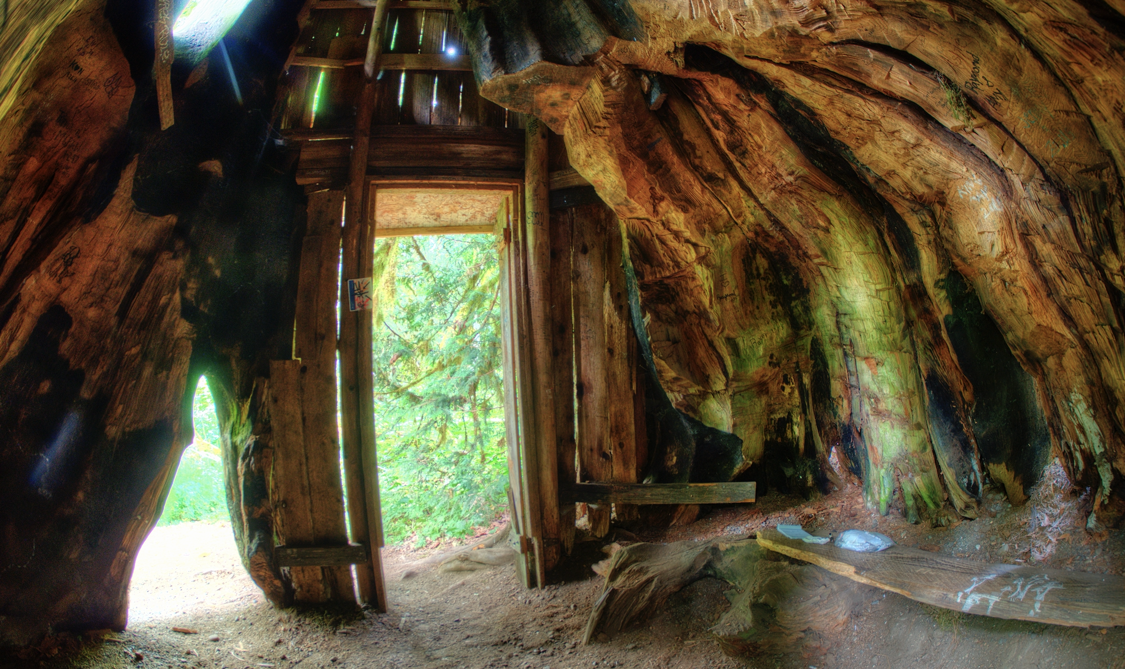
Inside the stump house | photo: George Stenberg
Local legend holds that the Stump House was originally built by Dirty Thompson an escaped convict. The notches carved in the large stump also gives evidence to springboard logging practices, which dates the stumps creation to the 1890s.
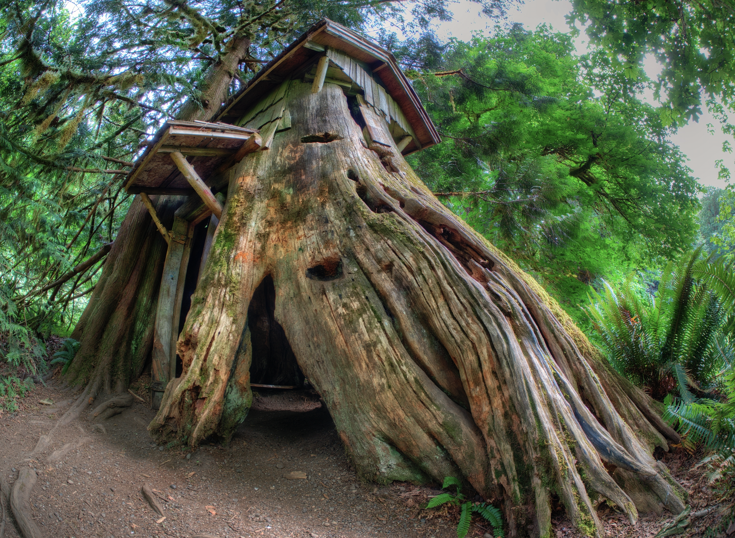
Stump house showing the springboard holes | photo George Stenberg
Loggers would carve notches in the tree to insert springboards above the flare of the roots on the tree so that they could stand on them while they laboriously cut the tree down with large handsaws.
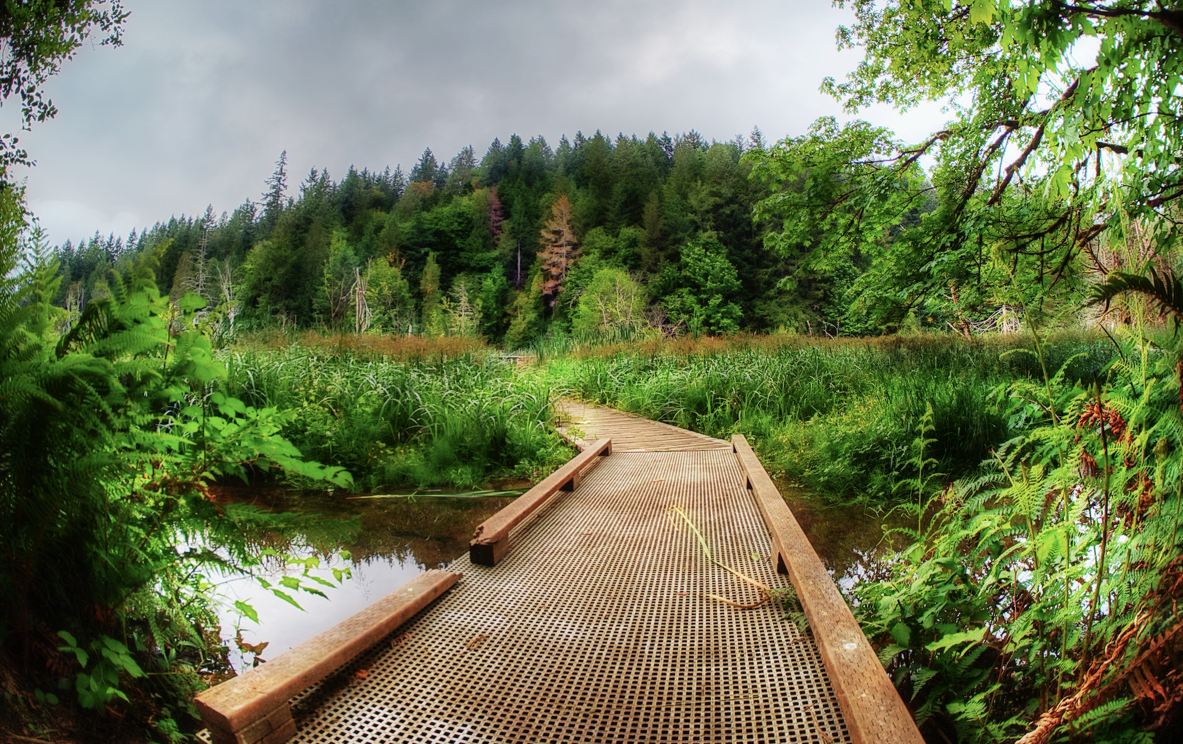
Boardwalks mark the trail to the Stump House | photo: George Stenberg
The park was originally a labor of love of the Reynolds family who bought the property in 1939. Avid bird watchers, the Reynolds renamed the cove “Guillemot” after the black and white birds that frequented the cove. In 1993, after many years of enjoying and caring for the land the family sold the property to the Trust for Public Land to preserve the natural beauty.

photo: George Stenberg
Planning your trip to the Stump House
The trails in the Guillemot Cove Nature Reserve are all natural surface trails. The 184 acre park can be found at 19235 Stavis Bay Road NW, Seabeck. The park feature saltwater beach access and walking trails. No restroom facilities available at this site. Dogs are not permitted. The Reserve has a “Pack it in – Pack it out” policy. Please bring a bag or other container for trash and take it when you leave.
Directions: From Hwy.3, take Newberry Hill exit; travel to Seabeck Holly Road; turn right. Drive to Miami Beach Road; turn right - drive to "Y"; veer left onto Stavis Bay Road. Drive 4.5 miles to the entrance and parking lot.

The Guillemot Cove Reserve is managed by Kitsap County Parks | Download map and trail guide


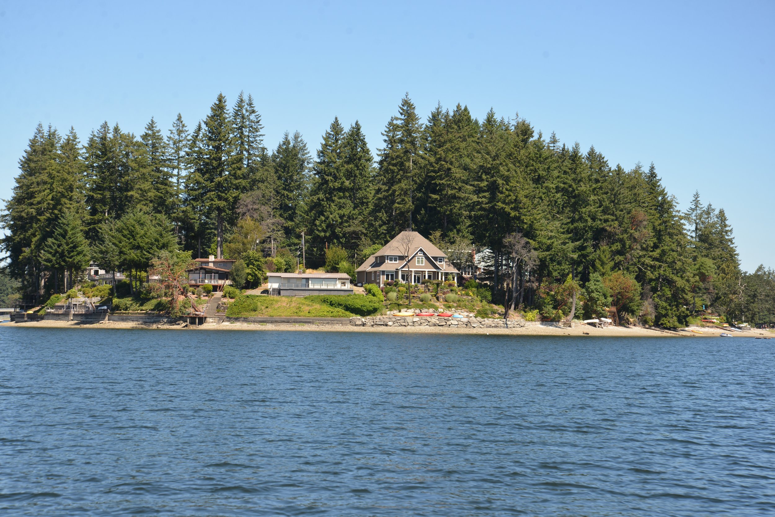
A Case Study of Islands in the Inlet
Case Inlet, at the mariner’s northeastern edge of Mason County, is home to many magical island getaways. Reach Island (AKA Treasure Island), verdant Stretch Island, secretive Herron Island, tiny McMicken Island, and Harstine Island all have interesting histories and unique characters.
Case Inlet, at the mariner’s northeastern edge of Mason County, is home to many magical island getaways. Reach Island (AKA Treasure Island), verdant Stretch Island, secretive Herron Island, tiny McMicken Island, and Harstine Island all have interesting histories and unique characters.
The water access provided by Case Inlet linked the early forestry and settlement farming of this area to Tacoma and Olympia. In the beginning Squaxin dugout canoes, row boats and temperamental sailboats were the main transportation. Small side-wheel freight ships (powered by coal, wood, and later diesel), known as the Mosquito Fleet, came to replace these early methods. They transported freight and passengers, shipped milled lumber, and even towed logs, connecting these remote communities and homesteads.
Reach Island
The first island we encounter heading from north to south down Case Inlet is Reach Island. The entirety of Reach Island was pre-empted and homesteaded by Joseph Pickford in 1885. By 1905, it was an established farm run by the Zizz family with cows, chickens, and fruit trees. Little farms like this were a major part of the Washington economy. Grapevines early on became important players in the agricultural scene of Case Inlet, or as it came to be known in the mid-1920s – the “grape belt of Washington.”
Stretch Island
Stretch Island saw the first efforts of grape growing on the inlet. Civil War veteran, Lambert Evans is credited with introducing the first concord grapevines to the island 150 years ago this year. Adam Eckert arriving in 1889 developed these into Washington’s own hybrid the Island Belle. This purply-red variety was hardier and ripened more successfully in the coastal climate.
Freight ships, such as the Skookum Chief would transport the Eckert Fruit Company’s fruit juice and grapes packed in round 6-pound wooden baskets to market in Shelton, Olympia, Tacoma, and Seattle.
After Adam Eckert passed away his lands and extensive grapevines were purchased by Charles Somers in 1918. Somers in partnership with his brother Frank expanded the business and began shipping to San Francisco. In 1922, the town of Detroit changed its name to Grapeview to reflect this growing resource.
In 1933, when the Federal laws known as Prohibition were lifted, Charles Somers was the very first applicant to be granted a winery permit in the 15th District (this included Washington, Oregon, Idaho, and Montana). St. Charles Winery started small with a French vintner overseeing the first casks of the only 3,000 gallons produced. Charles Somers’ sons Charles W. "Bill" Somers and Howard Somers joined the family business and by 1935 they were producing 38,000 gallons. Bill oversaw growing the fruit and harvesting and Howard (who specialized in chemical engineering at UW) took over the fermentation.

Charles Somers Vineyard
Vineyards throughout the area, especially on Harstine Island and along Pickering Passage added to their supply of grapes. In 1955, St. Charles processed over 500 tons of grapes from Mason County and another almost 300 tons from Yakima Valley. Although by 1965, the St. Charles winery had sold and the wine with it, there still exists on the Somers’ property on Stretch Island the original vine planted by Lambert Evans in 1872. Though not as popular, local vineyards still grow Island Belle and u-pick grape yards were a popular fall pastime until the 1980s. Hoodsport Winery still ferments Puget Sound Island Belle grapes. The wine is described as “a red wine bursting with flavors of fresh raspberries and cherries. A perfect wine for picnics and barbecues.”
Harstine Island
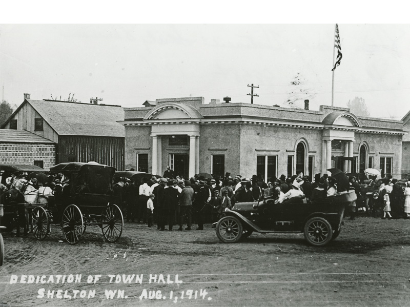
Just a little South of Stretch Island is Harstine Island. At over 18 squares miles it is the third largest island in the inland Puget Sound (after Bainbridge and Vashon), yet it is a sleepy wooded island with a population barely touching 1,500. Historically, residents were pioneer loggers (like Robert G. Jarrell of Jarrell Cove State Park fame), farmers, oystermen, fishermen and opportunistic captains (and many residents were all the above). Since the Island was only connected to the mainland in 1969 by bridge, traveling by water was very important to all aspects of life. Many famed Mosquito fleet captains lived here, building business and homes. The historic Community Hall was built in 1914.

According to the Harstine Island Community Club website, easy trees were harvested along the shores for lumber which was towed by Ed Cowan’s Levina and Raymond and John Haskell’s 40-foot launch the Marie to the sawmill at Taylor Bay.
The Community Hall held many popular dances and events with people coming by boat all the way from Agate, Stadium and Vaughn to attend. To this day it is a popular gathering spot for the Harstine community.
In 1922, the county established a ferry service crossing Pickering Passage. The 40-foot scow, the Island Belle (named for the popular grape) was their first ferry. She was built by Ira Libby of Hammersley Inlet with the help of Earl Harriman. She was designed from a ferry in operation on Lake Crescent.
With two load aprons she could carry three cars at a time, which would drive through on one end and unload on the other. She made the crossing in 30 minutes with her Fairbanks-Morse 10-horsepower engine, which drove by belt two side-paddle wheels.

She was replaced in 1929 by Earl Harriman who built his own log ferry to increase the capacity. Donette Glaser remembers that “ Earl was a pioneer of ferries. In those days, whenever we needed a new ferry Earl would tow a few logs and start building a new conveyance.” (Shelton Mason County Journal, March 26, 1959). This was soon replaced by the County’s Harstine I , and then the Harstine II in 1945 (eight car capacity).
Earl Harriman and his wife Mabel (daughter of Captain John Haskell above) were a staple of the community. Earl drove the ferry for 27 years and Mabel assisted him deck-handing when necessary. Mabel was also the chief local correspondent of Harstine Island, Pickering and Agate for the Shelton Mason County Journal for many years.
Captain Glenn Yates ran the Harstine II on her last crossing on Sunday, June 22, 1969 at 2 PM as the new Harstine bridge opening was celebrated with a parade, boat flotilla, and punch at the Harstine Community Hall. The traffic lined up on the mainland side of the bridge was further than any local had ever seen at a ferry wait. As the Captain’s wife, Carmen Yates, remarked at the time:
“The Island… saw its first major traffic jam that day. If anyone would have told me 25 years ago when I came to the island that one day I’d be involved in a traffic snarl that would take three deputies to unravel I would have just laughed at such an idea….And talk about waiting in line for a ferry How about that line that formed to go across the bridge? It extended from the bridge all the way past the ferry-landing as far as any of the longest ferry lines ever reached.” (Shelton Mason County Journal June 26, 1969).
With the new bridge, development on the island picked up as new residents and vacationers were attracted to the island life. This coincided with a popular developmental trend during the late 50s to 60s for logging companies such as Talbot & Sons Ltd. and Weyerhaeuser to revitalize their unique land holdings into private residential gated communities.
The entirety of Reach and Herron Island and the northern tip of Harstine Island experienced such development. Herron Island is only accessible by a private ferry from the Kitsap Peninsula, and you must be endorsed by a community member to visit. The development on Treasure (Reach) and Harstine Islands, however, are much more public as both are connected to the mainland by bridge and many cabins and houses in the community are available for short term rental. Much of Harstine Island offer excellent island diversions for a dat trip.
A Day on the Islands
Harstine Island is home to the Wild Felid Advocacy Center. Scheduled tours gets you right you right up close with about 50 wild cats from 13 species including a pair of tigers named Suri and Tabbi, a cougar, different leopards, and many others from five continents around the world. Visit wildfelids.org for more information on the different tours you can reserve.
On Harstine Island Jarrell Cove State Park is popular with boaters and campers alike; less developed Harstine Island Park offers tranquil beach time; and McMicken Island Marine Park offers a unique low tide hike across a tidal land bridge.
Not to be forgotten, Stretch Island has one state park which is accessible only by water. Community, history, great enterprises, and the importance of bridges all make up the waters of this meandering "Case" study on an Inlet’s islands.
Events Around Case Inlet


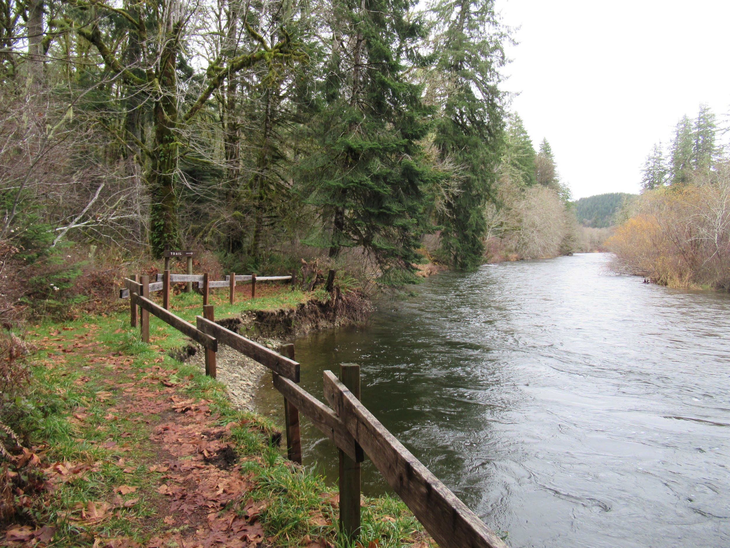
Do the Dosewallips
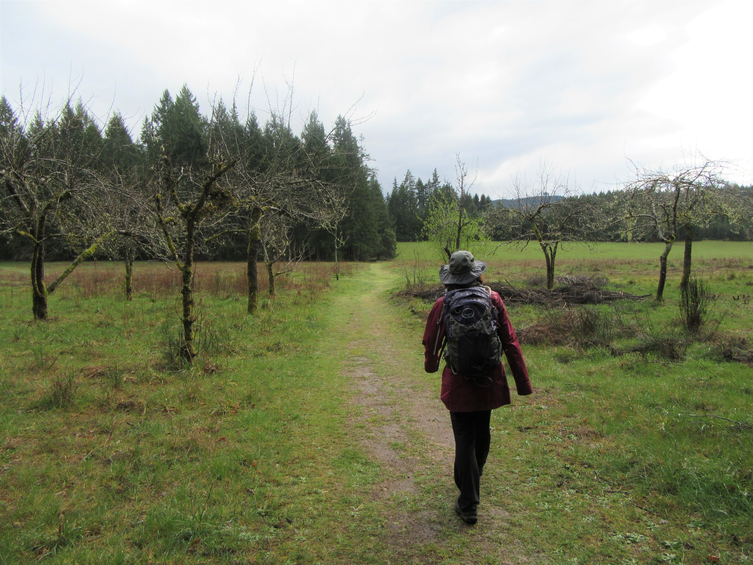
Well-known for its year-round family-friendly campground (complete with yurts) and excellent fishing and shell fishing opportunities, the park also contains a wonderful network of year round accessible hiking trails.
Craig Romano, author
Dosewallips State Park consists of more than 1000 acres of prime wildlife habitat along the Dosewallips River at its delta on Hood Canal. Well-known for its year-round family-friendly campground (complete with yurts) and excellent fishing and shell fishing opportunities, the park also contains a wonderful network of hiking trails. Saunter out to wildlife rich tidal wetlands on Hood Canal or explore quiet groves of mature forest graced with thickets of rhododendrons and cascading creeks. Hike along the glacier-fed Dosewallips River too. And retrace the route of an old railroad grade while sleuthing for relics of the area’s bygone logging days.
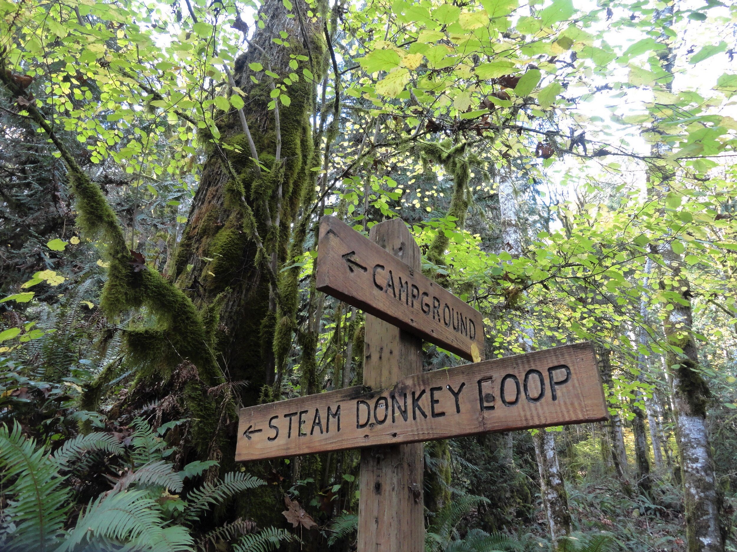
Photo credit: Craig Romano
Hit the Trail
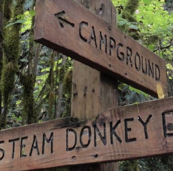
There are nearly five miles of trails in Dosewallips Park to explore with your family. Most of them are interconnected allowing for some loop options. An excellent 3.6 mile loop around a good portion of the park’s periphery can be made by following the Maple Valley and Steam Donkey Trails.

Start this loop hike from the ranger station by walking a short distance northwest up the dirt road signed for the Maple Valley Trail. After passing through the Meadow Group Camp, reach the Maple Valley Trailhead. Now head up the trail and soon come along the Dosewallips River.
Legend has it that Dos-wail-opsh was a Twana Indian who was turned into a mountain, forming the source of the Dosewallips River. From his lofty position in the Olympic Mountain wilderness, this transformed Native American did well by creating one of the peninsula’s most wild and scenic rivers.
The Twana once had a village at the mouth of the river on Hood Canal. In 1855 the Treaty of Point No Point resulted in many of the Twana people being relocated to the small Skokomish Reservation located at the mouth of the South Fork of the Skokomish River.
Hike along the river through a forest of cedars, cottonwoods and of course—maples, both bigleaf and vine. In fall the maples add touches of gold to the forest. Scan the forest for elk. They are prolific in this area and are frequently sighted in the state park. If you don’t see any of this hike, you’ll probably see plenty of signs of their presence.

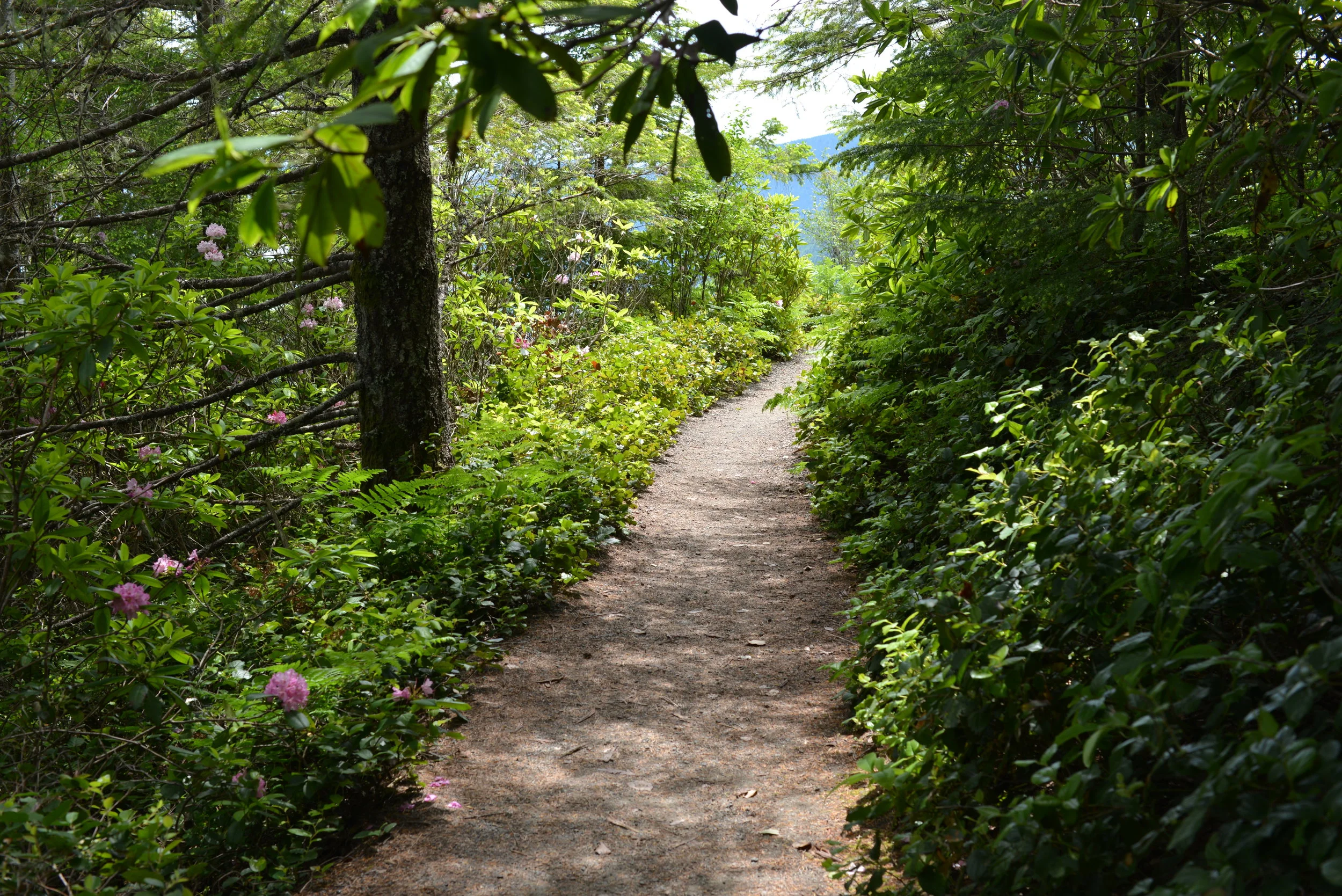
Photo Credit: Craig Romano
Continue along the trail hugging a steep slope above a river channel. The way then reaches a junction with the Rhody Cut-off Trail. You’ll be returning on that trail for this loop—so continue right. The way now gently descends to a bridged crossing of cascading Phantom Creek.
Then it’s time to climb again as the trail ascends a steep bluff and moves away from the river. Washington State Parks has been working with several agencies to greatly increase the size of this park to protect more riverfront. Once public access can be secured, there are plans to construct a trail along the river from the state park to national forest land about five miles upriver. Much of the new protected river corridor will be included in the state park.
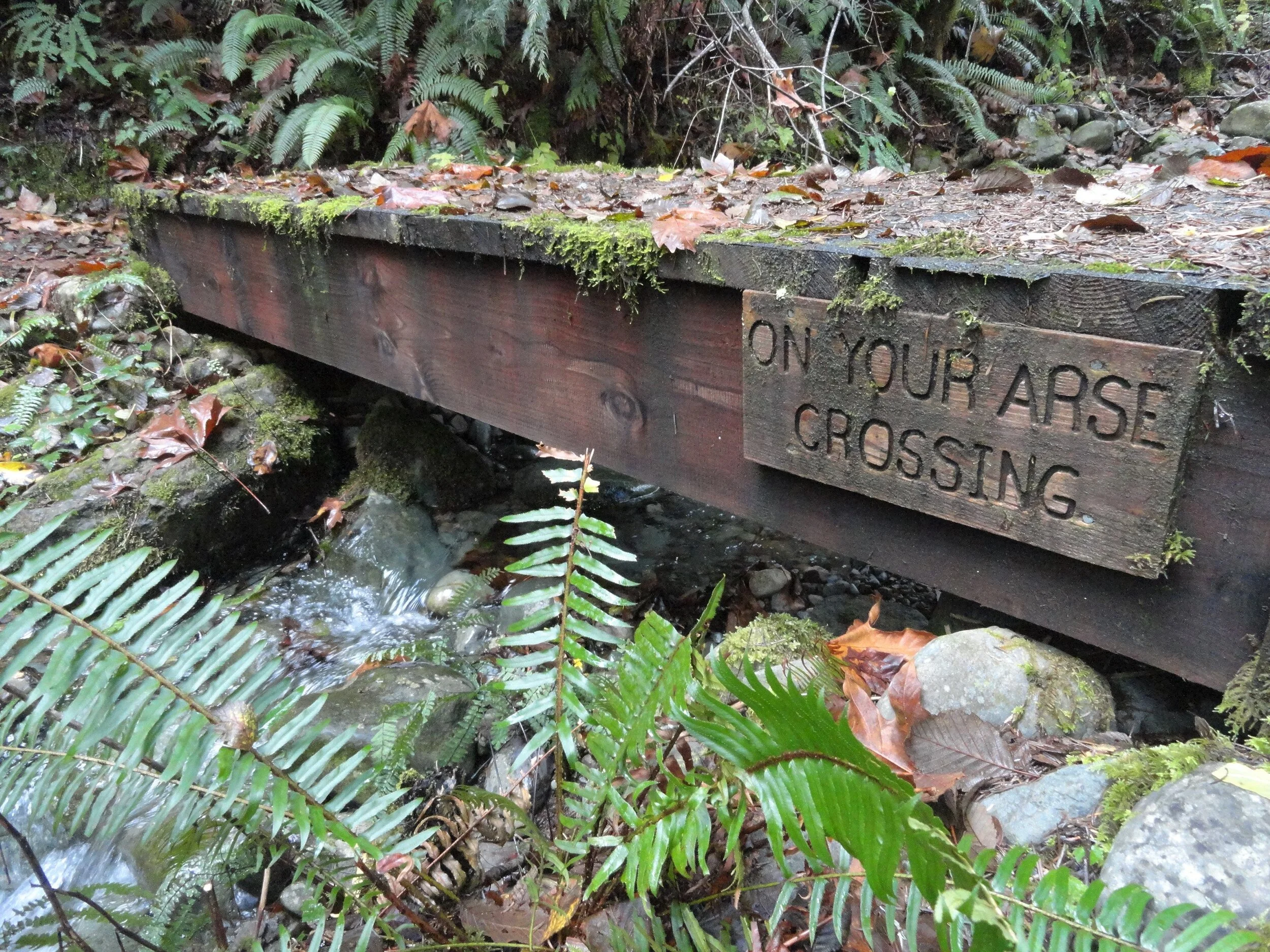
Photo Credit: Craig Romano
The Maple Valley Trail now bends southward skirting an old cut along the park’s current boundary. At about one mile from your start it reaches a fire road. The road can be used as a short-cut back to the campground.
To continue the loop proceed straight on the Steam Donkey Trail. Steam donkeys were steam powered winches used by loggers in the early twentieth century for yarding and loading downed timber.
Here as well as throughout much of the region timber was transported by rail to sawmills or to docks where it was floated to mills
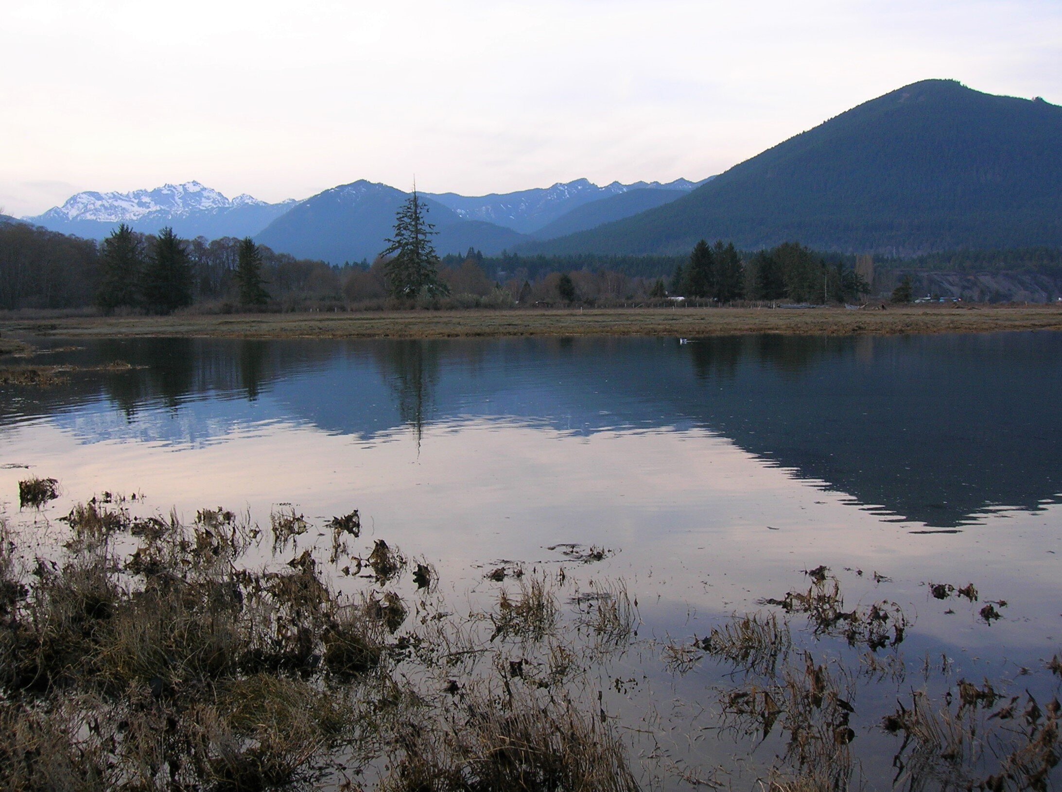
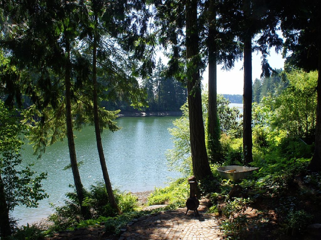
Photo Credit: Craig Romano
Running parallel to the Steam Donkey Trail and reached by walking just a short distance east on the Fire Road is the Izett Grade Trail. This trail follows a half mile stretch of an old railroad grade. The Izett Logging Company had constructed five miles of railroad in this area in the late 1890s. Logs were then transported to Hood Canal and floated to a mill in Seabeck. The Izett Grade Trail eventually reconnects with the Steam Donkey Trail and shortens the loop by only 0.1 mile.
The Steam Donkey trail continues south along the state park boundary gently climbing through maturing second growth. The trail passes a large fir struck by lightning in 2001 before crossing Phantom Creek. It then comes to a small bridge whimsically named the On Your Arse Crossing. The way then spans another cascading creek before cresting a ridge. It then begins a long gentle descent following an old road grade through maturing timber. After passing the southern end of the Izett Grade Trail the loop reaches a small dammed pool that once provided water to power the Izett Logging Company’s steam donkeys.

Photo Credit: Craig Romano
The trail then once again comes to the Fire Road. Cross the road and continue straight passing part of another stretch of old railroad bed. The logging railroads here were decommissioned in 1913 shortly after the logging company’s founder James Izett passed away. The trail next descends into a gulch coming to a junction. You can shorten the loop by heading right reaching the park road after crossing the short metal bridge
The recommended loop heads left now following the Rhody Cut-off Trail. It soon makes a bridged crossing of a creek shaded by attractive cedars; then veers left at a junction where a spur trail heads to a group camp. The trail then climbs a low ridge draped with rhododendrons. You’ll want to return to this stretch of trail in May or June. The Rhody-Cut-off Trail then loses elevation returning to the Maple Valley Trail. Return to your start by retracing a short stretch of trail to your right.
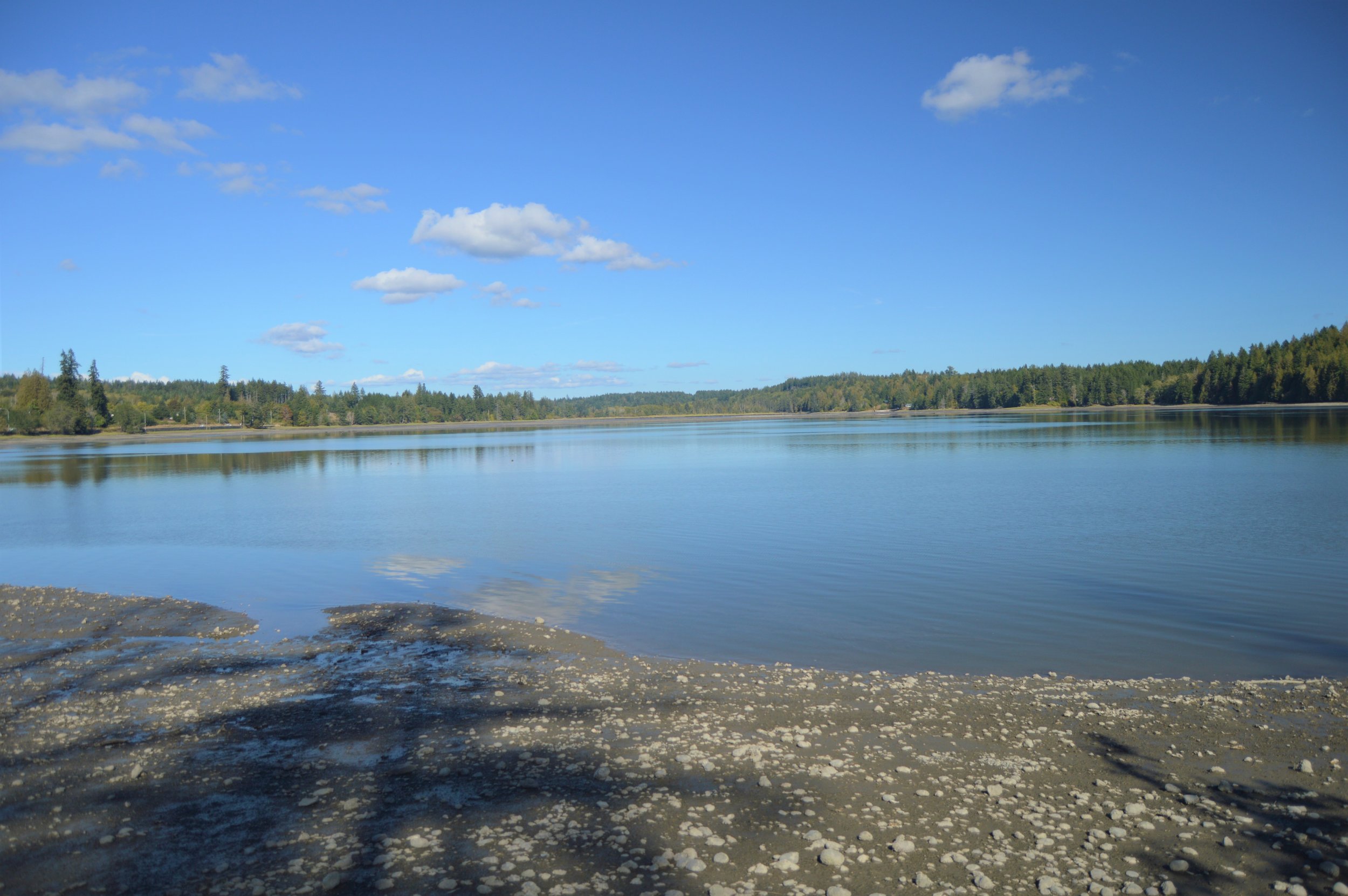
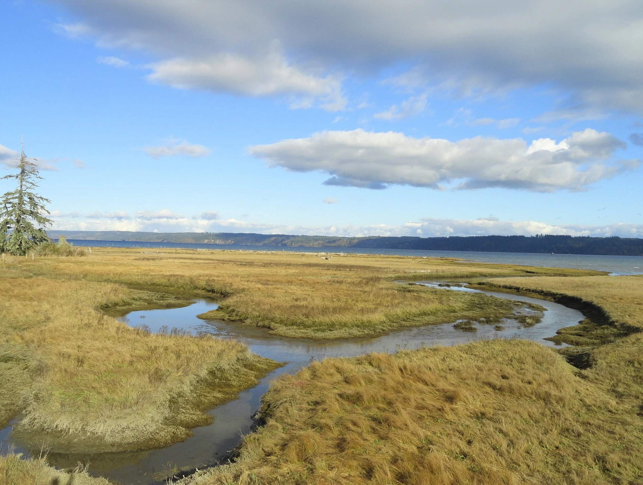
If you’ve got time and energy leftover, head over to the park’s North Tidal Trail. Follow this 0.3 mile trail to an observation deck near where the Dosewallips River drains into Hood Canal, creating a productive delta and estuary. Scan this ecologically rich ecosystem for seals and a wide array of birds.
Additional Details
Dog welcome but must be leashed while on the trail.
Land Agency Contact:
Dosewallips State Park
Recommended Map: Green Trails Olympic Mountains East 168S; State park map available at park ranger station.
Recommended Guidebooks: Day Hiking Olympic Peninsula 2nd edition (Romano, Mountaineers Books)
Trailhead Directions: From Shelton, drive US 101 north for 40 miles (From Quilcene drive US 101 south for 12 miles) to Dosewallips State Park entrance at milepost 307. Turn left (west) into camping entrance and proceed .3 mile to parking near ranger station.
Day-use parking is also available at picnic area and North Tidal Area Trailhead, trailhead facilities here include: privy, picnic area, ranger station, campground, and potable water.

50 Ways to Fill Your Days on Hood Canal
You probably don't need any urging – just enjoying one of the many parks and beaches or watching the wildlife in the water is enough for most visiting Hood Canal. But just in case you need a few ideas that allow for “social distancing” as well – here's a “couple” to inspire you .

You probably don't need any urging – just enjoying one of the many parks and beaches or watching the wildlife in the water is enough for most visiting Hood Canal. But just in case you need a few ideas here's a couple MORE to inspire you – Check out things to do for even more great suggestions.
#1. Hit the Beach
Hood Canal to Hope Island, it’s surprising how many beach access options there are. Pack a picnic, you’ll want to explore a while.
#2. Take a Hike
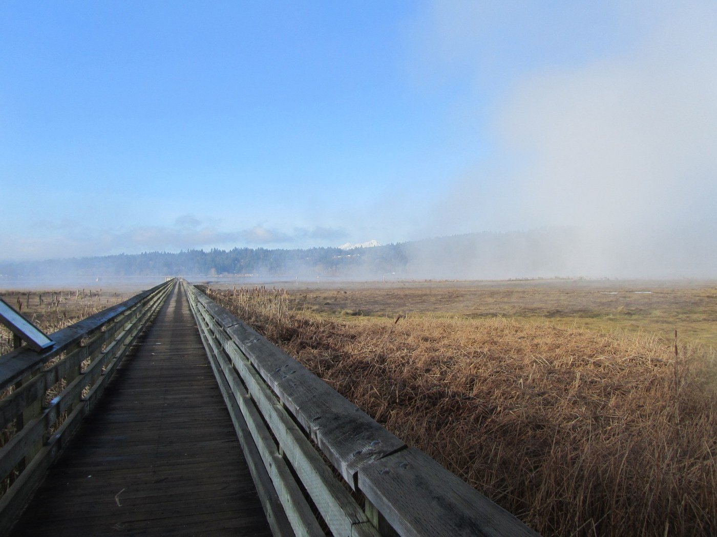
From a quiet city trail behind Shelton, forest walk at Twanoh State Park Trail (2.3 miles EASY) or Theler Wildlife Refuge (3.5 miles) where boardwalks over wetlands reveal flora and fauna. Here’s a list of great hiking spots around the Canal. Need a map? Try this link.
#3. Catch a Drift
Area lakes are stocked with trout and steelhead each Spring. Stop in at Verles for all the tips and tools. Fishing is the universal excuse to relax. Salmon season starts on Hood Canal and South Puget Sound in July and area lakes are stocked with trout and steelhead each Spring. Get your license at these local locations or online.
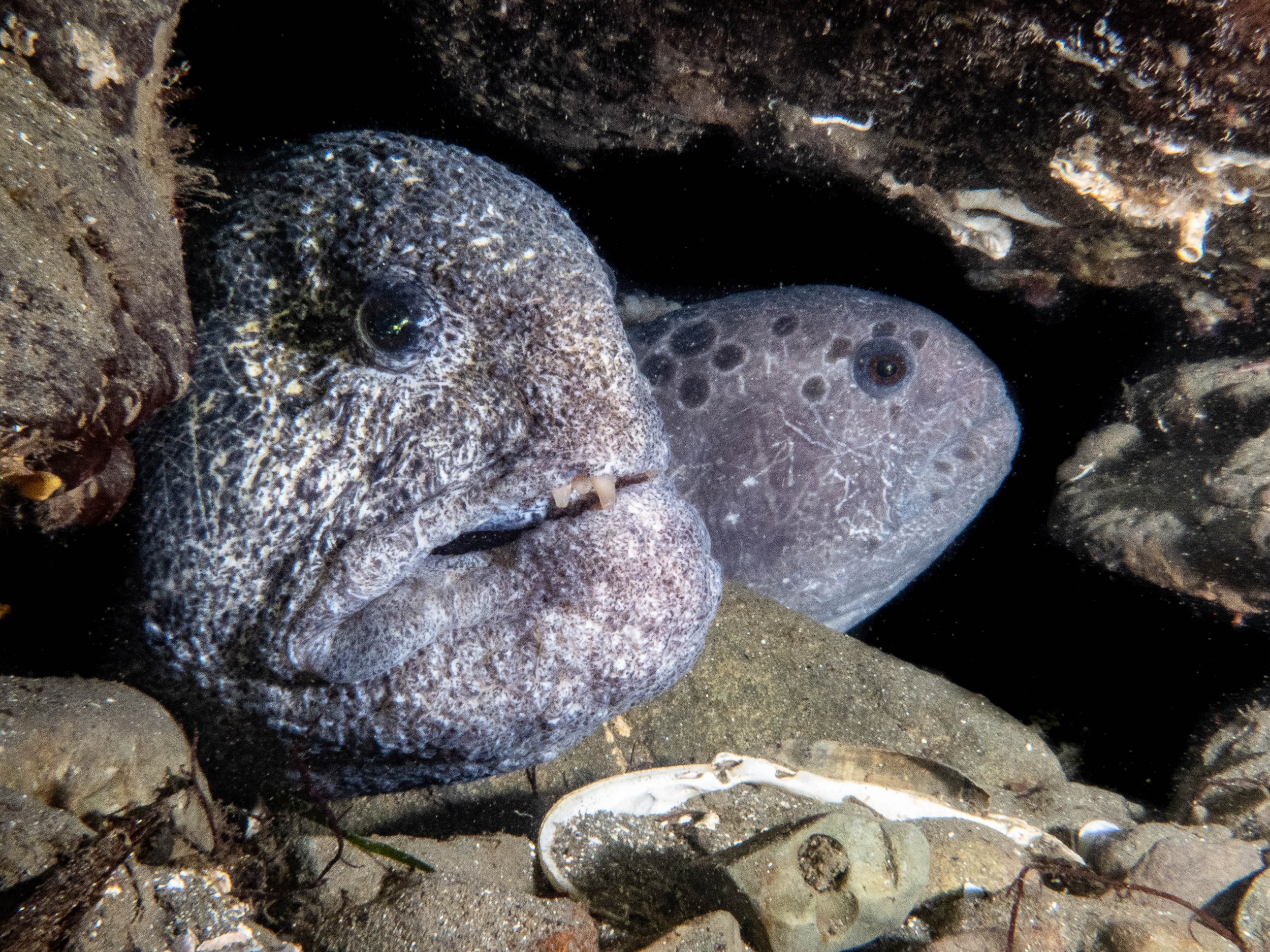
#4. Dive in the Canal
Giant octopi, friendly & curious wolf eels, and swarms of ancient rock cod add to the wonder of scuba adventures in Hood Canal. Scuba lessons, rentals (including air), and charters are available. The newly opened YSS diving in Hoodsport offers a whole series of certifications to "get your feet wet."


#5. Take the Leap
Views of the fjord and the Olympics and a seven minute free fall from 13,000 feet will change your perspective. Tandem flights $185-$215. Call Kapowsin Air Sports (360) 432-8000.

#6. Fly a Kite
Pick an afternoon low tide on Hood Canal and take advantage of the winds. The Port of Shelton (Hwy 101) has plenty of open fields.
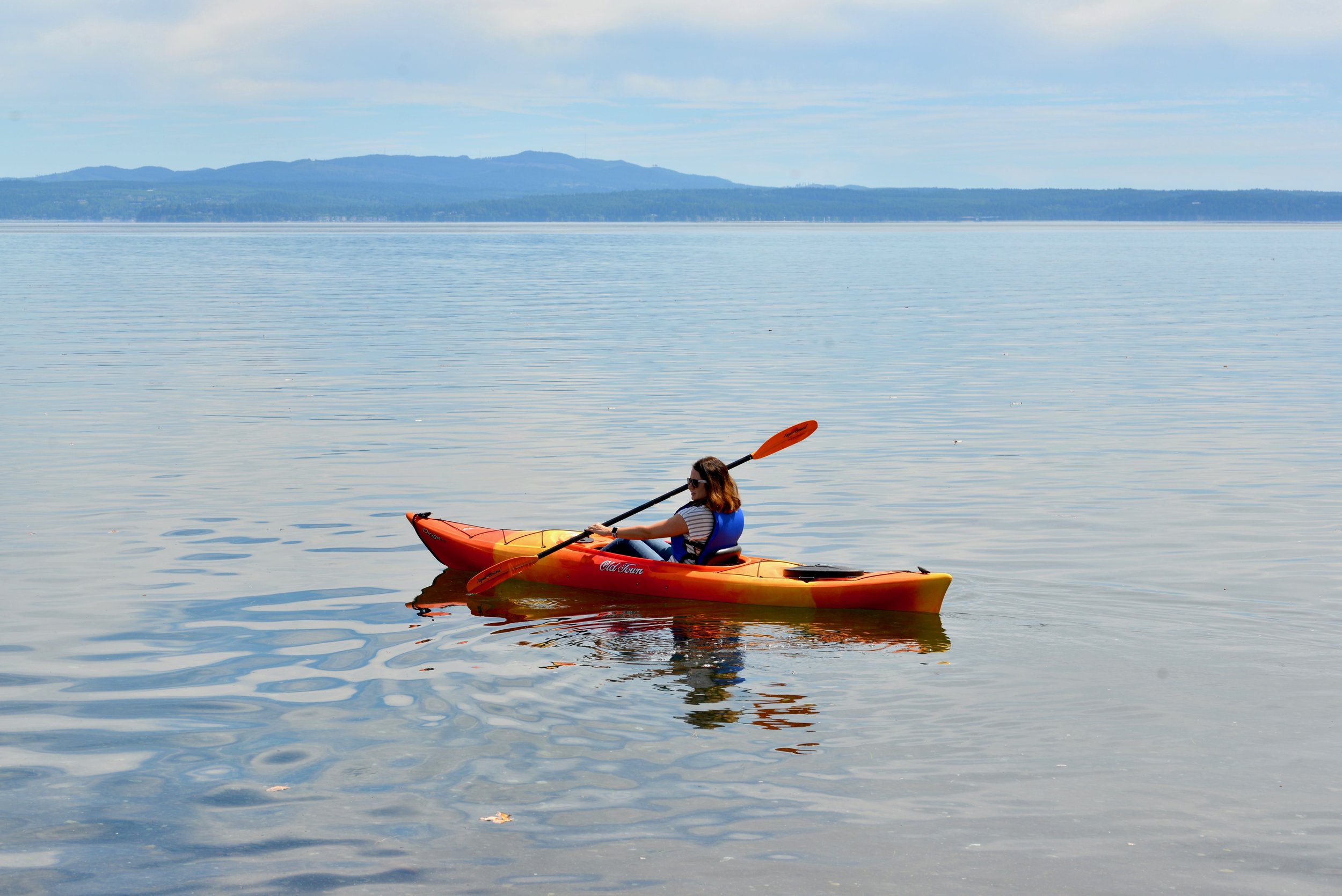
#7. Dip your Paddle
Hood Canal Adventure has kayaks for rent by the hour, day or week, and they'll deliver to your home or rental! and recently Mike’s Beach Resort teamed up with a local kayak company in Lilliwaup — learn more here.
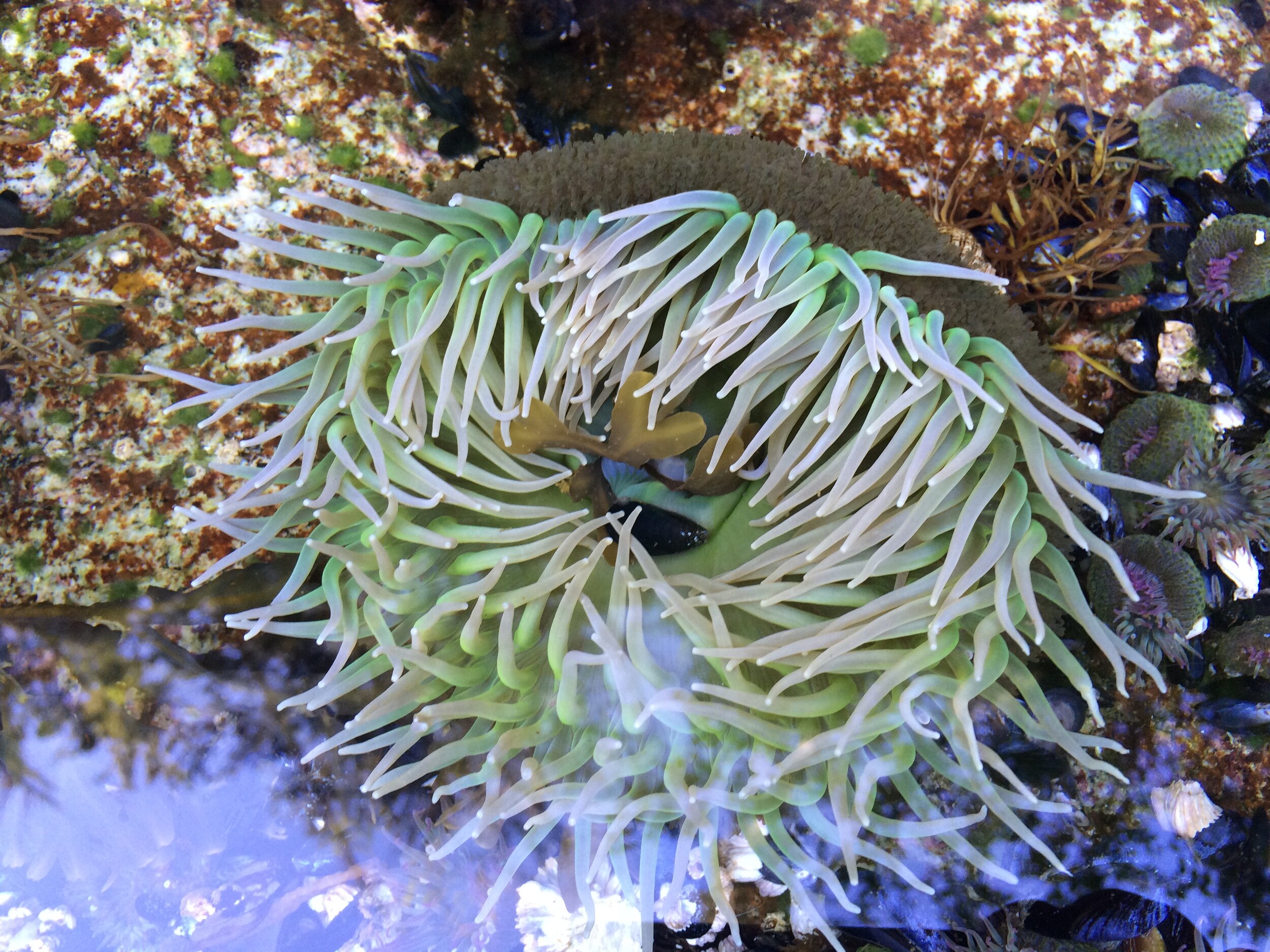
#8. Low tide wonders
The Canal and South Puget Sound expose amazing creature wonders at low tide. Spring is an especially amazing time to make discoveries – remember to replace your rocks carefully after flipping — that’s someone’s home!
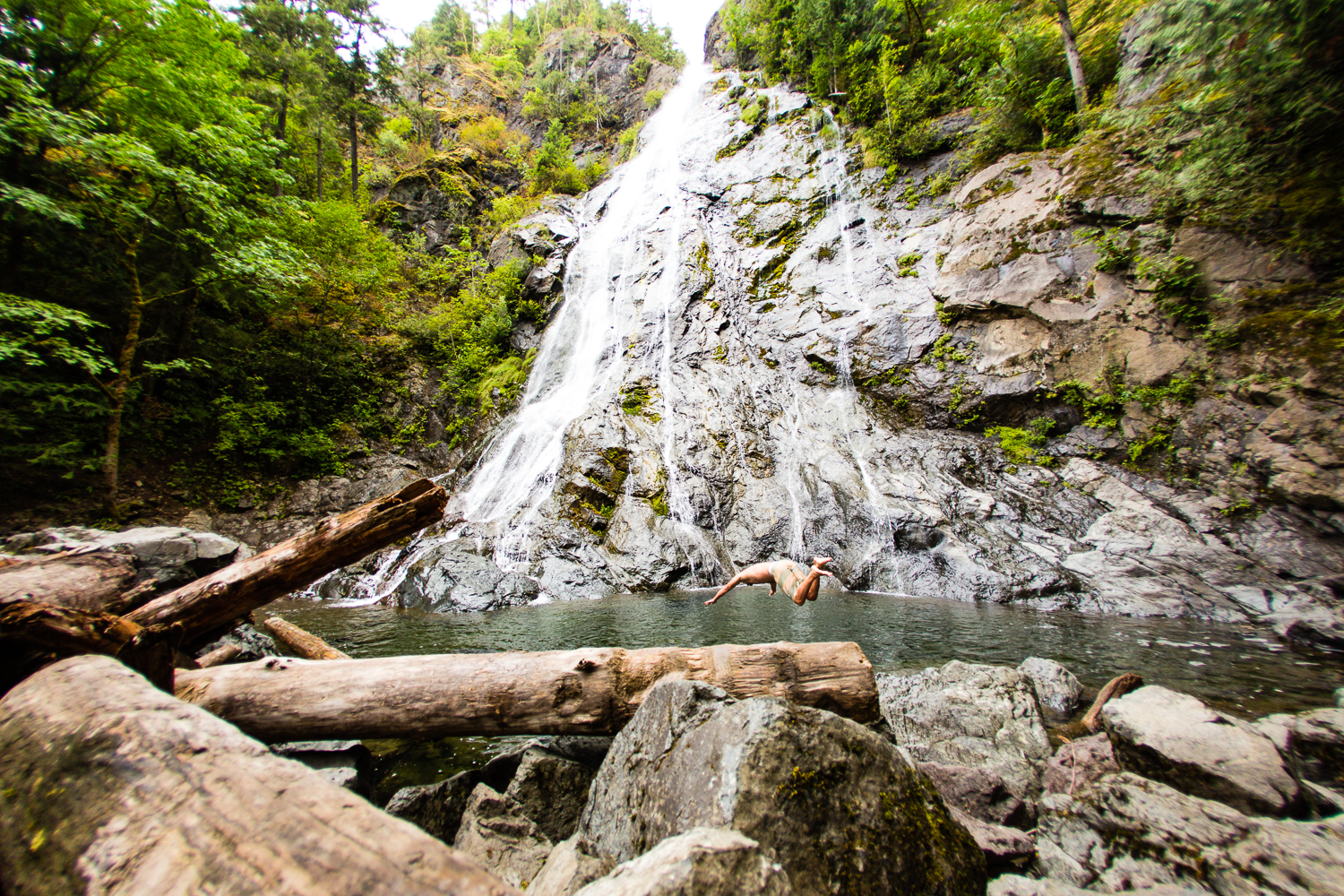
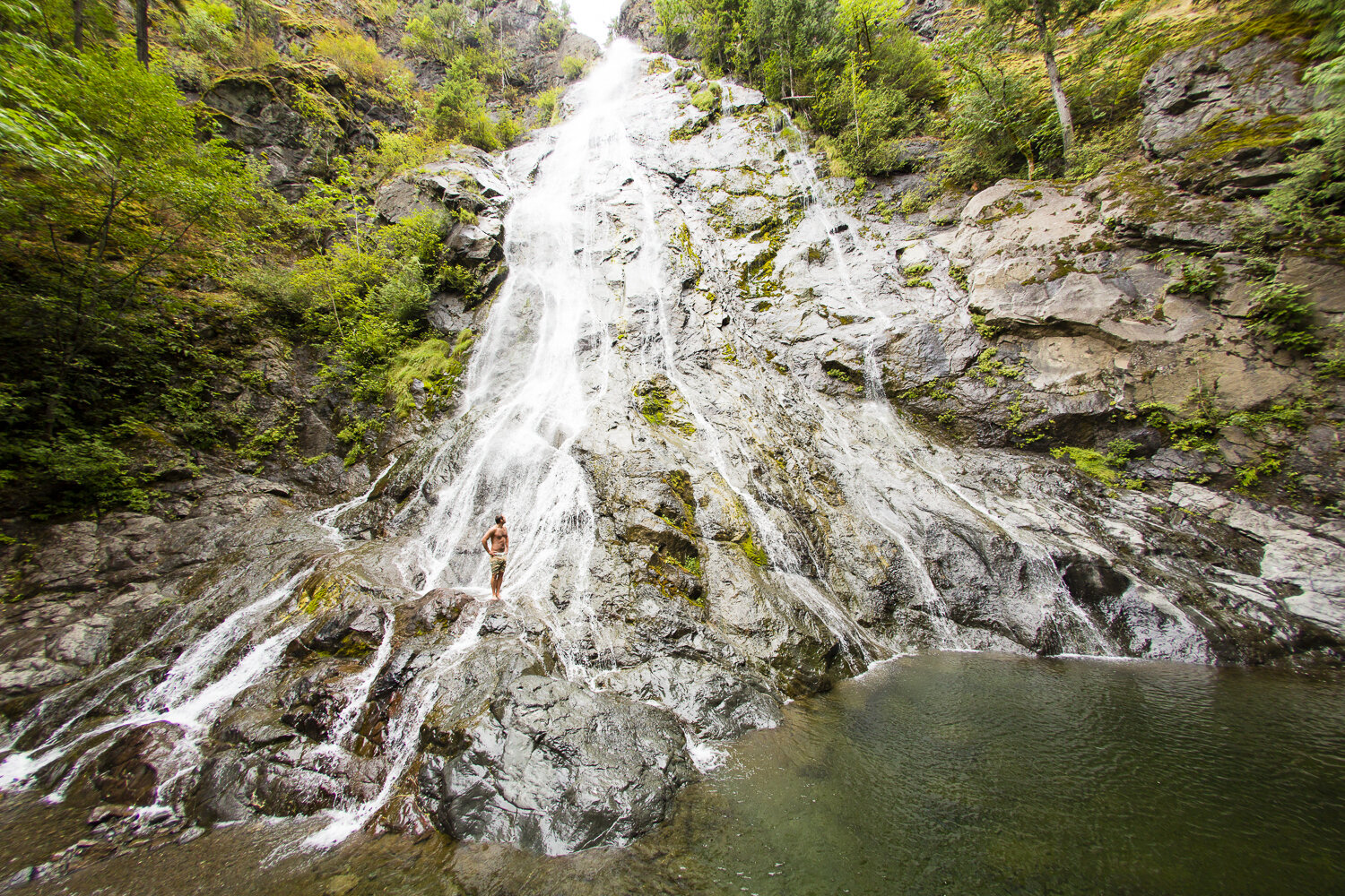
#9. Find a Fall
The waterfalls are delightful year round —and it’s fun to swim in the pools in warmer weather. Some waterfalls and rivers can be very dangerous with undertows; be aware of hazards and watch children or inexperienced swimmers.
Our favorites:


#10. Get a new View
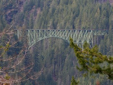
Soaring 420 feet above the Skokomish River, the High Steel Bridge (1929) is the highest steel truss arch in Washington. Follow Skokomish Valley Rd from U.S. 101 to bridge.
#11. Launch a Boat
Take the boat out and explore the islands and passages from Case Inlet on South Puget Sound, Hope Island near Arcadia Point Boat Launch and, of course through all the waterways and the Canal! Check out this list of boat launches and water access under fishing.
#12. Dine waterside
Our restaurants are back to normal with many having dining indoors and other offering take-out or curbside. Try the Hook & Fork at the nion City Market for fresh oysters and a changing seasonal with a GREAT view!
#13. Slurp!
Hama Hama Oyster Co., north of Lilliwaup, is open year round. Eat oysters – raw, baked and grilled, or try the crab cakes! The views alone will excite you.
The Taylor Shellfish retail store, South of Shelton is open daily for clams, oysters, geoduck and mussels – all harvested fresh in local waters!
#14. Pick a Peak
The Olympic National Forest and the Olympic National Park offer great climbing for all skill levels. Up for a challenge? Try the less visited but fulfilling Wagonwheel hike.
#15. Take a Hike
How about checking out the Big Loop Trail around Lake Cushman. Or if you are feeling more adventurous — check out Mildred Lakes.
#16. Run!
The Huff in Puff trail in Shelton is a great place to start but there are lots of beautiful trail run areas too. Consider participating in many of the seasonal runs that are back on the schedule again.
#17. Sip
Stottle Winery and Hoodsport Winery in Hoodsport; Mosquito Fleet Winery in Belfair; and Walter Dacon, Shelton, all have plenty of locally made beverages to go or to sip on site.
#18. Ice cream fix
For the perfect day include a scoop or two of locally made Olympic Mountain Ice Cream. Pick up a pint of Oly Mtn. Ice Cream fix at these Hood Canal & South Puget Sound locations.
#19. Bike the Fjord
Trails in the Olympic National Forest vary from challenging to easy gravel roads. Combine trails and roads to create loops that offer a variety of forests, streams and panoramic vistas.


#20. Ride the Current
Launch a kayak at the Shelton Marina on outgoing tides and ride currents in Hammersley Inlet to Arcadia Point. Lunch at Hope Island Park and return with the incoming current!
#21. Canal views
From every spot on the road looping Hood Canal you will find inspiring and rejuvenating view of the mountains and maybe even catch a glimpse of a whale or seal.
#22. Shell Creations
Head to a Hood Canal beach for the whitest oyster and clam shells perfect for the guest room soap dish – ask before taking, but most won't mind!
#23. Find a Lake
There is no shortage of accessible and open lakes throughout the area. Lake Cushman has plenty of great swimming spots!
#24. Hole in One
From the award winning Salish Cliffs Golf Club in Kamilche, Alderbrook Golf & Yacht Club in Union, Lake Limerick, Lake Cushman Golf Course, and Lake Land Village Golf Course in Allyn – all offer majestic views of the area with plenty of space for everyone. Click here for golfing options.


#25. Ride the Rails
Peddle powered rail rides with Vance Creek Railriders. Opening in May, pedal the rails on the decommissioned Simpson Logging rail line for a 12-mile round trip work out! As you pedal the multi-seat "railrider" along the track you will have the opportunity to see wildlife, old growth and new forests as well as diverse meadows teeming with wild flowers, moss, and ferns.
#26. Motorsports
Navigate 23,000 acres of working forest, Tahuya State Forest, networked by extensive and winding trails,there's has something for every adrenaline junkie.
#27. Forage!
New amongst the many activities offered by Hood Canal Adventures is guided mushroom foraging.
#28. Glamp On
From Canal beach side glamour picnic, or an overnight trip - check out the glamping opportunities around Hood Canal!
#29. Geocache Hunt
Start at Alderbrook Resort and Spa, experience the high-tech treasure hunt as you explore the resort. Check out a clue book and a Garmin Handheld GPS and search for hidden containers leading to prizes!


#30. Read a Book!
Never out of style and great for some social distancing. Here’s a few ideas to get you going!
#31. Take a S'more Break
This should be #1... be sure to remember the chocolate, graham crackers and marshmallows -- wouldn't be the same without the S'mores!
#32. Run with the Salmon
Visit one of the many fish hatcheries on Hood Canal! Visit fws.gov for information on area hatcheries.
#33. Potlatch Brewery for a Pint
New to Hoodsport is the Potlatch Brewery. Visit their tasting room on Hwy 101 in the center of town to relax after a hike. High Steel Brewery in Shelton also has some local beers that are gaining high acclaims!
#34. Take your Dog on a Hike
Check out this list of area hikes where Fido is welcome to tag along.


#35. Gyro on the Canal
Sunset Beach Grocery & Deli near Belfair on SR 106 is claimed as being the best kept secret and great for a quick take out menu item.
#36. For the Birds
The Theler Wetlands, Skokomish Delta, Duckabush, Dosewallips and Hamma Hamma are great places to catch glimpes of our resident and visiting avian community! Check out the local birding spots.
#37. Sleep under the Stars
Around every corner you will find a great place to pitch a tent.
#38. Roast the Beans
Urraco Coffee in Shelton roasts all their beans on site in their quaint and friendly cafe on 7th and Cota. The drive through is quick and friendly. Coffee available by the pound as well. Urraco is also serving coffee at their location on Steamboat Island and in Hoodsport at the Fjord Café.
#39. EAT MORE oysters!
Oysters have high levels of zinc that helps our bodies fight viruses. Catch your own or visit Hama Hama and Taylor Shellfish and the Fjord Oyster Bank to pick up clams as well.


#40. Get a Carve On
Stop in at the Bear in A Box, Allyn for chainsaw artwork by George Kenny and his team. Feeling like a lumberjack? Sign up to learn how to sculpt a squatch with a chainsaw! Get the details here!
#41. Hydro Savvy
Check out the first hydroelectric wheel on the fjord. Dalby Waterwheel is located on SR 106 between Cameo Boutique and Alderbrook Resort.
#42. Chuck a disc!
The Shelton Springs Disc Golf Course in Shelton just recently recieved top ratings. Visit masoncountydiscgolfassociation for details on all the local courses.
#43. Pizza Attack
In Shelton call Dominos or Westide Pizza on First Street or head up the Railroad Taproom on Railroad Ave for some authentic Italian flavors and a huge selection of brews on tap. All offer take out and you can call head to get your order prepared ahead of time.
#44. Squatch Watch
With over 22 sightings in Mason County alone - chances of catching a glimpse get higher each year. Keep your eyes peeled and your camera ready for that money shot! Learn more
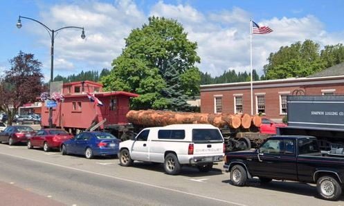
#45. Visit Tollie

The Shelton Visitor Center is in at this historic timber train. It was recently restored by volunteers so stop by the unmanned Caboose for area maps and be sure to get your picture with Tollie the engine. A historic logging locomotive (1924) operated in Mason County for Simpson Logging. Designed by Ephraim Shay, the locomotive negotiated heavy grades and curves. Tollie is joined by Caboose No.700, a 1920s log car.
#46. What's 'Sup?
A great way to explore the canal.
#47. Experience the Fjord Spirit
Using water from the Olympics, The Hardware Distillery, Hoodsport, offers spirits in an ambient tasting room and if you want to swing by quick to pick up some great spirits — they will prepare your order in advance and meet you curbside.
#48. Watch for Whales
Each year Hood Canal and South Puget Sound enjoy visits from orcas and grays. Follow their arrivals on the orcanetwork online.
#49. Beach Walk
Gather up the family and the buckets and head to the low tide for a giant aquarium that beats any confined exhibit. You’ll et wet and muddy but will walk with memories to last a lifetime!
#50. JUST R-E-L-A-X!
We have some of the cleanest air and water in the country, friendly people and gorgeous scenery everywhere.

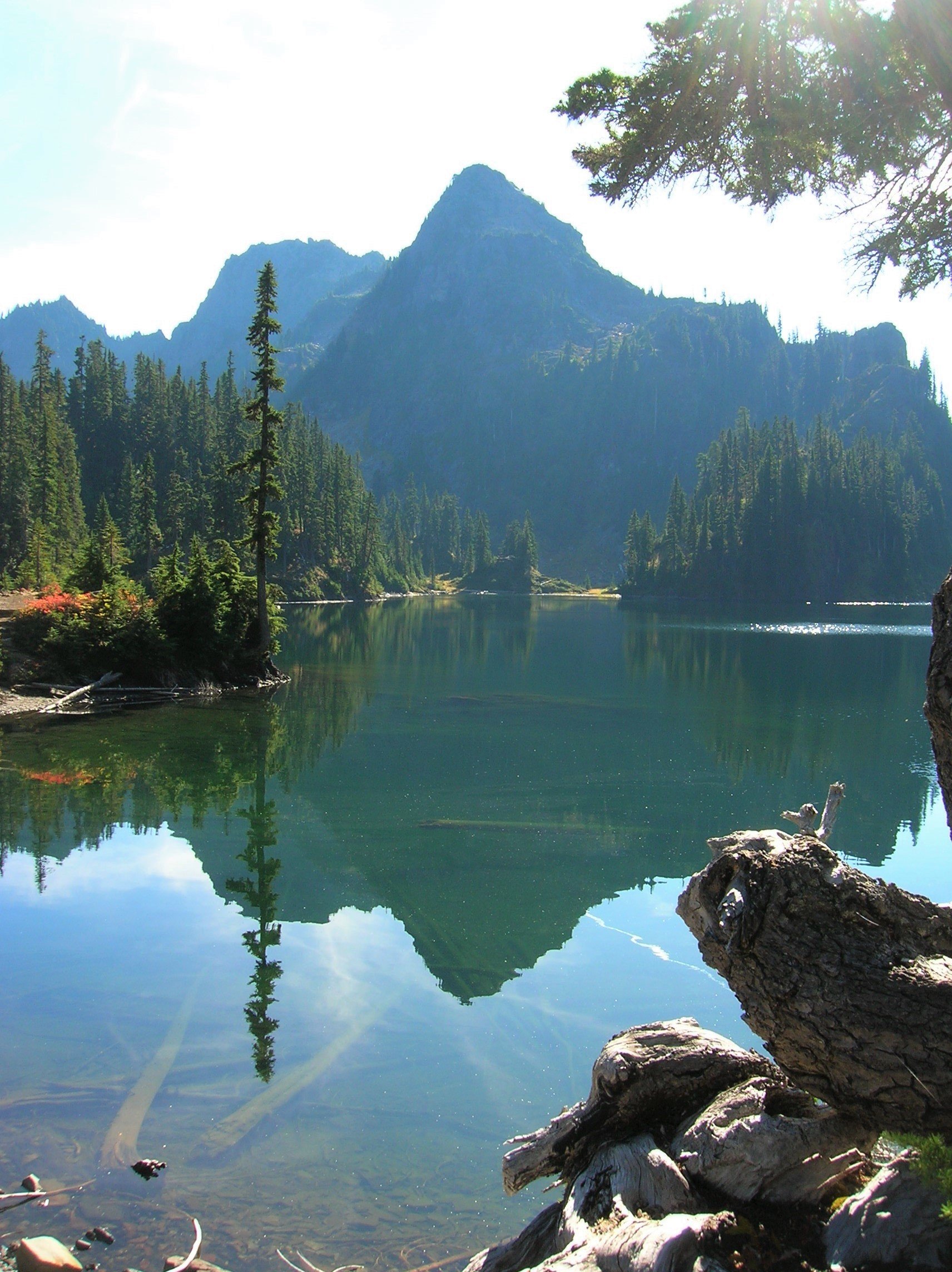
Wagonwheel Lake Hike features alpine views and solitude
One of the steepest trails in the Olympic Range, perhaps it's called "wagonwheel" because, as author, Craig Romano, puts it, "you’ll bust your axle" hiking this unforgiving climb if you are unprepared. Are you up for the challenge?
By Craig Romano
Craig Romano, is an author of more than twenty hiking guidebooks along with Day Hiking Olympic Peninsula 2nd Edition (Mountaineers Books), including 136 hikes on the Olympic Peninsula. craigromano.com
Utilizing tight switchbacks and no switchbacks at all, the Wagonwheel trail makes a grueling ascent up steep forested slopes. It’s a workout. There are some good, albeit limited views along the way. But you’ll probably feel short changed for the effort. In that case, summon your second wind and continue hiking heading up even steeper terrain to emerge at an unassuming peak granting sweeping views of craggy peaks, deep valleys, and some of the wildest and rugged terrain in the state.
"Old-growth forest, solitude, and alpine views await after a grueling ascent."
Hit the Trail

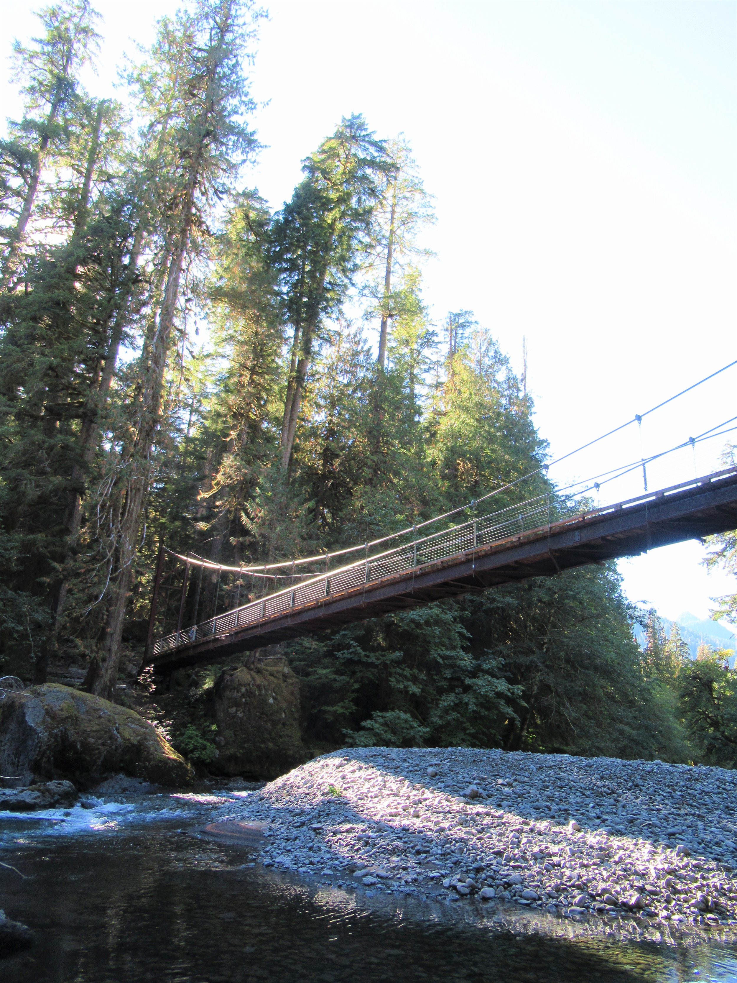
Sharing its start with the Staircase Rapids Loop and North Fork Skokomish River, don’t fret if the parking lot is packed. Almost all of those vehicles belong to hikers heading to those two other trails. Why not Wagonwheel Lake? Perhaps the sign at the trailhead does its job discouraging folks. It states that you’ll climb 3,200 feet in 2.9 miles followed by “Very Steep!” But even that assessment doesn’t correctly portray the magnitude of steepness of this trail.
The trail is gentle for a short stretch at the beginning and ending but still leaving nearly 2,800 feet of elevation gain within two miles. Yep—that’s very steep indeed!
Regardless of the fair warning, many hikers intent on reaching the lake ignore it or underestimate their fitness level and attempt this trail. And all too many of them poop out resigning themselves to accept that despite the trail’s short length—elevation gain can be a leveler! But for those of you who accept this hike as a challenge, take note.
The lake isn’t exactly one of the most stunning places in the Olympics. You may question if it was worth all of that sweat and toil. If your goal was a good workout in a natural environment—or perhaps a chance to commune deep in the woods all alone—then, yes it was worth it.
If it’s breathtaking views you are after, they are there, but you’re going to have to work a little bit more!
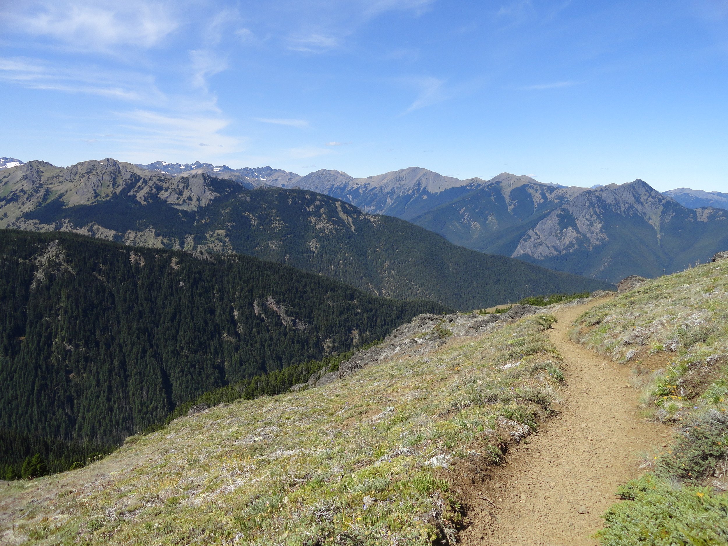
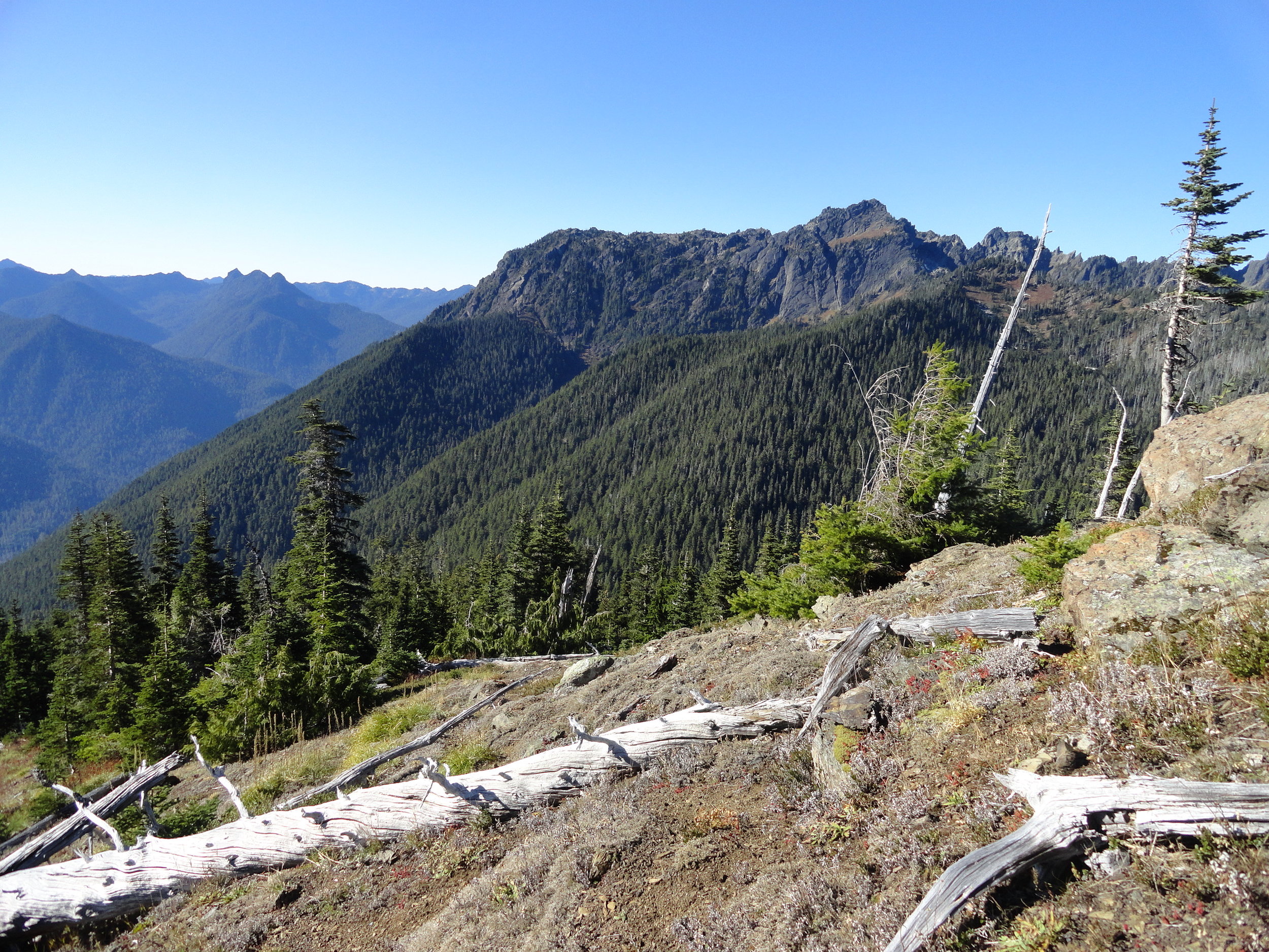
Beyond the forested basin cradling little Wagonwheel Lake you can follow a path another .4 mile and 700' of climbing to an open 4,755' knoll straddling the Mount Skokomish Wilderness-Olympic National Park Boundary.
From this spot framed with silver snags and clusters of firs you can enjoy excellent views of nearby Mount Lincoln, Mount Stone, Mount Skokomish, Mount Ellinor, Mount Washington; and the vast emerald ridges dividing the South and North Skokomish River valleys.

There are good views too across the North Fork Skokomish River Valley to Wonder Mountain, Five Ridge Peak, Six Ridge and other little known and little explored peaks. A region that pretty much looks as it did when Lieutenant Joseph P O’Neil explored this part of the Olympic interior more than 120 years ago.
Along the Way
Despite its grueling statistics, Wagonwheel Lake gets its fair share of visitors and attempted visitors. The trail starts in a lush understory of shoulder high ferns and salal.
The grade at first is deceptive, the going pretty easy. Keep a lookout to your right for an old mine shaft. Then prepare to do some serious climbing. The trail commences in a series of short tight switchbacks relentlessly ascending steep slopes.

Wind through mostly uniform seond-growth fir forest, a testament to a past disturbance—most likely a fire.
Among the monotonous make up of trees look for a few western white pines as well as Pacific rhododendrons. In late spring and early summer this flowering shrub, Washington’s state flower adds brilliant pinks and purples to the verdant surroundings. The monotony of the brutal climb however, is rarely broken.
At about 1.7 miles the trail comes to a small ledge. Here take a break and enjoy a window view of the valley below. Then commence climbing. The forest transitions from fir to hemlock. The trail and to your chagrin, steepens. Now foregoing switchbacks, the way takes an even more direct approach to subduing elevation. If you’ve hiked in the Adirondacks or White Mountains back east, the steepness of this trail compares to those areas where switchbacks are only spoken about as something that exists out west to make hiking easier.

After what feels like forever, the trail miraculously levels out. Now catch your breath, wipe your brow, swig some water and enjoy easier walking through old-growth fir and hemlock. The trail next traverses a steep slope breaking out onto a brushy avalanche chute. Work your way across slumping tread enjoying views to the northwest of Mount Lincoln and the serrated Sawtooth Range.
The trail then re-enters cool evergreen forest and crosses Wagonwheel Lake’s outlet creek. Just a hop, skip, and jump away lies the little lake in forested bowl. A small bench above the lake makes for a good place to collapse. But if you have any oomph left, locate a primitive path taking off from the main trail at the lake. It goes for a half mile straight up the 4,755-foot knoll to the north. The officially unnamed peak straddles the Olympic National Park and Mount Skokomish Wilderness in Olympic National Forest. From this peak’s meadows punctuated with silver snags enjoy a breathtaking panorama that includes the following prominent peaks: Pershing, Washington, Ellinor, Copper, Lincoln, Skokomish, Wonder, and the Brothers. Little Wagonwheel Lake sparkles below. Rest up and prepare your knees for the brutal descent.
For more trails and information check out Explore Hood Canal’s list of area hikes or visit the Explore Hood Canal Hiking Map.

Bird’s Eye View from Mount Townsend
Mount Townsend is a prominent landmark — and one of the region’s most hiked peaks. Its broad open summit affords sweeping views of some of the highest and craggiest peaks in the Olympics and a myriad of islands, straits, bays and peninsulas below.
Story & Photos: Craig Romano

Mount Townsend | photo credit Craig Romano
Rising more than 6200' at the northeast edge of the Olympic Mountains, Mount Townsend is a prominent landmark — and one of the region’s most hiked peaks. Its broad open summit affords sweeping views of some of the highest and craggiest peaks in the Olympics and a myriad of islands, straits, bays and peninsulas below. Stand atop this mountain on a clear day and watch ferries and vessels ply the shimmering waters below. Marvel at the Seattle skyline against a backdrop of snowy Cascade Mountains dominated by big, beautiful Mount Rainier. Ascend Townsend in the summer and be greeted by a brilliant array of wildflowers swaying in the alpine breezes.
Hit the Trail

There are four ways you can hike to get to the summit of Mount Townsend and all of them offer great views and a good workout. The most popular route to the mountain is the Mount Townsend Trail from its upper trailhead. An out and back via this route clocks in at 8.2 miles with just shy of 3000 feet of elevation gain. But if you don’t mind a slightly longer hike with a little more elevation gain, consider starting from the Lower Trailhead.
Throughout much of this hiking season you just may have to start from the Lower Trailhead as the Forest Service works on the upper trailhead access road rendering it off limits while under construction.
The Lower Trailhead start will add two more miles to your total roundtrip and another 500 feet of elevation gain. But it’s worth it. The way traverses a beautiful grove of primeval forest and passes by tiny Sink Lake where Townsend Creek performs a disappearing act. After one mile of pleasant walking you’ll emerge at the upper trailhead. As you approach the trailhead what may be an unsightly situation. The lack of an outhouse at such a popular trailhead as led many to violate leave no trace principles with some bad bathroom etiquette. Perhaps a note to the Forest Service in support of a trailhead privy can help rectify this situation.

From the Upper Trailhead, follow a well-beaten path and steadily ascend. The trail weaves through a stately grove of Douglas-fir and western hemlock adorned with Pacific rhododendrons. Time your hike for late May through June and enjoy brilliant blossoms. After a half mile enter the Buckhorn Wilderness protecting more than 44,000 acres of spectacular terrain in the Olympic Mountain’s northeastern rain shadow. Continue climbing transitioning into more open forest and start catching views that will only improve in magnitude as you carry on.
Cross several cascading creeks as you follow copious switchbacks upward.

At just past 2.5 miles reach a small pine and fir grove nestled on a small knoll just above tiny Windy Lake. And do hope the lake lives up to its name or its resident bugs may force you to move quickly through the area. In another half mile reach the scenic trail to the Silver Lakes. Bear right and soon leave the trees behind as you attain Townsend’s summit plateau.
Now traverse the subalpine tundra that upon a quick glance may appear barren. But it’s full of life and in summer beaming with color thanks to a myriad of wildflowers; cinquefoil, phlox, paintbrush, and harebells among them.

Look too in the rocky areas for Piper’s bellflower, a campanula that is endemic to the Olympic Mountains. Owing to its drier aspects, junipers hug the ground throughout Townsend’s summit.
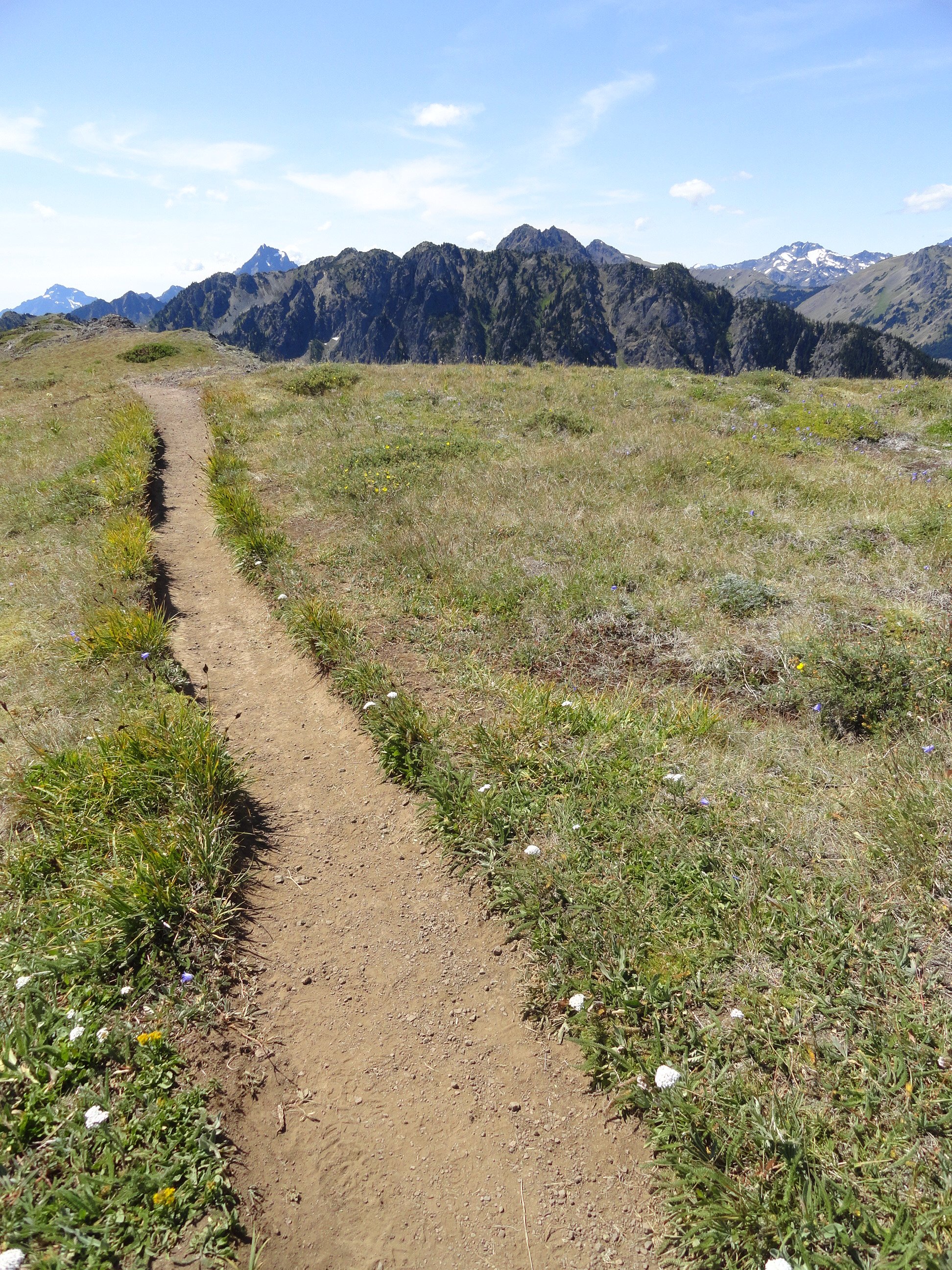
At 4.0 miles from the upper trailhead reach a junction. The main trail continues left descending to the Little Quilcene Trail offering two more approaches to the summit—one from the Northwest and one from the Northeast. Head right for 0.1 mile to the mountain’s highest point, its 6280-feet south summit. Consider continuing on the trail a short distance to Townsend’s northern 6212-foot summit too. It was on this point from 1933 until 1962 that a fire lookout once sat.
The views are great from anywhere along the open peak. Gaze out to the Salish Sea with its sprawling labyrinth of islands, bays, and channels. Watch ferries ply azure waters. Marvel at the Seattle skyline sparkling in the afternoon sunlight. And admire a fortress of Cascade peaks, punctuated by the snowy volcanoes. Look north to Dungeness Spit, Discovery Bay, the San Juan Islands, and Vancouver Island. And to the west, it’s nothing but pure Olympic wilderness—jagged peaks and deep green valleys.
And if you’re wondering if Townsend (as well as the nearby city and port) takes its name after the 19th century naturalist who named Townsend’s chipmunk, Townsend’s ground squirrel, Townsend’s solitaire and many other species—it is not!
Captain George Vancouver in 1792 bestowed the name Townsend—originally Townshend for the Marquess of Townshend. The father of Thomas Mamby, one of Vancouver’s crew members was an aide-de-camp to the Marquess at the time. The S’Klallam Tribe which had a community on the bay at the time originally called it Kah Tai which translates to pass through. You’ll probably want to pass through Mount Townsend on a return trip by perhaps ascending it via one of the other routes.
Mount Townsend Details
Distance: 8.2 miles roundtrip
Elevation Gain: 2980 feet
High Point: 6280 feet
Difficulty: moderately difficult
Snow free: June to November
Trailhead Pass Needed: None
Notes: trail also open to horses, wilderness rules apply
GPS waypoints: Trailhead: N 47 51.385, W 123 02.153
Land Agency Contact: Olympic National Forest, Hood Canal Ranger District, Quilcene; http://www.fs.usda.gov/olympic
Recommended Guidebook: Day Hiking Olympic Peninsula 2ed (Romano, Mountaineers Books)
Trailhead facilities: none
Trailhead directions: From Shelton, drive US 101 north for 50.5 miles. Upon crossing the Big Quilcene River just shy of the community of Quilcene turn left onto Penny Creek Road. The drive 1.5 miles and bear left onto Big Quilcene River Road (Forest Road 27). Follow this generally good road for 12.5 miles for the lower trailhead turnoff; or 13.7 miles for the upper turnoff. Then reach the lower trailhead in 0.8 mile or the upper trailhead in 0.7 mile.

Feast your eyes on a face with personality to spare!
Get any group of divers together in the Pacific Northwest and ask them what makes for a great dive. Everyone will agree that a wolf eel was somehow involved. There is something unique about the supremely ugly faces of an adult wolf eel staring at you from its den.
Story & Pictures, Thom Robbins
Get any group of divers together in the Pacific Northwest and ask them what makes for a great dive. Everyone will agree that a wolf eel was somehow involved. There is something unique about the supremely ugly faces of an adult wolf eel staring at you from its den.

Hood Canal Wolf Eel | Photo credit: Thom Robbins
This can turn an ordinary dive into a great one. The conditions don’t matter – cold, terrible visibility or strong currents are forgotten once a wolfie (as we call them locally) appears publicly. It’s not surprising why divers worldwide travel to places like the Hood Canal to catch a glimpse of these fantastic creatures.
Meet wolfie

Hood Canal Wolf Eel | Photo credit: Thom Robbins
Throughout history, the peoples of the northern Pacific have held wolf eels in deep respect. Many of the native tribes in the area viewed the wolf eel as a creature of strength and resilience, symbolizing protection due to its robust and intimidating appearance. This belief often extended to the spiritual realm, where the wolf eel was thought to embody protective spirits. In Washington, the wolf eel is now a protected species in the Puget Sound and Hood Canal.
This is not because they are endangered but because their value as a living resource to divers and photographers far exceeds whatever commercial value the species could provide as a food source. Some dive sites, like Sund Rock in the Hood Canal, are well-known locations where wolf eels interact with divers and provide unique photo opportunities.
Wolfies are not related to eels. Instead, they are part of a family known as the wolf fishes.

Hood Canal Wolf Eel | Photo credit: Thom Robbins
They belong to an even larger group of fish known as Perciform, generally considered perch-like fish. But their long-bodied, eel-like appearance is unique in this group of fishes. The wolf eel can be found as far south as San Diego in southern California, then northward up the Pacific coast to the Aleutian Islands in Alaska. The popular term “wolf eel” comes from the large frontal canine-like teeth used to seize their favorite meals, mainly hard-shelled crustaceans and invertebrates. The typical menu includes crabs like Dungeness, Red Rock, and Green Urchins.
Most wolf eels can grow to about six feet long and weigh almost thirty pounds, although they can grow to eight feet. These massive fish are speculated to live up to 10 years in the wild, though no research is available on their longevity. Scientists have found that they can begin reproducing between four to seven years, suggesting they may be long-living fish. One fact that I find fascinating is that they lack a swim bladder, a feature commonly found in most fish species. The swim bladder is an internal gas-filled organ that helps fish regulate their buoyancy and control their vertical position in the water column. However, the wolf eel has evolved without this organ, relying on its muscular body and strong pectoral fins to maneuver and maintain its position in the water. The lack of a swim bladder allows wolf eels to lounge around on the bottom or lay in their home lairs. Like snakes, they swim by making S shapes with their bodies and use their pectoral fins to steer. This unique adaptation allows the wolf eel to thrive in rocky coastal habitats, where it can navigate through crevices and caves with exceptional agility. By forgoing the swim bladder, the wolf eel has developed a specialized set of skills, making it an expert hunter and a master of its underwater domain.
Additionally, wolf eels have a slimy coating on their bodies, which serves several important purposes for their survival and protection in their marine environment. First, it acts as a natural defense against infections. The slime contains antibacterial and antimicrobial properties that help prevent the growth of harmful bacteria and parasites on their skin, reducing risk of infection.
The slimy coating makes it difficult for predators to grip or hold onto a wolf eel.
When threatened or attacked, a wolf eel can release more slime from its skin, making it slippery and challenging for predators to maintain a firm grip. This slippery defense mechanism allows the wolf eel to escape from potential threats. The slimy layer reduces friction when the wolf eel moves through the water, allowing them to easily pass through tight spaces and narrow cracks without getting stuck.
Lifecycle of a Wolf Eel
Approximately 24 hours before mating, the female wolf eel’s abdomen becomes noticeably distended. When this happens, the male will butt his head against the back of her abdominal region. This action appears to stimulate physiological activity. A series of waves move through the female's body from her head to her tail, particularly pronounced in her abdominal area. The male will then wrap himself around the female so that their heads will be side by side and their genital regions adjacent. In this position, the female releases the eggs, usually between 5,000 and 10,000, and the male fertilizes them as they appear. After fertilization, the female will coil about the eggs, molding them into a ball-like cluster. The eggs are adhesive to each other but not to the rocky walls of the den. Both parents will then coil themselves about the egg mass, sometimes together and at other times individually, tending the eggs and ensuring they are rotated so that a good flow of water passes through them.
After about 16 weeks, the eggs hatch, and the larvae float towards the upper part of the ocean or the sea, where they spend nearly two years of their lives. The tiny fish are born brownish pink, about 1 1/2 inches long. They turn dark gray within a day and start snacking on small shrimp after a few days. The larvae that emerge are left on their own to swim with the plankton in the ocean. From birth, they are voracious predators and will strike at their planktonic prey, much like a coiled snake will strike at a mouse. Constantly searching for prey, the larval wolf eels will lead a pelagic existence. Eventually, the maturing youngsters settle on the ground and enter a den. Denning will typically occur in the Puget Sound area from February through April.

Juveniles wolf eels exhibit a more vibrant and striking appearance. | Photo credit: Thom Robbins
The change from a pelagic to a bottom-dwelling existence spawns physical changes in the juvenile wolf eel. Juveniles exhibit a more vibrant and striking appearance. A vivid orange or reddish-orange color with darker markings often characterizes their appearance. This vibrant coloration helps juveniles blend in with their surroundings, such as rocky reefs or kelp forests. As they mature into adults, their coloration becomes more subdued brown or reddish-brown. The skin often has spots of a darker color, which may be outlined in a lighter color. The males will also develop a puffy face, enlarged jaws, huge bulbous lips, and a powerful sagittal crest at the top of their heads to support the increased muscle mass required for the jaws.
Friends & enemies
There is no fairness in the realm of a Salish Sea rocky reef. A fierce battle for ownership unfolds around the most desirable den sites. The key contenders are the Giant Pacific Octopus (GPO), and the formidable wolf eel.
Both species vie for control over these coveted shelters, which serve as their sanctuary in a harsh underwater world. This struggle is fueled by their shared habitat, prey, and an unyielding desire for the same type of den sites.
With its unmatched dexterity and cunning, the octopus poses a formidable challenge to the wolf eel. I have watched the battle when a GPO ruthlessly evicts a wolf eel, sometimes even targeting mated pairs, and claims the den as its own. Despite the wolf eel's valiant efforts, there is little it can do once an octopus of even modest size has set its sights on a particular den.
Ask any diver, and they can attest to the futility of trying to dislodge an entrenched octopus from its chosen abode.
Submerging into the chilly embrace of the Salish Sea transforms the ordinary into the sublime. A serene quietness wraps around you as you descend below the waves, echoing the solitude of an explorer charting new frontiers. Gripping your camera firmly, you traverse this alien landscape, feeling every inch an astronaut on an oceanic planet.

Hood Canal Wolf Eel | Photo credit: Thom Robbins
Before long, you approach a wall, its vastness urging you to uncover. You glide along its face, examining each nook, cranny, and boulder with a mix of awe and curiosity. The vividly colored marine life enchants you, each organism a stroke of brilliance from nature’s palette. In this marine maze, your adventure takes a thrilling turn.
From the periphery, a wolf eel appears, locking eyes with you. There’s a mutual recognition, a shared wonder between you and the creature, silently communicating in this mesmerizing undersea world. The thrill of the encounter sharpens your focus, and with camera in hand, you ready yourself to document this surreal moment. You aim and capture the scene, forever preserving your encounter with the wolf eel.
Hood Canal Diving:
Sund Rock Marine Preserve
26472 US-101, Hoodsport
sundrock.com
YSS Dive Charters
24080 N US-101, Hoodsport
yssdive.com/charters
About the Author: Thom Robbins

"Fascinated with the underwater world in the Pacific Northwest,I have been a diver for over thirty years and have never been happier than underwater with a camera. I spend as much time underwater as possible, shooting pictures or teaching diving and photography. You can see and purchase my photo collections at robbinsunderwater.com. If you want to learn about diving or photography, reach me at thomrobbins@gmail.com.
When not diving, I spend time with my wonderful, patient wife, Barb. We have just relocated to Shelton to enjoy a more relaxed life. Without Barb, I wouldn’t have continued my passion for diving. She is my best and often harshest critic, pushing me to explore better photos. I also have a 21-year-old son who makes me want to be a better person daily. Last but certainly not least are my two English Bulldogs, essential to my family's life."
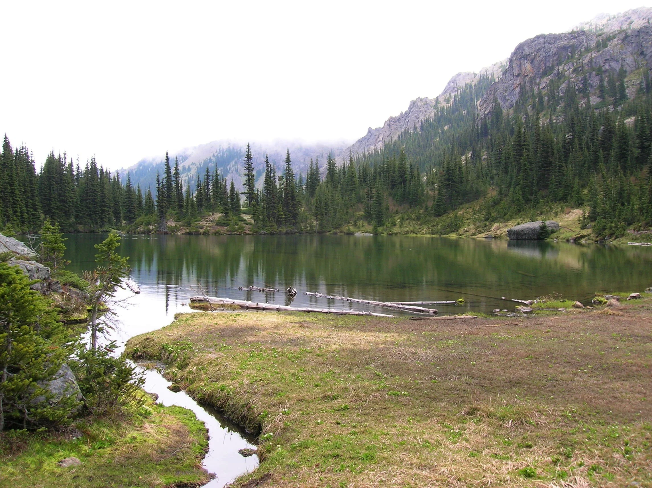
Silver Lake Hike
The Olympic National Forest’s Buckhorn Wilderness contains more than 44,000 acres of some of the finest backcountry on the Olympic Peninsula. Within this rugged corner of the Olympic Mountains you can hike on miles of trails traversing deep valleys of old-growth forests and along high windswept ridges granting stunning views.
Craig Romano | Story and Pictures
The Olympic National Forest’s Buckhorn Wilderness contains more than 44,000 acres of some of the finest backcountry on the Olympic Peninsula. Within this rugged corner of the Olympic Mountains you can hike on miles of trails traversing deep valleys of old-growth forests and along high windswept ridges granting stunning views.
Hit the Trail
Located within the Olympic rain-shadow, the Buckhorn receives ample sunshine and consists of a much drier landscape than points south and west. Lakes are rare in this wilderness. Silver Lake is one of the few gracing the region. It provides an oasis for wildlife and serves as an excellent destination for hikers.
There are two ways to reach Silver Lake. The shorter route is via Silver Creek. This route was never officially built, involving instead from a well-trodden user built boot path. It’s rugged in spots and to reach it involves a long rough dirt road from the north. The official trail starts high on the southern shoulder of Mount Townsend. It involves more effort to hike due to its length and elevation gain—but it’s well-built and highly scenic. And the approach to it is by a primarily good paved road.
Nearby Mount Townsend—one of the most popular hiking destinations in the Olympics keeps most hikers away from these trails, leaving Silver Lake a much quieter destination. In early season wildflowers give an added bonus to the official route—but lingering snow can make it tricky.

"Fall is the perfect time to visit Silver Lake with the added bonus that its resident biting insects have gone the way of the early blossoms."
Start your hike from the upper trailhead for the Mount Townsend Trail. Follow this well-worn & popular path through stately groves of firs and hemlocks adorned with Pacific rhododendrons. In late May and early June, the rhodies add an array of dazzling colors to the surrounding verdant cloak. The trail steadily climbs. Shortly after entering the Buckhorn Wilderness, the forest cover thins and views east emerge. Cross several cascading creeks and continue working your way upward. The trail switchbacks more than two dozen times.
The way crests a small knoll arriving at Camp Windy, which usually lives up to its name. Look below to tiny Windy Lake, not much more than a buggy pool most of the year. Then continue climbing coming to a junction at 3.0 miles.

Here most hikers will continue right to ascend the open summit of Mount Townsend. You want to head left on the trail less traveled. Your climbing isn’t yet over however. Muster up a little more energy and reach a small gap on a high ridge separating Mount Townsend from the Welch Peaks. Take a break and look back east for a great view of Windy and Sink Lakes directly below. Then face west and enjoy a sweeping view of the Silver Creek valley. Silver Lake however is not visible. It’s hidden behind a small wooded knob to the south.
Now resume hiking crossing a steep slope that comes alive with blossom in the summer. Via a couple of long switchbacks the way descends more than 600' into the valley. Be sure to save some energy for the return hike, as you’ll need to regain that elevation. At 4.6 miles reach a junction in the forested valley. Here the Silver Lake Way Trail descends northwest following alongside Silver Creek. Continue straight, soon coming to Silver Creek.
Hop across the creek and start climbing again following the creek to its source.

At 5.4 miles reach Silver Lake in a semi-open bowl flanked by craggy peaks and ridges. It’s a tranquil spot where soft breezes often leave rippling signatures on the lake’s surface; and the raucous calls of Clarks nutcrackers (more common east of the Cascade Crest) often break the silence.
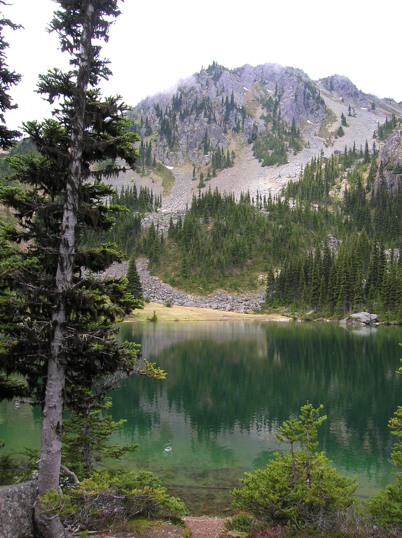
Find a shoreline rock and stay for a while. However, if you have some energy left, a steep half mile path to the south may entice you to follow it. It leads to a gap on a ridge high above the Big Quilcene River where you can stand mouth agape staring out at hulking Mount Constance towering over craggy ridges and deep emerald valleys.

Craig Romano is an author of more than 20 hiking guidebooks including the bestselling Day Hiking Olympic Peninsula 2nd Edition (Mountaineers Books), which includes descriptions for 136 hikes throughout the Olympic Peninsula. He is a regular contributor to Explore Hood Canal. Also check out his list of 25 Olympic Peninsula waterfalls at waterfalltrail.org.
Silver Lakes Notes
Distance: 10.8 miles round-trip
Elevation Gain: 3275 feet (High Point: 5675 feet)
Difficulty Loop: difficult
Snow free: mid-June to early November
Trailhead Pass Needed: Northwest Forest Pass or Interagency Pass
GPS waypoints:
Trailhead: N47 51.385, W123 02.153,
Silver Lake: N47 50.686 W123 04.247NW Forest pass required; Wilderness rules
Land Agency Contact: Olympic National Forest, Hood Canal Ranger District, Quilcene, (360) 765-2200; fs.usda.gov/olympic
Recommended Map:
Green Trails Olympic Mountains East 168SRecommended Guidebooks: Day Hiking Olympic Peninsula 2nd edition (Romano, Mountaineers Books)
Trailhead directions: From Quilcene drive US 101 south for 1.5 miles and turn right onto Penny Creek Road. After 1.5 miles bear left onto Big Quilcene River Road (Forest Road 27); which eventually becomes paved. Continue on FR 27 for 13.7 miles and turn left onto FR 27-190 reaching the trailhead in 0.7 mile.
Tips for safe and healthy hiking during the Covid-19 Pandemic
We all must do what we can to prohibit the continual spread of this disease. We can do that by adhering to the following while we enjoy our trails:
• Avoid crowded hiking destinations. If you arrive and the parking lot is already full, head to another location
• Opt for weekdays over weekends to hit the trail
• Hit the trail early morning before others arrive
• Avoid hiking in large groups outside of family
• Practice Social Distancing while on the trail, giving other hikers room to pass and keeping your distance from them at lakes and summits.
• Wear a mask when encountering others on the trail. A buff or bandanna works well.
• Pack hand sanitizer
• Pack it in pack it out
• Don’t be a surface pooper. Poop properly in the woods by always using privies first if available-or by heading at least 200 feet away from all trails, campsites and water sources and digging a cat hole for your business. Bury waste and TP.
• Pack out all pet waste.
A small family owned Italian food truck serving pasta dishes, meatball subs, clam chowder bread bowls, as well as fresh lobster shipped directly from Maine. Has outdoor seating, fireplace and serves vegetarian dishes. Open Friday-Sunday, 12-7 PM.