
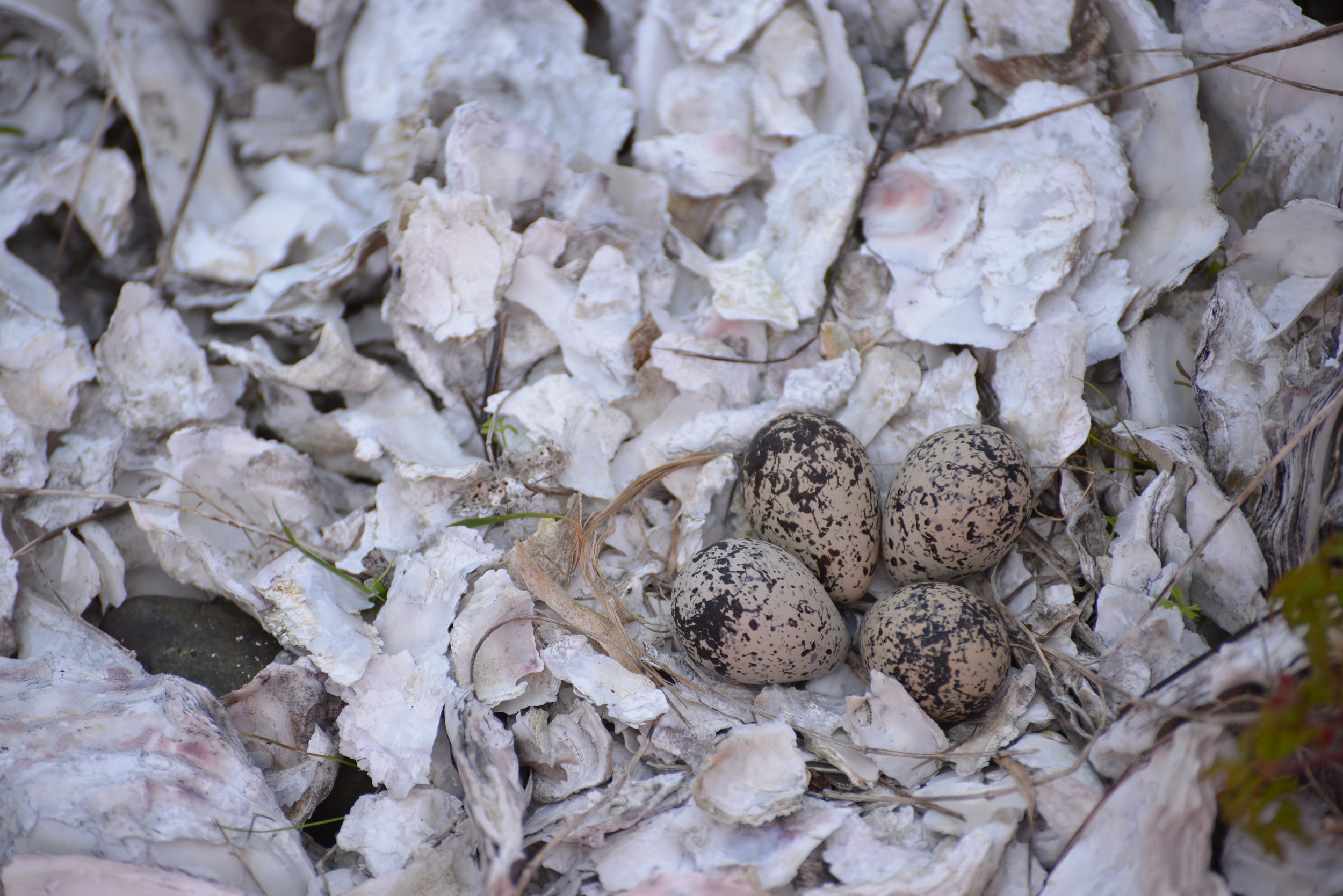
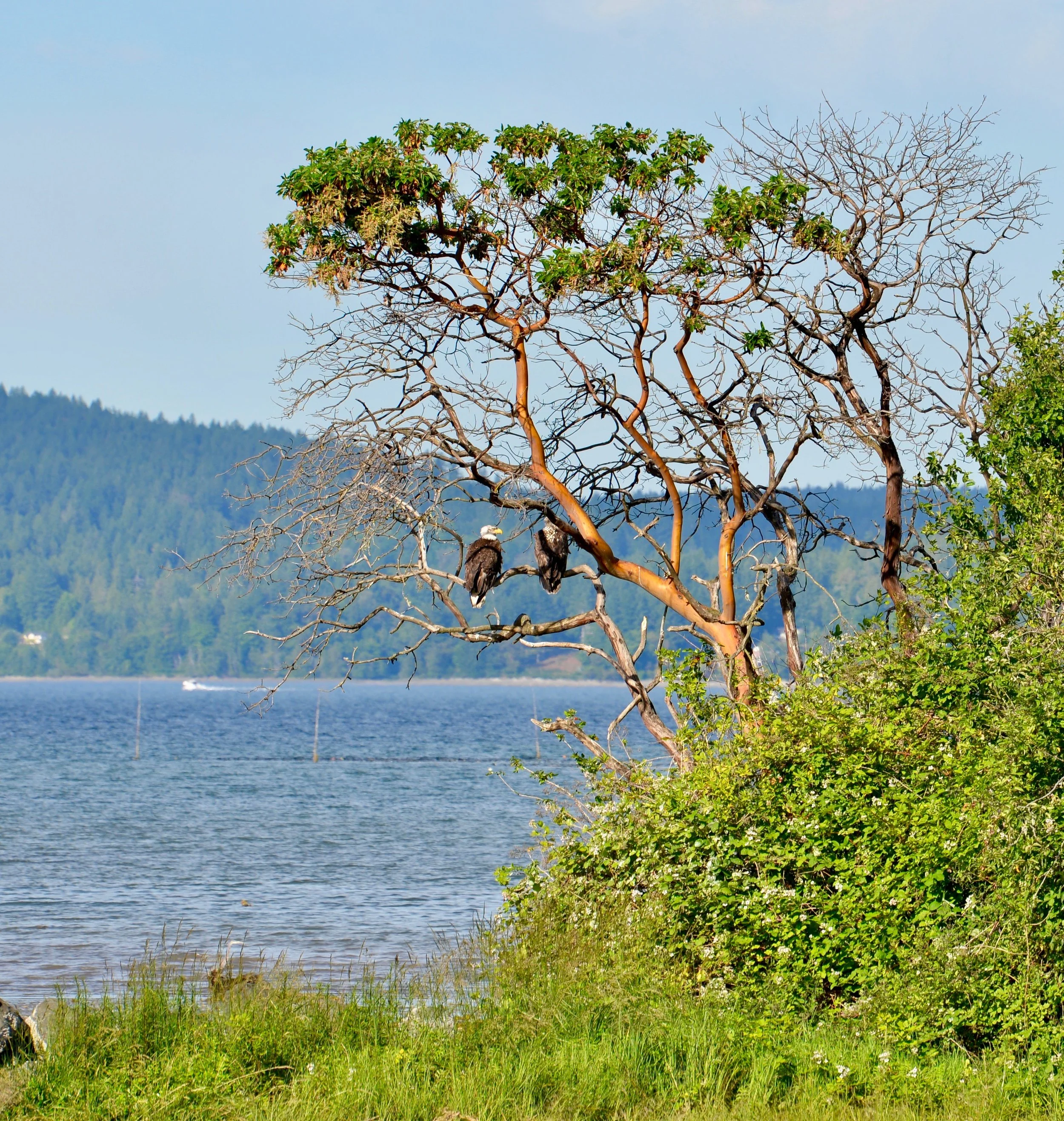
BIRDS OF A FEATHER FLOCK TOGETHER
Birding in the Pacific Northwest is more than checklists and binoculars. From wetlands and estuaries to forest trails along Hood Canal, this guide explores how modern birding blends technology, community, and quiet observation—highlighting local places in Mason County where birds and birders naturally gather.
H/T Tracing The Fjord | Winter ‘25 | STELLA WENSTOB | olympicbirdtrail.com
Those folks obsessed with bird identification? Yes, birders—and they’re far cooler than the stereotype suggests.
Once caricatured as binocular-toting nerds with overstuffed packs and dubious dried banana chips, today’s birders are more likely carrying a smartphone than a color-coded guidebook. Nerdy, it turns out, is in. Modern birding trades paper for sleek apps like iBird and iNaturalist, making it easy to identify, log, and even crowdsource sightings—all while contributing to real scientific understanding.
In the Pacific Northwest, with its remarkable variety of birdlife, birding is about far more than snacks and checklists. It’s an inviting way to slow down, look up, and connect with the natural world.
Getting Started
The Audubon Society is a great place to start if you’re just dipping your webbed foot into the vast waters of birding. Their website offers a free birding app, engaging articles, and access to hundreds of local chapters—five in the Olympic-Kitsap Peninsula area alone—that host birding classes, walks, and events.
One of those events is the longest-running bird census in the world: the Christmas Bird Count. Now entering its 125th year, the count gathers data from volunteer birders across North and South America. It was developed as a replacement for the old holiday “side hunt,” a competitive tradition among hunters that focused on the most game taken over the season.
Learning From the Nest
If the weather is too nasty to head outside, stay in your nest and feather it with avian knowledge. The Audubon Society offers online courses, including interactive Zoom lectures with local experts. The Cornell Lab of Ornithology provides more in-depth, accredited bird identification courses, along with plenty of solid free basics.
The Washington Ornithological Society and American Birding Association also offer a digital, up-to-date version of A Birder’s Guide to Washington. While it doesn’t help with identification, it provides an exhaustive list of where to find species and helps plan productive birding adventures.
Birding Mason County
If you’re ready to venture out in wintery weather, Mason County is teeming with migratory and year-round resident birds. Hit the trails and start scanning the skies, vegetation, and waterways.
Pack binoculars, a scope, digital camera, or smartphone (with iBird and Audubon maps downloaded). Old-school works too—just a notepad and pencil. Wear good walking shoes and weather-appropriate clothing.
Almost every green space—backyard or state park—offers birding potential. To honor the spirit of road trips and the hallowed practice of list-making, here are a few favorite local birding haunts.
For the Birds
Hilburn Preserve
The Capitol Land Trust Hilburn Preserve, just off Highway 101 west of Shelton, features an easy half-mile loop beside the lively Goldsborough Creek. The wooded habitat is ideal for spotting woodland birds such as Red-breasted Sapsucker, Hutton’s Vireo, Pacific Wren, and Cedar Waxwing.
Bayshore Preserve
Leaving Hilburn, head east on Railroad Avenue toward downtown Shelton, then north on Olympic Highway South. Turn right onto Highway 3 (East Pine Street), which follows Oakland Bay to the Bayshore Preserve.
This Capitol Land Trust property is part of the Great Washington State Birding Trail. Oak savannas border the shoreline and Johns Creek outflow. Peregrine Falcons have been spotted perched in the oaks, while Great Blue Herons frequent the open areas. Scan the bay for waterfowl diving in warmer waters.
Mary Theler Wetlands Nature Preserve
Located just outside Belfair (22641 WA-3), this 139-acre preserve protects estuarine habitat along the Union River delta. Marshlands, meadows, forests, and tidal waters support impressive wildlife diversity.
Five trails highlight different habitats, some with views of the southern Olympic Mountains. The River Estuary Trail—built atop breached dikes—offers sightings of river otters, Belted Kingfishers, and Great Blue Herons. Pools host Northern Pintail, Green-winged Teal, Common Merganser, and a wide range of shorebirds. Bald Eagles are commonly seen.
Twanoh State Park & Skokomish River Delta
Backtrack along Highway 106 toward Hood Canal to reach Twanoh State Park. With over 182 acres of forest and shoreline, it offers both terrestrial and marine birding. The 2.5-mile inland trail is reliable for Red Crossbills and Brown Creepers.
Continuing through Union brings you to the Skokomish River delta, rich with waterfowl such as Mallard, Northern Pintail, Red-breasted Merganser, and large flocks of American Wigeon. Bald Eagles are frequent here.
Hood Canal Corridor
Heading north on Highway 101 keeps you alongside Hood Canal, with strong birding stops at Potlatch State Park, Lilliwaup Creek, Eagle Creek, and Jorsted Creek.
At Jorsted Creek, pilings from an old log dump serve as roosts for all three species of cormorants. Lacking water-repellent oils, these birds are often seen perched with wings spread to dry.
The Hamma Hamma River estuary is another productive area and home to a nearby Great Blue Heron rookery.
Dosewallips State Park
The final stop on this list, Dosewallips State Park spans more than 1,000 acres of river, estuary, shoreline, and mature forest. Known for Roosevelt Elk and curious seals offshore, it also supports a wide range of bird species.
The North Tidal Trail crosses marshes and offers excellent winter views of migrating Trumpeter Swans.
The parks and preserves of the Pacific Northwest offer outstanding birding opportunities. Birds of a feather flock together—and birders are never far behind.
For more information on fjord birding, visit olympicbirdtrail.com.

A convocation of eagles
A convocation of eagles is not a feted occasion requiring black gowns and tasseled caps. Like a murder of crows or a gaggle of geese, a convocation is the unexpected collective noun for a group of eagles.
A convocation of eagles is not a feted occasion requiring black gowns and tasseled caps. Like a murder of crows or a gaggle of geese, a convocation is the unexpected collective noun for a group of eagles.
Eagles have inspired humans throughout history – and the world. The Ancient Romans used them as a symbol of Empire. Here in the United States, the Bald Eagle (Haliaeetus leucocephalus) is our national bird.
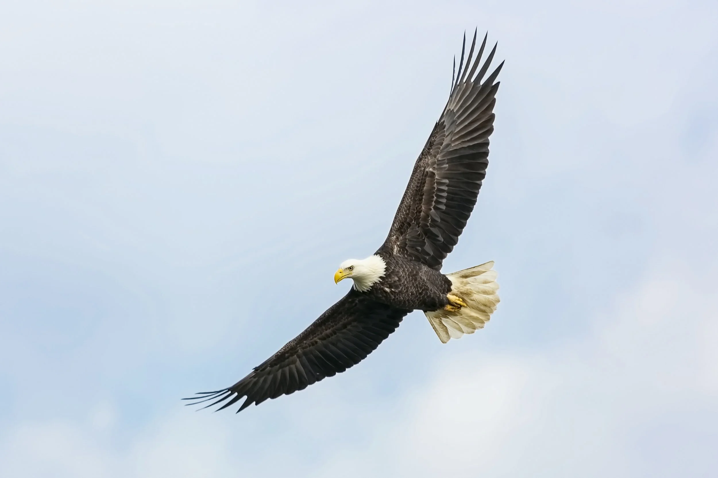
Native American tribes, including Hood Canal’s Skokomish, venerate the Bald Eagle. Many tribes associate the eagle with the creator. Since this bird is the strongest flyer, it is believed to carry prayers to the heavens. Feathers and other parts of the bird (such as the talons) are important to many Native American ceremonies, such as smudging, powwows, and talking circles.
At the turn of the 18th century, the Bald Eagle population was estimated to be between 300,000–500,000. In the early 20th century however, the eagle was targeted for sport and because of their perceived predation upon livestock. Between 1918 and 1930 one ornithologist estimated that approximately 70,000 bald eagles had been shot in the state of Alaska. Additionally, nesting sites were disturbed by logging and other forms of development.
The Bald Eagle Protection Act was introduced in 1940 to protect nests, eggs, feathers, and to stop the slaughter of Bald Eagles. By the 1950s, however, there were reported to be only 412 nesting pairs left in the 48 conterminous United States.
Pushed to near extinction
Further, pressure was placed upon Bald Eagles populations (and many birds of prey species) by the pesticide Dichlorodiphenyltrichloroethane (DDT). Since Bald Eagles are predators at the top of the food-chain, this chemical was concentrated in their prey and even the prey of their prey. This bioaccumulation disrupted the Bald Eagle’s metabolism of calcium, severely effecting fertility rates and inhibiting healthy egg production.
Bald Eagles were declared endangered in 1962.

Shari Sommerfeld Images
Revival of a species
However, this is actually a happy story. In 2007, the Bald Eagle was federally delisted from the endangered species list. With the banning of DDT in the United States in 1972 (1989 in Canada), extensive breeding programs, and the enforcement of the Bald and Golden Eagle Protection Act– the population soared. By 2005, in Washington State alone, it was estimated that there were over 840 breeding pairs. In 2009, the Bald Eagle population of the United States was estimated to be nearly 143,000 birds, this number is expected to stabilize at 228,000 birds in the next 5 to 15 years.
Speaking of resurgent populations, January to February is the mating season for Bald Eagles. Usually mating for life, male and females perform stunning aerobatic courtship displays with airborne talon clasping and free falls.

Along the Hood Canal, nests are in trees near water or open fields. Old cedar snags, giant spruces, or the larger coniferous trees are favorites. Both the male and female gather branches and twigs to weave into these monstrous nurseries.
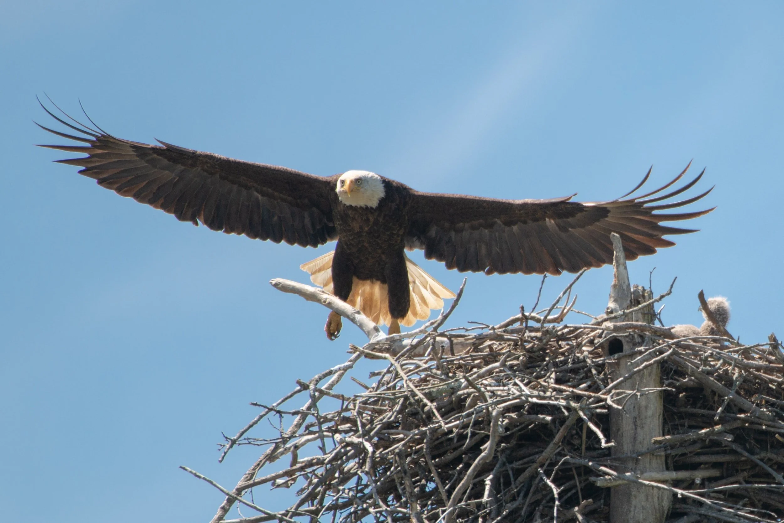
Eagle nests, known as aeries or eyries, are one of the largest nests at nearly 5-6 feet in diameter and 2-4 feet in height.
The female will typically lay 1-3 eggs and both the male and female will take turns incubating the eggs for 34-36 days. After 10-12 weeks (approximately late summer), when the fledglings have left the nest, the mating pair and fledglings may travel to Northern British Columbia and Alaska to take advantage of the early salmon runs.

Shari Sommerfeld Images
To learn more about birding locations on Hood Canal, visit olympicbirdtrail.org for a list of 25 top locations around the peninsula.
A Few Eagle Facts
Bald Eagles are not actually bald, their name comes from an older term for “white- headed.”
At 80.3 inches, the Bald Eagle’s wingspan is slightly greater than a Great Blue Heron. Mature Bald Eagles can weigh between 105.8 to 222.2 oz, with the females usually weighing in on the larger end of the spectrum.
The Bald Eagle is the only eagle native to North America. There are other eagle species in North America, but they are found more globally too, whereas the Bald Eagle is specifically found in North America.
Bald Eagles have a long-life span. The oldest recorded bird in the wild was killed by a car in 2005 in New York, 38 years after being banded in the same state in 1977.
Bald Eagles have a soft, chirpy call, which runs counter to the image of a strong, powerful bird, so its call is often dubbed over in TV and movies with the call of a Red-Tailed Hawk.
Bald Eagles are capable swimmers, if their free-fall salmon dive results in a catch that is just a little too large for lift-off, they can swim ashore with their catch, using their massive wings as “oars.”
Don’t keep an illegal eagle! Possession of an eagle feather without a federally approved permit may be punishable by a $100,000 fine and/ or a year in jail. Permits are only granted to federally recognized Native American Tribal members.
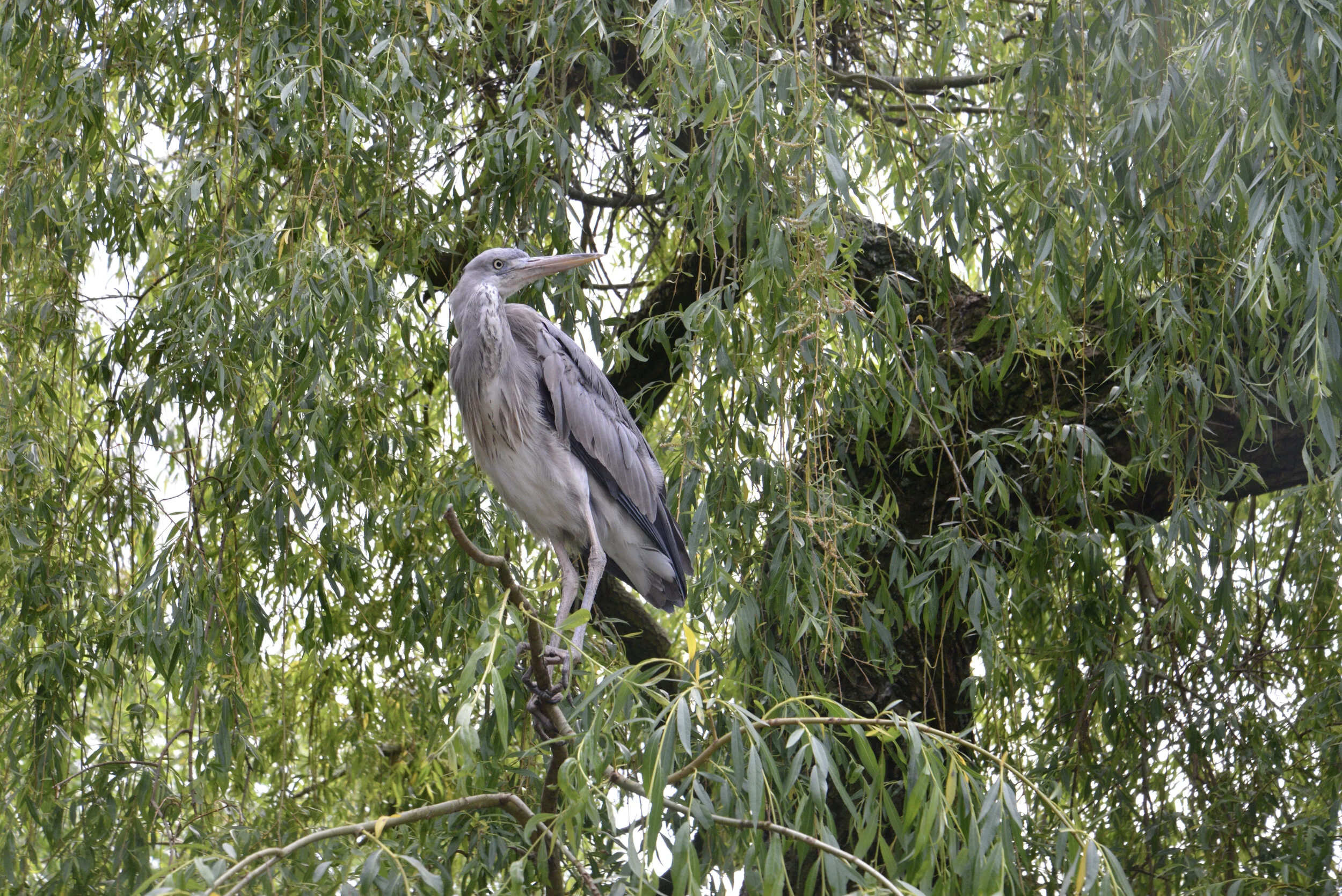
10 Myths & Facts about Great Blue Herons
It’s a common sight to see the “lucky” great blue heron patiently hunting on the shores of Hood Canal and South Puget Sound. Largest of the heron species, up to 4’ in height, they actually only weigh between 5-6 pounds. Here are a few things you may not have known about these iconic Northwest birds.
It’s a common sight to see the “lucky” great blue heron patiently hunting on the shores of Hood Canal and South Puget Sound. Largest of the heron species, up to 4’ in height, they actually only weigh between 5-6 pounds. Here are a few things you may not have known about these iconic Northwest birds.
MYTH
Great blue herons only eat fish.
Great blue herons dine mostly on fish but they will also stalk everything from insects to small mammals and even other birds. In Washington, mice and voles making up a major portion of their winter diet when they choose to hunt on land.
2. FACT
Herons spend about 90 percent of waking time stalking prey.
Great blue herons grab prey in their strong beaks or use their dagger-like bills to impale. This action is known simply as a ‘bill stab’. They shake the prey to break spines before gulping them down. Great blue herons can swallow fish that are much wider than their narrow neck and have even been know to catch small birds in flight. Patience and speed are the keys to their hunting success.
3. MYTH
Great Blue Herons are cranes.
A crane is totally different type of bird. You can tell them apart by looking at the beaks and the way they fly. Cranes have shorter beaks and hold their necks straight when in flight, whereas herons curve necks into an S-shape. Herons are able to do this because of specially shaped vertebra. Great blues also fly with their legs ‘hanging” which is unique from most birds.
4. FACT
Herons are often called “Dinosaur Birds.”
Fossil records date them back 1.8 million years ago, but they are thought to have existed about 25 million years ago during the Cenozoic age. Maybe it’s also because of the prehistoric sounds they make as they take off with the giant 6’ wingspan flapping!

5. MYTH
Great Blue Herons can’t swim.
The great blue does many things that other herons choose not to do, including swimming in deep water with apparent grace and comfort. A quick search on the internet will show multiple accredited images of herons happily swimming in deep water. It’s not a common occurrence though, so consider yourself lucky if you catch sight of this phenomena. Swimming is a testament to the great blue heron’s incredible adaptability.
6. FACT
Great blue herons have adapted “bib” feathers to keep them clean.
Specialized feathers on their chest grow continuously and fray into a fine cleaning powder. This powder is used to help groom their entire body and clean off fish slime.

7. MYTH
Great Blue Herons are monogamous.❤️
Not technically. Great blues are known to be ‘serial monogamous’ — they have one partner for a year but choose a different one each mating season. Despite being territorial with other herons, they typically breed in nesting colonies at the tops of trees containing up to 500 breeding pairs. These colonies are called “heronries.” They obviously do not have any social distancing issues. Great blue herons generally return to the same breeding grounds each year although with different partner choices.
8. FACT
Mates work to build the nest, as well as incubate and feed their young –together.
When the mating pair is chosen, the male gathers sticks while the female weaves them into a platform nest lined with moss, grass, and small branches. She lays 2-6 blue eggs, and both parents take turns incubating them for 4 weeks until the young hatch. They also take turns feeding regurgitated prey to the young chicks.
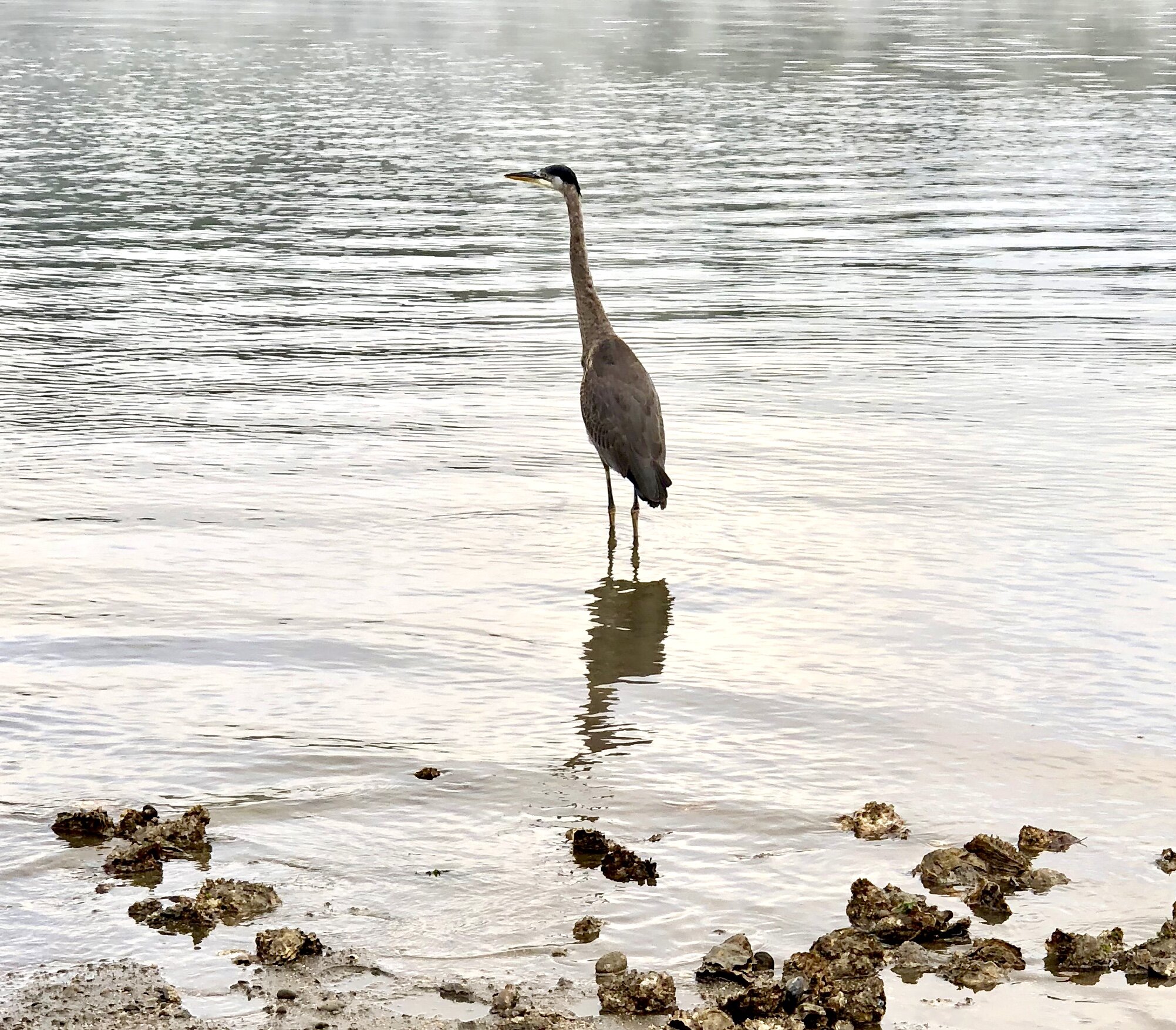
9. Myth
Heron chicks have yellow eyes when they are born.
Heron chicks have gray eyes when born that become bright yellow when they are adults. The parents continue feeding the nestlings for a few weeks after fledging (leaving) the nest. Young herons will fledge at around two months.
10. FACT
Great blue herons’ colors can demonstrate age, sex, and mating season.
Adult males are larger and generally have brighter orange legs than a female. During breeding season, the lore (the lore is the region between the eye and bill) will turn a bright blue, the iris will turn reddish, and the yellow bill will take on an orange hue.

A couple other things you didn’t need to know about great blue herons:
To keep cool they flutter their throat muscles to increase evaporation.
It can take up to two weeks to build a nest.
Life expectancy of a great blue heron is 15-23 years
Despite their size they can fly as fast as 30 MPH.
An adult heron consumes up to one pound of fish per day.
Learn more
The Cornell Lab - all about birds
Audubon - Great Blue Heron guide
Olympic Bird Trail - Top birding locations on Hood Canal, South Puget Sound, Pacific Coast, and Olympic Peninsula







Elk Lakes Trail
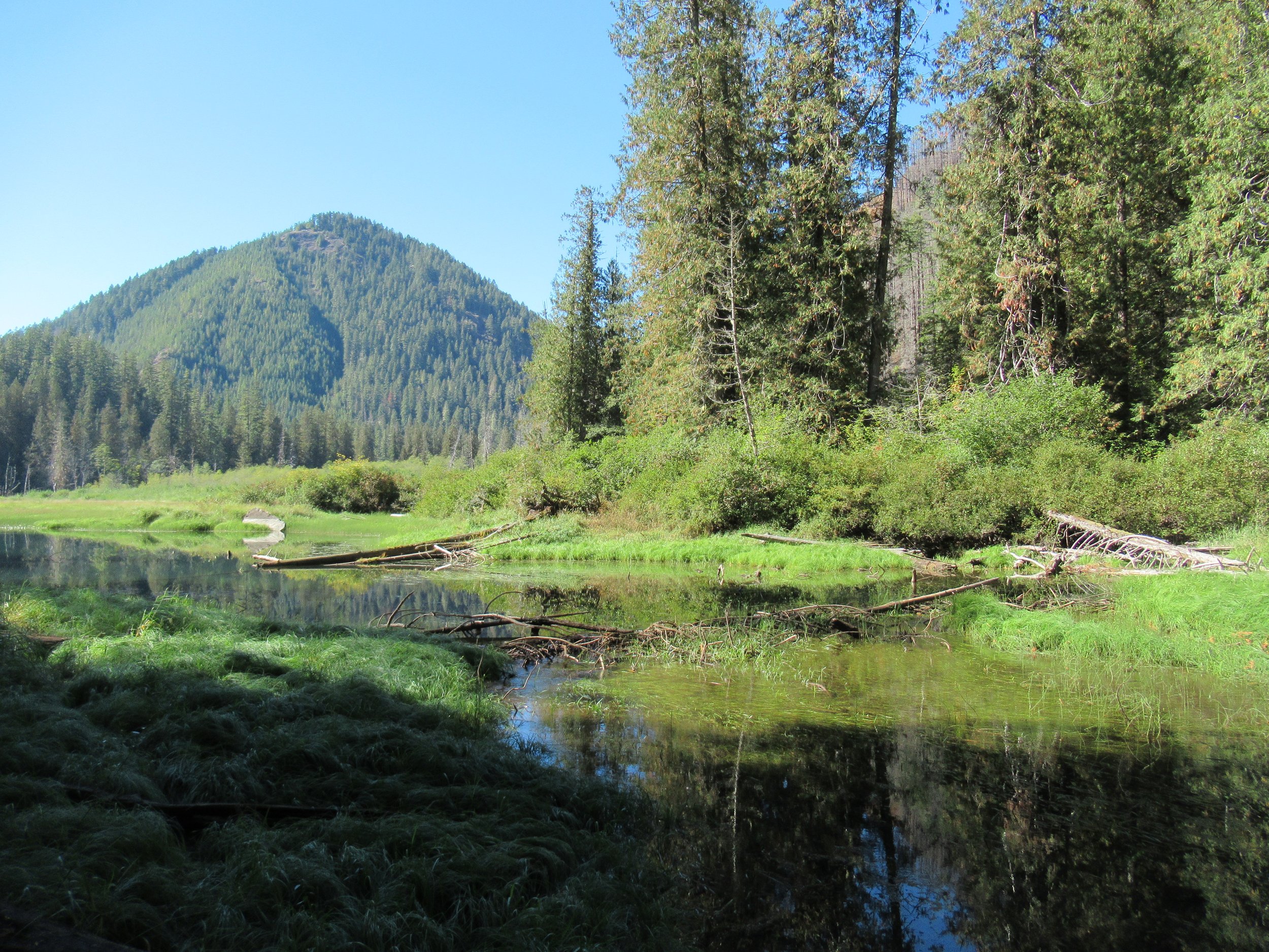
Named for one of the Olympic Peninsula’s most majestic animals, the two small Elk Lakes located within the Hamma Hamma River Valley offer quiet wanderings and a chance to see their namesake. The Elk Lakes offer a great alternative to the nearby oft-crowded Lena Lakes. While this hike is short, the lake’s tranquil shoreline and surrounding old-growth forest invite lingering. Bird watching is good as well as fishing for rainbow trout. Rhododendrons add colorful bouquets to the forest in spring, while maples and cottonwoods brighten the forest with golden touches come autumn.
By Craig Romano, Guide book author and guest columnist
Named for one of the Olympic Peninsula’s most majestic animals, the two small Elk Lakes located within the Hamma Hamma River Valley offer quiet wanderings and a chance to see their namesake. The Elk Lakes offer a great alternative to the nearby oft-crowded Lena Lakes. While this hike is short, the lake’s tranquil shoreline and surrounding old-growth forest invite lingering. Bird watching is good as well as fishing for rainbow trout. Rhododendrons add colorful bouquets to the forest in spring, while maples and cottonwoods brighten the forest with golden touches come autumn.
Hit the Trail
You can easily reach the lakes from a short spur off of Forest Road 2480. But I prefer hiking to the lakes following along a remnant of an old trail along Jefferson Creek. This gives you a longer and varied hike and a better appreciation for the area’s rugged landscape and how human activity has greatly impacted it. Reaching the trailhead for this approach however is via a rough road that only high clearance vehicles can negotiate. If that is not an option, you can always park at the beginning of the road and walk FR 2421 for 1.6 miles to the trailhead. The road traverses a recent cut offering excellent views of the Hamma Hamma Valley, making the extra mileage interesting.

The trail begins at a bend in the road and heads into a forest that was recently burned. In the early part of the last century the entire Jefferson Creek Valley was draped in old-growth forest. After World War II and up to the 1990s the area was intensively logged leaving only remnant stands of old-growth forest and just a small stretch of was once a long trail in the Eastern Olympics. But what survived made a delightful short hike in an area often overlooked by many hikers opting instead for the nearby Lena Lakes.
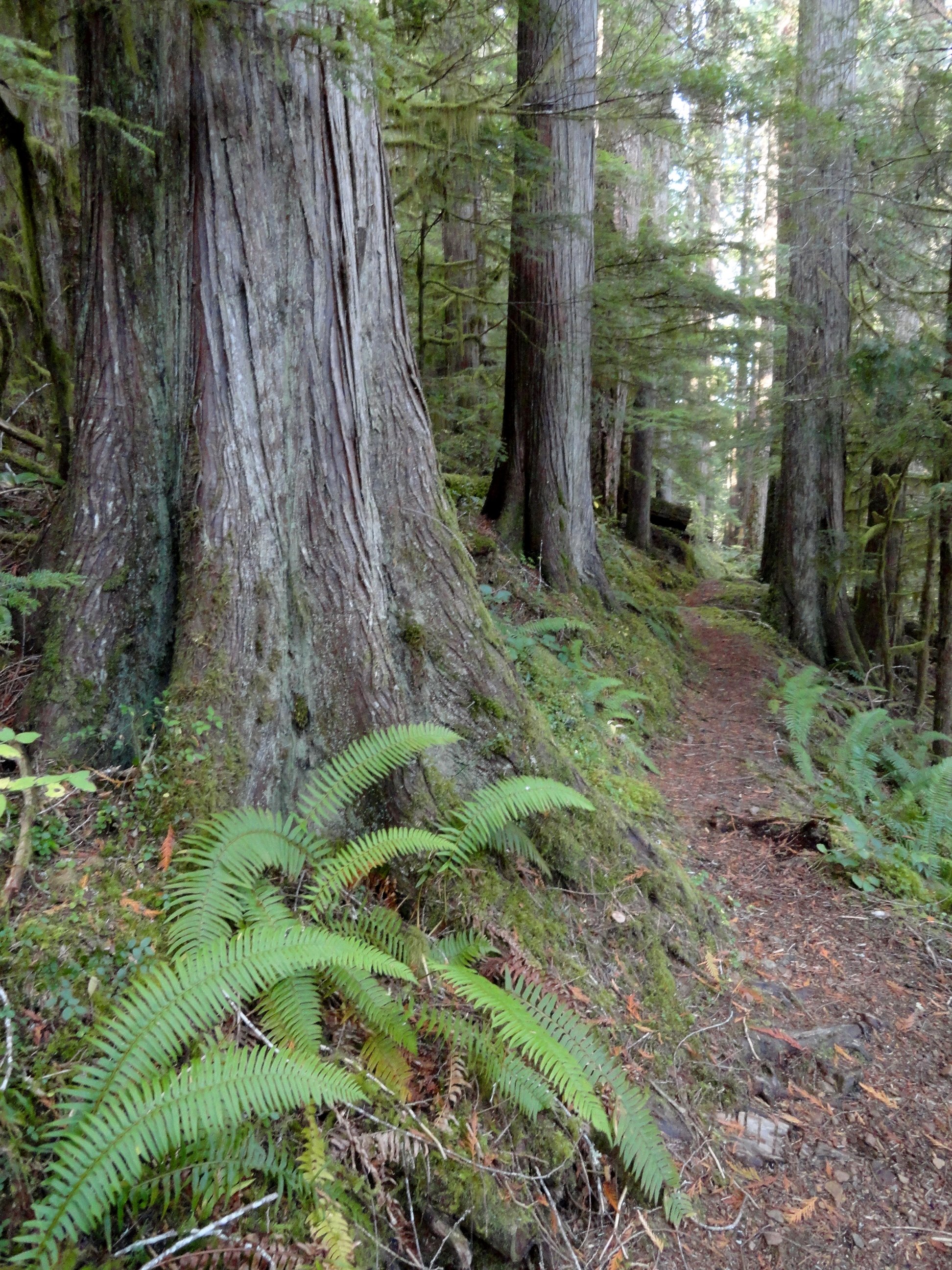
The beautiful old-growth forest remaining around the Elk Lakes almost entirely went up in flames in the Maple Fire of 2018. A group of timber poachers harvesting mature big-leaf maples in the area set the area ablaze when they set fire to a wasp nest in the base of a tree. The fire quickly spread torching 3300 acres and costing $4.5 million to combat. Two of the poachers were ultimately caught, brought to trial and given prison terms. Timber poaching remains a serious problem on the Olympic Peninsula. The Forest Service lacks the staff and resources to address it.
While the fire did some damage to the Elk Lake area, thankfully many of the older trees survived. Unfortunately the fire took a major toll on nearby Jefferson Ridge rendering the trail to its old lookout site nearly impassable now. Such a shame as that trail too offered a quiet alternative to many of the area’s nearby crowded trails.

Head up the trail traversing a dry hillside, several hundred feet above roaring Jefferson Creek. Born in the snowfields of Mount Ellinor and her rugged neighbors; the creek crashes through a steep and narrow canyon here before reaching the Hamma Hamma River. Pass through a mosaic burn on an up and down course before reaching cool old-growth forest.
The way then soon reaches a junction. Heading left will bring you to the upper trailhead. But for this suggested hike, you’ll be returning from that direction, so continue hiking straight through a grove of monster cedars coming to Elk Lake. Depending on the season the lake may be a wet grassy swale or a pretty reflecting pool. Regardless of water level, plenty of birdlife will be present.
Continue along the western shore before wandering along Jefferson Creek through more impressive old growth. The trail then terminates on FR 2401. You can retrace your steps, but I prefer making a loop by following the road left for 0.8 mile to another trail just after crossing Cedar Creek. But before heading down that trail back to Elk Lake, head right 0.2 mile on an oft overlooked and slightly brushy trail to pretty little Upper Elk Lake. This placid body of water offers beautiful reflections of nearby ridges and the surrounding forest.
Once you visit the Upper Lake pick up the trail near Cedar Creek and slightly descend to Elk Lake now hiking along its eastern shoreline. Pass some more big trees and come to a great shoreline area for casting a line or just admiring the area’s beauty. Then reach another junction.
The way right climbs and soon reaches the main trailhead on FR 2401. Continue left, soon crossing Jefferson Creek on large rocks. In spring and other periods of high water this may be difficult forcing you to retreat the way you came for a longer than anticipated hike. Just beyond the crossing reach a familiar junction. Here head right above the crashing creek retuning to your start.
The details
Distance: 4.5 miles roundtrip
Elevation Gain: 700 feet
High Point: 1200 feet
Difficulty: moderate
Snow free: year round Trailhead Pass Needed: None
Notes: Road to Lower Trailhead (Elk Branch) is extremely rough requiring a high clearance vehicle.
GPS waypoints: Lower Trailhead: N47 34.759 W123 07.222
Main Trailhead: N47 34.267 W123 08.008
Features: kid-friendly, dog friendly, old-growth, rhododendrons, bird-watching, fishingLand Agency Contact: Olympic National Forest, Hood Canal Ranger District, Quilcene, (360) 765-2200, fs.usda.gov/olympic
Recommended Guidebook: Day Hiking Olympic Peninsula 2nd edition (Craig Romano, Mountaineers Books)
Trailhead directions: From Hoodsport travel north on US 101 north for 13.7 miles turning left at milepost 318 onto FR 25 (Hamma Hamma River Road). Then continue west for 6.4 miles and turn left onto FR 2480. Cross the Hamma Hamma River and in 0.2 mile turn right onto unsigned FR 2421 for the Lower Trailhead (high clearance only). Follow this rough road 1.6 miles to a pullout on your left where the road makes a sharp turn right. This is the trailhead. For the Main Trailhead, pass the FR 2421 junction and continue on FR 2480 for 3 more miles. Then turn right onto FR 2401, and proceed 2.5 miles to a spur on your right leading 0.1 to the Main Trailhead. The spur is steep and can be rough. You can park alongside FR 2401 and walk the spur to the trailhead.

Bird’s Eye View from Mount Townsend
Mount Townsend is a prominent landmark — and one of the region’s most hiked peaks. Its broad open summit affords sweeping views of some of the highest and craggiest peaks in the Olympics and a myriad of islands, straits, bays and peninsulas below.
Story & Photos: Craig Romano

Mount Townsend | photo credit Craig Romano
Rising more than 6200' at the northeast edge of the Olympic Mountains, Mount Townsend is a prominent landmark — and one of the region’s most hiked peaks. Its broad open summit affords sweeping views of some of the highest and craggiest peaks in the Olympics and a myriad of islands, straits, bays and peninsulas below. Stand atop this mountain on a clear day and watch ferries and vessels ply the shimmering waters below. Marvel at the Seattle skyline against a backdrop of snowy Cascade Mountains dominated by big, beautiful Mount Rainier. Ascend Townsend in the summer and be greeted by a brilliant array of wildflowers swaying in the alpine breezes.
Hit the Trail

There are four ways you can hike to get to the summit of Mount Townsend and all of them offer great views and a good workout. The most popular route to the mountain is the Mount Townsend Trail from its upper trailhead. An out and back via this route clocks in at 8.2 miles with just shy of 3000 feet of elevation gain. But if you don’t mind a slightly longer hike with a little more elevation gain, consider starting from the Lower Trailhead.
Throughout much of this hiking season you just may have to start from the Lower Trailhead as the Forest Service works on the upper trailhead access road rendering it off limits while under construction.
The Lower Trailhead start will add two more miles to your total roundtrip and another 500 feet of elevation gain. But it’s worth it. The way traverses a beautiful grove of primeval forest and passes by tiny Sink Lake where Townsend Creek performs a disappearing act. After one mile of pleasant walking you’ll emerge at the upper trailhead. As you approach the trailhead what may be an unsightly situation. The lack of an outhouse at such a popular trailhead as led many to violate leave no trace principles with some bad bathroom etiquette. Perhaps a note to the Forest Service in support of a trailhead privy can help rectify this situation.

From the Upper Trailhead, follow a well-beaten path and steadily ascend. The trail weaves through a stately grove of Douglas-fir and western hemlock adorned with Pacific rhododendrons. Time your hike for late May through June and enjoy brilliant blossoms. After a half mile enter the Buckhorn Wilderness protecting more than 44,000 acres of spectacular terrain in the Olympic Mountain’s northeastern rain shadow. Continue climbing transitioning into more open forest and start catching views that will only improve in magnitude as you carry on.
Cross several cascading creeks as you follow copious switchbacks upward.

At just past 2.5 miles reach a small pine and fir grove nestled on a small knoll just above tiny Windy Lake. And do hope the lake lives up to its name or its resident bugs may force you to move quickly through the area. In another half mile reach the scenic trail to the Silver Lakes. Bear right and soon leave the trees behind as you attain Townsend’s summit plateau.
Now traverse the subalpine tundra that upon a quick glance may appear barren. But it’s full of life and in summer beaming with color thanks to a myriad of wildflowers; cinquefoil, phlox, paintbrush, and harebells among them.

Look too in the rocky areas for Piper’s bellflower, a campanula that is endemic to the Olympic Mountains. Owing to its drier aspects, junipers hug the ground throughout Townsend’s summit.
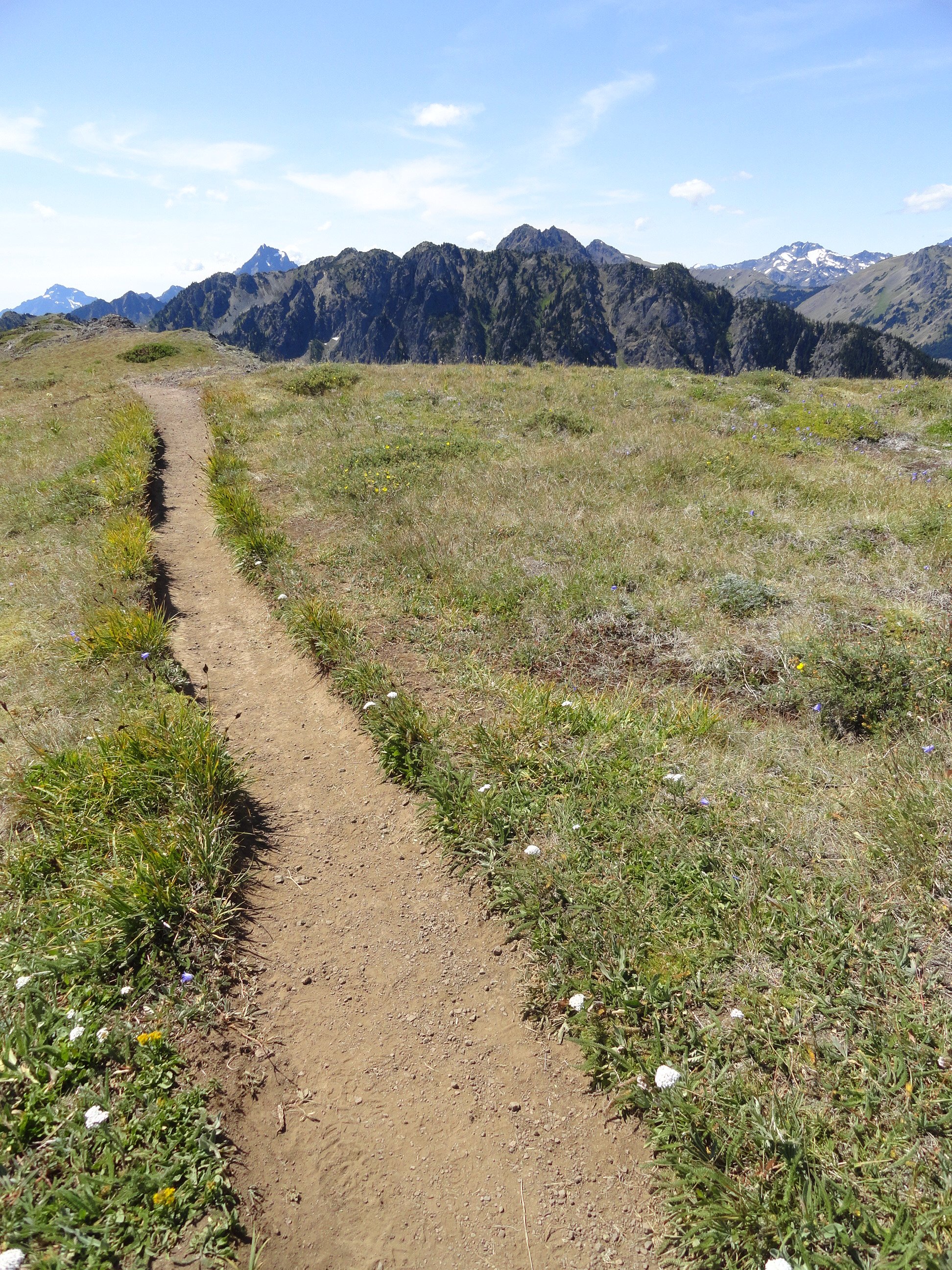
At 4.0 miles from the upper trailhead reach a junction. The main trail continues left descending to the Little Quilcene Trail offering two more approaches to the summit—one from the Northwest and one from the Northeast. Head right for 0.1 mile to the mountain’s highest point, its 6280-feet south summit. Consider continuing on the trail a short distance to Townsend’s northern 6212-foot summit too. It was on this point from 1933 until 1962 that a fire lookout once sat.
The views are great from anywhere along the open peak. Gaze out to the Salish Sea with its sprawling labyrinth of islands, bays, and channels. Watch ferries ply azure waters. Marvel at the Seattle skyline sparkling in the afternoon sunlight. And admire a fortress of Cascade peaks, punctuated by the snowy volcanoes. Look north to Dungeness Spit, Discovery Bay, the San Juan Islands, and Vancouver Island. And to the west, it’s nothing but pure Olympic wilderness—jagged peaks and deep green valleys.
And if you’re wondering if Townsend (as well as the nearby city and port) takes its name after the 19th century naturalist who named Townsend’s chipmunk, Townsend’s ground squirrel, Townsend’s solitaire and many other species—it is not!
Captain George Vancouver in 1792 bestowed the name Townsend—originally Townshend for the Marquess of Townshend. The father of Thomas Mamby, one of Vancouver’s crew members was an aide-de-camp to the Marquess at the time. The S’Klallam Tribe which had a community on the bay at the time originally called it Kah Tai which translates to pass through. You’ll probably want to pass through Mount Townsend on a return trip by perhaps ascending it via one of the other routes.
Mount Townsend Details
Distance: 8.2 miles roundtrip
Elevation Gain: 2980 feet
High Point: 6280 feet
Difficulty: moderately difficult
Snow free: June to November
Trailhead Pass Needed: None
Notes: trail also open to horses, wilderness rules apply
GPS waypoints: Trailhead: N 47 51.385, W 123 02.153
Land Agency Contact: Olympic National Forest, Hood Canal Ranger District, Quilcene; http://www.fs.usda.gov/olympic
Recommended Guidebook: Day Hiking Olympic Peninsula 2ed (Romano, Mountaineers Books)
Trailhead facilities: none
Trailhead directions: From Shelton, drive US 101 north for 50.5 miles. Upon crossing the Big Quilcene River just shy of the community of Quilcene turn left onto Penny Creek Road. The drive 1.5 miles and bear left onto Big Quilcene River Road (Forest Road 27). Follow this generally good road for 12.5 miles for the lower trailhead turnoff; or 13.7 miles for the upper turnoff. Then reach the lower trailhead in 0.8 mile or the upper trailhead in 0.7 mile.
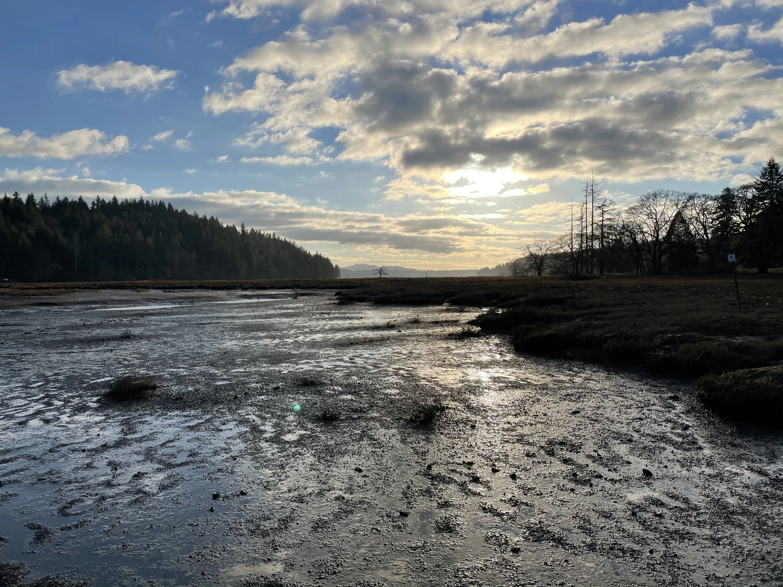
Exploring Bayshore Preserve Near Shelton
Occupying a peninsula on Oakland Bay at the mouth of Johns Creek, Bayshore Preserve provides exceptional wildlife habitat and several short delightful hiking trails. Once a golf course, this 74-acre parcel has been restored to a natural state on par with the state’s finest natural shoreline preserves.
Craig Romano
Occupying a peninsula on Oakland Bay at the mouth of Johns Creek, Bayshore Preserve provides exceptional wildlife habitat and several short delightful hiking trails. Once a golf course that heavily drew water from the salmon-spawning Johns and leached pesticides and fertilizers into the important shellfish rearing bay; now thanks to the Capitol Land Trust, Squaxin Island Tribe and a handful of other partners, this 74-acre parcel has been restored to a natural state on par with the state’s finest natural shoreline preserves.

Hit the Trail
From the trailhead immediately come to a kiosk with a map displaying the preserve’s interconnected short trails. There are about 1.5 miles of marked well developed paths traversing the property and they can easily be covered shortly in a brisk walk. However, Bayshore, with its salmon-spawning creek, salt marshes and mud flats, bird-flourishing prairie, and more than 4,000 feet of shoreline, calls out to be sauntered.
A quick inspection of the landscape before you reveals a land in flux. One that not too long ago sported well-manicured greenways fed by an irrigation system, a clubhouse and other structures, and a series of service roads. Those roads have since been converted into trails. The buildings have been removed, but a few vestiges of the irrigation system that is slowly being dismantled remain. And the greenways have been restored to native prairie grasses that wave golden in late summer.
Now sans golf clubs, putt along Bayshore’s trails watching for birds instead of scoring birdies. The Bayshore Peninsula located along the narrowest stretch of the slender and shallow Oakland Bay is far more important as wildlife habitat than as an altered manicured landscape for golfing.

The peninsula too is a special place to the Squaxin Island Tribe. It once housed one of their villages and according to several elders and historians, one of the largest longhouses on Puget Sound.
In 2014 the Capitol Land Trust purchased the Bayshore Golf Course and commenced with the Squaxin Island Tribe and other partners to restore this property to a natural state.

Restoring the peninsula was another albeit very important stage in the greater effort currently being employed to protect Oakland Bay—one of the least developed inlets and most important shellfisheries on Puget Sound. Oakland Bay’s preservation is not only important for wildlife, but also for sustaining the area’s fisheries and shellfish beds.
The Main Loop Trail travels triangularly through the property for 0.8 mile. It utilizes some of the old golf course’s service roads. Walk the path through native grasses and along colonnades of gigantic old Douglas firs and Garry (Oregon White) Oaks. The latter, the only native oak to Washington State once flourished in the area’s prairies. Washington’s First Peoples regularly set those prairies on fire to stimulate camas growth and favor other plants like oaks that thrive in savannas and other grassy environments. But as those prairies no longer saw regular burns, were overtaken by developments and invasive and hardier plants, the state’s Garry Oaks have become increasingly rare. These elegant hardwoods provide forage for a myriad of species. Bayshore contains some exceptionally large ones.

As you walk the loop be sure to deviate from it onto numerous spur trails. The 0.2 mile Lookout Trail crosses Johns Creek on a sturdy bridge and proceeds through a nice forest grove before skirting a prairie and ending along the creek bank. It’s an excellent trail to check out in November for its chum run.
The Johns Creek Trail is another fine choice for salmon watching. This path meanders along the edge of a riparian forest for .25 mile to link back up with the main loop.
The Johns Creek Estuary Trail leads a short distance to extensive tidal flats at a small estuary where Johns Creek flows into Oakland Bay. The trail leads to a fishing point on public tidelands.
Bayshore Preserve

Features: exceptional wildlife habitat on Oakland Bay, restored prairie, tall old Garry oaks and Douglas firs,
tidal mud flats, salmon-spawning creek and estuary.
Distance: 1.5 miles of trails
Elevation Gain: minimal; High Point: 40 feet
Difficulty: easy Snow free: year round
Trailhead Pass Needed: None
Notes: Dogs permitted on leash. Please stay on trails and respect all closed areas. Open from dawn to dusk. No removal of plants or fungi from the preserve.
GPS waypoints: Trailhead: N47 14.939 W123 02.655
Fishing Point: N47 14.707 W123 02.513
Contact: Capitol Land Trust, (360) 943-3012
Trail Map and Interpretive Guide available online

Trailhead: From Shelton, travel east on SR 3 for 3.8 miles to trailhead located on your right (directly across road from Bayshore General Store). Parking limited. More parking in adjacent WA Department of Fish and Wildlife’s Oakland Bay Recreational Area (Discover Pass required).

Hood Canal Travel Guide: Birdwatching
With its wealth of shoreline, fresh and saltwater marshes, mudflats, and bountiful forests, the Olympic Peninsula is a birders’ paradise.
A canalside Birding Itinerary
With its wealth of shoreline, fresh- and saltwater marshes, mudflats, and of course the bountiful forest, the Olympic Peninsula is a birders’ paradise. And whereas winter and spring aren’t the most popular seasons for human tourists (meaning less competition for lodging and dining), they happen to be the best for catching the avian crowds.
From soaring birds of prey to elusive divers, birdwatching is one more reason to get to Hood Canal when there aren't hordes of RVs cruising down HWY 101.

If you are looking for all the gritty details on Olympic Peninsula birding locations, check out Craig Romano’s list of the Top 25.
Whether it satisfies your ornithological cravings for the season or simply whets your appetite for much more, gear up (our suggestions are below) and follow along!
Theler Wetlands | 7am
If you only make one dedicated birding stop in the Hood Canal, Theler Wetlands, with its easily navigated trails, interpretive kiosks, and educational exhibits, should be it. More than two miles of interpretive walking trails through 39 acres of protected wetlands provide an excellent introduction to birdlife in the Hood Canal. Newbies and experienced birders alike will delight in views of bald eagles, green-winged teals, horned grebes, and more. You may even be able to spot otters in the freshwater marsh!

Photo courtesy of Clint Ferarra
Sunset Beach Deli | 10am
Whether you worked up an appetite for lunch or just need a quick coffee to fuel the next birding venture, the Sunset Beach Deli is a local favorite for gyros and Philly-style cheesesteaks. In the mornings, it’s also the go-to location for filling breakfast burritos. If you’re not quite ready to eat, have them wrap up a sandwich and take it to go.
Twanoh State Park | 1pm
Twanoh State Park is a favorite in the summer for swimming and watersports, but the quieter winter and spring months make it a great place for viewing wildlife and birds. Bring your binoculars to the shoreline for an eyeful of diving birds such as loons, mergansers, murrelets, and ruddy ducks with their distinctive upright tails. In the towering cedars and maples inland, listen for brown creepers and red crossbills.
Bonus: Between Twanoh and Potlatch, Highway 106 takes you right by the Skokomish River Delta. The overlook pull-off is a good spot to scope gulls, grebes, and goldeneyes.

Photo courtesy of Clint Ferarra
Potlatch State Park | 4pm
Like Twanoh, Potlatch bustles with humans in the summer and birds in the winter and spring. With 5,700 feet of saltwater shoreline, it’s a great place for viewing waterfowl, particularly during high tide. In the water, look for heron, scoters and scaups, and check the trees for fox sparrows and Steller’s jays.

Photo courtesy of Clint Ferarra
Dinner at 2 Margaritas | 6pm
Nothing works up an appetite quite like a day spent in the bracing sea air. Whether you’re celebrating new additions to your Life List or toasting to better luck next time, we recommend a margarita (or two) at the warm, colorful 2 Margaritas restaurant in Union. Generous portions in a cozy atmosphere make it the perfect cap to another beautiful day in the Hood Canal.
Need More inspiration?
Renowned guidebook writer and trail advocate, Craig Romano, shared 25 of his favorite bird viewing destinations with us. Start planning your trip now!
Hood Canal's Spectacular Birding Sights: Theler, Twanoh, & Potlatch
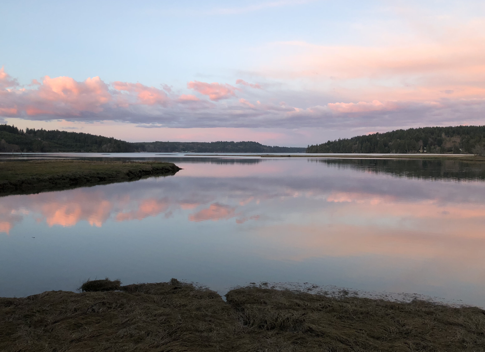
Looking for a refreshing easy local walk with plenty of birds and wildlife? Consider visiting the accessible Theler Wetlands near the south entrance to Belfair, WA. Interpretative signs, native plants, and even a reconstructed whale skeleton – makes this an inspiring walk.

With its wealth of shoreline, fresh and saltwater marshes, mudflats, and of course the bountiful forest, the fjord is a birders’ paradise.
And whereas winter and spring aren’t the most popular seasons for human tourists (meaning less competition for lodging and dining), they happen to be the best for catching the avian crowds. From soaring birds of prey to elusive divers, birdwatching is one more reason to head to the Canal.
The Audubon Society’s Great Washington State Birding Trail is a great resource.
Below we've included three birding areas to get you started!
Theler Wetlands
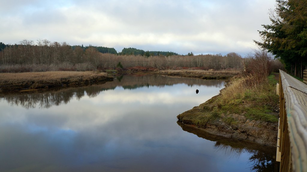
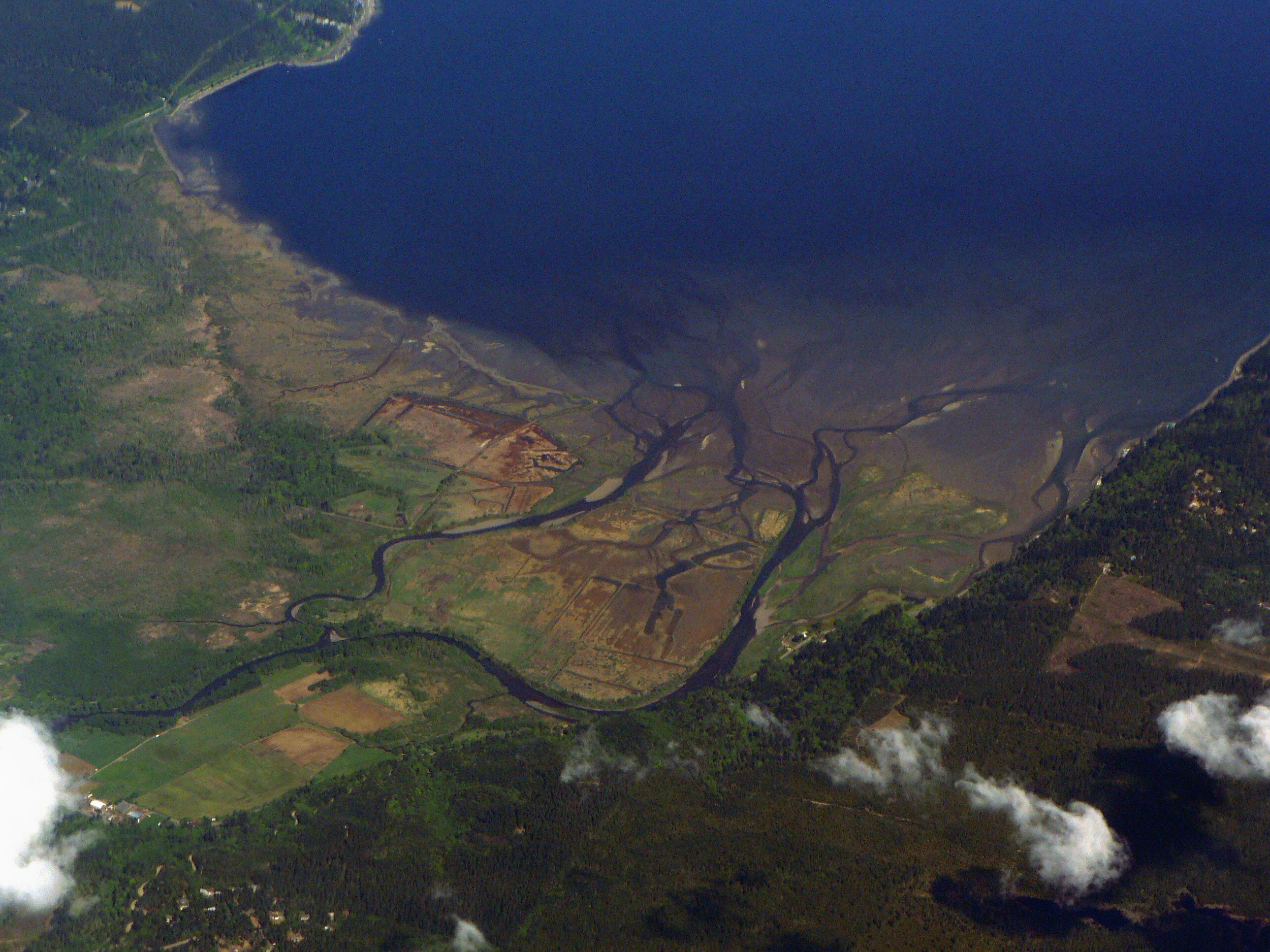
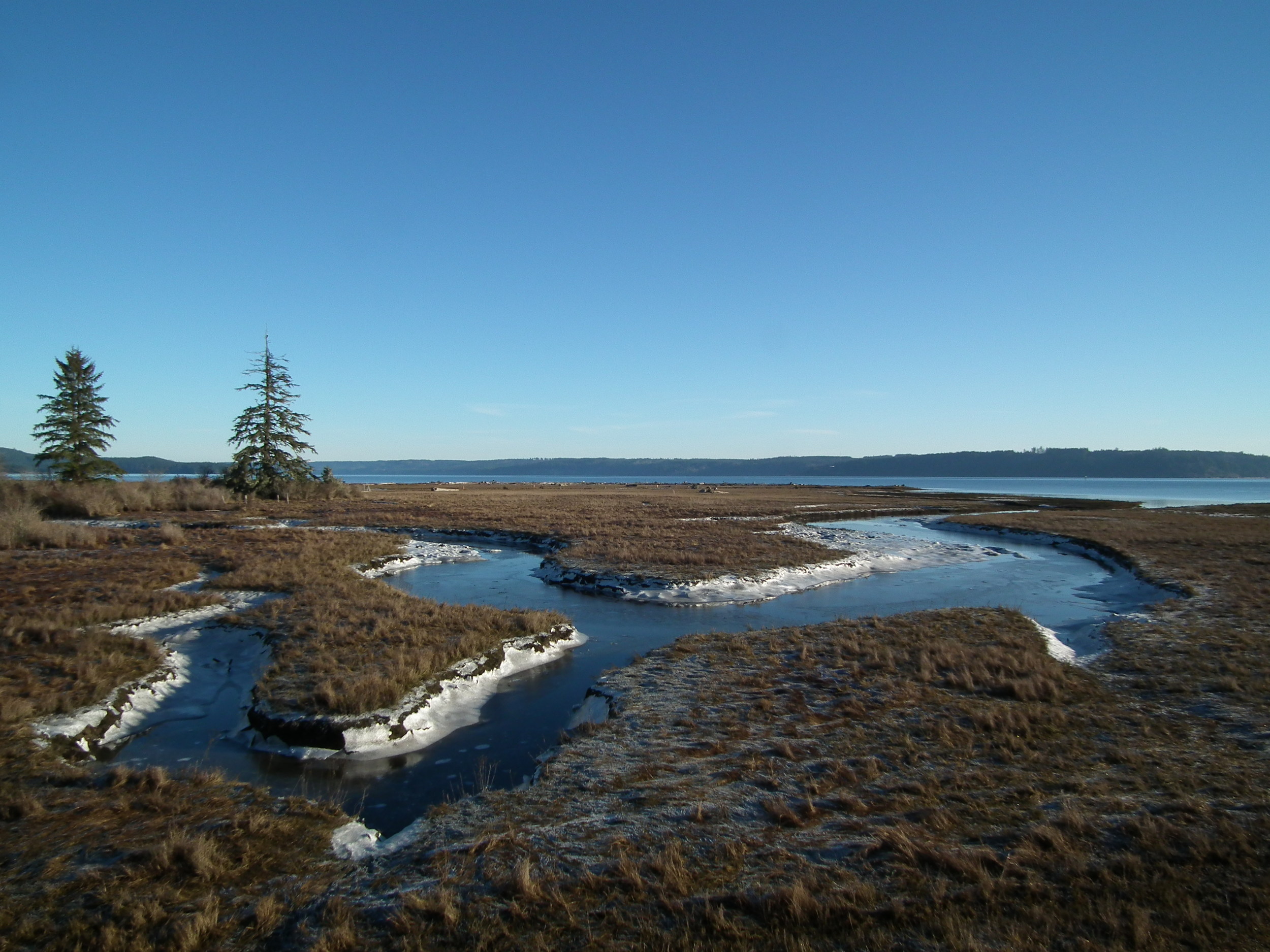
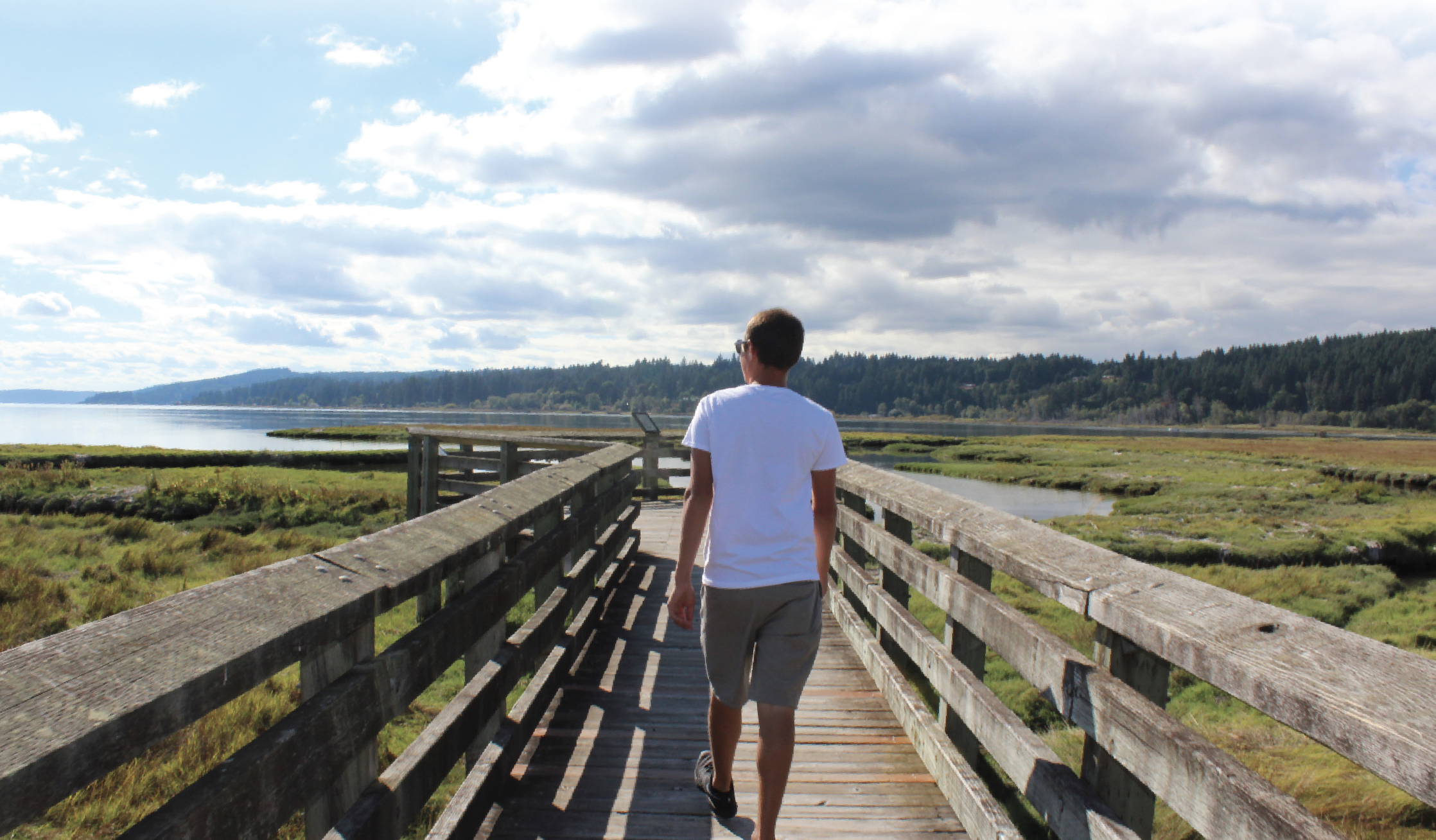
Located at the head of Hood Canal the Theler Wetlands offers several accessible walking trails within a protected salt marsh and estuary wetlands. The Theler Wetlands of Belfair include a gorgeous salt water estuary. The wetlands are accessible through many miles of level trails and boardwalks, surrounded by roses, shrubs, and blackberries in bloom in the summer months. The trails amount to 3.5 miles round-trip, with the option of three different routes.
The Union River Estuary Trail is the longest trail offered. To the left of the trail is an old dike that travels through some of the tidal wetlands, and to the right is fresh water marshes filled with cattails and tall grasses.
The viewing point from this perspective is spectacular! There are 360-degree views of the Union River, Hood Canal, and the Olympic Mountains.
Sam Theler, a real estate developer, deeded the wetlands to the North Mason School district in 1968 in honor of his wife.

Rebuilt whale skeleton on display in the interpretation classroom
Families can give these trails a visit, and if they are open, displays and hands-on exhibits are available to examine. They help to teach more about the wetlands ecosystem. There are mounted animals with plaques of information on each, along with a gray whale skeleton for display. There is a picnic area and a restroom as well. Keep an eye out for the many birdhouses along each trail—they are hard to miss! Often spotted are red-winged blackbirds, kingfishers, herons, eagles, otters, and geese. These trails are perfect for people of all ages.
Twanoh State Park
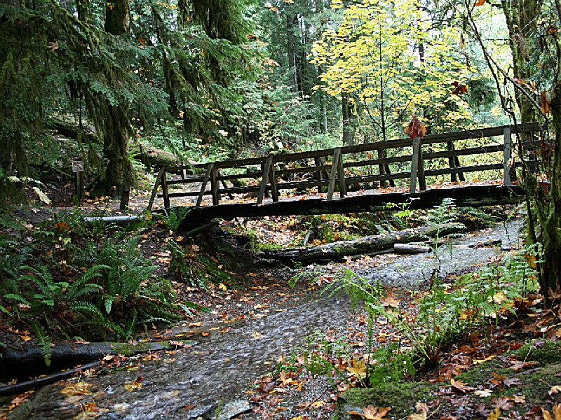
Twanoh State Park is a favorite in the summer for swimming and watersports, but the quieter winter and spring months make it a great place for viewing wildlife and birds. Bring your binoculars to the shoreline for an eyeful of diving birds such as loons, mergansers, murrelets, and ruddy ducks with their distinctive upright tails. In the towering cedars and maples inland, listen for brown creepers and red crossbills.
Potlatch State Park
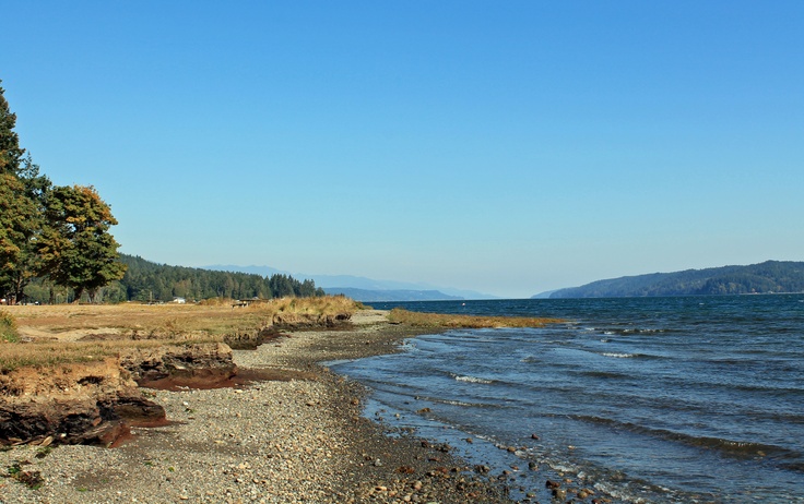
Like Twanoh, Potlatch bustles with humans in the summer and birds in the winter and spring. With 5,700 feet of saltwater shoreline, it’s a great place for viewing waterfowl, particularly during high tide. In the water, look for heron, scoters and scaups, and check the trees for fox sparrows and Steller’s jays.
For a complete list of bird sites check out this great PDF Audubon Guide.

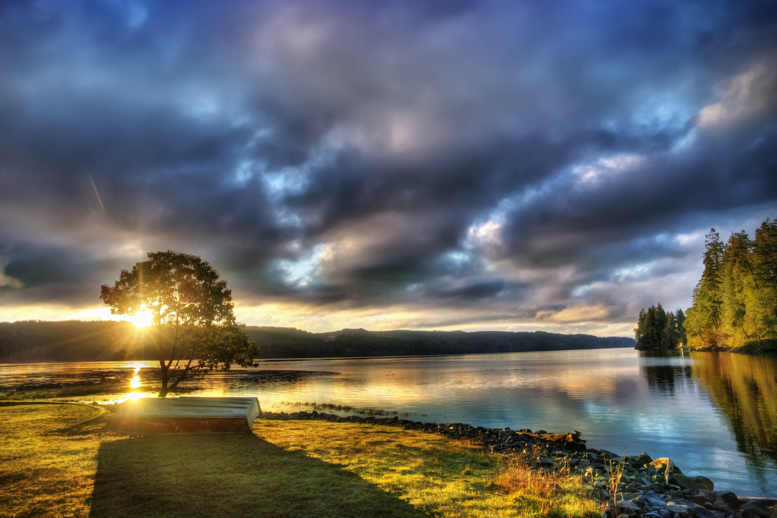
Landscape Photography with George Stenberg
Though there are many factors that come together to make a good photographer—gear, dedication, understanding of theory, etc.—the one elusive quality that boosts George Stenberg’s craft into the upper echelon is timing.
Though there are many factors that come together to make a good photographer—gear, dedication, understanding of theory, etc.—the one elusive quality that boosts George Stenberg’s craft into the upper echelon is timing. This is often translated to photographers terms as patience.
Although many assume that being in the right place at the right time is happenstance, one look at Stenberg’s extensive collection suggests there’s something more sophisticated at play. Time and time again, he publishes jaw-dropping creations that not only make us fall even more in love with our own DSLRs, but with Hood Canal that continually provides these glorious moments.

Note: all photos featured in this post belong to George Stenberg.
Meet George Stenberg
He’s the man behind the image that makes you say, “whoa.” And rightfully so—his mission is simply in the right place. “The world is a wonderful, amazingly beautiful place,” he says, “look around and see for yourself. Let’s cherish it and take good care of it for those who come after us."
We caught up with him for a little Q + A.
What makes shooting around Hood Canal and on the Olympic Peninsula special?
The simplest answer is because I love the Hood Canal and the Olympic Peninsula. I grew up in a small community along the Puget Sound called Dash Point. I always love to being by the water.
As a youngster, my folks would take us on weekend trips to my Grandparents' cabin at Maggie Lake, near Tahuya. We would also spend a lot time with friends who had a cabin nearby on Hood Canal. My earliest memories of the fjord are the warm waters, oysters, and a rocky beach. This was way different from our cold water and sandy beach in Dash Point.
Swimming in warm water was much nicer. Also, just about every summer we would take a trip around the Olympic Peninsula on beautiful Hwy 101. We called it a trip "around the loop." So I developed this love for Hood Canal and the Olympic Peninsula in my early years and as they say, "shoot what you love," applies to me.

What camera gear do you use to keep focused on what you do best as a photographer?
My equipment is very modest. I use an Olympus E-3 DSLR with two Zuiko lenses, 12-60 f2.8 and 40-150 f3.5. I shoot in RAW files and develop the images in Photomatix and/or Smart Photo Editor.
The Photomatix works well when I use HDR (High Dynamic Range) photography to help me capture the scene as I remember it. The Editor software is for basic editing and enhancing to suit the image and my taste.

Which photographers influence your work?
Port Angeles landscape photographer Pat O'Hara has been a big influence. I purchased his book Washington—Images of the Landscape almost thirty years ago, and I still refer to it and am inspired.
The late great Galen Rowell has been another huge influence. Mountain Light is a must read for any inspiring photographer. If only I could emulate his technical understanding of light and his passion for photography.
Also, Jim Brandenburg is an environmentalist and nature photographer and filmmaker based near Ely, Minnesota. Jim's work is nothing but spectacular in many ways. One of his books, White Wolf, is also a must read everyone who enjoys nature and particularly wolves.
Lastly, my Mom, Bonnie Stenberg, is another huge influence. I remember growing up with her taking pictures of us at all of our family events. Her photographs have accumulated in tons of scrapbooks and in frames filling the walls. She bought me my first camera when I went off to college. If only I had had the money for film and processing during those days.

Where is your favorite place to shoot around Hood Canal?
Every place on the Hood Canal is a favorite. It all depends the on time of year, the time of day, and many other factors. The view of the Olympics and the Big Bend is beautiful from the Union.
Lake Cushman, Skokomish Valley, and all the estuaries of the Skokomish, Hamma Hamma, Duckabush and Dosewallips Rivers are wonderful places to visit, explore, and take photos. I love to shoot from a special 3000' ridge top with a sweeping 360 degree view of the Cascades and Olympics. And there are many places that I have yet to find. But if I were to narrow my answer to one favorite place, it would be paddling in a kayak anywhere on Hood Canal on a warm summer evening.
Do you know someone who delights in shooting the under-trodden nooks of Hood Canal? Someone who sleeps with a tripod and welcomes the sunrise DSLR-in-hand? Is this person you? We’re on the hunt for those who love to shoot the Hood Canal. Get in touch with us, and you might be featured as next month’s Spotlight Photographer.
Until then, keep an eye out for photographic inspiration on Facebook, Twitter, Instagram, and Pinterest, and be sure to tag your creations with #wildsideWA so we can keep tabs on your travels about the Olympic Peninsula.

The Mountains are calling... ANSWER!
A weekend warrior is a 21st century beast whose population seems to be exponentially growing. As the “rolley chair blues” epidemic proliferates across the Pacific Northwest, so does the drive to combat it with an epic 48-hour adventure.
A weekend warrior is a 21st century beast whose population seems to be exponentially growing. As the “rolley chair blues” epidemic proliferates across the Pacific Northwest, so does the drive to combat it with an epic 48-hour adventure.
Here’s to those who burn the midnight oil finishing up reports and rise with the birds to knock presentations out of the park. This one’s for those who are at the gym until it closes so that their lungs are ready to be filled with alpine air come Saturday morning.
For those that simply cannot wait to escape Seattle’s concrete jungle when the clock hits 5 on a Friday, we have good news: Hood Canal is waiting for you in your backyard.

How to Get to Union, Washington
The Bremerton Ferry sets sail from Pioneer Square in the heart of Seattle over 15 times a day. As it scoots around Bainbridge Island, the impressive Olympic Mountains rise ever higher off of the water as your weekend playground draws ever nearer.
A short 45 minutes from the Bremerton Ferry Terminal lands you at Alderbrook Resort & Spa. But you’re a weekend warrior—you’ll take the extra half-hour trip to Lake Cushman. Or possibly even forge on a bit further in order to get in the thick of it with a visit to Staircase in Olympic National Park.

How to Make the Most of it
Breathe in, breathe out. You made it. Waking up underneath behemoth, moss-covered, primordial-looking trees and a tangle of lacy moss is what makes it all worthwhile. And you’ve got two whole diems to carpe!
Access to the Olympic National Park is second-to-none from Staircase Campground and it just so happens that some of our favorite biking trails are just down the road. The Lower South Fork Skokomish Trail #873 is bar-none one of the best trails around.
If a two-wheeled ride is not your pick of weekend poisons, Mt. Ellinor is a short drive away. An intrepid 6 miles of trail give way to breathtaking 360 degree summit views. And, as one of the more notable peaks in the area, bagging this peak will earn some serious bragging rights.
There is a wealth of adventure waiting around every twist of trail in Hood Canal. For more ideas, check out our extensive To-Do list.

How to Celebrate in Shelton, Washington
During a weekend away, we think just about anything is cheers-worthy. The good news? There’s no lack of handcrafted libations in Hood Canal. If you’re a gin or whiskey drinker, The Hardware Distillery crafts some of the best spirits in the Northwest. Their tasting room is open from 11am to 6pm Friday through Sunday.

If you find yourself drawn to a glass of wine made with locally sourced grapes as an after-adventure drink, Walter Dacon Wines in Shelton makes some of the best wine in the area and is dedicated to Rhone and Mediterranean styles. Their tasting room is open Wednesday through Sunday from noon until 6pm.
As weekend warriors ourselves, we revere those who rise early on Saturday and Sunday to take advantage of the precious weekend freedom. We’d love to see what you get into in our neck of the woods; tag your photos on social media with #wildsideWA, and be sure to find us on Facebook, Twitter, Instagram, and Pinterest for more.
Traditional Mexican along with views of the Hood Canal