
Crossing the Bar - McMicken Island
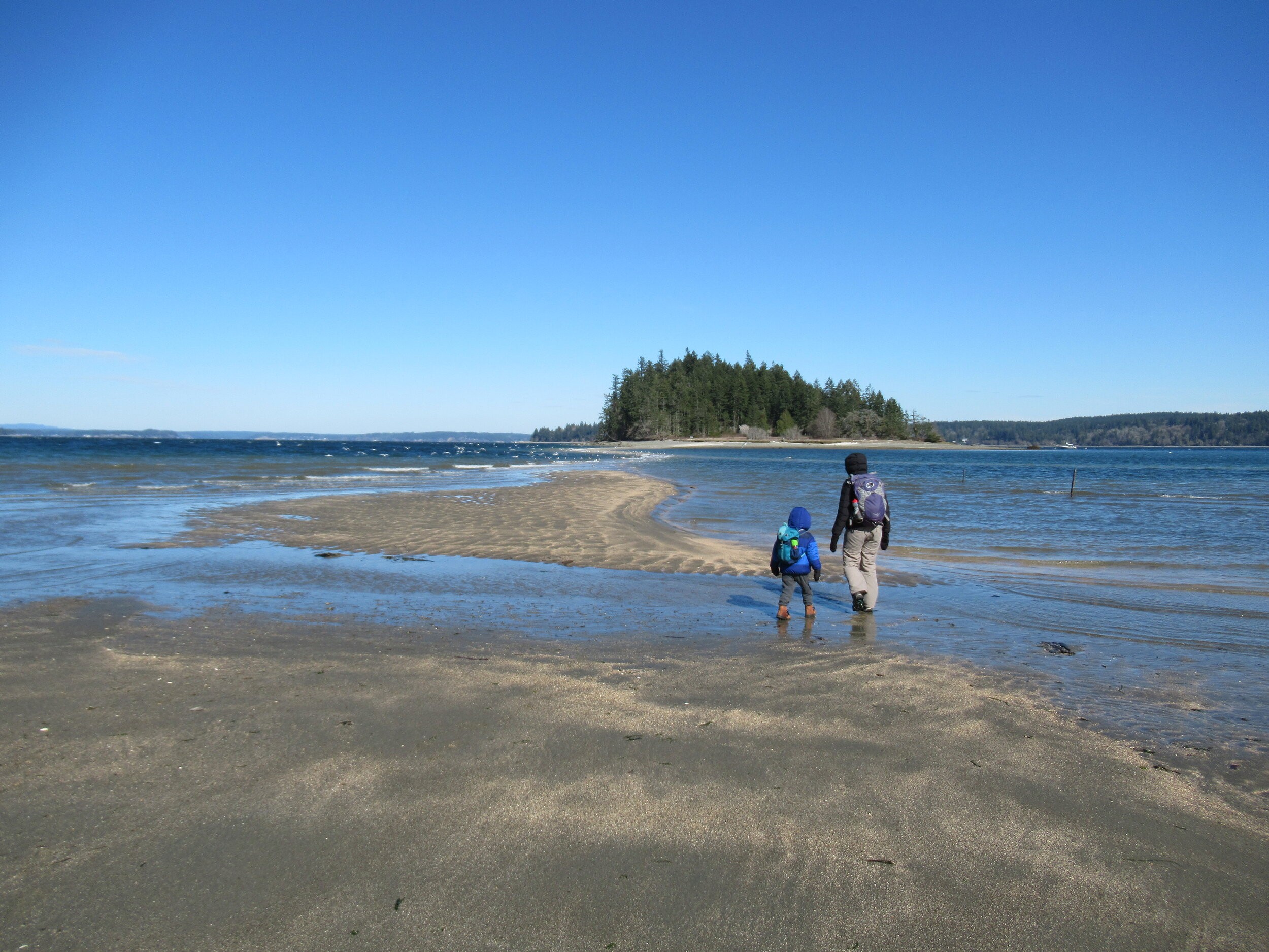
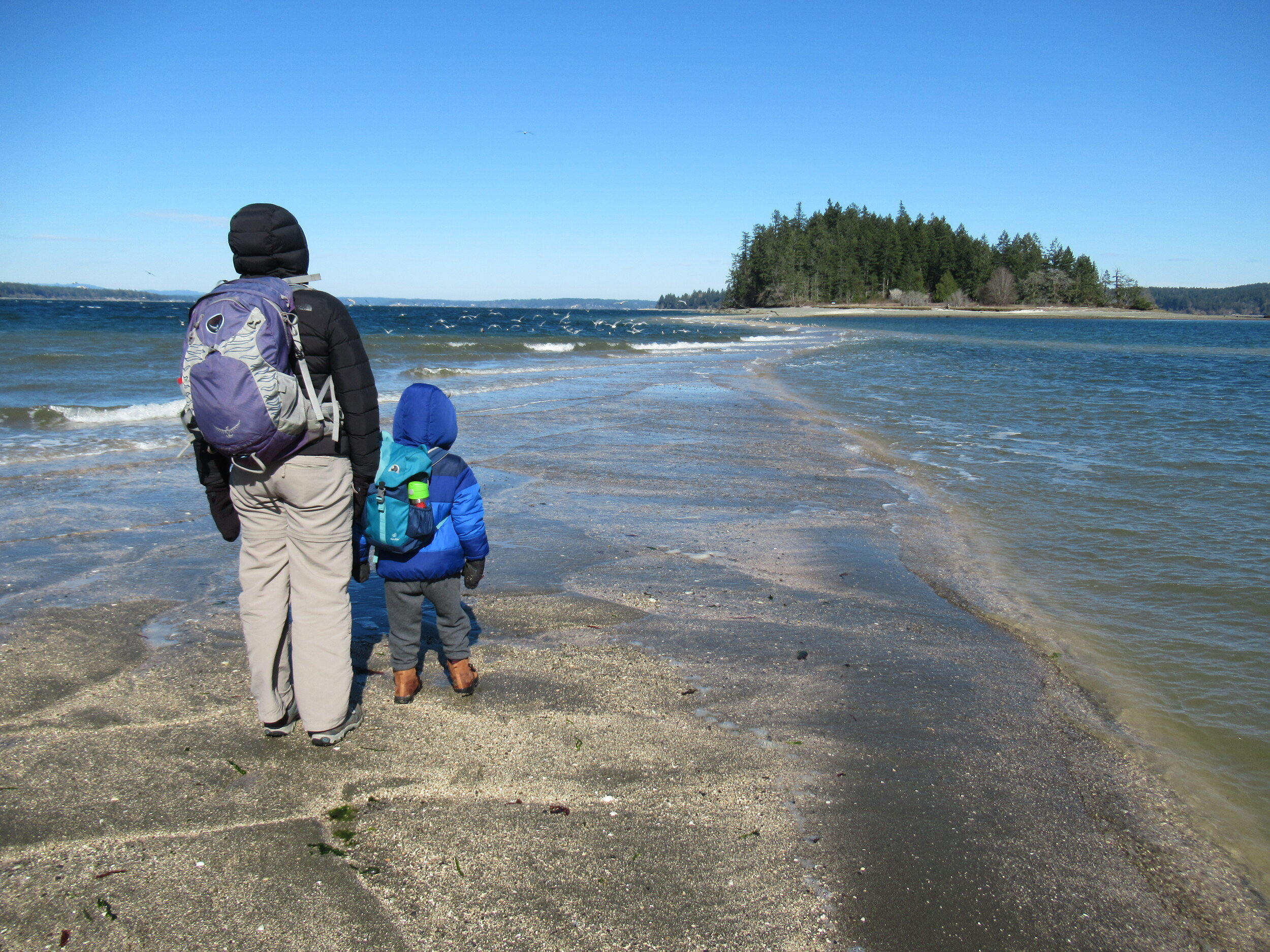
There are no bridges or causeways to little McMicken Island in Case Inlet. No ferry service either. But you don’t need a kayak or boat to visit. You can easily hike to this island which lies about 0.2 mile off of the eastern shore of Harstine Island. It’s all in the timing.
Craig Romano | Story & images
There are no bridges or causeways to little McMicken Island in Case Inlet. No ferry service either. But you don’t need a kayak or boat to visit. You can easily hike to this island which lies about 0.2 mile off of the eastern shore of Harstine Island. It’s all in the timing.

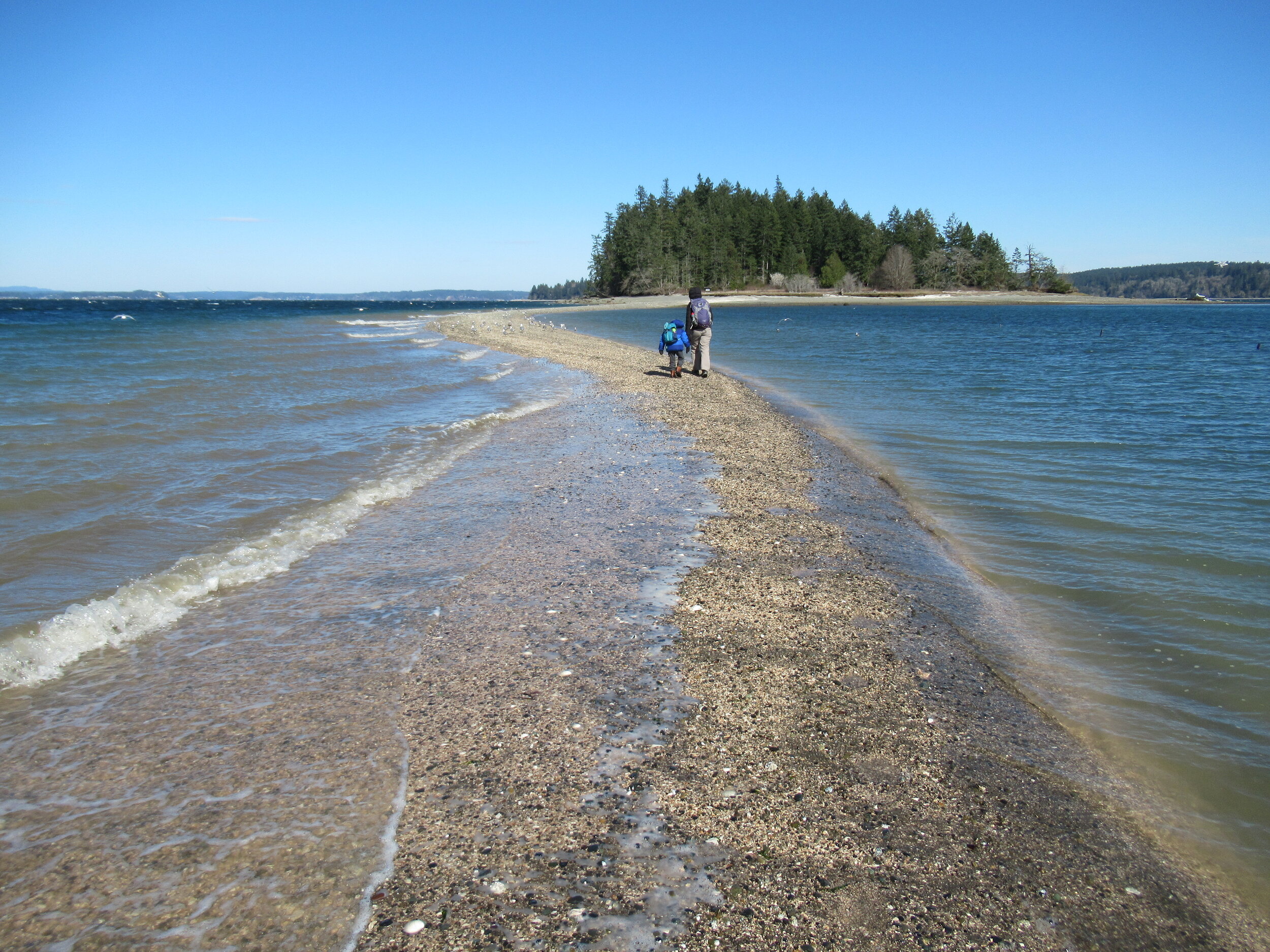
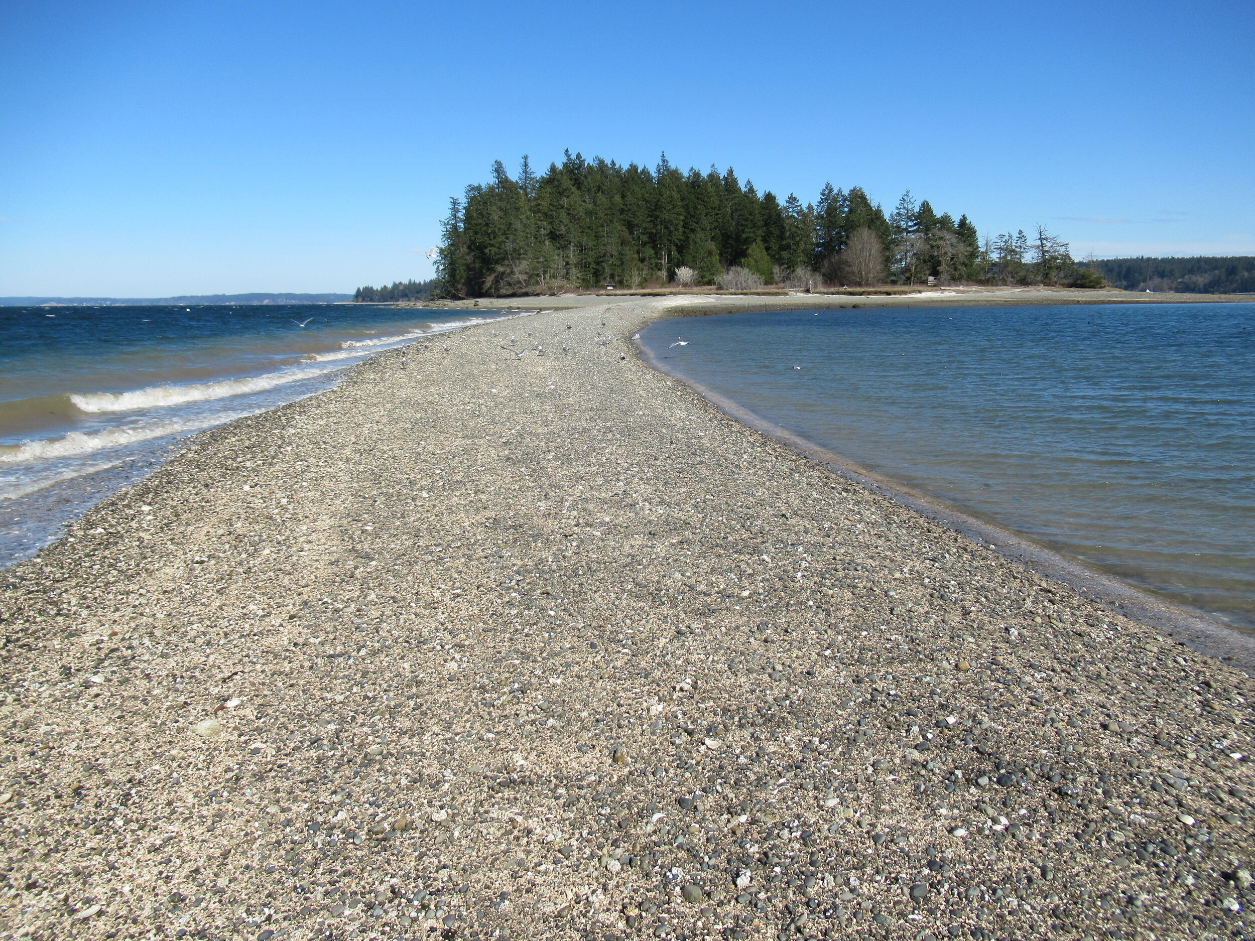
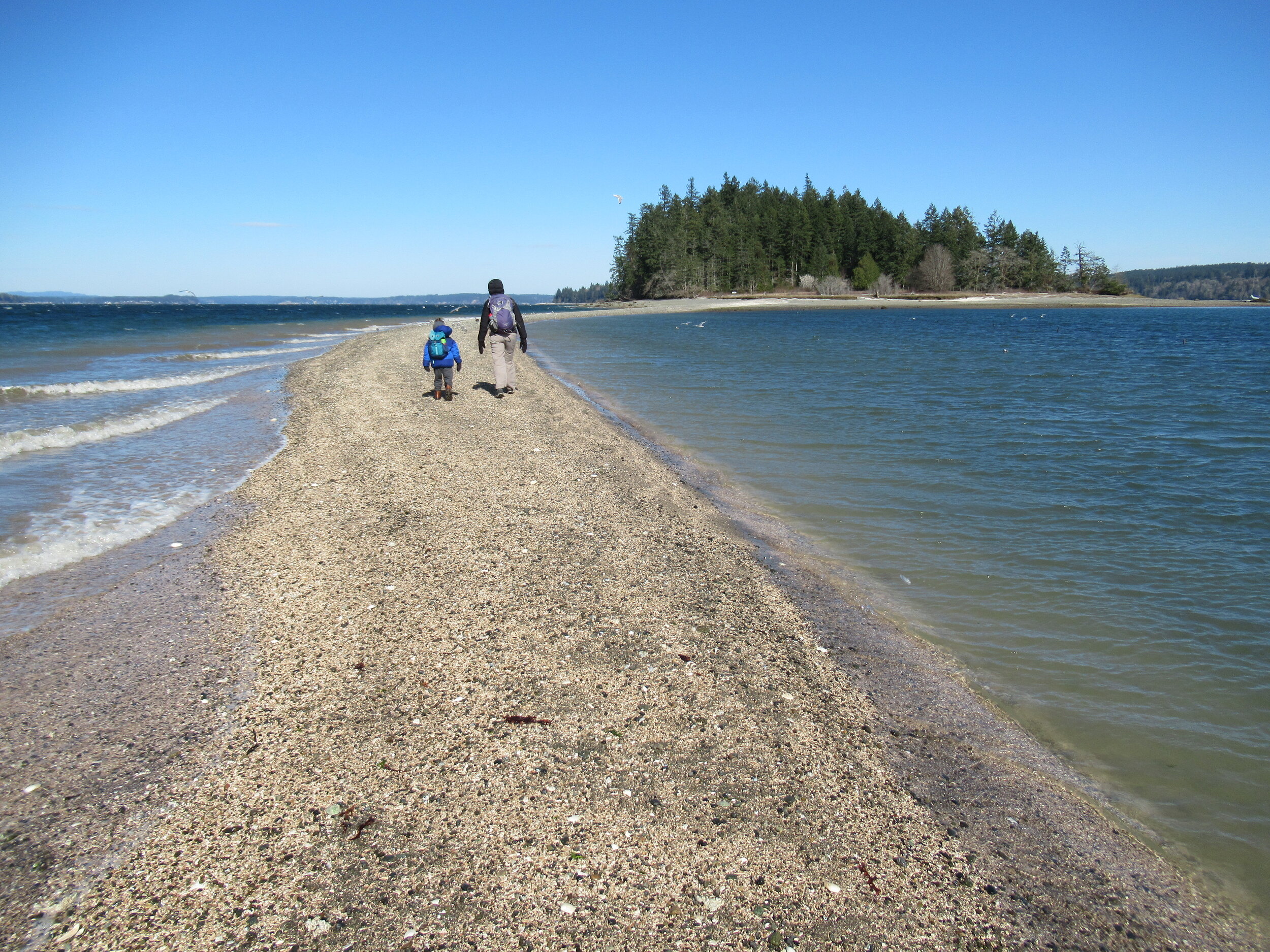
When the tide is low, a tombolo (a sandbar connecting the island to the mainland—or in this case another island) is exposed allowing you dry foot access to the island. You then can hike the island’s small half mile trail, picnic in its small meadow, or explore big barnacle-encrusted rocks in its intertidal zone. Just mind the incoming tide lest you make a big splash on your island exodus.

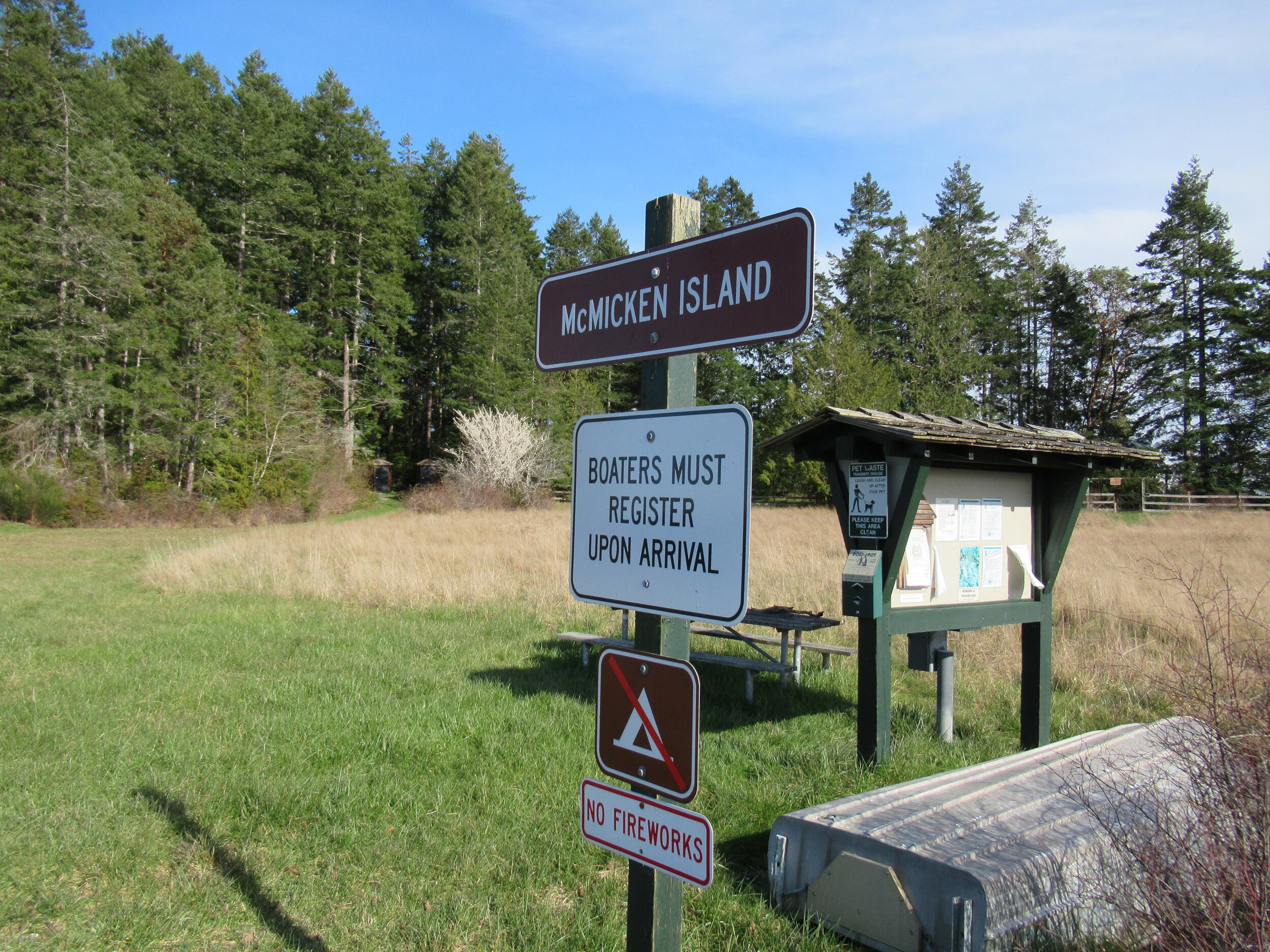

Hit the Trail
The hike to little 11.5 acre McMicken Island begins from the 300-acre Harstine Island State Park. A former Washington DNR property, most of the old timber was logged off, but small groves of old-growth remains on the property.
You want to head to the park’s beach reachable by the two trails taking off south from the parking lot. Take the one on the eastern end of the lot (away from the kiosk) for the more direct route.
The trail heads towards Case Inlet soon reaching the edge of a 100 foot high forested bluff. Continue along the bluff taking in glimpses of the remote beach below. The way then descends into a cool and dark ravine graced with big cedars and firs and reaches a junction.
The trail to the right loops back to the other main trail leaving the parking lot. Consider taking it upon your return from McMicken Island.
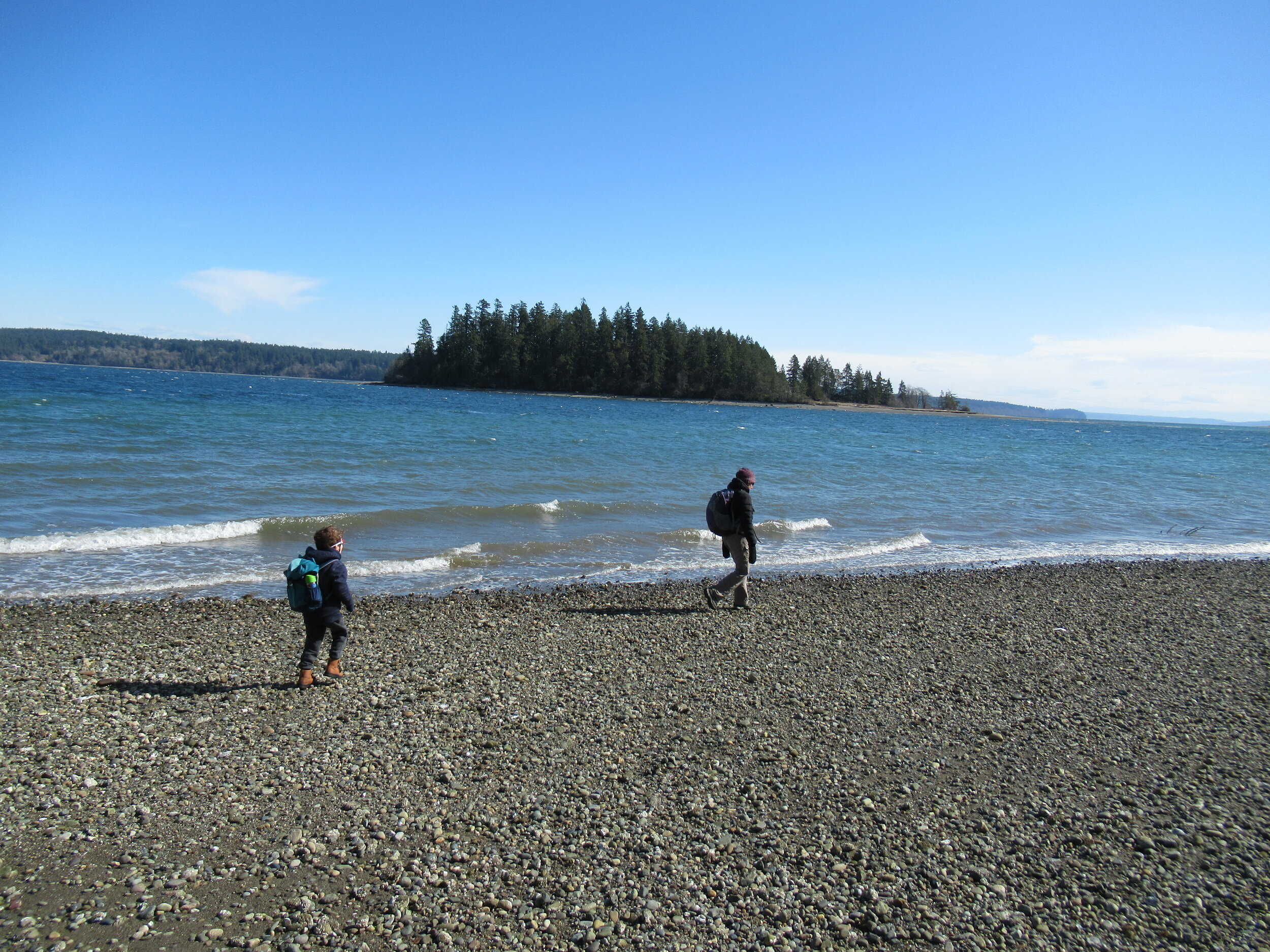
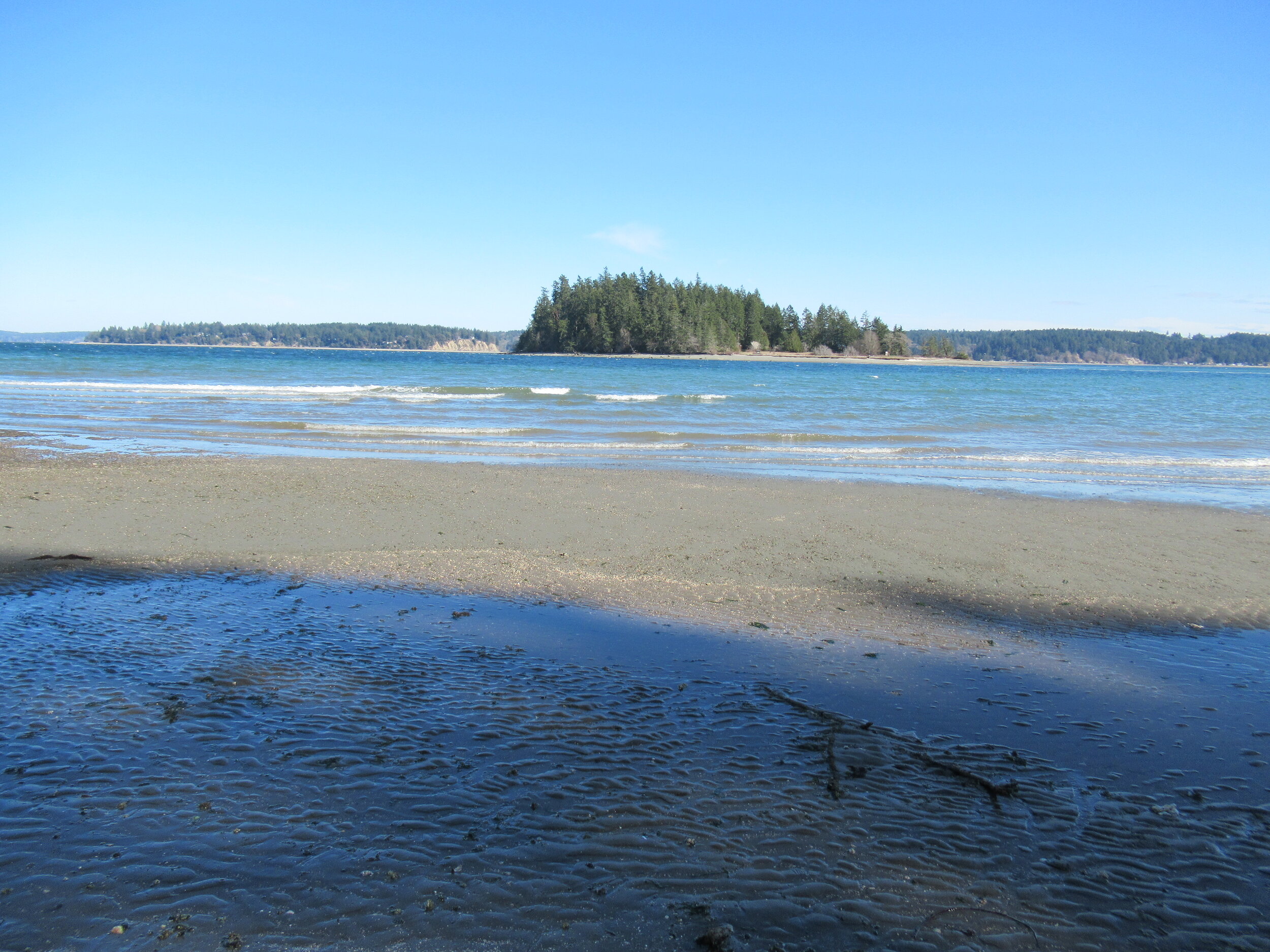
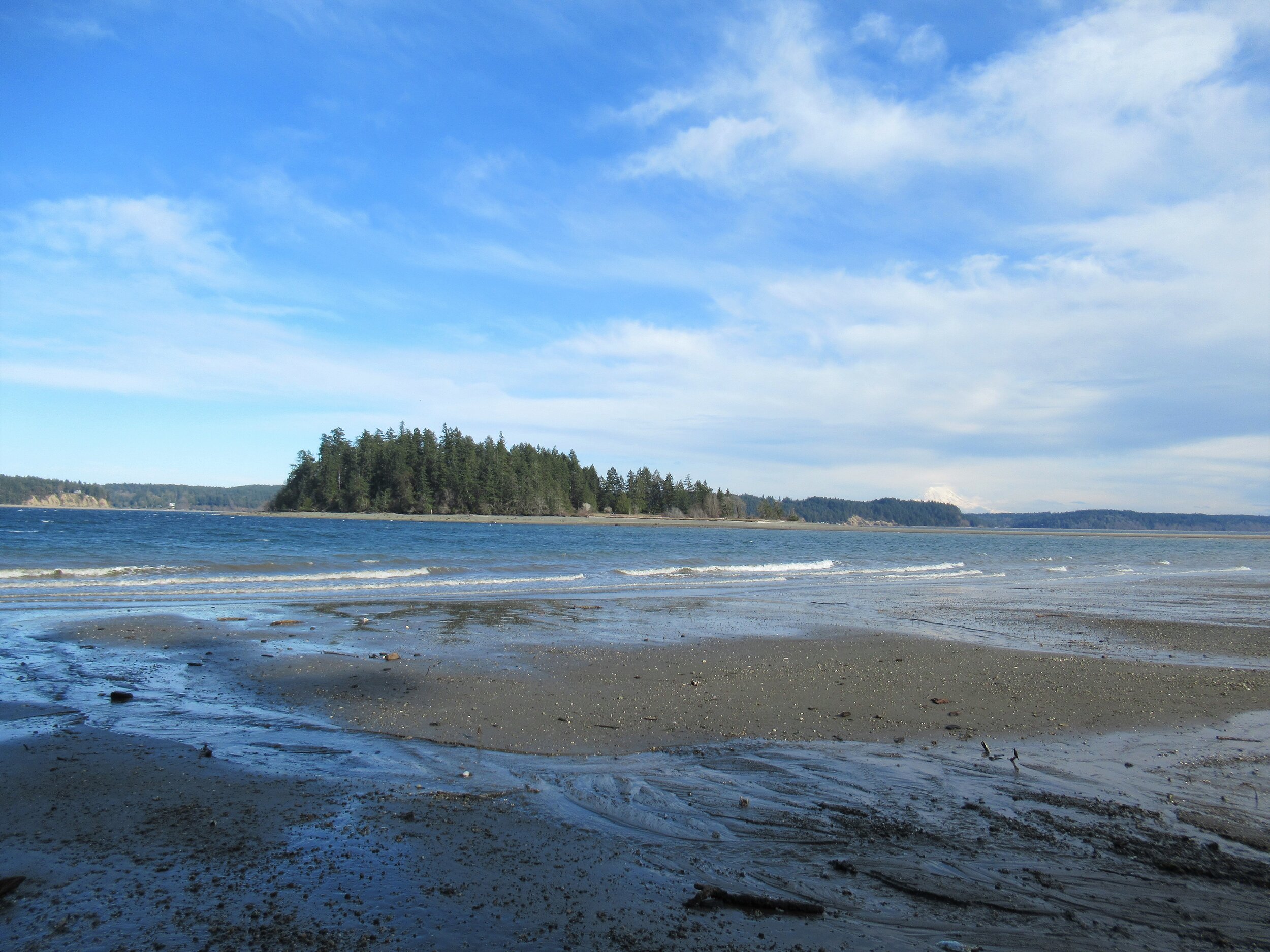
Head left through a row of big cedars and via a series of steps descend deeper into the ravine. After crossing a little creek the way emerges on a deserted beach. Look directly across Case Inlet to Herron Island and the Key Peninsula. Then look south and spot McMicken Island set against a backdrop of big beautiful Mount Rainier. If the tide is high, you’ll have to wait to hike the beach as overhanging trees prohibit passage. But in a low tide, a big wide easy to walk beach awaits your footprints.
Walk for more than a mile undulating between cobbles, mud and sand. Watch for sand dollars scatted across the tide flats. Look too for eagles, herons and a myriad of seabirds. Harstine is a wet place and plenty of side creeks fan out on the beach. You should be able to keep your shoes dry, but a pair of waterproof boots is not a bad idea. The entire way to the tombolo is on public tidelands. But there is a parcel of private property located between two large state park properties abutting the shoreline. Respect posted private property.
The tombolo is pretty distinctive in low tides—fairly wide and several feet raised above inlet waters. In high tides it’s completely submerged, although breakers will help you locate its position. It’s really fun to hike it when a receding tide first reveals it. Tap your inner Moses and part the seas watching the land bridge emerge as you amble along it.
Reaching the island
Once across the .2 mile sandy strip, reach McMicken Island. All of the little island except for a small fenced parcel with a couple of cabins is state park property. The private holding belongs to the family that once owned the entire island. They sold the island to the state withholding this small lot. Please keep out of it. The rest of the island however you are free to explore.
At the island’s western end is a small picnic area in a grassy opening. Here find some rare Garry oaks growing on a low bluff above the surf. Near a composting toilet at the eastern edge of the field is a small nature trail. Hike it! It weaves a half mile through towering firs and madronas to blufftop views on the eastern end of the island.
Be sure to explore the rocky tide flats surrounding the island too, and check out the large erratics scattered about. There is a particularly large one on the south side of the island. Enjoy your island wanderings and explorations—more than likely sharing it with no more than just a couple of other happy hikers. And be sure to keep track of the time and incoming tide so you don’t get trapped on the island.

Places to Stay
Waterfront cabin located on Harstine Is with beach access and a panoramic view of the Puget Sound, Mt. Rainier and McMicken island. Check availability
Hike back to Harstine Island State Park and call it a day or consider walking some more. The park contains three miles of trails. They traverse thick fir forests and swampy cedar groves and are family and dog-friendly.
McMicken Island Notes:

Forest Setting with Beach Access
Cross the bridge to Harstine Is. and enjoy a beautiful and quiet retreat in the woods. Relax in the comfortably furnished cabin or enjoy exploring the 5 acre property with meandering trails through a lovely forest. Check availability
Distance: 4.0 miles round trip
Difficulty: easy, pay attention to tides! Hike is only possible in low tides. Consult tide tables and plan accordingly. Dogs permitted on leash.
Trailhead Pass Needed: Discover Pass
GPS Waypoints: Harstine Island State Park Trailhead: N47 15.737 W122 52.236 McMicken Island Trailhead: N47 14.865 W122 51.780
Features: Kid and dog friendly, beach hiking, undeveloped coastline, small island reached via a sandbar, good bird watching, sublime views of Mount Rainier over Case Inlet.
Trailhead directions: From Olympia, head north on US 101 to Olympic Highway (SR 3) Exit in Shelton. Then turn and follow SR 3 east for 11.0 miles. Turn right onto Pickering Road (Signed for Harstine Island) and drive 3.3 miles. Then bear left onto Harstine Bridge Road and come to a T-junction upon entering Harstine Island. Go left on North Island Drive and after 3.0 miles turn right at the island community hall onto East Harstine Island Road. Proceed for one mile and turn left onto Yates Road. Continue 0.9 mile and turn right into Harstine Island State Park. Reach trailhead parking in 0.2 mile.
A Winter Guide to Our Local Tides
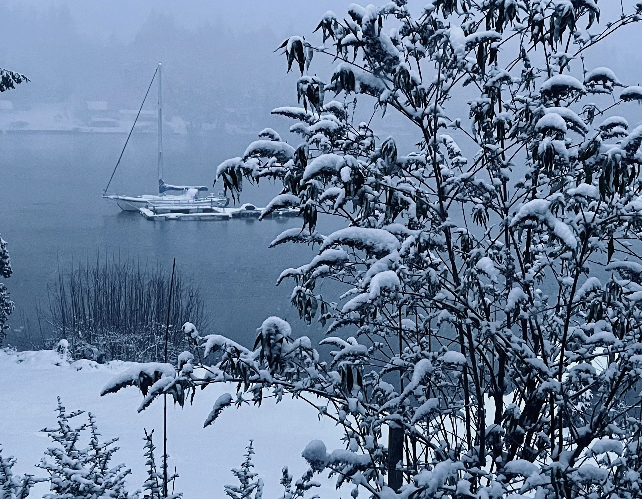
In winter, the tides along Hood Canal feel different. King tides push water higher than usual, low tides arrive before daylight, and currents move faster through familiar stretches of shoreline. Knowing how and why these tides shift can make winter outings safer and more rewarding.
H/T Tracing The Fjord | Winter ‘25
If you live or spend any time along Hood Canal or in the South Sound, you get used to checking the tides. They shape when people head out for recreation, plan a boat launch, or keep an eye on their waterfront. But the names we use for tides can feel a little mysterious until you break them down.
Tides are the rise and fall of the ocean caused by the gravitational pull of the moon and the sun. As the Earth turns, our area passes through these gravitational pulls, which is what causes the highs and lows we notice along the shoreline. Most of the Pacific Coast, including Hood Canal and South Puget Sound, experiences what’s called mixed semi-diurnal tides, meaning two highs and two lows every 24 hours. Still, each one is a little different in height. Regular tide-chart watchers recognize that pattern right away.
You’ll also hear terms like spring tides and neap tides. Spring tides aren’t tied to the season. They happen when the sun, moon, and Earth line up, which creates higher highs and lower lows. Neap tides are the opposite. They arrive when the sun and moon are at right angles to each other, pulling the water in different directions and producing milder highs and lows.
Another term that comes up often in winter is king tide. It’s not a scientific label, but a common nickname for the year’s highest tides. These happen when the moon is closest to Earth and lines up with the sun. Around Hood Canal, king tides can raise water levels several feet above normal. People may notice when the shoreline creeps inland and low-lying roads collect water.
In winter, tide shifts carry a different rhythm. Many of the lowest tides show up in the early morning or evening, long before daylight. Boaters and paddlers will see water levels changing faster through the Great Bend or around Ayock Point. Homeowners might keep an eye on their docks and pilings, since deep lows can expose more structure than usual.
Shellfish growers around the canal monitor winter tides too, since cold air paired with low water can stress their crops. And for anyone heading out to collect shellfish on local beaches, those low tides can be inviting—just make sure you have the proper license and check harvest openings before you go.
A better understanding of the tides helps explain what we see every day along the Canal. And for anyone heading out in the winter months, a quick tide check remains one of the easiest ways to stay safe and make the most of the season.

Escape to Jarrell Cove State Park | Harstine Island, WA
Located on the northwest tip of Harstine Island in Mason County, Washington, Jarrell Cove State Park is a peaceful, saltwater playground with forested campsites, moorage for boaters, and plenty of space to kayak, paddleboard, or unwind by the water.
Located on the northwest tip of Harstine Island in Mason County, Washington, Jarrell Cove State Park is a peaceful, saltwater playground with forested campsites, moorage for boaters, and plenty of space to kayak, paddleboard, or unwind by the water.
In this video, Jeff Slakey from Explore Hood Canal explores the park with Ranger Liesl Plomski and Park Aid Lucas Marin to uncover its hidden history, local wildlife, and everything that makes Jarrell Cove one of the South Sound’s best-kept secrets.
Fair Harbor Marina - A Boaters Destination
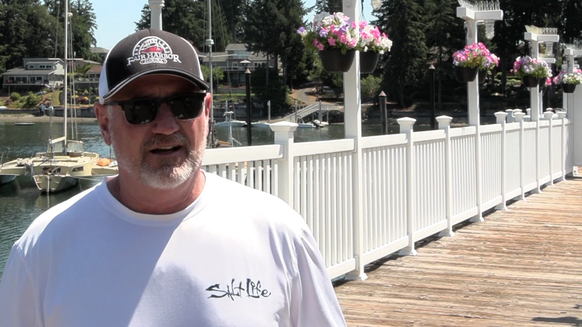
The Fair Harbor Marina, located at the Port of Grapeview, continues to grow in popularity. Managed by Kelly Granger and his team, the marina offers 82 slips with power, water, showers, and laundry facilities; making it a convenient stop for boaters. The marina's beauty has drawn comparisons to Cape Cod and Roache Harbor on San Juan Island, and it has become a venue for weddings, corporate events, and more. An additional 8-minute dingy ride gets you to the Port of Allyn, where you can find dining and drinks.
The Fair Harbor Marina, located at the Port of Grapeview, continues to grow in popularity. Managed by Kelly Granger and his team, the marina offers 82 slips with power, water, showers, and laundry facilities; making it a convenient stop for boaters. The marina's beauty has drawn comparisons to Cape Cod and Roache Harbor on San Juan Island, and it has become a venue for weddings, corporate events, and more. An additional 8-minute dingy ride gets you to the Port of Allyn, where you can find dining and drinks.
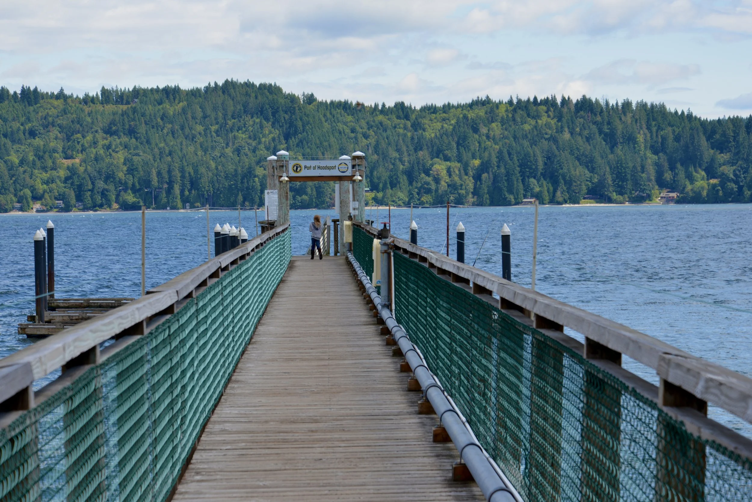
The Port Of Hoodsport Welcomes Divers, Disc Golfers and Visitors to the area
Port Of Hoodsport Commissioner Cody Morris talks about the Port of Hoodsport public dock, its recent updates, and future plans. After structural failures last winter, they secured emergency funding for repairs just in time for shrimp season. The dock is a popular spot for divers, fishermen, and visitors to downtown Hoodsport's shops and restaurants.
Port Of Hoodsport Commissioner Cody Morris talks about the Port of Hoodsport public dock, its recent updates, and future plans. They've been working on modernizing the dock to meet safety and environmental standards, replacing old materials, and making it more resilient to weather. After structural failures last winter, they secured emergency funding for repairs just in time for shrimp season. The dock is a popular spot for divers, fishermen, and visitors to downtown Hoodsport's shops and restaurants. Additionally, The Port of Hoodsport manages a disc golf course and a trail system up the Cushman Road.
If you had attended Fjordin Crossin in June, you may know that the Port has been working on modernizing the dock to meet safety and environmental standards, replacing old materials, and making it more resilient to weather. After structural failures last winter, they secured emergency funding for repairs just in time for shrimp season. The dock is a popular spot for divers, fishermen, and visitors to downtown Hoodsport's shops and restaurants.
"We are in negotiations with DNR to renew our lease," Cody Morris explained to Jeff, "and part of that stipulates that we need to modernize the material being used here. Our dock is quite old, and so it is very out of code, both for safety and environmental standards. So two of the main things we’re looking at is the materials."
Morris spoke regarding the winter dock closures, "we had some extreme structural failures, and for the safety, the port had to close it down and seek emergency funding from the state to hire a contractor to do the repairs. We were lucky that we were able to get repairs done just in the time of shrimp season. That’s definitely when this dock gets the most use. The second most use is during the salmon season."
Although the Port was able to make temporary repairs, Morris realizes there is still a lot of work to be done.
"As the dock is currently configured," he continued, "it kind of more or less has a self-destruct button. And that’s mostly from the fact that the dock itself doesn’t flex. It creates an insane amount of tension during the tidal changes, and those much gnarlier waters in the winter."
Regardless of the pending long term upgrades to the docks that will take some time and funds, Morris attests that the docks are an important asset to the Port of Hoodsport not just for the basic needs of accessibility but also for tourism. The local retail and restaurants in the area benefit greatly from the summer day traffic arriving by water.
A Case Study of Islands in the Inlet
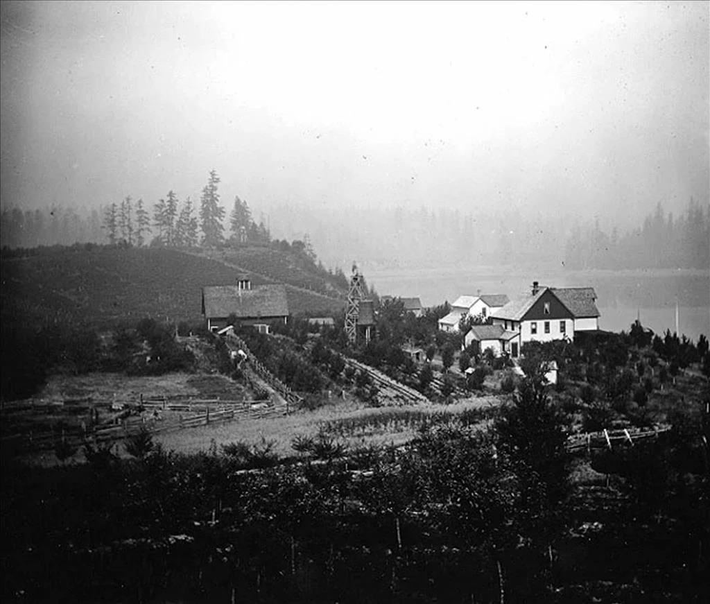
Case Inlet, at the mariner’s northeastern edge of Mason County, is home to many magical island getaways. Reach Island (AKA Treasure Island), verdant Stretch Island, secretive Herron Island, tiny McMicken Island, and Harstine Island all have interesting histories and unique characters.
Case Inlet, at the mariner’s northeastern edge of Mason County, is home to many magical island getaways. Reach Island (AKA Treasure Island), verdant Stretch Island, secretive Herron Island, tiny McMicken Island, and Harstine Island all have interesting histories and unique characters.
The water access provided by Case Inlet linked the early forestry and settlement farming of this area to Tacoma and Olympia. In the beginning Squaxin dugout canoes, row boats and temperamental sailboats were the main transportation. Small side-wheel freight ships (powered by coal, wood, and later diesel), known as the Mosquito Fleet, came to replace these early methods. They transported freight and passengers, shipped milled lumber, and even towed logs, connecting these remote communities and homesteads.
Reach Island
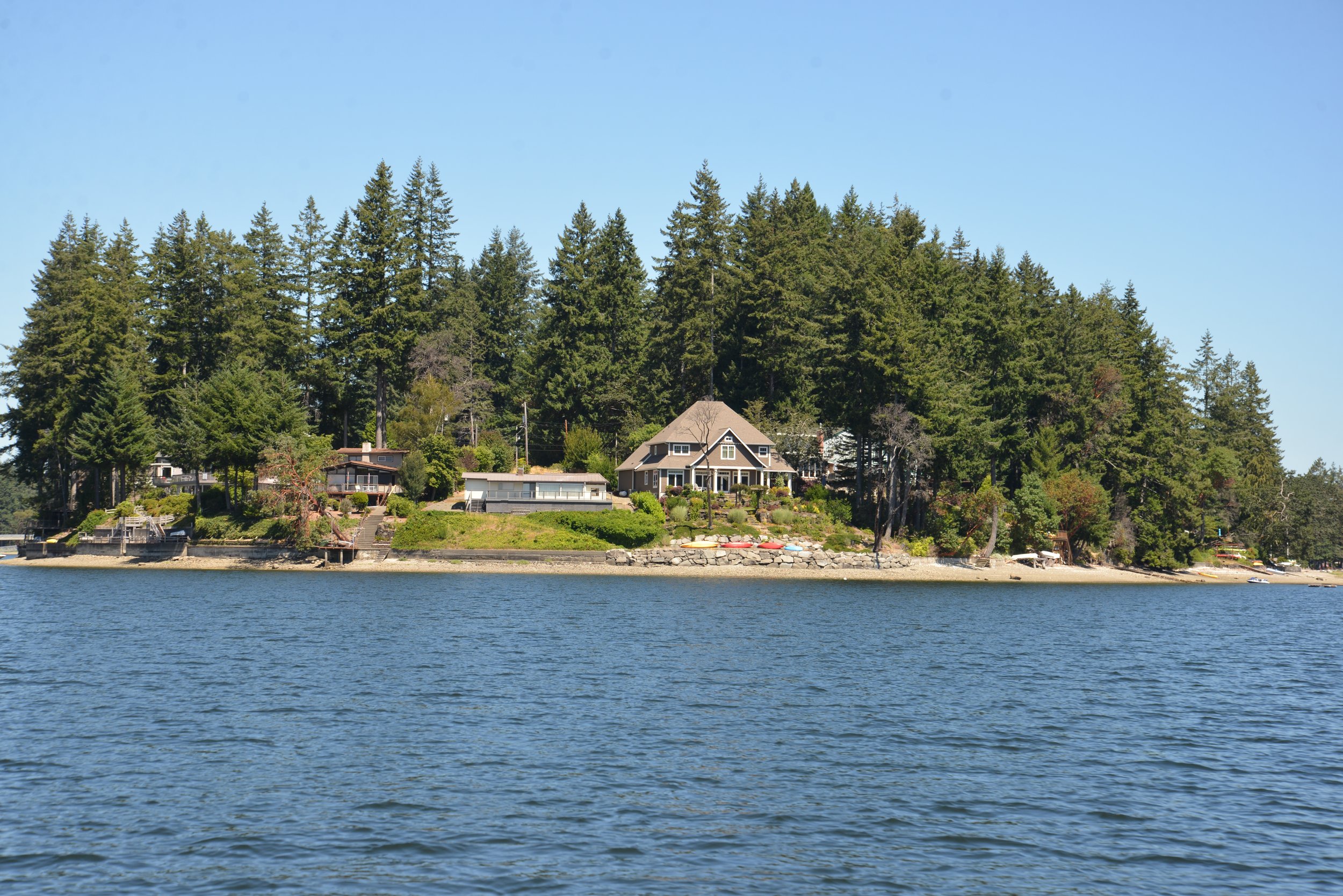
The first island we encounter heading from north to south down Case Inlet is Reach Island. The entirety of Reach Island was pre-empted and homesteaded by Joseph Pickford in 1885. By 1905, it was an established farm run by the Zizz family with cows, chickens, and fruit trees. Little farms like this were a major part of the Washington economy. Grapevines early on became important players in the agricultural scene of Case Inlet, or as it came to be known in the mid-1920s – the “grape belt of Washington.”
Stretch Island
Stretch Island saw the first efforts of grape growing on the inlet. Civil War veteran, Lambert Evans is credited with introducing the first concord grapevines to the island 150 years ago this year. Adam Eckert arriving in 1889 developed these into Washington’s own hybrid the Island Belle. This purply-red variety was hardier and ripened more successfully in the coastal climate.
Freight ships, such as the Skookum Chief would transport the Eckert Fruit Company’s fruit juice and grapes packed in round 6-pound wooden baskets to market in Shelton, Olympia, Tacoma, and Seattle.
After Adam Eckert passed away his lands and extensive grapevines were purchased by Charles Somers in 1918. Somers in partnership with his brother Frank expanded the business and began shipping to San Francisco. In 1922, the town of Detroit changed its name to Grapeview to reflect this growing resource.
In 1933, when the Federal laws known as Prohibition were lifted, Charles Somers was the very first applicant to be granted a winery permit in the 15th District (this included Washington, Oregon, Idaho, and Montana). St. Charles Winery started small with a French vintner overseeing the first casks of the only 3,000 gallons produced. Charles Somers’ sons Charles W. "Bill" Somers and Howard Somers joined the family business and by 1935 they were producing 38,000 gallons. Bill oversaw growing the fruit and harvesting and Howard (who specialized in chemical engineering at UW) took over the fermentation.

Charles Somers Vineyard
Vineyards throughout the area, especially on Harstine Island and along Pickering Passage added to their supply of grapes. In 1955, St. Charles processed over 500 tons of grapes from Mason County and another almost 300 tons from Yakima Valley. Although by 1965, the St. Charles winery had sold and the wine with it, there still exists on the Somers’ property on Stretch Island the original vine planted by Lambert Evans in 1872. Though not as popular, local vineyards still grow Island Belle and u-pick grape yards were a popular fall pastime until the 1980s. Hoodsport Winery still ferments Puget Sound Island Belle grapes. The wine is described as “a red wine bursting with flavors of fresh raspberries and cherries. A perfect wine for picnics and barbecues.”
Harstine Island
Just a little South of Stretch Island is Harstine Island. At over 18 squares miles it is the third largest island in the inland Puget Sound (after Bainbridge and Vashon), yet it is a sleepy wooded island with a population barely touching 1,500. Historically, residents were pioneer loggers (like Robert G. Jarrell of Jarrell Cove State Park fame), farmers, oystermen, fishermen and opportunistic captains (and many residents were all the above). Since the Island was only connected to the mainland in 1969 by bridge, traveling by water was very important to all aspects of life. Many famed Mosquito fleet captains lived here, building business and homes. The historic Community Hall was built in 1914.

According to the Harstine Island Community Club website, easy trees were harvested along the shores for lumber which was towed by Ed Cowan’s Levina and Raymond and John Haskell’s 40-foot launch the Marie to the sawmill at Taylor Bay.
The Community Hall held many popular dances and events with people coming by boat all the way from Agate, Stadium and Vaughn to attend. To this day it is a popular gathering spot for the Harstine community.
In 1922, the county established a ferry service crossing Pickering Passage. The 40-foot scow, the Island Belle (named for the popular grape) was their first ferry. She was built by Ira Libby of Hammersley Inlet with the help of Earl Harriman. She was designed from a ferry in operation on Lake Crescent.
With two load aprons she could carry three cars at a time, which would drive through on one end and unload on the other. She made the crossing in 30 minutes with her Fairbanks-Morse 10-horsepower engine, which drove by belt two side-paddle wheels.

She was replaced in 1929 by Earl Harriman who built his own log ferry to increase the capacity. Donette Glaser remembers that “ Earl was a pioneer of ferries. In those days, whenever we needed a new ferry Earl would tow a few logs and start building a new conveyance.” (Shelton Mason County Journal, March 26, 1959). This was soon replaced by the County’s Harstine I , and then the Harstine II in 1945 (eight car capacity).
Earl Harriman and his wife Mabel (daughter of Captain John Haskell above) were a staple of the community. Earl drove the ferry for 27 years and Mabel assisted him deck-handing when necessary. Mabel was also the chief local correspondent of Harstine Island, Pickering and Agate for the Shelton Mason County Journal for many years.
Captain Glenn Yates ran the Harstine II on her last crossing on Sunday, June 22, 1969 at 2 PM as the new Harstine bridge opening was celebrated with a parade, boat flotilla, and punch at the Harstine Community Hall. The traffic lined up on the mainland side of the bridge was further than any local had ever seen at a ferry wait. As the Captain’s wife, Carmen Yates, remarked at the time:
“The Island… saw its first major traffic jam that day. If anyone would have told me 25 years ago when I came to the island that one day I’d be involved in a traffic snarl that would take three deputies to unravel I would have just laughed at such an idea….And talk about waiting in line for a ferry How about that line that formed to go across the bridge? It extended from the bridge all the way past the ferry-landing as far as any of the longest ferry lines ever reached.” (Shelton Mason County Journal June 26, 1969).
With the new bridge, development on the island picked up as new residents and vacationers were attracted to the island life. This coincided with a popular developmental trend during the late 50s to 60s for logging companies such as Talbot & Sons Ltd. and Weyerhaeuser to revitalize their unique land holdings into private residential gated communities.
The entirety of Reach and Herron Island and the northern tip of Harstine Island experienced such development. Herron Island is only accessible by a private ferry from the Kitsap Peninsula, and you must be endorsed by a community member to visit. The development on Treasure (Reach) and Harstine Islands, however, are much more public as both are connected to the mainland by bridge and many cabins and houses in the community are available for short term rental. Much of Harstine Island offer excellent island diversions for a dat trip.
A Day on the Islands
Harstine Island is home to the Wild Felid Advocacy Center. Scheduled tours gets you right you right up close with about 50 wild cats from 13 species including a pair of tigers named Suri and Tabbi, a cougar, different leopards, and many others from five continents around the world. Visit wildfelids.org for more information on the different tours you can reserve.
On Harstine Island Jarrell Cove State Park is popular with boaters and campers alike; less developed Harstine Island Park offers tranquil beach time; and McMicken Island Marine Park offers a unique low tide hike across a tidal land bridge.
Not to be forgotten, Stretch Island has one state park which is accessible only by water. Community, history, great enterprises, and the importance of bridges all make up the waters of this meandering "Case" study on an Inlet’s islands.
Events Around Case Inlet


Dog Friendly Fjord
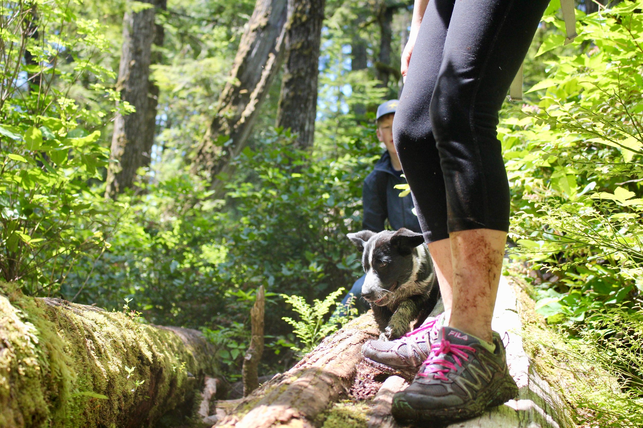
The dog days of summer are here, and our four legged friends around the region can’t help but wag their tails enthusiastically. After months of rain, wind, and snow, we need little excuse to take our dogs out into the wilds of the Hood Canal.
By Douglas Scott, The Outdoor Society
The dog days of summer are nearly here, and our four legged friends around the region can’t help but wag their tails enthusiastically. After months of rain, wind, and snow, we need little excuse to take our dogs out into the wilds of the Hood Canal.
While we are just as excited as our pets to hit the trails, sometimes it can be difficult to locate a dog-friendly destination. Luckily, the Hood Canal is full of incredible locations for us and our dogs– from an easy day out to a tongue hanging trek!
Location is the easiest way to know if a trail is dog-friendly or not. In Olympic National Park, dogs are not allowed on trails. If the trail is located in Olympic National Forest, DNR Land, or at a State Park, the majority of trails will be dog friendly. Remember that even if a trail is dog friendly, you are still responsible for keeping them on a leash and picking up after them. Not everyone on a trail is used to dogs, so please be conscientious of others. Also, never leave a bag of waste on the side of the trail, carry it with you, even if you are hiking back past it later. Finally, always remember to bring extra water for you and your dog, as water sources are not always readily available.
Easy Access Spots
Dosewallips State Park
Found right off of Highway 101 and along Hood Canal, Dosewallips has a few hiking options, with a favorite being the fantastic Steam Donkey Trail. At just 3.5 miles in length and an elevation gain of 400 ', this trail reveals water cascades, bridge crossings, ferns and river views.Your dog will love visiting with other dogs and the endless sticks to pick up. Yes, this gentle dog-friendly hike will have the whole pack begging for more adventures.

Twanoh State Park and Trail
On the eastern side of Hood Canal, Twanoh State Park is yet another incredible dog-friendly destination. Situated right along the water, between Union and Belfair, Twanoh has a few miles of trails in the woods and along the shore, helping to making this one of the most dog-friendly locations on this stretch of Hood Canal. Your dog will love this for the beach and the water.
Ranger Hole
Twenty-two miles north of Hoodsport, the Duckabush River makes for a fun stop for you and your dog. The Ranger Hole Trail is just two miles in length but feels very remote. Passing through second growth timber, the trail leads to the Duckabush River, where you can watch the raging waters churn in white rapids. Dogs, kids, and families will love this short day hike. Your dog will love this trail for the walk, the trees and the many smells from the local wildlife.
Next Level Destinations
Upper South Fork Skokomish
Here, you and your dog can wander in pristine old-growth forests and enjoy this corner of Olympic National Forest. The trail crosses over bridges and through towering trees for nearly four miles before reaching the Olympic National Park boundary. The road here is closed to motor vehicles between the months of October and April, making it an ideal summer destination. Your dog will love this for the remoteness and the many chances to dip in the water.
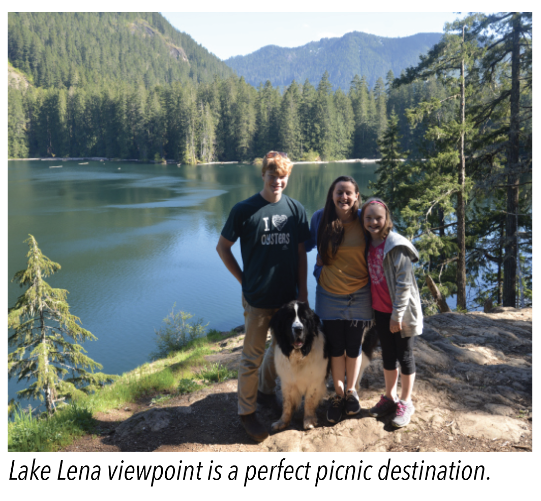
Lena Lake
Found along the Hamma Hamma River in the Olympic National Forest, this trail is for hikers and dogs hoping for a long day of hiking and exploring. At around seven miles round trip and gaining 1,300 ft in elevation, this hike can be hard for many people and pooches. Bring water and treats for all. Take your time while hiking through a mossy forest, over cool bridges and enjoy the stunning lake.
Memorable Canine Adventures
The Valley of Silent Men
Past Lena Lake, those hoping for an even more amazing adventure should hike into the Valley of the Silent Men. You’ll be hiking for 10 miles or so round trip, but this valley is a wonderland. Full of old growth, moss-covered boulders, and cascading creeks, you and your dog will be intoxicated with the beauty of this overlooked section of Olympic National Forest. Your dog will love this for the remoteness and the creeks to wade in.
Marmot Pass
Marmot Pass is a classic hike, and doing it with your dog makes it even better. At 11 miles round trip and gaining 3,500 feet in elevation, this is a trail for dogs and humans able to hike steep trails for miles on end. Starting in a forest, you’ll eventually climb to majestic views of the Olympic interior and even Hood Canal and Puget Sound. Your dog will love this for the varying terrain and seeing you happy!
Olympic Peninsula’s Dog Friendly Map

Check out this fantastic pet friendly map provided by our partners at Olympicpeninsula.org!
Download and pack a copy along with your leash and collapsible water dish!
6 Tips for Hike Savvy Canines
Like house-bound humans, dogs need a little prep time to get ready for the trail. Here are six tips to help you and Fido have a safe and fun adventure.
#1 Take it Easy : Start with easy trails and slowly build up stamina & strength.
#2 Care for Tender Paws: Make sure your dog's pads are toughened or purchase hiking booties and let him get used to them before heading into the wild.
#3 Yield to oncoming traffic: No matter how sweet Fido appears, its good practice to verbalize how friendly he is. Step off the trail when hikers pass and heel your dog.
#4 Leash Control: If the trail requires leashes or if if your dog might run into other hikers, keep him on a short leash (-6') since a long leash is more likely to get tangled on brush. Your dog should not be allowed to roam freely.
#5 Leave no trace: Bring bags to collect and carry out your dog’s poop. If you’ll be backpacking overnight, bury it at least 6” deep and at least 200 ' from walkways, camps, and water sources.
#6 Command Ready: Hazards in the woods differ than the cul de sac. Don’t let your dog stray. Some plants are poisonous, and some creatures bite and may host diseases. Irressistable smells will lure pooch away in a flash. Make sure your obedience training is on track.
Visit backpacker.com for more ideas on a safe and rewarding journey!
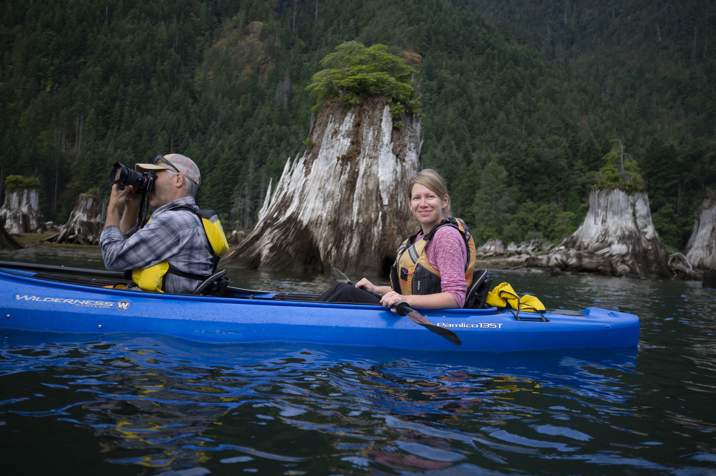
Its time to paddle
With balmier weather and longer days, it is time to get outside and explore the shores and waterways of Hood Canal and the inlets of Mason County. Kayaks, canoes and stand up paddleboards are a great way to be on the water without the expense or headache of a powerboat.
With balmier weather and longer days, it is time to get outside and explore the shores and waterways of Hood Canal and the inlets of Mason County. Kayaks, canoes and stand up paddleboards are a great way to be on the water without the expense or headache of a powerboat.
Get on the water
Whether you seek tide-ripped saltwater passages, challenging whitewater, or lakes big and small, Hood Canal is a kayaker, canoer, or paddleboarder’s ideal destination. Few places in the world can match the stunning scenery and easy access of the Hood Canal region. Sea kayakers can explore seemingly endless miles of pristine saltwater shoreline, cruise the reaches of lakes Cushman and Kokanee in the foothills of the Olympic Mountains, or ride the gentle currents of the Skokomish and Tahuya Rivers.
Wet your paddle with these adventure ideas:
Explore Skokomish River, using public put-in on Sunnyside Rd, just north of the Skokomish Valley Rd.
Launch at Shelton Marina or Walker Park and paddle (with the tide) out Hammersley Inlet to Hope Island. Ride the tide back for a little help with the paddling. There is a strong current in this passage that is difficult to paddle against but great to use to your advantage. It is necessary to be aware of the tides. If you miss the tide, head to the inlet shores to escape the prevailing currents. Hope Island can also be reached with an easy paddle from Arcadia Point boat launch. At the launch you will find plenty of parking and easy access to the water. Hope Island has sandy beaches all around the island for easy landing and plenty of trails to explore.

Hood Canal can be unpredictable with weather “outbursts” but generally putting it at Potlatch State park in early morning or in the evening after the afternoon breeze has settled can be rewarding.
Paddle the lower reaches of the Skokomish near Union, explore the shores of Hood Canal or explore any of the lakes.
A great Mason County destination is Lake Kokanee, or Lower Lake Cushman; this scenic lake channel wind, so watch the weather.

Rob Casey image | Salmon Bay Paddle Hammersley race.
An interesting two-hour paddle starts at the boat launch at Lake Isabella. At the far end of the lake, enter Mill Creek through a patch of water lily pads. Glide through the willows for half a mile before the stream drops and becomes too shallow to navigate.
The rivers of Olympic Peninsula are renown for their great beauty as well as their technically difficult white water rafting and kayaking routes. Placed high in the wilderness of the Olympics, the rivers that drain into Hood Canal are wild, steep and undeveloped. However, do you research before you go! Many are Class IV - V rapids and are not to be attempted by the novice paddler. For information on white water sites in the area, americanwhitewater.org provides excellent river classifications and descriptions. Gary Korb’s, A Paddlers Guide to the Olympic Peninsula (1997), is also an invaluable resource before attempting these rivers.

Case Inlet’s calm waters and sandy beaches are renown for paddling popularity
Kayak rentals
If you are just getting your paddles wet, or are a seasoned paddler, there are some great opportunities in Mason County for kayak or SUP rentals. Hood Canal Events offers organized excursions with catered meals. Hoodsport Kayak Rentals, offers hourly rentals and excursions with kayak or pedal boat drop off at nearby Kokanee Lake. Hood Canal Adventures, located in Brinnon, has a fleet of single and tandem vessels and offers biologist guided eco-tours by kayak or SUP.
Additional resources for rentals and guided tours available here.
Watch for paddling events
Hood Canal and South Puget Sound is often host to kayak and SUP races and events. SUPs, canoes, and kayaks lend themselves well to COVID sensitive planning with cute mottos like “keep a paddle distance apart.”
Salmon Bay Paddle recently included Hammersley Inlet in their paddling competition series this May complete with a sea kayak paddling clinic in their event held at Shelton, Hammer the Inlet.
Based out of Seattle, Salmon Bay Paddle is the leading provider of personalized one-on-one and small group stand up paddle board (SUP), kayak and surf ski lessons in the Pacific Northwest. Owner, Rob Casey, is the author of two paddling books and is considered a pioneer of stand up paddling by Stand Up Journal Magazine. Rob and his certified coaches travel the Northwest offering paddling skills and safety classes from beginner to advanced paddler. Salmon Bay Paddle’s event on Hammersley included guest speaker, ICF World Champion Fiona Wylde, hosting a SUP racing clinic at the Shelton Yacht Club; the Hammer the Inlet Race and on-site kayaking clinics.
Thirty-one paddlers participated including eighteen SUPs, eight kayaks, two rowers, an outrigger canoe, and one rowboat (romantically called Starlight). Beginning at Shelton’s Yacht Club, paddlers took the 1.9 knot ebb out from Shelton and the 1.4 knot flood current back up the winding picturesque inlet to where it empties into lesser Puget Sound.

Rob Casey Image | Hammer the Inlet Race 2021
Paddlers call this run the ‘Hammersley Shuttle’ for the tidal push allowing for a nice glide with the current. Back eddies and eddy-lines add a little spice or challenge around the various bends and curves at Skookum and Libby Points and Cape Horn. The fastest vessel to complete the grueling 15.3 mile Hammer the Inlet Race was a SUP that clocked in at 2:18:32.7. Participants faced a challenging race with strong 15 knot winds, cross current conditions, and a muddy, low tide finish line – resulting in some comical watercraft exits.
After the race, fourteen dozen local oysters were enjoyed from South Sound Mariculture. Part of the race proceeds were donated to the South Sound Restoration Project.
Be water smart:
Paddling events are a great way to share ideas on skills as well as water safety. Like the trails and parks filling to bursting, COVID restrictions have led to a rise in purchase of personal watercraft but perhaps not an increase in water safety awareness. Kayaks and SUPs, mass produced for the desperate consumers in dizzying shades of enticing colors, are available at every big box store promising a cheap and easy way to get freedom on Washington’s waterways. Although one can be delighted that sales surged and people got outdoors, the risk associated with little instruction on proper use offered by stores online or giants like Walmart or Dick’s has led to a much more disturbing fallout than litter and over-crowding in our parks.
Accidents and drownings statistics in 2020 were so alarming that a Bill was proposed to require safety certification for all people on the water — not just for those in powered boats over 15 HP.
The current rules are simple and common sense should prevail.
Wear a life jacket, understand your surroundings, educate yourself about winds, currents, tides, travel in groups and develop a safety plan. Take advantage of public events to educate yourself.
There are also plenty of useful online resources and books. Book yourself lessons with Salmon Bay Paddle and become a paddling pro –they even offer online courses, so you could learn some basics before you head out. Even if you aren’t using a watercraft with a 15 HP engine, the Washington State Boater safety course is only a short online course with an exam and costs $29.95 plus tax.
Additionally, the friendly staff at outdoor stores such as Verle’s, Hood Canal Adventures, and Hoodsport Kayak Rental can answer questions and make recommendations about water conditions, good local spots to check out and other queries you may have.

Don’t let the chilly water discourage you…dive in!
Just below the surface of the waters of the Hood Canal, a whole new world exists waiting to be explored. It is carpeted with sponges and seaweed, populated by wolf eels and octopus and visited by the occasional seal and even (rarely) a six-gilled shark. Although the cold water of the Pacific is daunting, the variety of marine life it holds is well worth the chilly SCUBA dive.
Just below the surface of the waters of the Hood Canal, a whole new world exists waiting to be explored. It is carpeted with sponges and seaweed, populated by wolf eels and octopus and visited by the occasional seal and even (rarely) a six-gilled shark. Although the cold water of the Pacific is daunting, the variety of marine life it holds is well worth the chilly SCUBA dive.

With its comparably slower currents (to the rest of Puget Sound), the Hood Canal offers many opportunities for rewarding shore dives and live boat dives of various experience levels. Diving is not just for the summer time, the winter and early spring offer excellent opportunities because the cooler weather means clearer visibility (rain run off notwithstanding).
We have coalesced a list of some of the top dive sites of the Hood Canal as recorded by excellent books such as Betty Pratt-Johnson’s 141 Dives in the Protected Waters of Washington and British Columbia (1977) and Stephen Fischnaller’s Northwest Shore Dives (2000), as well as diver’s blog reviews, such as Scott Boyd at Emerald Sea Scuba and Nicolle Prat at Pacific Northwest Scuba.

Mikes Beach is one of the oldest and most picturesque resorts in hood canal with a unique blend of the rustic look of the Northwest and the relaxed, charming and cozy German Chalet style
#1. Flag Pole Point
East and West
Outside of Lilliwaup, just to the South of Mike’s Beach Resort is a dive site more comfortably accessed by boat (but you can free swim to it also). Called “the knuckle” this dive site consists of a series of rock formations, rising like a mini range of mountains from the ocean floor. Because this formation is farther out and more exposed to currents, this site usually has excellent visibility and there are lots to see. Lingcod lay their eggs at this protected site, and there are resident wolf eel and octopus populations. Since the rise of “the knuckles” is so rapid, the site can be difficult to locate— check the dive blogs for more information and ask your local dive shop.
#2. Potlatch Park -
While the diving at Potlatch is less dramatic than the site above , if you are just getting your flippers wet, this is a great place to start out. This shore diving spot is easy to get to, has showers to wash off gear, and it provides opportunities to get comfortable with your equipment and practice techniques.
#3. Scenic Beach State Park –
Like Potlatch, this site is accessible from the beach and it is rewarding for all experience levels. There are plenty of marine life to observe on this sandy-cobble beach, which shifts after 15 ft into a large eelgrass bed, likewise teaming with all the sea creatures that are heir to this environment.
#4. Octopus Hole –
Although parking for this site is limited, this wall site is easy to access from shore and gratifying for all experience levels, but it is a popular spot! It is recommended you brings a flashlight to see the friendly octopuses and wolf eels. Remember this is a protected site, so no harvesting or disturbing the site (and no taking of the glass bottles that octopuses like to hide in).
#5. Sund Rock Marine Preserve
Easy beach access to this site is available through Hoodsport ’N Dive for $20 per diver. This is an iconic dive spot of the area —Hoodsport ’N Dive even offers diving classes at this site. From the beach you swim out through eelgrass environs filled with perch, crabs and other types of sea life. When you reach the Rock you are greeted by wolf eels, octopuses, sea stars, lingcod and other bottom fish. As it is a marine preserve it is closed to harvesting and fishing — so no spear guns!
Twanoh State Park offers easy access to the water.
#6. Twanoh State Park –
This full service park, has a gentle current, which gives divers the freedom to dive whenever— independent of slack tides. You will find a large eelgrass bed filled with interesting fish, such as tube-snouts, black eye gobies and sticklebacks. After about 40 foot depth you can find tube-dwelling anemones. These anemones are entertaining to watch as they feed with their long graceful tentacles. Use a dive flag and submerge when you pass the roped swimming area (and stay submerged and deep to avoid any boat traffic).
#7. The east side of Hood Canal Bridge
This is a more intermediate dive. Leaving from the park at Salsbury Point heading toward the Hood Canal Bridge, this shore dive requires you time your swim out to the dive area right before the beginning of slack tide, so that the current pulls you out to the bridge, then you can save your energy for the swim back. On your swim out to the bridge you pass through eelgrass beds, which are teeming with perch, soles, shiners and other sea creatures. When you reach the concrete bridge supports you are greeted by a fantastic display of plumose anemones and many different types of nudibranchs. Be careful of boat traffic and pace yourself for the long swim to and from the bridge.
For more information on scuba opportunities in the Hood Canal area, visit our scuba things to do page!