
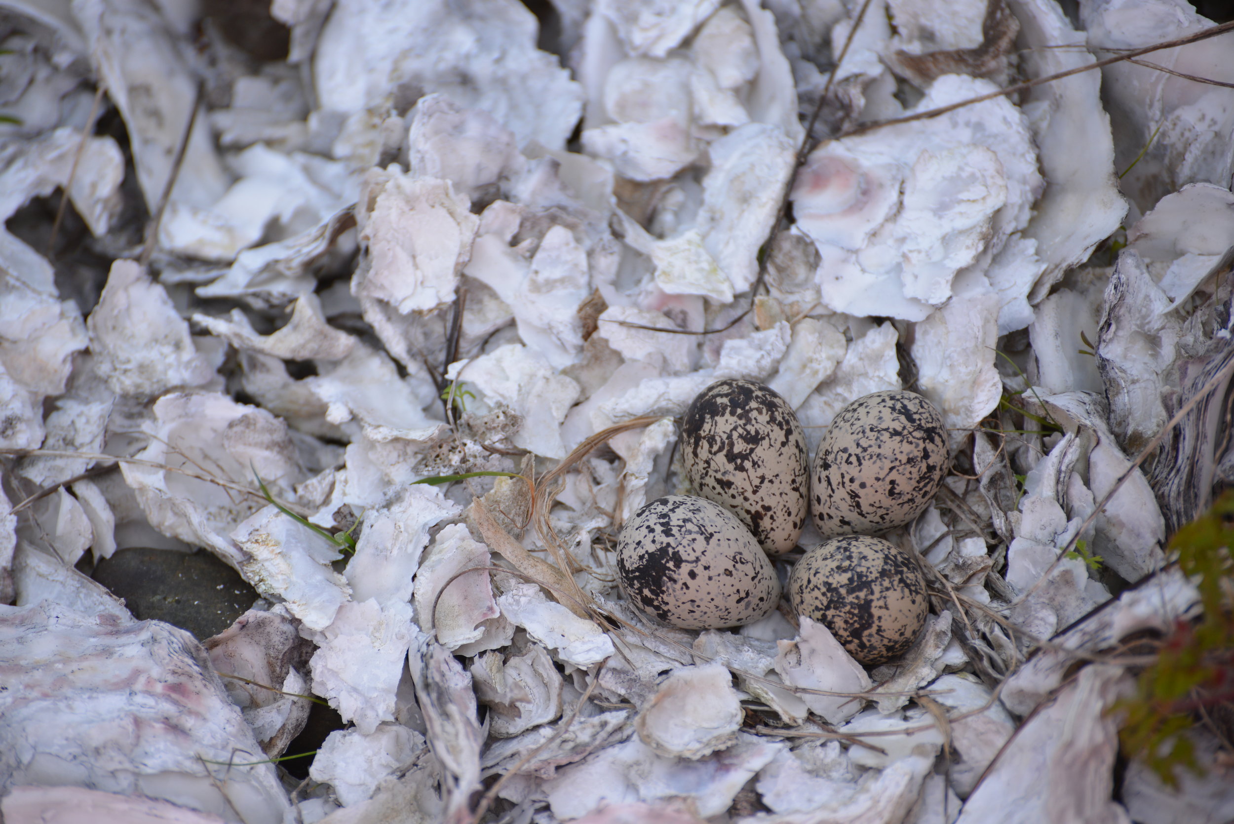

BIRDS OF A FEATHER FLOCK TOGETHER
Birding in the Pacific Northwest is more than checklists and binoculars. From wetlands and estuaries to forest trails along Hood Canal, this guide explores how modern birding blends technology, community, and quiet observation—highlighting local places in Mason County where birds and birders naturally gather.
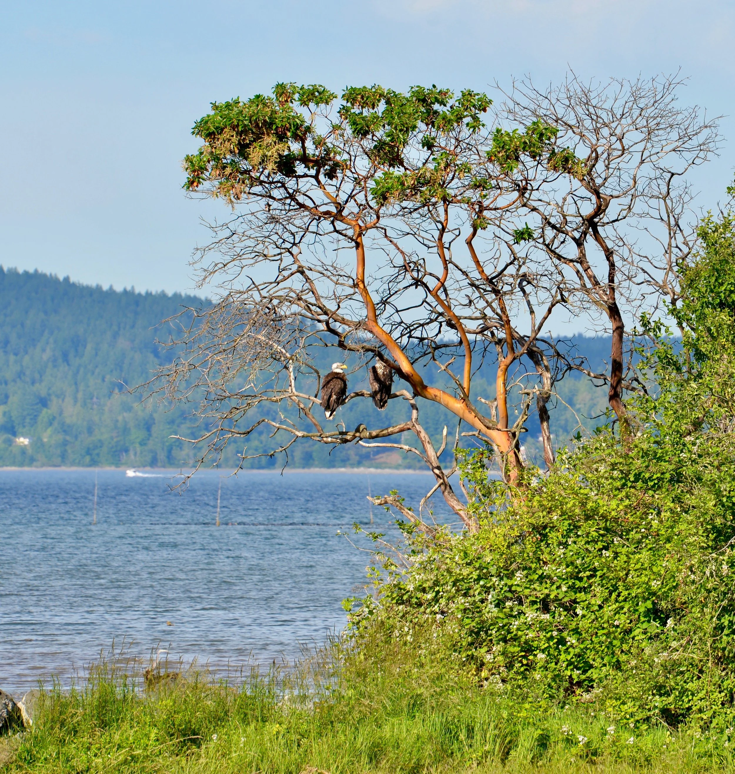
H/T Tracing The Fjord | Winter ‘25 | STELLA WENSTOB | olympicbirdtrail.com
Those folks obsessed with bird identification? Yes, birders—and they’re far cooler than the stereotype suggests.
Once caricatured as binocular-toting nerds with overstuffed packs and dubious dried banana chips, today’s birders are more likely carrying a smartphone than a color-coded guidebook. Nerdy, it turns out, is in. Modern birding trades paper for sleek apps like iBird and iNaturalist, making it easy to identify, log, and even crowdsource sightings—all while contributing to real scientific understanding.
In the Pacific Northwest, with its remarkable variety of birdlife, birding is about far more than snacks and checklists. It’s an inviting way to slow down, look up, and connect with the natural world.
Getting Started
The Audubon Society is a great place to start if you’re just dipping your webbed foot into the vast waters of birding. Their website offers a free birding app, engaging articles, and access to hundreds of local chapters—five in the Olympic-Kitsap Peninsula area alone—that host birding classes, walks, and events.
One of those events is the longest-running bird census in the world: the Christmas Bird Count. Now entering its 125th year, the count gathers data from volunteer birders across North and South America. It was developed as a replacement for the old holiday “side hunt,” a competitive tradition among hunters that focused on the most game taken over the season.
Learning From the Nest
If the weather is too nasty to head outside, stay in your nest and feather it with avian knowledge. The Audubon Society offers online courses, including interactive Zoom lectures with local experts. The Cornell Lab of Ornithology provides more in-depth, accredited bird identification courses, along with plenty of solid free basics.
The Washington Ornithological Society and American Birding Association also offer a digital, up-to-date version of A Birder’s Guide to Washington. While it doesn’t help with identification, it provides an exhaustive list of where to find species and helps plan productive birding adventures.
Birding Mason County
If you’re ready to venture out in wintery weather, Mason County is teeming with migratory and year-round resident birds. Hit the trails and start scanning the skies, vegetation, and waterways.
Pack binoculars, a scope, digital camera, or smartphone (with iBird and Audubon maps downloaded). Old-school works too—just a notepad and pencil. Wear good walking shoes and weather-appropriate clothing.
Almost every green space—backyard or state park—offers birding potential. To honor the spirit of road trips and the hallowed practice of list-making, here are a few favorite local birding haunts.
For the Birds
Hilburn Preserve
The Capitol Land Trust Hilburn Preserve, just off Highway 101 west of Shelton, features an easy half-mile loop beside the lively Goldsborough Creek. The wooded habitat is ideal for spotting woodland birds such as Red-breasted Sapsucker, Hutton’s Vireo, Pacific Wren, and Cedar Waxwing.
Bayshore Preserve
Leaving Hilburn, head east on Railroad Avenue toward downtown Shelton, then north on Olympic Highway South. Turn right onto Highway 3 (East Pine Street), which follows Oakland Bay to the Bayshore Preserve.
This Capitol Land Trust property is part of the Great Washington State Birding Trail. Oak savannas border the shoreline and Johns Creek outflow. Peregrine Falcons have been spotted perched in the oaks, while Great Blue Herons frequent the open areas. Scan the bay for waterfowl diving in warmer waters.
Mary Theler Wetlands Nature Preserve
Located just outside Belfair (22641 WA-3), this 139-acre preserve protects estuarine habitat along the Union River delta. Marshlands, meadows, forests, and tidal waters support impressive wildlife diversity.
Five trails highlight different habitats, some with views of the southern Olympic Mountains. The River Estuary Trail—built atop breached dikes—offers sightings of river otters, Belted Kingfishers, and Great Blue Herons. Pools host Northern Pintail, Green-winged Teal, Common Merganser, and a wide range of shorebirds. Bald Eagles are commonly seen.
Twanoh State Park & Skokomish River Delta
Backtrack along Highway 106 toward Hood Canal to reach Twanoh State Park. With over 182 acres of forest and shoreline, it offers both terrestrial and marine birding. The 2.5-mile inland trail is reliable for Red Crossbills and Brown Creepers.
Continuing through Union brings you to the Skokomish River delta, rich with waterfowl such as Mallard, Northern Pintail, Red-breasted Merganser, and large flocks of American Wigeon. Bald Eagles are frequent here.
Hood Canal Corridor
Heading north on Highway 101 keeps you alongside Hood Canal, with strong birding stops at Potlatch State Park, Lilliwaup Creek, Eagle Creek, and Jorsted Creek.
At Jorsted Creek, pilings from an old log dump serve as roosts for all three species of cormorants. Lacking water-repellent oils, these birds are often seen perched with wings spread to dry.
The Hamma Hamma River estuary is another productive area and home to a nearby Great Blue Heron rookery.
Dosewallips State Park
The final stop on this list, Dosewallips State Park spans more than 1,000 acres of river, estuary, shoreline, and mature forest. Known for Roosevelt Elk and curious seals offshore, it also supports a wide range of bird species.
The North Tidal Trail crosses marshes and offers excellent winter views of migrating Trumpeter Swans.
The parks and preserves of the Pacific Northwest offer outstanding birding opportunities. Birds of a feather flock together—and birders are never far behind.
For more information on fjord birding, visit olympicbirdtrail.com.

A Guide to 25 Waterfalls from Canal to Coast and points between
Receiving hundreds of inches of rain annually, the Hoh, Quinault and Queets Rainforests are located on the coastal foothills of the Olympics, receiving 21+’ of snow and rain at its peaks! It’s no wonder there is a myriad of spectacular waterfalls lacing the area. Explore this sampling curated by celebrated guidebook author and avid hiker, Craig Romano. Some are small, secret, and unique, others are popular but magnificent. All are worth the journey!
When Craig Romano agreed to share with us a few of his favorite waterfalls in the Pacific Coastal region of Washington, we were frankly thrilled. If you’re looking for straight details on Northwest hikes and wilderness destinations — and fun facts - Craig is the guy to call.
Craig has written more than 20 hiking guidebooks including Day Hiking Olympic Peninsula 2nd Edition which includes details for popular and little known hikes across the Peninsula. An avid hiker, runner, paddler, and cyclist, Craig is currently working on Urban Trails Vancouver USA (2020); Backpacking Washington 2nd Edition (2021); and Day Hiking Central Cascades 2nd Edition (2022). He is also a featured columnist for the Fjord and Explore Hood Canal.

Enchanted Valley | Craig Romano photo
Why we are so keen about our falls?
As storms from the Pacific Ocean move across the peninsula, they crash into the Olympics and are forced to release moisture in the impact. Consequentially, the clouds release massive amounts of moisture (up to 170 inches annually) in the coastal side of the range – creating the “rain shadow effect.”
The massive rainfall has given life blood to the hanging mosses of the perpetually wet Northwest rainforests – Hoh and Quinault. On top the Olympic Mountains this moisture lands as snow frosting the peaks with as much as 35 feet each year.
Each spring the snow melts and creates icy run-off. Mix in a little more rainfall and the result is a spectacular waterfalls ring envelops the base of Olympic range.
Pacific coastal waterfalls are gorgeous year round but tend to be most spectacular in early spring or during the autumn rainy season.
Let’s go Chasing Waterfalls
1. Tumwater Falls
Olympia Metro | Located minutes from Olympia, Tumwater Falls is an iconic landmark near the state capital. These thundering multi-tiered showy falls along the Deschutes River are located within a 15-acre park created on land donated by the Olympia Brewing Company. Meander along manicured paths and saunter over foot bridges and under historic road bridges taking in a little history along with the sensational scenery.
At the base of the upper falls admire a replica of the famous bridge that once appeared on the labels of Olympia beer spanning the river above the lower falls. Walk trails along the gorge between the falls and admire deep pools, eddies and jumbled boulders. Take time to read the informative panels on Tumwater—Washington’s oldest permanent non-Native settlement on Puget Sound. Let’s Go!
2. Kennedy Creek Falls
Kamilche, South of Shelton | From its origin at Summit Lake in the Black Hills, Kennedy Creek flows just shy of 10 miles to Oyster Bay tumbling over a two-tiered waterfall along the way. Reaching these pretty falls involves a half day hike on a closed-to-vehicles logging road through patches of cuts and mature standing timber. Start walking across a recent cut. In about a mile reach a grove of mature timber and the Kennedy Creek Salmon Trail which opens in the fall for salmon viewing and field trips. Keep walking on the main road avoiding diverting roads. The route leaves state land for private timberland and rolls along. Take in decent views of the surrounding foothills. At 2.8 miles (just before crossing a creek) follow an obvious but unmarked trail to the right. This path can be muddy and slick during periods of heavy rainfall. The trail descends to a grove of big cedars, firs and yews—and the falls. Here Kennedy Creek tumbles over an ancient basalt flow. The upper falls are small but quite pretty. The lower falls are difficult to see as they tumble into a narrow chasm of columnar basalt. Let’s Go!
3. Vincent Creek Falls
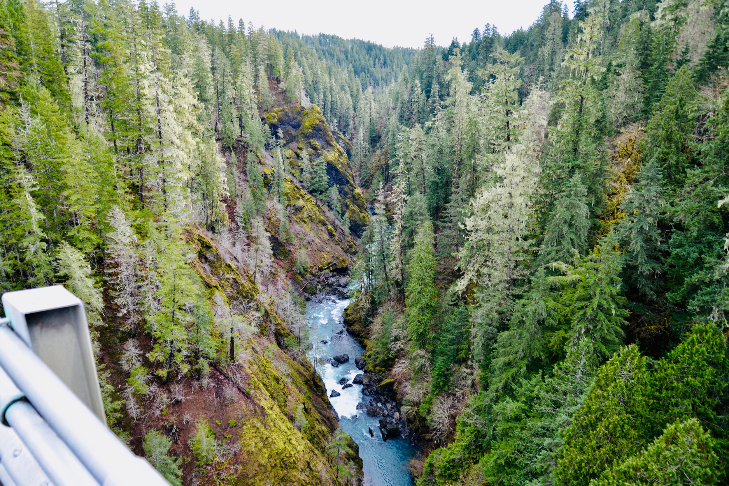
South Hood Canal, Skokomish Valley | While Vincent Creek Falls are quite stunning crashing 250 feet into the South Fork Skokomish River in a deep narrow canyon; the High Steel Bridge which allows for their viewing is even more spectacular. The 685-foot long bridge spans 375 feet above the canyon. Walk across the bridge but use caution along its north side where the guardrail is only 3 feet tall. The arched truss steel bridge was built in 1929 originally for a logging railroad. In 1950 it was converted for road use. It is the 14th highest bridge in the country. Your heart is sure to pound as you walk upon its airy span. Eventually Vincent Creek Falls comes into view. Through a series of falls, Vincent Creek drops 250 feet down a canyon wall into the roaring South Fork Skokomish River. Walk all the way across the bridge if you plan on capturing the falls in their entirety in a photo. Let’s Go!

Big Creek | Craig Romano Photo
4. Big Creek Cascades
Lake Cushman Area, Hood Canal | Amble on a circuitous route in the Big Creek drainage within the shadows of Mount Ellinor; and delight in a series of small tumbling cascades. This wonderful loop utilizes old logging roads, new trails and a series of beautifully built bridges. It was constructed by an all-volunteer crew that continues to improve and maintain this excellent family and dog-friendly loop. Starting from the Big Creek Campground, follow the Upper Big Creek Loop Trail to Big Creek and the first of several sturdy bridges along the way. After a short climb you’ll reach the Creek Confluence Trail which drops to the confluence of the tumbling Big and North Branch Creeks. The main loop continues to cross North Branch Creek on a good bridge. Just beyond it crosses Big Creek on a new bridge above a gorgeous cascade. The loop then descends skirting big boulders and passing good views of roaring Big Creek. It crosses a couple more cascading creeks before traversing attractive forest and returning to the campground. Let’s Go!
5. Staircase Rapids
Lake Cushman Area, Hood Canal — Currently Closed until mid-September
This loop involves a section of an historic route across the Olympic Mountains to a suspension bridge spanning the North Fork Skokomish River near a series of thundering rapids. Cross the North Fork Skokomish on a solid bridge and follow a trail that was once part of the original O’Neil Mule Trail. In 1890 Lieutenant Joseph O’Neil accompanied by a group of scientists led an Army expedition across the Olympic Peninsula. Among his party’s many findings was a realization that this wild area deserved to be protected as a national park. March up alongside the roiling river, passing big boulders and a series of roaring rapids. The rapids’ name come from a cedar staircase O’Neil built over a rocky bluff to get past them. Follow the bellowing river from one mesmerizing spot to another before reaching a sturdy suspension bridge spanning the wild waterway. Cross the river and complete this delightful loop by now heading downriver following the North Fork Skokomish River Trail back to the Ranger Station. Let’s Go!
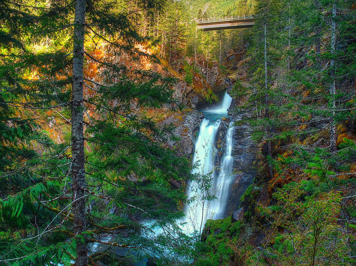
Hamma Hamma | George Stenberg photo
6. Hamma Hamma Falls
Hamma Hamma River Valley, Hood Canal | Talk about a bridge over troubled waters. From the Mildred Lakes Trailhead walk across the high concrete bridge at the road’s end. You no doubt heard the roar of the falls when you drove across it. Now peer over the bridge and witness the cataracts responsible for the racket.
Directly below, the Hamma Hamma River careens through a tight rocky chasm. These impressive falls are two-tiered crashing more than 80 vertical feet. The road spans directly above the upper and smaller of the falls. The overhead view is pretty decent, but the lower and larger falls are more difficult to fully see. A very rudimentary path leads along cliff edges for better viewing, but it’s slick, exposed and treacherous.It’s best to experience the falls from the safety of the bridge. During periods of high water flow you’ll get the added bonus of feeling the falls too thanks to a rising mist. On the drive back look for a couple of pull-offs providing views of secondary falls along the Hamma Hamma, Let’s Go!
7. Murhut Falls
Duckabush River Valley, Hood Canal | Hidden in a lush narrow ravine and once accessed by a treacherous path, Murhut Falls were long unknown to many in the outside world. But now a well-built trail allows hikers of all ages and abilities to admire this beautiful 130-foot two-tiered waterfall. The trail starts by following an old well-graded logging road. It was past logging in this area that led to the discovery of these falls. The old road ends after a short climb of about 250 feet to a low ridge. The trail then continues on a good single track slightly descending into a damp, dark, cedar-lined ravine. As you work your way toward the falls, its roar will signal you’re getting closer. Reach the trail’s end and behold the impressive falls crashing before you. The upper falls drops more than 100 feet while the lower one crashes about 30 feet. Blossoming Pacific rhododendrons lining the trail in May and June make the hike even more delightful. Let’s Go!
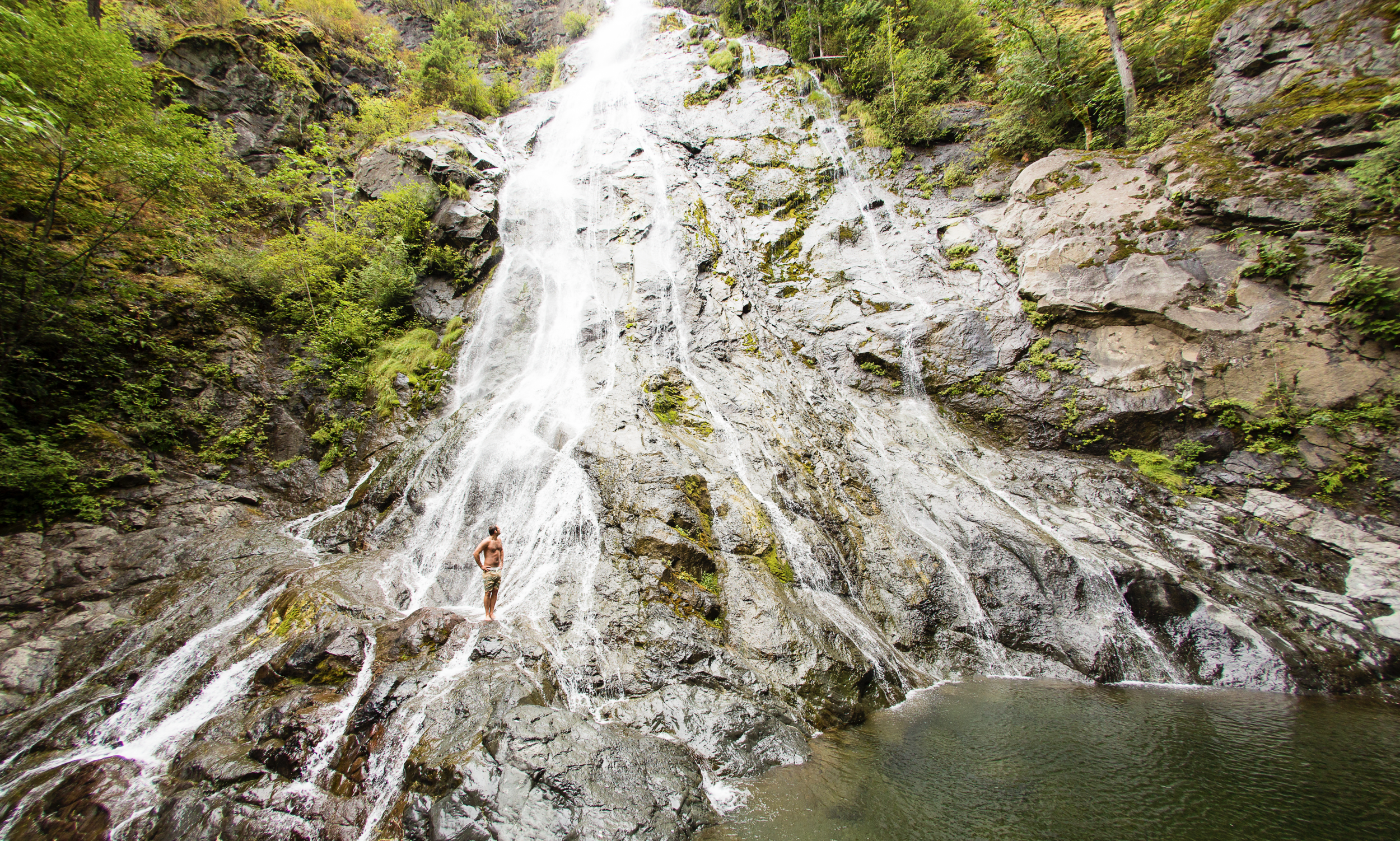
Rocky Brook Falls
8. Rocky Brook Falls
Dosewallips River Valley, Hood Canal | One of the tallest waterfalls on the Peninsula, Rocky Brook Falls is also among the prettiest. Follow the trail past a small hydroelectric generating building and come to the base of the stunning towering falls fanning over ledges into a large splash pool surrounded by boulders. This classic horsetail waterfall crashes more than 200 feet from a small hanging valley above. While a penstock diverts water from the brook for electricity production, the flow over the falls is almost always pretty strong. Like all waterfalls, these too are especially impressive during periods of heavy rainfall. On warm summer days the falls become a popular destination for folks seeking some heat relief. And while many waterways east of the Mississippi River are called brooks, creek is the preferred name in the west. There are only a few waterways on the Peninsula called brooks, and they were more than likely named by someone who hailed from back east. Let’s Go!
9. Dosewallips Falls
Dosewallips River Valley, Hood Canal | This spectacular waterfall used to be easily reached by vehicle. But the upper Dosewallips Road has been closed to vehicles since 2002 after winter storms created a huge washout that has yet to be repaired. Now to reach this waterfall you must hike or mountain bike the closed road. Walk past the road barrier and immediately come to the washout and a bypass trail. Steeply climb on the riverbank above the slide. Then descend back to the road and walk along the churning river. The road then pulls away from the river, passes a campground and climbs. The river now far below in a canyon is out of sight, but not out of sound. Pass beneath ledges and cross cascading Bull Elk Creek on a bridge. At 3.9 miles in a recent burn zone enter Olympic National Park. Cross tumbling Constance Creek on a bridge and continue climbing passing a big overhanging boulder. Then descend and skirt beneath a big ledge coming to the base of dramatic 100-foot plus Dosewallips Falls. Admire the raging cascade’s hydrological force—it’s mesmerizing. Let’s Go!
10. Fallsview Falls
Big Quilcene River Valley | As far as cascades go, Fallsview Falls lacks the “Wow factor.” However the canyon these falls tumble into is pretty impressive. And if you plan your visit for late spring, blossoming rhododendrons line the trail and frame the view with brilliant pinks and purples. The trail to the falls is short, easy and ADA accessible. Follow the 0.2 mile loop to a fenced promontory above a tight canyon embracing the Big Quilcene River. Gaze straight down to the roiling river. Then cast your glance directly across the canyon to an unnamed creek cascading 100 feet into it. By late summer it just trickles—but during the rainy season the falls put on a little show. If you want to stretch your legs some more afterward, you can follow a trail into the little canyon and hike along the frothing river. Let’s Go!

And 15 more…
For a day trip, weekend, or a month-long adventure – the Olympic Peninsula is a fantastic place to get away and enjoy nature – and waterfalls! It’s not just 1000’s of waterfalls, there are countless lakes, rivers, streams and trails to suit every ability level. Embraced by the Pacific Ocean on the west, the Strait of Juan de Fuca on the north, and the Hood Canal on the east, it is famed for being home to Olympic National Park, more than 600 miles of hiking trails and 73 miles of pristine ocean wilderness beaches.
The Olympic Peninsula hosts activities for families and outdoor enthusiasts alike, attracting visitors from near and far. Start planning your next adventure!
Click here for a complete list of all 25 waterfalls on the Olympic Peninsula curated by Craig!

Spider Lake: Perfect year round hiking destination
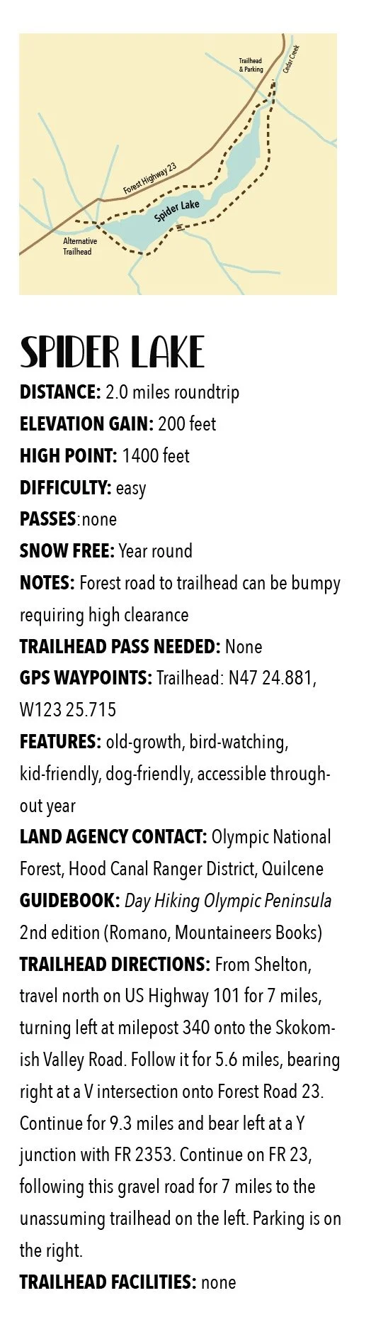
With a name that may instill a chill if you’re prone to arachnophobia, fear not a visit to Spider Lake. Children will love hiking along its shores looking for birds, fish, amphibians and other critters. They’ll also appreciate the well-built bridges spanning the lake’s inlet and outlet streams. And the trail with its gentle course around the lake is ideal for hikers of all ages and abilities.
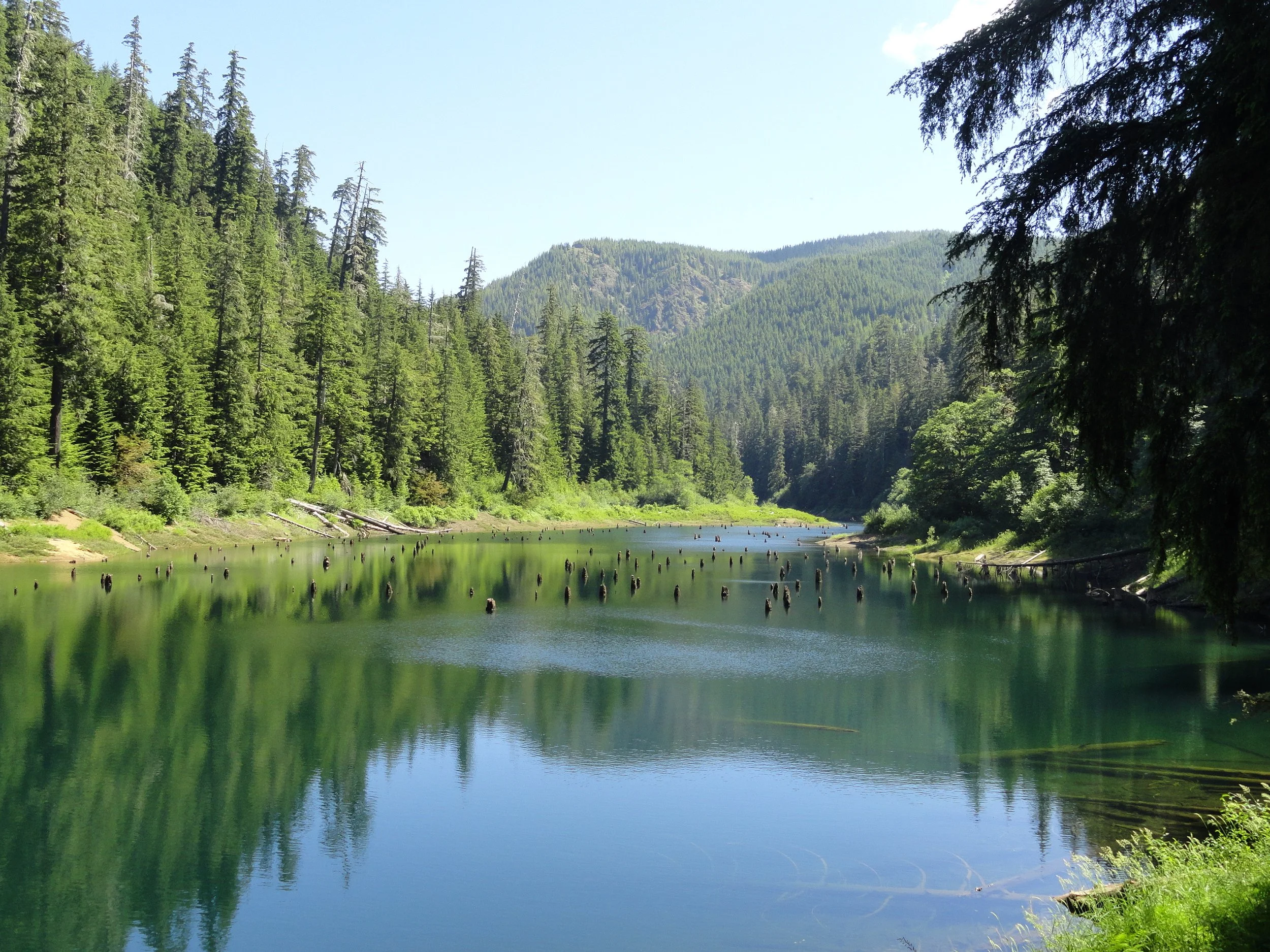
With a name that may instill a chill if you’re prone to arachnophobia, fear not a visit to Spider Lake. The small lake on the South Fork Skokomish River—Satsop River divide is actually an inviting place. Surrounded by towering ancient conifers and fed by cascading creeks, Spider Lake is quite tranquil. Children will love hiking along its shores looking for birds, fish, amphibians and other critters. They’ll also appreciate the well-built bridges spanning the lake’s inlet and outlet streams. And the trail with its gentle course around the lake is ideal for hikers of all ages and abilities.
Hit the Trail
Hikers of a certain age may start humming the Jim Stafford classic Spiders and Snakes upon beginning their jaunt to this lake. And if you’re in agreement to the chorus of “I don’t like spiders and snakes…” take solace. There are only three species of snakes that call the Olympic Peninsula home, and none of them are venomous. However there are more than 900 species of spiders that reside on the peninsula! Yet, the majority of them you’ll never encounter. And the common ones, crab spiders, jumping spiders, and orbweavers are nothing to be afraid of. You’re more likely to run into their webs (especially if you’re the first one on the trail that day) than into them. Voracious eaters of insects, spiders help keep the population of those hiking nuisances down.
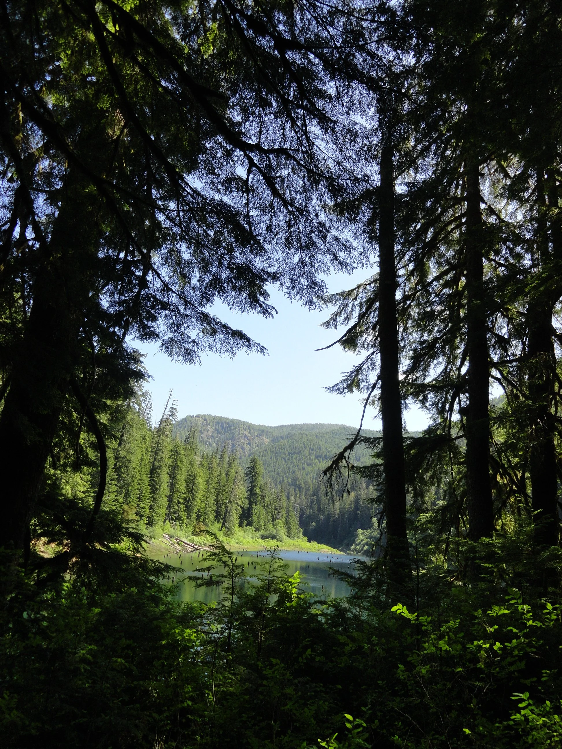
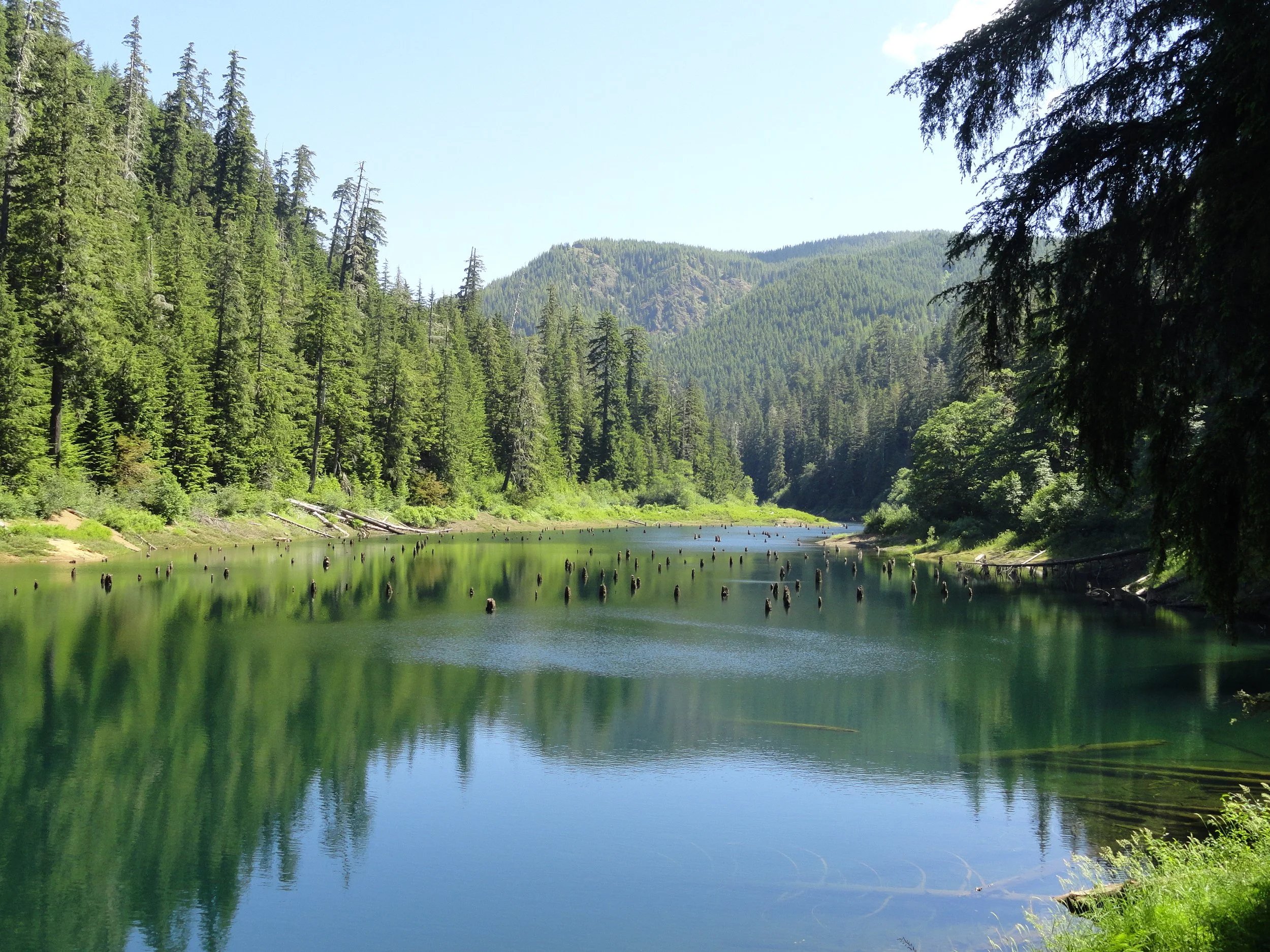
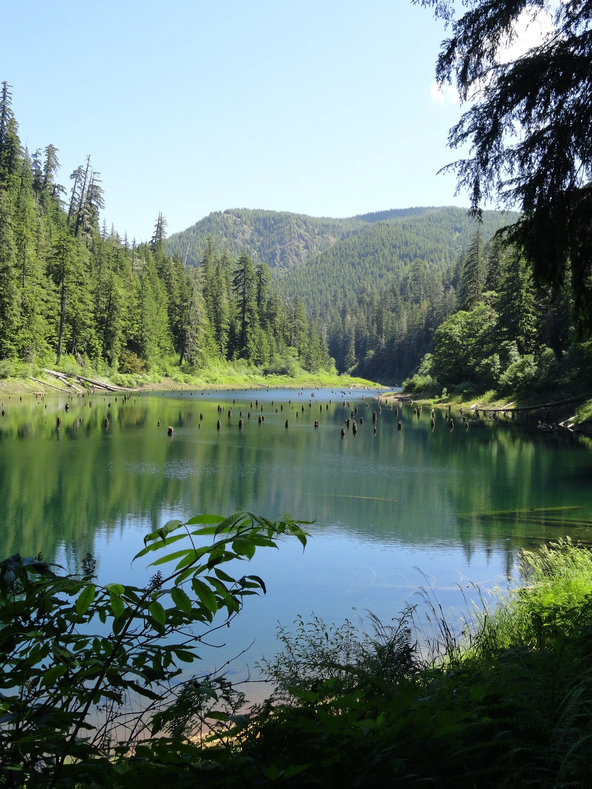



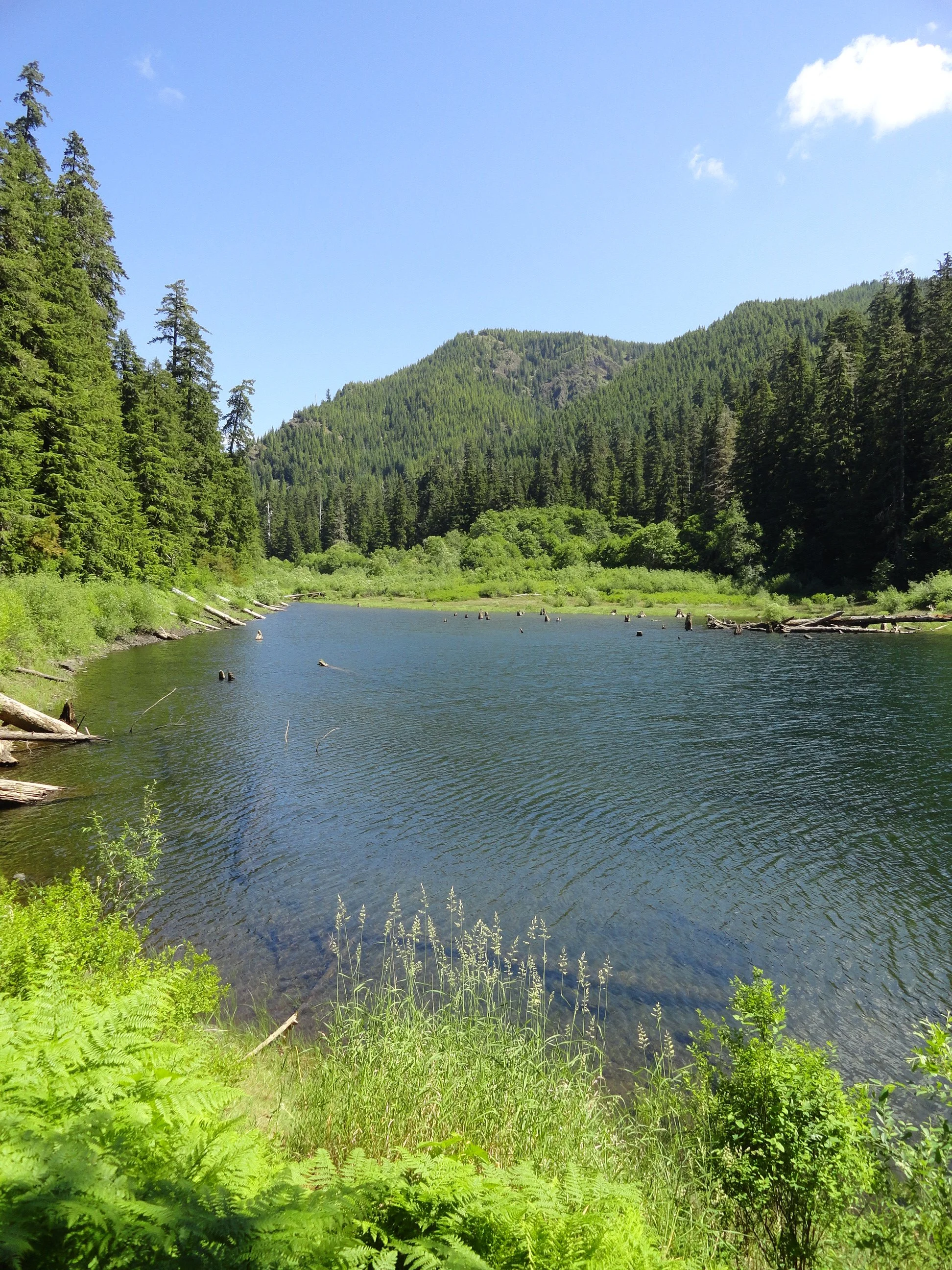

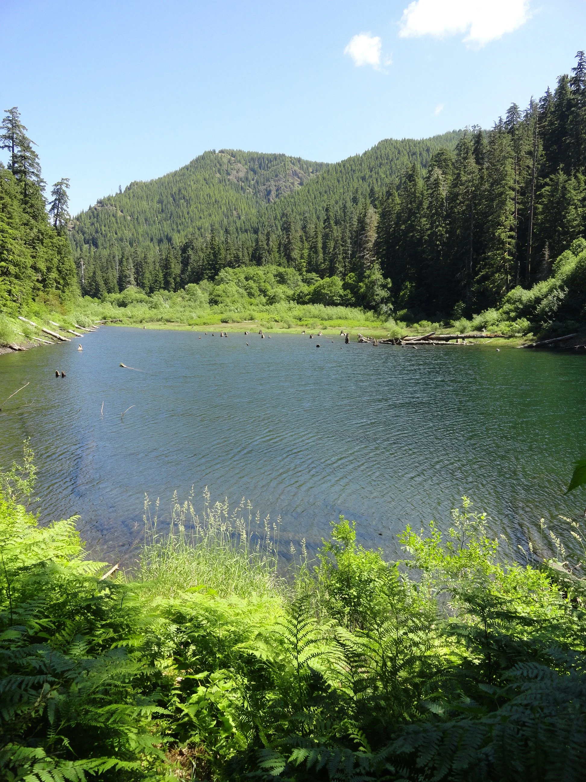
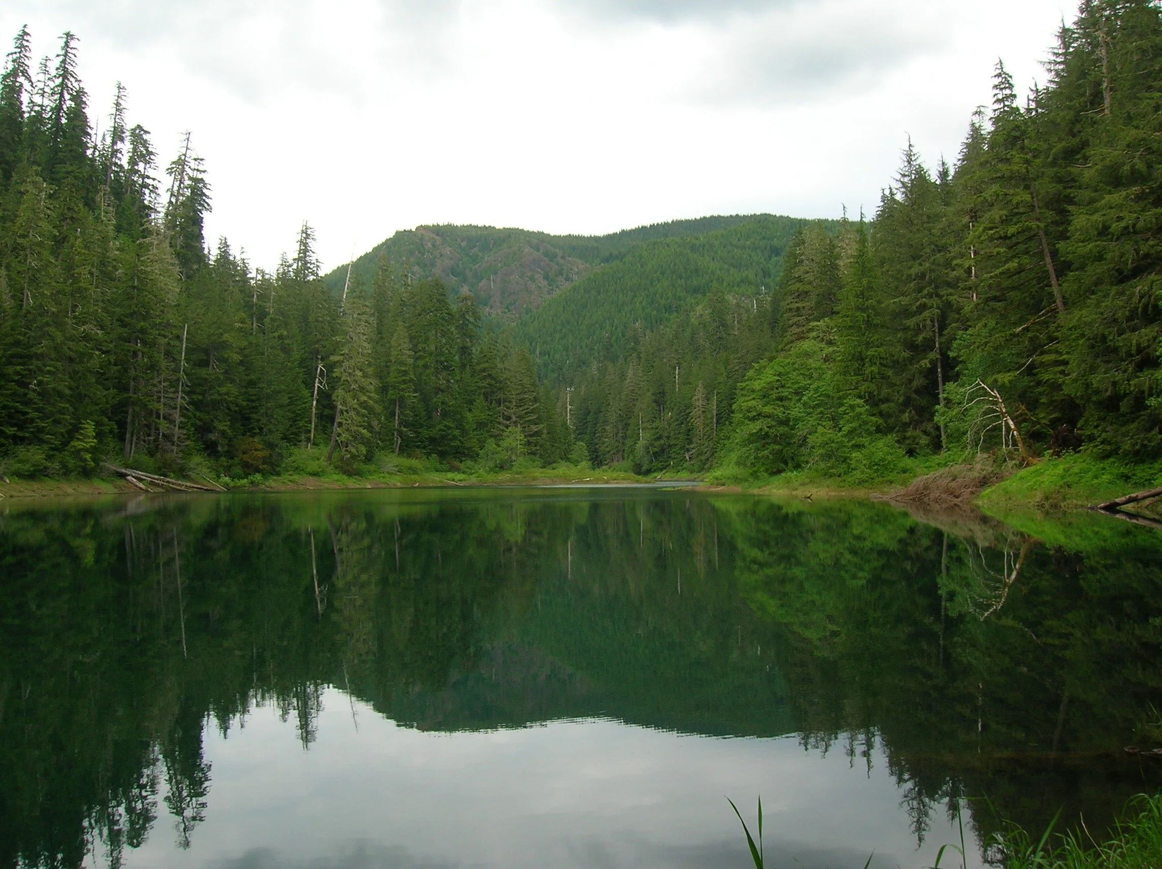
So is there an abundance of spiders at Spider Lake? No—no more than pretty much anywhere else in the Olympics. So what’s with the name? No one’s quite sure, as any record to how this lake got its name can’t be easily found. Spider Meadow in the Cascades Mountains is named after a mine, so that’s a possibility. Spyder Lake in Quebec and Spider Lake in Minnesota are named for their shapes resembling the arachnid. Is this lake shaped like a spider? No, it’s shaped more like a flatworm. Perhaps an early explorer simply named the lake after the arachnid because he had a spider encounter there—who knows?
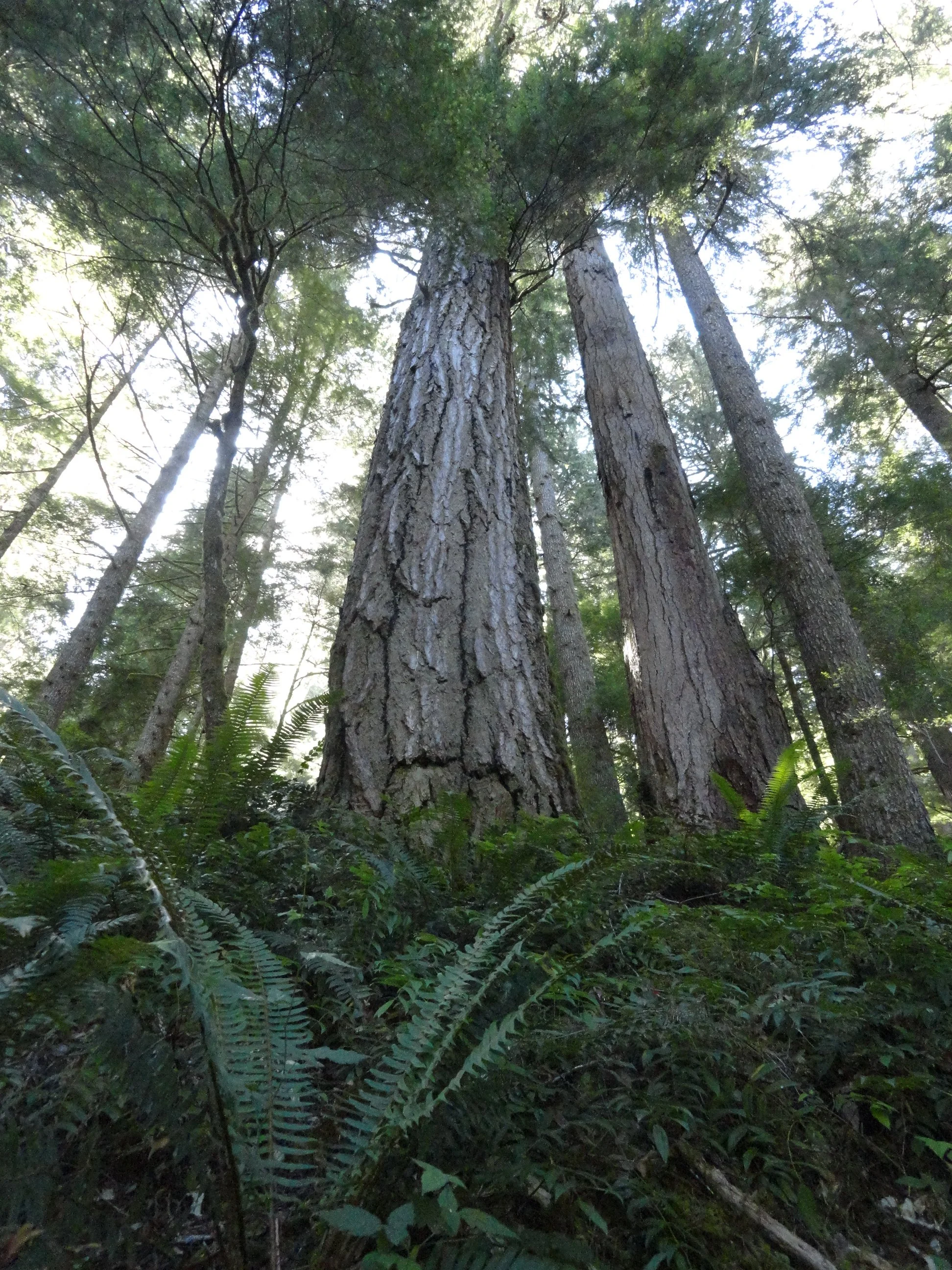
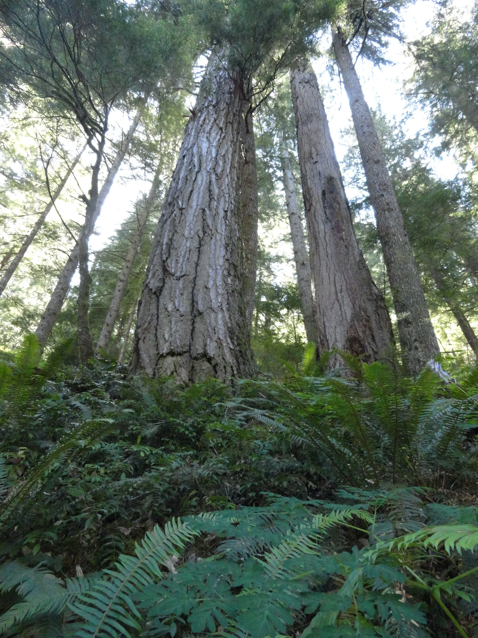
In any case Spider Lake isn’t grand in any sense, this hike’s main draw is its trees. The lake is surrounded by gorgeous ancient forest—a tiny fragment of the grand forest that once shrouded the hills and ridges along this entire divide. The trail too is a fragment—once a much longer route connecting the South Fork Skokomish River Valley to the Satsop River Valley. Decades of intensive logging in this corner of Olympic National Forest not only obliterated the area’s primeval forest but also much of its extensive trail system.
With the cut now a fraction of what it once was and with trail usage at record numbers, it would be a great time to bring folks together to start rebuilding trails in the southern Olympic flank.
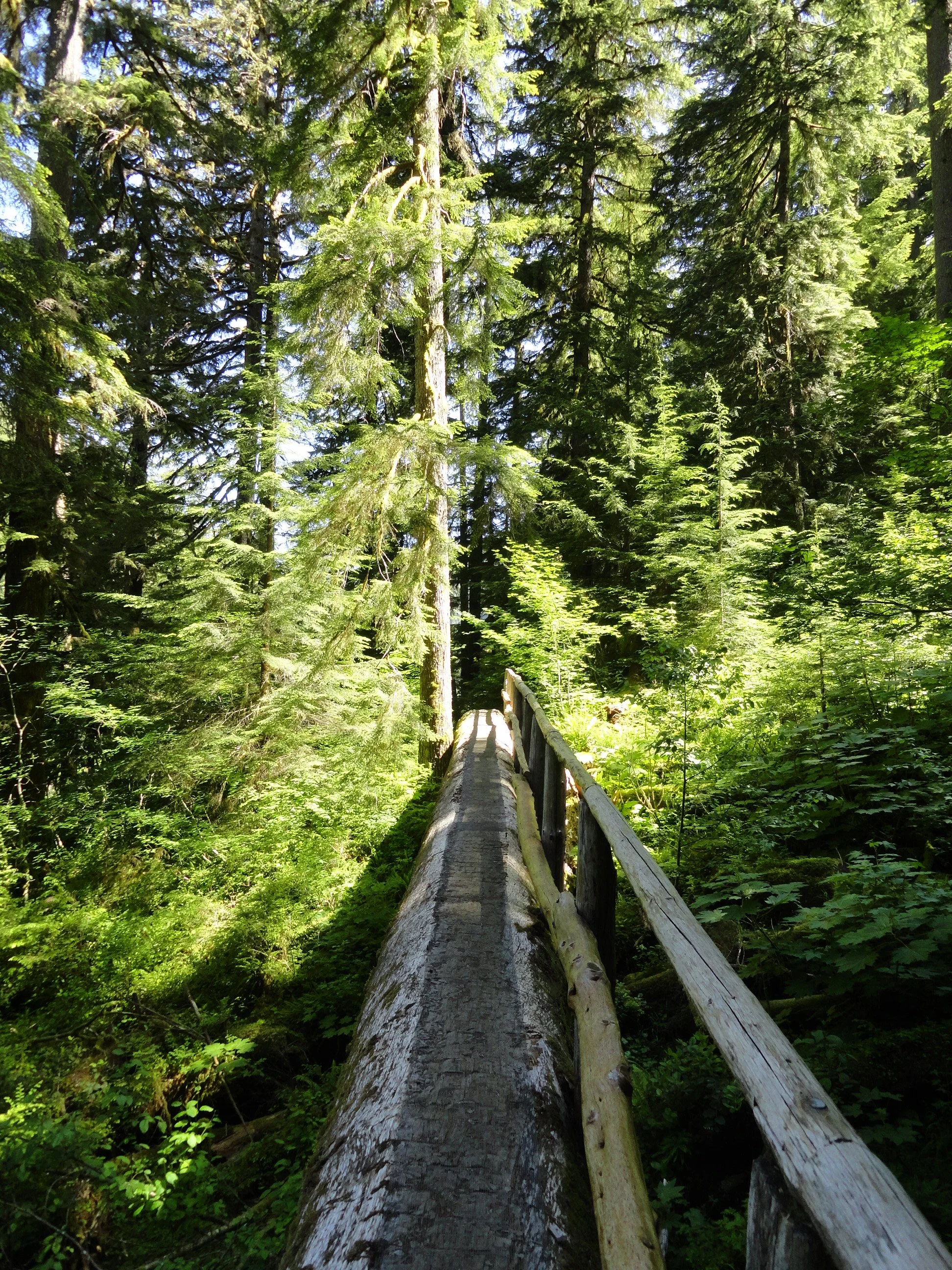
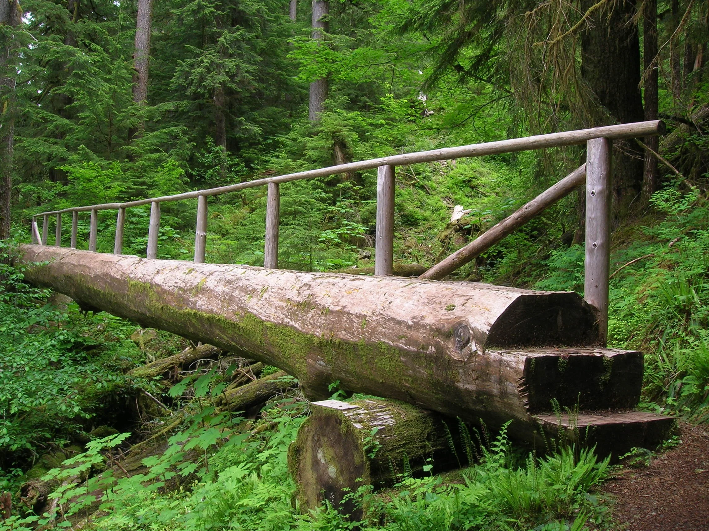
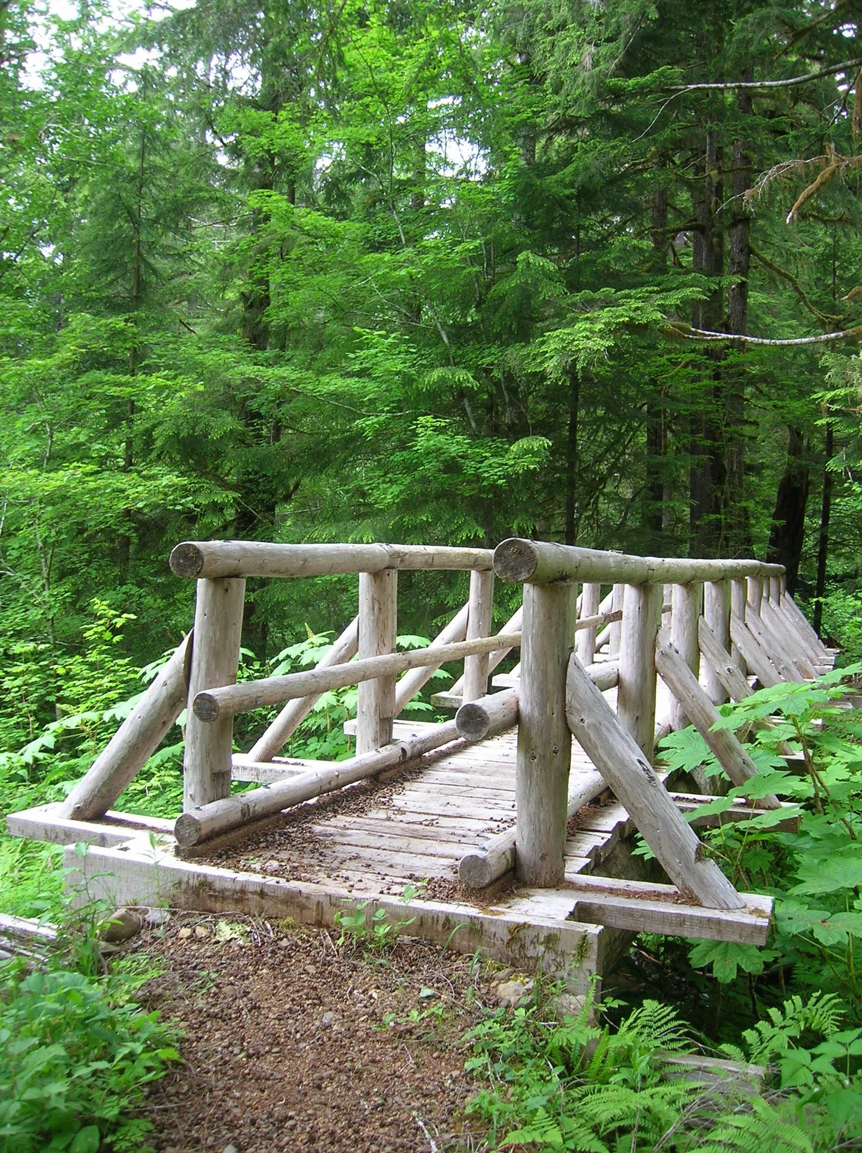
In the mid-1990s, trail builders resurrected a portion of the old trail that once traveled up the Cedar Creek valley and constructed adjoining new tread to build a two-mile loop around little Spider Lake. Trail-building aficionados will probably find the loop’s three large bridges noteworthy for their durability and aesthetics. Kids will love crossing them—probably doing a few repeats on the spans.
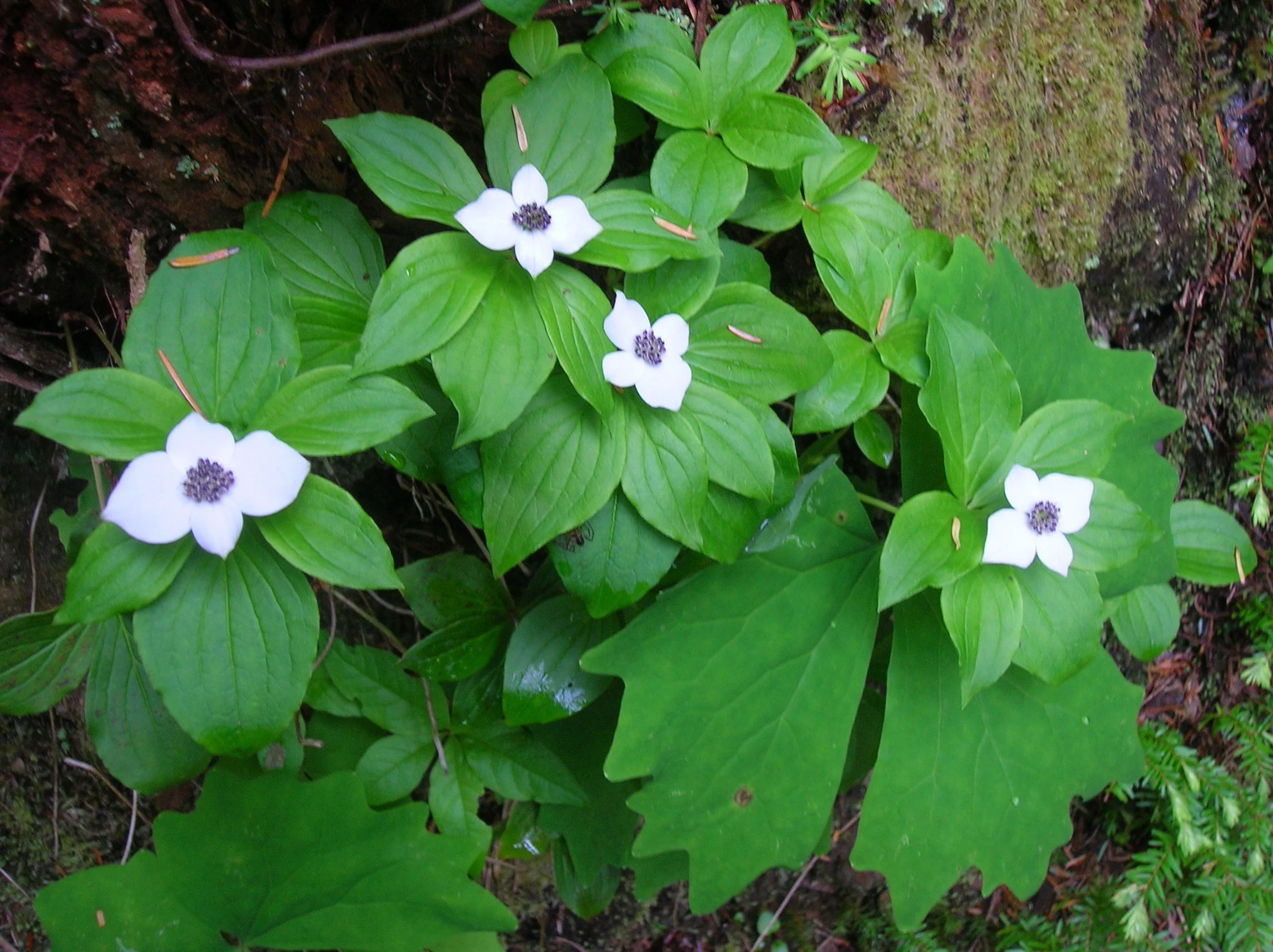
This trail is a joy to hike anytime of the year, but it glows pearly white in early summer when blossoming dwarf dogwood and queen’s cup blanket the forest floor. A few shrubs and sedges will add some golden touches in autumn. From the trail’s unassuming trailhead (there’s another unassuming trailhead to the south) immediately enter cool old-growth forest and come to a junction. Turn right (although either direction will work), crossing the outlet stream and soon reaching Spider’s western shoreline. Now saunter past towering trees, good fishing spots, and excellent viewpoints of the placid lake. Look for avian and amphibious residents. Cast your glances upward at the surrounding ridges. These intensively logged hillsides offer quite a contrast to the virgin groves cradling the lake.
After about a mile, cross a small creek and reach a junction. The trail heading right steeply climbs a short distance to an alternative trailhead. Continue left climbing a little above the green waters of the lake while being shaded by ancient behemoths. Now continue along the eastern shoreline climbing a bit more to traverse a steep slope.
After crossing a high log bridge, the trail begins its descent back to lake level. It then crosses an inlet stream in a marshy area before returning to the junction where you started your trip around the lake.
The hike is short, but the surroundings beckon you to slow down and enjoy the natural beauty of this small lake and its big trees. Perhaps you’ll be fortunate to see some wildlife along the way—and more than likely you probably won’t recall if you encountered a spider or two!
contributor
Craig Romano is an award-winning guidebook author whose deep connection to Washington trails, dedication to accuracy, and passion for conservation have made him a trusted name in the outdoor community. His contributions to Tracing the Fjord magazine bring rich, informed outdoor narratives to a readership that lives and loves the Hood Canal region. Craig's guidebooks stand out for their thorough research. He physically scouts trails, GPS-tracks routes, and includes lesser-known—and at-risk—options to offer diverse, accurate, and reliable resources for hikers. He incorporates sidebars with natural or cultural history and conservation insights in his writing. He emphasizes responsible use and stewardship of trails, challenging readers to be “good conservation and trail stewards.” Craig has written more than 25 guidebooks, including celebrated “Day Hiking” and “Urban Trails” series published by Mountaineers Books—featuring areas like the Olympic Peninsula, Vancouver BC, and beyond.

Mount Rose: Summer hike with a climb
This hike is one of the steepest in the Olympics but with a blanket of wildflowers and stunning views, it is well worth the climb! With a nod to William Shakespeare, that which we call Mount Rose by any other name would still be as steep!
Story and pictures: Craig Romano
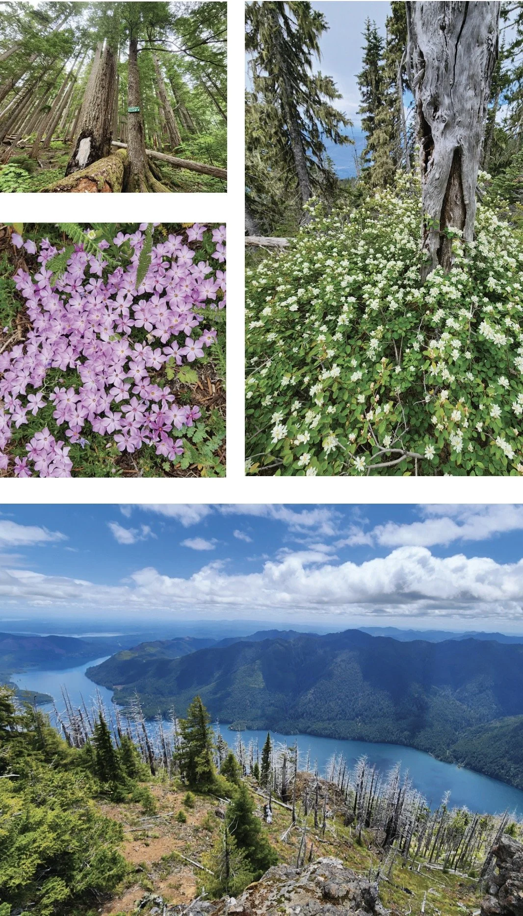
This hike isn’t terribly long. And its trailhead is fairly easy to reach via mainly good paved roads. The trail traverses impressive towering old-growth forest. And in summer wildflowers brighten the forest floor and decorate summer ledges. Views? They’re stunning, especially of Lake Cushman sparkling 3,500-feet directly below. But every rose has its thorn. And for Mount Rose, all of this natural beauty and splendor comes at a steep price—literally. This hike is one of the steepest in the Olympics.
Hit the Trail
Yes, the trail up Mount Rose is grueling. But it makes this hike all that much sweeter by weeding out the crowds. Rose makes for an excellent quieter alternative to nearby Mount Ellinor. And being more than 1,000 feet lower than that popular peak means a longer snow free hiking season on Rose. And while handfuls of hikers may swear off this mountain—plenty swear by it and swear on it while going up it. They embrace its steepness as a great conditioner for harder hikes planned later in the season. In any case, do not under estimate this hike. Trekking poles will significantly help—especially on the insanely steep descent. And take plenty of water.
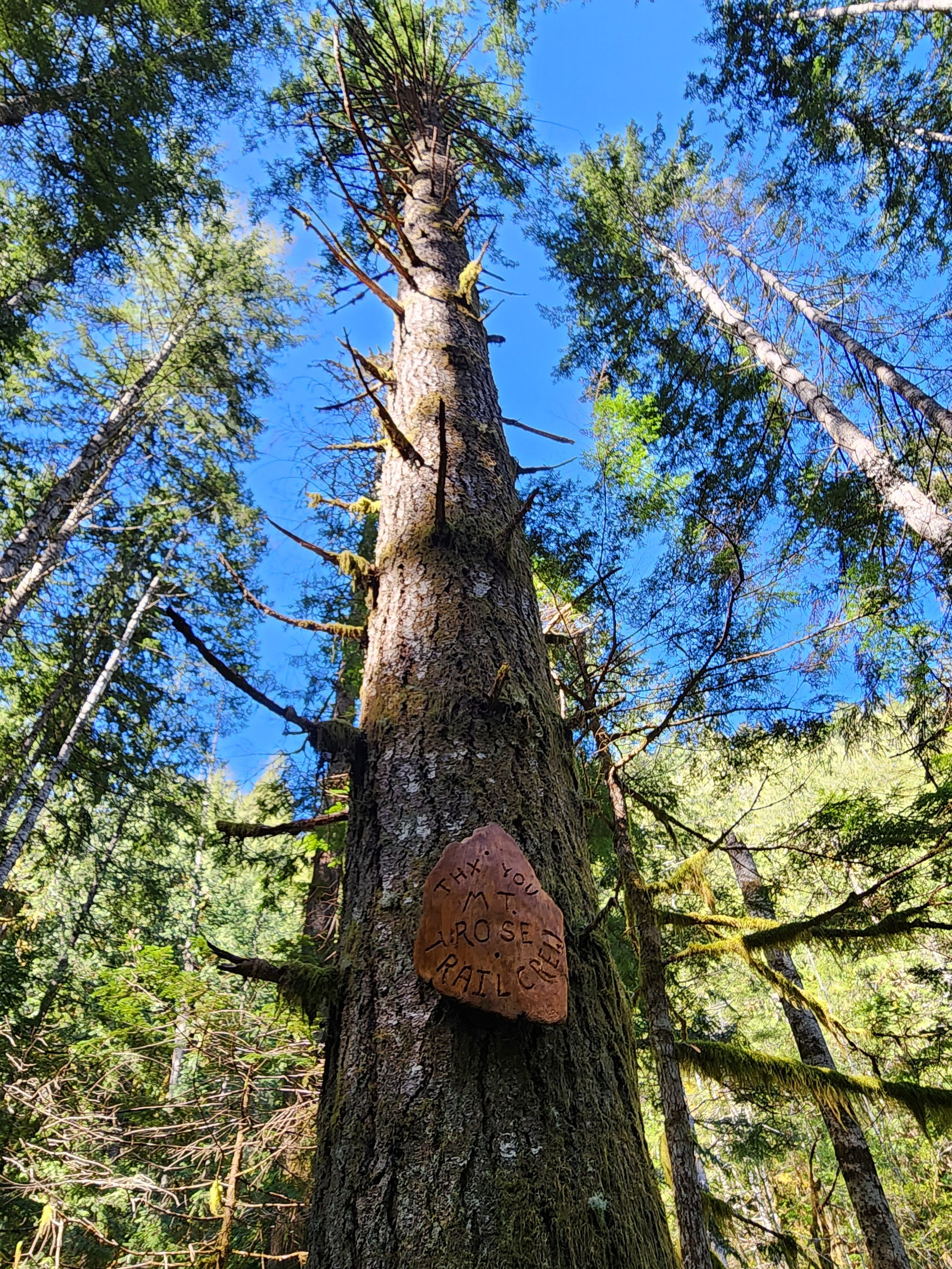
The trail starts out deceptively easy on a fairly level traverse along the base of the mountain. After crossing a pair of cascading creeks and passing a square-shaped builder shrouded in ferns the way gets down to business. A seemingly endless procession of switchbacks will keep you occupied. And if you think the going is steep—it used to be steeper! The all-volunteer Mount Rose Trail Crew reconfigured and rebuilt much of this trail several years ago, making it much more negotiable. The Mount Rose Trail Crew has left their positive marks on many of the trails in the Lake Cushman area.
Much of the lower mountain is covered in uniform second growth forest thanks to fires early in the last century. But a handful of surviving towering old-growth giants break the monotony of the younger forest. The trail enters the 13,000 Mount Skokomish Wilderness, one of five wilderness areas in Olympic National Forest flanking Olympic National Park. At just shy of 2.0 miles (although it may feel a lot longer) the trail reaches the summit loop junction. Here a small plaque honors the crew that built this trail.
Which direction you take the loop is dependent on your preference. The way left is much steeper which for many is easier to ascend than descend. But if you head right instead you will reach the scenic payoff later—prolonging the anticipation. Most folks head left first to tackle 1300 feet of ascent within a mile. The way relentlessly climbs passing through dark moist forest before transitioning to a forest recovering from a 2006 wildfire. At 2.9 miles from the trailhead reach the 4301-foot open-forested summit. Your attention will be immediately drawn to sparkling Lake Cushman below. It’s a breathtaking view of the large lake cradled by steep emerald slopes. But do scan the lake’s surroundings too admiring Lightning Peak and Timber Mountain rising majestically above it. Take in views too of Wonder Mountain and Church Peak to the southwest; and the Skokomish delta, Black Hills, Willapa Hills, and Mount Rainier to the south. And catch glimpses through silver snags and white pines of the deep valley of the North Fork Skokomish River.


After admiring the stunning views, continue on the loop along a narrow forested ledge. Along the way you’ll be greeted with more fine views including close ups of Copper Mountain towering above you and Hood Canal in the distance. The way then enters impressive old-growth forest and passes a fascinating colonnade of four silver firs. They’ve grown so close together they appear fused. The summit loop will deliver you back to a familiar junction from where a brutal descent will deliver you back to the trailhead.
Mount Rose’s views are indeed sweet. But the mountain’s summit floral show can be equally stunning. The mountain however is not named for roses, of which four native species grow in the Olympics. The mountain takes its name from Alfred A. Rose, who in 1885 arrived in the valley below with his wife and three children from California. Rose was one of the first non-native settlers in the valley, claiming 150 acres along Lake Cushman. But his tenure here was short. He succumbed to small pox four years later. In 1926 the lake was dammed greatly increasing its size and inundating Rose’s original homestead as well as other early settlements. I’m not sure if Rose ever grunted to the summit that bears his name. But with a nod to William Shakespeare, that which we call Mount Rose by any other name would still be as steep!


Rowboats and Recitals: The Story of Mason County’s Early Schools
In this feature, Explore Hood Canal visits the Mason County Historical Society Museum in downtown Shelton to explore “More Than a Building,” a powerful exhibit on the early schools of Mason County. Featuring insights from curator Liz Arbaugh, this video reveals how schools were the heart of tiny communities—from tribal lands to logging camps.
What if I told you the quiet forests and mossy clearings of Mason County once echoed with the sound of children learning—and even rowing boats just to get to class? In this feature, Explore Hood Canal visits the Mason County Historical Society Museum in downtown Shelton to explore “More Than a Building,” a powerful exhibit on the early schools of Mason County. Featuring insights from curator Liz Arbaugh, this video reveals how schools were the heart of tiny communities—from tribal lands to logging camps.
📍 Visit the museum: 427 W Railroad Ave, Shelton, WA 98584
👨💻 Online: www.masoncountyhistoricalsociety.org
🗂️ View the exhibit and the Dayton archives
🎄 Learn about schoolhouse dances, Christmas parties, and how education shaped this region
💬 Leave a comment if you remember your Mason County school days!
#MasonCountyHistory #SheltonWA #HistoricalSchools #PacificNorthwestHistory #ExploreHoodCanal

Copper Creek trail
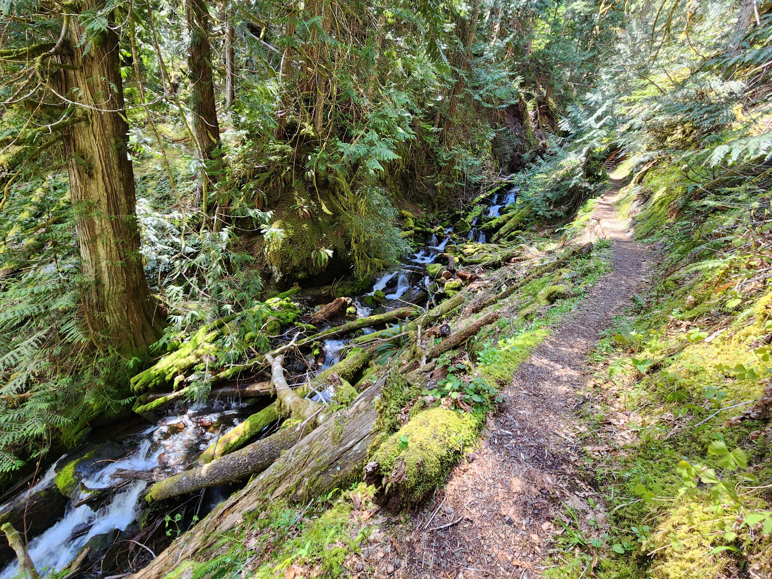
Tenacious hikers toil up steep slopes past the mines to a high shoulder on Lightning Peak. Views are limited, but the trailside cascading creek and surrounding towering primeval forest is striking. And if its solitude you seek, ye shall be rewarded.
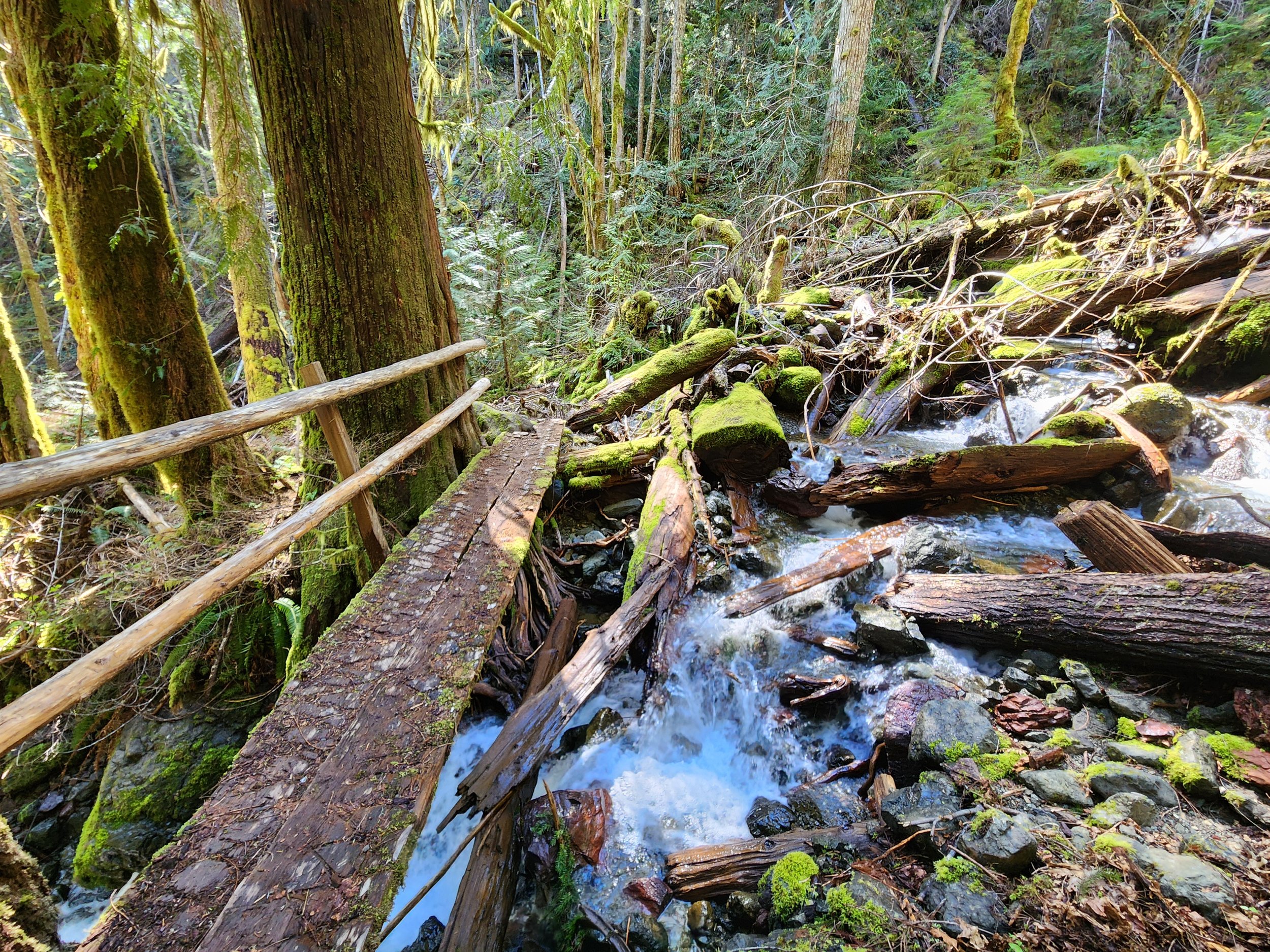
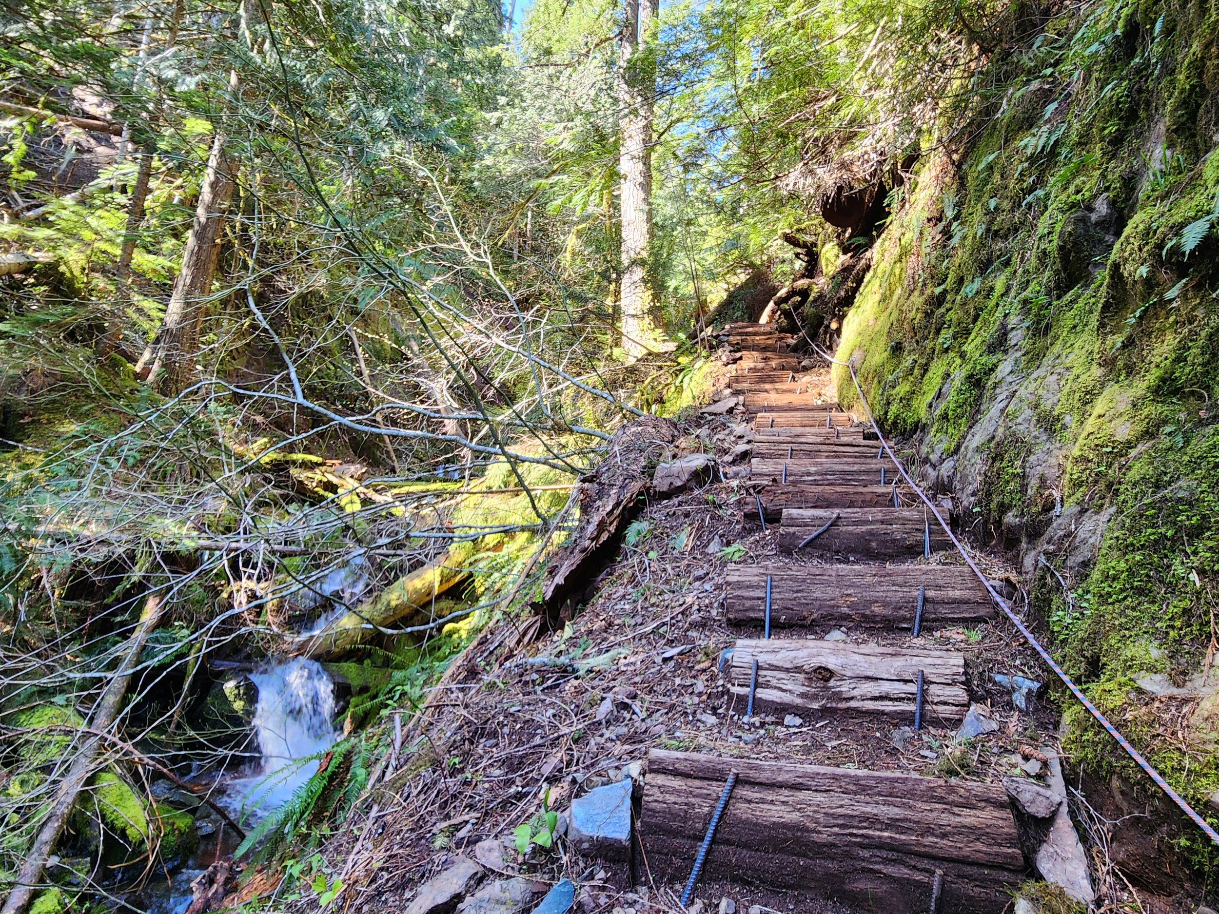
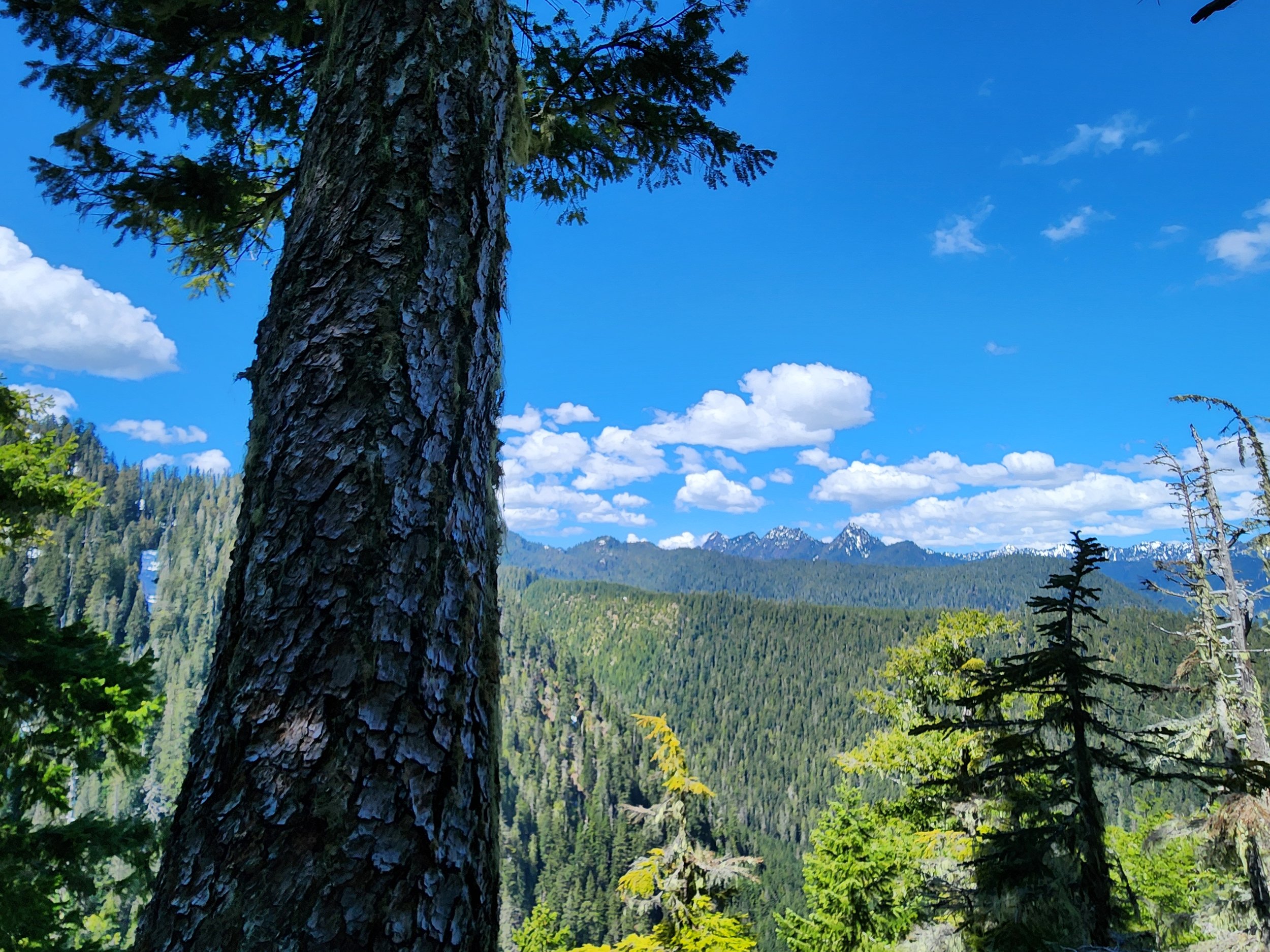
Text and images Craig Romano
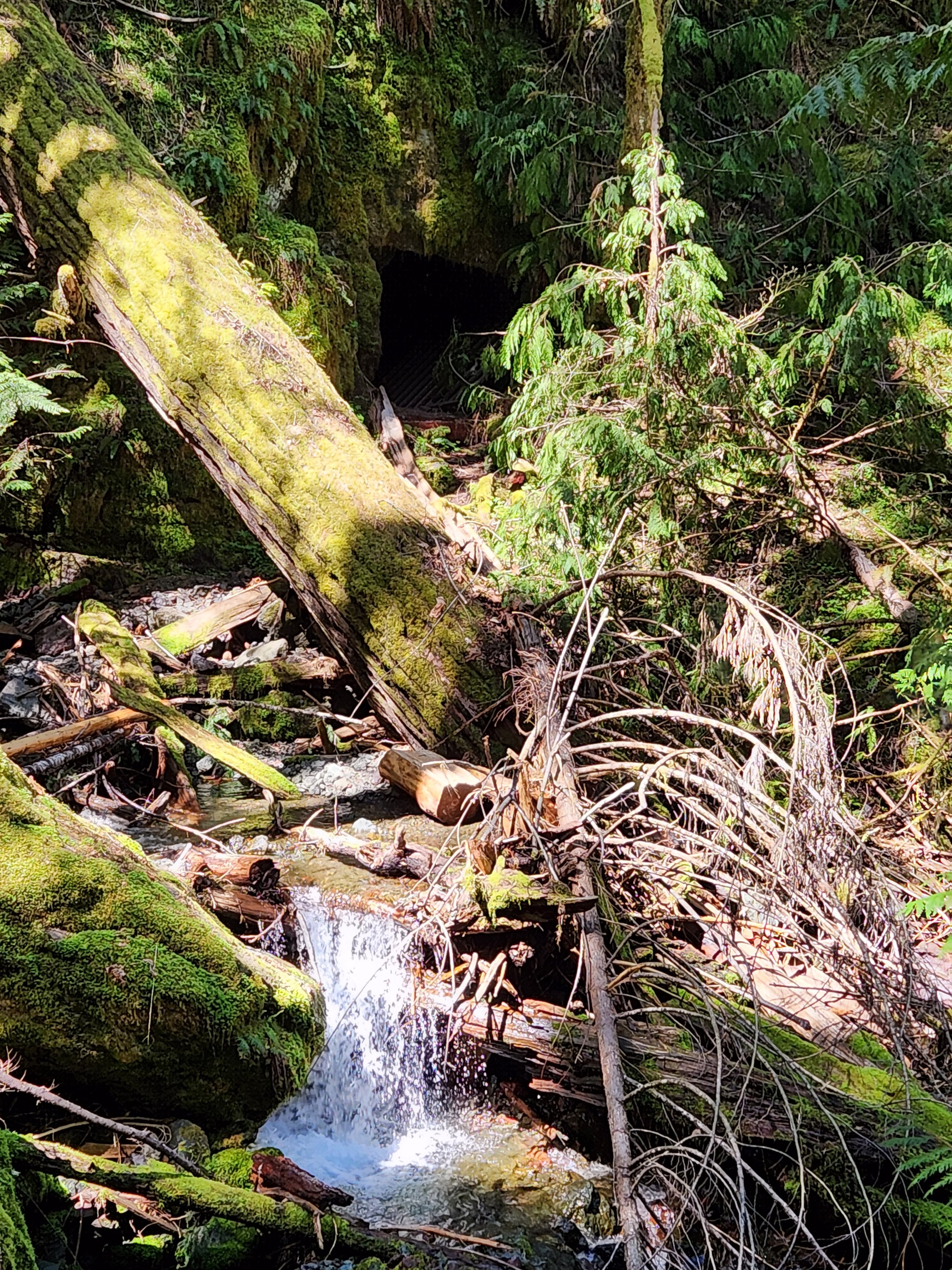
Copper Creek tumbles through a rugged area harboring several old mines. But it was mostly manganese, not copper that lured hardscrabble miners up this rough and tumble trail along Copper Creek to work several mines. After World War II the mines ceased operation and the trail to them was abandoned. But after the turn of the last century the volunteer Mount Rose Trail Crew reopened—reinforced—and extended this trail. Now tenacious hikers can toil up steep slopes past the mines to a high shoulder on Lightning Peak. Views are limited, but the trailside cascading creek and surrounding towering primeval forest is striking. And if its solitude you seek, ye shall be rewarded.










Hit the Trail
The Copper Creek Trail begins a short distance from where the North Fork Skokomish River flows into Lake Cushman. The lake which was once much smaller was dammed in 1924 to provide power to a booming Tacoma. Today the lake continues to provide hydro-electric energy and is well-known for its outdoor recreation offerings. But from 1880 until the 1940s this region was an active mining district with over 400 claims.

The Copper Creek Trail was originally built in 1915 by prospectors. After decades of abandonment, volunteers from the Mount Rose Trail Crew reopened it. They restored parts of the original tread as well as constructed new tread and pushed the trail beyond the old mines to a shoulder high on Lightening Peak. Like the original trail, this trail is steep—brutally steep in spots. And while it’s been greatly improved, it still contains some rough patches. It’s guaranteed to get your heart rate up and give your quads and hamstrings a good workout. The trail’s steepness, relative obscurity, and lack of sweeping views guarantees an uncrowded experience.Start climbing, entering a narrow and dark ravine.
Witness large stumps, testaments of the primeval giants that grew here before loggers sent them off to the mills. The area’s steep and rugged terrain made logging difficult higher up the surrounding slopes. Impressive old-growth cedars and firs will greet you as you ascend higher. Cross the crashing waterway on a good bridge. Just downstream from the bridge scan the west side of the ravine wall to spot a shaft from the Brown Mule Mine. Another shaft is located farther downstream. Use caution if you wish to explore them. The mine began operation in 1915 and produced mainly manganese and silica. The mines were busy during World War I and then slowly ceased production.
The trail now gets steeper and traverses a stretch prone to slides. Take a break at one of the trailside benches and admire a cascading tributary plummeting steep ravine walls from high above. Then continue working your way up an increasingly narrow ravine. Copper Creek crashes below your feet. The trail then gets insanely steep climbing above the creek via a series of tight switchbacks and steps.
The way eases in grade as it enters a grand forest of giant ancient cedars and Douglas-firs. At 1.4 miles, reach an easy to miss junction. Here a short trail leads left to the site of the Apex Mine. Manganese was the main metal mined here. A small amount of jacobsite was also extracted from this mine. The Apex Mine is the only known site in the country where this rare metal was mined. By and large though it was manganese, attracting most of the attention.
The entire Lake Cushman Mining District contains large concentrations of this metal which is important in steel production. During World War II operations were ramped up and pressure was put on Olympic National Park to allow access to many of the claims within the park. Attempts were made by business interests to allow for unrestricted mining within the national park. Several existing claims were allowed to continue years after the park was established. But park administrators held strong on the park’s original enabling act which didn’t allow for expanded and extended mining.
After checking out the old Apex site return to the main trail and continue steeply climbing, soon reaching another junction. Here the trail forms a loop. Head in either direction through primeval forest to attain a 3280-foot narrow shoulder of Lightning Peak. Views are limited on forested ridge, but you’ll be able get glimpses of the rugged Lightning Peak towering above and of shimmering Lake Cushman and the Elk Creek basin below. You’ll also be able to catch a decent view west to the Five Ridge Peaks and Wonder Mountain—some of the loneliest summits in the Olympics.
After closing the loop brace yourself for one knee-jarring descent. Trekking poles will definitely come in handy!
Feature author
Craig Romano
An award-winning author, photographer, ardent conservationist, Craig is also a NW trails and hiking expert. He hikes, runs, paddles, and bikes and has written about these passions for more than two dozen publications, including; Seattle Met, Backpacker, Paddler, Northwest Runner, AMC Outdoors, and Northwest Travel and Life. Craig writes weekly content for Hikeoftheweek.com and is the author of more than 25 books. Craig has been a regular columnist in Tracing the Fjord since 2019.

Wagonwheel Lake Hike features alpine views and solitude
One of the steepest trails in the Olympic Range, perhaps it's called "wagonwheel" because, as author, Craig Romano, puts it, "you’ll bust your axle" hiking this unforgiving climb if you are unprepared. Are you up for the challenge?
By Craig Romano
Craig Romano, is an author of more than twenty hiking guidebooks along with Day Hiking Olympic Peninsula 2nd Edition (Mountaineers Books), including 136 hikes on the Olympic Peninsula. craigromano.com
Utilizing tight switchbacks and no switchbacks at all, the Wagonwheel trail makes a grueling ascent up steep forested slopes. It’s a workout. There are some good, albeit limited views along the way. But you’ll probably feel short changed for the effort. In that case, summon your second wind and continue hiking heading up even steeper terrain to emerge at an unassuming peak granting sweeping views of craggy peaks, deep valleys, and some of the wildest and rugged terrain in the state.
"Old-growth forest, solitude, and alpine views await after a grueling ascent."
Hit the Trail

Sharing its start with the Staircase Rapids Loop and North Fork Skokomish River, don’t fret if the parking lot is packed. Almost all of those vehicles belong to hikers heading to those two other trails. Why not Wagonwheel Lake? Perhaps the sign at the trailhead does its job discouraging folks. It states that you’ll climb 3,200 feet in 2.9 miles followed by “Very Steep!” But even that assessment doesn’t correctly portray the magnitude of steepness of this trail.
The trail is gentle for a short stretch at the beginning and ending but still leaving nearly 2,800 feet of elevation gain within two miles. Yep—that’s very steep indeed!
Regardless of the fair warning, many hikers intent on reaching the lake ignore it or underestimate their fitness level and attempt this trail. And all too many of them poop out resigning themselves to accept that despite the trail’s short length—elevation gain can be a leveler! But for those of you who accept this hike as a challenge, take note.
The lake isn’t exactly one of the most stunning places in the Olympics. You may question if it was worth all of that sweat and toil. If your goal was a good workout in a natural environment—or perhaps a chance to commune deep in the woods all alone—then, yes it was worth it.
If it’s breathtaking views you are after, they are there, but you’re going to have to work a little bit more!
Beyond the forested basin cradling little Wagonwheel Lake you can follow a path another .4 mile and 700' of climbing to an open 4,755' knoll straddling the Mount Skokomish Wilderness-Olympic National Park Boundary.
From this spot framed with silver snags and clusters of firs you can enjoy excellent views of nearby Mount Lincoln, Mount Stone, Mount Skokomish, Mount Ellinor, Mount Washington; and the vast emerald ridges dividing the South and North Skokomish River valleys.

There are good views too across the North Fork Skokomish River Valley to Wonder Mountain, Five Ridge Peak, Six Ridge and other little known and little explored peaks. A region that pretty much looks as it did when Lieutenant Joseph P O’Neil explored this part of the Olympic interior more than 120 years ago.
Along the Way
Despite its grueling statistics, Wagonwheel Lake gets its fair share of visitors and attempted visitors. The trail starts in a lush understory of shoulder high ferns and salal.
The grade at first is deceptive, the going pretty easy. Keep a lookout to your right for an old mine shaft. Then prepare to do some serious climbing. The trail commences in a series of short tight switchbacks relentlessly ascending steep slopes.

Wind through mostly uniform seond-growth fir forest, a testament to a past disturbance—most likely a fire.
Among the monotonous make up of trees look for a few western white pines as well as Pacific rhododendrons. In late spring and early summer this flowering shrub, Washington’s state flower adds brilliant pinks and purples to the verdant surroundings. The monotony of the brutal climb however, is rarely broken.
At about 1.7 miles the trail comes to a small ledge. Here take a break and enjoy a window view of the valley below. Then commence climbing. The forest transitions from fir to hemlock. The trail and to your chagrin, steepens. Now foregoing switchbacks, the way takes an even more direct approach to subduing elevation. If you’ve hiked in the Adirondacks or White Mountains back east, the steepness of this trail compares to those areas where switchbacks are only spoken about as something that exists out west to make hiking easier.

After what feels like forever, the trail miraculously levels out. Now catch your breath, wipe your brow, swig some water and enjoy easier walking through old-growth fir and hemlock. The trail next traverses a steep slope breaking out onto a brushy avalanche chute. Work your way across slumping tread enjoying views to the northwest of Mount Lincoln and the serrated Sawtooth Range.
The trail then re-enters cool evergreen forest and crosses Wagonwheel Lake’s outlet creek. Just a hop, skip, and jump away lies the little lake in forested bowl. A small bench above the lake makes for a good place to collapse. But if you have any oomph left, locate a primitive path taking off from the main trail at the lake. It goes for a half mile straight up the 4,755-foot knoll to the north. The officially unnamed peak straddles the Olympic National Park and Mount Skokomish Wilderness in Olympic National Forest. From this peak’s meadows punctuated with silver snags enjoy a breathtaking panorama that includes the following prominent peaks: Pershing, Washington, Ellinor, Copper, Lincoln, Skokomish, Wonder, and the Brothers. Little Wagonwheel Lake sparkles below. Rest up and prepare your knees for the brutal descent.
For more trails and information check out Explore Hood Canal’s list of area hikes or visit the Explore Hood Canal Hiking Map.

Union City: Hood Canal town steeped in history
Hosting a rich tradition spanning generations of first people and settlers, Union hosts fantastic views of the Olympics and Canal while embracing the arts and community. It is little wonder it was voted one of the 20 Prettiest Towns in USA by Forbes Traveller.
Stella Wenstob, featured columnist
Descriptions of Union, WA usually run along the lines of "inspired by nature." The first time I encountered that aphorism I took it as artistic whimsy, but by the third website I read about Union, I became curious. Is only one person writing all of this advertising content? Maybe. Or perhaps there is something more here. Perhaps there is something inspirational about Union’s situation near the bend of the Hood Canal with uninterrupted views of Mount Washington, Mount Constance and the iconic Brothers.
Maybe there is a muse in this coastal, Mediterranean microclimate colored by the luscious, green foliage of salal bushes and the imposing Western Red Cedar and the bright red trunks of the Madrona trees. Possibly more is fed than the stomach on Hood Canal seafood. At Union maybe the soul is fed too. When I started to examine the history of the extraordinary people that lived in this area, I began to see this inspired lifestyle stretching back countless generations.

Union, circa 1910; Mason County Historical Society
The members of the Skokomish Tribe are descendants of the Twana people whose traditional territory covered an extensive area along the Hood Canal, inland to the peaks of the Olympic Mountains. The Skokomish River on the Eastern side of the Olympic Peninsula with its productive salmon run and valuable grasses for weaving baskets was especially important to the Skokomish. When their lands were limited to a small section of the Skokomish River by the Treaty of Point No Point in 1855 one elder from the area, S’Hau-at-Seha-uk, voiced his fear of losing his home and way of life, “I do not want to leave the mouth of the River. I do not want to leave my home; and my burying ground; I am afraid I shall die if I do.” Despite losing traditional lands and the damaging effects of colonialism – the Skokomish are a thriving people.
Skokomish Community Centre
Skokomish arts and culture are informed and shaped by nature. Bear grass basket making, though threatened by development of the traditional picking sites on the Skokomish river, is an intricate example of natural resources, ingenuity and art coming together along with cedar carvings, dugout canoes, drum songs and traditional dance. To see a beautiful display of the technique and intricacy of the Skokomish basket makers or the ornate carvings drop in on the newly built Skokomish Community Centre (located just off of Highway 101).
Opened in 2017 and located just outside of Union on the Skokomish Reserve, this intriguing hybrid building is a handsome example of Indigenous informed design – combining traditional plank, big-house style architecture with modern needs and conveniences—such as a gym, a meeting hall and a commercial kitchen. With over 400 solar panels on its roof the Skokomish Community Centre also offers a marvelous example of environment informing design.
The Ultimate Road Trip

If you continue traveling Highway 101 past the Skokomish Salmon Hatchery and take the turn on to Highway 106 you will find yourself on a winding highway following the Skokomish River as it meets up with Hood Canal.
After about twelve minutes of mossy delta and interesting views of cottages clinging to the thin strip of land between the road and the gently eroding riverbank reminiscent of a scene from Ken Kesey’s Sometimes a Great Notion you will head around the headland that opens up until the area we now recognize as Union.
Known as duxWhLu’qWat3d to the Twana people, then called Skokomish by early settlers, in 1889 it was renamed Union City by lumberman, developer and legislator John McReavy to celebrate Washington’s declaration of statehood.
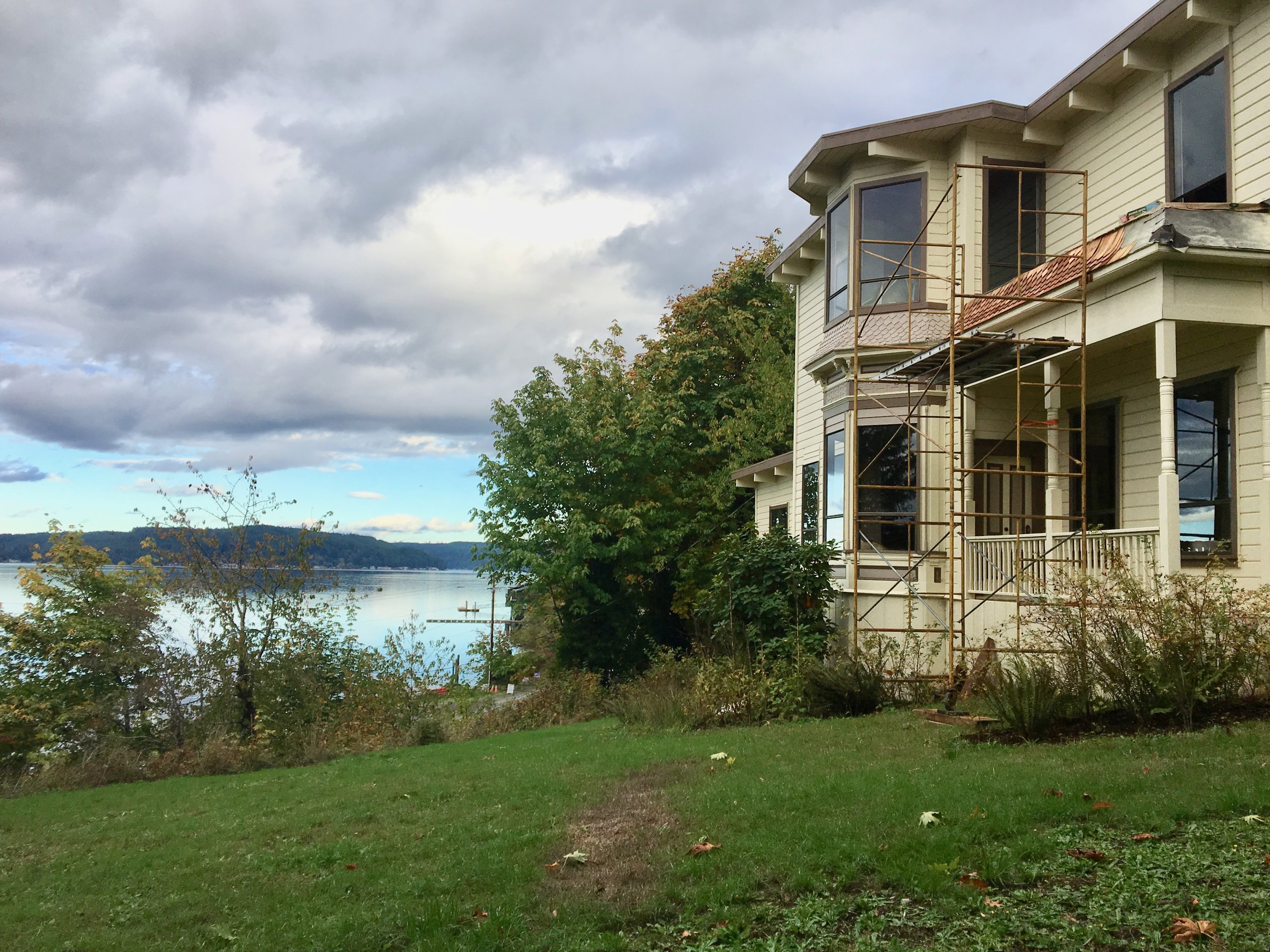
McCreavy was a boom and bust figure who had dreams of creating the “Venice of the Pacific” in Union. His mansion built in 1890 on the bluff overlooking Union is the site of a loving restoration project and is purported to be the oldest pioneer house on Hood Canal–and of course hosts a few ghosts.
As you continue on the East State Route 106 you will pass shops and a general store.
Along the highway you will find the remnants of Olympus Manor, Washington’s first artist’s colony created in the 1920s by the charismatic artist and musician Orre Nobles and his family. Influenced by an Asian -Art Deco aesthetic Olympus Manor was resplendent with a music room enclosed with rescued stain glass, a pipe organ and rich oriental rugs underfoot. The grounds were complete with a Torri gate that was crowned with a Native American dugout canoe.

Orre Nobles sketches in studio - UW Libraries, Special Collections
Although destroyed in a fire in 1952 the glamorous stories of the artists, musicians, actors, and stars that came to partake in the Hood Canal’s delights at Olympus Manor are the stuff of legends.
For a colorful and fascinating account of this early historical era of Union pick up a copy of Michael Fredson’s The Artist Colony on Hood Canal: Pixley, Orre Nobles & Waldo Chase (2011).
Another honorable mention found along this highway is the Robin Hood Village and Restaurant, built in 1934 by Don Beckman. A set designer from Hollywood, Beckman is known for working on the set for the classic Robin Hood starring Errol Flyn. In fact, one of the Robin Hood Village's early visitors was Errol Flyn himself.
The area has retained its reputation as an artsy community and guests of Robin Hood Village have the option of staying in the new cabins or historic cottages, one of which is rumored to be the cottage where Flynn stayed after he finished filming the classic tale and came to visit his old friend Beckham. The Restaurant and Pub carry on the arts tradition in Union with their year-round live entertainment feature local and visiting musicians.
After the sharp bend in the highway you head a bit inland and encounter the refurbished Dalby Waterwheel. Originally built in the 1920s, Edwin J. Dalby created the first source of hydroelectric power on the Hood Canal to provide electricity for his Seattle bride, Ethel. Ed Dalby was raised on the Canal and an adapt linguist speaking Skokomish and the Chinook Trade language. While studying at the University of Washington he worked as a researcher for the photographer Edward S. Curtis on his controversial The North American Indian (1907-1930) which strove to document in twenty volume images of the purported vanishing culture of the Native Americans. Now considered overtly racist in the project’s main philosophy that indigenous culture and identity was slated to be subsumed by Euro-American culture and many of the photographs Curtis produced are criticized for being too contrived, there is however an artistic, romantic quality to many of the pictures that transcends this. Dalby introduced Curtis to the Skokomish Tribe and, with the assistance of Skokomish brothers Frank and Henry Allen, persuaded local tribe members to pose in costumes, in imaginative scenes.

washingtonhistory.org
The misty shot of two women standing near a reed tent and beautiful cedar dugouts is iconic and quintessential. However, it is–like most romantic notions– highly contrived. Skokomish people in 1912 did not wear reed clothing or live in reed tents, being more accustomed at this time to western clothes and plank houses.
Henry Allen continued to assist Curtis and Dalby accompanying them in their work as far as North Dakota. Henry Allen’s voice was also recorded by Curtis on wax discs singing traditional songs. Curtis combined the recorded music of many different Native American voices and their photographs to create a musical slide show which he dubbed a “Picture Opera.” Curtis took his “Picture Opera” on tour across the country and played to a packed audience at Carnegie Hall in NY.
Skokomish music continues to influence Carnegie worthy works. On May 24, 2019 Union’s Great Bend Chorale and Youth Chorale led by Matthew Blegen will be performing at Carnegie Hall as part of the Distinguished Concerts in New York series. They will be performing a commissioned piece by conductor John Muehleisen inspired by early Salish recordings.
The hybrid work titled Borders begins with a Salish song of welcome, then Muehleisen weaves together European, African, Asian, and Latin American folk songs with his own settings of the poetry of Emma Lazarus, Brian Bilston, and Alberto Ríos in a powerful and moving musical journey that explores the historical roots of immigration and the modern relevance of America’s identity. The work takes up the question: How are we to treat the stranger, the foreigner, the outsider, and the “Other” amongst us? The local debut will be June 1 in Shelton and June 2 in Bremerton.
Hosting a rich tradition spanning generations of first people and settlers, Union hosts fantastic views of the Olympics and Canal while embracing the arts and community. It is little wonder it was voted one of the 20 Prettiest Towns in USA by Forbes Traveller. Whether it is the people, the history, the music, the food or the natural beauty, Union has something inspiring for everyone.

Spring day at Staircase
This easy 2-mile trail winds through old growth forest to a bridge over the North Fork Skokomish River with only a 200-foot elevation gain.
During spring the Staircase Entrance of the National Park offers some opportunity for great hikes with virtually no one else on them that early in the season! Take the kids or friends and plan a mountain adventure. Build an igloo, go snowshoeing, or just have a snow ball battle. Although the lower reaches may be drowning in rain, if you head to the hills you might just find a drier, fluffier version.

Last spring we packed up a picnic and headed for the park. On a Sunday, first week of March, we saw about seven cars in the Staircase parking lot and passed about a dozen people on the Loop Trail. With the horror stories from overcrowding last summer during the peak of the lockdown – we were thrilled to have the trail practically to ourselves.
Getting There
The road from Hoodsport to Lake Cushman is narrow and windy. Be prepared to go slow as then you will find it charming and scenic with glimpses of the lake between the trees and driveways. Lake Cushman was originally a straight broadening of the North Fork of the Skokomish River that was naturally dammed by gravel and debris deposited by glacial movement during the last ice age. This small lake was artificially dammed in the 1920s to meet the increased power needs after World War I.
The evidence of the forest that once was is prominent in the incredibly low water of the lake.. This is a natural occurrence in early spring – late winter, but the effect was astonishing. Surrounded by a sea of first growth stumps and rock "islands," the giant boulder renown as ‘The Big Rock’ was perched on smaller rocks creating a magical grotto with reflecting pools magnifying the beauty of the snow dusted treed hillsides plunging sharply into Lake Cushman. We scrambled around the rocks and enjoyed a whole new experience.
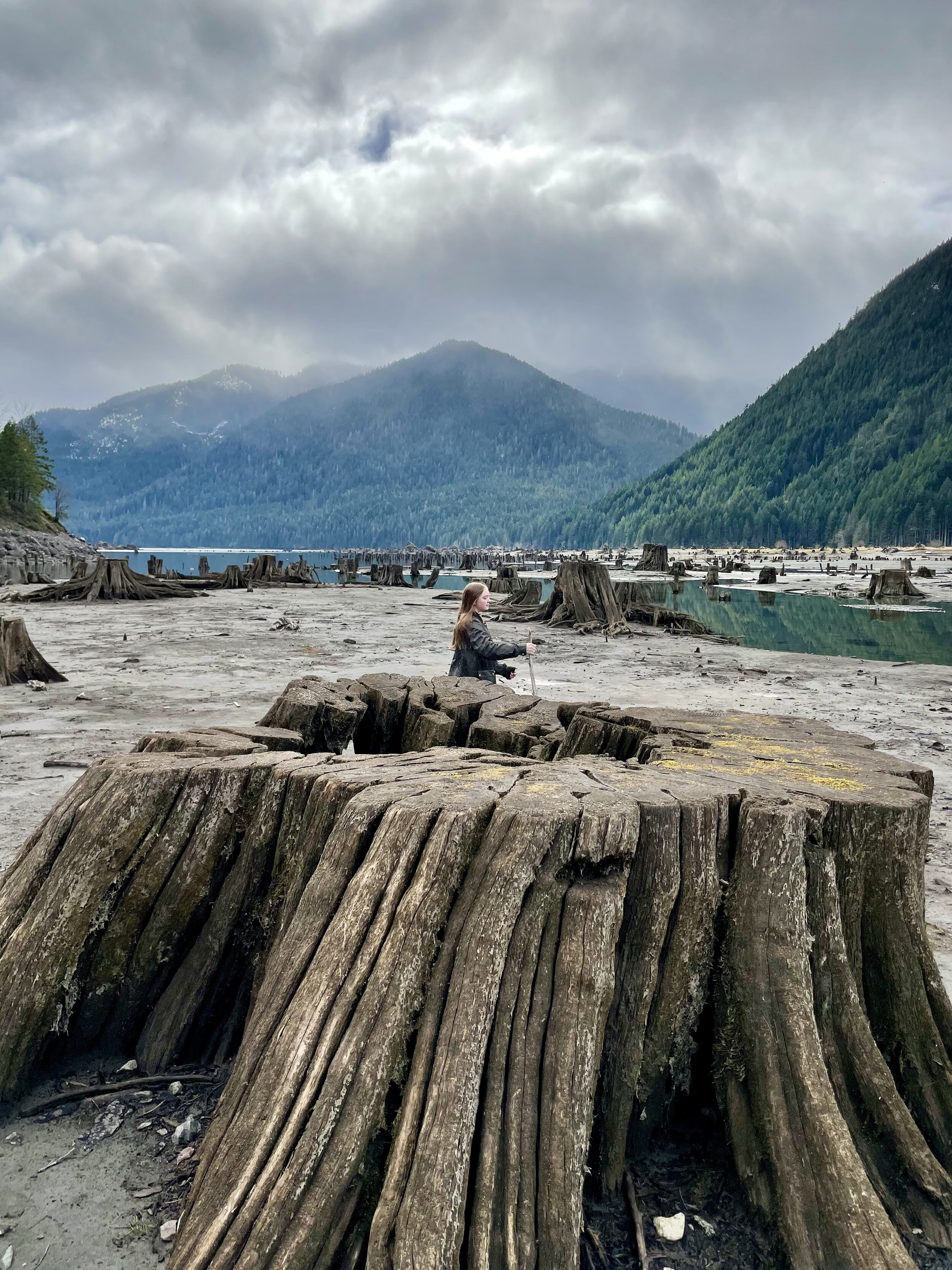
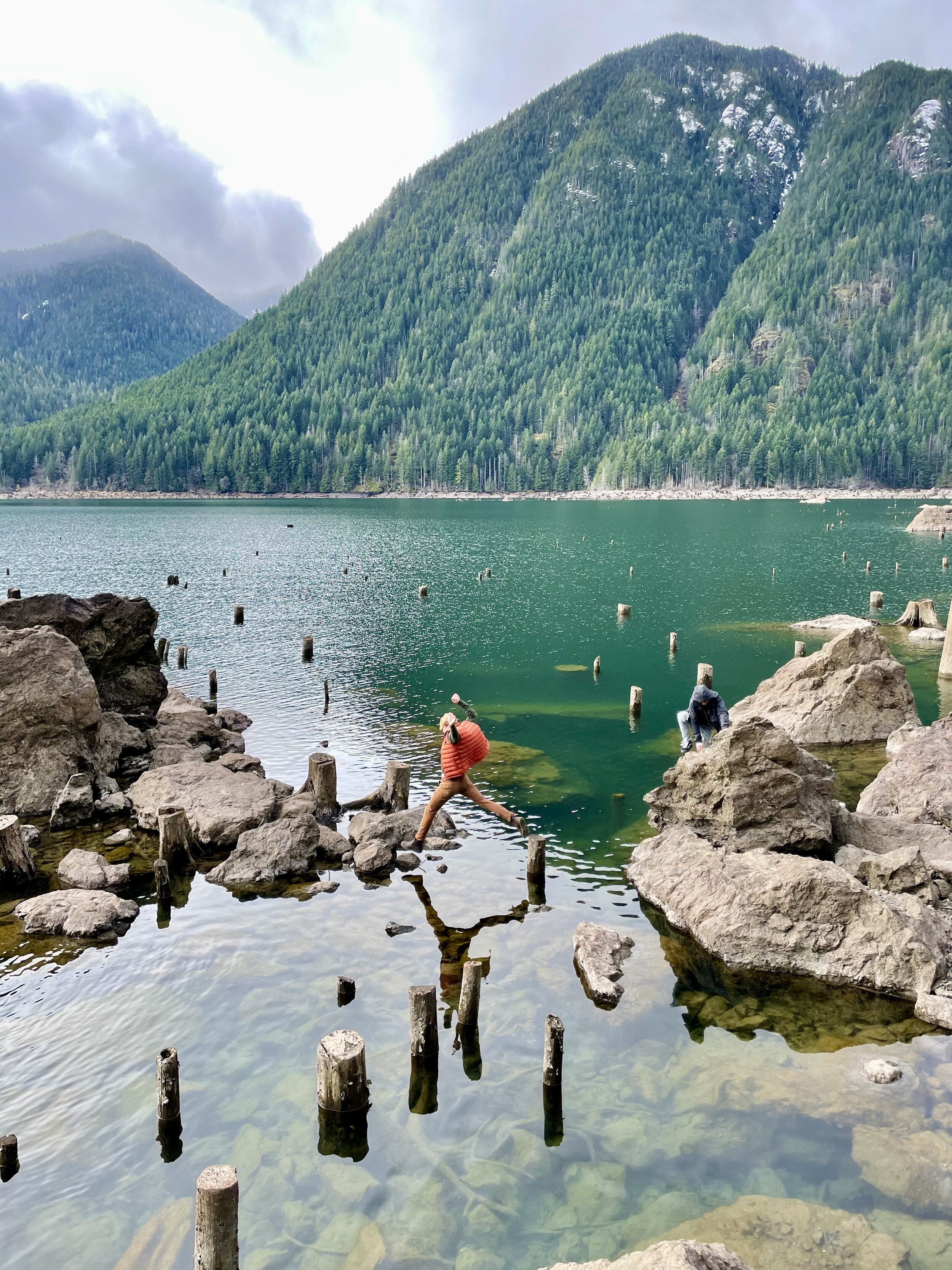
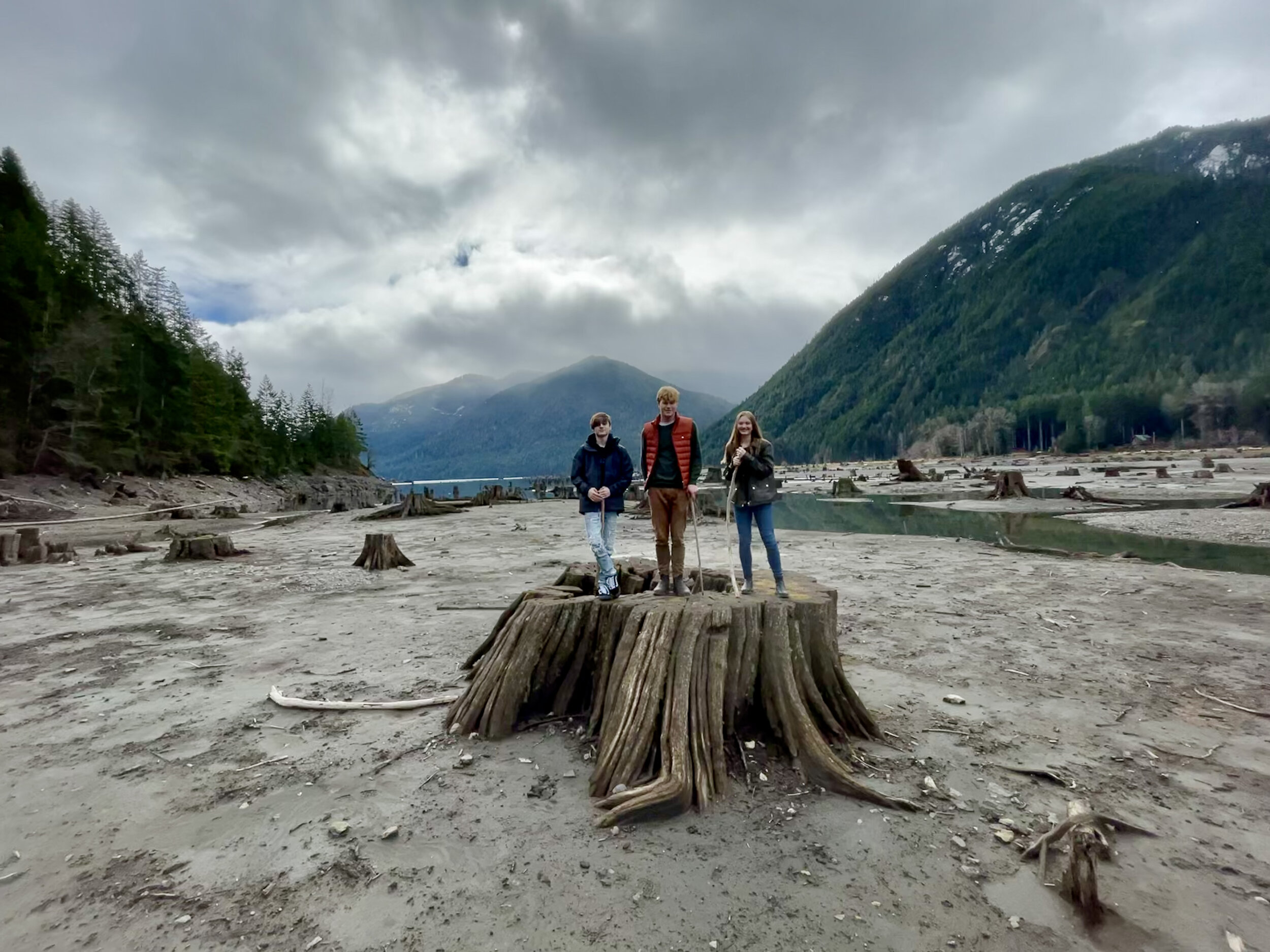
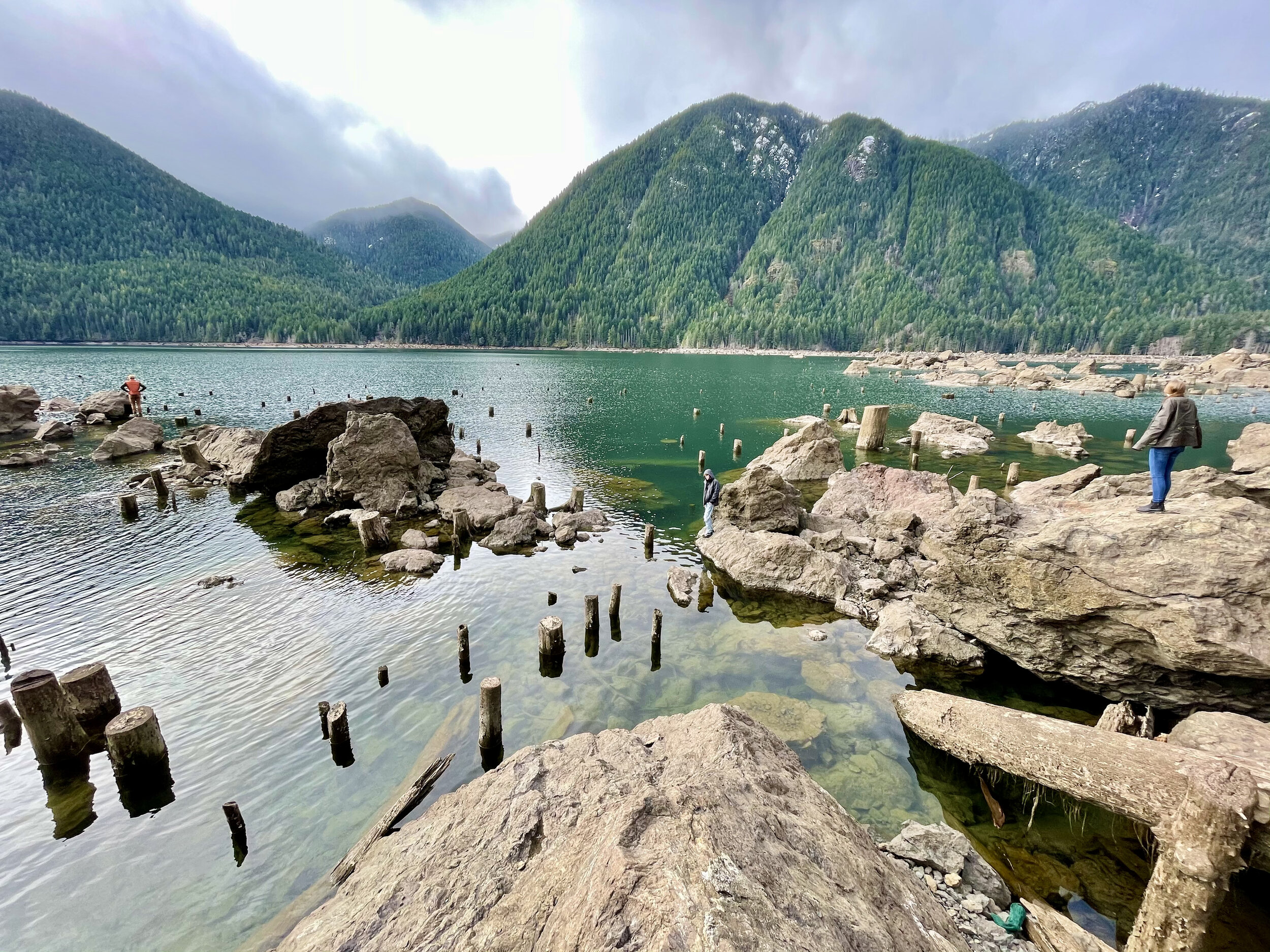
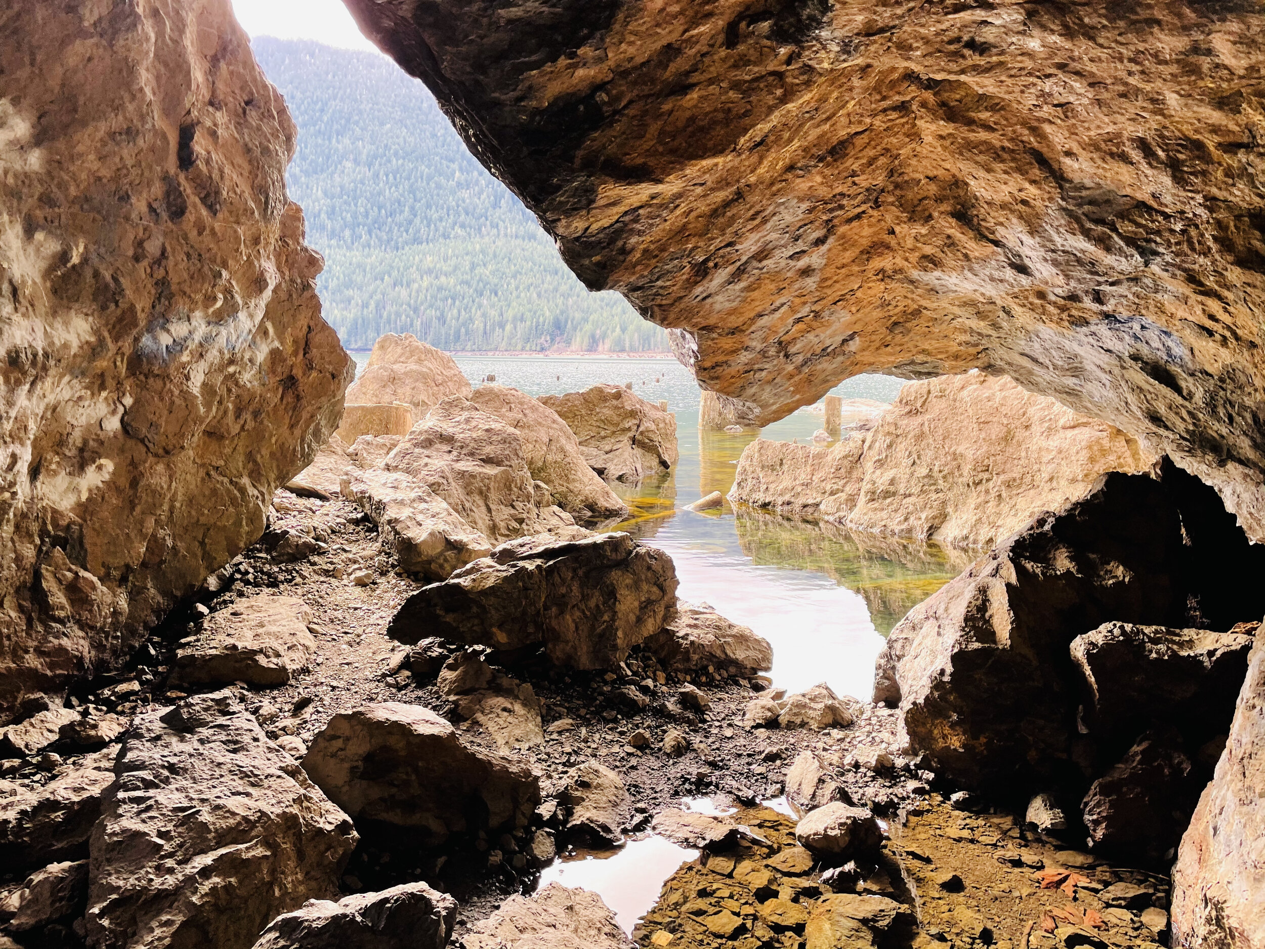
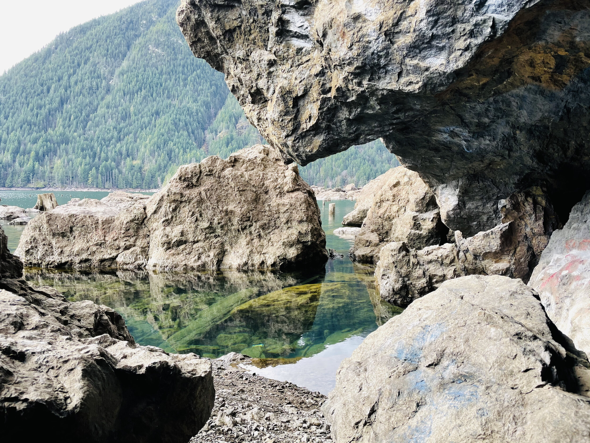
A little further down the road is a pull out at the end of the lake. Here the “sea” of stumps is even more fantastic. The landscape is great for exploring and dramatic photos. The springboard holes used by the early foresters as they cleared the valley are perfectly archived.
Staircase Loop Trail
The entrance to Staircase was un-manned when we arrived. There were just a few cars parked in the lot. You will need to have a pass to park. We recently purchased the America The Beautiful Annual Pass. This pass covers federally managed recreation lands such as National Parks, National Forests, National Wildlife Refuges, and Bureau of Land Management Recreation Areas throughout the country.If you purchase this pass you may use it for both the Olympic National Park and for trailheads requiring a NW Forest Pass. The pass covers all people in your vehicle and covers two pass signers at walk-in locations, so at $80 per year, it’s a pretty good value and takes a lot of guesswork out of what passes needed when exploring the Olympic National Forest and Park.

Near the parking lot there are vault toilets and information boards. The trails go in a multitude of directions but we took the standard Staircase Loop. It’s less than two miles and follows the curves of the North Fork of Skokomish River. We love loops. Something different around every bend and when you drop back in the parking lot you are still wanting more.
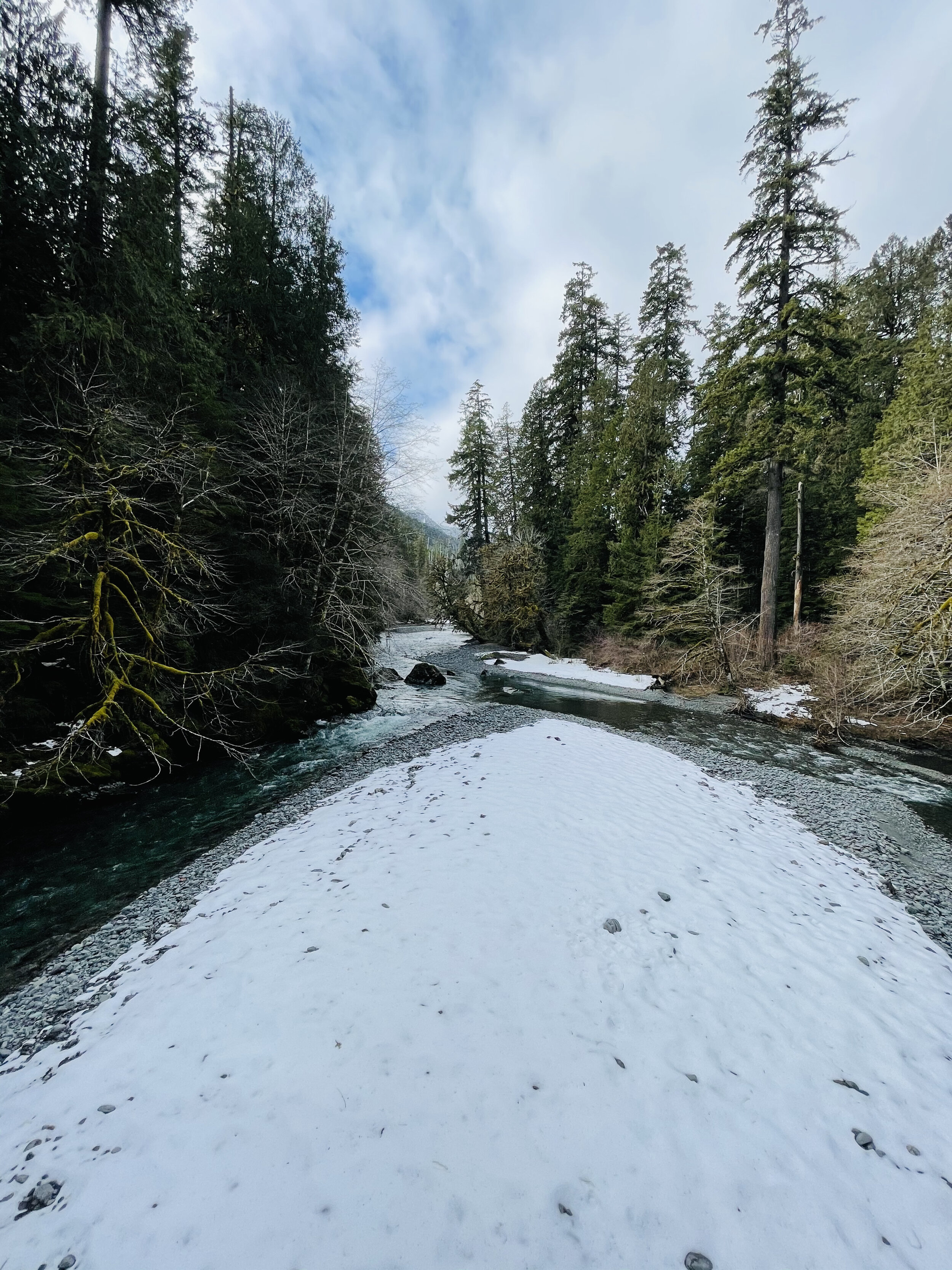
There was enough snow on the trail, peeping through the breaks in the dense canopy, to make it perfect contrast for photos against the mossy green – and the odd snowball to break the reflection.
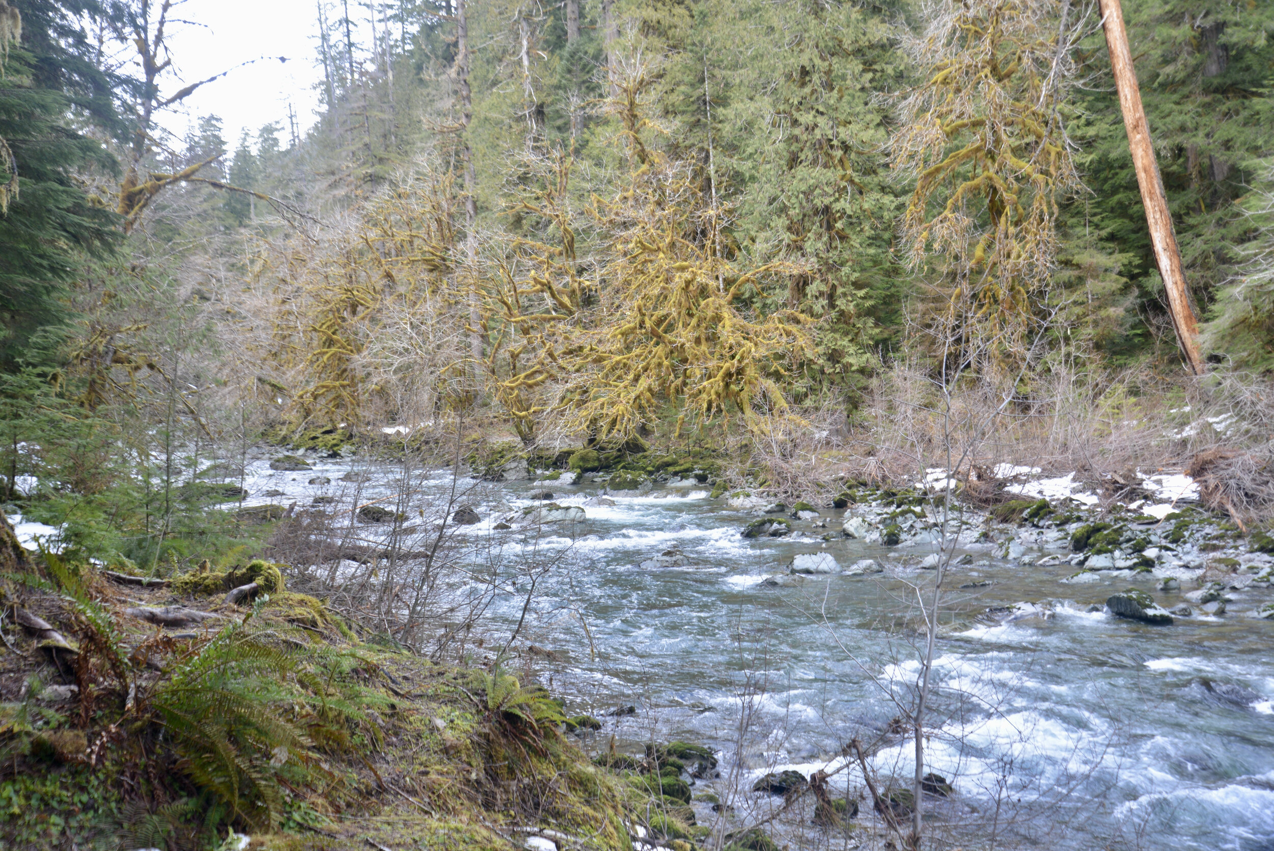
Heads up…you will see no staircase at Staircase today. In 1890, when Lt. O’Neil and his crew blazed their trail through the Skokomish wilderness, the rock bluff across the river from the campground was a major obstacle. To get over it they built a cedar staircase. Until the nearby Shady Lane Trail was built in 1911, the ‘Devil’s Staircase’ was the only path over the bluff. The name, and O’Neil’s legacy, remains. However, as you follow the river with its tumbling force of river over huge basalt boulders – you can kind of imagine the rapids are staircase of sorts.

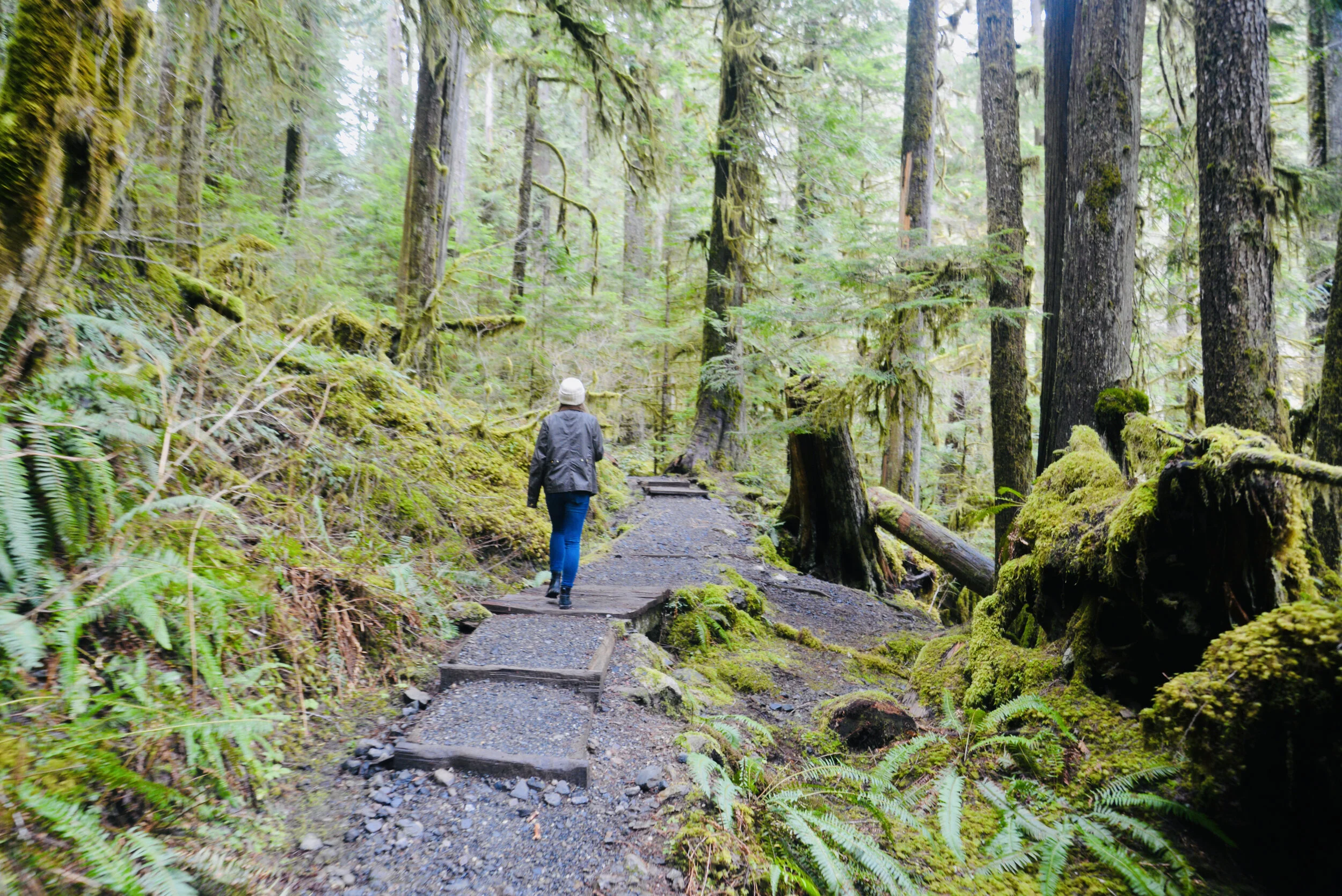
We stopped off by the river at the “swimming hole” to make lunch on the beach. With a Jetboil and some hot freeze dried meals, it was sublime. They’ve come a long way from what I remember as an instant meal. Having hot tea after in the chill of the forest was magical too.

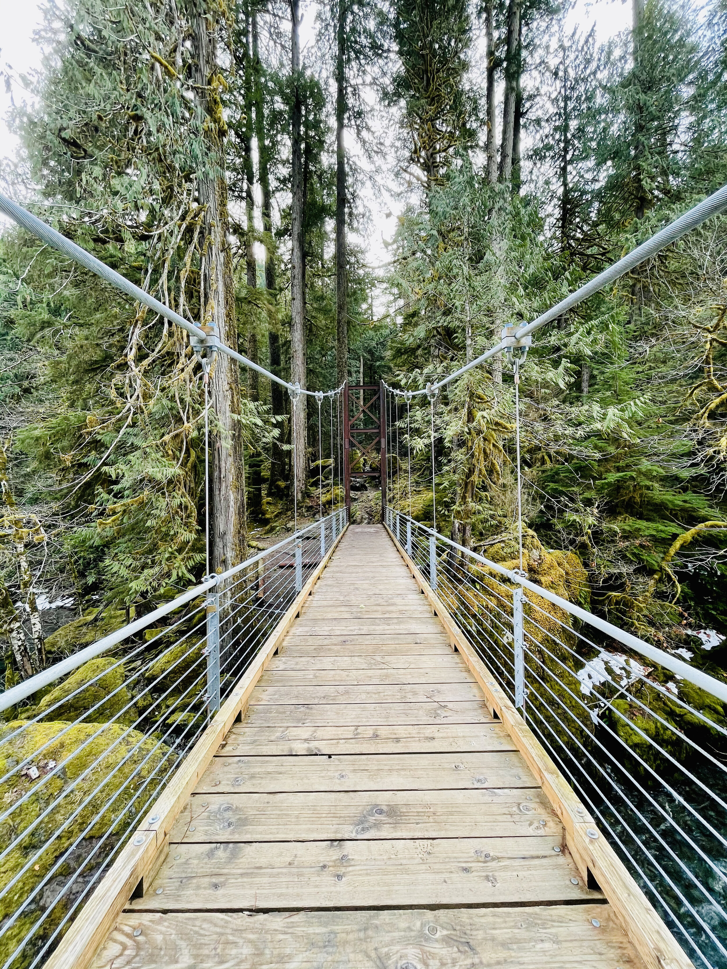
The trail crosses over the river at a dramatic suspension bridge. Here the view opens up and you can see a few snow covered glacial peaks of the Olympics. Despite their jutting appearance, the Olympic Mount Range are not volcanic. This is surprising given the proliferation of volcanic ranges in the Pacific Northwest, for example Mount Baker and Mount Rainer. As evidenced by the marine fossils found in the summits of the range, the Olympic Range once was part of the ocean floor. Approximately 120 million years ago, the Pacific Tectonic Plate crashed into the North American Plate and created the Olympic Range.
Journey Back
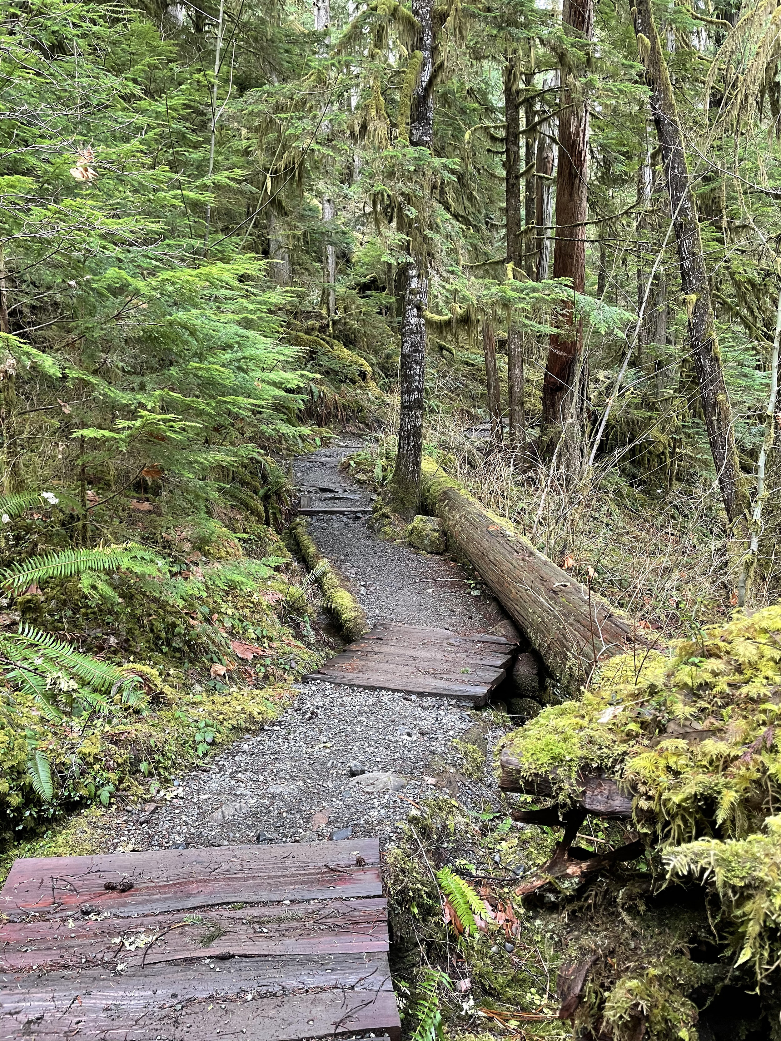
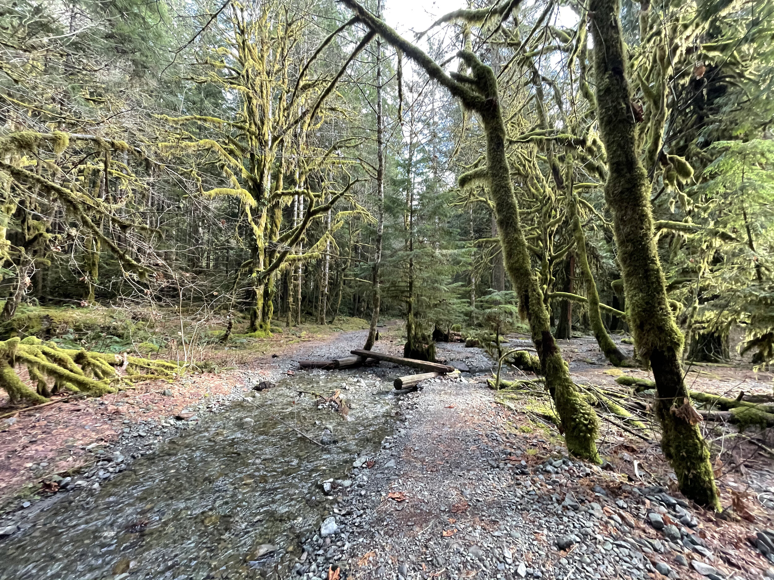
The trail back on the opposite shore is a vast contrast to winding hummocks covered in moss and ferns. The path now follows an old road bed peppered by giant cedars, firs and fallen nurse logs. At two points you cross log bridges to ford the gentle streams coming down from the hills above. The trail ascends up a makeshift timber “staircase” and then drops back into the parking lot near the ranger station.


Six Mountain Bike Zones to Check Out Around Hood Canal
While popular mountain biking trail networks like Seattle, Port Angeles, and the Capital Forest network dot the outskirts, a circumnavigation of the Hood Canal will uncover some local favorites and family-friendly riding.
While popular mountain biking trail networks like Seattle, Port Angeles, and the Capital Forest network dot the outskirts, a circumnavigation of the Hood Canal will uncover some local favorites and family-friendly riding.
These zones can be accessed by day trip from a home-base picturesque cabin rental on the water or through more of a nomadic road trip utilizing campsites as you go. Whatever your style of travel, family needs, or riding goals a fully customizable mountain bike-centric trip can be found here.
While these six areas are predominantly beginner and intermediate trails with the occasionally rowdy advanced downhill track, within an hour from any one spot, there is an abundance of variety in both the trails and scenery.
#1. South Fork Skokomish Trail
The South Fork Skokomish Trail wanders beautifully through old-growth forest as it crosses its namesake river and several streams along the way while climbing gently for the first two miles.

Beyond that, it continues up at a steep grade as the trail rises above the river valley. Another five miles along, the trail ends at the Olympic National Park boundary. This is a great spot to catch your breath before enjoying the exciting downhill that you’ve earned.
The Lower South Fork Skokomish Trail heads nine miles in the opposite direction. This section tends to be less maintained but if you’re up for an adventure it is worth the challenge. The trail takes you through more stunning Olympic National Forest old-growth and roughly a mile in from the northern trail entrance, it fords a river that can only safely be crossed between August and early October. Despite the challenge of added brush and fallen trees, this section of South Fork Skokomish Trail has far less elevation to contend with than the upper and it can be shuttled as it has parking at both ends.
For a list of Lodging in this area, click here.
2. West Shelton

The West Shelton trail network has nine miles of cross-country trails that can be accessed from the heart of Shelton. Nearly all the trails are rated green and while there are a few punchy climbs, there is no sustained elevation for beginner riders to worry about.
Flowy trails like Au Natural, She’s a Pitch, Single Track, and Tie In, tend to have flowy sections, pitchy climbs, and some gentle flats. A few, especially the aptly named Sometimes a River, can turn into small streams after a good rain but generally, this area makes for great year-round riding. To view the network of trails available in Shelton, visit trailforks.com/region/shelton.
Both Union and Shelton would be convenient home bases to explore this trail network.

3. Green Mountain
A 22 mile network of mostly beginner and intermediate multi use trails with a couple of advanced downhill routes in the mix. There are two trails heads, Gold Creek and Wildcat, on opposite sides of the mountain that both lead to the Vista Summit and fun descents. Climbing up the sometimes rocky and loose Wildcat Trail will give you a challenging 1100 feet of gain in 4.5 miles and deliver stunning views of Bremerton and Seattle. On particularly clear days, riders will also be treated to Mt. Rainier and Mt. Adams too. While the trails here are primarily categorized as cross-country, there is quite a bit of variety to be had. Wildcat Trail from the summit is loose and fast with flowy berms and plenty of tech available. For those looking for a long and more challenging climb on an out-and-back that delivers a speedy and fun descent on the return, Gold Creek Trail would be the best choice. But with the same elevation gain of 1100 feet, this time in just over 2 miles, riders need to make sure their legs are ready for the challenge.
Camping in the Tahuya State Forest or staying in one of the many lodging around Belfair would be a great option to make a weekend of exploring these trails.

#4. Forest Heritage Park

Port Gamble Forest Heritage Park offers 33.5 miles of everything from beginner to advanced all-mountain trails. The network is linked by non-motorized use logging roads and includes a range of tech and flow with a little something for everyone. Green rated trails like Outer Limits are easy cross-country trails with just enough variation to be great for teaching new riders. Clear Cut and Twisted Sister are other beginner trails that offer some fun corners and mostly flat terrain to learn on.
Intermediate trails include Ankle Biter, the longest climb or descent in the park depending on your direction; Derailed, a relatively new downhill trail with a few tabletop jumps and optional doubles; The Hood, a flow trail with berms and small optional jumps; and Forbidden Forest, a rooty and technical singletrack route.
Drop Tail is one of the few advanced trails here and is a short track that includes a few drops and bridges. The range for all abilities packed into this trail network is impressive making it an easy crowd-pleaser no matter who you’re traveling with.
#5. Lower Big Quilcene

This intermediate 6.2 miles of lowland forested trail offers a scenic pedal along the Big Quilcene River. Lush moss lines an old roadbed through a young forest before winding through massive old-growth cedars. Blooming rhododendrons add bursts of color to the forest greens in spring and summer. For anyone looking for a light bike-packing adventure, there is an established campsite just under 3 miles from the trailhead right on the banks of the river.
This trail can be ridden as a 12.4-mile out-and-back or a shuttle can be arranged with a pick-up at the FS Road 2750 exit.
For a list of Lodging in this area, click here.
#6. Gold Creek-Dungeness
Just a short drive up the forest service road from the Lower Big Quilcene trail is a huge trail network boasting 43 miles of multi-use trails connected by fire roads.


About the Author
Danielle Baker is a freelance writer from Squamish, BC. Her work can be viewed in FreeHub Magazine, Mountain Life, Red Bull Canada, Eskapee, Rocky Mountain Bicycles, Pinkbike.com, and many others.

Mountain Biking Lower South Fork Skokomish
The fall colors on Hood Canal are heralding the close of summer. Time to head to the hills to embrace the much needed rains in the Olympic National Park as the hills and valleys go back to the Technicolor spectrum of green.
Whenever the impending rains approach Olympic National Park, they turn our hills and valleys back into the spectrum of green that makes home feel like home.

Photo Credit: Bike List
For some of us, that means misty morning walks up our favorite mountains (like Mt. Ellinor), for others, that means relaxing indoors with a good book, but for those of us that feel best while we are two-wheeling, that means tacky dirt and flowy mountain biking trails!
Grab your elbow pads and helmets, and tune up your metal steeds as we embark on our newest in the Hood Canal Travel guide.
Fuel Your Fire | 9AM
Serious riders (or pure-and-simple fun-seekers like us) need a belly full of goodness to fuel a full day of thrill-seeking. If you’re an early bird and a breakfast fiend, stop into Blondie’s for down home from-scratch diner food. The biscuits and gravy take the cake at this friendly local joint.
Hit the trail | 11AM
After meandering down some forest roads underneath the towering Olympics, come to the Lower South Fork Skokomish River Trail #873. Characterized by its intermediate single track riding through some of the finest ancient forests in the Northwest, this ride serves up a bit of everything. Doable as a 20.9 mile loop, if you care to climb the road and ride trail down although most prefer to ride single track up the trail and then back down.
Olympic elk still roam the hillsides, and as you are slashing short, quick ascents and sending sometimes rocky and rooted descents, take in the uncontested beauty of the river valley sliced by the surging Skokomish River.

"I love this fun, flowy cross-country trail that parallels the South Fork of the Skokomish River. It has a bit of everything!" - Jaime, local bike shredder
Before embarking, be sure to check trail conditions here, and prepare to be without cell service by having a good map and a USFS Rec Guide. Keep in mind that, like most USFS land, a Recreation Pass is required, which you can find here, or at a number of local businesses like Verle’s Sports Center and Marine in Shelton.
Treat yourself to a view | 2pm
Before that plastered grin that characterizes a good ride fades away, get yourself to one of the most recognized historical relics of Hood Canal. From the trailhead, a short 20 minute drive takes you to the High Steel Bridge. The highest railway arch ever built in the United States spans the South Fork of the Skokomish (a river that you are already quite familiar with) a dizzying 365 feet above the forest floor. Originally constructed in 1929 by the Simpson Logging Company, the bridge was converted to road use in 1950.

As you flip through the memories of a day well spent, remember that we love keeping up with you! Tag your photos and thoughts on social media with #explorehoodcanal #wildsideWA #hoodcanal. Be sure to check in with us on Facebook, Twitter, Instagram, and Pinterest for more ideas on how to get the most out of your road trip to Hood Canal. Happy trails.
Daily: 5am-9pm
360.432.2777
Lower South Fork Skokomish River Trail #873

Lake Sundown
There are four ways to reach Lake Sundown, a pretty little body of water in the rugged and isolated southwestern corner of Olympic National Park. All of these routes are difficult and each contains their own charms and challenges. The route via the South Fork Skokomish River Valley includes miles of primeval cathedral forest along a wilderness waterway and an ascent of a 4,125-foot pass offering sweeping views of this wild landscape. If the trek to the lake is too daunting, a stroll just through the groves of ancient trees will provide a satisfying hike.
Pictures & Story by Craig Romano
There are four ways to reach Lake Sundown, a pretty little body of water in the rugged and isolated southwestern corner of Olympic National Park. All of these routes are difficult and each contains their own charms and challenges. The route via the South Fork Skokomish River Valley includes miles of primeval cathedral forest along a wilderness waterway and an ascent of a 4,125-foot pass offering sweeping views of this wild landscape. If the trek to the lake is too daunting, a stroll just through the groves of ancient trees will provide a satisfying hike.

Hit the Trail
Lake Sundown is one of the few backcountry lakes in the southern Olympic Mountains. Remote and difficult to get to, it’s also lightly visited. The shortest approach is via rugged Wynoochee Pass. The easiest (but not easy) approach is via Graves Creek requiring a long drive to the trailhead in the Quinault River Valley.
The approach via Six Ridge is the longest and most difficult, but also stunning when it comes to scenery and a wilderness experience.
The approach described here via the South Fork Skokomish River is challenging but includes varied terrain, excellent views, and an easier to access trailhead from Hood Canal.
While strong hikers can do this hike out and back in a day, it’s ideal for a one night backpack trip. Be sure to secure an Olympic National Park wilderness camping permit before heading out—unless you plan on camping in the national forest before reaching the park. There are two creek fords on this hike which can only safely be done in late summer and early fall. During this period the crossings are not much more than ankle deep. And finally, while the lake and its surrounding high country generally remain snow free through October, FR 2361 is gated on October 1st. So if you plan on doing this hike during October you’ll need to walk an additional 5.1 miles each way or mountain bike to the trailhead.

From the trailhead, head north on the Upper South Fork Skokomish River following an old roadbed. Soon reach the old trailhead and continue on single track coming to a narrow shelf. Carefully wander to the edge of the trail and stare straight down at the South Fork careening through a tight chasm.

At a little past a mile, cross Rule Creek on a big log bridge. Shortly after come to your first crossing of the South Fork Skokomish River. Fortunately a large fallen cedar can be used here to cross the river. Now climb above the wild waterway weaving through groves of primordial giants that’ll have you staring up to the lofty forest canopy. Conservationists were disheartened when this incredible tract of old-growth forest (one of the largest remaining expanses of old growth forest in the southern reaches of the Olympic National Park) was excluded from the 1984 Washington State Wilderness Act.

Continue hiking, crossing copious side creeks before coming to camps and the second crossing of the South Fork Skokomish River. By late summer the ford here is usually a mere rock hop. But if it looks tricky, this is a great turning around spot for a nice 5.2 mile hike. Otherwise carry on and upon reaching the far bank of the river, continue up the valley through mossy flats alongside the river bed—but not always along the river as sections of it often flow underground late in the season.
The trail eventually pulls away from the river and begins climbing. And what had so far been a fairly easy hike begins to get tougher.
At 4.4 miles reach Startup Creek which can be tricky to cross early in the summer. Now prepare to start climbing reaching the Olympic National Park boundary (dogs prohibited beyond) just past 5.0 miles. The trail soon afterward traverses a couple of wet meadows that showcase a myriad of flowers early in the season. Tread is absent here and navigating can be tricky. Angle to the northwest where good tread can be found again at forest edge. Don’t be led astray by elk trails. And do stay alert for these large members of the deer family. A large herd calls this valley home.
Continue deeper into the wilderness. After crossing a small creek, the trail steeply climbs reaching a small open basin graced with wildflowers in early summer and sparkling tarns providing the headwaters of the South Fork Skokomish River. Now reenter forest and steeply climb once more reaching forested 4,124-foot Sundown Pass. A short descent awaits you next through meadows providing good views of Wynoochee Pass and the Graves Creek drainage. Mount Olympus can be seen in the distance. At 7.8 miles, come to a junction. Left leads to Wynoochee Pass and the North Fork Quinault River.

You want to go right here through a pretty basin reaching Lake Sundown (elev. 3810 feet) in 0.4 mile.
Situated in a semi-open emerald basin on the western flank of Six Ridge, the lake is a pretty sight. A couple of campsites can be found at the old shelter site near the lake’s outlet. To catch the sunset, you’ll need to work your way to the eastern shore to look west across the lake to peaks and ridges beyond. On a warm day the lake’s refreshing waters make for a good dip. Savor the solitude and serenity of this remote backcountry lake. You worked hard to experience it!


More Details
Distance: 16.4 miles roundtrip
Elevation Gain: 3700 feet
High Point: 4125 feet
Difficulty: difficult
Snow free: July—October
Trailhead Pass Needed: None
Notes: FR 2361 closed Oct 1–Apr 30 to protect wildlife. Hike involves two fords safe only in low flow; dogs prohibited at national park boundary. Camping at Lake Sundown and in Olympic National Park requires an Olympic NP wilderness camping permit. No fires above 3500'.
GPS waypoints:
Trailhead: N 47 28.765, W 123 27.125
Lake Sundown: N47 32.170 W123 30.691
Land Agency Contact: Olympic National Forest, Hood Canal Ranger District, Quilcene, (360) 765-2200, http://www.fs.usda.gov/olympic; and Olympic National Park, Wilderness Information Center, (360) 565-3100, www.nps.gov/olym
Recommended Guidebook: Day Hiking Olympic Peninsula 2nd edition (Romano, Mountaineers Books)
Trailhead directions: From Shelton, travel north on US 101 for 7 miles, turning left at milepost 340 onto the Skokomish Valley Road (signed “Skokomish Recreation Area”). Follow for 5.6 miles, bearing right at a V intersection onto Forest Road 23. Continue for 9.3 miles bearing left at Y-junction with FR 2353. Then continue on FR 23, following this good gravel road for 4.3 miles and bearing right onto FR 2361. Then proceed 5.1 miles to trailhead at road’s end.

An Autumn Trek to Black and White Lakes
Visit the Black and White Lakes in late September and discover a surrounding landscape far from black and white. Revel instead in an alpine world of living color. The lakes sit in a basin long burned of its forest cover and since carpeted in berry bushes, mountain ashes and other shrubs that burst with brilliant hues of red, orange and yellow.
Craig Romano | Story & Pictures
Craig Romano has written more than 25 outdoor guide books including "Day Hiking Olympic Peninsula."
Visit the Black and White Lakes in late September and discover a surrounding landscape far from black and white. Revel instead in an alpine world of living color. The lakes sit in a basin long burned of its forest cover and since carpeted in berry bushes, mountain ashes and other shrubs that burst with brilliant hues of red, orange and yellow come the autumn equinox. It’s a grunt to reach them, but chance are good you won’t have too much company — unless you count gregarious ground squirrels, docile deer, and inquisitive bears.

Craig Romano Photo
Hit the Trail
While the Black and White Lakes lie on the trail less traveled, you must first hike some well-trodden paths. Start your journey on the North Fork Skokomish River Trail, which begins on an old road that was decommissioned in the 1970s. Hike through wild country, much like what U.S. Army Second Lieutenant Joseph P. O’Neil saw in the 1880s on his exploratory trips into the Olympic Mountains. But something O’Neil saw that you won’t were legendary fish runs. Before the North Fork Skokomish’s flow was dammed by Tacoma Power in the 1920s, this river was one of the largest salmon-rearing waterways on the peninsula.
Hike upstream on a wide path and gentle grade crossing several side creeks. Traverse a luxuriant bottomland of big cedars, Douglas-firs, and moss-cloaked big-leaf maples. Pass the Staircase Rapids Loop Trail and consider taking it on the return for a slight variation. After passing Slide Camp, hike across the Beaver Fire of 1985, caused by an illegal campfire during a drought and resulting in 1400 acres of old growth going up in flames.

Craig Romano Photo
The trail then pulls away from the river. At 3.6 miles, reach a junction just before Spike Camp. Now head right on the Flapjack Lakes Trail and slowly climb out of the valley along the old burn line. After a few switchbacks, the trail turns northward on a fairly gentle course. Admire a big cedar grove along the way, then cross Madeline Creek on a sturdy bridge.
The creek cascades below through a narrow ravine. Now start heading up steeper and rockier terrain and follow alongside cascading Donahue Creek. At 7.1 miles comes to a junction. The way to the right is where most folks head—to the Flapjack Lakes and Gladys Divide. You want to head left instead on the less-traveled trail.
Cross a pair of creeks, and then steeply climb, rounding a ridge to emerge at a 1936 burn site, now blanketed in berry bushes and mountain ash. After passing the log foundation of an old cabin, come to a junction with the Black and White Way Trail at 8.2 miles.
The old cabin was once part of a long mining operation here at the lakes. By the mid-1970s it had collapsed leaving only the rotting foundation behind. As you continue to hike into the lake basin, look around for evidence of old mining operations in the form of tailings, pits and cuts.

Craig Romano Photo
Now continue straight another 0.2 mile to an unmarked junction. The trail continues for one mile dropping into a forested basin housing Smith Lake. You want to go right and immediately reach the largest of the trio of Black and White Lakes. The lake is small but pretty with a couple of primitive campsites nearby. The other two lakes are not much more than pothole ponds tucked a little higher in the surrounding basin.
While the lakes aren’t stunning, the views from the open basin are—especially of the surrounding wilderness. Particularly striking is Wonder Mountain and the Three Sisters to the south, Six Ridge to the southwest, and Mount Steel to the northwest.

Craig Romano Photo
In autumn, this basin transforms into a mosaic of dazzling reds, oranges, and yellows.
So where did the name Black and White come from? There are a handful of name origin theories that include the lakes being named after a brand of whiskey, the last names of the original prospectors, and a way of describing manganese found at the site.
In any case the mining history here goes back to claims made in 1907. Copper was the original mineral mined. Getting the copper to market from this remote and rugged location however proved to be a challenge. A proposed flume was never built to help get the ore to the North Fork Skokomish Valley from where it was transported to Tacoma via roads. The mine’s claims were sold several times over the years. In the 1940s the mine’s owners dug a 200 foot tunnel. By the 1960s however mining activity had pretty much ceased at the lakes.

Craig Romano Photo
When you are ready to leave this beautiful and interesting place, retrace your steps 0.2 mile back to the junction near the old cabin remains. Then return the way you came or consider hiking out via the Black and White Way Trail. It’s a shorter route, but a knee knocker dropping more than 2600 feet in 2.2 incredibly steep miles. While the way is knee-jarring, the tread is smooth and not rocky.
The way trail ends at the North Fork Skokomish Trail at the junction with the spur to Big Log Camp. From here it’s 5.4 miles back to the trailhead via the North Fork Skokomish Trail.
Black and White Lakes hike:
Distance: 16.8 miles roundtrip
Elevation Gain: 3,800 feet
High Point: 4,515 feet
Difficulty: moderately difficult
Snow free: mid-June – Oct
Trailhead Pass Needed: National park entrance fee.
Olympic NP wilderness camping permit required if backpacking.
Notes: Dogs prohibited. No campfires above 3500 feet.
GPS waypoints: Trailhead: N47 30.968 W123 19.691
Black and White Lakes: N47 34.493 W123 20.556
Features: magnificent old-growth forest, wildlife rich backcountry lake, exceptional autumn foliage, excellent alpine views, historic mining area.
Land Agency Contact:
Olympic National Park, Wilderness Information Center, Port Angeles, (360) 565-3100, www.nps.gov/olym;
Recommended Guidebooks:
Backpacking Washington 2nd edition (Romano, Mountaineers Books)
Trailhead directions:
From Shelton, travel north on US 101 for 15 miles to Hoodsport. Turn left onto State Route 119 and drive 9.3 miles to a T intersection with Forest Road 24. Turn left, continuing on SR 119 which becomes FR 24 for 5.4 miles. Then bear right, coming to the Staircase Ranger Station in 1.2 miles and the trailhead.

A Quiet trek to Pine Lake
The South Fork Skokomish River Valley offers quite a contrast from the North Fork Skokomish River Valley. Located within Olympic National Forest and not Olympic National Park, the South Fork sees a fraction of the number of folks that visit the North Fork.
Craig Romano | Story and Pictures
The South Fork Skokomish River Valley offers quite a contrast from the North Fork Skokomish River Valley. Located within Olympic National Forest and not Olympic National Park, the South Fork sees a fraction of the number of folks that visit the North Fork. Once a heavily logged area, the South Fork is slowly reverting back to a more natural state. Miles of former Forest Service logging roads in this wildlife rich valley have been decommissioned; some converted into trails. The converted trail to pretty little Pine Lake is a pure pleasure to walk. And surprisingly, the lake is surrounded by beautiful ancient forest. Majestic hemlocks, Douglas firs, and red cedars—just no pines.
Hit the Trail
Much of the South Fork Skokomish Valley in the Olympic National Forest was intensely logged from the 1940s to the 1980s. By the 1990s however timber harvesting on the Olympic and other Western Washington national forests was heavily curtailed due to market place changes and new management objectives favoring habitat protection and recreation. This resulted in the Forest Service decommissioning hundreds of miles of old logging roads. Some of these old roads however presented new opportunities to expand the trail system.

Olympic National Forest once contained hundreds of miles of trails in the South Fork Skokomish and Wynoochee River watersheds. Intensive logging destroyed most of those trails. Forest Service officials and citizen groups now see new opportunities to regain many miles of these lost trails through road conversions. The trail to Pine Lake is one of these new trails. And unlike so many road-trail conversion that simply involves gating the road and removing culverts—the Pine Lake Trail was designed with aesthetes in mind.
The road to trail conversion to this little lake involved constructing bends and curves in the original road bed to better mimic a real trail. And the road bed was restored to original contours in places further obscuring old road cuts.
The Forest Service planted native vegetation along the road bed so that in time it will be very difficult to see that this route was once a wide logging road. And while logging did occur within the Pine Creek watershed, it wasn’t as intense as in some of the smaller watersheds farther south and east. Large patches and tracts of old-growth forest were left uncut. And as the second growth patches adjacent to the primeval tracts continue to mature, evidence of past logging in the basin containing Pine Lake becomes less obvious.
"Surprisingly this trail is not on many hiker’s radar. Come on a weekday and you may have the lake to yourself."
From the small parking area, follow the trail through second growth forest traversing slopes high above Pine Creek. About half way up the trail you’ll encounter a patch of invasive Scotch broom, a plant that crowds out native vegetation in disturbed areas. The Forest Service along with Washington Conservation Corp crews have done a good job at Pine Lake restoring native vegetation. Unfortunately this pervasive and hardy invasive plant has gotten a foothold in this valley. Hopefully they can soon attack the broom before it sweeps across the valley.
At about two miles the trail enters an attractive grove of old-growth forest. The way then steepens a little breaking stride from its relatively gentle grade to this point. In another .75 mile the trail leaves the old road bed to traverse a grove of big trees and descend to Pine Lake. The lake is pretty shallow and surrounded by grasses, sedges and other small plants—many planted by the Forest Service to help rehabilitate the shoreline from past abuses.
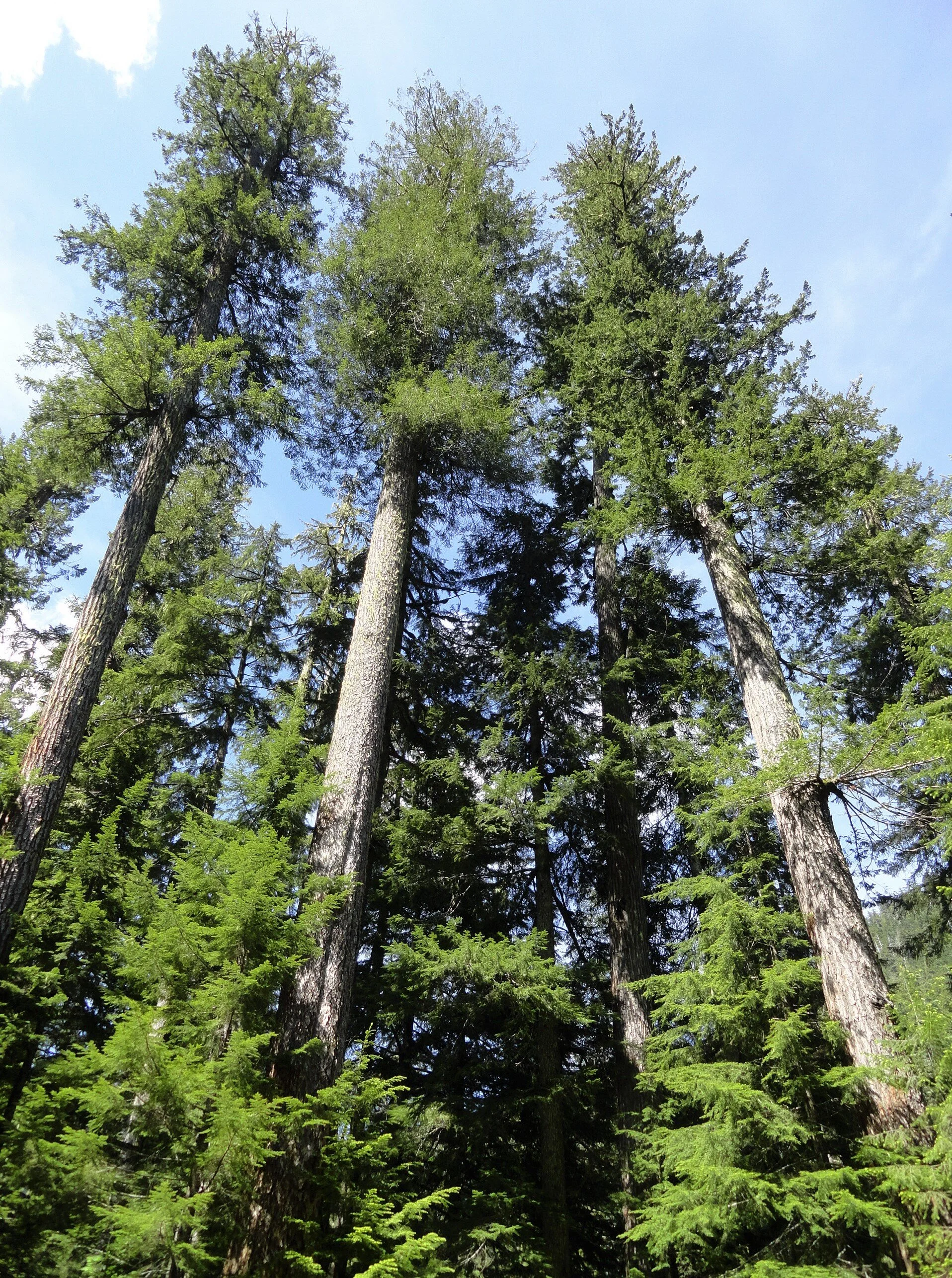
Treat the area with respect by sticking to established paths and not trampling vegetation.
Savor the serenity of the scene. Look for resident waterfowl on the lake’s open waters and in its vegetated coves.
Admire the forested hillsides too and Chapel Peak which often reflects upon the lake’s placid waters. Notice too that among the stately conifers surrounding the lake, there does not appear to be any pines. Western white pines valued for their fine wood, were once abundant in the Olympics and Cascades. But it wasn’t logging that erased them from much of these landscapes—but a Eurasian disease, white pine blister rust that decimated stands of this majestic tree.

It’s possible that is what occurred here at Pine Lake. Then again, early pioneers and explorers were also known for misnaming features. There are no badgers in Olympic National Park’s Badger Valley for example nor black oaks growing anywhere near Black Oak Creek in the North Cascades. Perhaps someone named the lake Pine referring to the area’s evergreens as pines. I have seen this mistake numerous times in travel journals and tourism brochures! Anyhow, Pine Lake’s name origins may remain a mystery. But pine or no pines, the lake is a pretty hiking destination. And if you are intent on seeing some beautiful western white pines, nearby Six Ridge in Olympic National Park harbors some healthy stands of them—but it is no easy hike reaching them.

Pine Lake Hike Resources
Land Agency Contact: Olympic National Forest, Hood Canal Ranger District, Quilcene, http://www.fs.usda.gov/olympic
Recommended Guidebooks: Day Hiking Olympic Peninsula
2nd edition (Romano, Mountaineers Books)
Trailhead directions: From Shelton, travel north on US 101 for 7 miles, turning left at milepost 340 onto the Skokomish Valley Road (signed “Skokomish Recreation Area”). Follow for 5.6 miles, bearing right at a V intersection onto Forest Road 23. Continue for 9.3 miles bearing left at Y-junction with FR 2353. Continuing on FR 23 (pavement ends) follow this good gravel road for 4.3 miles bearing right onto FR 2361. Continue for 1.2 miles and turn left onto unsigned Spur 200. Follow .7 mile to trailhead.
Distance: 5.8 miles roundtrip
Elevation Gain: 700 feet
High Point: 1830 feet
Difficulty: moderate
Snow free: Mar—Dec
Trailhead Pass Needed: None
Notes: Forest Road 2361 is gated and closed from October 1 to April 30th to protect wildlife. You can walk or bike the road (adding 3.8 miles roundtrip) during this time to reach the trailhead.
GPS waypoints: Trailhead: N47 26.270 W123 25.678 | Pine Lake: N47 25.839 W123 28.618
Features: kid and dog friendly, backcountry lake in old-growth forest, chances for solitude and wildlife watching
Safe & healthy hiking during the Covid-19
Avoid crowded hiking destinations. If you arrive and the parking lot is already full, head to another location
Opt for weekdays over weekends and/or early morning to hit the trail
Avoid hiking in large groups outside of your family
Practice Social Distancing while on the trail, giving other hikers lots of room to pass and keeping your distance from them at lakes, summits, etc.
Wear a mask when encountering others on the trail. A buff or bandanna works well, and remember to pack hand sanitizer
Pack it in pack it out (including pet waste) and don’t be a surface pooper. Always using privies first if available-or head at least 200' away from all trails, campsites and water sources and digging a cat hole for your business. Bury your waste and toilet paper.
Our Guide
Craig Romano is an author of more than 20 hiking guidebooks including the bestselling Day Hiking Olympic Peninsula 2nd Edition (Mountaineers Books), which includes descriptions for 136 hikes throughout the Olympic Peninsula.

Tracing the Fjord
The Hood Canal fjord formed during the Late Pleistocene era approximately 13,000 years ago when the Cordilleran Ice Sheet retreated. The ice sheet excavated the channels of Puget Sound, Lake Washington, Hood Canal, and other long, straight valleys in the Puget Sound area.
Like a giant fish hook snaking around glacier capped peaks, lush rain soaked forests and spanned by a web of waterways and inlets, the Hood Canal is poised to catch your imagination and reel in memories for years to come.
The Hood Canal fjord formed during the Late Pleistocene era approximately 13,000 years ago when the Cordilleran Ice Sheet retreated. The ice sheet excavated the channels of Puget Sound, Lake Washington, Hood Canal, and other long, straight valleys in the Puget Sound area.
“Christened “Hood’s Channel” by Captain Vancouver when he traced the shores of the sixty mile fjord in May 1792, the Twana people have called this hook of saltwater “home” for countless generations before European arrival.”
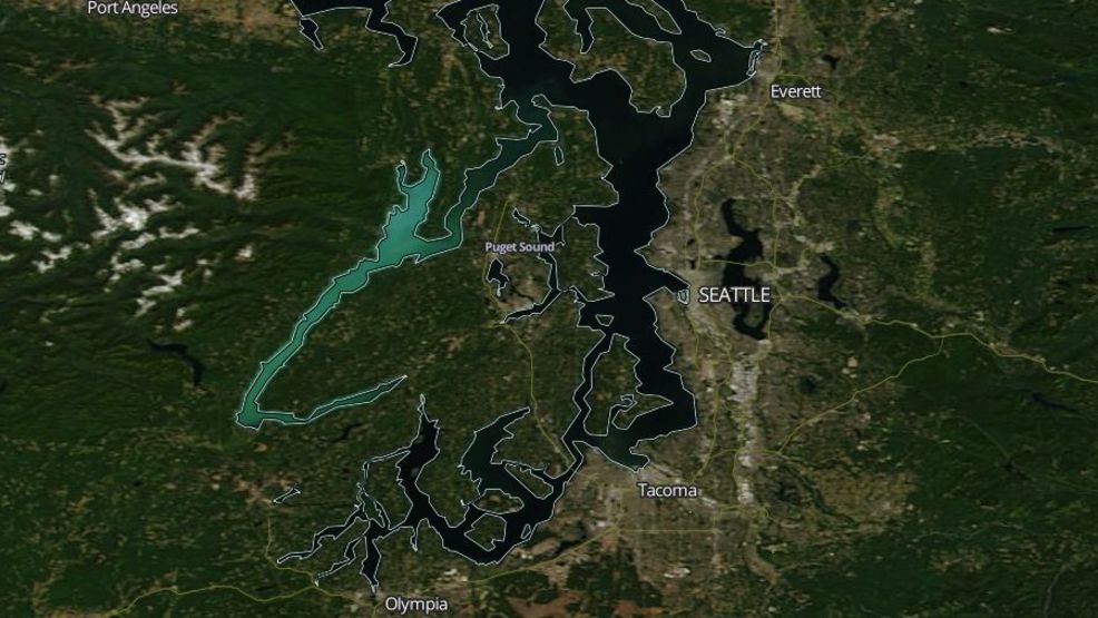
A NASA MODIS satellite image showing the teal-colored Hood Canal as a 2017 plankton bloom covers the Canal a harmless but tropic aquamarine. (Photo: NASA/MODIS)
The curious question as to how did the massive glacier turn in it’s course to create the “hook” may be answered by examining a combination of forces including the formation of great glacial lakes and erosion. The broad valley of the Skokomish River joins the southern tip of the Canal from the west in much the same way as the arm “hook” joins from the East.
As the Skokomish valley cut down through the valley it joined the glacier lake with the major fjord thereby creating the “L- shaped” channel. This troughing of the glacial till and erosion may account for the massive sills of glacial sediment that make up the sea floor in many areas of the Canal.
Christened “Hood’s Channel” by Captain Vancouver when he traced the shores of the sixty mile fjord in May 1792, the Twana people have called this hook of saltwater “home” for countless generations before European arrival.
Spending winters in villages near the mouths of the major rivers, the Twana people lived in cedar plank homes and enjoyed a rich culture and livelihood on the fjord. Salmon, clams, plants, and game provided year round generous bounty for their families.
The warmer months were marked with visits to neighboring settlements as well as further journeys to trade with people from as far away as what is now Alaska’s outer coast.
In 1792, Vancouver ventured into Hood Canal in longboats. He left his ships, the Discovery and Chatham, in nearby Port Townsend. Vancouver and his crew journeyed as far as the mouth of the Skokomish River, where Menzies, his botanist, was amazed by the rich vegetation as well as the natural beauty of the area. He wrote in his journal, “here the arm was hemmed in by lofty Mountains on one side and low flat country of considerable extent on the other.”
After a few days of exploration and trade with the Twana people, Vancouver and his men retraced their path out of the Canal leaving behind a legacy of European names in their wake.
Over two centuries later the Canal remains much the same. The settlements are replaced with small towns and knots of houses. Harvested hillsides have regrown new forests. The water route is replaced with a two lane highway that follows the shoreline.
“As Highway 101 meanders along the canal edge, we pass pockets of civilization and catch glimpses of the beauty through the trees.”
Hood Canal is renown as a diving mecca as its glacial fjord formation caused underwater biomes that appear no where else. Adventurers travel worldwide for the area’s spectacular hiking, boating, fishing, camping and relaxing opportunities. Heralded for its rich timber history and aquaculture resources it is the place where many of us choose to raise our kids and build our livelihoods.