
Before You Head to the Beach: Hood Canal's Shellfish Scene, and What to Know Right Now
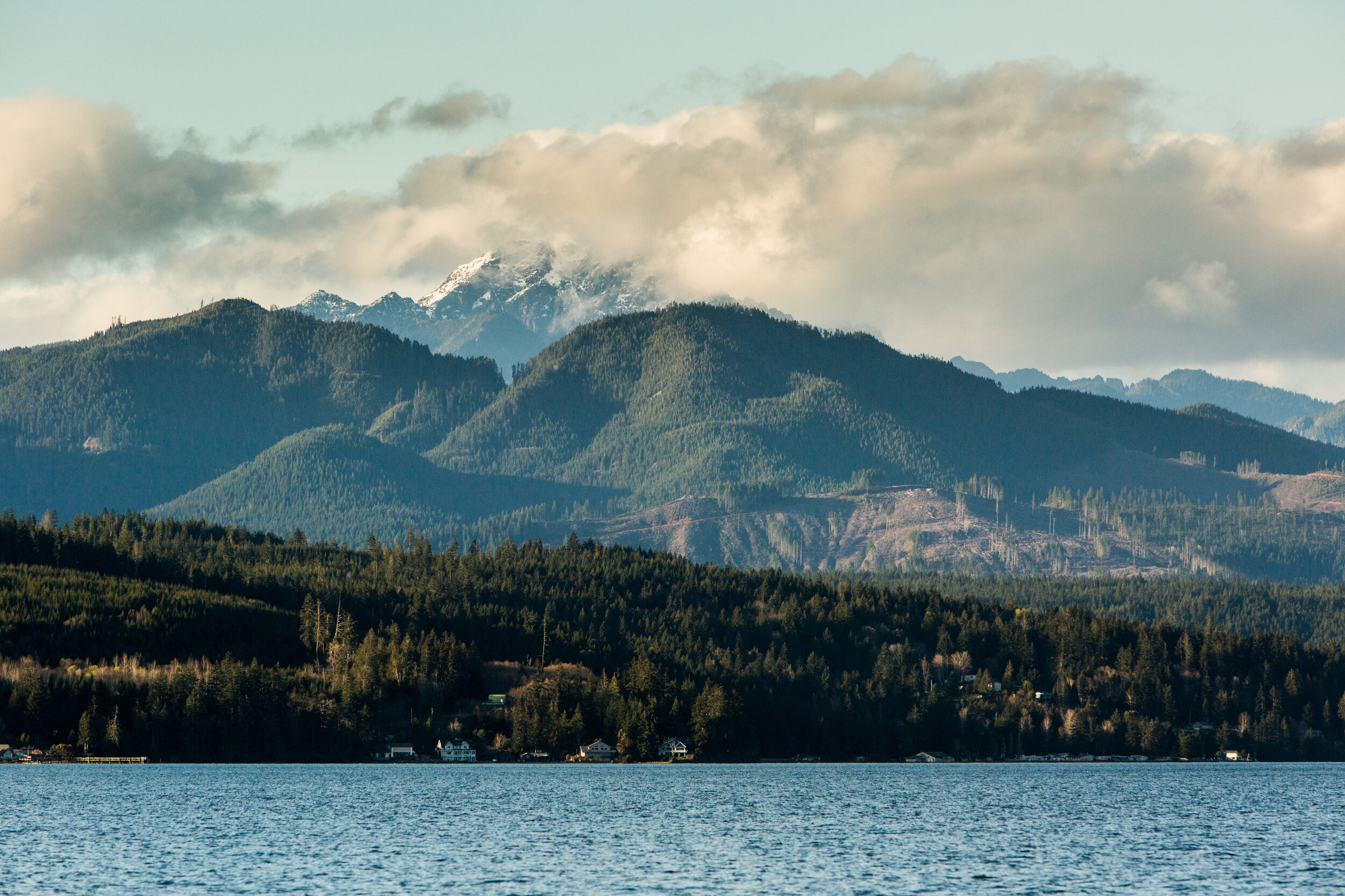
Hood Canal looks like a bay but it technically isn't. It's a fjord, which is a long, deep arm of saltwater carved out by glaciers during the last ice age. The water is cold and rich, the kind of cold that is very good for shellfish, which is why Mason County has become one of the best places in world to dig clams, eat oysters, mussels and geoduck. The farms and tideflats along the canal have supplied restaurants and raw bars for decades, and recreational harvesting has been a local tradition for even longer.

Hood Canal looks like a bay but it technically isn't. It's a fjord, which is a long, deep arm of saltwater carved out by glaciers during the last ice age. The water is cold and rich, the kind of cold that is very good for shellfish, which is why Mason County has become one of the best places in world to dig clams, eat oysters, mussels and geoduck. The farms and tideflats along the canal have supplied restaurants and raw bars for decades, and recreational harvesting has been a local tradition for even longer.
The Washington Shellfish Trail
If you want a guide to it all, shellfishtrail.org is where to start. The Washington Shellfish Trail is a statewide resource that maps out oyster farms, shellfish events, and self-harvest beaches across the state. The site includes links to WDFW licensing information if you're planning to harvest. To harvest shellfish or seaweed in Washington, everyone age 15 and older needs a Washington State Shellfish/Seaweed License. These are easy to get online through the Washington Department of Fish and Wildlife (WDFW) website or at sporting goods stores and many local shops. Be sure to bring your license along on your trip, it is required whenever you gather your own oysters or clams.
Check Before You Go: A New Beach Status Tool
The Shellfish Trail recently added a new feature at on its website. The live "beach status" page pulls daily harvest data from the Washington Department of Health and displays current open, conditional, or closed status for beaches across the state. It also includes a GPS-based tide tool that uses your location to provide upcoming tide predictions for the nearest NOAA station. It's a handy tool for anyone planning a harvesting trip. Conditions can change quickly, and having the current status makes planning easier.
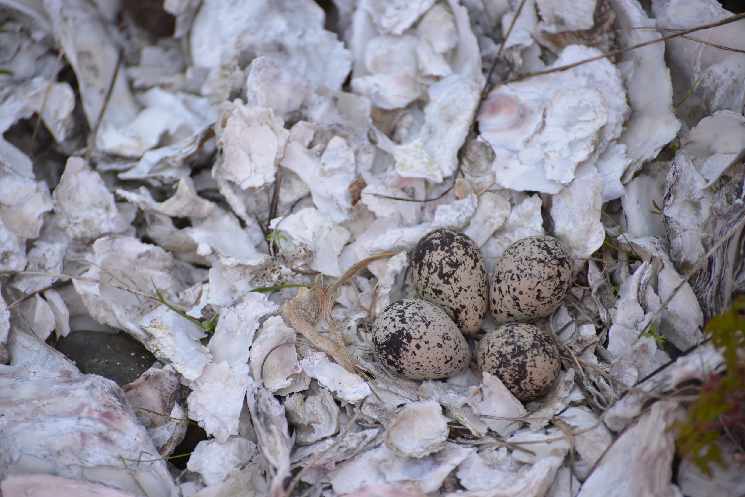
Two Very Different Bodies of Water
Mason County is shellfish country, but not all of its water is the same, and if you're planning a harvesting trip, its important to learn the terrain. Hood Canal runs about 50 miles from its northern entrance near Foulweather Bluff all the way south and around the Great Bend to Lynch Cove near Belfair. It's deep, up to 600 feet in places, with an average depth of around 177 feet. That depth is a characteristic of a fjord. There's a shallow underwater ridge, called a sill, near the northern entrance that limits how freely deeper water can exchange with Puget Sound. The Skokomish River pours freshwater into the south end, creating a layer of lighter freshwater on top of denser saltwater below. Those two layers don't mix easily, so the deep water of Hood Canal can go a long time without being replenished with oxygen-rich water from the surface or from outside. That's a natural condition of a fjord. When algae blooms occur and produce toxins, those conditions can linger.

Hammersley Inlet and Oakland Bay, near Shelton, close to the canal as the crow flies, are almost entirely different bodies of water. Hammersley is a shallow, winding tidal channel -- about eight nautical miles of twisting waterway that connects Oakland Bay to the greater South Puget Sound. When the tide changes, all the water in Oakland Bay has to move through that single narrow passage, and it does so fast. Currents in Hammersley can run up to five knots. That tidal movement means the water flushes on every tide cycle, mixing and exchanging far more actively than the deep, stratified water of Hood Canal. Oakland Bay itself receives freshwater from Goldsborough Creek and several other smaller streams through Shelton, making it more of a true estuary, shallower and warmer with the tides.
That difference in water character is one reason these two areas can have different conditions at any given time. A closure on Hood Canal doesn't automatically mean Hammersley or Oakland Bay are affected, and vice versa. In fact, even when one area is closed, you might find that another nearby beach remains open for harvesting. The beach status tool mentioned above shows each growing area's status independently, so you can easily see which beaches are currently open. Checking by location lets you find alternative spots rather than assuming one closure covers everything.
Right Now: Hood Canal Is Closed for Recreational Harvest
On June 12, the Washington State Department of Health issued a warning after lab testing found lethal levels of Paralytic Shellfish Poison in shellfish samples collected near Union. As a result, all recreational shellfish harvesting in Hood Canal is currently closed, from Foulweather Bluff and Port Ludlow Bay south, including Port Gamble Bay, Quilcene Bay, Dabob Bay, and Mats Mats Bay. The closure covers clams, oysters, mussels, scallops, and other molluscan shellfish. Crab and shrimp are not included.

If someone has eaten shellfish from a closed area or starts having symptoms like tingling, numbness, dizziness, or trouble breathing after eating shellfish, call 911 right away. Paralytic Shellfish Poisoning can become serious very quickly, and it is important to get medical help immediately. Warning signs have been posted at public beaches in Mason, Kitsap, and Jefferson counties. PSP is caused by a naturally occurring marine toxin produced by certain algae. Shellfish accumulate it as they filter-feed, and there's no way to tell by looking, smelling, or tasting whether they are contaminated. Cooking doesn't destroy it either. Symptoms can come on within minutes to a few hours after eating affected shellfish and can be serious. The closure will stay in place until DOH testing confirms toxin levels have dropped to safe concentrations. Beach status is updated daily as new water and shellfish test results become available, so you can rely on recent information for planning your trip. The most current status is always available on the DOH Shellfish Safety Map (fortress.wa.gov/doh/biotoxin/biotoxin.html), or you can check the Shellfish Trail's beach status tool above. For the fastest updates, you can also sign up for email or text notifications on the DOH website to be alerted when conditions change.
Still Worth the Trip
A PSP closure is a sign that Hood Canal is a living, healthy ecosystem, and that the water quality here is monitored closely because people depend on it. The canal's fjord-like geography means it doesn't flush and refresh as shallower bays do, making it especially sensitive to conditions in the water column. That's also part of what makes it so productive when conditions are right. The beaches are still beautiful. The farms are still operating (commercial shellfish goes through a separate, federally supervised monitoring program). Kayaking, crab and shrimp fishing, swimming, and shoreline exploration are all unaffected. Keep an eye on the beach status page on shellfishtrail.org for updates -- and bookmark it for your next trip out to the water.