
Home Lake
Craig Romano | photos & story
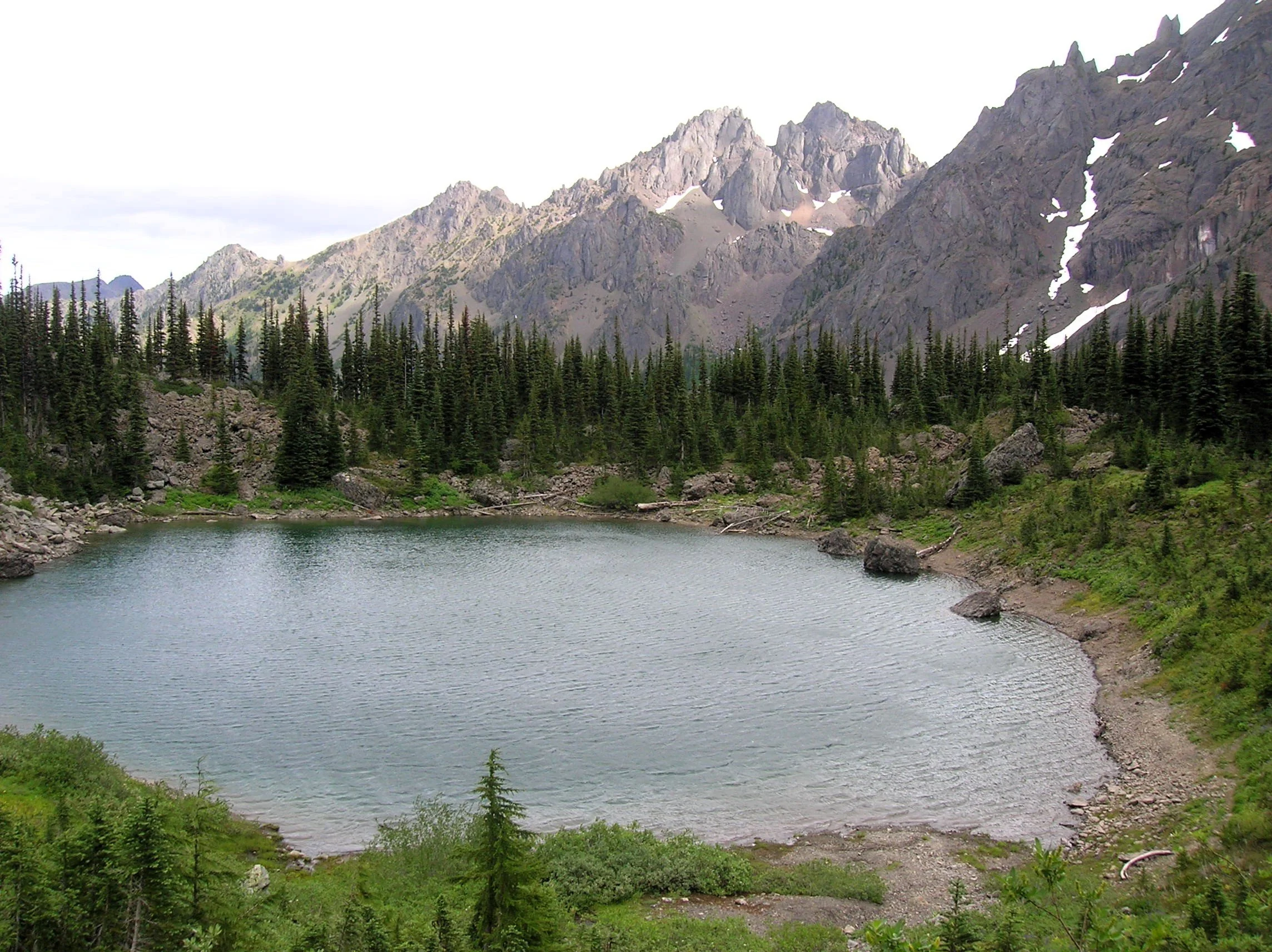
Little Home Lake lies on a rugged and remote ridge tucked between some of the highest and most impressive peaks in the Olympic Mountains. Fed by springs and surrounded by clusters of subalpine firs and flowering meadows, Home’s setting is quite serene. But cast your attention beyond its placid waters and be blown away by the staggering beauty of its neighboring mountains—especially of 7,756-foot Mount Constance, whose sheer western rock face towers above the lake. It’s an awe-inspiring scene, and a side of the mountain so starkly different from the one presented to countless folks who have admired this familiar peak from the east.
It’s a long way to Home Lake making it a multi-day hike for all but the strongest hikers and trail runners. The lake can be approached via four routes with the approach starting on the Upper Dungeness Trail being the shortest and easiest (but not easy). That route along with the Tubal Cain Mine Trail approach involve long (and bumpy) drives for folks coming from the South Sound.
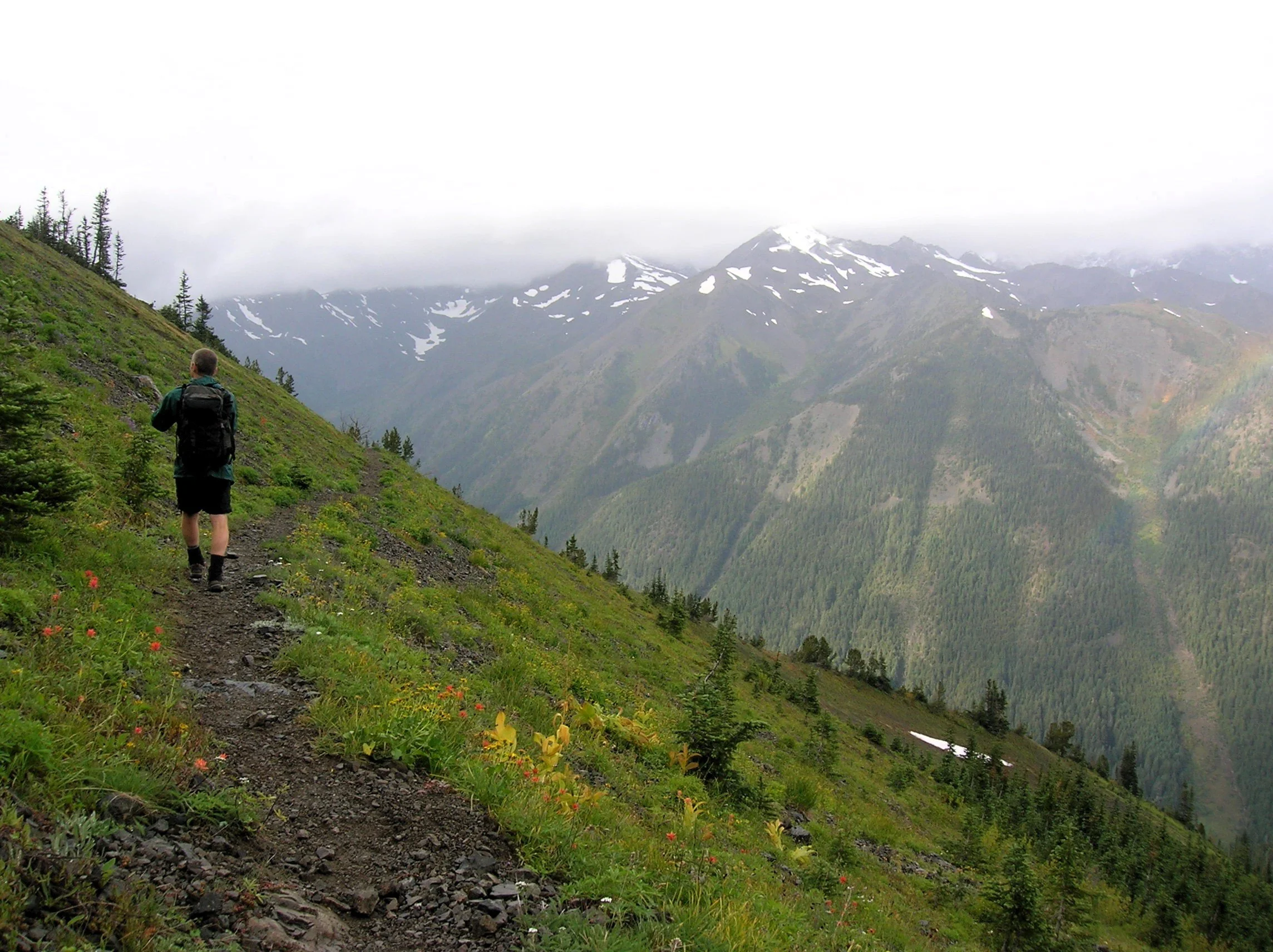
The Dosewallips-Constance Pass approach involves walking a long stretch of old road and a very steep lightly maintained trail. My preferred route to Home is via the Upper Big Quilcene River Trail to Marmot Pass. While this means enduring a busy trail for a few miles, you’re rewarded with exceptional views and several excellent campsites along the way if the 11 mile route to the lake is too much to do in one day.
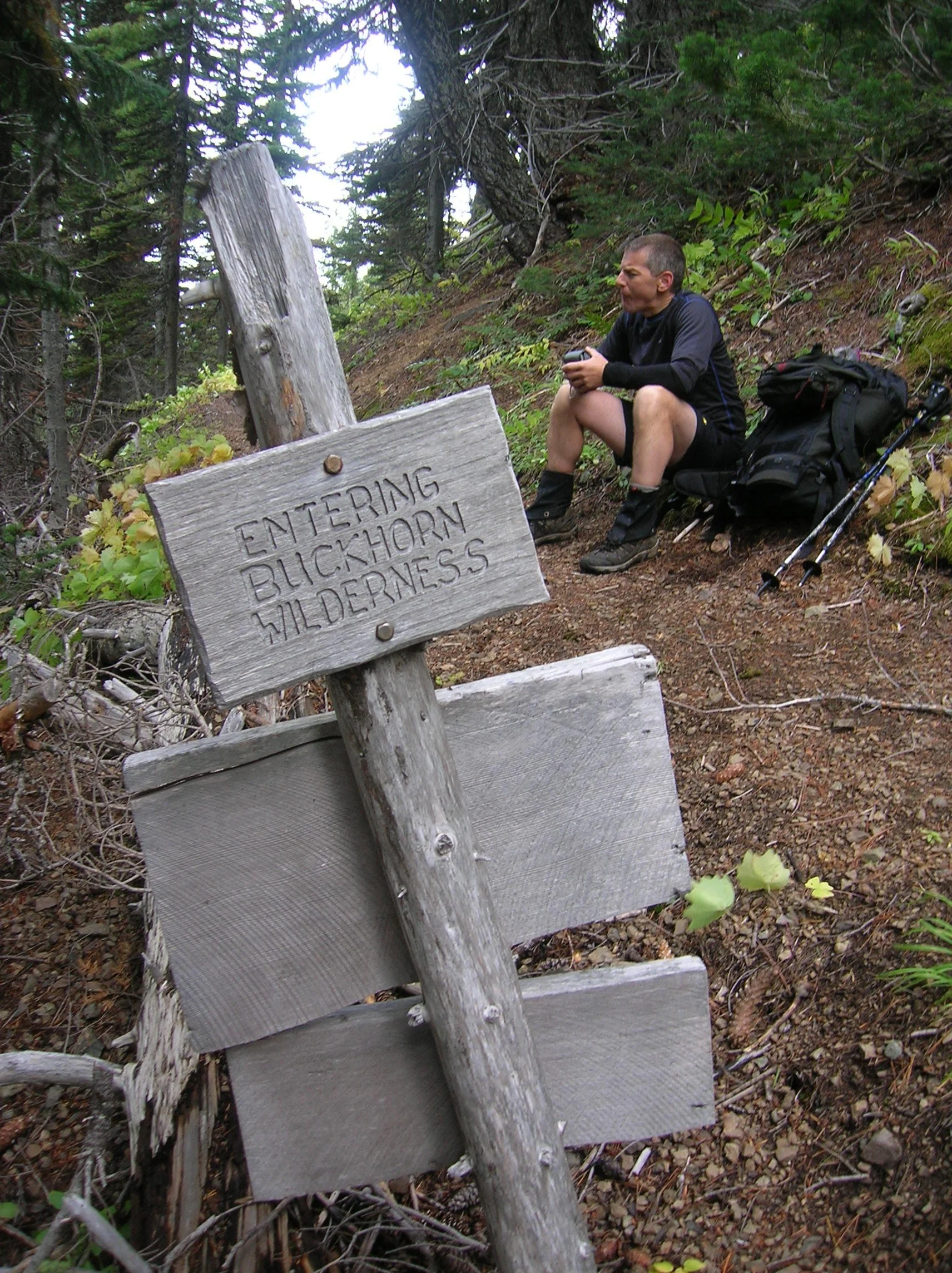
The Upper Big Quilcene River Trail enters the 44,258-acre Buckhorn Wilderness, the largest roadless area within the Olympic National Forest. The trail starts off gently traversing magnificent stands of primeval forest along the churning waters of the Big Quilcene River. You’ll cross many side creeks along the way. Lack of water is not an issue on this route. After passing Shelter Rock Camp, the trail steeply climbs away from the river to begin traversing open avalanche chutes and scree slopes offering good views of the rugged surroundings. Keep climbing—it only gets better. At just shy of five miles the trail reaches busy Camp Mystery set in a grove of Alaska yellow cedars and subalpine firs. Its springs are a great place to refill water bottles.
The trails now leaves the forest for subalpine meadows which burst with wildflowers through the summer. Watch for scurrying ground squirrels, languid marmots, and docile deer. At 5.3 miles, crest 5,950-foot Marmot Pass and savor the excellent view east to Hood Canal, Puget Sound, and the Cascades. Then gaze west towards the Dungeness Valley flanked by Mounts Mystery, Deception, and Walkinshaw; some of the highest summits in the Olympics.
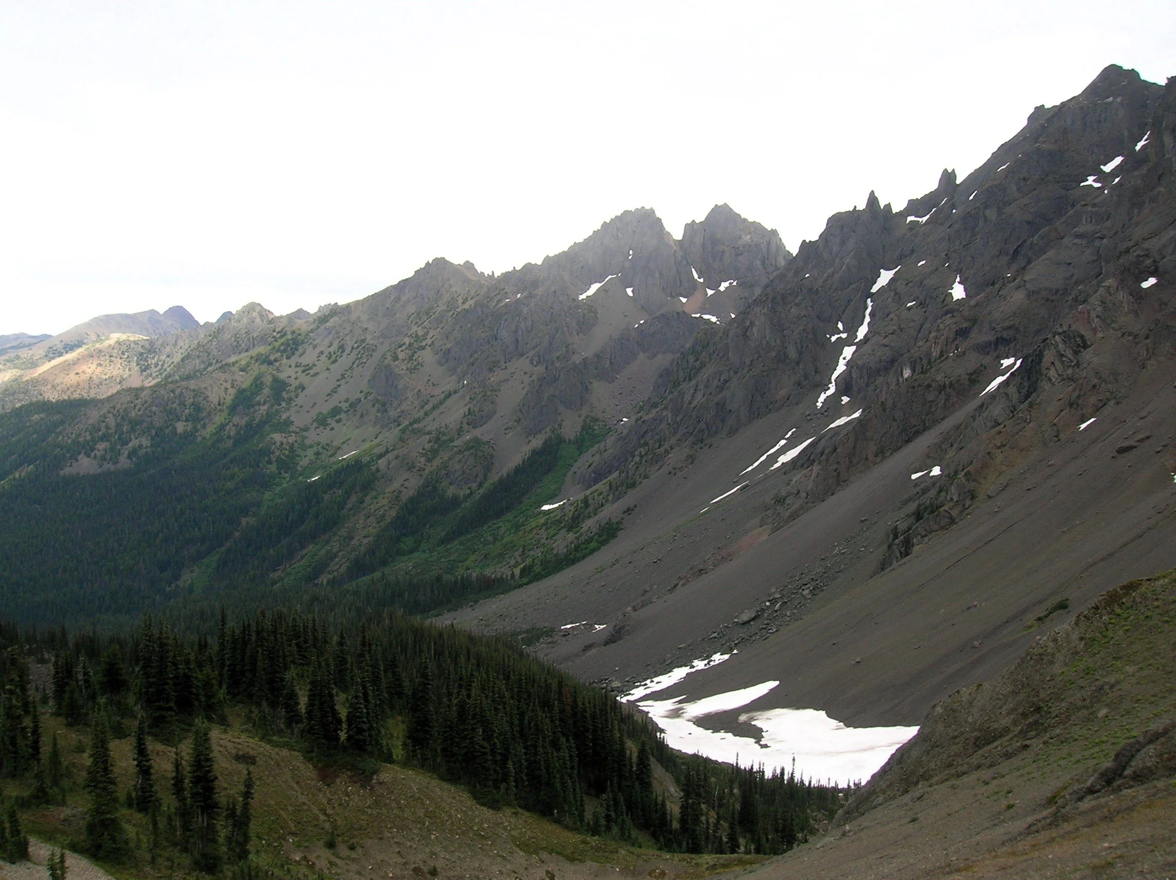
From the pass, the Tubal Cain Trail veers right offering another albeit longer and more difficult approach to the pass. For Home Lake head left traversing open slopes granting sweeping views of a wall of craggy summits. Here in the Olympic rainshadow, the terrain is much drier than the rest of the Olympics. Lodgepole and whitebark pines cling to the ridges and steep slopes.
Look for Clark’s nutcracker, a jay-like bird which feeds on pine nuts. Listen for its raucous call, a rare sound in the Olympics.
The way now descends and traverses a steep slope that often harbors two steep (potentially dangerous) snowfields earlier in the summer. The trail then enters open pine forest and descends steeply. Remember—you’ll have to climb this stretch on your return. At just over 7 miles the trail reaches a junction with the Dungeness River Trail—the easiest approach to Home Lake.
Now continue left on the Home Lake Trail crossing a creek and entering an open basin littered with jumbled boulders. Here find Boulder Camp with its restored and historic shelter. This is a good place to set up camp for the night.
For Home Lake continue south climbing to a forested swale and soon reaching an unmarked junction. The trail left leads one mile to a 6,300-foot gap from where a steep scramble path drops 800 feet to the tiny Charlia Lakes tucked in a rugged cirque. It makes for a spectacular and challenging side trip.
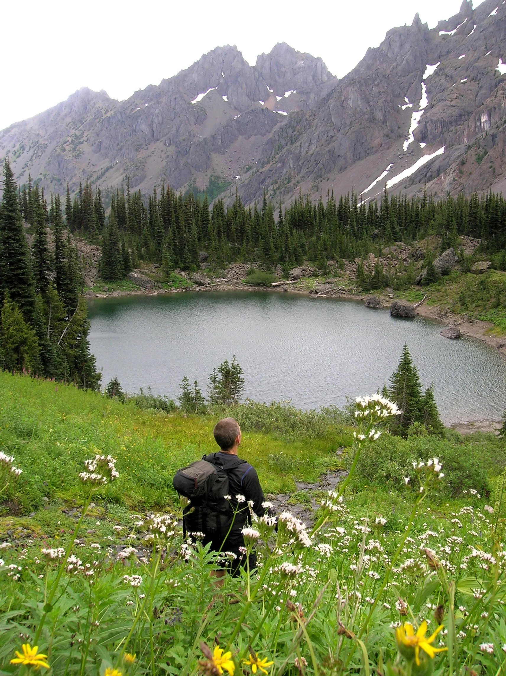
Continue south traversing steep slopes sporting stunted trees. At 8.0 miles enter Olympic National Park. If you’re hiking with a dog, this is your turning around spot. From here the lightly used path skirts steep avalanche swept slopes and crosses several cascading creeks. The terrain opens up as the trail travels beneath the formidable towering and stark walls of 7,300-foot Warrior Peak and 7,756- Mount Constance, third highest peak in the Olympics. The trail descends and gets rougher traversing a sprawling boulder and talus field. The walking is slow over the jumbled mess coupled by an inclination to keep tilting your head upwards and pause in amazement.
After negotiating the rocky mess the trail once again climbs. It ducks into a forested area to skirt snowfields at the base of Constance. At 10.5 miles and at an elevation of 5300 feet, reach Home Lake housed in a small basin beneath steep flowered slopes.
From its south shore enjoy home sweet views of Warrior Peak (named by celebrated climber Fred Beckey when he solo climbed it back in 1946). Lightly used camps (permits required) can be found on the wooded bluff above its western shore.
If you have any energy left, be sure to continue on the trail beyond the lake for another half mile climbing steeply up heather and flower fields to 5,800-foot Constance Pass. From here take in a breathtaking view of the Dosewallips Valley below and magnificent views of The Brothers, Mount Anderson, Mount La Crosse and a wide swath of the wild Olympic interior. Upon completing this hike, you just might be quoting a famous Dorothy with, “there’s no place like home!”
If you go:
Distance: 21.0 miles roundtrip
Elevation Gain: 5800 feet
High Point: 5350 feet
Difficulty: difficult
Snow free: July through October
Notes: Overnight camping permits required for Home Lake which is in Olympic National (acquire at Recreation.gov or from Wilderness Information Center in Port Angeles; https://www.nps.gov/olym/index.htm). Dogs are prohibited at Home Lake and in Olympic National Park. Campfires are prohibited Home Lake and above 3,500'. Dangerous steep snowfield just beyond Marmot Pass often lingers well into summer.
Trailhead Pass Needed: Northwest Forest Pass or Interagency Pass
GPS waypoints: Trailhead: N47 49.669, W123 02.445
Land Agency Contact: Olympic National Forest, Hood Canal Ranger District, Quilcene; and Olympic National Park, Wilderness Information Center, Port Angeles, www.nps.gov/olym
Recommended Guidebooks: Day Hiking Olympic Peninsula 3rd edition (Romano, Mountaineers Books) and Backpacking Washington 2nd edition (Romano, Mountaineers).
Trailhead directions: From Shelton, follow US 101 north for 48 miles turning right onto Penny Creek Road (about 1.5 miles south of Quilcene). After 1.5 miles bear left onto Big Quilcene River Road (FR 27) and follow this road for 9.3 miles turning left onto FR 2750. Continue 4.7 miles to the Upper Big Quilcene River Trailhead.
Trailhead facilities: privy