
Six Mountain Bike Zones to Check Out Around Hood Canal
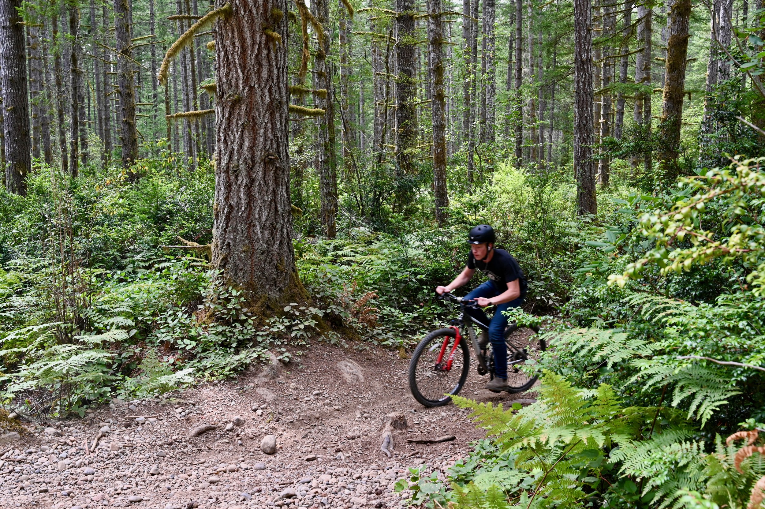
While popular mountain biking trail networks like Seattle, Port Angeles, and the Capital Forest network dot the outskirts, a circumnavigation of the Hood Canal will uncover some local favorites and family-friendly riding.
While popular mountain biking trail networks like Seattle, Port Angeles, and the Capital Forest network dot the outskirts, a circumnavigation of the Hood Canal will uncover some local favorites and family-friendly riding.
These zones can be accessed by day trip from a home-base picturesque cabin rental on the water or through more of a nomadic road trip utilizing campsites as you go. Whatever your style of travel, family needs, or riding goals a fully customizable mountain bike-centric trip can be found here.
While these six areas are predominantly beginner and intermediate trails with the occasionally rowdy advanced downhill track, within an hour from any one spot, there is an abundance of variety in both the trails and scenery.
#1. South Fork Skokomish Trail
The South Fork Skokomish Trail wanders beautifully through old-growth forest as it crosses its namesake river and several streams along the way while climbing gently for the first two miles.

Beyond that, it continues up at a steep grade as the trail rises above the river valley. Another five miles along, the trail ends at the Olympic National Park boundary. This is a great spot to catch your breath before enjoying the exciting downhill that you’ve earned.
The Lower South Fork Skokomish Trail heads nine miles in the opposite direction. This section tends to be less maintained but if you’re up for an adventure it is worth the challenge. The trail takes you through more stunning Olympic National Forest old-growth and roughly a mile in from the northern trail entrance, it fords a river that can only safely be crossed between August and early October. Despite the challenge of added brush and fallen trees, this section of South Fork Skokomish Trail has far less elevation to contend with than the upper and it can be shuttled as it has parking at both ends.
For a list of Lodging in this area, click here.
2. West Shelton

The West Shelton trail network has nine miles of cross-country trails that can be accessed from the heart of Shelton. Nearly all the trails are rated green and while there are a few punchy climbs, there is no sustained elevation for beginner riders to worry about.
Flowy trails like Au Natural, She’s a Pitch, Single Track, and Tie In, tend to have flowy sections, pitchy climbs, and some gentle flats. A few, especially the aptly named Sometimes a River, can turn into small streams after a good rain but generally, this area makes for great year-round riding. To view the network of trails available in Shelton, visit trailforks.com/region/shelton.
Both Union and Shelton would be convenient home bases to explore this trail network.

3. Green Mountain
A 22 mile network of mostly beginner and intermediate multi use trails with a couple of advanced downhill routes in the mix. There are two trails heads, Gold Creek and Wildcat, on opposite sides of the mountain that both lead to the Vista Summit and fun descents. Climbing up the sometimes rocky and loose Wildcat Trail will give you a challenging 1100 feet of gain in 4.5 miles and deliver stunning views of Bremerton and Seattle. On particularly clear days, riders will also be treated to Mt. Rainier and Mt. Adams too. While the trails here are primarily categorized as cross-country, there is quite a bit of variety to be had. Wildcat Trail from the summit is loose and fast with flowy berms and plenty of tech available. For those looking for a long and more challenging climb on an out-and-back that delivers a speedy and fun descent on the return, Gold Creek Trail would be the best choice. But with the same elevation gain of 1100 feet, this time in just over 2 miles, riders need to make sure their legs are ready for the challenge.
Camping in the Tahuya State Forest or staying in one of the many lodging around Belfair would be a great option to make a weekend of exploring these trails.

#4. Forest Heritage Park

Port Gamble Forest Heritage Park offers 33.5 miles of everything from beginner to advanced all-mountain trails. The network is linked by non-motorized use logging roads and includes a range of tech and flow with a little something for everyone. Green rated trails like Outer Limits are easy cross-country trails with just enough variation to be great for teaching new riders. Clear Cut and Twisted Sister are other beginner trails that offer some fun corners and mostly flat terrain to learn on.
Intermediate trails include Ankle Biter, the longest climb or descent in the park depending on your direction; Derailed, a relatively new downhill trail with a few tabletop jumps and optional doubles; The Hood, a flow trail with berms and small optional jumps; and Forbidden Forest, a rooty and technical singletrack route.
Drop Tail is one of the few advanced trails here and is a short track that includes a few drops and bridges. The range for all abilities packed into this trail network is impressive making it an easy crowd-pleaser no matter who you’re traveling with.
#5. Lower Big Quilcene

This intermediate 6.2 miles of lowland forested trail offers a scenic pedal along the Big Quilcene River. Lush moss lines an old roadbed through a young forest before winding through massive old-growth cedars. Blooming rhododendrons add bursts of color to the forest greens in spring and summer. For anyone looking for a light bike-packing adventure, there is an established campsite just under 3 miles from the trailhead right on the banks of the river.
This trail can be ridden as a 12.4-mile out-and-back or a shuttle can be arranged with a pick-up at the FS Road 2750 exit.
For a list of Lodging in this area, click here.
#6. Gold Creek-Dungeness
Just a short drive up the forest service road from the Lower Big Quilcene trail is a huge trail network boasting 43 miles of multi-use trails connected by fire roads.


About the Author
Danielle Baker is a freelance writer from Squamish, BC. Her work can be viewed in FreeHub Magazine, Mountain Life, Red Bull Canada, Eskapee, Rocky Mountain Bicycles, Pinkbike.com, and many others.
Exploring Bayshore Preserve Near Shelton
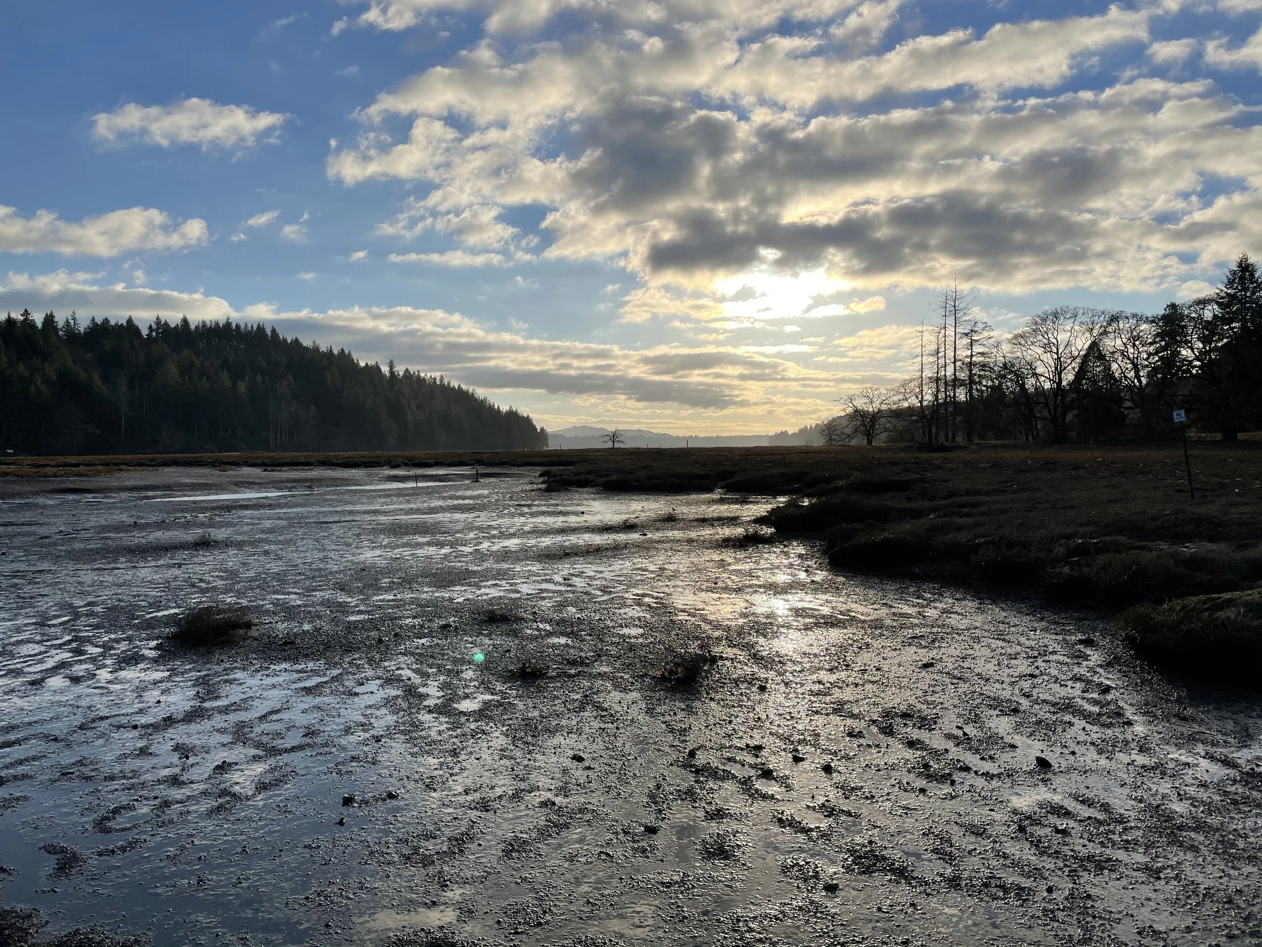
Occupying a peninsula on Oakland Bay at the mouth of Johns Creek, Bayshore Preserve provides exceptional wildlife habitat and several short delightful hiking trails. Once a golf course, this 74-acre parcel has been restored to a natural state on par with the state’s finest natural shoreline preserves.
Craig Romano
Occupying a peninsula on Oakland Bay at the mouth of Johns Creek, Bayshore Preserve provides exceptional wildlife habitat and several short delightful hiking trails. Once a golf course that heavily drew water from the salmon-spawning Johns and leached pesticides and fertilizers into the important shellfish rearing bay; now thanks to the Capitol Land Trust, Squaxin Island Tribe and a handful of other partners, this 74-acre parcel has been restored to a natural state on par with the state’s finest natural shoreline preserves.

Hit the Trail
From the trailhead immediately come to a kiosk with a map displaying the preserve’s interconnected short trails. There are about 1.5 miles of marked well developed paths traversing the property and they can easily be covered shortly in a brisk walk. However, Bayshore, with its salmon-spawning creek, salt marshes and mud flats, bird-flourishing prairie, and more than 4,000 feet of shoreline, calls out to be sauntered.
A quick inspection of the landscape before you reveals a land in flux. One that not too long ago sported well-manicured greenways fed by an irrigation system, a clubhouse and other structures, and a series of service roads. Those roads have since been converted into trails. The buildings have been removed, but a few vestiges of the irrigation system that is slowly being dismantled remain. And the greenways have been restored to native prairie grasses that wave golden in late summer.
Now sans golf clubs, putt along Bayshore’s trails watching for birds instead of scoring birdies. The Bayshore Peninsula located along the narrowest stretch of the slender and shallow Oakland Bay is far more important as wildlife habitat than as an altered manicured landscape for golfing.

The peninsula too is a special place to the Squaxin Island Tribe. It once housed one of their villages and according to several elders and historians, one of the largest longhouses on Puget Sound.
In 2014 the Capitol Land Trust purchased the Bayshore Golf Course and commenced with the Squaxin Island Tribe and other partners to restore this property to a natural state.

Restoring the peninsula was another albeit very important stage in the greater effort currently being employed to protect Oakland Bay—one of the least developed inlets and most important shellfisheries on Puget Sound. Oakland Bay’s preservation is not only important for wildlife, but also for sustaining the area’s fisheries and shellfish beds.
The Main Loop Trail travels triangularly through the property for 0.8 mile. It utilizes some of the old golf course’s service roads. Walk the path through native grasses and along colonnades of gigantic old Douglas firs and Garry (Oregon White) Oaks. The latter, the only native oak to Washington State once flourished in the area’s prairies. Washington’s First Peoples regularly set those prairies on fire to stimulate camas growth and favor other plants like oaks that thrive in savannas and other grassy environments. But as those prairies no longer saw regular burns, were overtaken by developments and invasive and hardier plants, the state’s Garry Oaks have become increasingly rare. These elegant hardwoods provide forage for a myriad of species. Bayshore contains some exceptionally large ones.

As you walk the loop be sure to deviate from it onto numerous spur trails. The 0.2 mile Lookout Trail crosses Johns Creek on a sturdy bridge and proceeds through a nice forest grove before skirting a prairie and ending along the creek bank. It’s an excellent trail to check out in November for its chum run.
The Johns Creek Trail is another fine choice for salmon watching. This path meanders along the edge of a riparian forest for .25 mile to link back up with the main loop.
The Johns Creek Estuary Trail leads a short distance to extensive tidal flats at a small estuary where Johns Creek flows into Oakland Bay. The trail leads to a fishing point on public tidelands.
Bayshore Preserve

Features: exceptional wildlife habitat on Oakland Bay, restored prairie, tall old Garry oaks and Douglas firs,
tidal mud flats, salmon-spawning creek and estuary.
Distance: 1.5 miles of trails
Elevation Gain: minimal; High Point: 40 feet
Difficulty: easy Snow free: year round
Trailhead Pass Needed: None
Notes: Dogs permitted on leash. Please stay on trails and respect all closed areas. Open from dawn to dusk. No removal of plants or fungi from the preserve.
GPS waypoints: Trailhead: N47 14.939 W123 02.655
Fishing Point: N47 14.707 W123 02.513
Contact: Capitol Land Trust, (360) 943-3012
Trail Map and Interpretive Guide available online

Trailhead: From Shelton, travel east on SR 3 for 3.8 miles to trailhead located on your right (directly across road from Bayshore General Store). Parking limited. More parking in adjacent WA Department of Fish and Wildlife’s Oakland Bay Recreational Area (Discover Pass required).
Twanoh State Park Trails -- Day hiking around Alderbrook Resort & Union
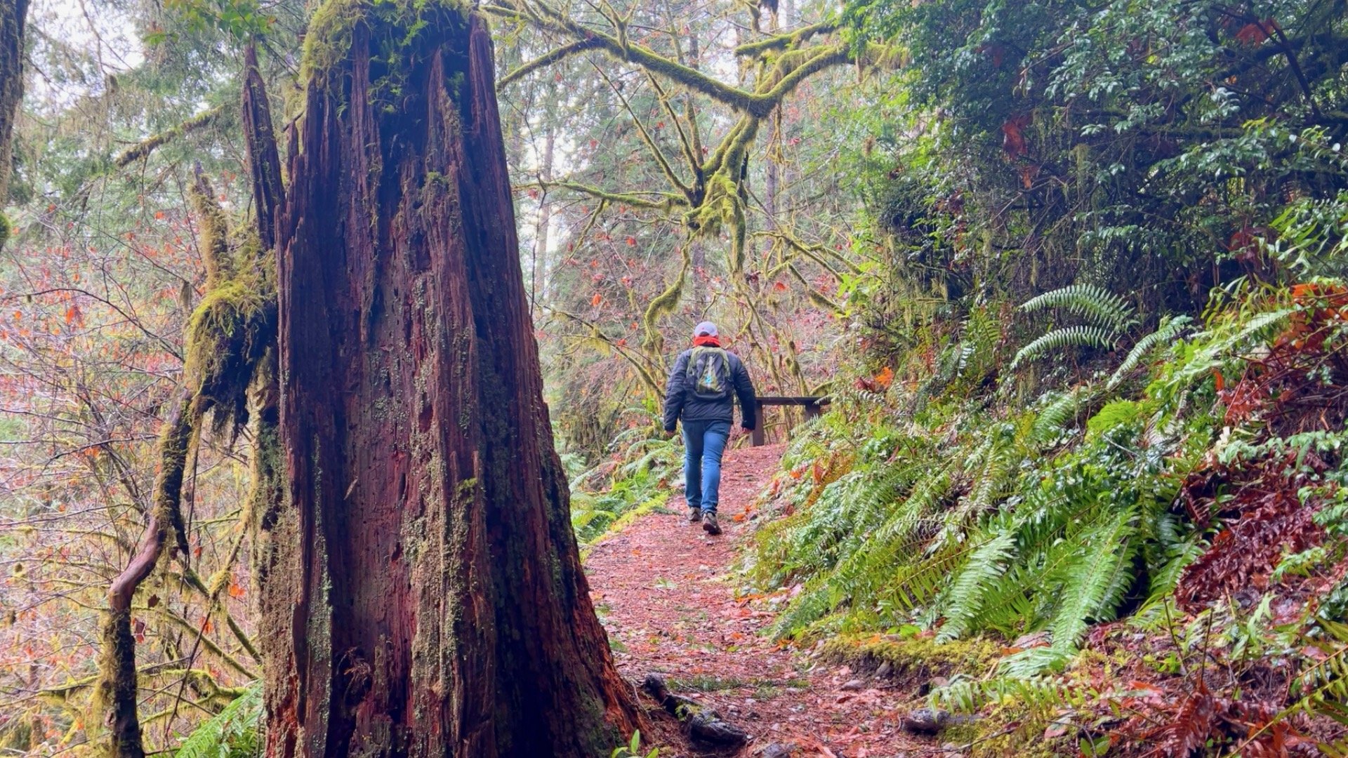
Number #2 on our best hikes around Hood Canal according to Craig Romano is Twanoh State Park’s hiking trails. Famous for its large beach on Hood Canal with some of the warmest salt water in the state, many who flock to this park, go straight to the beach or the campground, leaving the 182-acre park’s hiking trails pretty quiet.

Craig Romano
Famous for its large beach on Hood Canal with some of the warmest salt water in the state, many who flock to this park, go straight to the beach or the campground, leaving the 182-acre park’s hiking trails pretty quiet.
Locate the trailhead and start hiking on a wide trail through a cluster of rhododendrons. The way parallels gurgling Twanoh Creek which forms a small delta on the park’s beach. The trail soon comes to a junction.
Here a side trail crosses the creek on an attractive bridge and reaches the campground—an alternative start if you’re camping in the park.
The main trail continues straight through a tunnel of rhododendrons and a grove of big cedars. It then begins working its way up a small ravine cradling the small creek. While this ravine was logged in the past, the second growth forest here is now quite mature.
At .3 mile come to a junction for the loop.
While you can go either way, head left for a clockwise loop and a gradual ascent and transition out of the ravine. As you ascend out of the tight draw, the salal and evergreen huckleberries thin out.
It’s much drier on the ridge above the ravine. After two switchbacks, the trail reaches the head of the ravine. Now head right following an old woods road.
The walking is easy going. Slowly descending come to a group campsite. Then come to another junction. The old road continues straight leading back to the Day Use Parking Area and can be used as an alternative return.
The loop continues right on a switchback descent back into the ravine. Take it passing by a few big old Douglas firs and clusters of leathery-leaved rhododendrons. Reach the loop junction and head left back to the trailhead—and perhaps a trip to the beach.


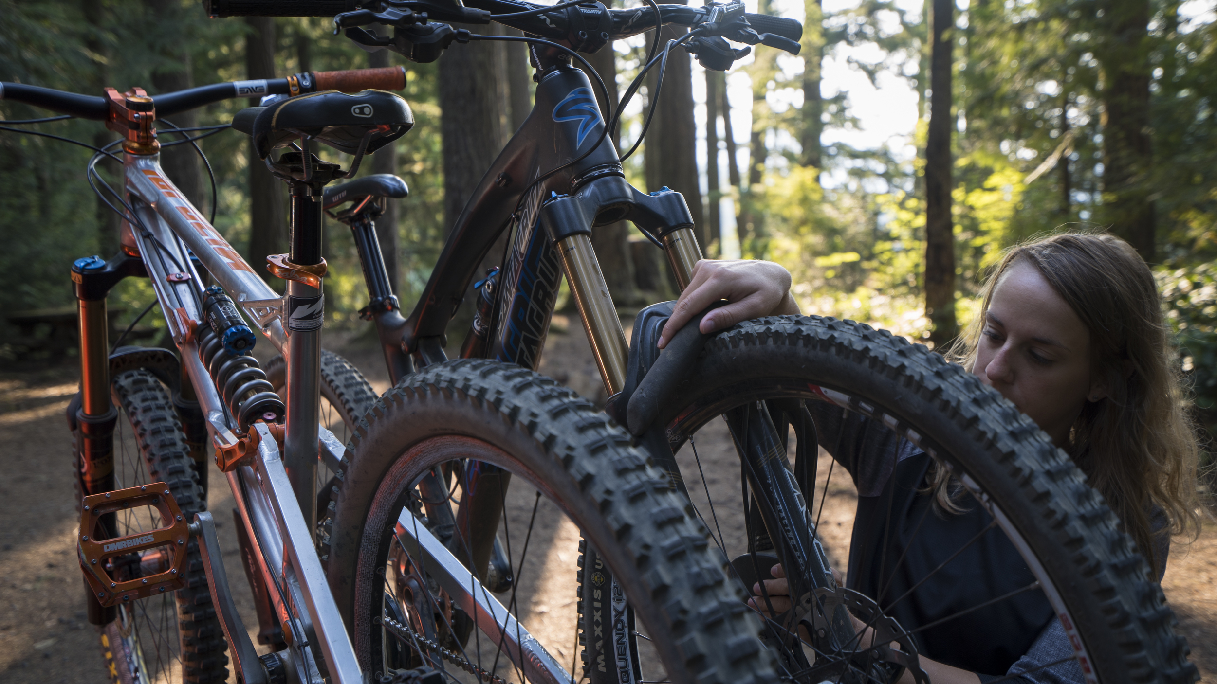
Mountain Biking Lower South Fork Skokomish
The fall colors on Hood Canal are heralding the close of summer. Time to head to the hills to embrace the much needed rains in the Olympic National Park as the hills and valleys go back to the Technicolor spectrum of green.
Whenever the impending rains approach Olympic National Park, they turn our hills and valleys back into the spectrum of green that makes home feel like home.

Photo Credit: Bike List
For some of us, that means misty morning walks up our favorite mountains (like Mt. Ellinor), for others, that means relaxing indoors with a good book, but for those of us that feel best while we are two-wheeling, that means tacky dirt and flowy mountain biking trails!
Grab your elbow pads and helmets, and tune up your metal steeds as we embark on our newest in the Hood Canal Travel guide.
Fuel Your Fire | 9AM
Serious riders (or pure-and-simple fun-seekers like us) need a belly full of goodness to fuel a full day of thrill-seeking. If you’re an early bird and a breakfast fiend, stop into Blondie’s for down home from-scratch diner food. The biscuits and gravy take the cake at this friendly local joint.
Hit the trail | 11AM
After meandering down some forest roads underneath the towering Olympics, come to the Lower South Fork Skokomish River Trail #873. Characterized by its intermediate single track riding through some of the finest ancient forests in the Northwest, this ride serves up a bit of everything. Doable as a 20.9 mile loop, if you care to climb the road and ride trail down although most prefer to ride single track up the trail and then back down.
Olympic elk still roam the hillsides, and as you are slashing short, quick ascents and sending sometimes rocky and rooted descents, take in the uncontested beauty of the river valley sliced by the surging Skokomish River.

"I love this fun, flowy cross-country trail that parallels the South Fork of the Skokomish River. It has a bit of everything!" - Jaime, local bike shredder
Before embarking, be sure to check trail conditions here, and prepare to be without cell service by having a good map and a USFS Rec Guide. Keep in mind that, like most USFS land, a Recreation Pass is required, which you can find here, or at a number of local businesses like Verle’s Sports Center and Marine in Shelton.
Treat yourself to a view | 2pm
Before that plastered grin that characterizes a good ride fades away, get yourself to one of the most recognized historical relics of Hood Canal. From the trailhead, a short 20 minute drive takes you to the High Steel Bridge. The highest railway arch ever built in the United States spans the South Fork of the Skokomish (a river that you are already quite familiar with) a dizzying 365 feet above the forest floor. Originally constructed in 1929 by the Simpson Logging Company, the bridge was converted to road use in 1950.

As you flip through the memories of a day well spent, remember that we love keeping up with you! Tag your photos and thoughts on social media with #explorehoodcanal #wildsideWA #hoodcanal. Be sure to check in with us on Facebook, Twitter, Instagram, and Pinterest for more ideas on how to get the most out of your road trip to Hood Canal. Happy trails.
Daily: 5am-9pm
360.432.2777
Lower South Fork Skokomish River Trail #873
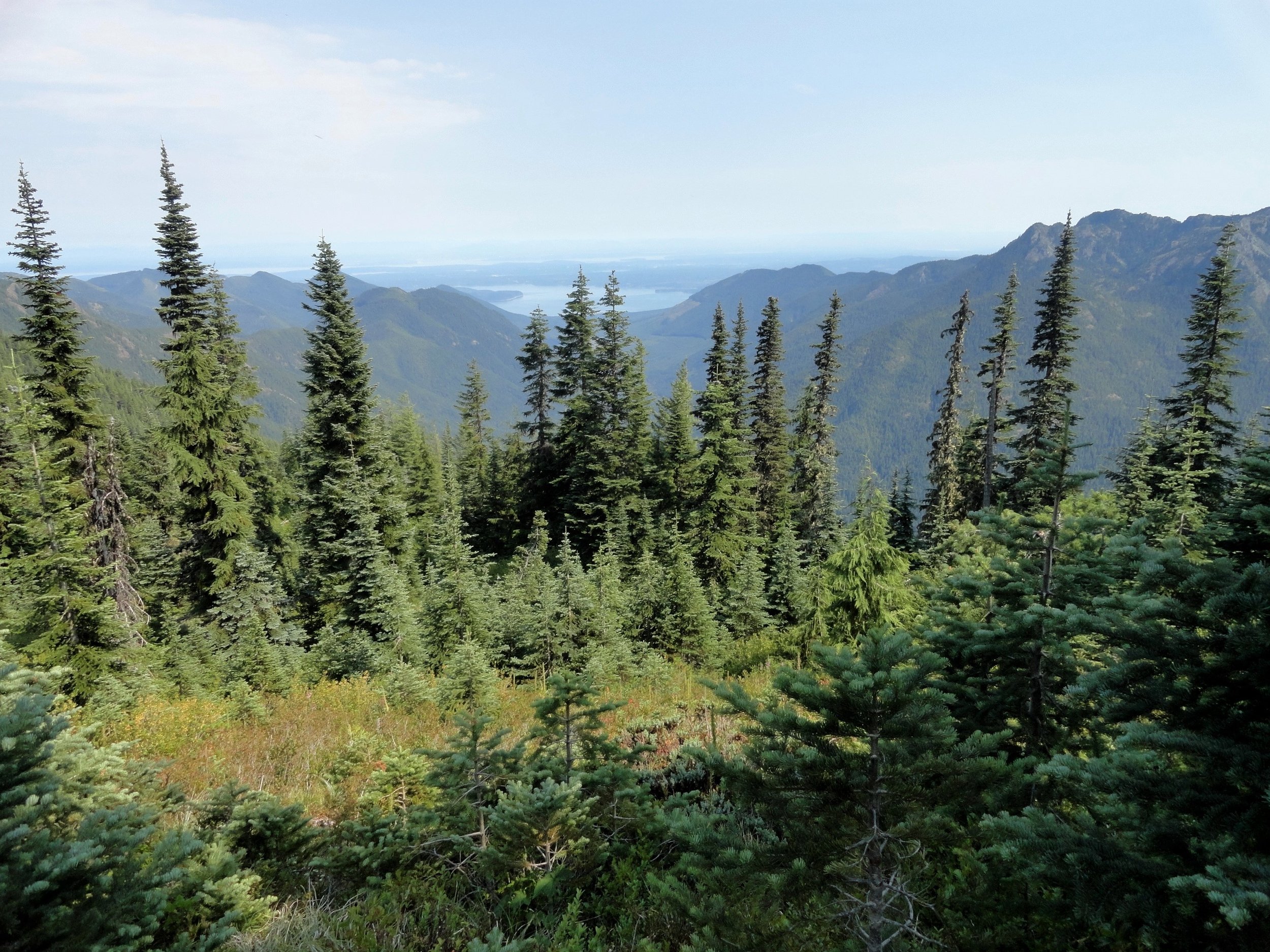
Tunnel Creek Trail Hike
Olympic National Forest’s Tunnel Creek Trail lies just a few miles south of the popular Big Quilcene Trail. But unlike the Big Quil which leads to Marmot Pass, a high windswept wildflower-rich gap providing sweeping views—the Tunnel Creek trail travels mainly beneath a thick canopy of primeval forest.
Craig Romano | author
Olympic National Forest’s Tunnel Creek Trail lies just a few miles south of the popular Big Quilcene Trail. But unlike the Big Quil which leads to Marmot Pass, a high windswept wildflower-rich gap providing sweeping views—the Tunnel Creek trail travels mainly beneath a thick canopy of primeval forest. Lacking the wow factor of Marmot Pass, Tunnel Creek gets passed over by many a hiker. However, those who take to this trail less taken soon discover; Tunnel Creek offers plenty of delightful spots and some pretty decent views as well. And all without the crowds of Marmot Pass.
Hit the Trail

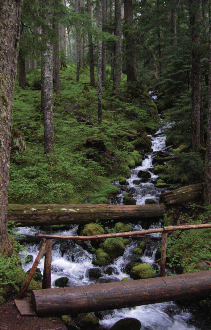
The Tunnel Creek Trail immediately enters the 44,258-acre Buckhorn Wilderness, the largest roadless area in Olympic National Forest. Much of the wilderness lies within the Olympic rain shadow encompassing some of the driest mountainous terrain in the Olympics. But here at the wilderness’s southern reaches, precipitation increases. And it’s noticeable immediately upon starting up the trail. The surroundings are verdant—draped in mosses and lichens. The trees are grand. And the valley is alive with the sound of cascading water.
Work your way up a tight valley following alongside tumbling South Fork Tunnel Creek through a tunnel of towering old-growth western hemlocks and Douglas-fir. The hike is magical, almost ethereal on a misty morning. And it’s welcoming on a sweltering summer day, as the ancient trees do an excellent job of regulating the temperature, providing some much appreciated air-conditioning.
After 3.3 miles and gaining a modest 1500 feet of elevation, reach the still intact Tunnel Creek Shelter. A remnant from when this trail was much longer (before logging and roads obliterated much of it). In the early days of Olympic National Forest and Olympic National Park there were more than 90 trailside shelters in the Olympics. Many were developed through the guidance of Frederick William Cleator, who became one of the nascent US Forest Service’s first recreational specialists. Along with calling for trails, shelters, and fire lookouts, Cleator also advocated for a large portion of the Olympics to be left as wilderness, free from any developments.
The early shelters were meant to help administer the forest by providing rangers, trail workers and foresters a place to overnight while traversing the vast wild lands of the Olympics. But they were also welcomed by the few backpackers who plodded into the Olympic backcountry at the time. Through the years many of the shelters succumbed to fire, collapse and disrepair. And as recreational use increased and attitudes changed regarding land management, many hikers and land managers began to question the role of these structures in the wilderness. Under new directives many of the shelters were allowed to fall in disuse or were intentionally dismantled.
Many recreationists however continued to argue for the need of these shelters to provide emergency cover for backcountry users caught in severe weather. Many other recreationists including this author have argued to maintain the remaining shelters now numbering only around 20 as historically significant and preserve them as historic structures.
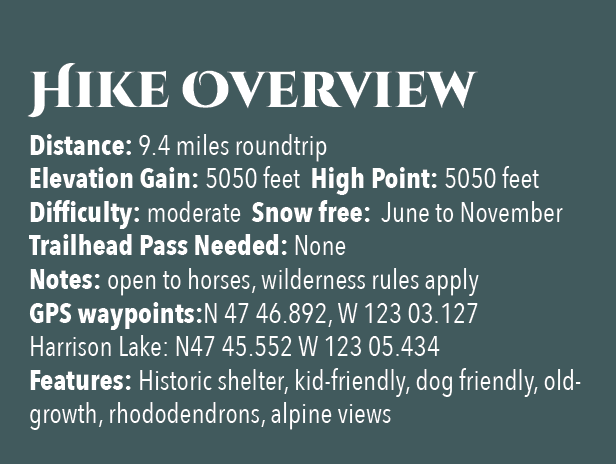
The Tunnel Creek Shelter is one of the last remaining in Olympic National Forest. Perhaps use it for a lunch break. Reflect on its long history and the role it has played providing refuge to many a wanderer on a cold and wet day. And help protect it from misuse. Beyond the shelter, the trail crosses via a log bridge the South Fork of Tunnel Creek and then gets down to business. They way now steadily and steeply climbs out of the valley ascending a thickly forested ridge. Eventually reach a small saddle in the ridge harboring two small bodies of water. The first is a small grassy pond known as Karnes Lake. Just beyond and a little higher up at 4.3 miles from the trailhead and at an elevation of 4300 feet is the more appealing Harrison Lake.
You don’t want to call it quits yet however. Conjure up a little more energy and continue hiking, ascending through open forest and over ledge coming to the 5050-foot ridge crest at 4.7 miles. Now take in an exceptional view of 7,743-foot (third highest peak in the Olympics) Mount Constance’s impressive sheer vertical east face.
You can scramble along the rocky ridge a little higher to better appreciate Constance’s towering presence, less than two miles away to the northwest.
For most hikers this is the turning around spot. But the trail continues from here making an insanely steep drop of more than 4300 feet in 3.6 miles to the Dosewallips River Road. It’s brushy in spots and easy to lose along the ridge. Otherwise it’s in decent shape down steep slopes and through old growth and past a small waterfall at Gamm Creek.
f you can arrange a car shuttle consider hiking out this route. There are some good views down to the Dosewallips River valley and out to Hood Canal during the initial descent if you want to just wander a little way down the trail. Otherwise start heading back to the cool forests of South Fork Tunnel Creek on the much more agreeable trail back to your start.
The details
Land Agency Contact: Olympic National Forest, Hood Canal Ranger District, Quilcene, (360) 765-2200,fs.usda.gov/olympic
Recommended Guidebook: Day Hiking Olympic Peninsula 2nd edition (Romano, Mountaineers Books)
Trailhead directions: From Shelton follow US 101 north for 50.5 miles. (From Quilcene, drive US 101 south for 1.5 miles). Turn left (west) onto Penny Creek Rd. After 1.5 miles bear left onto Big Quilcene River Rd (Forest Rd 27); which eventually becomes paved. At 3.0 miles bear left onto graveled FR 2740 and follow for 6.9 miles
Satsop Lakes via Church Creek
This moderately difficult dog friendly trail offers magnificent old-growth forest, a wildlife rich backcountry lake, and fantastic opportunities for solitude.
Craig Romano | story & pictures
Named not for a house of worship but after Frederic Church, a member of Colonel O’Neil’s 1890 Exploratory Trip across the Olympics; never-the-less this trail is sure to touch your soul. The path winds through an ancient forest of towering cathedral trees where gaps in the lofty canopy shine beams of ethereal sunlight upon the forest floor. And while the forest is heavenly, the way is rough in spots and involves some decent climbing. But your toil will be redeemed upon reaching the Satsop Lakes in a tranquil verdant basin that teems with wildlife.
Features: Dog friendly, magnificent old-growth forest, wildlife rich backcountry lake, and fantastic opportunity for solitude.

Craig Romano photo
Hit the Trail
Like many trails in the southern flanks of the Olympic National Forest, the Church Creek Trail was once much longer than its current 3.5 mile length. It once extended all the way from the South Fork of the Skokomish River to the Wynoochie River. But the Forest Service accelerated logging in this region after World War II with little regard to preserving many of the historic and scenic trails that traversed this lugged landscape.
By the 1990s however due to pressure from conservationists, and concerned citizens and elected officials, the Forest Service shifted its timber harvesting management objectives to protect old-growth forests. Tens of thousands of acres of the primeval forest that shrouded the rugged valleys and mountains of the southern flanks of the Olympic Mountains however had been cut down. But fortunately large pockets still remained including along that 3.5 mile stretch of the Church Creek Trail. But due to budget cuts, the Forest Service abandoned the trail in the early 1990s.
In 2005 the Church Creek Trail was resurrected thanks to the Olympia Mountaineers. They adopted it; restoring it to a top-notch trail. The trail makes for an excellent alternative to the busier trails in the North Fork Skokomish River Valley. And while the Satsop Lakes make for a lovely destination, it’s the forest along this hike that is the prime attraction.
Towering Douglas-firs reaching dizzying heights and wide-girth cedars and hemlocks hundreds of years old line the trail from end to end.

From an unimposing trailhead, start hiking immediately entering a cathedral forest of buttressed cedars and spires of firs. | Craig Romano photo
From an unimposing trailhead, start hiking immediately entering a cathedral forest of buttressed cedars and spires of firs. Cascading Church Creek, audible but not visible, adds a soothing aria to this sanctuary. The creek and a nearby peak were named in honor of Frederic Church of the 1890 O’Neil Expedition. Lieutenant O’Neil and his men explored large portions of the Olympic interior from east to west.
Along his three month cross Peninsula trek he sent out smaller parties to explore and map watersheds. Church was among these explorers.

Lieutenant Joseph P. O'Neil (1862-1938), Courtesy Robert B. Hitchman
The O’Neil Expedition’s findings were invaluable. They mapped, explored and collected specimens from at the time was one of the last major mountain ranges in the Continental United States that had not been explored by Non-native peoples. One of O’Neil’s most important revelations was summed up in his report to the 54th US Congress. He wrote, "I would state that while the country on the outer slope of these mountains is valuable, the interior is useless for all practical purposes. It would, however, serve admirably for a national park. There are numerous elk—that noble animal so fast disappearing from this country—that should be protected.” O’Neil’s recommendations would later lead to the establishment of Olympic National Park.
The trail winds and climbs under a lofty canopy supported by gigantic beams. Hopefully your attention will be diverted upward by staring at these amazing old-growth giants; helping to take your mind off of the stiff climb. The way utilizes a series of switchbacks and comes close to Church Creek on several occasions. But the plummeting waterway remains hidden in a deep lush ravine.
The forest understory is thick and verdant and also commands your attention. In early summer, fawn lilies, calypso orchids, and marsh marigolds add additional colors to this emerald world. Return later in August to harvest some sweet rewards in the form of succulent huckleberries.
The trail crosses several small creeks and after about 1.5 miles it reaches a decommissioned road. This entire basin was once slated for the mills. The forest now remains as it did when O’Neil’s group passed by more than 130 years ago. Turn right and follow the old road bed for about 500 feet before picking up the trail again. Then through a more open forest continue climbing, reaching the 3,150 foot divide between the South Fork Skokomish and Satsop Rivers within another half mile. A humongous hemlock with two pistol-butted limbs stands sentry at the divide.
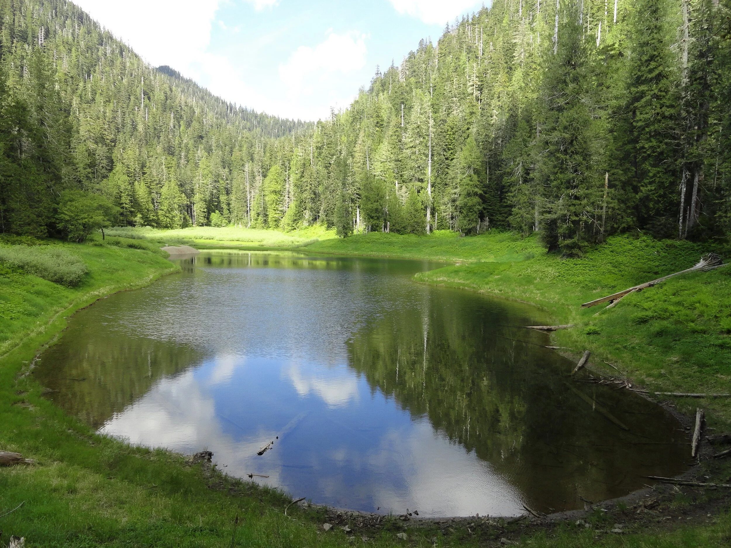
Now continue hiking through a forest of silver fir, and begin rapidly descending. Pass a pretty cascade fanning into a steep ravine. Giant cedars and Doug-firs are once again encountered as the trail levels out. In 3.2 miles and after losing 1,000 feet of elevation emerge in a grassy opening housing the largest of the five Satsop Lakes. Locate a gravel outwash area which provides for an excellent resting spot. Keep your eyes on the lake for trout and surfacing rough skinned newts. The lake is home to thousands of the latter. Look too along the forest’s edges for bigger critters.

Craig Romano photo
Roam around the lake and notice there is no outlet. Water seeps to the Satsop River via a cavernous basalt basin. Four other lakes are hidden in the surrounding forest if you feel inclined to find them. But while the distance to reach them may not be great, the terrain can be challenging. The trail continues for another .3 mile through more groves of giant trees ending at Forest Road 2372. Yes, you can reach the lakes via a much shorter hike if they are your sole intent. But you’d miss most of the grand forest. But now you get to traverse it one more time as you make the journey back to your vehicle.
Trails notes:
Land Agency Contact: Olympic National Forest, Hood Canal Ranger District, Quilcene, fs.usda.gov/olympic
Distance: 6.4 miles roundtrip
Elevation Gain: 2,350 feet
High Point: 3,150 feet
Difficulty: moderately difficult
Snow free: June--Oct
Trailhead Pass Needed: None
Notes: FR 2361 is gated and closed from October 1 to April 30 to protect wildlife. You can walk or bike the road (adding 11.2 miles roundtrip) during this time to reach the trailhead.
GPS waypoints: Trailhead: N 47 26.928 W 123 29.437; Satsop Lakes N 47 25.818 W 123 30.851
Recommended Guidebooks: Day Hiking Olympic Peninsula 2nd edition (Romano, Mountaineers Books)
Trailhead directions: From Shelton, travel north on US 101 for 7 miles turning left at milepost 340 onto the Skokomish Valley Road (signed Skokomish Recreation Area). Follow this paved road for 5.6 miles bearing right at a V-intersection onto Forest Road 23. Continue for 9.3 miles bearing left at a Y-junction with FR 2353. Continue on FR 23 (pavement ends) for 4.3 miles. Then bear right onto FR 2361 and follow for 3.4 miles. Next turn left onto FR 2361-600 (if you crossed Church Creek you’ve gone too far) and drive 2.2 miles to a hairpin turn. The trailhead is located on your right.
Ranger Hole
The deep forests, wild rivers, and forbidding mountains of the Olympic Peninsula harbor many secrets. And outdoors people of all ages and abilities are often drawn to trying to unlock their mysteries. But when it comes to legendary fishing holes, don’t even think about asking fishermen and fisherwomen to reveal their coveted spots. One luring spot of lore however, the Ranger Hole, is no secret at all. It can reached by a short and delightful trail. And best of all, while it’s no secret, it’s often overlooked by many hikers. So a little peace and solitude is possible on this trail.
Craig Romano | author
The deep forests, wild rivers, and forbidding mountains of the Olympic Peninsula harbor many secrets. And outdoorspeople of all ages and abilities are often drawn to trying to unlock their mysteries. But when it comes to legendary fishing holes, don’t even think about asking fishermen and fisherwomen to reveal their coveted spots. One luring spot of lore however, the Ranger Hole, is no secret at all. It can reached by a short and delightful trail. And best of all, while it’s no secret, it’s often overlooked by many hikers. So a little peace and solitude is possible on this trail.
Hit the Trail
Upon arriving at the trailhead located near at the Interrorem Cabin, you’ll immediately be taken back to the early days of the Olympic National Forest. Before heading out for the famed Ranger Hole, take a little stroll back in time on the Interrorem Nature Trail to get a better appreciation for this area. The trail makes a 0.3 mile loop behind the cabin and it’s wheelchair accessible.


The simple, rustic, but elegant Interrorem Cabin was built in 1907 by Hoodsport pioneer Emery J. Finch as the first administrative site of the newly established Olympic National Forest (which at the time included what would become the Olympic National Park in 1938). Finch an assistant forest ranger with the Olympic National Reserve (which would be reorganized as a national forest) was chosen to build the cabin and administer the new national forest from it. Upon building the structure he moved his newlywed wife Mabel in with him in the spring of 1908. The building was knowns as “No. 27 Interrorem Administrative Site,” as it was intended to be a temporary structure.
What proved to be temporary however, was Finch, as he resigned in 1910. The Interrorem Ranger Station however continued to serve as the main administrative building for the Olympic National Forest and the newly created Mount Olympus National Monument (which later became Olympic National Park) until 1933. Look at that little and snug structure which consists of three rooms: an office, bedroom and kitchen. Now try to imagine that it served as the main administrative office for a public land area of more than 1.5 million acres!
Eventually new and larger ranger stations were built. The Interrorem Ranger Station became known as the Interrorem Guard Station and served as a basecamp for the Depression era Works Progress Administration (WPA) and the Civilian Conservation Corp (CCC). A CCC camp was also established on the grounds near the cabin. After Congress closed the CCC in 1942, the cabin continued to be in use, serving as a fireguard station all the way until 1986. After that time it began to fall in disrepair, but thankfully it was restored. In 1994 the cabin became available to the public for overnight rentals. In 2013 it was rightfully added to the National Register of Historic Places as the oldest Forest Service building in Olympic National Forest and among the oldest in the Pacific Northwest.

As you walk the Interrorem Nature Trail try to envision the area more than a century ago. Next to the cabin once stood a barn, corral, and woodshed. Big moss-draped second growth firs, cedars, and hemlocks have replaced the pasture that Finch’s horse grazed upon. Upon completing this loop, set out on the adjoining Ranger Hole Trail.
Ranger Finch was an avid fisherman. He was responsible for building the Ranger Hole Trail, a path to his favorite fishing hole on the Duckabush River. Head down the trail through mature second growth. The way climbs a little hump before making a gradual descent toward the river. While the surrounding forest can be dark at times, come spring hundreds of trilliums line the way adding whites, pinks, and purples to the emerald landscape.

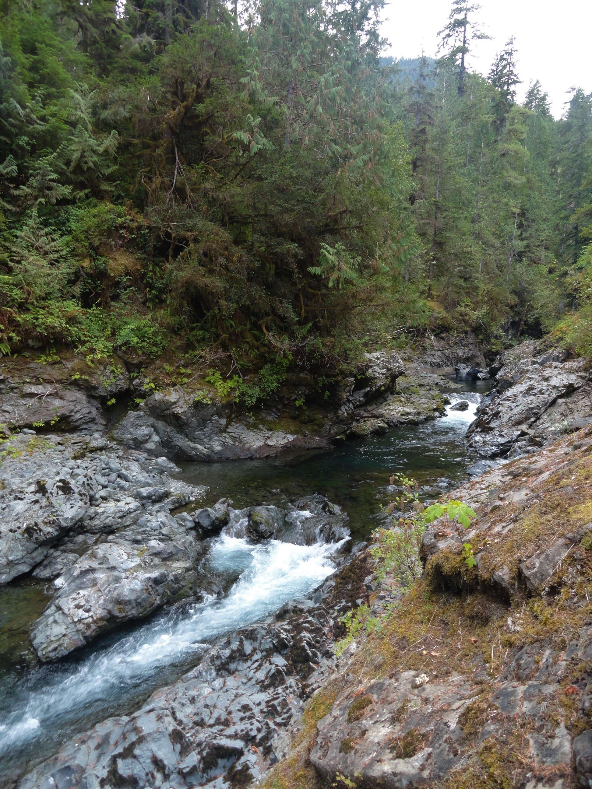
Soon the Duckabush River’s roar becomes more audible. During the wetter months it is quite loud. You are almost there. The trail makes a short steep drop and emerges along the banks of the Duckabush. A short distance beyond reach the famed fishing spot. Here the river crashes and thunders through a narrow rocky chasm to a deep pool. Frothy gurgling waters crash up against the narrow cleft. Be sure to keep children and dogs nearby while admiring this landmark. When the sun is shining, its ray reach this spot, providing a little warmth and light and providing a nice contrast to the dark and damp surrounding forest.
Chinook salmon, chum salmon, pink salmon, coho salmon, and steelhead trout still ply the Duckabush’s waters. And while their numbers are a fraction of what they were back in Finch’s time, fishing (be sure to check regulations and seasons) is still allowed and can be good on the Duckabush. And perhaps you have a favorite fishing hole on this river or another in the national forest. A secret spot you don’t have to reveal to anyone!

Ranger Hole
Features: Historic Ranger Station, Kid-friendly, dog-friendly, Duckabush River Access, spring woodland wildflowers
Distance: 1.9 miles roundtrip
Elevation Gain: 250 feet
High Point: 320 feet
Difficulty: easy
Snow free: year round
Trailhead Pass Needed: Northwest Forest Pass or Interagency Pass required
Notes: Please respect the privacy of any guests staying at the Interrorem Cabin
GPS waypoints: Trailhead: N47 40.882 W122 59.670; Ranger Hole: N47 40.499 W122 59.830
Land Agency Contact: Olympic National Forest, Hood Canal Ranger District, Quilcene, (360) 765-2200, http://www.fs.usda.gov/olympic; and Olympic National Park, Wilderness Information Center, (360) 565-3100, www.nps.gov/olym
Recommended Guidebook: Day Hiking Olympic Peninsula 2nd edition (Romano, Mountaineers Books)
Trailhead directions: From Shelton, drive north on US 101 for 37 miles turning left at Milepost 310 onto the Duckabush Road (From Quilcene, drive south on US 101 for 15.5 miles turning right onto the Duckabush Road). Then drive 3.6 miles to the trailhead at the Interrorem Cabin.
Trailhead facilities: privy, water (seasonal)
Troll hunting on Olympic's Staircase trail
Mary and Jill set out on a day adventure at Olympic National Park’s Staircase Entrance above Lake Cushman. Here’s a glimpse of their trek as they were inspired to search for a river troll.

Guest Post: Mary Thygeson
“The weather has been so beautiful that I decided to head out without my fearless leader, Jeff Slakey. My friend Jill and I headed to Staircase for a hike.“
The ride from Olympia to the Olympic National Park Staircase Entrance above Lake Cushman was easy and well-marked and we arrived in a little over an hour. Once there, there were several options, but we chose the shortest, the Rapids Bridge Loop.


An ear to the ground.
As we began our walk, we noticed right away that someone was listening and probably watching so the quest was on to find a River Troll.
The trail itself was easy and followed along the river. Flat in most places with a few rock and man-made stairs.

As well as a few surprises here and there…
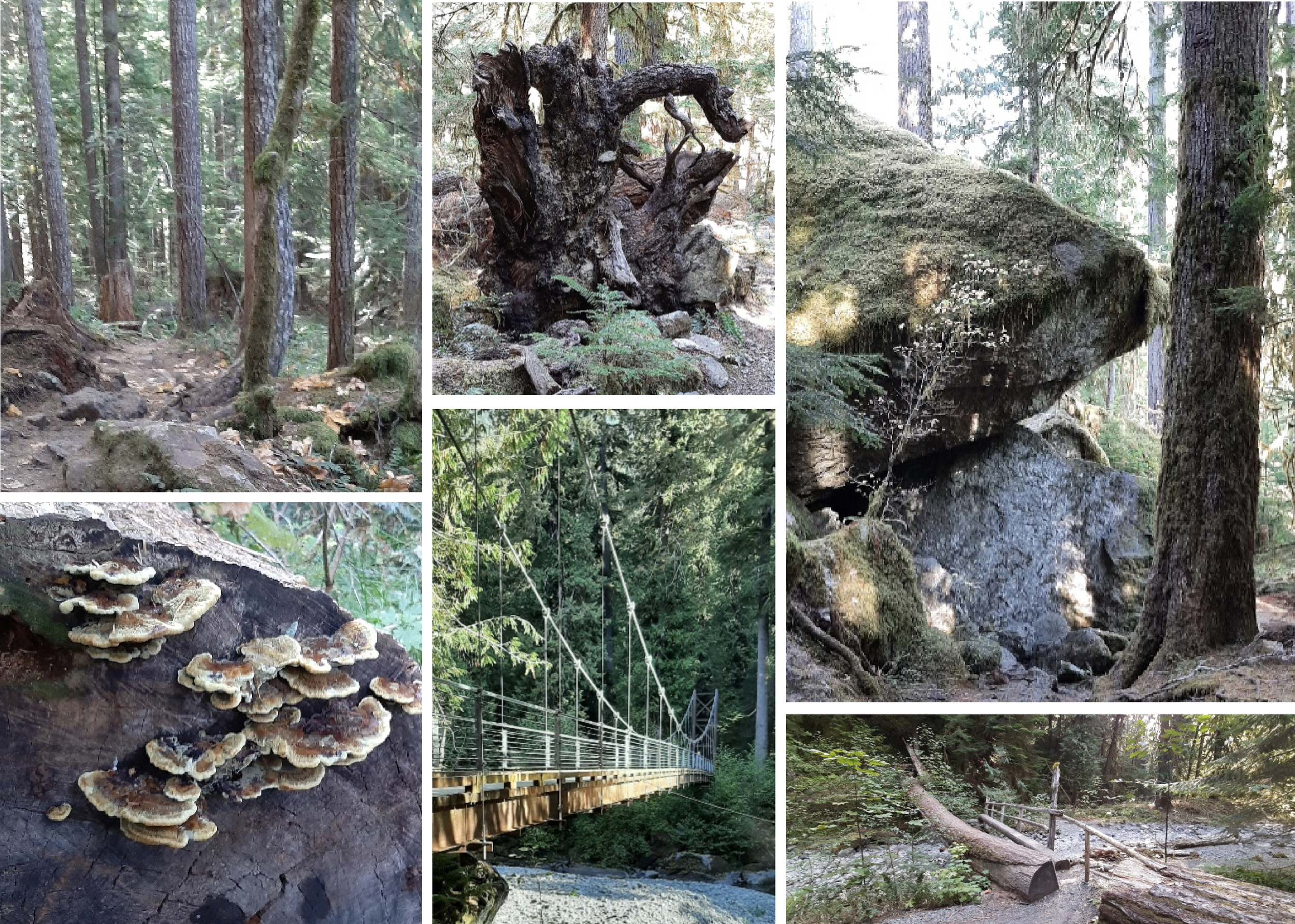
The river is low this time of year, but it revealed some beautiful rock formations.

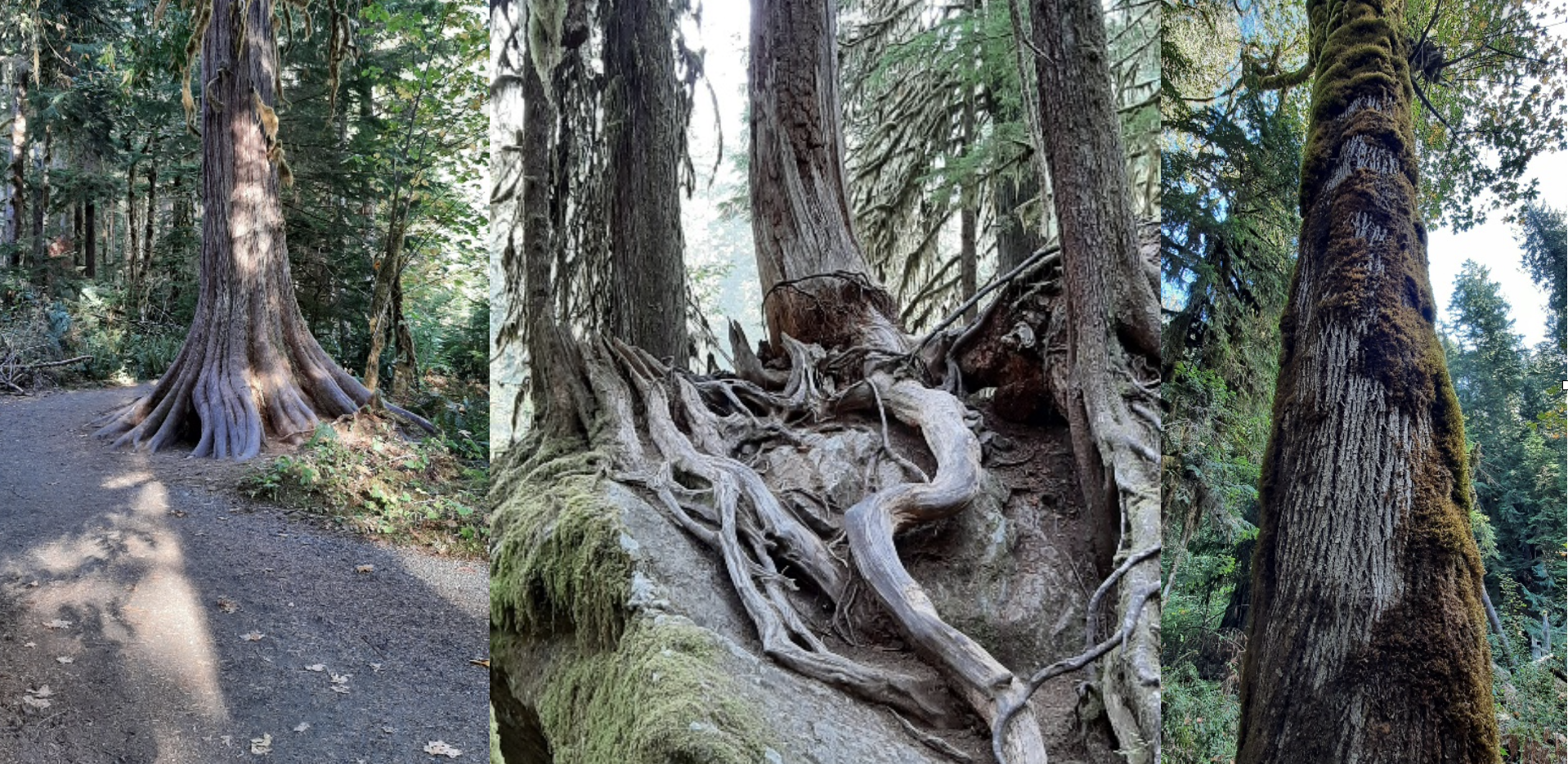
The trees were fascinating as well. Fun to find faces in the bark – but no troll yet!

The whole loop took us a little longer than advertised, but with stopping for pictures and troll hunting it took us about and hour and half. So much to see in such a short and easy hike and well worth it on a beautiful Fall day.
We will definitely be going back in the Spring to see the changes!
But wait… we finally found two shaggy-haired trolls. Can you see them too?

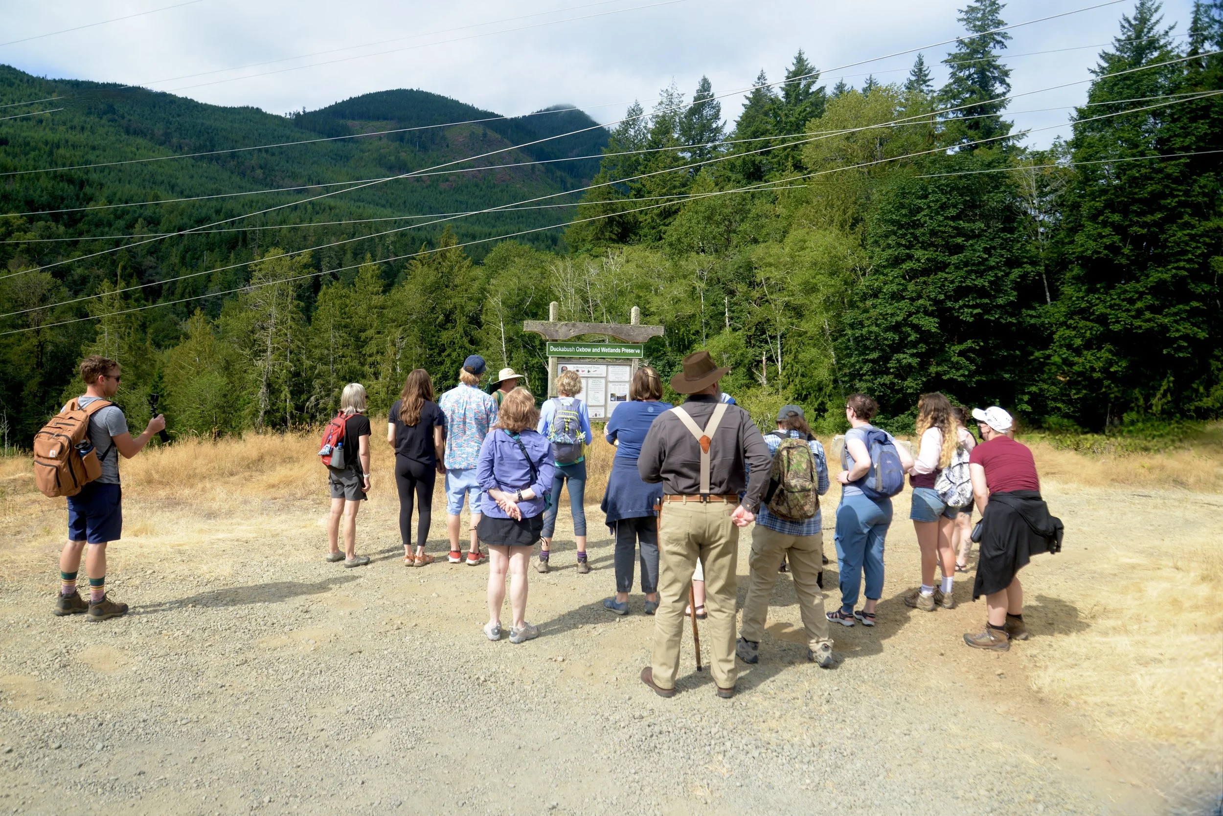
Nature Tour on a Duckabush Trail
If you live in the Pacific Northwest you've probably entertained the fleeting dream of "living off the land." Last August our team was invited to attend Hood Canal Adventures' "Wild Edible & Medicinal Plants, Lichen and Fungi of the PNW" tour. The experience reignites the desire to learn more about foraging in the Pacific Northwest.
If you live in the Pacific Northwest you've probably entertained the fleeting dream of "living off the land." Last August Tracing the Fjord was invited to attend Hood Canal Adventures' "Wild Edible & Medicinal Plants, Lichen and Fungi of the PNW" tour. The experience reignites the desire to learn more about foraging in the Pacific Northwest.
The group gathered at the Hood Canal Adventure's Base Camp office located in Brinnon. Here we were met by owner and resident biologist, Christina Maloney. Christina also operates a successful kayaking rental and tour operation at the nearby Yelvik beach. In the last few years she has expanded the company's profile to include education marine and forest tours. Christina works with local naturalists and guides to lead her tours. Today our guide was herpetologist and professional forager, Jerry Novak. Growing up in southern California, Jerry cemented his fascination with edible and medicinal plants and fungi working Washington Department of Fish & Wildlife as a steward at an amphibian sanctuary near the Columbia River. The days connecting with the land fueled his infectious curiosity which is clearly a mantra of his current foraging tours.
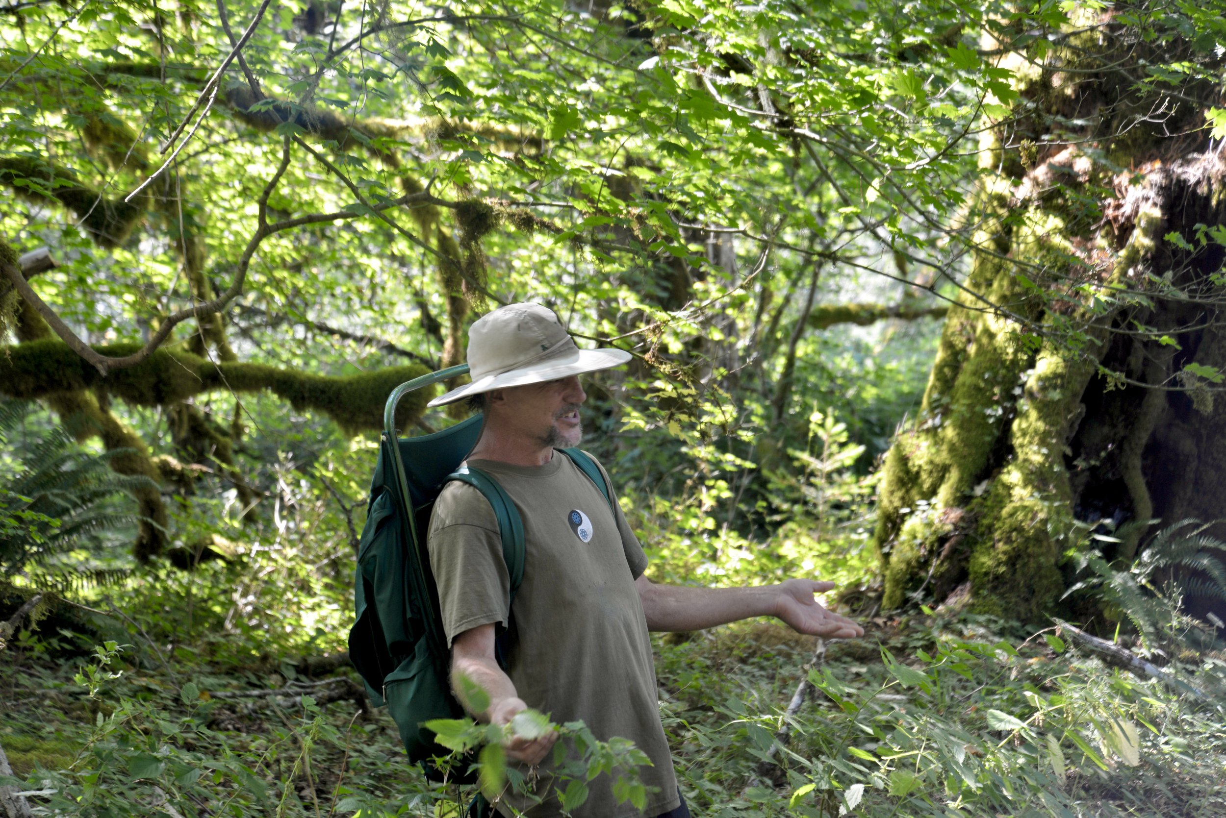
From the moment he pulled up in the dusty passenger van the tone was set with energy and anticipation.
After loading up (some participants chose the option to drive their own vehicles to the trailhead) Jerry drove us the 15-20 minutes to a Jefferson Land Trust preserve located on the Duckabush River. Literally under the power lines, we piled out in the hot August sun and surveyed the seemingly uninteresting logging slash around us.
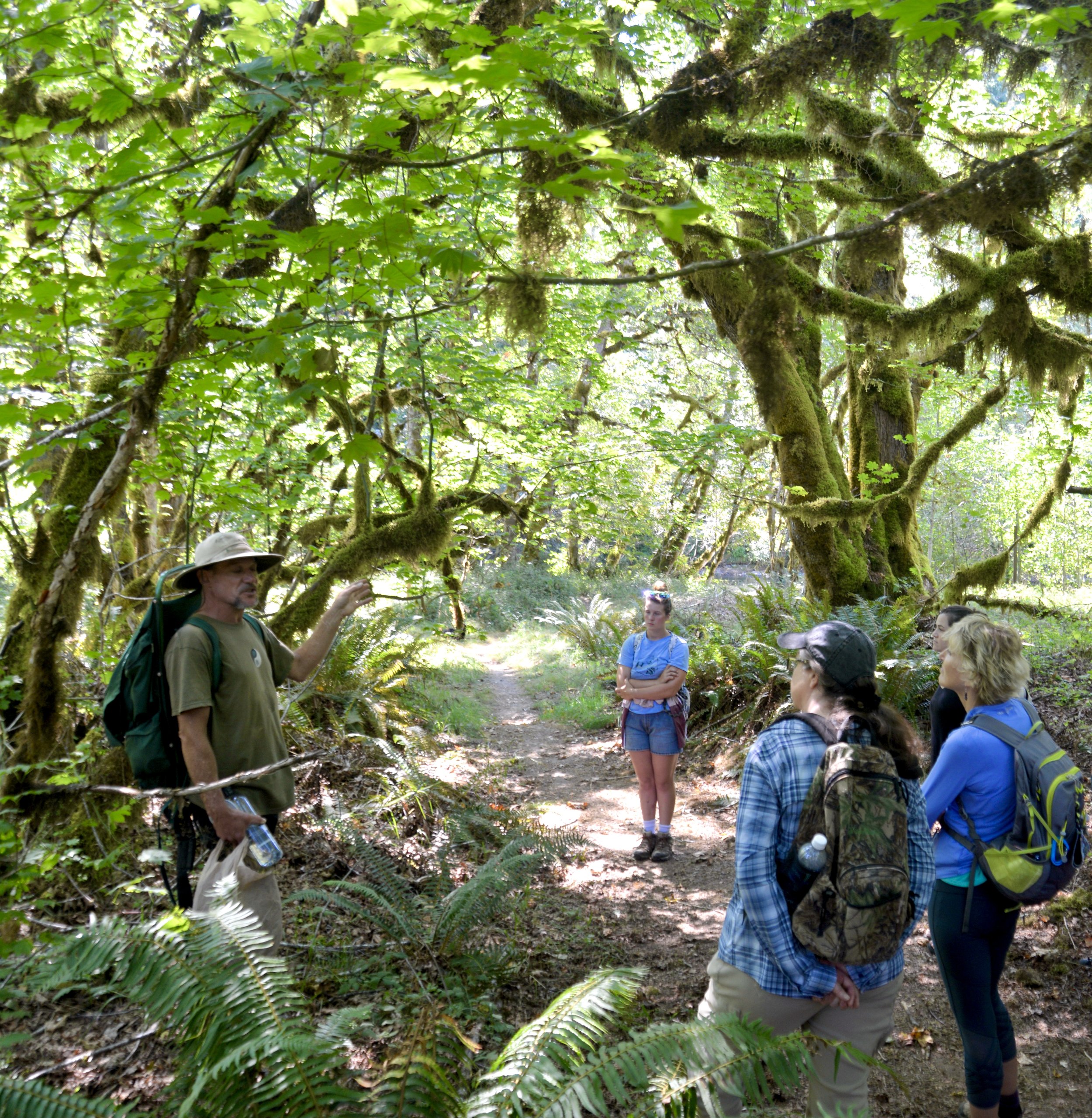
The unseen quickly became seen. Jerry reached down and grabbed a handful of dusty weeds with a head of purple flowers intertwined in the blackberry vines. His first plant was one that I had often overlooked as they are an ubiquitous on the forest floor. But never had I understood their varied healing properties. Some of which, Novak claimed, rivaled those bought over the counter.
Jerry shared the historical lore of each plant and his own personal experiences using the plants for their early medicinal uses.

He expressed a disregard for writers who reported on the benefits of flora without actually testing the methods themselves.
The tour descended into a sun dappled shady giant maple glen near the Skokomish River. Here we explored different fungi and trees and even sunk our teeth into a rhizome of licorice fern.
Despite it being mid-August and most of the plants past their prime and fungi still hidden beneath the soil, everywhere our guide stood, whether it be in an elk-trodden meadow or near the bank of the Duckabush River, there were countless opportunities to bring the "goodness" from the earth. You could do this walk anytime of the year and it would be an utterly different experience as the season changed.
As for poisonous plants and berries, he had some advice. "If they are too easy, don't eat them." Often times the plants that have no natural protection like thorns or "stings" are actually poisonous. I mulled over this later and could think of lots of plants that this rule doesn't apply to – like Huckle or Thimble berries for example, but unless you are sure, this is a good rule to adhere to. Nighshade and Snowberry (Ghostberry) definitely fit the definition.

The tour concluded with picnic lunch on the beach at the Duckabush River while Jerry prepared a hot wild foraged tea for the participants.
Hood Canal Adventures Fall Foraging & Fungi Tour Schedule:
Contact Christina directly, 360-301-6310, to reserve your spot or visit hoodcanaladventures.com to book online. Cost is $59/69 per person.
Mushrooms of the Olympic Peninsula - Walking Tour
September 24, 25 & 30; October 2, 7, 9, 14-16, 21- 23, 28- 30; November 4, 6, 11-13, 18-20, 26-27; December 2- 4
Edible & Medicinal Plant, Lichen & Fungi - Walking Tour
October 1; November 5
Mushrooms of the Olympic Peninsula - Walking Tour followed by Lecture with foraging author Langon Cook (sponsored by Jefferson County Libraries)
October 8:
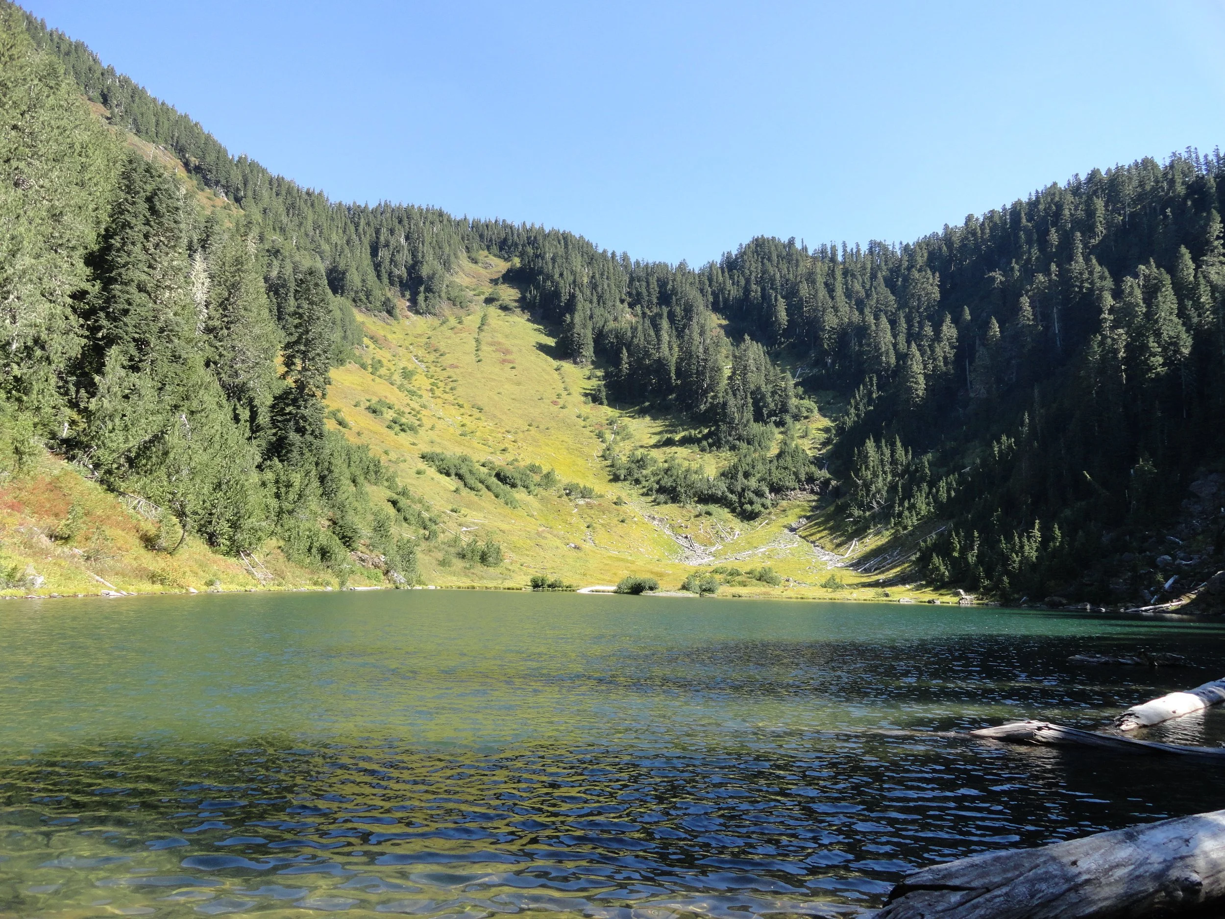
Lake Sundown
There are four ways to reach Lake Sundown, a pretty little body of water in the rugged and isolated southwestern corner of Olympic National Park. All of these routes are difficult and each contains their own charms and challenges. The route via the South Fork Skokomish River Valley includes miles of primeval cathedral forest along a wilderness waterway and an ascent of a 4,125-foot pass offering sweeping views of this wild landscape. If the trek to the lake is too daunting, a stroll just through the groves of ancient trees will provide a satisfying hike.
Pictures & Story by Craig Romano
There are four ways to reach Lake Sundown, a pretty little body of water in the rugged and isolated southwestern corner of Olympic National Park. All of these routes are difficult and each contains their own charms and challenges. The route via the South Fork Skokomish River Valley includes miles of primeval cathedral forest along a wilderness waterway and an ascent of a 4,125-foot pass offering sweeping views of this wild landscape. If the trek to the lake is too daunting, a stroll just through the groves of ancient trees will provide a satisfying hike.

Hit the Trail
Lake Sundown is one of the few backcountry lakes in the southern Olympic Mountains. Remote and difficult to get to, it’s also lightly visited. The shortest approach is via rugged Wynoochee Pass. The easiest (but not easy) approach is via Graves Creek requiring a long drive to the trailhead in the Quinault River Valley.
The approach via Six Ridge is the longest and most difficult, but also stunning when it comes to scenery and a wilderness experience.
The approach described here via the South Fork Skokomish River is challenging but includes varied terrain, excellent views, and an easier to access trailhead from Hood Canal.
While strong hikers can do this hike out and back in a day, it’s ideal for a one night backpack trip. Be sure to secure an Olympic National Park wilderness camping permit before heading out—unless you plan on camping in the national forest before reaching the park. There are two creek fords on this hike which can only safely be done in late summer and early fall. During this period the crossings are not much more than ankle deep. And finally, while the lake and its surrounding high country generally remain snow free through October, FR 2361 is gated on October 1st. So if you plan on doing this hike during October you’ll need to walk an additional 5.1 miles each way or mountain bike to the trailhead.

From the trailhead, head north on the Upper South Fork Skokomish River following an old roadbed. Soon reach the old trailhead and continue on single track coming to a narrow shelf. Carefully wander to the edge of the trail and stare straight down at the South Fork careening through a tight chasm.

At a little past a mile, cross Rule Creek on a big log bridge. Shortly after come to your first crossing of the South Fork Skokomish River. Fortunately a large fallen cedar can be used here to cross the river. Now climb above the wild waterway weaving through groves of primordial giants that’ll have you staring up to the lofty forest canopy. Conservationists were disheartened when this incredible tract of old-growth forest (one of the largest remaining expanses of old growth forest in the southern reaches of the Olympic National Park) was excluded from the 1984 Washington State Wilderness Act.

Continue hiking, crossing copious side creeks before coming to camps and the second crossing of the South Fork Skokomish River. By late summer the ford here is usually a mere rock hop. But if it looks tricky, this is a great turning around spot for a nice 5.2 mile hike. Otherwise carry on and upon reaching the far bank of the river, continue up the valley through mossy flats alongside the river bed—but not always along the river as sections of it often flow underground late in the season.
The trail eventually pulls away from the river and begins climbing. And what had so far been a fairly easy hike begins to get tougher.
At 4.4 miles reach Startup Creek which can be tricky to cross early in the summer. Now prepare to start climbing reaching the Olympic National Park boundary (dogs prohibited beyond) just past 5.0 miles. The trail soon afterward traverses a couple of wet meadows that showcase a myriad of flowers early in the season. Tread is absent here and navigating can be tricky. Angle to the northwest where good tread can be found again at forest edge. Don’t be led astray by elk trails. And do stay alert for these large members of the deer family. A large herd calls this valley home.
Continue deeper into the wilderness. After crossing a small creek, the trail steeply climbs reaching a small open basin graced with wildflowers in early summer and sparkling tarns providing the headwaters of the South Fork Skokomish River. Now reenter forest and steeply climb once more reaching forested 4,124-foot Sundown Pass. A short descent awaits you next through meadows providing good views of Wynoochee Pass and the Graves Creek drainage. Mount Olympus can be seen in the distance. At 7.8 miles, come to a junction. Left leads to Wynoochee Pass and the North Fork Quinault River.

You want to go right here through a pretty basin reaching Lake Sundown (elev. 3810 feet) in 0.4 mile.
Situated in a semi-open emerald basin on the western flank of Six Ridge, the lake is a pretty sight. A couple of campsites can be found at the old shelter site near the lake’s outlet. To catch the sunset, you’ll need to work your way to the eastern shore to look west across the lake to peaks and ridges beyond. On a warm day the lake’s refreshing waters make for a good dip. Savor the solitude and serenity of this remote backcountry lake. You worked hard to experience it!


More Details
Distance: 16.4 miles roundtrip
Elevation Gain: 3700 feet
High Point: 4125 feet
Difficulty: difficult
Snow free: July—October
Trailhead Pass Needed: None
Notes: FR 2361 closed Oct 1–Apr 30 to protect wildlife. Hike involves two fords safe only in low flow; dogs prohibited at national park boundary. Camping at Lake Sundown and in Olympic National Park requires an Olympic NP wilderness camping permit. No fires above 3500'.
GPS waypoints:
Trailhead: N 47 28.765, W 123 27.125
Lake Sundown: N47 32.170 W123 30.691
Land Agency Contact: Olympic National Forest, Hood Canal Ranger District, Quilcene, (360) 765-2200, http://www.fs.usda.gov/olympic; and Olympic National Park, Wilderness Information Center, (360) 565-3100, www.nps.gov/olym
Recommended Guidebook: Day Hiking Olympic Peninsula 2nd edition (Romano, Mountaineers Books)
Trailhead directions: From Shelton, travel north on US 101 for 7 miles, turning left at milepost 340 onto the Skokomish Valley Road (signed “Skokomish Recreation Area”). Follow for 5.6 miles, bearing right at a V intersection onto Forest Road 23. Continue for 9.3 miles bearing left at Y-junction with FR 2353. Then continue on FR 23, following this good gravel road for 4.3 miles and bearing right onto FR 2361. Then proceed 5.1 miles to trailhead at road’s end.

Hamma Hamma's Living Legacy Trail
Take a leisurely hike back into time on this delightful trail along the Hamma Hamma River to the historic Hamma Hamma Cabin.
By Craig Romano, feature columnist
Craig Romano, is an author of more than twenty hiking guidebooks including the bestselling Day Hiking Olympic Peninsula 2nd Edition (Mountaineers Books), which includes detailed descriptions for 136 hikes throughout the Olympic Peninsula. Visit CraigRomano.com for more information.
Take a leisurely hike back into time on this delightful trail along the Hamma Hamma River to the historic Hamma Hamma Cabin. Constructed by the Depression-era Civilian Conservation Corp (CCC), the cabin was used as a guard station in Olympic National Forest. Today it stands as a testament to the craftsmanship and hard work of the CCC. Learn more about “Roosevelt’s Tree Army” and their legacy on this family friendly interpretive trail.

Photo: Craig Romano
In April of 1933 in the midst of the Great Depression, newly inaugurated president Franklin D Roosevelt established the CCC through an executive order. Roosevelt’s aim was more than just putting young men to work and allowing them to provide for their families.
"Roosevelt strongly believed in the spiritual and physical values of working in nature, and in the importance of conservation of our natural resources for the nation’s health and prosperity."
At its height in 1935, more than 500,000 young men were stationed in more than 2900 CCC camps in every state as well as Puerto Rico and the Virgin Islands. At the program’s close in 1942, more than 3 million men (nearly 5% of the country’s male population) had served in the CCC. This trail sheds some light on what life was like for these men during their time in the Corp—and highlight some of their achievements and legacy.

Photo: Craig Romano
Among their many projects, CCC recruits were responsible for building vast amounts of infrastructure within parks and forests throughout the country—including both the Olympic National Park and Forest.
They also fought fires, reforested large tracts of land and worked on flood control projects. There were camps established right within Olympic National Park and Olympic National Forest, including one in the nearby Staircase Region. Nearby Twanoh State Park on Hood Canal also was the site of a large CCC camp.
Hit the Trail
Start your hike east on a wide and level path through a riparian forest of large mossy maples and speckled barked alders. The first quarter mile of this recently refurbished trail is ADA compliant. While this trail emphasizes the historic role the CCC played in this corner of Olympic National Forest, there is plenty of natural beauty to be enjoyed long the way as well. It is the only trail (albeit just for a short stretch) that runs along the Hamma Hamma River.

Photo: Craig Romano
The river’s name come from the Twana (whose ancestral lands included much of the Hood Canal region) word Hab’hab, which refers to a reed along the river’s banks. The name means big stink, or literally stinky, stinky in reference to the aroma the reeds emitted. The trail hugs a bank above the river allowing for some excellent views of the pretty waterway.
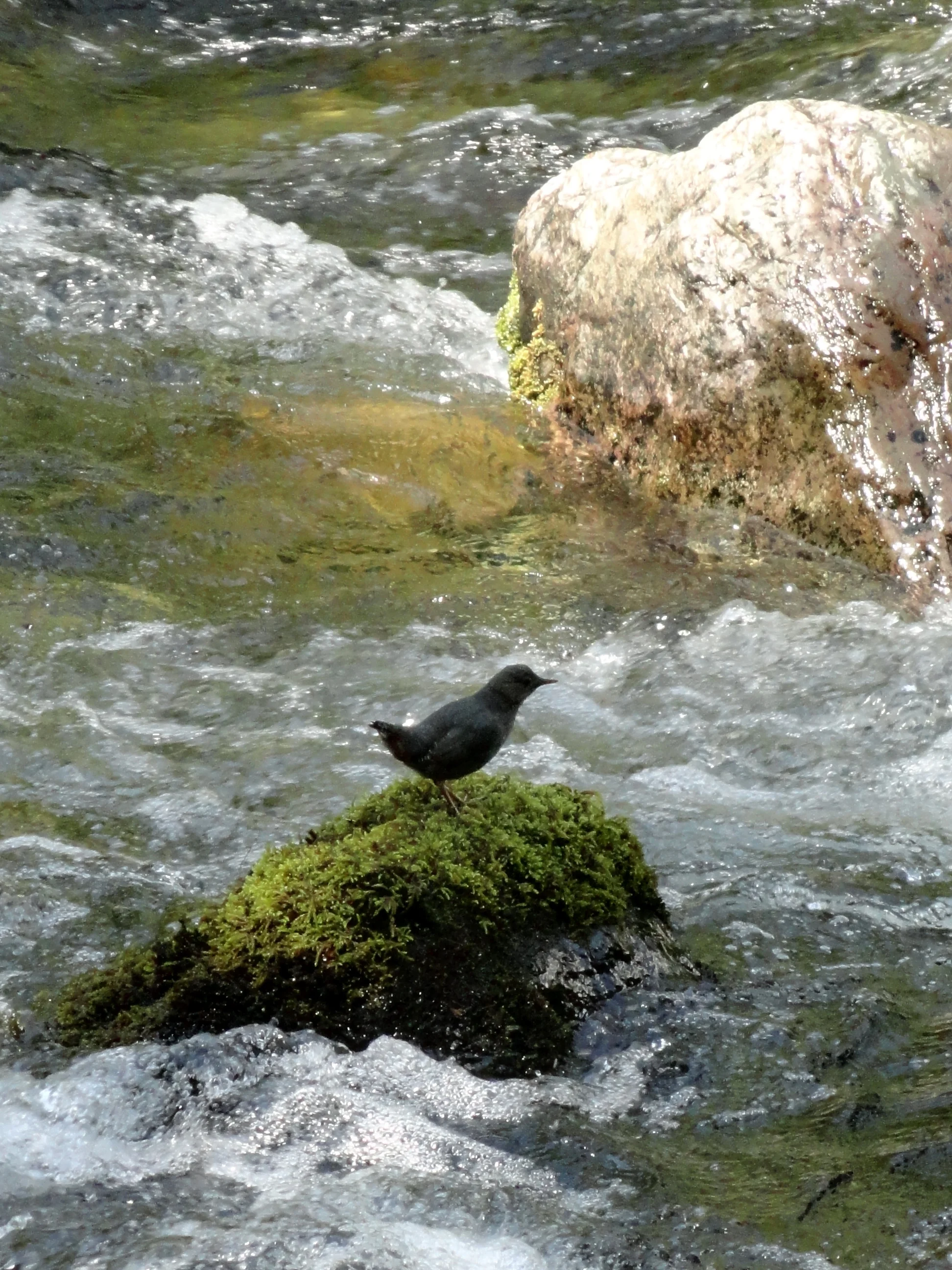
Photo: Craig Romano
Stop and look for dippers—robin sized birds that feed on aquatic insects and nest along the shorelines of rushing water. In spring look for Harlequin ducks returning from the Salish Sea. One of the prettiest sea ducks, they build hidden nests along rapid moving creeks and rivers.
The trail climbs a small bluff granting an excellent view of the pretty waterway, before leaving the river for forest. At 0.5 mile the trail turns north to cross Forest Road 25. Now walk along cascading Watson Creek climbing about 100 feet to a wooden bench on a perch overlooking the creek. It’s a great spot to sit and enjoy the sound of nature’s water music. By late spring nesting thrushes and other songbirds add a wide range of melodies.
The trail now turns west to soon reach the historic Hamma Hamma Guard Station. Built by the CCC from 1936 to 1937, it was used for administrative purposes for forest fire and trail crews. Today this eloquently rustic structure with its hexagonal bay window can be rented out for an overnight stay recreation.gov. Please respect the privacy of any guests staying at the cabin by not walking on the grounds. Otherwise wander around the structure. Note the landscaping too, especially the rhododendrons which will be in bloom come May.
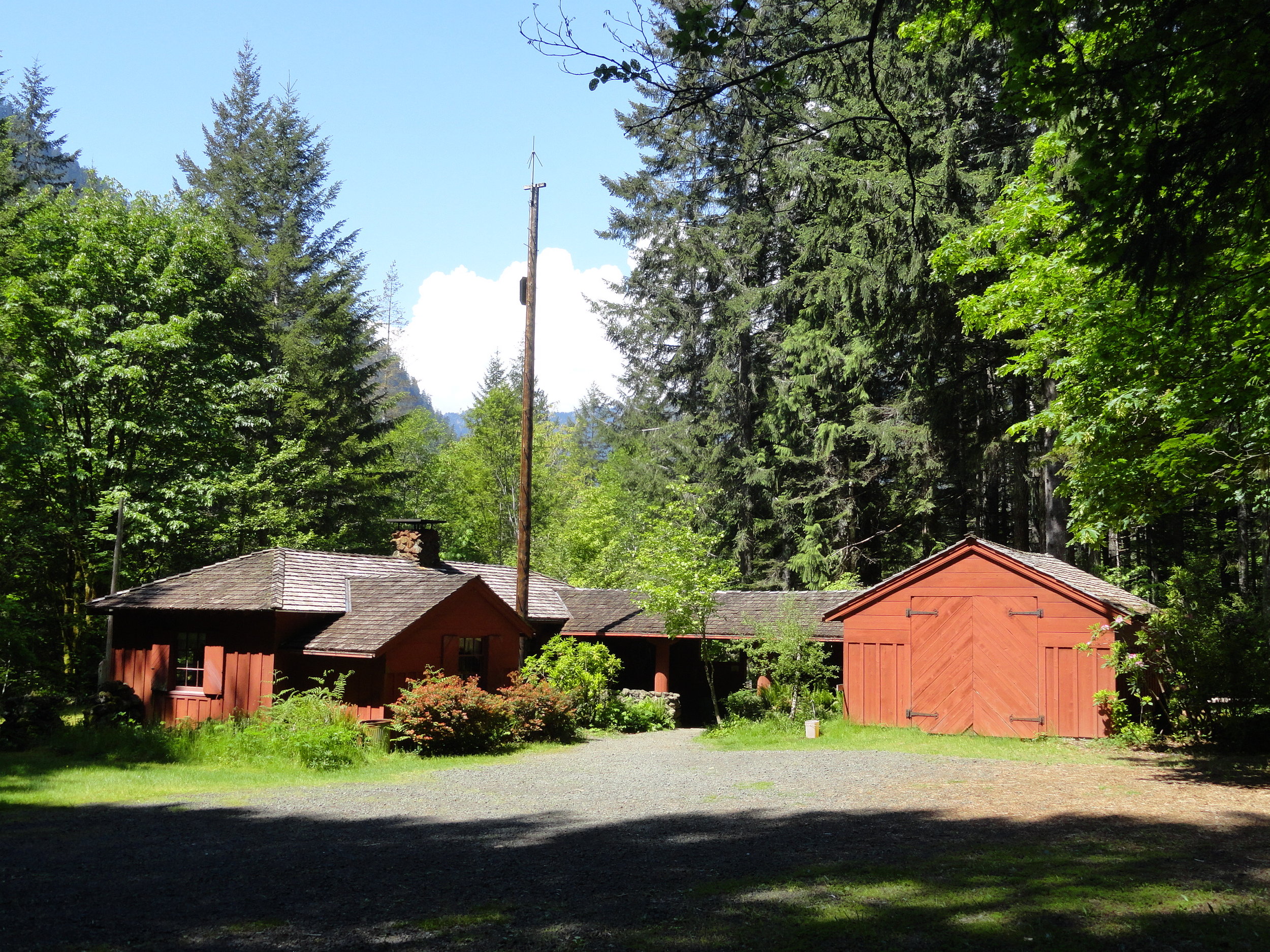
Photo: Craig Romano
After admiring the historic structure continue west on the loop crossing a small creek and traversing a grove of mature second growth firs. The way then descends into a ravine before re-crossing FR 25. Continue hiking passing some big beautiful old trees before reaching the campground loop road near campsite no. 6. Now turn right and walk the loop road a short distance back to your start closing your loop hike at 1.8 miles. Reflect on some of the achievements of the Corp including the thousands of miles of trails they built, more than 3400 fire towers constructed, nearly 3 billion trees planted, and the development of amenities and infrastructure in more than 800 parks across the nation. Many of their works are still standing and in use in Olympic National Park and Olympic National Forest as well as at several nearby state parks. The Corp’s legacy continues to live on for the next generation of outdoorsmen and women.

Getting Here
First .25 mile ADA; Leave No Trace Principles
Land Agency Contact: Olympic National Forest, Hood Canal Ranger District, www.fs.usda.gov/olympic
Recommended Map: Green Trails Olympic Mountains East 168S
Trailhead directions: From Hoodsport travel north on US 101 north for 13.7 miles turning left at milepost 318 turn onto FR 25 (Hamma Hamma River Road). Then continue west for 6.0 miles turning left into the Hamma Hamma Campground. Proceed for 0.1 mile to trailhead located near site no. 12.
Trailhead facilities: campsites (fee), privy
April Showers Bring Spring Flowers
Although the Pacific Northwest is known for its temperate rainforests accompanied by an abundant amount of green, with April warmth, we can start to look forward to the colorful relief offered by the return of the native flowers around the Canal and South Puget Sound area.
Although the Pacific Northwest is known for its temperate rainforests accompanied by an abundant amount of green, with spring’s warmth, we can start to look forward to the colorful relief offered by the return of the native flowers around the Canal and South Puget Sound area.
April to June is the best time of year for finding the delicate jewel tones out here on the wet coast. Whilst domesticated daffodils and tulips will always be celebrated markers of Spring, our native plants are often forgotten gems of the forests understory. As the days get longer and the weather gets warmer, take a ramble down one of Mason County’s forested walks, like Twanoh State Park Trail or for a more adventurous alpine hike, with spectacular views and unique flora, try Mount Ellinor Trail.
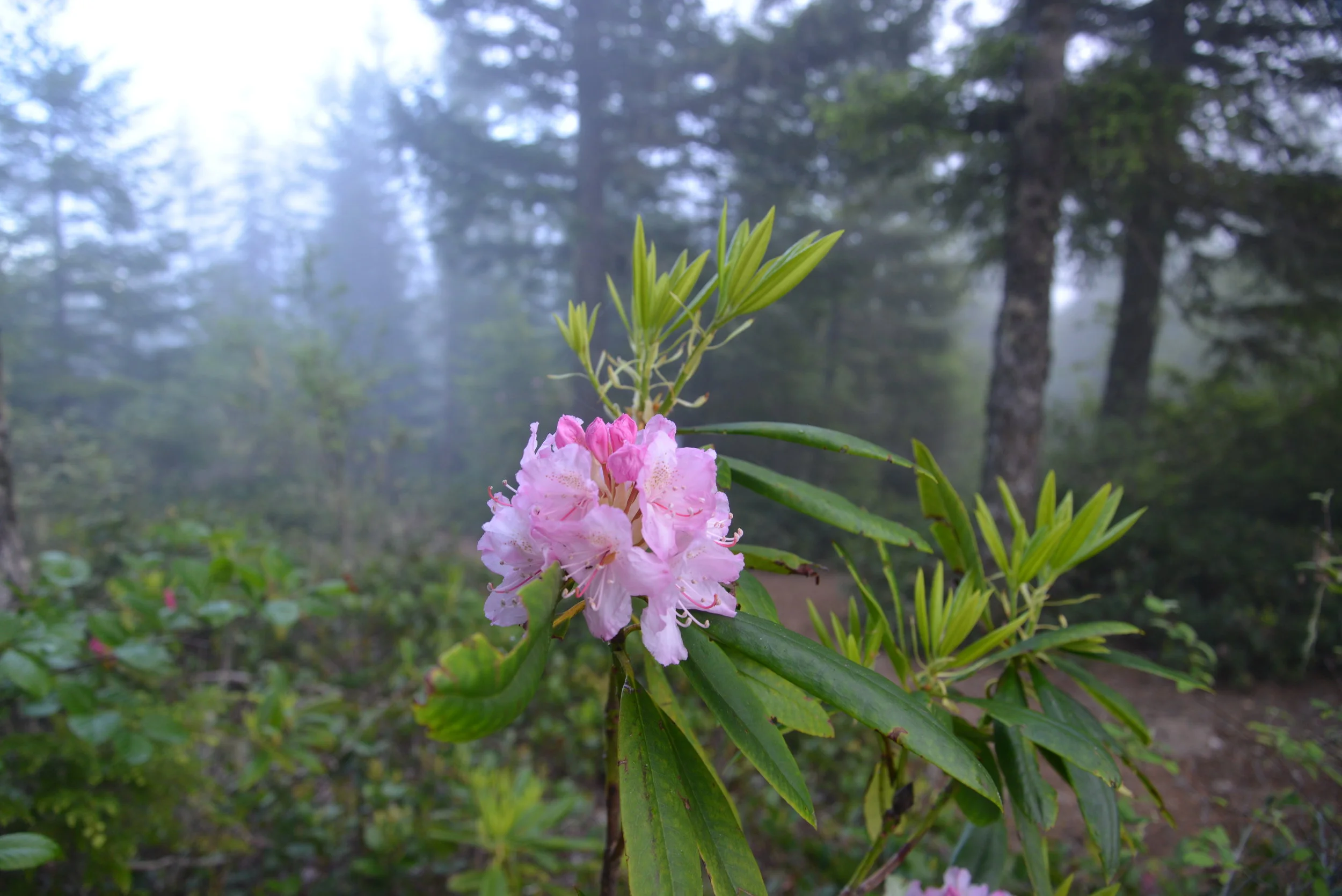
Keep your eyes peeled for the first nodding, purple blossoms of Henderson's Shooting Star (Dodecatheon hendersonii) and the showy, pinky-purple blooms of our local variety of Rhododendron (Rhododendron macrophyllum).

The Pacific Rhododendron is Washington’s State flower and is found in drier parts of the Hood Canal in the understory of coniferous forests.
There are nearly 30 varieties of Rhododendrons native to North America. The Pacific Rhododendron is Washington’s State flower and is found in drier parts of the Hood Canal in the understory of coniferous forests. Pacific Rhododendron can also be seen in partly sunny, open areas, such as along roads. The Pacific Rhododendrons and also Goat's Beard (Aruncus dioicus) can be found in proliference along the winding, scenic 101 Highway following Hood Canal. For an especially spectactular showing of the native rhodendrons, head up to the scenic outlook on Mount Walker.

Pink Fawn Lily
In sunnier, damper areas, near streams, look for the bright pink flowers of Pink Fawn Lily (Erythronium revolutum) or the iconic, if not slightly smelly, “West Coast Daffodil”— Skunk Cabbage (Fritillaria lanceolata). Also in sightly shady, waterside spots, look for carpets of pink Bleeding Heart (Dicentra formosa)— a more delicate version of our domestic variety. Try the Kamilche Kennedy Creek Trail for these humid loving flowers.
Orange Honeysuckle
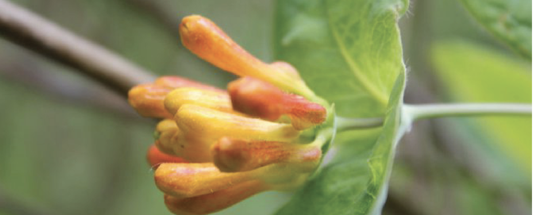
As the weather gets warmer (from May to June) search in the partly shady area of the woods for the trailing tender beauty of Orange Honeysuckle (Lonicera ciliosa), and the yellow blossoms of Tall Oregon Grape (Mahonia aquifolium). The delicate, orange-red blooms of Red Columbine (Aquilegia formosa) also emerge during this time.

Camas was actively cultivated and traded between first peoples throughout the Northwest who would harvest the bulbs in the early spring and roast them in pit cooks.
Other blossoms to look for in the late spring are the azure, crocus-like flowers of the Common Camas (Camassia quamash). Found in full sunlight in open places, such as fields, parklands, the bulbs from the Camas were an important part of the diet of Native Americans. Known as k’a’w˜up to the Skokomish and sxa’dzaêb by the Squaxin, this bulbous flower was actively cultivated and traded between Nations throughout the Pacific Northwest who would harvest the bulbs in the early spring and roast them in pit cooks.
On one of those calm days when you believe it might just be summer here early, pack a lunch and hop in the boat and travel to Hope Island Marine State Park. Here you will be greeted by lovely trails and beautiful naturalized gardens with a mix of introduced and native species.
Red Paintbrush
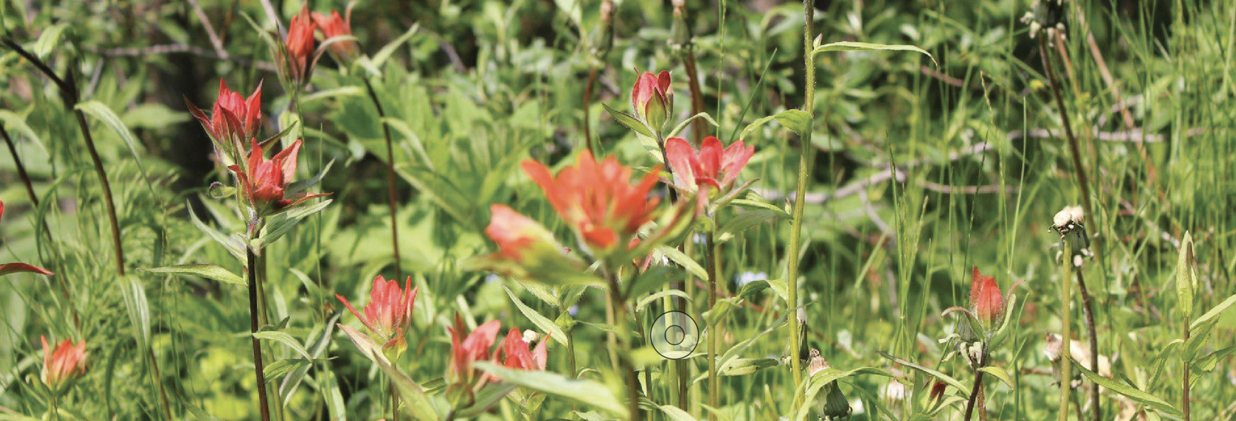
Once settled as a farm, Hope Island has historic fruit trees mixed in with native camas, honeysuckle and the elegant red, trunks of Madrone (Arbutus menziesii). An unusual looking plant found along sun-facing, beach banks is the Red Paintbrush (Castilleja miniata), whose tiny green flowers are hidden in bright red leaves that give the appearance of a brush dipped in red paint. Since most of these species are protected against picking or transplanting, remember to keep your enjoyment to viewing.
You can take as many photographs as you like, but refrain from taking bouquets and let the native flowers thrive.
If casual enjoyment of our native plants is what your after, the Washington Native Plant Society has plant identification resources online and there are plenty of guide books to help. Pojar and Mackinnon’s Plants of the Pacific Northwest Coast (2014) and Nancy J. Turner’s Food Plants of Coastal First Peoples (1995) offer excellent information, photographs and tidbits that add color to an already polychromatic subject. Happy hunting!

Hood Canal Travel Guide: Waterfall Wonders
Waterfall Road Trip
Cascading waterfalls tucked into hidden nooks are simply and quintessentially Hood Canal. Sure, we love summer, but winter is truly a marvel in our corner of the world. We daresay we prefer it when it comes to admiring the majestic cascades tumbling from the woods.
Waterfall Wonders Near Shelton, Washington
It’s undeniable that cascading waterfalls tucked into hidden nooks are simply and quintessentially Hood Canal. Winter and early spring are optimal for peeping these rushing beauties.
As the rain falls, it keeps our hillsides the vibrant green that makes the Olympic Peninsula feel like home. This also means the waters rise, and the cascades fill in. So check the forecast, grab your best adventure buddies, and get to some of the most beautiful gems that Hood Canal has to offer.
Visit the Olympic waterfall trail and see our detailed notes on each destination below. This trip is ideal for Seattle weekend road trippers taking advantage of the Kingston Ferry, looping up through Port Gamble, then down Hwy 101.
Take the plunge | 10am | through 2026 - Weekends only during construction around trail .
Situated just north of Brinnon, Rocky Brook Falls remains one of the best easy-to-reach waterfalls on the Olympic Peninsula. After a 1986 micro hydro project was installed at the top of the falls, locals feared that the falls would run dry. Thanks to operators of the facility, the beautiful 229’ tall falls run year-round.

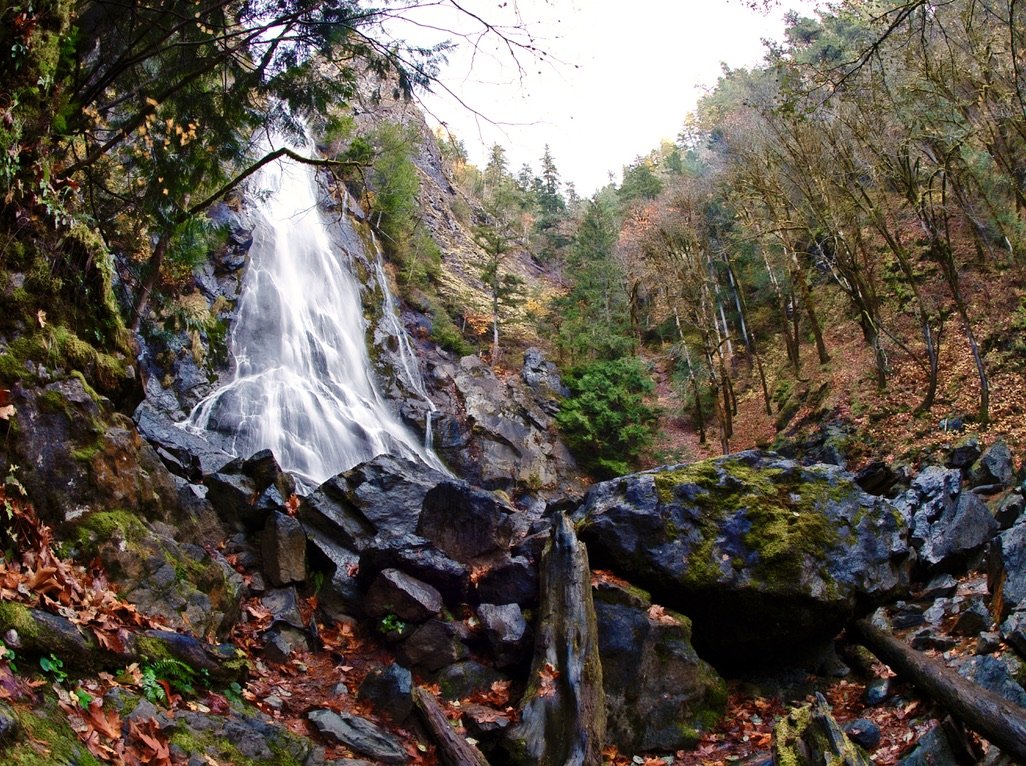

For the waterfall nerds out there, Rocky Brook’s primary form is in tiered horsetails, with three thundering drops until it reaches the small pool below.
Upon arriving at Rocky Creek, park just beyond the small bridge and follow the trail that leads past the hydro facility for about 500 feet. Note that the rocks around the pool can be slick, especially when wet, so it’s best to exercise caution.
Test your navigation skills | 1pm
Little is written about these falls, and visiting them requires a fair bit of exploring. Over the years, a number of the most intrepid kayakers have ventured to the Olympic Peninsula in order to run Hamma Hamma Falls. The boiling pool at the bottom of its pristine and highly technical 25’ first drop gives paddlers just enough time to set up for the 50’ drop immediately after.We would reccomend enjoying it from the top instead.
A concrete bridge spans the river over the falls at the fall line of the upper drop, but an adventure-seeker will need to navigate the lower banks to get a full-frontal view of this beauty.


Re-orientate your GPS | 2pm
Just three miles downstream, Lower Hamma Hamma Falls is the slightly-less-majestic sister to the beaut upstream. Dropping into a small gorge, the falls tumble over a large pile of boulders. As such, it’s difficult to see the whole falls from any one location and it is advised to exercise extreme caution when trying to gain a better downstream view.


The ultimate “selfie spot” framed by waterfalls at Vincent Creek falls — aka High Steel Bridge
Get a great view at High Steel Bridge | 4pm

No waterfall itinerary would be complete without a trip to the historic High Steel Bridge that spans the gorge and sits a staggering 300’ above the mighty South Fork of the Skokomish River.
The vertigo-inducing High Steel Bridge has an uncontested view of the last cascade on the itinerary, Vincent Creek Falls, and is easily accessed from Hwy 101. It’s also a quick pit stop after an awesome wintery afternoon of mountain biking if you happen to visit the area on a dry-ish day.

Wash it down in Union, Washington | 6pm
Here’s the ultimate challenge of your day: organize it so that the end of your satisfyingly adventurous day brings you straight to a good cocktail at the newly renovated Alderbrook Resort and Spa.
As you sort through the memories of a day well spent, remember that we love keeping up with you! Tag your photos and thoughts on social media with #explorehoodcanal, #wildsideWA, or #hoodcanal for a chance to be featured by us.
Be sure to check in with us on Facebook, Twitter, or Instagram for more ideas on how to get the most out of your road trip to Hood Canal. Happy adventuring!
For more fantastic waterfalls in the area, check out this waterfall trail throughout the Olympic Peninsula. This guide is curated by author, Craig Romano, and hosted by Explore Hood Canal.
An Autumn Trek to Black and White Lakes
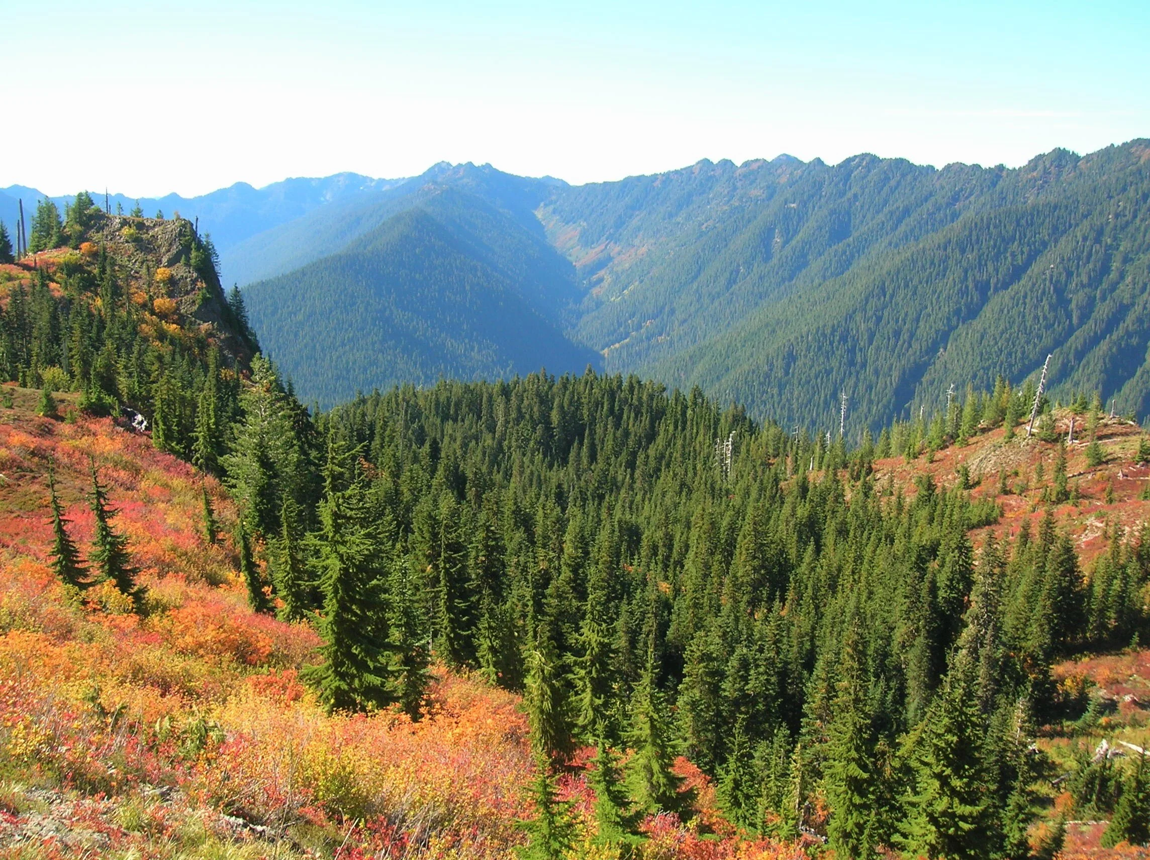
Visit the Black and White Lakes in late September and discover a surrounding landscape far from black and white. Revel instead in an alpine world of living color. The lakes sit in a basin long burned of its forest cover and since carpeted in berry bushes, mountain ashes and other shrubs that burst with brilliant hues of red, orange and yellow.
Craig Romano | Story & Pictures
Craig Romano has written more than 25 outdoor guide books including "Day Hiking Olympic Peninsula."
Visit the Black and White Lakes in late September and discover a surrounding landscape far from black and white. Revel instead in an alpine world of living color. The lakes sit in a basin long burned of its forest cover and since carpeted in berry bushes, mountain ashes and other shrubs that burst with brilliant hues of red, orange and yellow come the autumn equinox. It’s a grunt to reach them, but chance are good you won’t have too much company — unless you count gregarious ground squirrels, docile deer, and inquisitive bears.

Craig Romano Photo
Hit the Trail
While the Black and White Lakes lie on the trail less traveled, you must first hike some well-trodden paths. Start your journey on the North Fork Skokomish River Trail, which begins on an old road that was decommissioned in the 1970s. Hike through wild country, much like what U.S. Army Second Lieutenant Joseph P. O’Neil saw in the 1880s on his exploratory trips into the Olympic Mountains. But something O’Neil saw that you won’t were legendary fish runs. Before the North Fork Skokomish’s flow was dammed by Tacoma Power in the 1920s, this river was one of the largest salmon-rearing waterways on the peninsula.
Hike upstream on a wide path and gentle grade crossing several side creeks. Traverse a luxuriant bottomland of big cedars, Douglas-firs, and moss-cloaked big-leaf maples. Pass the Staircase Rapids Loop Trail and consider taking it on the return for a slight variation. After passing Slide Camp, hike across the Beaver Fire of 1985, caused by an illegal campfire during a drought and resulting in 1400 acres of old growth going up in flames.

Craig Romano Photo
The trail then pulls away from the river. At 3.6 miles, reach a junction just before Spike Camp. Now head right on the Flapjack Lakes Trail and slowly climb out of the valley along the old burn line. After a few switchbacks, the trail turns northward on a fairly gentle course. Admire a big cedar grove along the way, then cross Madeline Creek on a sturdy bridge.
The creek cascades below through a narrow ravine. Now start heading up steeper and rockier terrain and follow alongside cascading Donahue Creek. At 7.1 miles comes to a junction. The way to the right is where most folks head—to the Flapjack Lakes and Gladys Divide. You want to head left instead on the less-traveled trail.
Cross a pair of creeks, and then steeply climb, rounding a ridge to emerge at a 1936 burn site, now blanketed in berry bushes and mountain ash. After passing the log foundation of an old cabin, come to a junction with the Black and White Way Trail at 8.2 miles.
The old cabin was once part of a long mining operation here at the lakes. By the mid-1970s it had collapsed leaving only the rotting foundation behind. As you continue to hike into the lake basin, look around for evidence of old mining operations in the form of tailings, pits and cuts.

Craig Romano Photo
Now continue straight another 0.2 mile to an unmarked junction. The trail continues for one mile dropping into a forested basin housing Smith Lake. You want to go right and immediately reach the largest of the trio of Black and White Lakes. The lake is small but pretty with a couple of primitive campsites nearby. The other two lakes are not much more than pothole ponds tucked a little higher in the surrounding basin.
While the lakes aren’t stunning, the views from the open basin are—especially of the surrounding wilderness. Particularly striking is Wonder Mountain and the Three Sisters to the south, Six Ridge to the southwest, and Mount Steel to the northwest.

Craig Romano Photo
In autumn, this basin transforms into a mosaic of dazzling reds, oranges, and yellows.
So where did the name Black and White come from? There are a handful of name origin theories that include the lakes being named after a brand of whiskey, the last names of the original prospectors, and a way of describing manganese found at the site.
In any case the mining history here goes back to claims made in 1907. Copper was the original mineral mined. Getting the copper to market from this remote and rugged location however proved to be a challenge. A proposed flume was never built to help get the ore to the North Fork Skokomish Valley from where it was transported to Tacoma via roads. The mine’s claims were sold several times over the years. In the 1940s the mine’s owners dug a 200 foot tunnel. By the 1960s however mining activity had pretty much ceased at the lakes.

Craig Romano Photo
When you are ready to leave this beautiful and interesting place, retrace your steps 0.2 mile back to the junction near the old cabin remains. Then return the way you came or consider hiking out via the Black and White Way Trail. It’s a shorter route, but a knee knocker dropping more than 2600 feet in 2.2 incredibly steep miles. While the way is knee-jarring, the tread is smooth and not rocky.
The way trail ends at the North Fork Skokomish Trail at the junction with the spur to Big Log Camp. From here it’s 5.4 miles back to the trailhead via the North Fork Skokomish Trail.
Black and White Lakes hike:
Distance: 16.8 miles roundtrip
Elevation Gain: 3,800 feet
High Point: 4,515 feet
Difficulty: moderately difficult
Snow free: mid-June – Oct
Trailhead Pass Needed: National park entrance fee.
Olympic NP wilderness camping permit required if backpacking.
Notes: Dogs prohibited. No campfires above 3500 feet.
GPS waypoints: Trailhead: N47 30.968 W123 19.691
Black and White Lakes: N47 34.493 W123 20.556
Features: magnificent old-growth forest, wildlife rich backcountry lake, exceptional autumn foliage, excellent alpine views, historic mining area.
Land Agency Contact:
Olympic National Park, Wilderness Information Center, Port Angeles, (360) 565-3100, www.nps.gov/olym;
Recommended Guidebooks:
Backpacking Washington 2nd edition (Romano, Mountaineers Books)
Trailhead directions:
From Shelton, travel north on US 101 for 15 miles to Hoodsport. Turn left onto State Route 119 and drive 9.3 miles to a T intersection with Forest Road 24. Turn left, continuing on SR 119 which becomes FR 24 for 5.4 miles. Then bear right, coming to the Staircase Ranger Station in 1.2 miles and the trailhead.
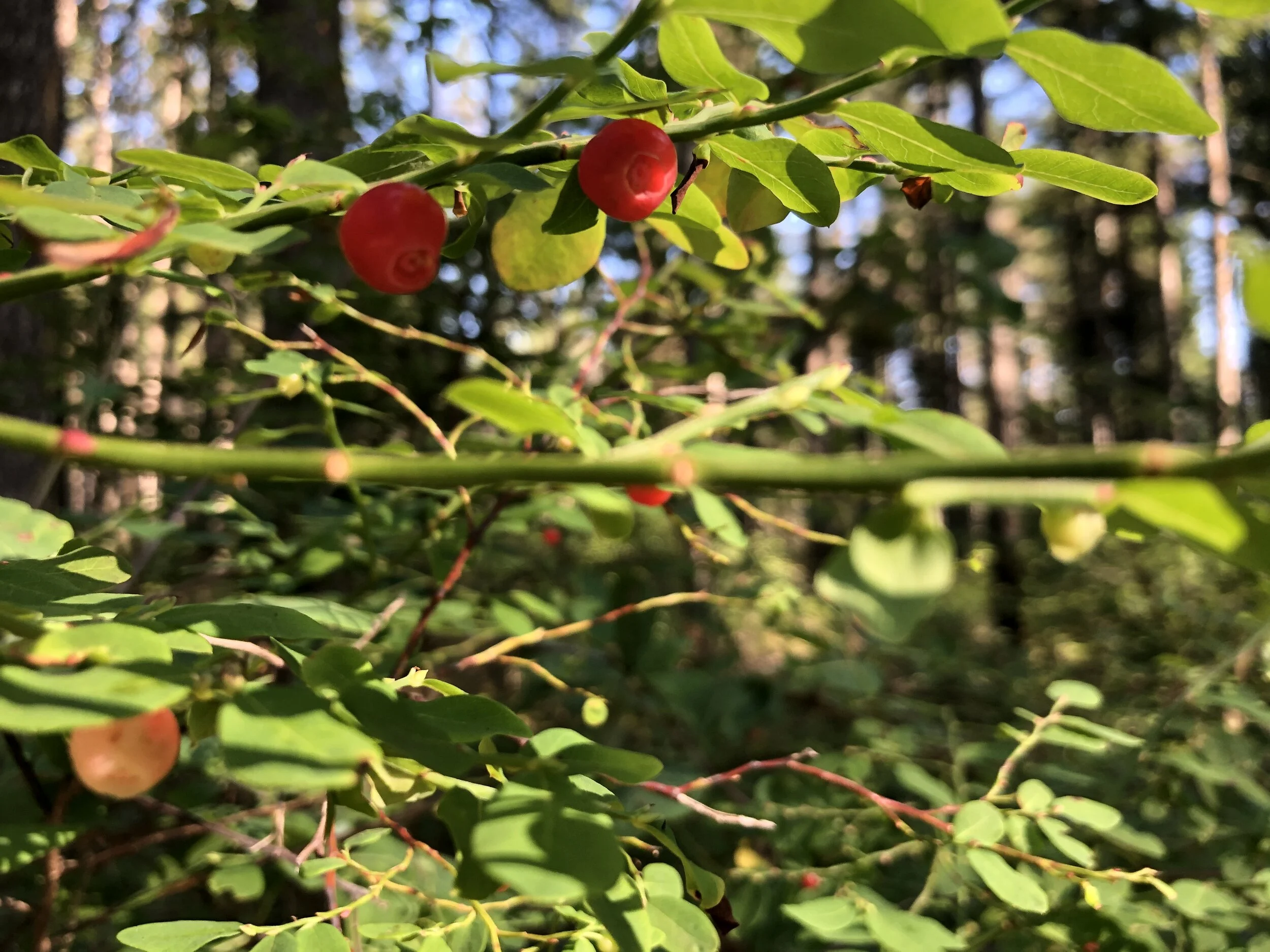
8 berries to be ATE on the trail
The Pacific Northwest with its lush temperate climate is home to some of the most mouth-watering berry bushes. The Native Americans have a long tradition of picking and preserving and promoting the growth of these “nature’s candy” and with long summer days ahead of us, why not try your hand at picking wild berries?
The Pacific Northwest with its lush temperate climate is home to some of the most mouth-watering berry bushes. The Native Americans have a long tradition of picking and preserving and promoting the growth of these “nature’s candy” and with long summer days ahead of us, why not try your hand at picking wild berries? Prepare yourself for a productive and palatable adventure.
1. Salmonberry
Hummingbirds happily proclaim the first opening of the salmonberries’ (Rubus spectablilis) early bright pink blossoms in late February. Salmonberries typically ripen in late April to mid-June making it the first berry of the season. The fresh shoots cleaned of its prickly outer layer are harvested by many Native American groups (as well as by foodie foragers) and are reported to taste similar to asparagus when steamed.

Salmonberry (Rubus Spectablilis)
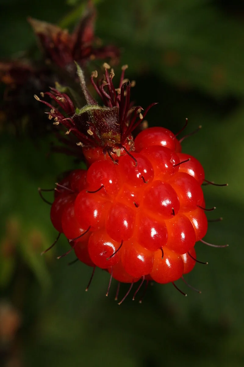
The berries are loved by bears, birds, and children. They vary in color from orange to a deep red reminiscent of salmon eggs, which is where some believe the name came from. The flavors can also vary depending on the bush but are generally sweet with a slightly acidic aftertaste that can make the uninitiated wince. The berries are a drupelet shape, similar to raspberries and blackberries, which is a composite berry made of lots of seeds. They make great jams, jellies, and sauces for the more savory taste buds looking to dress up pork roasts and duck.
Somewhere near the mouth of the Duckabush River, there is rumored to be a hybrid variety to this rose cousin with showy double blossoms.
Look for this tall, bushy berry in shady areas near streams. Berries are often located higher on branches so if you are vertically challenged be sure to bring a stick with a crooked end, something to stand on, or an obligingly tall friend. Gloves and long sleeves are recommended because salmonberry thorns don’t give up their berry bounty without a fight.
2. Thimbleberry

Thimbleberry flowers
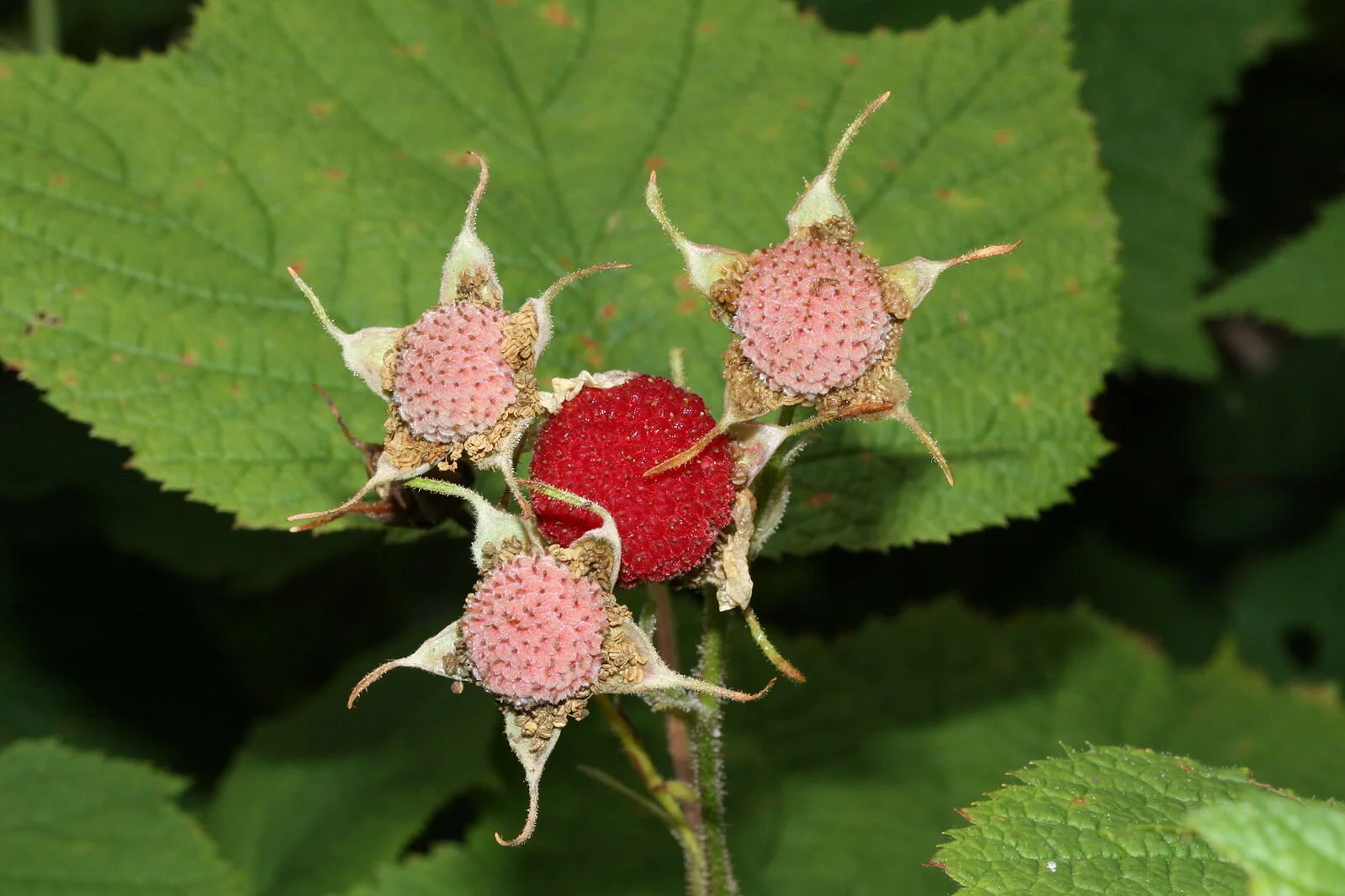
The next ripe berry on the west coast is the sweetly tangy Thimbleberry (Rubus parviflorus) which comes into fruit late June to early July. Thankfully thorn-less, this tall bush also has edible shoots in the early spring, adorned with delicate white flowers. The tender spring shoots are delicious peeled and dipped in sugar. Theses berries are also drupelet in shape, but the fleshy part is much thinner and the berry is hollow inside allowing the whole picked product to easily fit over the fingertip, just as a thimble would. The large soft maple-shaped leaves are covered in a fine hair and are known to be one of the best natural substitutes for toilet paper if you are ever stuck in the woods. Besides harvesting the stems, Native Americans would press and dry the berries into cakes for later use. These delicate berries are a little tricky to harvest since they have a tendency to fall off the branch when bumped, so be ready with your basket, bowl or baseball cap to catch the fruit.
3. Red Huckleberry

Although Red Huckleberries (Vaccinium parvifolium) start forming on the bush in early June, they don’t reach ambrosial ripeness until July, when the berry’s light blush changes to a tasty red. The bush and berry of the huckleberry are very similar to the domesticated blueberry. The Native American Salishan word for Red Huckleberry, t’əәxw (Twana dialect known amongst the Skokomish) or t’íxw(i) (Lushootseed dialect known amongst the Squaxin) both describe how it was traditionally picked with combs ‘to brush, sweep, [or] shake out’ the berries. Slightly sour to taste, these berries do well in jams and pies.
4. Salal

Facing warm sunny locations, along shorelines, roadsides and trails is the prolific Salal (Gaultheria Shallon). Popular amongst florists as a filler since the 1940s, this cut green is a huge industry and is actively gathered by permitted commercial harvesters in the Olympic National Forest. The dark-purpley/black berries ripen in August, once the sticky white bell-shaped flowers have been pollinated. The berries form on the branch in a way similar to grapes. Children find the berries fun to play with as their round shape can be squeezed to form a star. Packed with antioxidants, flavonoids, and up to five times more tannins than blueberries, these sweet, slightly mealy berries are a newly re-discovered superfood. A little goes a long way with these black beauties, as these berries are a natural hunger suppressant. Salal’s health benefits have long been reported by Native Americans up and down the coast who would traditionally press and dry these berries into cakes or fruit leathers. Jams and jellies are the most popular way to process salal berries now and it really does taste like a good medicine when you spread it on your toast. Salal berries aren’t guarded by nasty thorns, but they do release a dark pigment, that can be used as a natural dye, but also can irreparably stain clothes, so dress accordingly before harvesting. Another difficulty with salal is the way in which the berries firmly attach to their branch. I usually pick the whole branch and clean them when I get to a table or flat area.
Jelly and jam makers often combine the sweet flavour of the Salal with the tangy, sour of the Oregon Grape (Mahonia aquifolium) another August (to September) fruit.
5. Oregon Grape

Oregon Grape (Mahonia aquifolium)
You probably won’t be eating these on the trail because they are pretty unpalatable raw… but if you have the opportunity to gather and reduce over a stove, Oregon grape is a great addition to your jelly repertoire. Oregon Grape (Mahonia aquifolium), the state flower of Oregon, grows on a three-five-foot tall bush that has large sharply, serrated green to red leaves reminiscent of holly. The berry matures from a bright yellow flower, changing in color from green, yellow, red, purple before ripening to a pale chalky blue.
Oregon grape is a quintessential bitter plant that has the capacity to cleanse, clarify, and enliven body and spirit. The berries themselves, though perfectly edible are bitterly sour and don’t release their deliciousness until a sweetener is added and the berries are cooked into a syrup or jelly. Oregon Grape syrup makes a lovely addition to ice cream and vodka or gin cocktails.
6. Evergreen Huckleberry
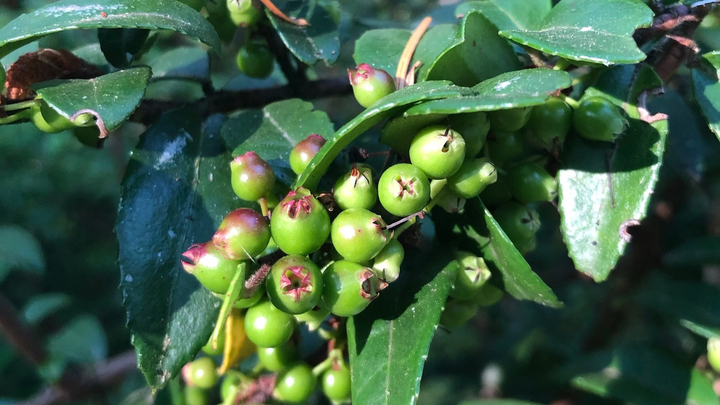
Evergreen Huckleberry ( Vaccinium ovatum)
This thick and bushy shrub can be found in gravelly sandy soils, nestled in coniferous forests.
The Evergreen Huckleberry (Vaccinium ovatum) begins to ripen in early autumn but they can still be seen on the bushes until December. You can spot the tight clusters of small flowers which are white to pink in color. As the small berry ripens it is a black and shiny or occasionally a dusty blue. Once you harvest your evergreen huckleberries expect a sweet and slightly dry taste. The berries are slightly seedy but have a unique refreshing flavor.
7. Oval-leaved Blueberry

Oval-leaved Blueberry (Vaccinium ovalifolium)
These berries can be found in moist coniferous forests and along shaded stream banks. Oval-leaved blueberries (Vaccinium ovalifolium) are around 4 feet tall shrubs with thin leaves which are oval in shape and are rounded at the ends. The pinkish flowers appear before the leaves mature and are solitary. The flavorful blueberries ripen in July and are of good size and very flavorful. Ova-leaved blueberries are dark blue and are covered in a waxy coating causing them to look gray and moldy in appearance.
8. Himalayan Blackberry
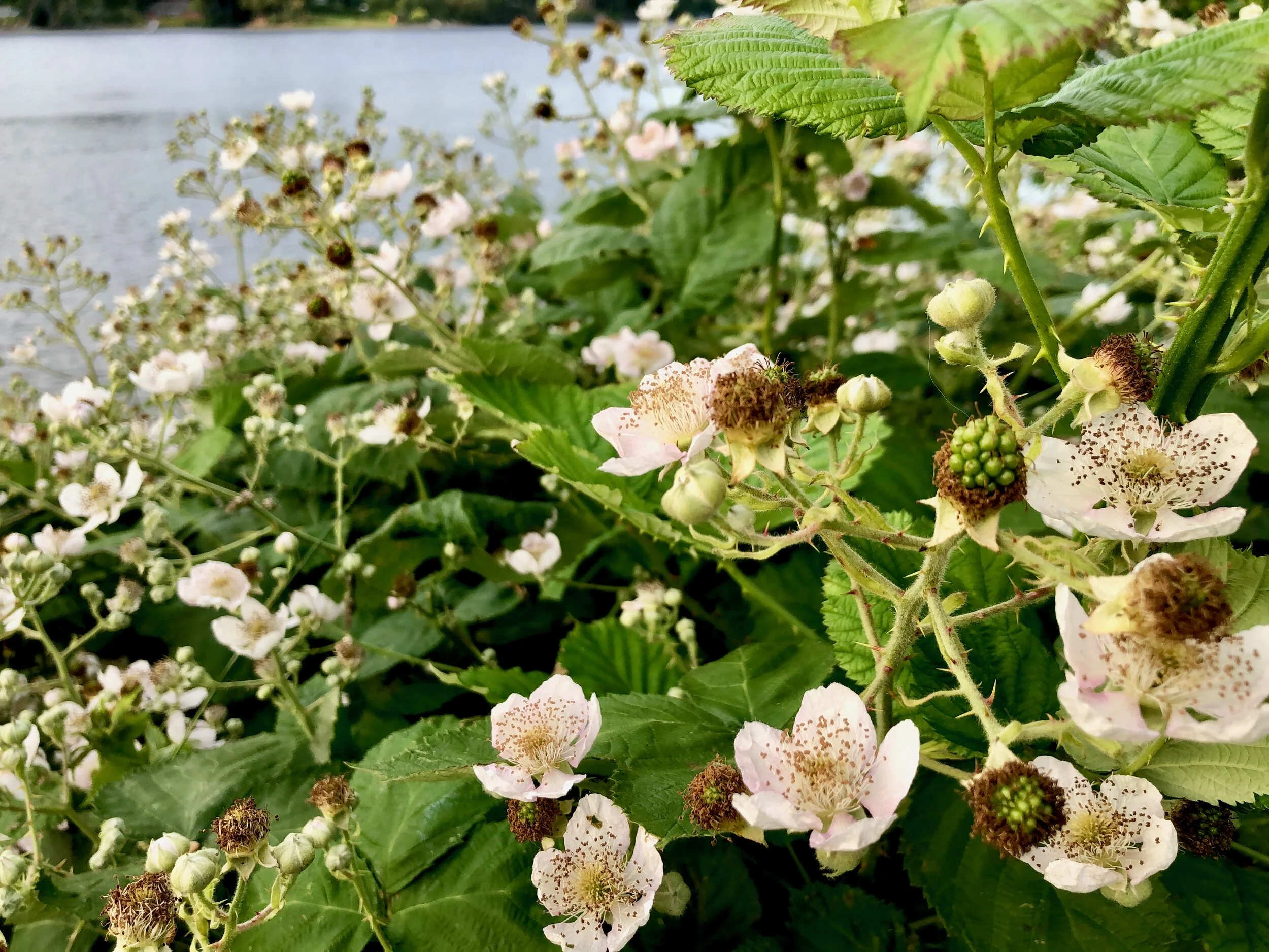
Himalayan Blackberry (Rubus armeniacus)
Himalayan blackberry is a semi-evergreen shrub that can grow nearly 10 feet high. The plump purple/blue berries ripen in late summer. Although Rubus armeniacus is an invasive species and is an aggressive contender against the natural species, it is a great berry to enjoy on the trail.

Himalayan blackberry plants can produce up to 13,000 seeds per square meter, and seeds can remain viable in the soil for several years. The plant creates dense thickets that are impassable and sprawls over surrounding vegetation.
Check out Pojar and Mackinnon’s definitive classic Plants of the Pacific Northwest (2004) to find out more. The internet also has many great sources, such as the Burke Herbarium Image Collection and Dana Kelley Bressette’s Pacific Northwest plant encyclopedia.
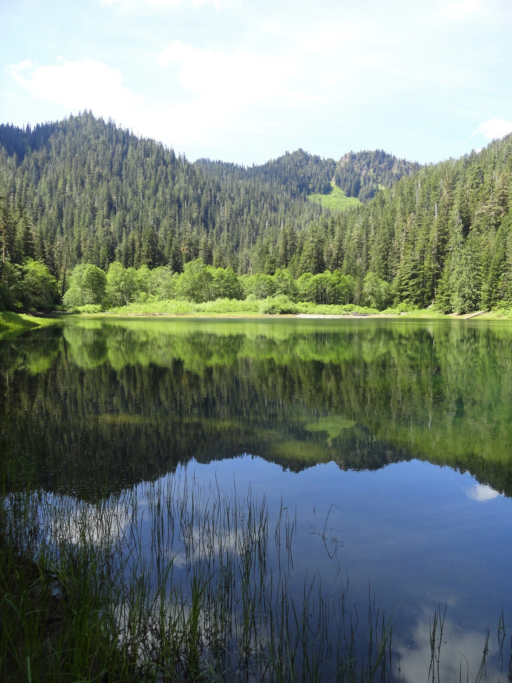
A Quiet trek to Pine Lake
The South Fork Skokomish River Valley offers quite a contrast from the North Fork Skokomish River Valley. Located within Olympic National Forest and not Olympic National Park, the South Fork sees a fraction of the number of folks that visit the North Fork.
Craig Romano | Story and Pictures
The South Fork Skokomish River Valley offers quite a contrast from the North Fork Skokomish River Valley. Located within Olympic National Forest and not Olympic National Park, the South Fork sees a fraction of the number of folks that visit the North Fork. Once a heavily logged area, the South Fork is slowly reverting back to a more natural state. Miles of former Forest Service logging roads in this wildlife rich valley have been decommissioned; some converted into trails. The converted trail to pretty little Pine Lake is a pure pleasure to walk. And surprisingly, the lake is surrounded by beautiful ancient forest. Majestic hemlocks, Douglas firs, and red cedars—just no pines.
Hit the Trail
Much of the South Fork Skokomish Valley in the Olympic National Forest was intensely logged from the 1940s to the 1980s. By the 1990s however timber harvesting on the Olympic and other Western Washington national forests was heavily curtailed due to market place changes and new management objectives favoring habitat protection and recreation. This resulted in the Forest Service decommissioning hundreds of miles of old logging roads. Some of these old roads however presented new opportunities to expand the trail system.

Olympic National Forest once contained hundreds of miles of trails in the South Fork Skokomish and Wynoochee River watersheds. Intensive logging destroyed most of those trails. Forest Service officials and citizen groups now see new opportunities to regain many miles of these lost trails through road conversions. The trail to Pine Lake is one of these new trails. And unlike so many road-trail conversion that simply involves gating the road and removing culverts—the Pine Lake Trail was designed with aesthetes in mind.
The road to trail conversion to this little lake involved constructing bends and curves in the original road bed to better mimic a real trail. And the road bed was restored to original contours in places further obscuring old road cuts.
The Forest Service planted native vegetation along the road bed so that in time it will be very difficult to see that this route was once a wide logging road. And while logging did occur within the Pine Creek watershed, it wasn’t as intense as in some of the smaller watersheds farther south and east. Large patches and tracts of old-growth forest were left uncut. And as the second growth patches adjacent to the primeval tracts continue to mature, evidence of past logging in the basin containing Pine Lake becomes less obvious.
"Surprisingly this trail is not on many hiker’s radar. Come on a weekday and you may have the lake to yourself."
From the small parking area, follow the trail through second growth forest traversing slopes high above Pine Creek. About half way up the trail you’ll encounter a patch of invasive Scotch broom, a plant that crowds out native vegetation in disturbed areas. The Forest Service along with Washington Conservation Corp crews have done a good job at Pine Lake restoring native vegetation. Unfortunately this pervasive and hardy invasive plant has gotten a foothold in this valley. Hopefully they can soon attack the broom before it sweeps across the valley.
At about two miles the trail enters an attractive grove of old-growth forest. The way then steepens a little breaking stride from its relatively gentle grade to this point. In another .75 mile the trail leaves the old road bed to traverse a grove of big trees and descend to Pine Lake. The lake is pretty shallow and surrounded by grasses, sedges and other small plants—many planted by the Forest Service to help rehabilitate the shoreline from past abuses.
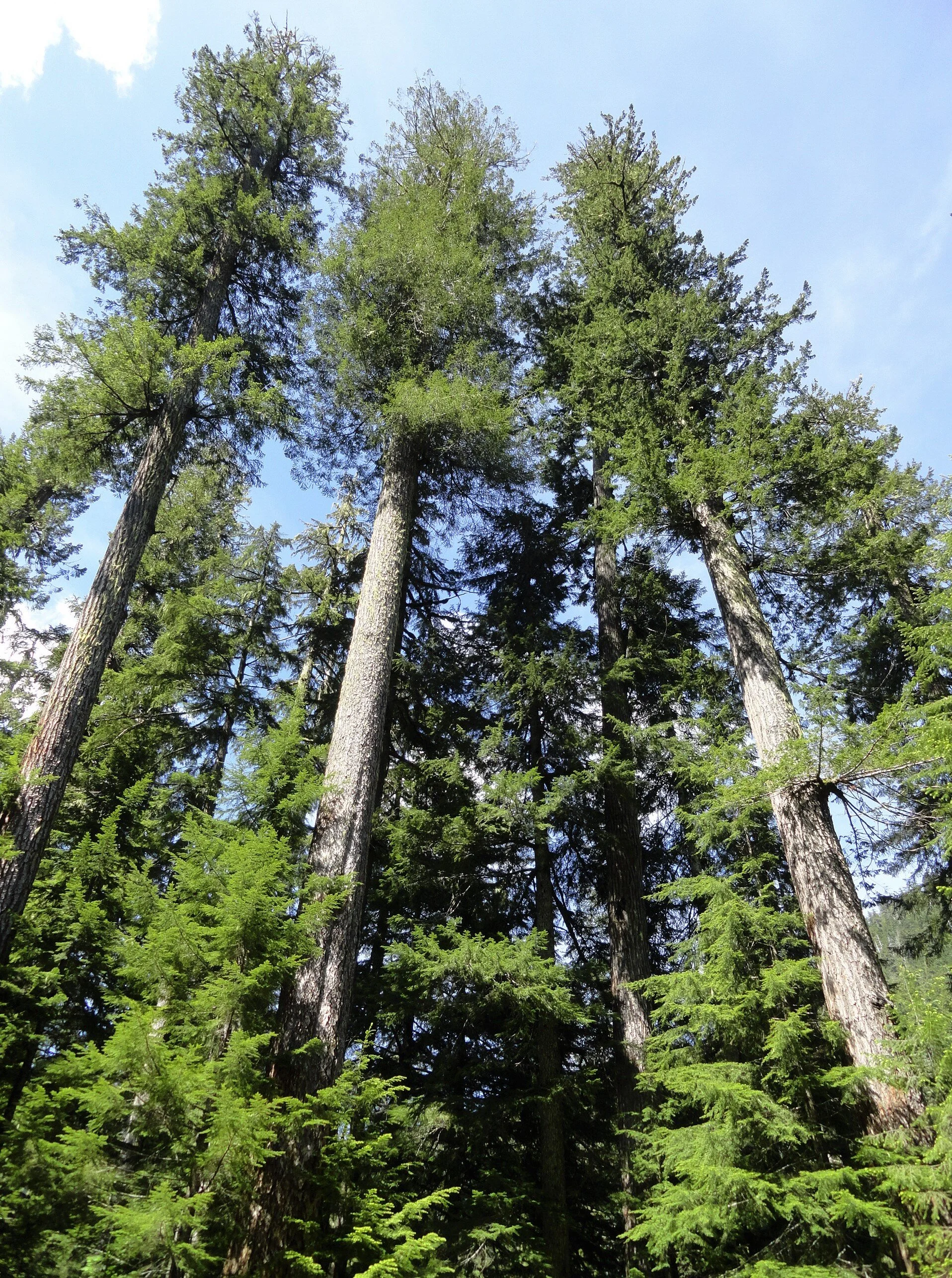
Treat the area with respect by sticking to established paths and not trampling vegetation.
Savor the serenity of the scene. Look for resident waterfowl on the lake’s open waters and in its vegetated coves.
Admire the forested hillsides too and Chapel Peak which often reflects upon the lake’s placid waters. Notice too that among the stately conifers surrounding the lake, there does not appear to be any pines. Western white pines valued for their fine wood, were once abundant in the Olympics and Cascades. But it wasn’t logging that erased them from much of these landscapes—but a Eurasian disease, white pine blister rust that decimated stands of this majestic tree.

It’s possible that is what occurred here at Pine Lake. Then again, early pioneers and explorers were also known for misnaming features. There are no badgers in Olympic National Park’s Badger Valley for example nor black oaks growing anywhere near Black Oak Creek in the North Cascades. Perhaps someone named the lake Pine referring to the area’s evergreens as pines. I have seen this mistake numerous times in travel journals and tourism brochures! Anyhow, Pine Lake’s name origins may remain a mystery. But pine or no pines, the lake is a pretty hiking destination. And if you are intent on seeing some beautiful western white pines, nearby Six Ridge in Olympic National Park harbors some healthy stands of them—but it is no easy hike reaching them.

Pine Lake Hike Resources
Land Agency Contact: Olympic National Forest, Hood Canal Ranger District, Quilcene, http://www.fs.usda.gov/olympic
Recommended Guidebooks: Day Hiking Olympic Peninsula
2nd edition (Romano, Mountaineers Books)
Trailhead directions: From Shelton, travel north on US 101 for 7 miles, turning left at milepost 340 onto the Skokomish Valley Road (signed “Skokomish Recreation Area”). Follow for 5.6 miles, bearing right at a V intersection onto Forest Road 23. Continue for 9.3 miles bearing left at Y-junction with FR 2353. Continuing on FR 23 (pavement ends) follow this good gravel road for 4.3 miles bearing right onto FR 2361. Continue for 1.2 miles and turn left onto unsigned Spur 200. Follow .7 mile to trailhead.
Distance: 5.8 miles roundtrip
Elevation Gain: 700 feet
High Point: 1830 feet
Difficulty: moderate
Snow free: Mar—Dec
Trailhead Pass Needed: None
Notes: Forest Road 2361 is gated and closed from October 1 to April 30th to protect wildlife. You can walk or bike the road (adding 3.8 miles roundtrip) during this time to reach the trailhead.
GPS waypoints: Trailhead: N47 26.270 W123 25.678 | Pine Lake: N47 25.839 W123 28.618
Features: kid and dog friendly, backcountry lake in old-growth forest, chances for solitude and wildlife watching
Safe & healthy hiking during the Covid-19
Avoid crowded hiking destinations. If you arrive and the parking lot is already full, head to another location
Opt for weekdays over weekends and/or early morning to hit the trail
Avoid hiking in large groups outside of your family
Practice Social Distancing while on the trail, giving other hikers lots of room to pass and keeping your distance from them at lakes, summits, etc.
Wear a mask when encountering others on the trail. A buff or bandanna works well, and remember to pack hand sanitizer
Pack it in pack it out (including pet waste) and don’t be a surface pooper. Always using privies first if available-or head at least 200' away from all trails, campsites and water sources and digging a cat hole for your business. Bury your waste and toilet paper.
Our Guide
Craig Romano is an author of more than 20 hiking guidebooks including the bestselling Day Hiking Olympic Peninsula 2nd Edition (Mountaineers Books), which includes descriptions for 136 hikes throughout the Olympic Peninsula.
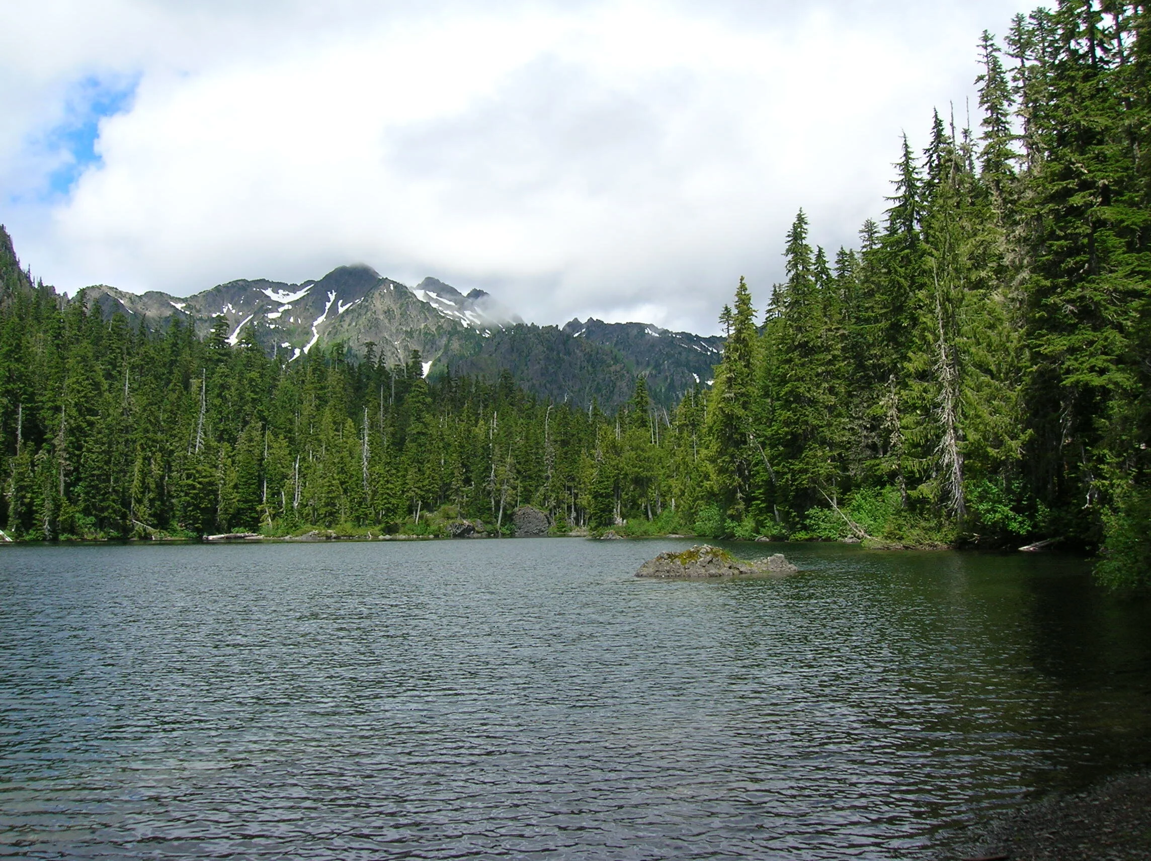
Mildred Lakes
This grueling hike to a trio of backcountry lakes in a rugged wilderness setting is not for the weak of heart. Mildred Mildred Lakes, among the largest backcountry lakes the Olympics with excellent views of Sawtooth Ridge and Mount Pershing, is a challenging trail requiring use of hands and determination.
Craig Romano is an author of more than twenty hiking guidebooks including the bestselling Day Hiking Olympic Peninsula 2nd Edition (Mountaineers Books), which includes detailed descriptions for 136 hikes throughout the Olympic Peninsula. He is a featured columnist for the Fjord and Explore Hood Canal.
t’s the hardest, nastiest, meanest trail in the Olympics! And that declaration should not be taken lightly, as I have hiked thousands of miles (and written about hundreds of hikes) throughout the Olympic Peninsula. With perhaps only the trail to Lake Constance ranking as just as nasty—you won’t find a more curse-inducing trail than this one. The first time I ever hiked to the Mildred Lakes, I swore to myself that I would never ever do this trail again. I hated it. But alas, I was back on that wretched trail again a few years afterward. And my conclusion was that it’s still the hardest, nastiest, you-have-to-be-crazy-for hiking-this trail in the Olympics! So are you interested in hiking it?
Distance: 9.0 miles roundtrip | Elevation Gain: 2900 feet | High Point: 4100 feet Difficulty Loop: difficult | Snow free: July to October
Trailhead Pass Needed: Northwest Forest Pass or Interagency Pass
GPS waypoints: Trailhead: N47 34.517, W123 15.672 | Upper Lake: N47 33.461 W123 18.021
Hit the Trail
Okay, before hitting this trail, let’s have a chat.
No cheery coating—this is what you’re in for. This trail was never officially built. The trailhead was however. It’s fancy with a picnic table, privy and a view of a stunning waterfall. But don’t let those amenities fool you into thinking the trail is anything special. The trail is only 4.5 miles to the lakes, yet it will take you nearly that many hours to reach them. Why? The actual evaluation difference between the trailhead and the lakes is a mere 1,900 feet. But the real elevation gain is more than 3200 feet with copious ups and downs.
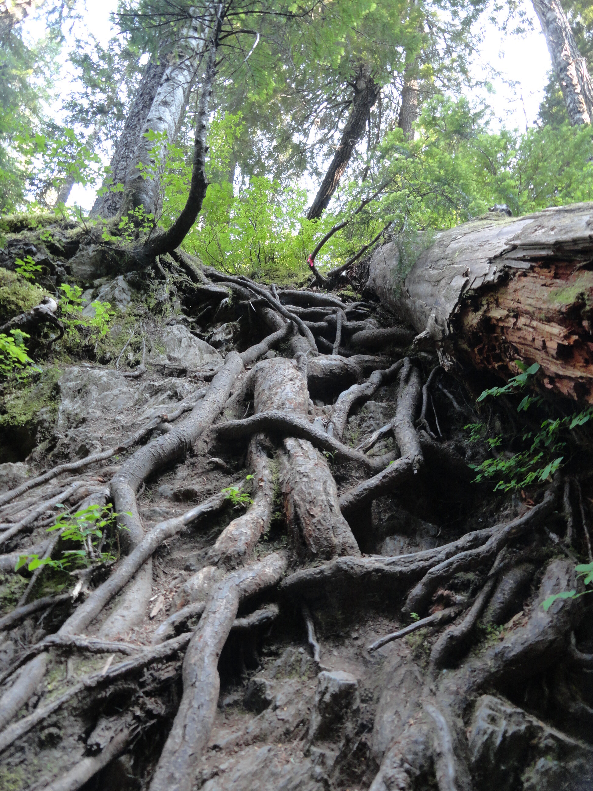
®Craig Romano Photo
There’s one section of trail that climbs more than 1,000 feet in about a half mile. It is a nasty clamber up roots, rocks and loose gravel. But don’t curse the root—for they’ll be your handholds. There’s another trail section where you have to vertically drop about 25 feet into a tight ravine. And you’ll be using a veggie belay to climb out of it. You will skirt mud, go through mud, and probably be covered in mud upon reaching the lakes.
And if you don’t let out a scream, your knees and toes most certainly will! So why then unless you’re a sheer masochist would anyone want to hike this trail? For one thing, the Mildred Lakes are among the largest backcountry lakes the Olympics. Their setting is quite sublime in a rugged basin surrounded by serrated peaks. You will definitely earn these lakes; as many hikers just aren’t cut out for this grueling journey. That means you’ll see a fraction of the amount of people you’d see at nearby Lena Lake.
And in this age of social distancing, the Mildred Lakes’ brutal approach helps make that directive easier to comply. So if you’re ready to bust your rump, read on!

Hamma Hamma Falls | ®George Stenberg
The Mildred Lakes Trail leaves the roar of the cascading Hamma Hamma River behind and enters the 13,000-acre Mount Skokomish Wilderness. Starting out fairly easy, the path winds through an old cut that has been growing back in pretty nicely. The way then passes a large avalanche chute and enters gorgeous old growth forest. Here what once a decent path now deteriorates into an obstacle course. Around fallen logs, over fallen logs, and straight-up rocky and rooty slopes the trail steeply climbs a 3200-foot ridge. Catch your breath, wipe the sweat from your brow and enjoy a good view of nearby Mount Pershing looming above.

®Craig Romano Photo
The trail then descends from the ridge into a cool forested glen graced by rushing Huckleberry Creek. And yes, there are huckleberries here—lots of ‘em to sweeten this hike a tad come late summer. At the creek come to a questionable log crossing. You can teeter on it to cross the creek. But it’s probably far safer to wade across. Don’t bother drying your feet, because another creek crossing awaits shortly afterward.
The trail now get tougher and a tad bit tricky. It ascends a steep ridge and comes to a tight ravine. Using roots as handholds, drop 25 steep feet into the dank draw before resuming a taxing climb. After clambering over rock, root, and ledge—and gaining 1000 feet in elevation in a little more than a half mile—the insanity ends on a 4100-foot ridge. Now wander along open ledges, enjoying excellent views of Mount Cruiser and the Sawtooth Range. You might be a little dismayed however as there are no lakes in sight. Your punishment isn’t over yet.

®Craig Romano Photo
The trail continues. Drop 250 feet and trudge through marshy mosquito breeding grounds. Make haste through it and finally reach the first of the Mildred Lakes. It’s set in deep old timber with a backdrop of rugged summits. The scene is serene. Scramble over more roots and rocks to the far side of the lake for good fishing spots, resting spots and campsites. Watch resident osprey dive bomb the placid lake.
The other lakes are prettier, so carry on by crossing lower Mildred’s inlet stream and following a rough path through heather meadows for about 0.3 mile to a junction. Here a rudimentary path leads right to middle Mildred Lake. Admire its rocky islands. Upper Mildred, one of the largest backcountry lakes in the Olympics can be reached by continuing on the more defined path for just a couple hundred yards forward. Located in a bowl between Mount Lincoln and Mount Cruiser, the setting is as rugged as the terrain you just hiked across. Quite beautiful too, and hopefully justification for all of the bruises, scratches, and aches and pains you’ll bring back with you to the trailhead.

®Craig Romano Photo
Mildred Lakes Notes

Wilderness rules apply
Land Agency Contact: Olympic National Forest, Hood Canal Ranger District, Quilcene, (360) 765-2200; http://www.fs.usda.gov/olympic
Recommended Map: Green Trails Olympic Mountains East 168S
Recommended Guidebooks: Day Hiking Olympic Peninsula 2nd edition (Romano, Mountaineers Books)
Trailhead directions: From Hoodsport travel north on US 101 north for 13.7 miles turning left at milepost 318 onto FR 25 (Hamma Hamma River Road). Continue for 13.3 miles (the last five miles are gravel and can be rough) to the trailhead.
Trailhead facilities: privy, picnic area
Tips for safe and healthy hiking during the Covid-19 Pandemic
It’s imperative that we do all we can to prohibit a second devastating outbreak of this disease. We can do that by adhering to the following while we enjoy our trails:
Avoid crowded hiking destinations. If you arrive and the parking lot is already full, head to another location
Avoid hiking in large groups outside of your family
Practice Social Distancing while on the trail, giving other hikers lots of room to pass and keeping your distance from them at lakes, summits, etc.
Wear a mask when encountering others on the trail. A buff or bandanna works well.
Pack hand sanitizer
Pack it in pack it out
Don’t be a surface pooper. Learn how to properly poop in the woods by always using privies first if available-or by heading at least 200 feet away from all trails, campsites and water sources and digging a cat hole for your business. Bury your waste and toilet paper
Pack out all pet waste.
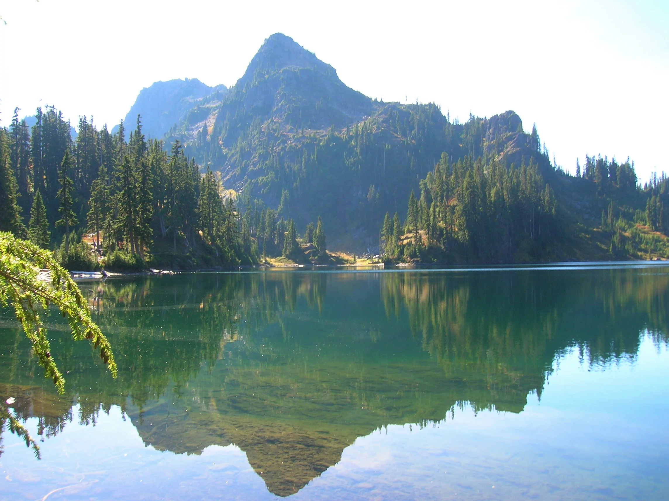
Lena Lakes Hiking Destinations
Gracing the Hamma Hamma Valley are two lakes sharing the name, “Lena.” But aside from the name, they are strikingly different from each other. Renown guidebook writer, Craig Romano, takes us on a trip to visit both these lakes.
Craig Romano | Craigromano.com
Gracing the Hamma Hamma Valley are two lakes sharing the name Lena. But aside from the name, they are strikingly different from each other.
The hike to Lower Lena is an easy kid and dog friendly jaunt through old growth forest. The hike to Upper Lena is a grueling and demanding grunt to a stunning high basin within Olympic National Park. Seasoned backpackers take to the upper lake and often set out afterward to scramble surrounding craggy peaks or head out on a rugged high country route. Lower Lena entertains first time hikers and newbie backpackers often testing their gear and skills for the first time. Expect plenty of company at the lower lake and a good chance for solitude at the Upper Lena.
Hit the Trail
Both lakes use the same approach. On a very well-trodden path head off in second-growth forest. The way immediately climbs, but the grade is gentle. Lena Creek can be heard crashing in the distance.
Lena Lake
Continue up the trail and eventually enter groves of beautiful old growth forest. The trail nears Lena Creek and then crosses it on a solid bridge. You might be dismayed however to be standing on a bridge spanning a dry rocky draw. What happened to the creek? It often makes a subterranean passage beneath all of those mossy rocks.
Now continue hiking working your way around and below a ledge. The trail then continues to climb coming to a junction at 3.0 miles. If you’re lower lake bound, bear right and within no time come to an inviting ledge granting a wonderful view of Lena Lake 100 feet below.
To reach the shoreline continue and descend passing busy campsites. You’ll eventually come to a junction with a trail leading back to the trail heading for the upper lake. Head right and reach the shoreline. The trail crosses Lena Creek and continues towards The Brothers—but that’s more of interest to climbers. You’ll figure out in no time that Lena Lake is one of the most popular hikes in the Olympics. Be sure to treat this heavily visited place with care and to practice Leave No Trace ethics.

Upper Lena Lake
If you’re more interested in a wilder setting, skip the trip to Lower Lena and from that first junction, head left. Immediately notice how much lighter the tread is now. Bear left at the next junction and begin following Lena Creek through spectacular primeval forest. At just over 4.0 miles the trail enters Olympic National Park. Dogs are prohibited from this point on—and if you plan to camp at Upper Lena you must have a backcountry permit (issued at Hoodsport Visitor Center and other Olympic National Park ranger stations). Until this point the climbing has been fairly moderate, but that is all about to radically change.
The trail continues alongside Lena Creek heading up an increasingly tighter valley. After crossing a tributary creek on a log bridge the trail gets downright nasty! Prepare yourself for an insanely steep climb up a rocky, rooty, and at times brushy course. It’s arduous and physically taxing, and when soaked by rainfall it can be treacherous. A good set of trekking poles will come in handy. The climbing eases after you carefully negotiate a ledge and clamber up a steep rocky bed of big rocks,
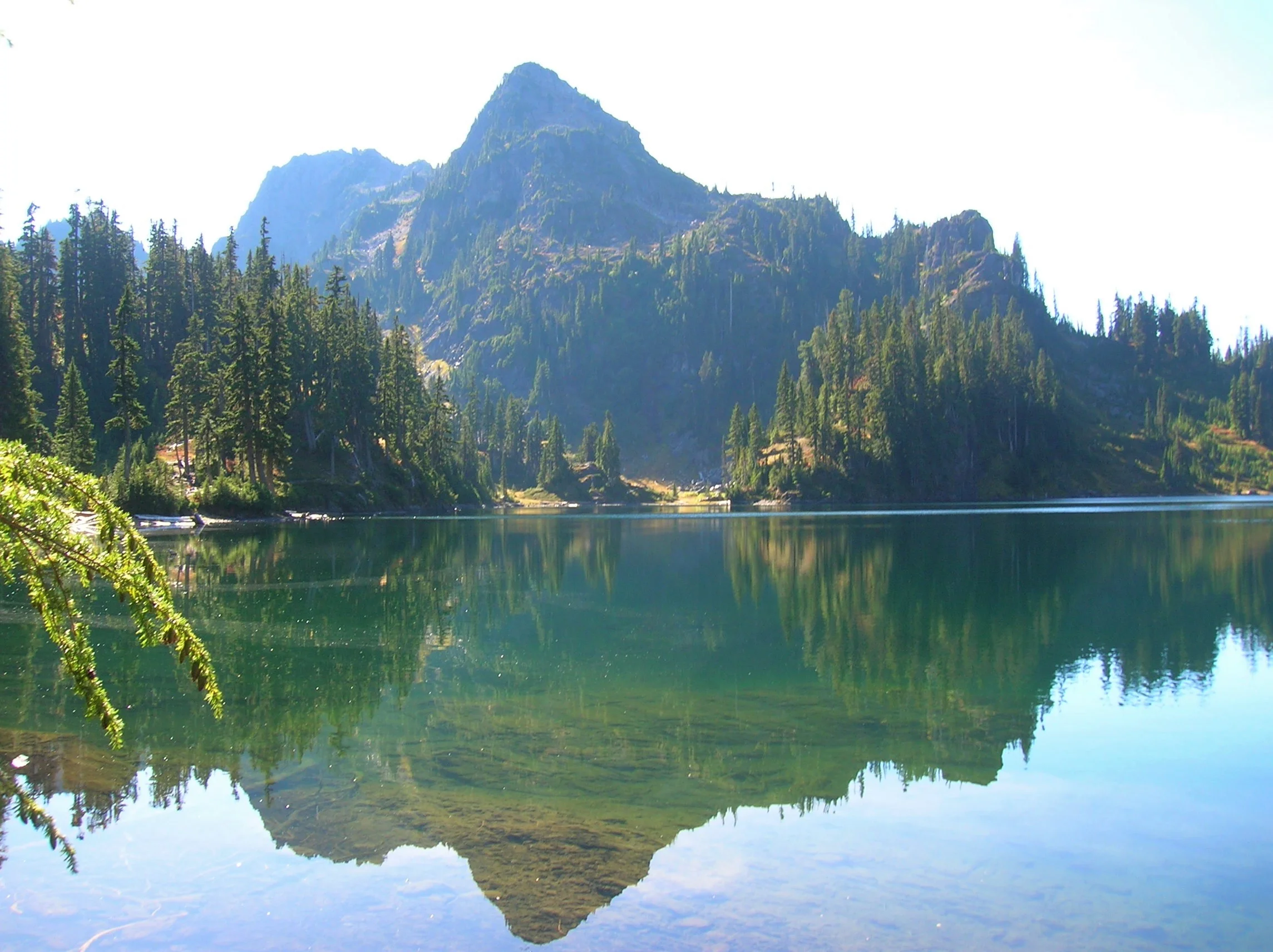
Once again come to and cross Lena Creek, which may be following a subterranean passage here as well.
Continue through open attractive old-growth forest groves. Make one more steep climb before cresting a ridge cradling Upper Lena Lake. Before bolting for the lake, turn around and look back at Mount Rainier in the distance. Now charge for the lake. Enjoy a breathtakingly beautiful backdrop view of 5960-foot Mount Bretherton rising above and reflecting in the lake. Camps (permits required) are along the lake’s eastern shore, and by a short path, on the lake’s western shore.

If you’re up for the day, stay awhile and soak up the beauty. In autumn the surrounding hills colorfully reflect in the lake’s placid waters. Look for critters big and small frolicking in those hills looking for berries. Feel free to help yourself to a handful as well. If you have any energy left consider following a half mile side trail to beautiful Milk Lake set beneath a small glacier on Mount Bretherton. Then rest up and prepare your knees for the brutal and jarring descent back to your vehicle. The beauty and solitude are definitely worth the grind.
Craig Romano
Award winning author and outdoors writer who has authored and co-authored of more than 20 books including Day Hiking Olympic Peninsula 2nd Edition (Mountaineers Books), which features 136 hikes on the Olympic Peninsula. craigromano.com
Lena Lakes Details
Distance:
Lower Lake: 6.0 miles roundtrip; Upper Lake: 14.0 miles roundtrip
Elevation Gain: Lower Lake: 1225 feet; Upper Lake: 4100 feet
High Point: Lower Lake: 1900 feet; Upper Lake: 4600 feet
Difficulty: Lower Lake: moderate; Upper Lake: strenuous
Snow free: Lower Lake: March—Dec; Upper Lake: July—November
Trailhead Pass Needed: Northwest Forest Pass or Interagency
GPS waypoints:
Trailhead: N47 35.984 W123 09.055
Lower Lake: N47 36.994 W123 09.789
Upper Lake: N47 38.068 W123 12.329
Dogs are ok at Lower Lena but prohibited at Upper Lena Lake.
Camping (no fires) at Upper Lake requires National Park Wilderness Camping Permit (contact Olympic National Park, Wilderness Information Center (360) 565-3100)
Land Agency Contact: Olympic National Forest, Hood Canal Ranger District, Quilcene, fs.usda.gov/olympic and Olympic National Park, nps.gov/olym
Recommended Map: Green Trails Olympic Mountains East 168S
Recommended Guidebooks: Day Hiking Olympic Peninsula 2nd edition and Backpacking Washington (Romano, Mountaineers Books)
Trailhead directions: From Hoodsport travel north on US 101 north for 13.7 miles turning left at milepost 318 onto FR 25 (Hamma Hamma River Road). Continue for 7.5 paved miles to the trailhead.
Trailhead facilities: privy
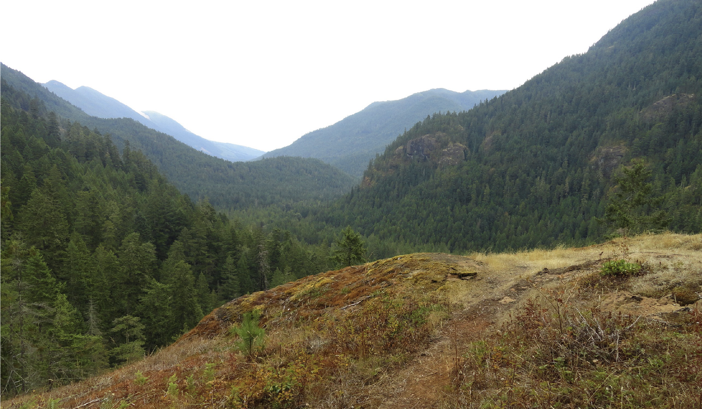
Hood Canal Hike: Duckabush River Trail
The Duckabush River starts in the heart of the Olympic Mountains. Fed by glaciers, snowfields, and a myriad of springs and alpine lakes; this major Olympic Peninsula river provides excellent wildlife habitat and makes for some stunning scenery. Explore this valley in the winter for the added bonus of solitude, a chance to observe elk, and to witness a rain-swollen river careening through clefts and over boulders.
Craig Romano | author Day Hiking Olympic Peninsula 2nd Edition

The Duckabush River starts in the heart of the Olympic Mountains. Fed by glaciers, snowfields, and a myriad of springs and alpine lakes; this major Olympic Peninsula river provides excellent wildlife habitat and makes for some stunning scenery. Explore this valley in the winter for the added bonus of solitude, a chance to observe elk, and to witness a rain-swollen river careening through clefts and over boulders.
Hit the Trail
The Duckabush River Trail is a portal into the wild interior of the Olympic Peninsula. A well-maintained trail travels along a good portion of the waterway allowing you to experience its grandeur. The trail travels a verdant valley for more than 20 miles terminating at Marmot Lake in the heart of Olympic National Park.
That’s a long journey primarily reserved for multi-day backpackers who often continue farther from there to cross historic O’Neil Pass. Day hikers however will be content to head up this trail for just a few miles.
An objective for many hikers and one that includes a good day’s worth of mileage and a little climbing too is to an imposing riverside knoll known as the Big Hump.
If the 7.8 mile distance and more than 1400 feet of elevation gain to reach this destination is too much, a satisfying turnaround spot is a nice stretch of river just prior to the climb.
The Duckabush River Trail like many of the trails leading along rivers into the Olympic interior begins as an old roadbed. Park officials, foresters and others once sought to punch roads deeper into the Olympics. However, over time, changing attitudes that emphasized preservation of areas free of roads and dwindling budgets that couldn’t maintain many miles of backcountry byways led to miles of roadway being converted to trails. In almost all of these cases this has meant miles of gentle hiking as the old roadways were often well graded. That is the case for the beginning of this trail.
Head off down the trail gently climbing through a uniform forest of second-growth fir. This part of the Duckabush River valley was logged—but it was many decades ago. The real old and impressive trees are yet to come. At 1.2 miles the trail enters The Brothers Wilderness, a 16,000-plus acre federally protected section of the Olympic National Forest. Wilderness designation means that this rugged and ecologically important tract of land bordering the national park will never be logged, developed or have a road traverse it. Bicycles and machinery are not permitted either, allowing folks who come to explore this area by foot or horseback a true wilderness experience.
The trail continues through a low gap near Little Hump and then begins a descent of 250 feet, following an old logging railroad grade on an almost perfectly level trajectory. Loggers here didn’t take all of the big timber as a few standing giants attest.
While this part of the Olympics is in a rainshadow, receiving around 70-80 inches of rain a year compared to two to three times that on the other sides of the mountains, mossy limbs and a thick understory makes it feel somewhat like a rainforest.
After passing a campsite the trail finally comes upon the Duckabush River. At 2.6 miles, you’ll reach a spectacular spot where giant cedars and firs hang over the churning, crashing river. This is a great spot to turn around and perfect for a good half day hike or one with young adventurers.
Go Farther
If you’re intent on tackling the Big Hump, continue up the trail preparing yourself for a stiff 1,000 foot climb. The way steadily and steeply at times climbs. Old-growth greenery is soon replaced with fire-scarred trees and burnt and downed timber. Here in 2011 a careless camper started a wildfire that scorched a large patch of old-growth on the Big Hump. Hardy fire-scarred trees stand among stands of fire-ravaged timber. While trail crews have since rehabilitated the tread here, avoid this section of trail during periods of high wind, as burnt snags are prone to toppling.

At a little over 3 miles come to a ledge with a spectacular view east down the river valley.
On a clear day you can see all the way to the Cascades. To the south, impressive St. Peters Dome hovers—often catching swirling low clouds. Return to this spot later in the spring and you’ll have an array of wildflowers enhancing the views. Keep hiking and come to another outcropping before finally cresting 1700-foot Big Hump at 3.9 miles.
For most day hikers, this is far enough. But if you still feel like hiking, continue through a mosaic of old growth and fire scorched trees and descend 600 feet back to the river. Here at 5.3 miles from the trailhead is a camping area near a series of impressive rapids. During periods of heavy rain the river can be deafening here. Watch for darting dippers in the rapids as you rest up for your return to your start.

And if you are a strong hiker or are out on a several day backpacking adventure, the trail generally remains snow-free through the winter for many more miles. Note that at 6.7 miles from the trailhead it enters the national park—meaning dogs are not allowed to continue—and if you are planning on camping, you’ll need to secure a backcountry permit beforehand.