
Head to the Mount Walker Summit
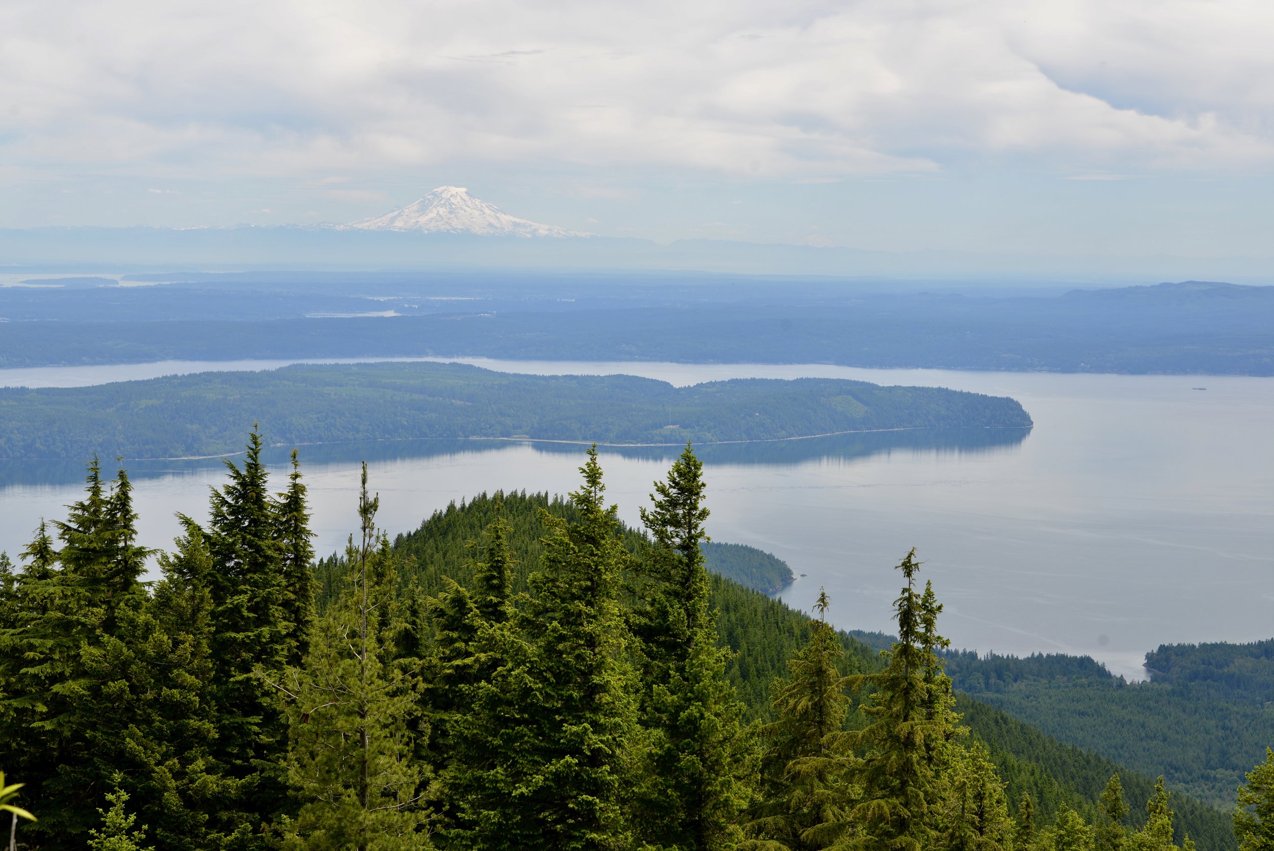
The Easternmost peak in the Olympic Mountains, Mount Walker offers a commanding view of Dabob Bay sparkling below and the Seattle skyline shimmering across Puget Sound. The close up of massive Mount Constance, the third highest peak in the Olympic Mountains is pretty darn impressive too. But the real joy to hiking this trail is ambling through its profuse clusters of rhododendrons. Hit the trail to Mount Walker in May or June for an ascent up a purple mountain majesty!
Craig Romano | story
The Easternmost peak in the Olympic Mountains, Mount Walker offers a commanding view of Dabob Bay sparkling below and the Seattle skyline shimmering across Puget Sound. The close up of massive Mount Constance, the third highest peak in the Olympic Mountains is pretty darn impressive too. But the real joy to hiking this trail is ambling through its profuse clusters of rhododendrons. Hit the trail to Mount Walker in May or June for an ascent up a purple mountain majesty!
Hit the Trail
While a dirt road winds four miles up the north and east side of Mount Walker allowing folks to drive to the views—hiking to them is far more rewarding. The trail ascends the mountain’s thickly forested west side far away from the road. But if the thought of busting your rump up a mountain only to be greeted by fresh-smelling folks who just popped out of their vehicle doesn’t appeal to you—then consider a hike up Walker when the road is gated and closed to vehicles. It’s also during that time that you can consider a loop hike by returning on the road.
On the rare occasions that snow accumulates on this low Olympic peak, the road makes for an excellent snowshoe or cross country ski route.
From the unimposing trailhead immediately begin climbing through a tunnel of rhododendrons under a uniform canopy of second-growth cedars and hemlocks. Washington’s state flower, the Pacific (or coast) rhododendron, grows in profusion along the steep dry slopes of Mount Walker. For much of the year the rhodies merely add a layer of dark green to the forest understory.

Pacific Rhododendron
But come late spring this hardy shrub begins to blossom, speckling the surrounding firs and hemlocks with rosy-purple bouquets. By June, vibrant violet bell-shaped blossoms ring throughout the emerald forest.
Interestingly, that although the Pacific Rhododendron is Washington’s state flower, it’s not very widespread in the Evergreen State. It primarily grows along the east slopes of the Olympics near Hood Canal, the Kitsap Peninsula and a few pockets on the western slopes of the Cascades.
It’s far more distributed in Oregon and grows profusely in the state’s southern Coastal Mountains as well as along California’s north coast. A clover, a flower more widespread in Washington, but not nearly as grand and showy as the rhododendron, almost became the state’s official flower back in 1892. But the rhodie overwhelmingly won the vote by thousands to represent Washington in the 1893 Chicago World’s Fair. It wasn’t until 1959 however when the state legislature made the rhodie officially the state’s flower. Mount Walker is one of the best places in Washington to appreciate this beautiful flower.

The trail climbs steeply. Occasionally take a break and look up to see if you can locate any of the old wire and insulators that once serviced a fire tower on the summit. After about 1.5 miles small ledges begin to break the monotony of the forest and tease with limited views. The grade then eases. Finally after 2 miles and nearly 2000 feet of climbing reach the North Summit viewpoint, which was the site of a fire lookout from 1931—1967.

Enjoy good but limited views west and north here. Then head to the South Summit (dogs must be leashed at the summits) by walking the graveled Summit Road for 0.4 mile to a picnic area and then following a 0.1 mile trail to a breathtaking panoramic view of Puget Sound.
Stare straight down to Quilcene Bay, Dabob Bay and the Toanodos Peninsula. Across the sparkling waters Green and Gold Mountains rise on the Kitsap Peninsula. Locate the Seattle skyline east of Kitsap. When clouds are absent or high in the sky, Mount Rainier adds a snowy backdrop to this beautiful scene. And if you’re here in June, the view will be framed with fragrant purple boughs.

Mount Walker
Distance: 5.0 miles roundtrip
Elevation Gain: 2050 feet
High Point: 2805 feet
Difficulty: difficult
Snow free: April—December
Trailhead Pass Needed: None
Notes: From November 1 until March 31 FR 2730 is gated. During this time park away from the gate near US 101 and walk .3 mile to the trailhead. Do not block the gate, park in the road, or block any private driveways.
GPS waypoints: Trailhead: N47 46.554 W122 54.854 | Summit picnic area: N47 47.100 W122 54.077
Features: Exceptional views of Hood Canal; historic fire tower site; one of the finest trails in the Olympics for rhododendron blooms
Land Agency Contact:
Olympic National Forest, Hood Canal Ranger District, Quilcene, (360) 765-2200, http://www.fs.usda.gov/olympic
Recommended Guidebook:
Day Hiking Olympic Peninsula 2nd edition (Romano, Mountaineers Books)
Trailhead directions:
From Shelton follow US 101 north for 47 miles. From Quilcene drive US 101 south for 5 miles) to just north of milepost 300. Turn right onto Mount Walker Road (FR 2730) and proceed 0.3 mile to the trailhead.
Guest Columnist:
Craig Romano
From forest ranger, to history teacher and now a full-time outdoor writer, Romano developed a love of the natural world growing up in rural New Hampshire. Romano has written more than 25 outdoor guide books including "Winter Hikes of Western Washington” (Mountaineers Books, 2009) and "Day Hiking Olympic Peninsula." He lives in Mt. Vernon with his wife and son.

Mount Rose: Summer hike with a climb
This hike is one of the steepest in the Olympics but with a blanket of wildflowers and stunning views, it is well worth the climb! With a nod to William Shakespeare, that which we call Mount Rose by any other name would still be as steep!
Story and pictures: Craig Romano
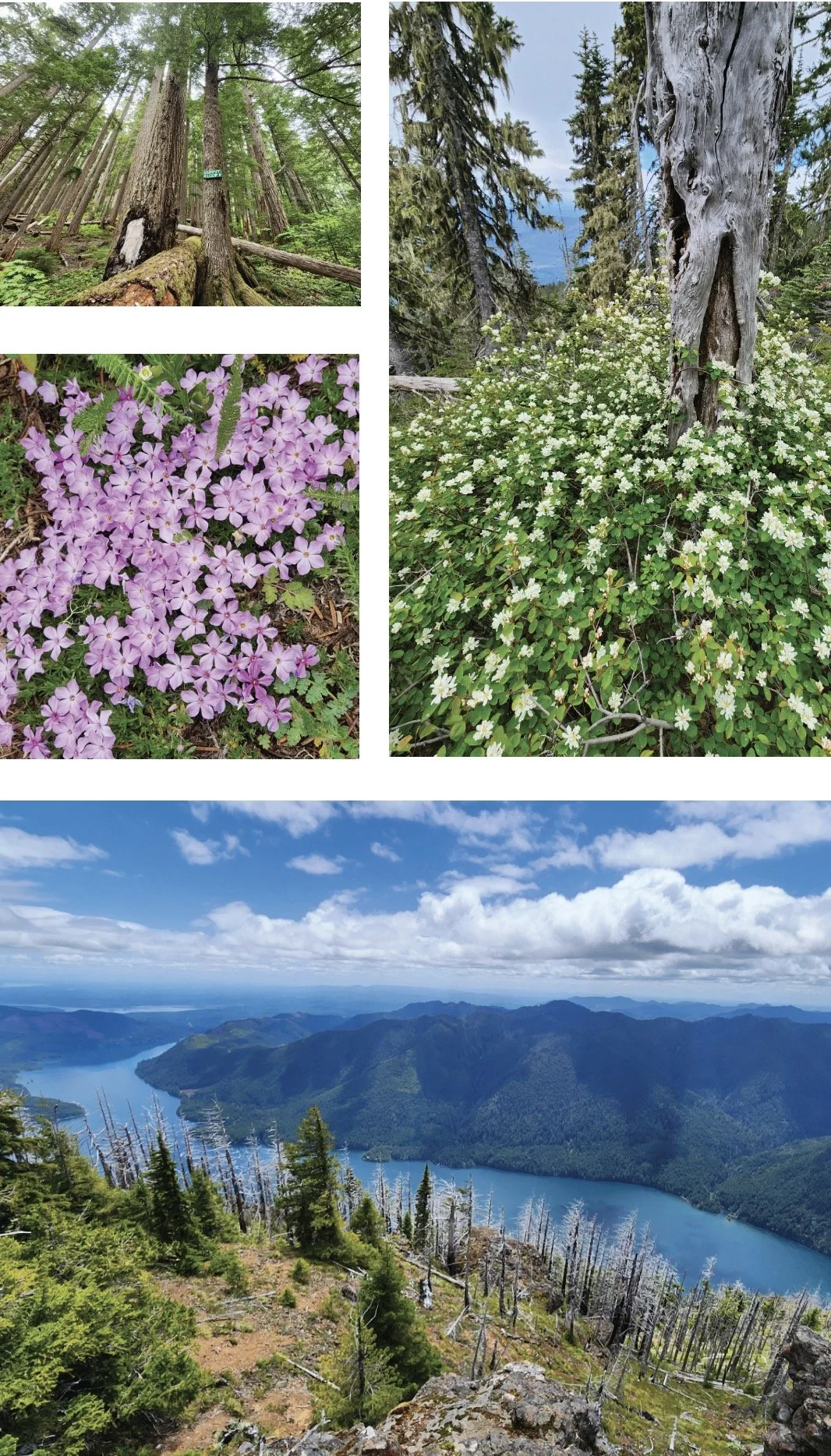
This hike isn’t terribly long. And its trailhead is fairly easy to reach via mainly good paved roads. The trail traverses impressive towering old-growth forest. And in summer wildflowers brighten the forest floor and decorate summer ledges. Views? They’re stunning, especially of Lake Cushman sparkling 3,500-feet directly below. But every rose has its thorn. And for Mount Rose, all of this natural beauty and splendor comes at a steep price—literally. This hike is one of the steepest in the Olympics.
Hit the Trail
Yes, the trail up Mount Rose is grueling. But it makes this hike all that much sweeter by weeding out the crowds. Rose makes for an excellent quieter alternative to nearby Mount Ellinor. And being more than 1,000 feet lower than that popular peak means a longer snow free hiking season on Rose. And while handfuls of hikers may swear off this mountain—plenty swear by it and swear on it while going up it. They embrace its steepness as a great conditioner for harder hikes planned later in the season. In any case, do not under estimate this hike. Trekking poles will significantly help—especially on the insanely steep descent. And take plenty of water.
The trail starts out deceptively easy on a fairly level traverse along the base of the mountain. After crossing a pair of cascading creeks and passing a square-shaped builder shrouded in ferns the way gets down to business. A seemingly endless procession of switchbacks will keep you occupied. And if you think the going is steep—it used to be steeper! The all-volunteer Mount Rose Trail Crew reconfigured and rebuilt much of this trail several years ago, making it much more negotiable. The Mount Rose Trail Crew has left their positive marks on many of the trails in the Lake Cushman area.
Much of the lower mountain is covered in uniform second growth forest thanks to fires early in the last century. But a handful of surviving towering old-growth giants break the monotony of the younger forest. The trail enters the 13,000 Mount Skokomish Wilderness, one of five wilderness areas in Olympic National Forest flanking Olympic National Park. At just shy of 2.0 miles (although it may feel a lot longer) the trail reaches the summit loop junction. Here a small plaque honors the crew that built this trail.
Which direction you take the loop is dependent on your preference. The way left is much steeper which for many is easier to ascend than descend. But if you head right instead you will reach the scenic payoff later—prolonging the anticipation. Most folks head left first to tackle 1300 feet of ascent within a mile. The way relentlessly climbs passing through dark moist forest before transitioning to a forest recovering from a 2006 wildfire. At 2.9 miles from the trailhead reach the 4301-foot open-forested summit. Your attention will be immediately drawn to sparkling Lake Cushman below. It’s a breathtaking view of the large lake cradled by steep emerald slopes. But do scan the lake’s surroundings too admiring Lightning Peak and Timber Mountain rising majestically above it. Take in views too of Wonder Mountain and Church Peak to the southwest; and the Skokomish delta, Black Hills, Willapa Hills, and Mount Rainier to the south. And catch glimpses through silver snags and white pines of the deep valley of the North Fork Skokomish River.


After admiring the stunning views, continue on the loop along a narrow forested ledge. Along the way you’ll be greeted with more fine views including close ups of Copper Mountain towering above you and Hood Canal in the distance. The way then enters impressive old-growth forest and passes a fascinating colonnade of four silver firs. They’ve grown so close together they appear fused. The summit loop will deliver you back to a familiar junction from where a brutal descent will deliver you back to the trailhead.
Mount Rose’s views are indeed sweet. But the mountain’s summit floral show can be equally stunning. The mountain however is not named for roses, of which four native species grow in the Olympics. The mountain takes its name from Alfred A. Rose, who in 1885 arrived in the valley below with his wife and three children from California. Rose was one of the first non-native settlers in the valley, claiming 150 acres along Lake Cushman. But his tenure here was short. He succumbed to small pox four years later. In 1926 the lake was dammed greatly increasing its size and inundating Rose’s original homestead as well as other early settlements. I’m not sure if Rose ever grunted to the summit that bears his name. But with a nod to William Shakespeare, that which we call Mount Rose by any other name would still be as steep!

Tunnel Creek Trail Hike
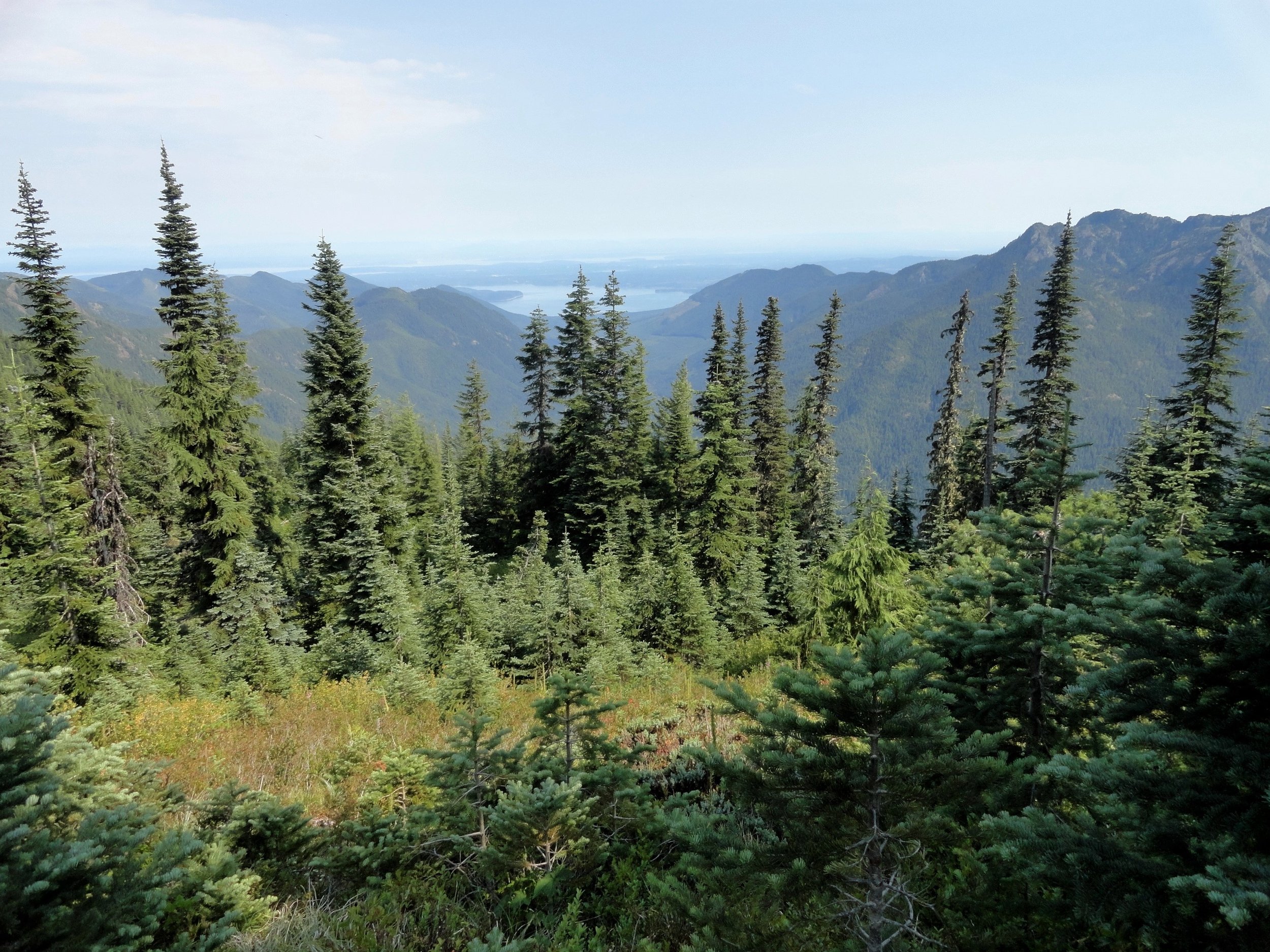
Olympic National Forest’s Tunnel Creek Trail lies just a few miles south of the popular Big Quilcene Trail. But unlike the Big Quil which leads to Marmot Pass, a high windswept wildflower-rich gap providing sweeping views—the Tunnel Creek trail travels mainly beneath a thick canopy of primeval forest.
Craig Romano | author
Olympic National Forest’s Tunnel Creek Trail lies just a few miles south of the popular Big Quilcene Trail. But unlike the Big Quil which leads to Marmot Pass, a high windswept wildflower-rich gap providing sweeping views—the Tunnel Creek trail travels mainly beneath a thick canopy of primeval forest. Lacking the wow factor of Marmot Pass, Tunnel Creek gets passed over by many a hiker. However, those who take to this trail less taken soon discover; Tunnel Creek offers plenty of delightful spots and some pretty decent views as well. And all without the crowds of Marmot Pass.
Hit the Trail

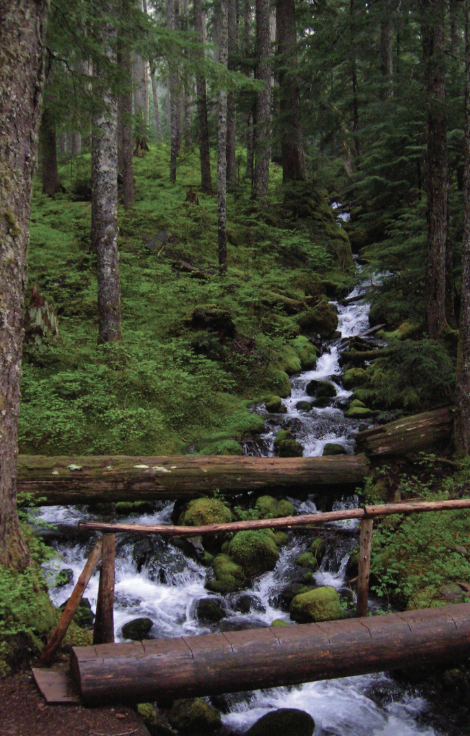
The Tunnel Creek Trail immediately enters the 44,258-acre Buckhorn Wilderness, the largest roadless area in Olympic National Forest. Much of the wilderness lies within the Olympic rain shadow encompassing some of the driest mountainous terrain in the Olympics. But here at the wilderness’s southern reaches, precipitation increases. And it’s noticeable immediately upon starting up the trail. The surroundings are verdant—draped in mosses and lichens. The trees are grand. And the valley is alive with the sound of cascading water.
Work your way up a tight valley following alongside tumbling South Fork Tunnel Creek through a tunnel of towering old-growth western hemlocks and Douglas-fir. The hike is magical, almost ethereal on a misty morning. And it’s welcoming on a sweltering summer day, as the ancient trees do an excellent job of regulating the temperature, providing some much appreciated air-conditioning.
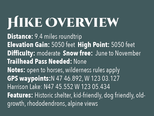
After 3.3 miles and gaining a modest 1500 feet of elevation, reach the still intact Tunnel Creek Shelter. A remnant from when this trail was much longer (before logging and roads obliterated much of it). In the early days of Olympic National Forest and Olympic National Park there were more than 90 trailside shelters in the Olympics. Many were developed through the guidance of Frederick William Cleator, who became one of the nascent US Forest Service’s first recreational specialists. Along with calling for trails, shelters, and fire lookouts, Cleator also advocated for a large portion of the Olympics to be left as wilderness, free from any developments.
The early shelters were meant to help administer the forest by providing rangers, trail workers and foresters a place to overnight while traversing the vast wild lands of the Olympics. But they were also welcomed by the few backpackers who plodded into the Olympic backcountry at the time. Through the years many of the shelters succumbed to fire, collapse and disrepair. And as recreational use increased and attitudes changed regarding land management, many hikers and land managers began to question the role of these structures in the wilderness. Under new directives many of the shelters were allowed to fall in disuse or were intentionally dismantled.
Many recreationists however continued to argue for the need of these shelters to provide emergency cover for backcountry users caught in severe weather. Many other recreationists including this author have argued to maintain the remaining shelters now numbering only around 20 as historically significant and preserve them as historic structures.
The Tunnel Creek Shelter is one of the last remaining in Olympic National Forest. Perhaps use it for a lunch break. Reflect on its long history and the role it has played providing refuge to many a wanderer on a cold and wet day. And help protect it from misuse. Beyond the shelter, the trail crosses via a log bridge the South Fork of Tunnel Creek and then gets down to business. They way now steadily and steeply climbs out of the valley ascending a thickly forested ridge. Eventually reach a small saddle in the ridge harboring two small bodies of water. The first is a small grassy pond known as Karnes Lake. Just beyond and a little higher up at 4.3 miles from the trailhead and at an elevation of 4300 feet is the more appealing Harrison Lake.
You don’t want to call it quits yet however. Conjure up a little more energy and continue hiking, ascending through open forest and over ledge coming to the 5050-foot ridge crest at 4.7 miles. Now take in an exceptional view of 7,743-foot (third highest peak in the Olympics) Mount Constance’s impressive sheer vertical east face.
You can scramble along the rocky ridge a little higher to better appreciate Constance’s towering presence, less than two miles away to the northwest.
For most hikers this is the turning around spot. But the trail continues from here making an insanely steep drop of more than 4300 feet in 3.6 miles to the Dosewallips River Road. It’s brushy in spots and easy to lose along the ridge. Otherwise it’s in decent shape down steep slopes and through old growth and past a small waterfall at Gamm Creek.
f you can arrange a car shuttle consider hiking out this route. There are some good views down to the Dosewallips River valley and out to Hood Canal during the initial descent if you want to just wander a little way down the trail. Otherwise start heading back to the cool forests of South Fork Tunnel Creek on the much more agreeable trail back to your start.
The details
Land Agency Contact: Olympic National Forest, Hood Canal Ranger District, Quilcene, (360) 765-2200,fs.usda.gov/olympic
Recommended Guidebook: Day Hiking Olympic Peninsula 2nd edition (Romano, Mountaineers Books)
Trailhead directions: From Shelton follow US 101 north for 50.5 miles. (From Quilcene, drive US 101 south for 1.5 miles). Turn left (west) onto Penny Creek Rd. After 1.5 miles bear left onto Big Quilcene River Rd (Forest Rd 27); which eventually becomes paved. At 3.0 miles bear left onto graveled FR 2740 and follow for 6.9 miles
Early Summer Roadside Attractions | Native Flowers
Driving down the Hood Canal in early summer you are not only greeted by views of the sparkling fjord and glimpses of the blue hills of the Kitsap Peninsula and the receding snow on the Olympics, , but the luscious greens and pops of white and pinks of the native and non-native vegetation that flourishes along the highway is a feast for the eyes.
Driving down the Hood Canal in early summer you are not only greeted by views of the sparkling fjord and glimpses of the blue hills of the Kitsap Peninsula and the receding snow on the Olympics, but the luscious greens and pops of white and pinks of the native and non-native vegetation that flourishes along the highway is a feast for the eyes.
Ocean spray – Holodiscus discolor

Ocean spray – Holodiscus discolor
Ocean Spray or Ironwood is a medium to large (on average 3 to 10 feet high) shrub of the Rosaceae (rose) family characterized by its white, drooping chained flowers (or sprays). These flower sprays resemble the foam churned up by an angry sea –hence the name Ocean Spray. It blooms typically from July to August. The leaves are also distinctively lobbed oval to angular in shape with deep toothed edges. These are often covered in a fine fuzz of hairs.
It has a large range from California to Alaska, in both inland and coastal areas, but it prefers to have its feet wet and lots of Southern sun exposure. It is very hardy, able to propagate from root, seeds, and cuttings. Roots buried under rock fragments and particles ejected by the 1980 Mount St. Helen’s eruption still managed to push up growth, allowing Ocean Spray to be a successful colonizing plant of the ravaged landscape.
The wood of Ocean Spray is very hard and is prized by Native Americans for a multitude of uses: such as arrow shafts, bows, spears, harpoons, digging sticks, fishhooks, needles, and canoe paddles. Since it increases in strength when exposed to heat, it was useful for fire tongs in early days. Before iron nails were readily available, pegs of Ocean Spray were used. The leaves, flowers and bark were used medically by Native Americans to treat diarrhea, smallpox, chickenpox and as a blood tonic.
Nootka Rose –Rosa nutkana
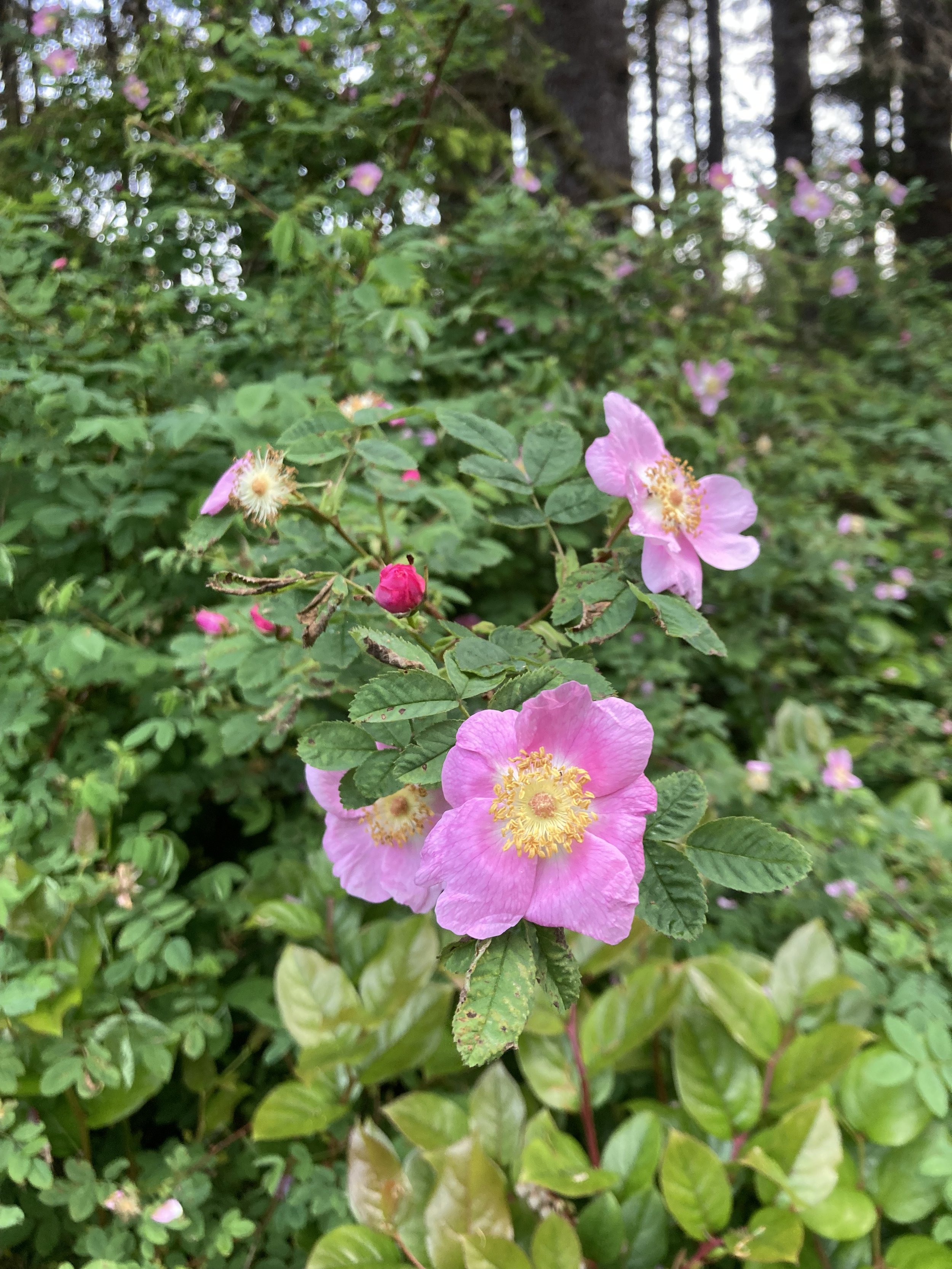
Nootka Rose is one of three wild rose varieties native to the coastal region. It is named for Nootka Sound, BC, where it was first described by botanists in the late 1700s. It is a rigorous climbing rose with spaced thorns and bright yellow sepals on striking large pink blossoms (usually a single blossom to the branch). The leaves are round with toothed edges. It flowers from May to July and forms bright red rose hips which ripen early fall and stay on the branch well into winter. Look for a sunny exposure for this plant too, but it may be found on the edges of forests as well.
Also known as “Deer Candy,” the petals are sweetly scented and may be eaten raw, used as a base for rose syrup, or any rose infused baking. The fruit (or hips) are high in vitamin A, C and E and are used in teas, jams, and jellies. Native Americans created a decoction of the roots as an eyewash and to treat sore throats. A tea made from the bark was used to treat labor pains.
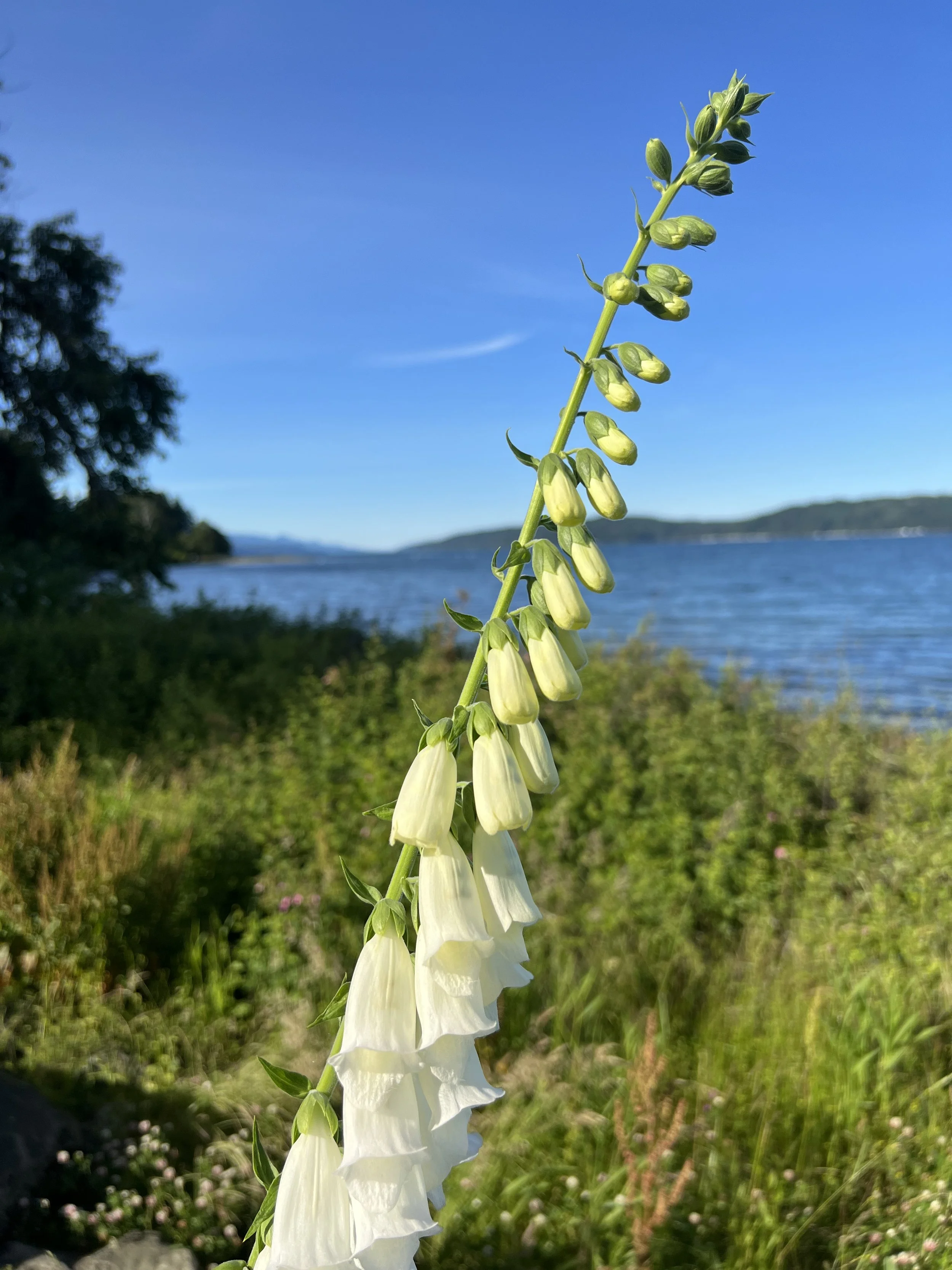
Foxglove – Digitalis purpurea

Although now considered an invasive species in the Pacific Northwest by the USDA, foxgloves are a beautiful addition to the roadside. Furthermore, they are incredibly toxic, so they don’t promote wildlife foraging along the highway. The tall purple and white spired flowers look like fairy apartment blocks and are a favourite amongst bumble bees and other pollinators.
The name digitalis comes from the Latin digitus or finger, which was ascribed to the plant first by Leonhart Fuchs in 1542 based upon the German name for the plant Fingerhut which means ‘thimble,’ but literally translates to English as ‘finger hat.’ It is unclear if the English name of foxglove is a corruption of folk’s glove and somehow related to the wee folk or fairies, or if it is related to the myth of foxes donning the petal cups to muffle their footsteps as they sneak up on the farmer’s chickens. Either way the foxgloves are surrounded by whimsy.
Less whimsical names for the plants relate to the high toxicity of it: dead man's bells and witch's gloves. All parts of the plant are toxic, whether dried or fresh and even drinking the water of a vase where cut foxgloves have been kept can be fatal.
However, digoxin harvested from the plant has been used by herbalists since the 16th century to treat heart conditions and even today it is used in heart medications.
April Showers Bring Spring Flowers
Although the Pacific Northwest is known for its temperate rainforests accompanied by an abundant amount of green, with April warmth, we can start to look forward to the colorful relief offered by the return of the native flowers around the Canal and South Puget Sound area.
Although the Pacific Northwest is known for its temperate rainforests accompanied by an abundant amount of green, with spring’s warmth, we can start to look forward to the colorful relief offered by the return of the native flowers around the Canal and South Puget Sound area.
April to June is the best time of year for finding the delicate jewel tones out here on the wet coast. Whilst domesticated daffodils and tulips will always be celebrated markers of Spring, our native plants are often forgotten gems of the forests understory. As the days get longer and the weather gets warmer, take a ramble down one of Mason County’s forested walks, like Twanoh State Park Trail or for a more adventurous alpine hike, with spectacular views and unique flora, try Mount Ellinor Trail.
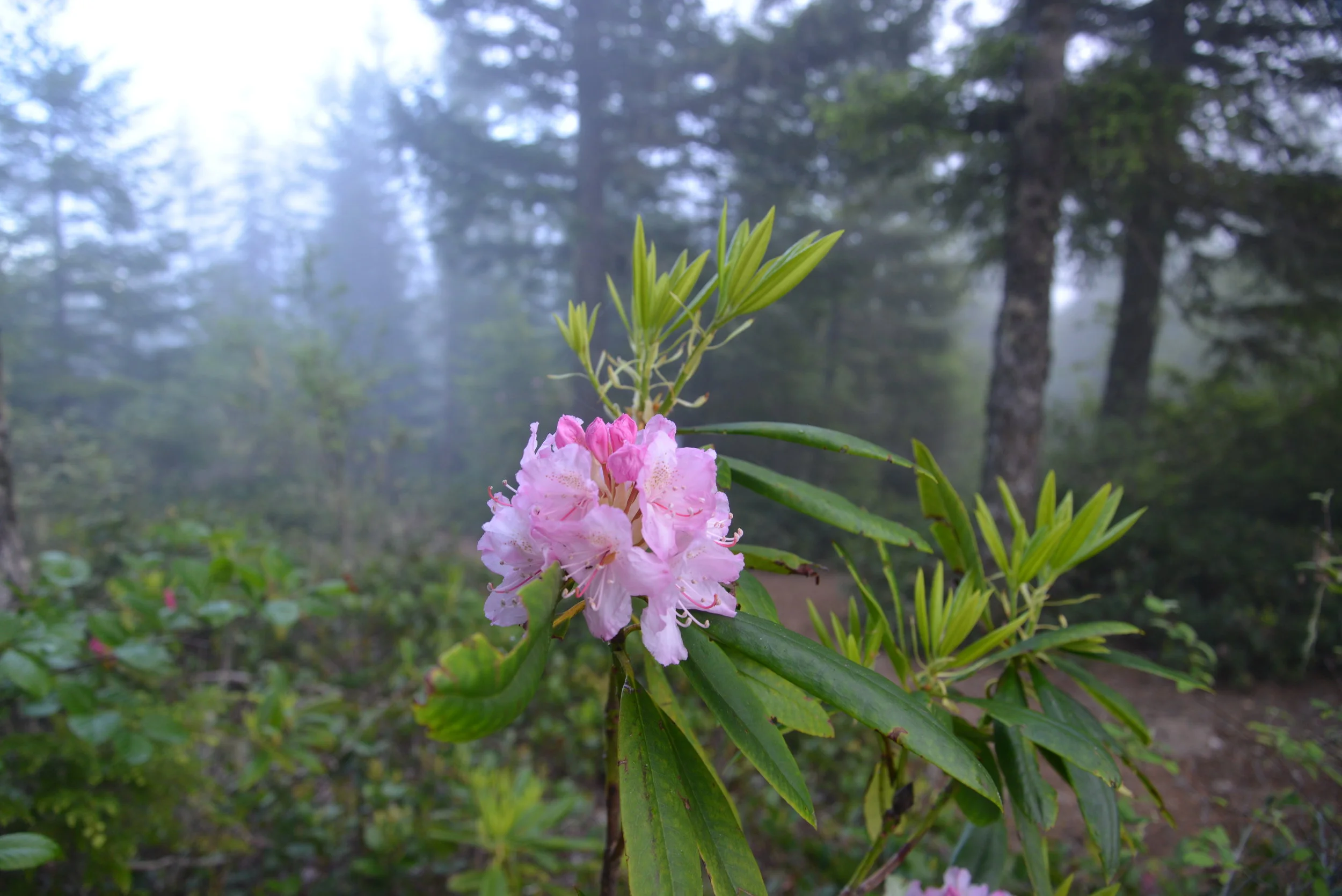
Keep your eyes peeled for the first nodding, purple blossoms of Henderson's Shooting Star (Dodecatheon hendersonii) and the showy, pinky-purple blooms of our local variety of Rhododendron (Rhododendron macrophyllum).

The Pacific Rhododendron is Washington’s State flower and is found in drier parts of the Hood Canal in the understory of coniferous forests.
There are nearly 30 varieties of Rhododendrons native to North America. The Pacific Rhododendron is Washington’s State flower and is found in drier parts of the Hood Canal in the understory of coniferous forests. Pacific Rhododendron can also be seen in partly sunny, open areas, such as along roads. The Pacific Rhododendrons and also Goat's Beard (Aruncus dioicus) can be found in proliference along the winding, scenic 101 Highway following Hood Canal. For an especially spectactular showing of the native rhodendrons, head up to the scenic outlook on Mount Walker.

Pink Fawn Lily
In sunnier, damper areas, near streams, look for the bright pink flowers of Pink Fawn Lily (Erythronium revolutum) or the iconic, if not slightly smelly, “West Coast Daffodil”— Skunk Cabbage (Fritillaria lanceolata). Also in sightly shady, waterside spots, look for carpets of pink Bleeding Heart (Dicentra formosa)— a more delicate version of our domestic variety. Try the Kamilche Kennedy Creek Trail for these humid loving flowers.
Orange Honeysuckle
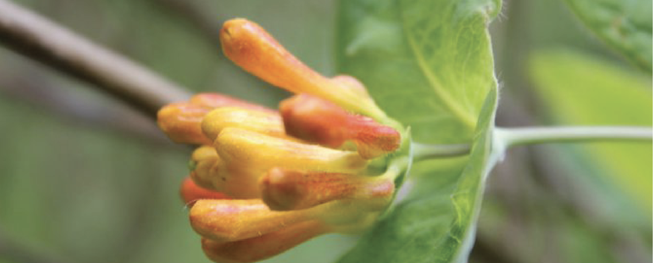
As the weather gets warmer (from May to June) search in the partly shady area of the woods for the trailing tender beauty of Orange Honeysuckle (Lonicera ciliosa), and the yellow blossoms of Tall Oregon Grape (Mahonia aquifolium). The delicate, orange-red blooms of Red Columbine (Aquilegia formosa) also emerge during this time.

Camas was actively cultivated and traded between first peoples throughout the Northwest who would harvest the bulbs in the early spring and roast them in pit cooks.
Other blossoms to look for in the late spring are the azure, crocus-like flowers of the Common Camas (Camassia quamash). Found in full sunlight in open places, such as fields, parklands, the bulbs from the Camas were an important part of the diet of Native Americans. Known as k’a’w˜up to the Skokomish and sxa’dzaêb by the Squaxin, this bulbous flower was actively cultivated and traded between Nations throughout the Pacific Northwest who would harvest the bulbs in the early spring and roast them in pit cooks.
On one of those calm days when you believe it might just be summer here early, pack a lunch and hop in the boat and travel to Hope Island Marine State Park. Here you will be greeted by lovely trails and beautiful naturalized gardens with a mix of introduced and native species.
Red Paintbrush
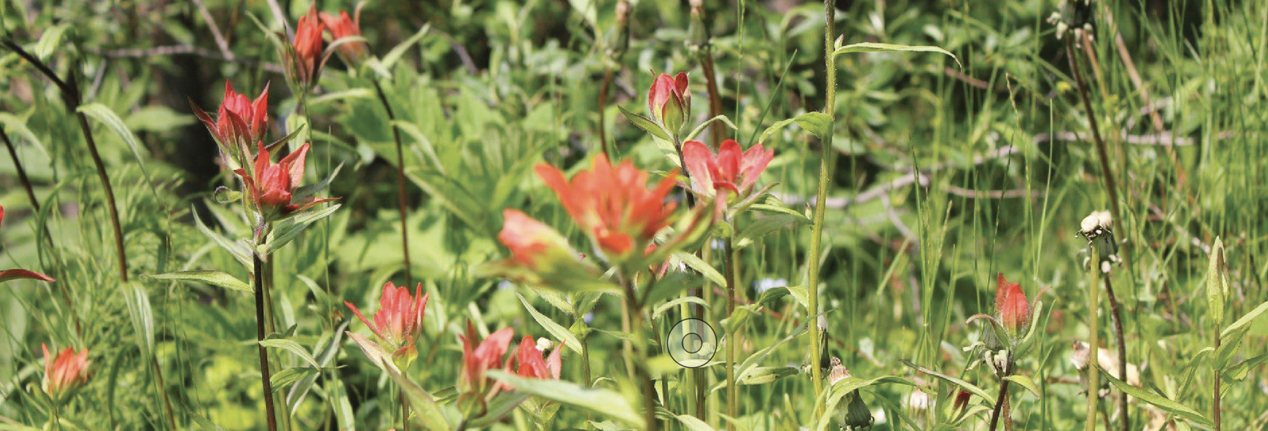
Once settled as a farm, Hope Island has historic fruit trees mixed in with native camas, honeysuckle and the elegant red, trunks of Madrone (Arbutus menziesii). An unusual looking plant found along sun-facing, beach banks is the Red Paintbrush (Castilleja miniata), whose tiny green flowers are hidden in bright red leaves that give the appearance of a brush dipped in red paint. Since most of these species are protected against picking or transplanting, remember to keep your enjoyment to viewing.
You can take as many photographs as you like, but refrain from taking bouquets and let the native flowers thrive.
If casual enjoyment of our native plants is what your after, the Washington Native Plant Society has plant identification resources online and there are plenty of guide books to help. Pojar and Mackinnon’s Plants of the Pacific Northwest Coast (2014) and Nancy J. Turner’s Food Plants of Coastal First Peoples (1995) offer excellent information, photographs and tidbits that add color to an already polychromatic subject. Happy hunting!
Need some Color? This weekend is the Dahlia Days Event!
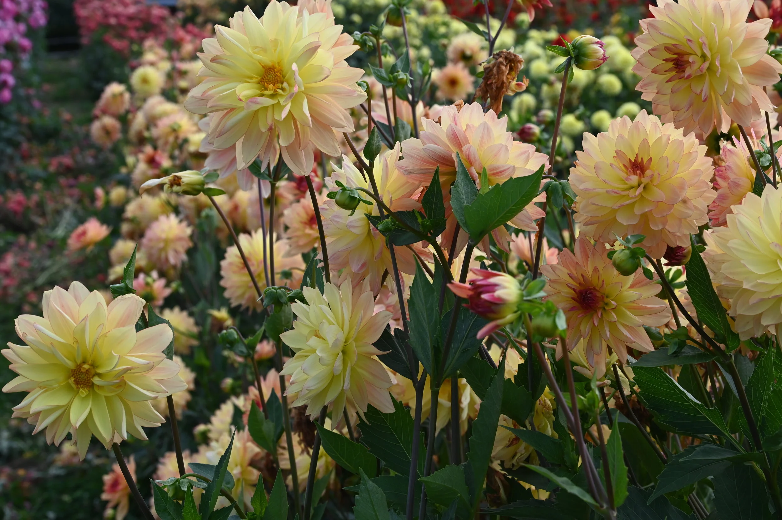
Need some color in your life? Then head over to Lynch Creek's Dahlia Farm where the blooms are bursting with a rainbow of shades and shapes!
Need some color in your life? Then head over to Lynch Creek's Dahlia Farm where the blooms are bursting with a rainbow of shades and shapes!
Lynch Creek Farm has been growing dahlias for well over 20 years. In 2018 owner, Andy Hunter, decided to open the dahlia fields to the public as a u-pick – and ever since it has been a much anticpated annual attraction.
Many locals photographers and families have been bringing the kids, cameras, and even dogs for some spectacular photos in a beautiful setting.

With three acres of dahlias to plant and prepare, it's a family affair with three generations of the Hunter family making sure their are plenty of blooms to go around. Arranged in giant rows, it's a rainbow so large that small planes overhead do a fly over.
The flowers are at their peak in the fall - like right now! – so make a day out of it with your friends and family. This makes a great annual tradition with the bonus of beautiful hand-picked bouquets, special pictures, and a fun adventure.

LCF Dahlia Days
On Saturday, August 28th, head over to the Bouquet Making Masterclass with renowned Mason County florist Colleen Hunter. They’ll also have games, concessions, and a local food truck out at the field! There will be something for every member of the family to enjoy! If you are interested in the Bouquet Making Masterclass, click the link below. They have limited space and are expecting the spots for this section of our Dahlias Day event to go fast! https://lynchcreekdahlias.com/lcf-dahlia-days/

The farm is open dawn until dusk every day until the first frost (late October) and the stand is often manned with helpful staff. Certain days during the summer a local non-profit groups take over the farm and all proceeds for that day are donated to their cause. When it’s not staffed there are signs, buckets, clippers, pre-made bouquets, and a drop box to help offset weeding expense.
More information is available at lynchcreekdahlias.com. See you in the flowers!
