

5 amazing hikes around Hood Canal
Craig Romano has outlined 25 great hiking destinations for us on Hood Canal — Here’s five to get you started!
Award winning local guidebook author, Craig Romano, shared 25 of his top area hikes with us in a handy “stuff-in-your-glovebox guide,” here are a few of the many hikes that are open and awaiting your adventure! Welcome to the #wildsideWA.
Tighten your laces!

1. Murhut Falls
(Olympic National Forest)
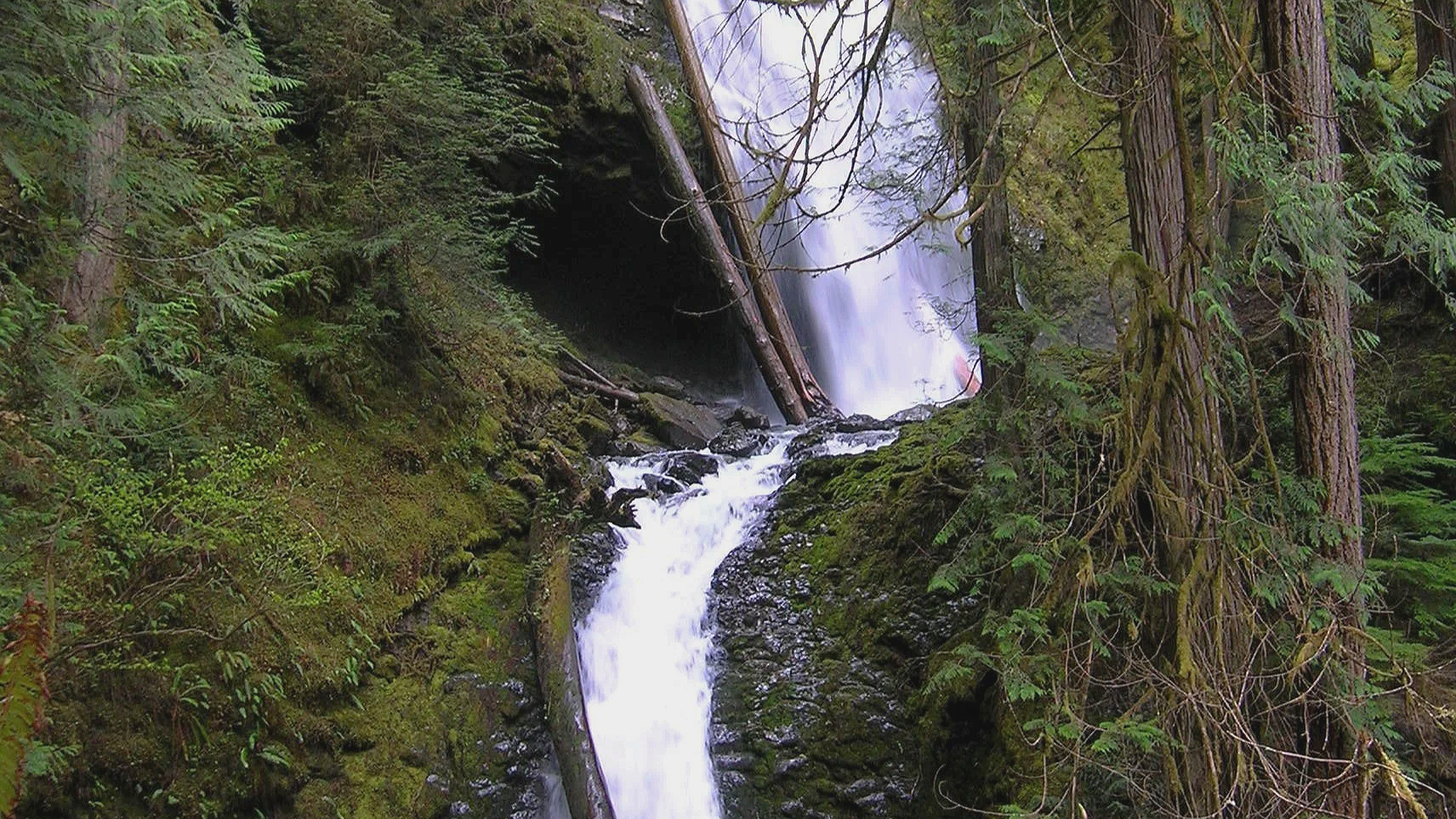
Hidden in a lush narrow ravine, Murhut Falls were long unknown to many in the outside world. But all that changed upon the construction of a well-built and easy to hike trail. This two-tiered waterfall that plummets 130 feet has become a favorite cascade for many Olympic Peninsula hikers. The trail starts by following an old well-graded logging road. As you work your way toward the falls, its roar will signal that you’re getting closer. Reach the trail’s end and behold the impressive falls crashing before you. The upper falls drops more than 100 feet while the lower one crashes about 30 feet.
Difficulty: Easy, 300 feet elevation gain, 1.6 miles
Permits: Not required
Kid and Dog Friendly: Yes
2. DuckabusH River trail
(Olympic National Forest)
The Duckabush River starts in the heart of the Olympic Mountains and flows through a deep verdant valley on its way to Hood Canal. Duckabush River Trail travels near and along the river for more than 20 miles terminating at Marmot Lake in the heart of Olympic National Park. At a little over 3 miles you will come to a ledge with a spectacular view east down the river valley. On a clear day you can see all the way to the Cascades.
Highlights: Old-growth forest, low elevation wilderness valley, backpacking opportunities
Distance: Moderate, 10.6 miles R/T Elevation gain: 2150 feet
Permits: NW Forest Pass /Interagency Pass
Kid & Dog Friendly: Yes

Duckabush River
3. LENA LAKES TRAIL
(OLYMPIC NATIONAL FOREST & PARK)

With all the fire activity this iconic trail system remains far removed from the bustle. The Lena Lakes are located above the Hamma Hamma valley. Despite having the same name, the two lakes have distinct differences. The lower lake is a simple, family and pet-friendly walk through old, tall trees in Olympic National Forest. The upper lake is a tough climb to a beautiful high area in Olympic National Park. The lower lake can be busy with hikers on a summer Saturday while the upper lake offers more solitude. Access to both lakes is the same.
Highlights: Old-growth forest, water!
Distance: Lower: 6 miles R/T; Upper: 14 miles R/T
Elevation gain: Lower: 1225 feet; Upper : 4100 feet
Difficulty: Lower Lake: moderate; Upper Lake: strenuous Permits: Northwest Forest or Interagency Pass
Hiking Season: Lower Lake: March to Dec; Upper Lake: July to November
Notes: Camping (no fires) at Upper Lake requires National Park Wilderness Camping Permit (contact Olympic National Park, Wilderness Information Center (360) 565-3100)
Kid-Friendly: Yes Lower Lake; no Upper Lake Dog-Friendly: yes Lower Lake; prohibited Upper Lake

4. spider lake
(Olympic National Forest)
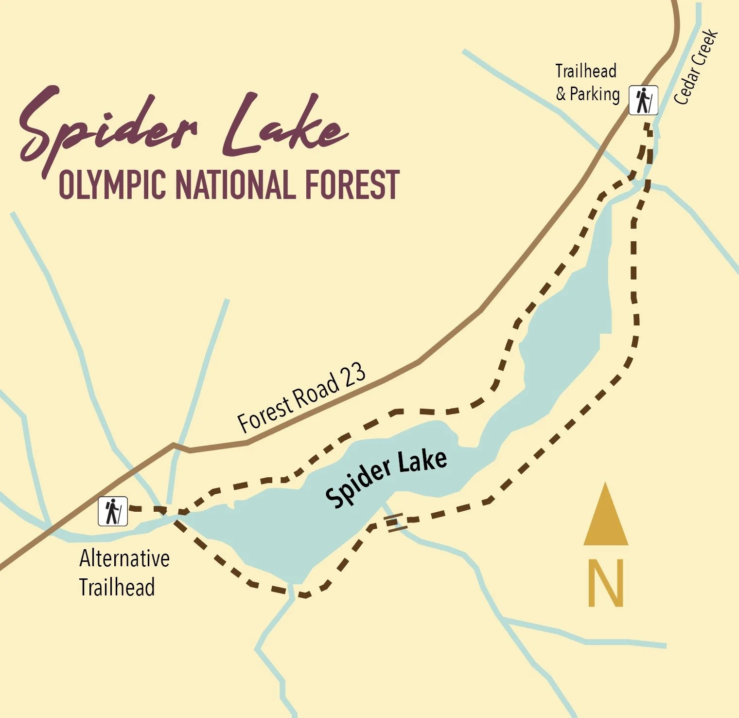
A long slender lake tucked within a narrow valley on the Skokomish–Satsop River divide, Spider is graced with groves of ancient giant old-growth forest. The trail around the lake is a remnant of a longer trail that once traversed miles of primeval trees. Most of those trees have since been logged, and the trail truncated to the lake. The remaining trail has since been restored and the forests on the surrounding hillsides are regenerating nicely.
Highlights: Old-growth forest Distance: 2 mile R/T Difficulty: Easy Elevation gain: 250 feet
Permits: None
Kid and Dog Friendly: Yes

5. Schafer Forest Trail
(Schafer State Park)

Tucked along the East Fork Satsop River in extreme southwestern Mason County, Schafer State Park is off-the-beaten path. While this park is far from population centers, it was a thriving spot for many years. In 1872 the Schafer Family came from Wisconsin to homestead here. Three of their sons, Peter, Albert and Hubert begin logging the homestead in the 1890s. They donated this parcel to the state in 1924, and it continued to host many large company gatherings as well as other groups. Today the park is much quieter, but families still come here to gather. The park’s trails however tend to remain pretty peaceful.
Highlights: Historic homestead; trail along Satsop River; salmon spawning creek and estuary
Distance: 1.3 mile loop Elevation gain: 75 feet
Difficulty: Easy Permits: Discover Pass Kid & Dog Friendly: Yes

This is only a SMALL sampling of the amazing hikes available in the area! Check out the hikes link for a full list of places to explore, visit the waterfalls trail for a comprehensive list of year-round waterfall destinations — or pick up or download a copy of Romano’s Top 25 Hikes!

Mount Rose: Summer hike with a climb
This hike is one of the steepest in the Olympics but with a blanket of wildflowers and stunning views, it is well worth the climb! With a nod to William Shakespeare, that which we call Mount Rose by any other name would still be as steep!
Story and pictures: Craig Romano
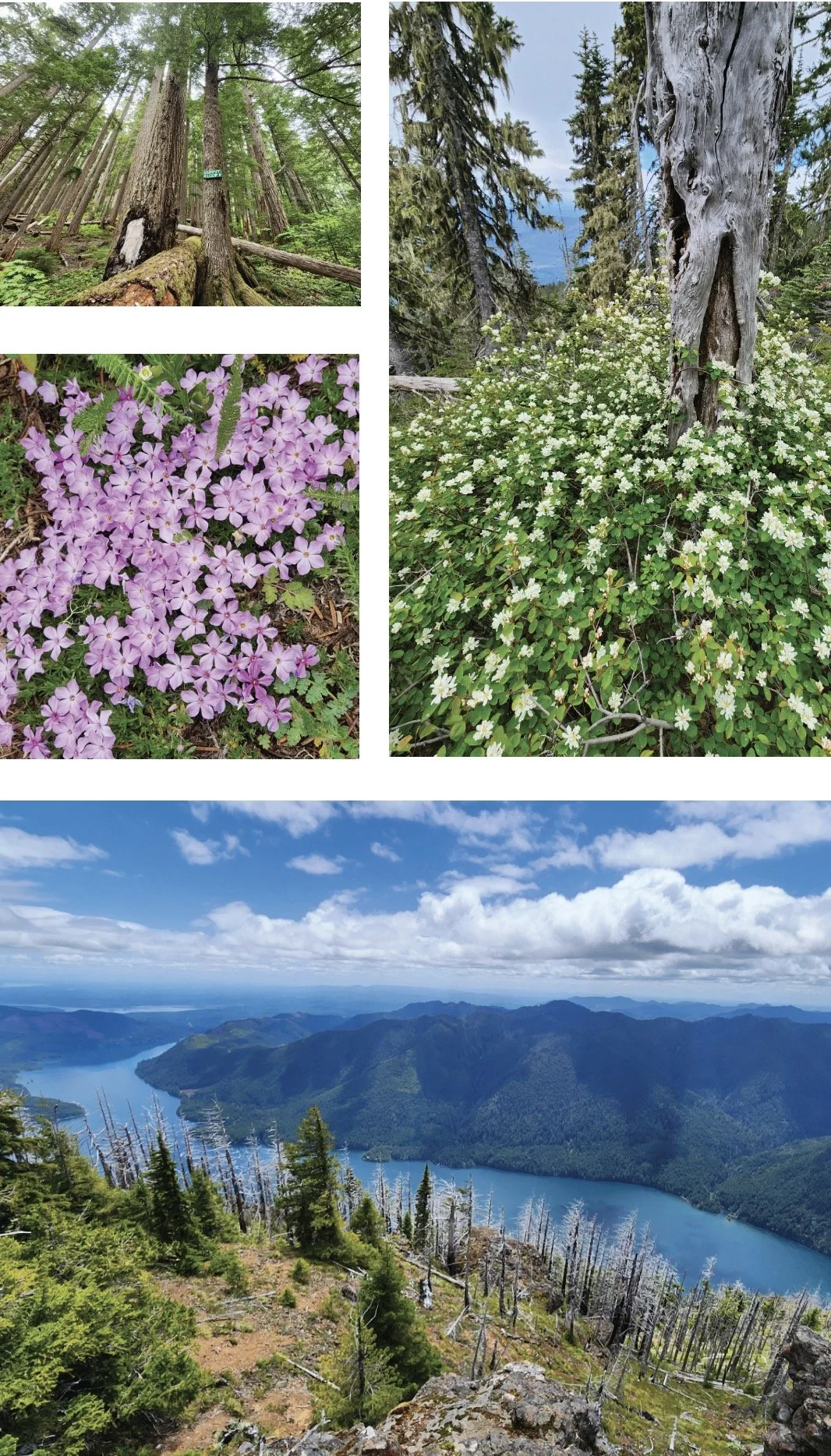
This hike isn’t terribly long. And its trailhead is fairly easy to reach via mainly good paved roads. The trail traverses impressive towering old-growth forest. And in summer wildflowers brighten the forest floor and decorate summer ledges. Views? They’re stunning, especially of Lake Cushman sparkling 3,500-feet directly below. But every rose has its thorn. And for Mount Rose, all of this natural beauty and splendor comes at a steep price—literally. This hike is one of the steepest in the Olympics.
Hit the Trail
Yes, the trail up Mount Rose is grueling. But it makes this hike all that much sweeter by weeding out the crowds. Rose makes for an excellent quieter alternative to nearby Mount Ellinor. And being more than 1,000 feet lower than that popular peak means a longer snow free hiking season on Rose. And while handfuls of hikers may swear off this mountain—plenty swear by it and swear on it while going up it. They embrace its steepness as a great conditioner for harder hikes planned later in the season. In any case, do not under estimate this hike. Trekking poles will significantly help—especially on the insanely steep descent. And take plenty of water.
The trail starts out deceptively easy on a fairly level traverse along the base of the mountain. After crossing a pair of cascading creeks and passing a square-shaped builder shrouded in ferns the way gets down to business. A seemingly endless procession of switchbacks will keep you occupied. And if you think the going is steep—it used to be steeper! The all-volunteer Mount Rose Trail Crew reconfigured and rebuilt much of this trail several years ago, making it much more negotiable. The Mount Rose Trail Crew has left their positive marks on many of the trails in the Lake Cushman area.
Much of the lower mountain is covered in uniform second growth forest thanks to fires early in the last century. But a handful of surviving towering old-growth giants break the monotony of the younger forest. The trail enters the 13,000 Mount Skokomish Wilderness, one of five wilderness areas in Olympic National Forest flanking Olympic National Park. At just shy of 2.0 miles (although it may feel a lot longer) the trail reaches the summit loop junction. Here a small plaque honors the crew that built this trail.
Which direction you take the loop is dependent on your preference. The way left is much steeper which for many is easier to ascend than descend. But if you head right instead you will reach the scenic payoff later—prolonging the anticipation. Most folks head left first to tackle 1300 feet of ascent within a mile. The way relentlessly climbs passing through dark moist forest before transitioning to a forest recovering from a 2006 wildfire. At 2.9 miles from the trailhead reach the 4301-foot open-forested summit. Your attention will be immediately drawn to sparkling Lake Cushman below. It’s a breathtaking view of the large lake cradled by steep emerald slopes. But do scan the lake’s surroundings too admiring Lightning Peak and Timber Mountain rising majestically above it. Take in views too of Wonder Mountain and Church Peak to the southwest; and the Skokomish delta, Black Hills, Willapa Hills, and Mount Rainier to the south. And catch glimpses through silver snags and white pines of the deep valley of the North Fork Skokomish River.


After admiring the stunning views, continue on the loop along a narrow forested ledge. Along the way you’ll be greeted with more fine views including close ups of Copper Mountain towering above you and Hood Canal in the distance. The way then enters impressive old-growth forest and passes a fascinating colonnade of four silver firs. They’ve grown so close together they appear fused. The summit loop will deliver you back to a familiar junction from where a brutal descent will deliver you back to the trailhead.
Mount Rose’s views are indeed sweet. But the mountain’s summit floral show can be equally stunning. The mountain however is not named for roses, of which four native species grow in the Olympics. The mountain takes its name from Alfred A. Rose, who in 1885 arrived in the valley below with his wife and three children from California. Rose was one of the first non-native settlers in the valley, claiming 150 acres along Lake Cushman. But his tenure here was short. He succumbed to small pox four years later. In 1926 the lake was dammed greatly increasing its size and inundating Rose’s original homestead as well as other early settlements. I’m not sure if Rose ever grunted to the summit that bears his name. But with a nod to William Shakespeare, that which we call Mount Rose by any other name would still be as steep!


Rowboats and Recitals: The Story of Mason County’s Early Schools
In this feature, Explore Hood Canal visits the Mason County Historical Society Museum in downtown Shelton to explore “More Than a Building,” a powerful exhibit on the early schools of Mason County. Featuring insights from curator Liz Arbaugh, this video reveals how schools were the heart of tiny communities—from tribal lands to logging camps.
What if I told you the quiet forests and mossy clearings of Mason County once echoed with the sound of children learning—and even rowing boats just to get to class? In this feature, Explore Hood Canal visits the Mason County Historical Society Museum in downtown Shelton to explore “More Than a Building,” a powerful exhibit on the early schools of Mason County. Featuring insights from curator Liz Arbaugh, this video reveals how schools were the heart of tiny communities—from tribal lands to logging camps.
📍 Visit the museum: 427 W Railroad Ave, Shelton, WA 98584
👨💻 Online: www.masoncountyhistoricalsociety.org
🗂️ View the exhibit and the Dayton archives
🎄 Learn about schoolhouse dances, Christmas parties, and how education shaped this region
💬 Leave a comment if you remember your Mason County school days!
#MasonCountyHistory #SheltonWA #HistoricalSchools #PacificNorthwestHistory #ExploreHoodCanal
Elk Lakes Trail
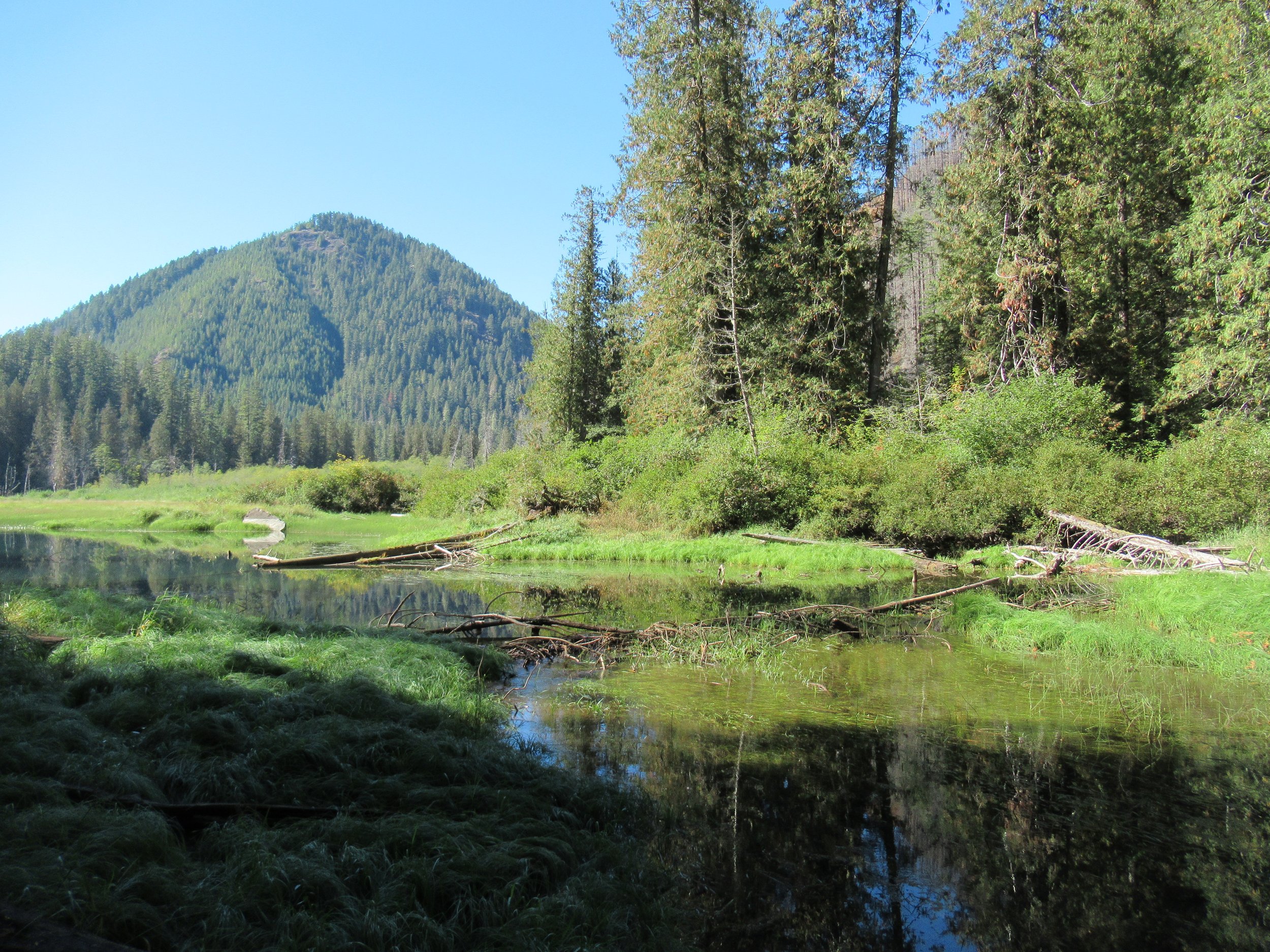
Named for one of the Olympic Peninsula’s most majestic animals, the two small Elk Lakes located within the Hamma Hamma River Valley offer quiet wanderings and a chance to see their namesake. The Elk Lakes offer a great alternative to the nearby oft-crowded Lena Lakes. While this hike is short, the lake’s tranquil shoreline and surrounding old-growth forest invite lingering. Bird watching is good as well as fishing for rainbow trout. Rhododendrons add colorful bouquets to the forest in spring, while maples and cottonwoods brighten the forest with golden touches come autumn.
By Craig Romano, Guide book author and guest columnist
Named for one of the Olympic Peninsula’s most majestic animals, the two small Elk Lakes located within the Hamma Hamma River Valley offer quiet wanderings and a chance to see their namesake. The Elk Lakes offer a great alternative to the nearby oft-crowded Lena Lakes. While this hike is short, the lake’s tranquil shoreline and surrounding old-growth forest invite lingering. Bird watching is good as well as fishing for rainbow trout. Rhododendrons add colorful bouquets to the forest in spring, while maples and cottonwoods brighten the forest with golden touches come autumn.
Hit the Trail
You can easily reach the lakes from a short spur off of Forest Road 2480. But I prefer hiking to the lakes following along a remnant of an old trail along Jefferson Creek. This gives you a longer and varied hike and a better appreciation for the area’s rugged landscape and how human activity has greatly impacted it. Reaching the trailhead for this approach however is via a rough road that only high clearance vehicles can negotiate. If that is not an option, you can always park at the beginning of the road and walk FR 2421 for 1.6 miles to the trailhead. The road traverses a recent cut offering excellent views of the Hamma Hamma Valley, making the extra mileage interesting.

The trail begins at a bend in the road and heads into a forest that was recently burned. In the early part of the last century the entire Jefferson Creek Valley was draped in old-growth forest. After World War II and up to the 1990s the area was intensively logged leaving only remnant stands of old-growth forest and just a small stretch of was once a long trail in the Eastern Olympics. But what survived made a delightful short hike in an area often overlooked by many hikers opting instead for the nearby Lena Lakes.
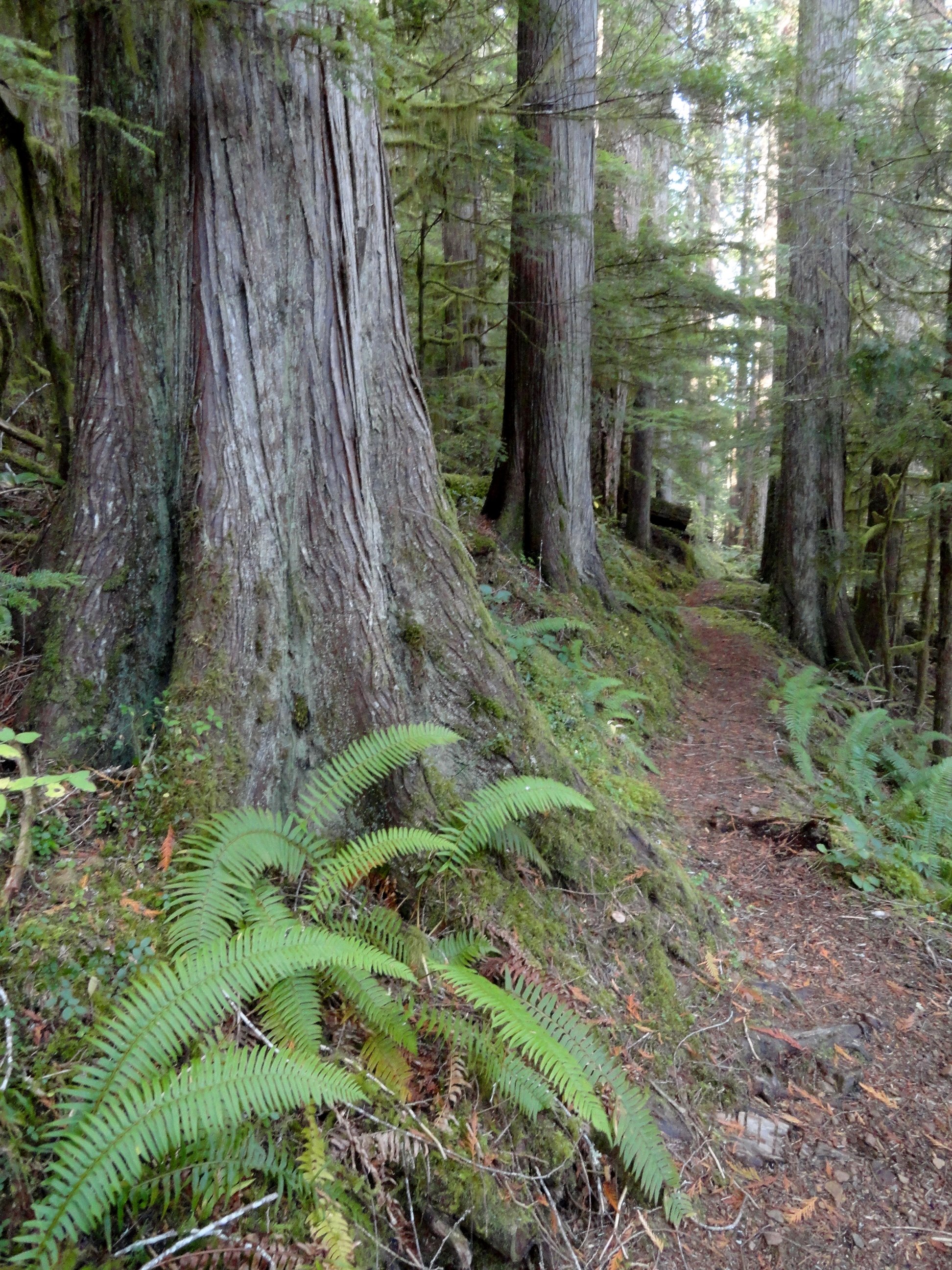
The beautiful old-growth forest remaining around the Elk Lakes almost entirely went up in flames in the Maple Fire of 2018. A group of timber poachers harvesting mature big-leaf maples in the area set the area ablaze when they set fire to a wasp nest in the base of a tree. The fire quickly spread torching 3300 acres and costing $4.5 million to combat. Two of the poachers were ultimately caught, brought to trial and given prison terms. Timber poaching remains a serious problem on the Olympic Peninsula. The Forest Service lacks the staff and resources to address it.
While the fire did some damage to the Elk Lake area, thankfully many of the older trees survived. Unfortunately the fire took a major toll on nearby Jefferson Ridge rendering the trail to its old lookout site nearly impassable now. Such a shame as that trail too offered a quiet alternative to many of the area’s nearby crowded trails.

Head up the trail traversing a dry hillside, several hundred feet above roaring Jefferson Creek. Born in the snowfields of Mount Ellinor and her rugged neighbors; the creek crashes through a steep and narrow canyon here before reaching the Hamma Hamma River. Pass through a mosaic burn on an up and down course before reaching cool old-growth forest.
The way then soon reaches a junction. Heading left will bring you to the upper trailhead. But for this suggested hike, you’ll be returning from that direction, so continue hiking straight through a grove of monster cedars coming to Elk Lake. Depending on the season the lake may be a wet grassy swale or a pretty reflecting pool. Regardless of water level, plenty of birdlife will be present.
Continue along the western shore before wandering along Jefferson Creek through more impressive old growth. The trail then terminates on FR 2401. You can retrace your steps, but I prefer making a loop by following the road left for 0.8 mile to another trail just after crossing Cedar Creek. But before heading down that trail back to Elk Lake, head right 0.2 mile on an oft overlooked and slightly brushy trail to pretty little Upper Elk Lake. This placid body of water offers beautiful reflections of nearby ridges and the surrounding forest.
Once you visit the Upper Lake pick up the trail near Cedar Creek and slightly descend to Elk Lake now hiking along its eastern shoreline. Pass some more big trees and come to a great shoreline area for casting a line or just admiring the area’s beauty. Then reach another junction.
The way right climbs and soon reaches the main trailhead on FR 2401. Continue left, soon crossing Jefferson Creek on large rocks. In spring and other periods of high water this may be difficult forcing you to retreat the way you came for a longer than anticipated hike. Just beyond the crossing reach a familiar junction. Here head right above the crashing creek retuning to your start.
The details
Distance: 4.5 miles roundtrip
Elevation Gain: 700 feet
High Point: 1200 feet
Difficulty: moderate
Snow free: year round Trailhead Pass Needed: None
Notes: Road to Lower Trailhead (Elk Branch) is extremely rough requiring a high clearance vehicle.
GPS waypoints: Lower Trailhead: N47 34.759 W123 07.222
Main Trailhead: N47 34.267 W123 08.008
Features: kid-friendly, dog friendly, old-growth, rhododendrons, bird-watching, fishingLand Agency Contact: Olympic National Forest, Hood Canal Ranger District, Quilcene, (360) 765-2200, fs.usda.gov/olympic
Recommended Guidebook: Day Hiking Olympic Peninsula 2nd edition (Craig Romano, Mountaineers Books)
Trailhead directions: From Hoodsport travel north on US 101 north for 13.7 miles turning left at milepost 318 onto FR 25 (Hamma Hamma River Road). Then continue west for 6.4 miles and turn left onto FR 2480. Cross the Hamma Hamma River and in 0.2 mile turn right onto unsigned FR 2421 for the Lower Trailhead (high clearance only). Follow this rough road 1.6 miles to a pullout on your left where the road makes a sharp turn right. This is the trailhead. For the Main Trailhead, pass the FR 2421 junction and continue on FR 2480 for 3 more miles. Then turn right onto FR 2401, and proceed 2.5 miles to a spur on your right leading 0.1 to the Main Trailhead. The spur is steep and can be rough. You can park alongside FR 2401 and walk the spur to the trailhead.
Silver Lake Hike
The Olympic National Forest’s Buckhorn Wilderness contains more than 44,000 acres of some of the finest backcountry on the Olympic Peninsula. Within this rugged corner of the Olympic Mountains you can hike on miles of trails traversing deep valleys of old-growth forests and along high windswept ridges granting stunning views.
Craig Romano | Story and Pictures
The Olympic National Forest’s Buckhorn Wilderness contains more than 44,000 acres of some of the finest backcountry on the Olympic Peninsula. Within this rugged corner of the Olympic Mountains you can hike on miles of trails traversing deep valleys of old-growth forests and along high windswept ridges granting stunning views.
Hit the Trail
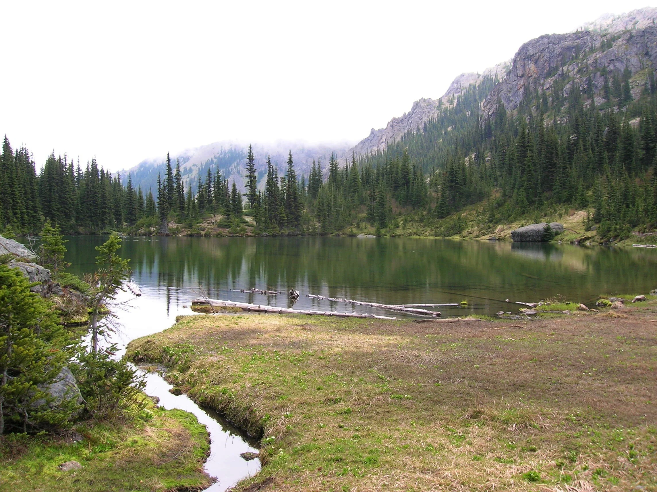
Located within the Olympic rain-shadow, the Buckhorn receives ample sunshine and consists of a much drier landscape than points south and west. Lakes are rare in this wilderness. Silver Lake is one of the few gracing the region. It provides an oasis for wildlife and serves as an excellent destination for hikers.
There are two ways to reach Silver Lake. The shorter route is via Silver Creek. This route was never officially built, involving instead from a well-trodden user built boot path. It’s rugged in spots and to reach it involves a long rough dirt road from the north. The official trail starts high on the southern shoulder of Mount Townsend. It involves more effort to hike due to its length and elevation gain—but it’s well-built and highly scenic. And the approach to it is by a primarily good paved road.
Nearby Mount Townsend—one of the most popular hiking destinations in the Olympics keeps most hikers away from these trails, leaving Silver Lake a much quieter destination. In early season wildflowers give an added bonus to the official route—but lingering snow can make it tricky.

"Fall is the perfect time to visit Silver Lake with the added bonus that its resident biting insects have gone the way of the early blossoms."
Start your hike from the upper trailhead for the Mount Townsend Trail. Follow this well-worn & popular path through stately groves of firs and hemlocks adorned with Pacific rhododendrons. In late May and early June, the rhodies add an array of dazzling colors to the surrounding verdant cloak. The trail steadily climbs. Shortly after entering the Buckhorn Wilderness, the forest cover thins and views east emerge. Cross several cascading creeks and continue working your way upward. The trail switchbacks more than two dozen times.
The way crests a small knoll arriving at Camp Windy, which usually lives up to its name. Look below to tiny Windy Lake, not much more than a buggy pool most of the year. Then continue climbing coming to a junction at 3.0 miles.

Here most hikers will continue right to ascend the open summit of Mount Townsend. You want to head left on the trail less traveled. Your climbing isn’t yet over however. Muster up a little more energy and reach a small gap on a high ridge separating Mount Townsend from the Welch Peaks. Take a break and look back east for a great view of Windy and Sink Lakes directly below. Then face west and enjoy a sweeping view of the Silver Creek valley. Silver Lake however is not visible. It’s hidden behind a small wooded knob to the south.
Now resume hiking crossing a steep slope that comes alive with blossom in the summer. Via a couple of long switchbacks the way descends more than 600' into the valley. Be sure to save some energy for the return hike, as you’ll need to regain that elevation. At 4.6 miles reach a junction in the forested valley. Here the Silver Lake Way Trail descends northwest following alongside Silver Creek. Continue straight, soon coming to Silver Creek.
Hop across the creek and start climbing again following the creek to its source.

At 5.4 miles reach Silver Lake in a semi-open bowl flanked by craggy peaks and ridges. It’s a tranquil spot where soft breezes often leave rippling signatures on the lake’s surface; and the raucous calls of Clarks nutcrackers (more common east of the Cascade Crest) often break the silence.
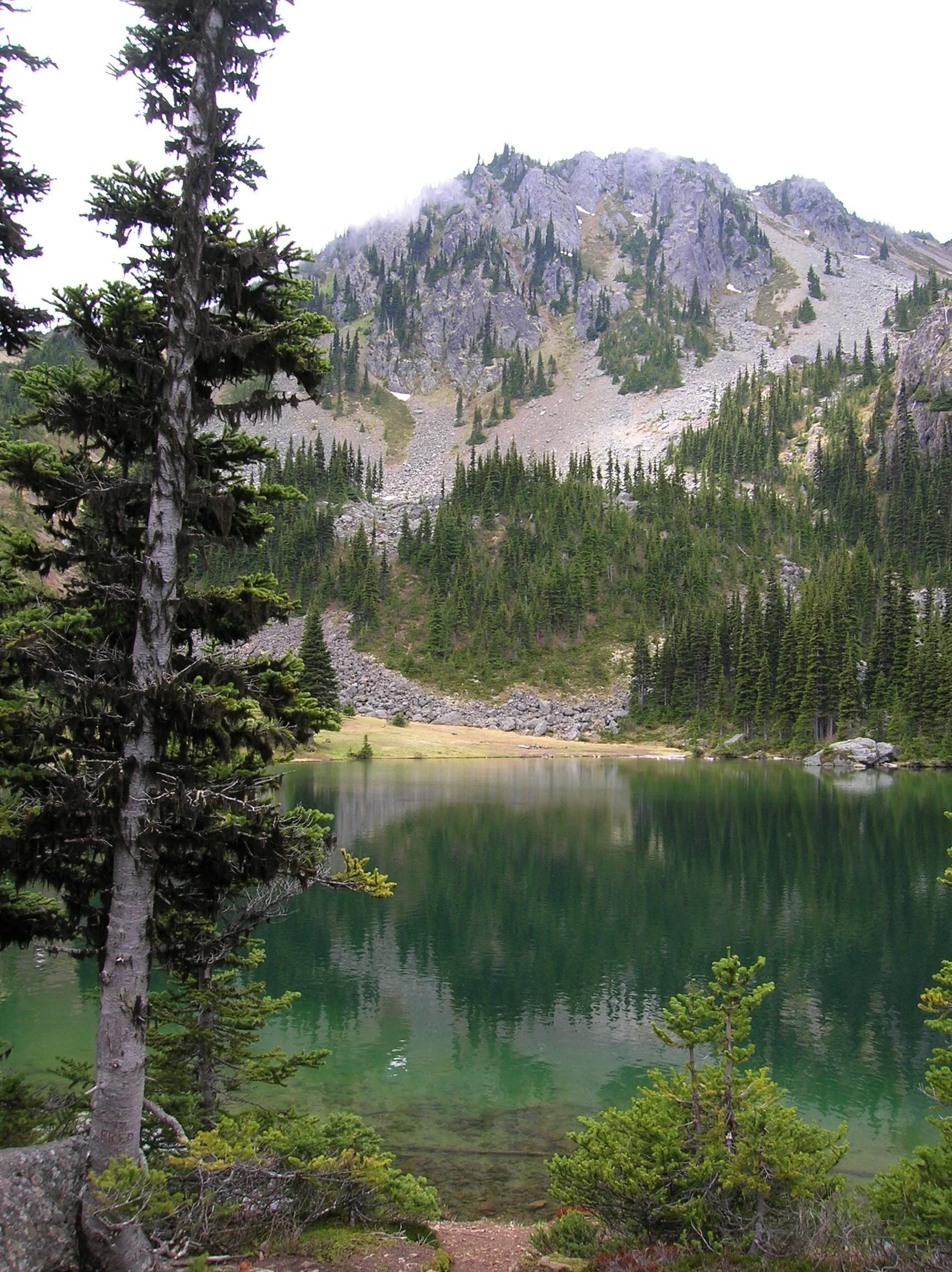
Find a shoreline rock and stay for a while. However, if you have some energy left, a steep half mile path to the south may entice you to follow it. It leads to a gap on a ridge high above the Big Quilcene River where you can stand mouth agape staring out at hulking Mount Constance towering over craggy ridges and deep emerald valleys.

Craig Romano is an author of more than 20 hiking guidebooks including the bestselling Day Hiking Olympic Peninsula 2nd Edition (Mountaineers Books), which includes descriptions for 136 hikes throughout the Olympic Peninsula. He is a regular contributor to Explore Hood Canal. Also check out his list of 25 Olympic Peninsula waterfalls at waterfalltrail.org.
Silver Lakes Notes
Distance: 10.8 miles round-trip
Elevation Gain: 3275 feet (High Point: 5675 feet)
Difficulty Loop: difficult
Snow free: mid-June to early November
Trailhead Pass Needed: Northwest Forest Pass or Interagency Pass
GPS waypoints:
Trailhead: N47 51.385, W123 02.153,
Silver Lake: N47 50.686 W123 04.247NW Forest pass required; Wilderness rules
Land Agency Contact: Olympic National Forest, Hood Canal Ranger District, Quilcene, (360) 765-2200; fs.usda.gov/olympic
Recommended Map:
Green Trails Olympic Mountains East 168SRecommended Guidebooks: Day Hiking Olympic Peninsula 2nd edition (Romano, Mountaineers Books)
Trailhead directions: From Quilcene drive US 101 south for 1.5 miles and turn right onto Penny Creek Road. After 1.5 miles bear left onto Big Quilcene River Road (Forest Road 27); which eventually becomes paved. Continue on FR 27 for 13.7 miles and turn left onto FR 27-190 reaching the trailhead in 0.7 mile.
Tips for safe and healthy hiking during the Covid-19 Pandemic
We all must do what we can to prohibit the continual spread of this disease. We can do that by adhering to the following while we enjoy our trails:
• Avoid crowded hiking destinations. If you arrive and the parking lot is already full, head to another location
• Opt for weekdays over weekends to hit the trail
• Hit the trail early morning before others arrive
• Avoid hiking in large groups outside of family
• Practice Social Distancing while on the trail, giving other hikers room to pass and keeping your distance from them at lakes and summits.
• Wear a mask when encountering others on the trail. A buff or bandanna works well.
• Pack hand sanitizer
• Pack it in pack it out
• Don’t be a surface pooper. Poop properly in the woods by always using privies first if available-or by heading at least 200 feet away from all trails, campsites and water sources and digging a cat hole for your business. Bury waste and TP.
• Pack out all pet waste.
Spring day at Staircase
This easy 2-mile trail winds through old growth forest to a bridge over the North Fork Skokomish River with only a 200-foot elevation gain.
During spring the Staircase Entrance of the National Park offers some opportunity for great hikes with virtually no one else on them that early in the season! Take the kids or friends and plan a mountain adventure. Build an igloo, go snowshoeing, or just have a snow ball battle. Although the lower reaches may be drowning in rain, if you head to the hills you might just find a drier, fluffier version.

Last spring we packed up a picnic and headed for the park. On a Sunday, first week of March, we saw about seven cars in the Staircase parking lot and passed about a dozen people on the Loop Trail. With the horror stories from overcrowding last summer during the peak of the lockdown – we were thrilled to have the trail practically to ourselves.
Getting There
The road from Hoodsport to Lake Cushman is narrow and windy. Be prepared to go slow as then you will find it charming and scenic with glimpses of the lake between the trees and driveways. Lake Cushman was originally a straight broadening of the North Fork of the Skokomish River that was naturally dammed by gravel and debris deposited by glacial movement during the last ice age. This small lake was artificially dammed in the 1920s to meet the increased power needs after World War I.
The evidence of the forest that once was is prominent in the incredibly low water of the lake.. This is a natural occurrence in early spring – late winter, but the effect was astonishing. Surrounded by a sea of first growth stumps and rock "islands," the giant boulder renown as ‘The Big Rock’ was perched on smaller rocks creating a magical grotto with reflecting pools magnifying the beauty of the snow dusted treed hillsides plunging sharply into Lake Cushman. We scrambled around the rocks and enjoyed a whole new experience.
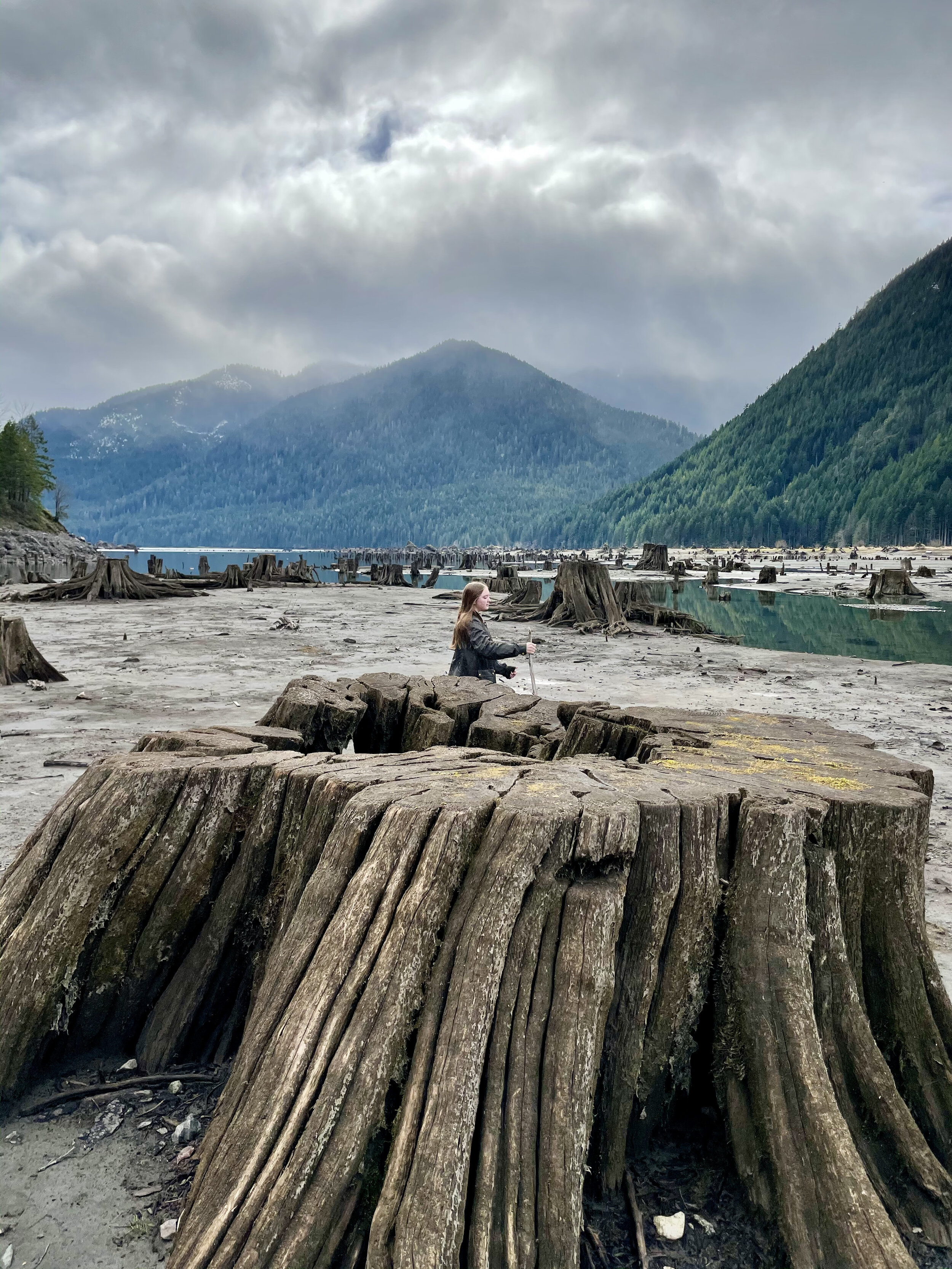
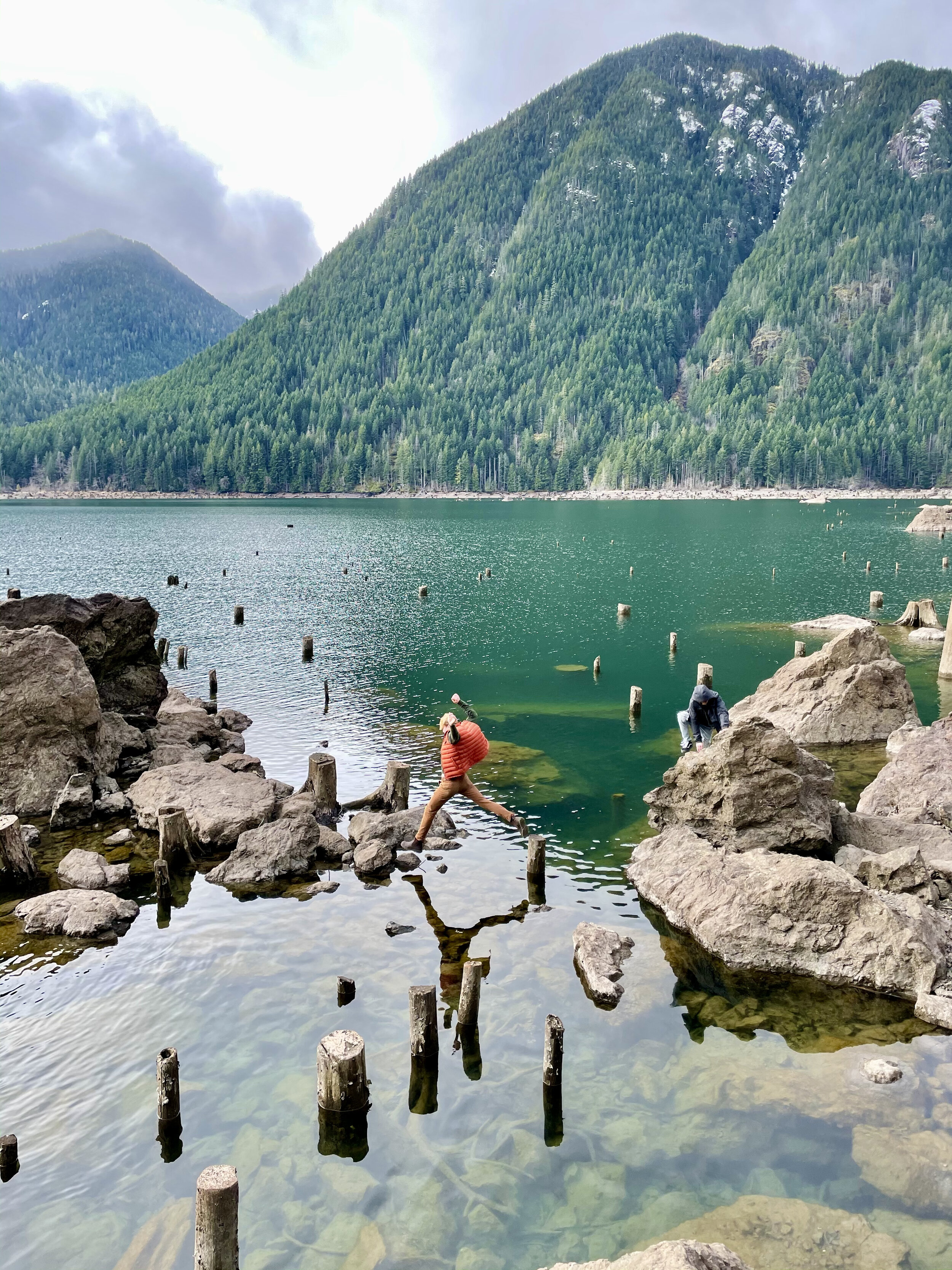
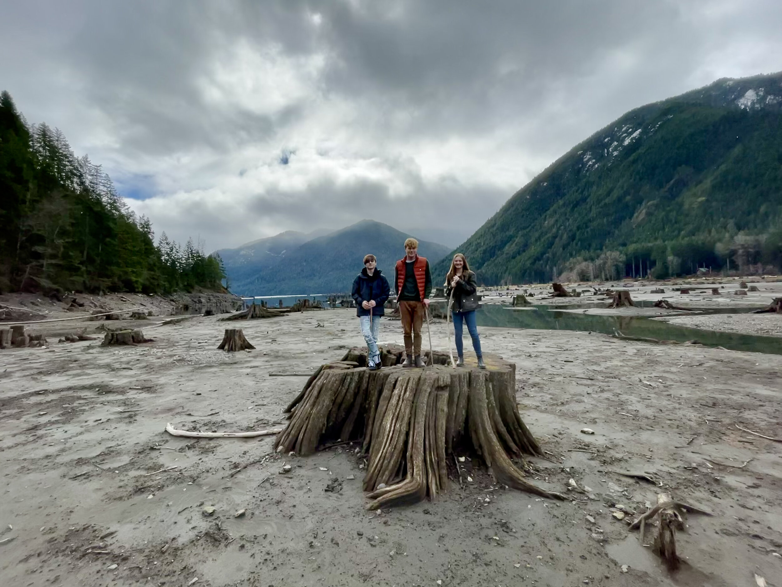
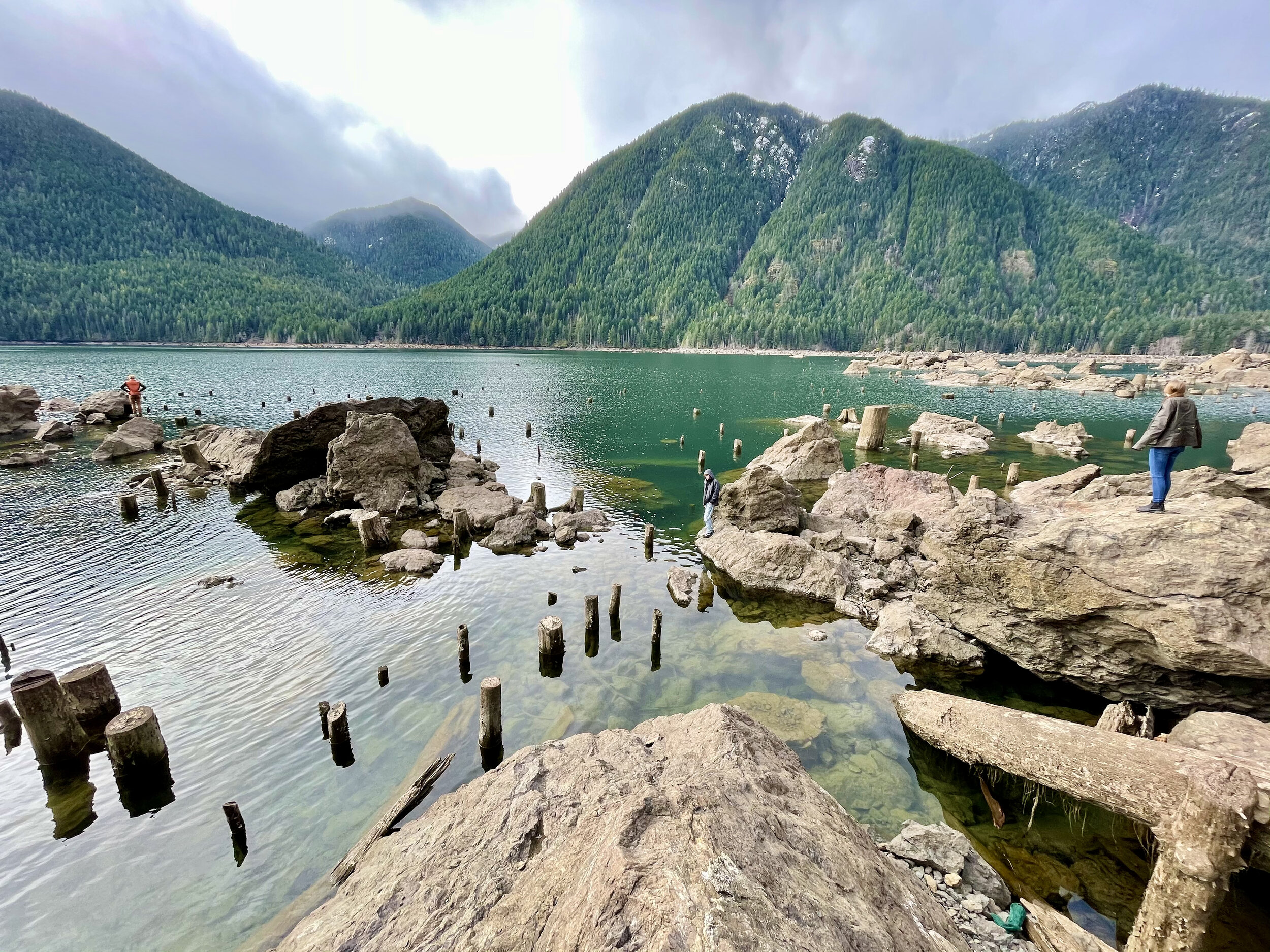
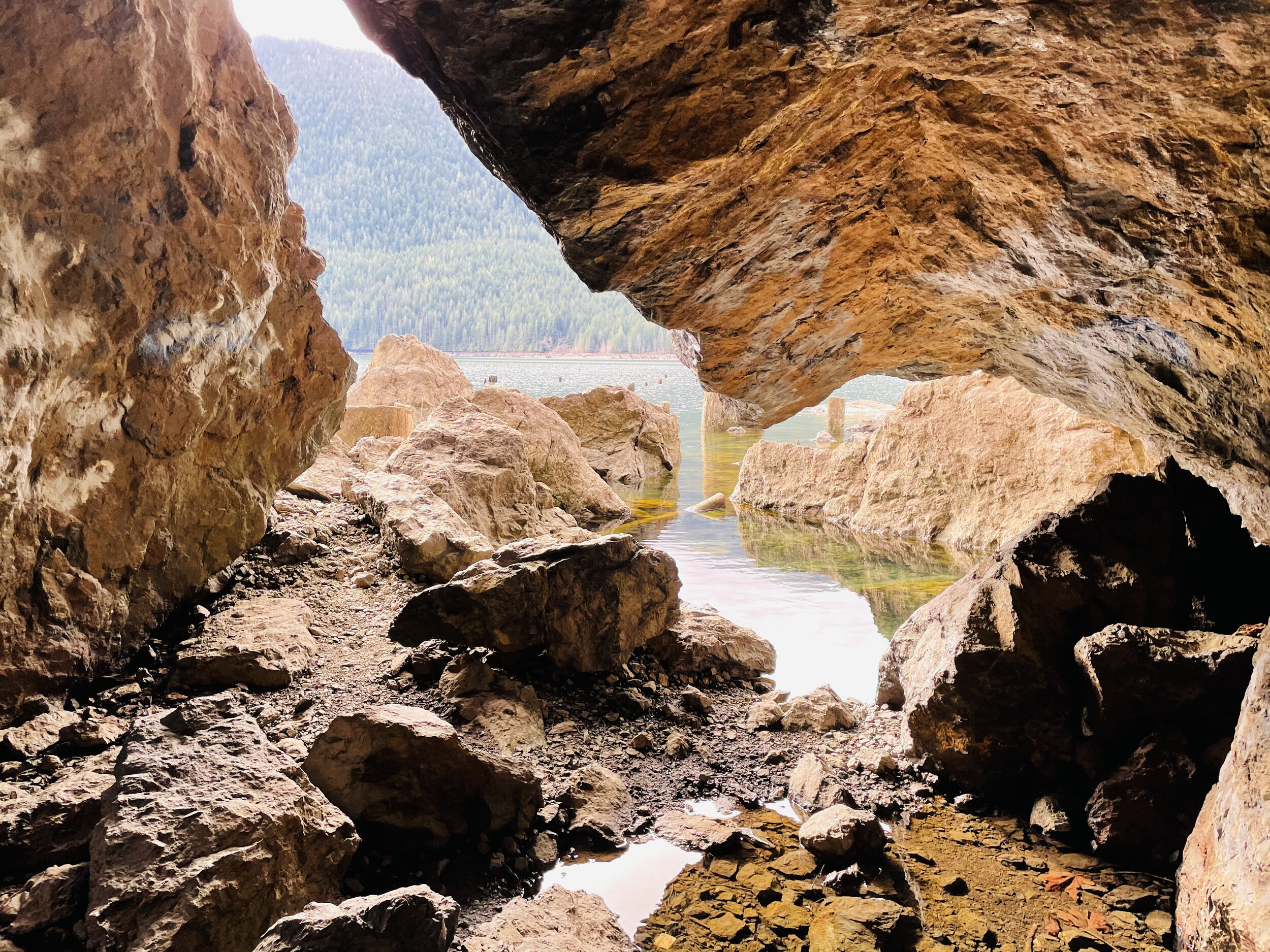
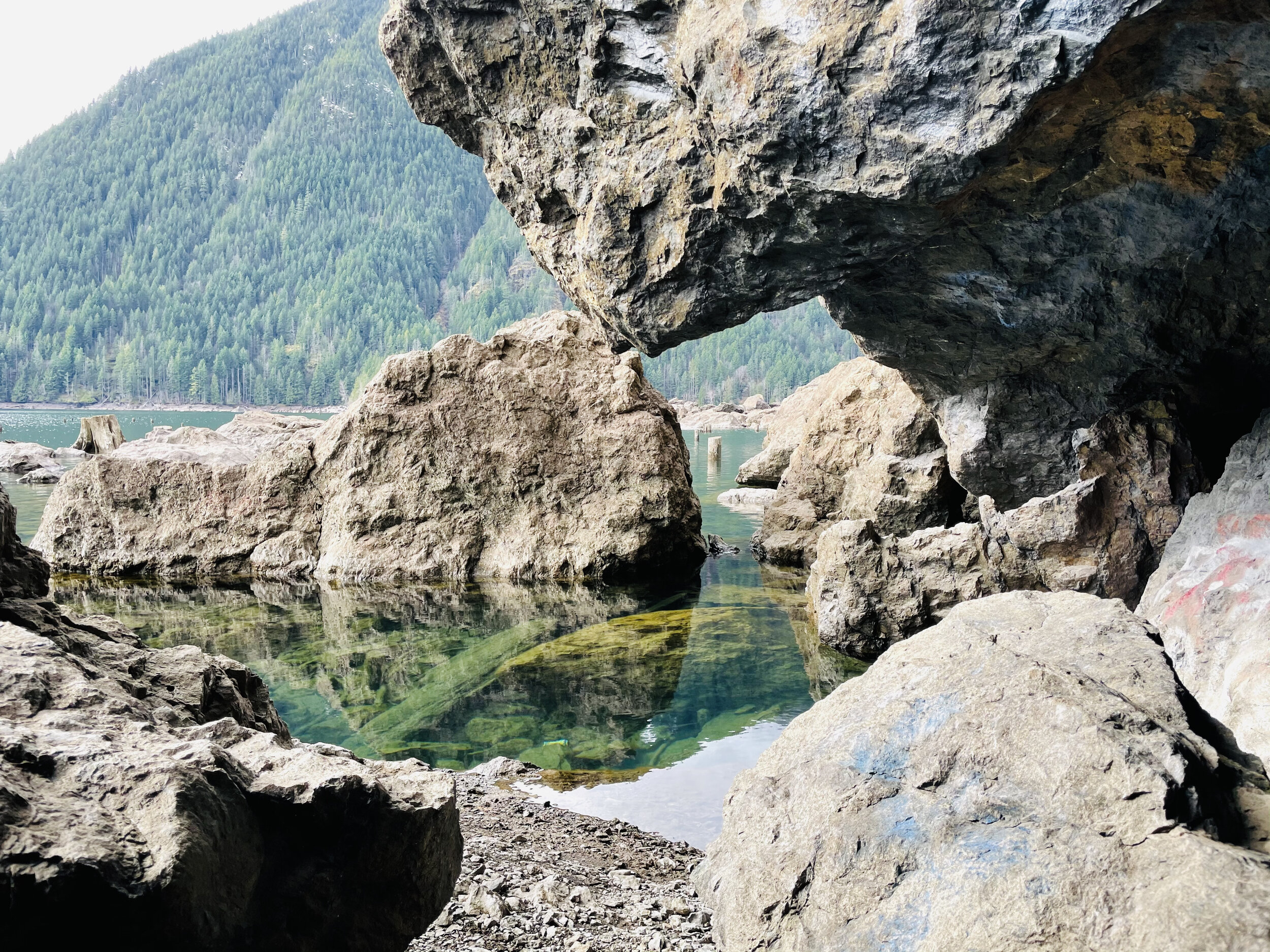
A little further down the road is a pull out at the end of the lake. Here the “sea” of stumps is even more fantastic. The landscape is great for exploring and dramatic photos. The springboard holes used by the early foresters as they cleared the valley are perfectly archived.
Staircase Loop Trail
The entrance to Staircase was un-manned when we arrived. There were just a few cars parked in the lot. You will need to have a pass to park. We recently purchased the America The Beautiful Annual Pass. This pass covers federally managed recreation lands such as National Parks, National Forests, National Wildlife Refuges, and Bureau of Land Management Recreation Areas throughout the country.If you purchase this pass you may use it for both the Olympic National Park and for trailheads requiring a NW Forest Pass. The pass covers all people in your vehicle and covers two pass signers at walk-in locations, so at $80 per year, it’s a pretty good value and takes a lot of guesswork out of what passes needed when exploring the Olympic National Forest and Park.

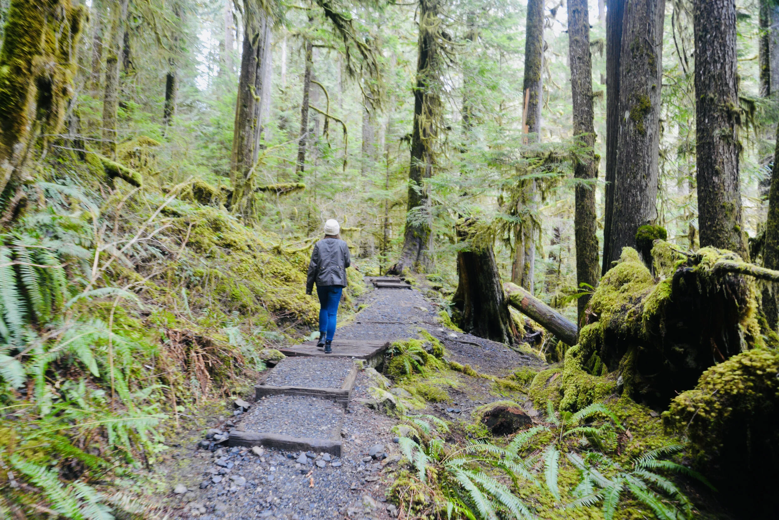
Near the parking lot there are vault toilets and information boards. The trails go in a multitude of directions but we took the standard Staircase Loop. It’s less than two miles and follows the curves of the North Fork of Skokomish River. We love loops. Something different around every bend and when you drop back in the parking lot you are still wanting more.
There was enough snow on the trail, peeping through the breaks in the dense canopy, to make it perfect contrast for photos against the mossy green – and the odd snowball to break the reflection.
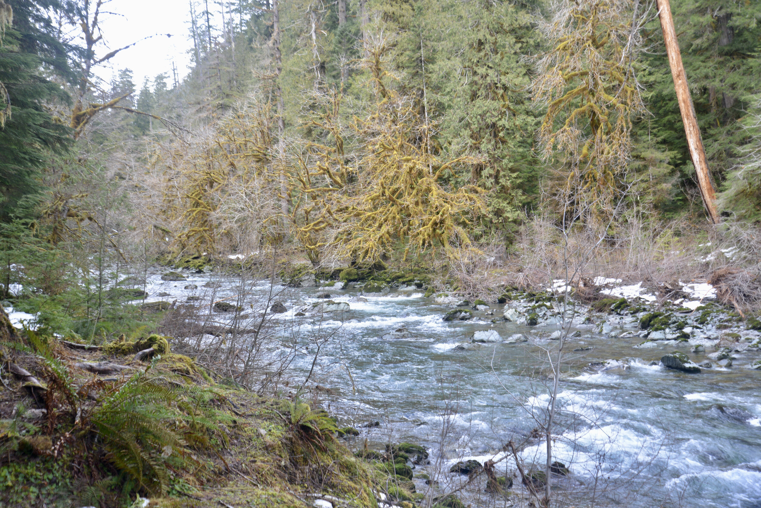
Heads up…you will see no staircase at Staircase today. In 1890, when Lt. O’Neil and his crew blazed their trail through the Skokomish wilderness, the rock bluff across the river from the campground was a major obstacle. To get over it they built a cedar staircase. Until the nearby Shady Lane Trail was built in 1911, the ‘Devil’s Staircase’ was the only path over the bluff. The name, and O’Neil’s legacy, remains. However, as you follow the river with its tumbling force of river over huge basalt boulders – you can kind of imagine the rapids are staircase of sorts.

We stopped off by the river at the “swimming hole” to make lunch on the beach. With a Jetboil and some hot freeze dried meals, it was sublime. They’ve come a long way from what I remember as an instant meal. Having hot tea after in the chill of the forest was magical too.

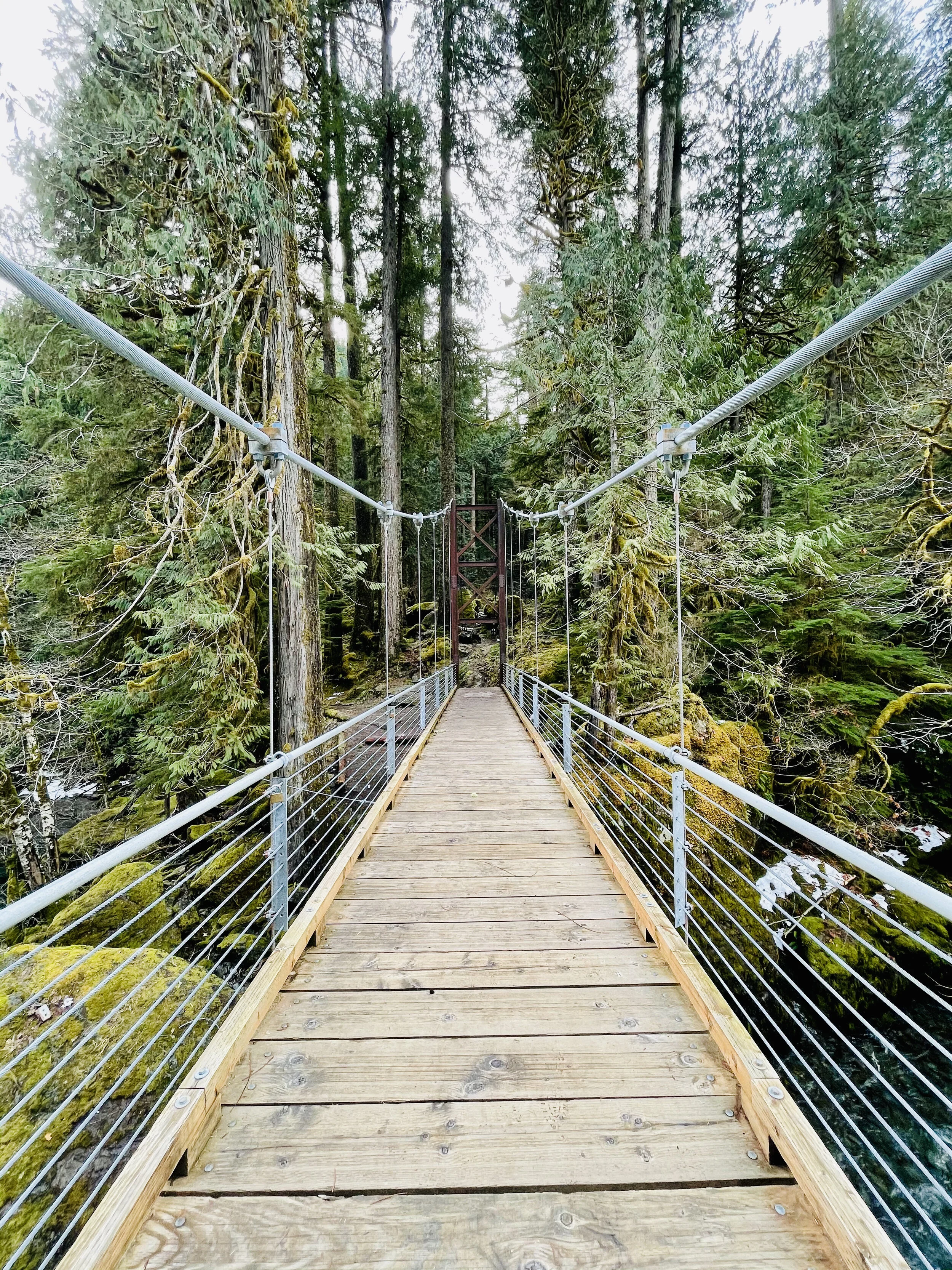
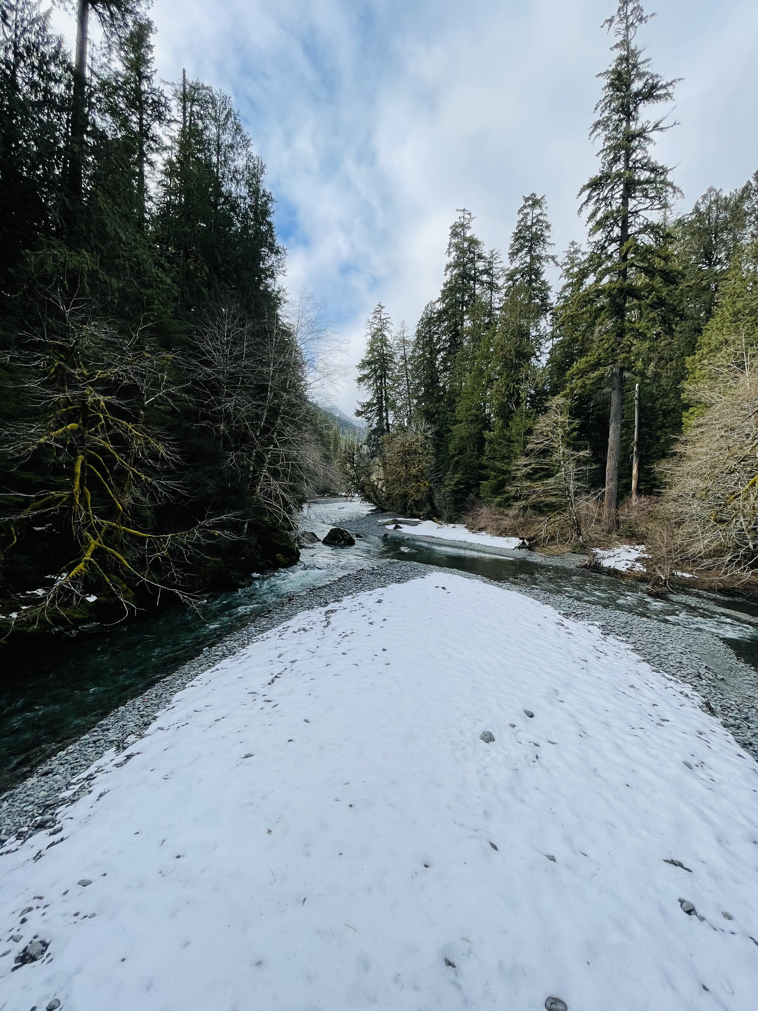
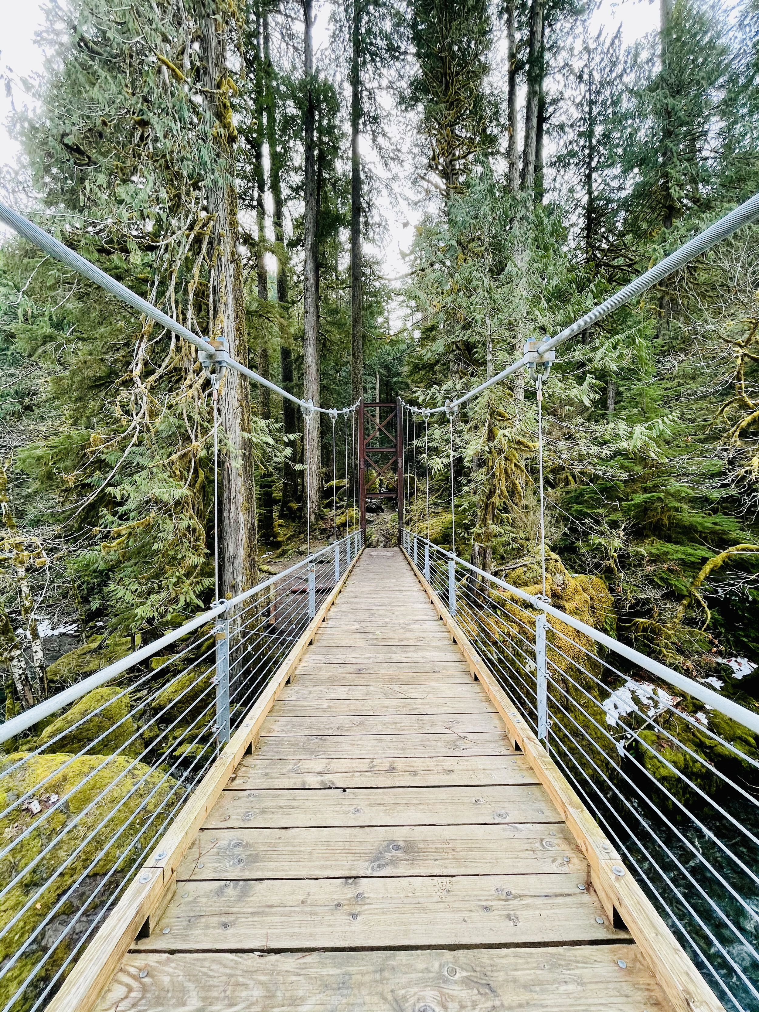
The trail crosses over the river at a dramatic suspension bridge. Here the view opens up and you can see a few snow covered glacial peaks of the Olympics. Despite their jutting appearance, the Olympic Mount Range are not volcanic. This is surprising given the proliferation of volcanic ranges in the Pacific Northwest, for example Mount Baker and Mount Rainer. As evidenced by the marine fossils found in the summits of the range, the Olympic Range once was part of the ocean floor. Approximately 120 million years ago, the Pacific Tectonic Plate crashed into the North American Plate and created the Olympic Range.
Journey Back
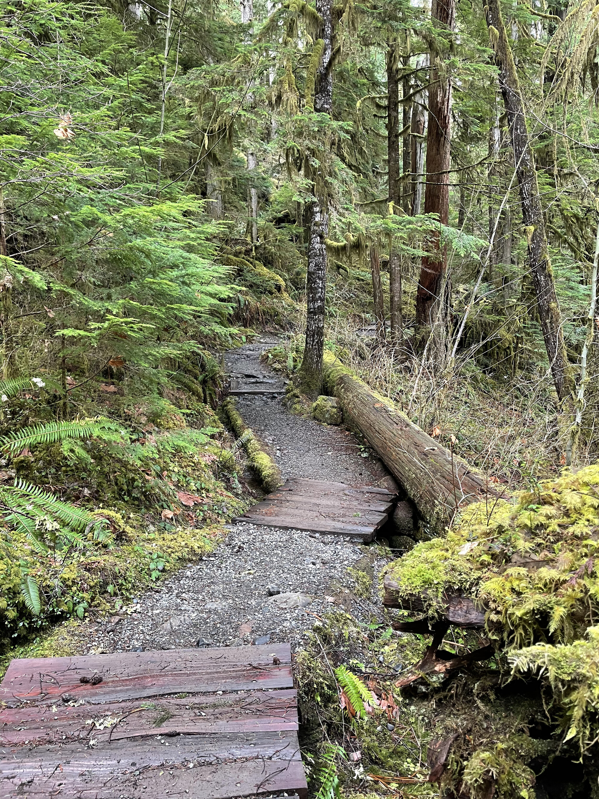
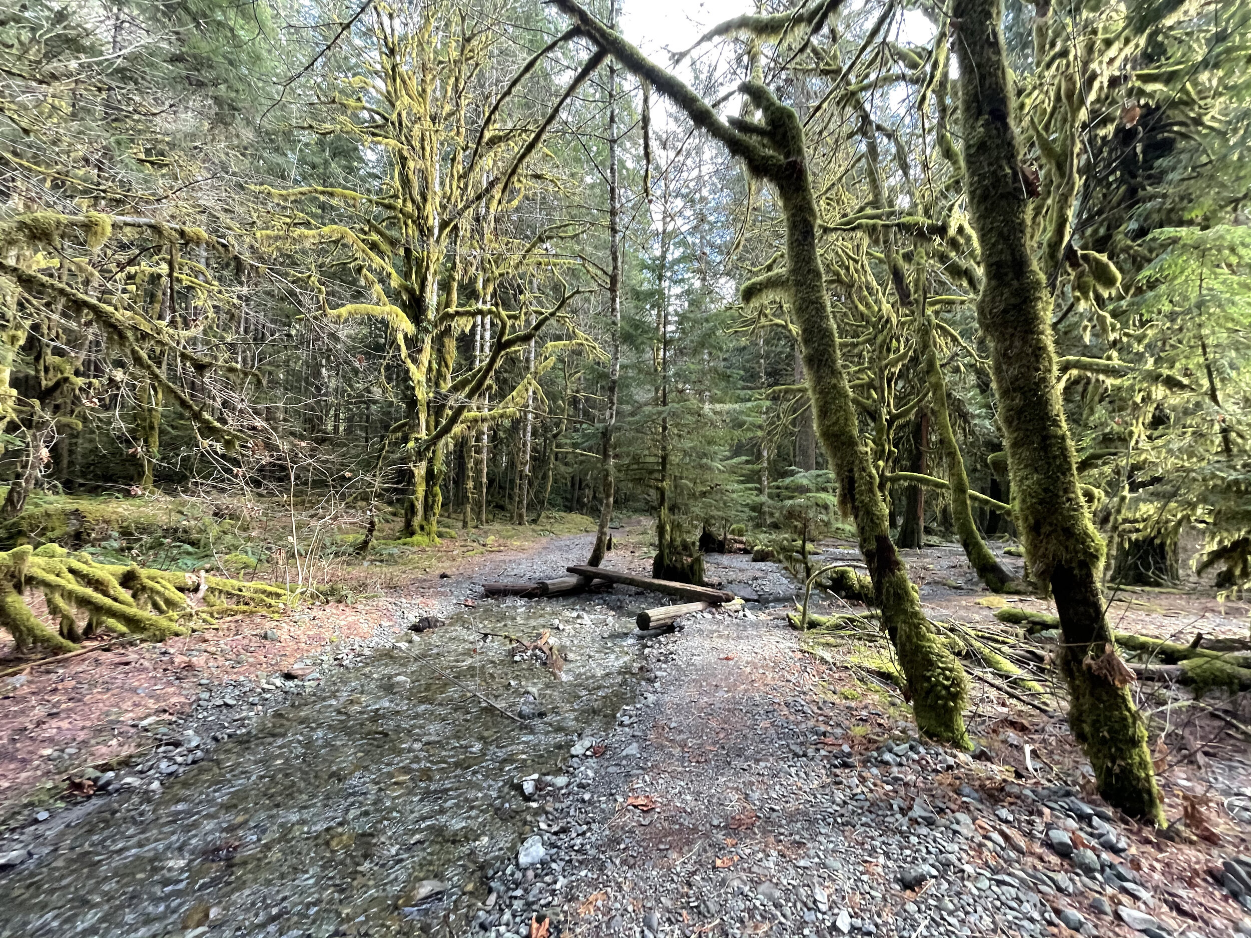
The trail back on the opposite shore is a vast contrast to winding hummocks covered in moss and ferns. The path now follows an old road bed peppered by giant cedars, firs and fallen nurse logs. At two points you cross log bridges to ford the gentle streams coming down from the hills above. The trail ascends up a makeshift timber “staircase” and then drops back into the parking lot near the ranger station.

Satsop Lakes via Church Creek
This moderately difficult dog friendly trail offers magnificent old-growth forest, a wildlife rich backcountry lake, and fantastic opportunities for solitude.
Craig Romano | story & pictures
Named not for a house of worship but after Frederic Church, a member of Colonel O’Neil’s 1890 Exploratory Trip across the Olympics; never-the-less this trail is sure to touch your soul. The path winds through an ancient forest of towering cathedral trees where gaps in the lofty canopy shine beams of ethereal sunlight upon the forest floor. And while the forest is heavenly, the way is rough in spots and involves some decent climbing. But your toil will be redeemed upon reaching the Satsop Lakes in a tranquil verdant basin that teems with wildlife.
Features: Dog friendly, magnificent old-growth forest, wildlife rich backcountry lake, and fantastic opportunity for solitude.

Craig Romano photo
Hit the Trail
Like many trails in the southern flanks of the Olympic National Forest, the Church Creek Trail was once much longer than its current 3.5 mile length. It once extended all the way from the South Fork of the Skokomish River to the Wynoochie River. But the Forest Service accelerated logging in this region after World War II with little regard to preserving many of the historic and scenic trails that traversed this lugged landscape.
By the 1990s however due to pressure from conservationists, and concerned citizens and elected officials, the Forest Service shifted its timber harvesting management objectives to protect old-growth forests. Tens of thousands of acres of the primeval forest that shrouded the rugged valleys and mountains of the southern flanks of the Olympic Mountains however had been cut down. But fortunately large pockets still remained including along that 3.5 mile stretch of the Church Creek Trail. But due to budget cuts, the Forest Service abandoned the trail in the early 1990s.
In 2005 the Church Creek Trail was resurrected thanks to the Olympia Mountaineers. They adopted it; restoring it to a top-notch trail. The trail makes for an excellent alternative to the busier trails in the North Fork Skokomish River Valley. And while the Satsop Lakes make for a lovely destination, it’s the forest along this hike that is the prime attraction.
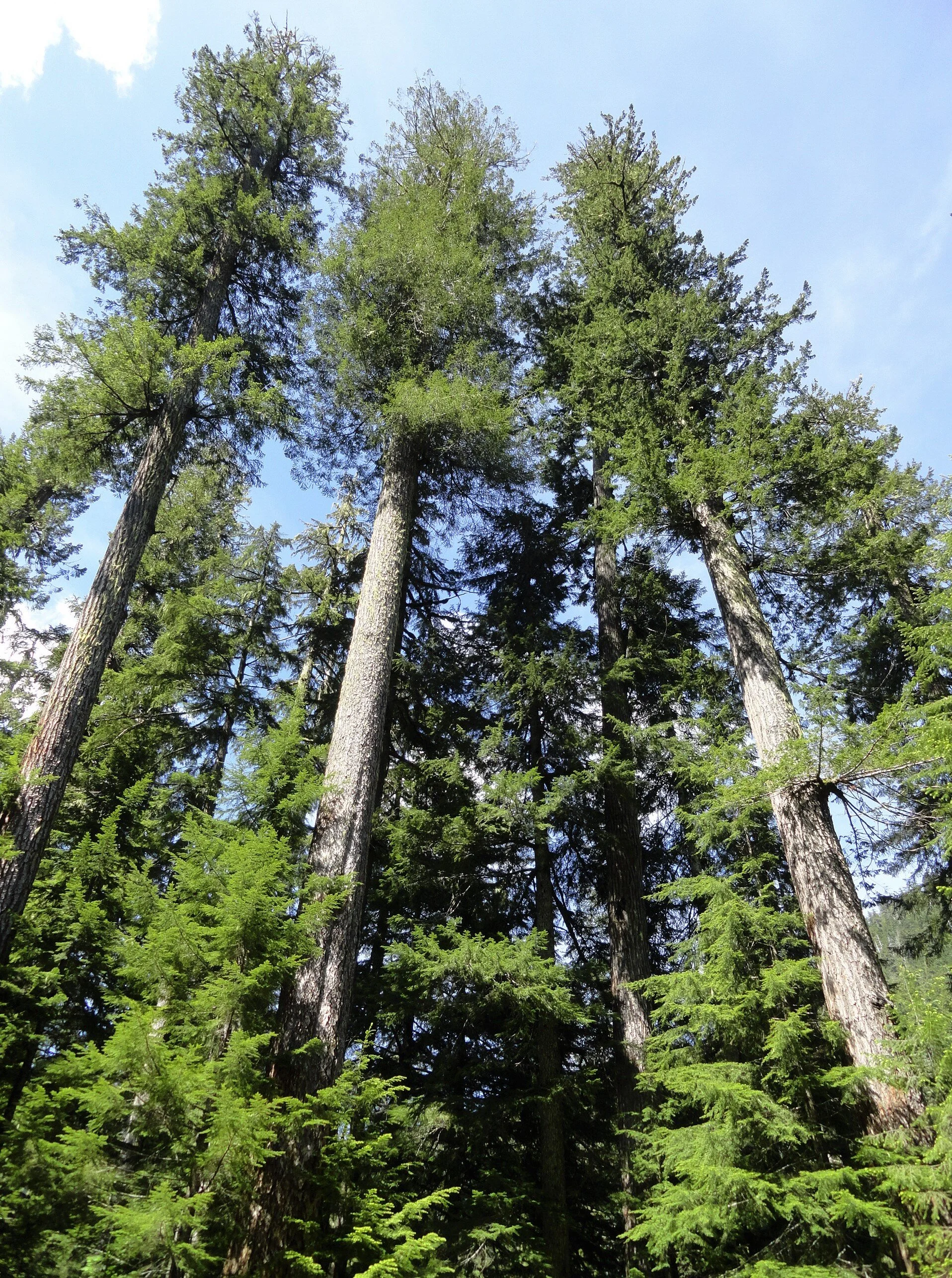
Towering Douglas-firs reaching dizzying heights and wide-girth cedars and hemlocks hundreds of years old line the trail from end to end.

From an unimposing trailhead, start hiking immediately entering a cathedral forest of buttressed cedars and spires of firs. | Craig Romano photo
From an unimposing trailhead, start hiking immediately entering a cathedral forest of buttressed cedars and spires of firs. Cascading Church Creek, audible but not visible, adds a soothing aria to this sanctuary. The creek and a nearby peak were named in honor of Frederic Church of the 1890 O’Neil Expedition. Lieutenant O’Neil and his men explored large portions of the Olympic interior from east to west.
Along his three month cross Peninsula trek he sent out smaller parties to explore and map watersheds. Church was among these explorers.

Lieutenant Joseph P. O'Neil (1862-1938), Courtesy Robert B. Hitchman
The O’Neil Expedition’s findings were invaluable. They mapped, explored and collected specimens from at the time was one of the last major mountain ranges in the Continental United States that had not been explored by Non-native peoples. One of O’Neil’s most important revelations was summed up in his report to the 54th US Congress. He wrote, "I would state that while the country on the outer slope of these mountains is valuable, the interior is useless for all practical purposes. It would, however, serve admirably for a national park. There are numerous elk—that noble animal so fast disappearing from this country—that should be protected.” O’Neil’s recommendations would later lead to the establishment of Olympic National Park.
The trail winds and climbs under a lofty canopy supported by gigantic beams. Hopefully your attention will be diverted upward by staring at these amazing old-growth giants; helping to take your mind off of the stiff climb. The way utilizes a series of switchbacks and comes close to Church Creek on several occasions. But the plummeting waterway remains hidden in a deep lush ravine.
The forest understory is thick and verdant and also commands your attention. In early summer, fawn lilies, calypso orchids, and marsh marigolds add additional colors to this emerald world. Return later in August to harvest some sweet rewards in the form of succulent huckleberries.
The trail crosses several small creeks and after about 1.5 miles it reaches a decommissioned road. This entire basin was once slated for the mills. The forest now remains as it did when O’Neil’s group passed by more than 130 years ago. Turn right and follow the old road bed for about 500 feet before picking up the trail again. Then through a more open forest continue climbing, reaching the 3,150 foot divide between the South Fork Skokomish and Satsop Rivers within another half mile. A humongous hemlock with two pistol-butted limbs stands sentry at the divide.
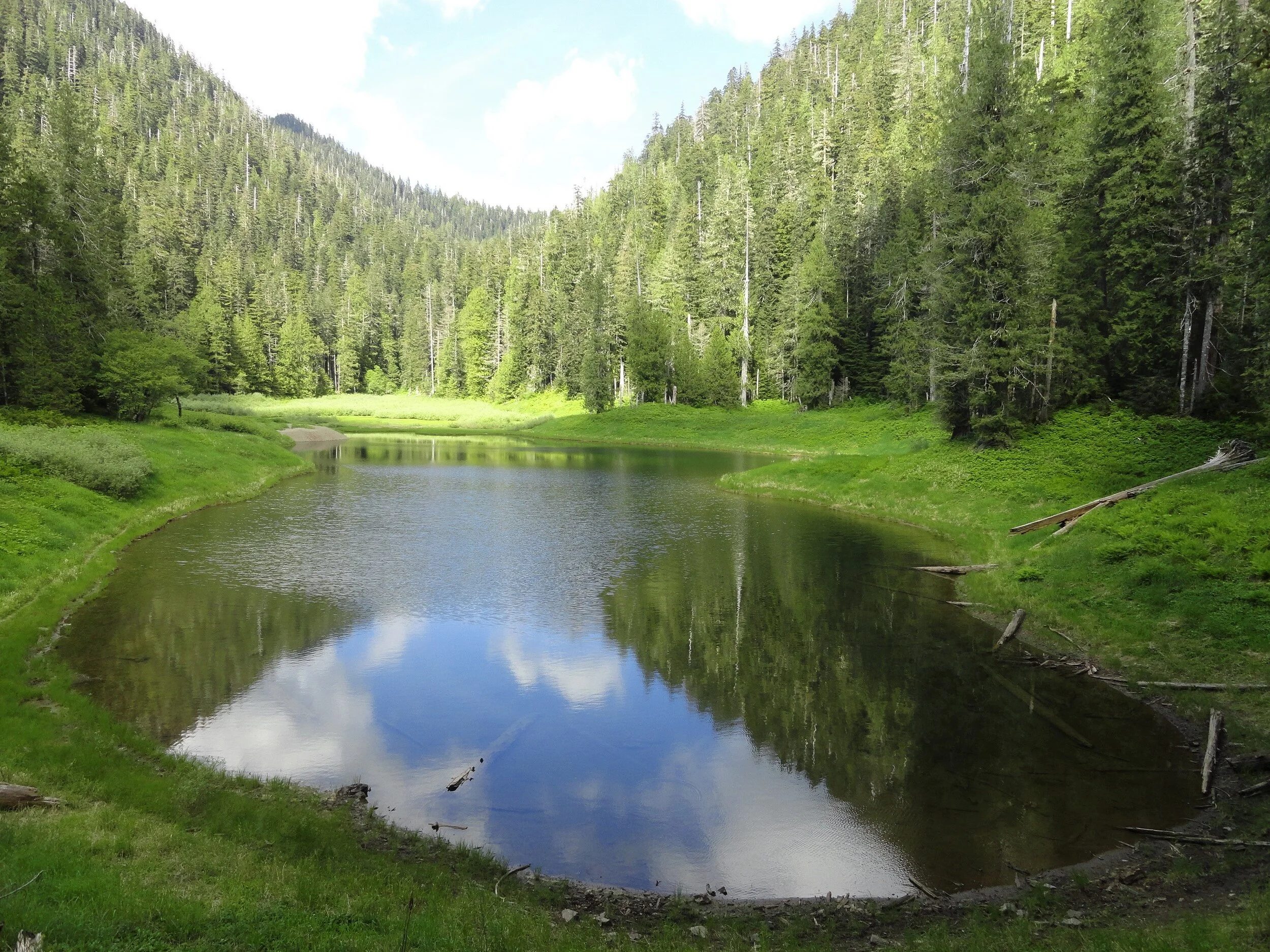
Now continue hiking through a forest of silver fir, and begin rapidly descending. Pass a pretty cascade fanning into a steep ravine. Giant cedars and Doug-firs are once again encountered as the trail levels out. In 3.2 miles and after losing 1,000 feet of elevation emerge in a grassy opening housing the largest of the five Satsop Lakes. Locate a gravel outwash area which provides for an excellent resting spot. Keep your eyes on the lake for trout and surfacing rough skinned newts. The lake is home to thousands of the latter. Look too along the forest’s edges for bigger critters.

Craig Romano photo
Roam around the lake and notice there is no outlet. Water seeps to the Satsop River via a cavernous basalt basin. Four other lakes are hidden in the surrounding forest if you feel inclined to find them. But while the distance to reach them may not be great, the terrain can be challenging. The trail continues for another .3 mile through more groves of giant trees ending at Forest Road 2372. Yes, you can reach the lakes via a much shorter hike if they are your sole intent. But you’d miss most of the grand forest. But now you get to traverse it one more time as you make the journey back to your vehicle.
Trails notes:
Land Agency Contact: Olympic National Forest, Hood Canal Ranger District, Quilcene, fs.usda.gov/olympic
Distance: 6.4 miles roundtrip
Elevation Gain: 2,350 feet
High Point: 3,150 feet
Difficulty: moderately difficult
Snow free: June--Oct
Trailhead Pass Needed: None
Notes: FR 2361 is gated and closed from October 1 to April 30 to protect wildlife. You can walk or bike the road (adding 11.2 miles roundtrip) during this time to reach the trailhead.
GPS waypoints: Trailhead: N 47 26.928 W 123 29.437; Satsop Lakes N 47 25.818 W 123 30.851
Recommended Guidebooks: Day Hiking Olympic Peninsula 2nd edition (Romano, Mountaineers Books)
Trailhead directions: From Shelton, travel north on US 101 for 7 miles turning left at milepost 340 onto the Skokomish Valley Road (signed Skokomish Recreation Area). Follow this paved road for 5.6 miles bearing right at a V-intersection onto Forest Road 23. Continue for 9.3 miles bearing left at a Y-junction with FR 2353. Continue on FR 23 (pavement ends) for 4.3 miles. Then bear right onto FR 2361 and follow for 3.4 miles. Next turn left onto FR 2361-600 (if you crossed Church Creek you’ve gone too far) and drive 2.2 miles to a hairpin turn. The trailhead is located on your right.
A Quiet trek to Pine Lake
The South Fork Skokomish River Valley offers quite a contrast from the North Fork Skokomish River Valley. Located within Olympic National Forest and not Olympic National Park, the South Fork sees a fraction of the number of folks that visit the North Fork.
Craig Romano | Story and Pictures
The South Fork Skokomish River Valley offers quite a contrast from the North Fork Skokomish River Valley. Located within Olympic National Forest and not Olympic National Park, the South Fork sees a fraction of the number of folks that visit the North Fork. Once a heavily logged area, the South Fork is slowly reverting back to a more natural state. Miles of former Forest Service logging roads in this wildlife rich valley have been decommissioned; some converted into trails. The converted trail to pretty little Pine Lake is a pure pleasure to walk. And surprisingly, the lake is surrounded by beautiful ancient forest. Majestic hemlocks, Douglas firs, and red cedars—just no pines.
Hit the Trail
Much of the South Fork Skokomish Valley in the Olympic National Forest was intensely logged from the 1940s to the 1980s. By the 1990s however timber harvesting on the Olympic and other Western Washington national forests was heavily curtailed due to market place changes and new management objectives favoring habitat protection and recreation. This resulted in the Forest Service decommissioning hundreds of miles of old logging roads. Some of these old roads however presented new opportunities to expand the trail system.

Olympic National Forest once contained hundreds of miles of trails in the South Fork Skokomish and Wynoochee River watersheds. Intensive logging destroyed most of those trails. Forest Service officials and citizen groups now see new opportunities to regain many miles of these lost trails through road conversions. The trail to Pine Lake is one of these new trails. And unlike so many road-trail conversion that simply involves gating the road and removing culverts—the Pine Lake Trail was designed with aesthetes in mind.
The road to trail conversion to this little lake involved constructing bends and curves in the original road bed to better mimic a real trail. And the road bed was restored to original contours in places further obscuring old road cuts.
The Forest Service planted native vegetation along the road bed so that in time it will be very difficult to see that this route was once a wide logging road. And while logging did occur within the Pine Creek watershed, it wasn’t as intense as in some of the smaller watersheds farther south and east. Large patches and tracts of old-growth forest were left uncut. And as the second growth patches adjacent to the primeval tracts continue to mature, evidence of past logging in the basin containing Pine Lake becomes less obvious.
"Surprisingly this trail is not on many hiker’s radar. Come on a weekday and you may have the lake to yourself."
From the small parking area, follow the trail through second growth forest traversing slopes high above Pine Creek. About half way up the trail you’ll encounter a patch of invasive Scotch broom, a plant that crowds out native vegetation in disturbed areas. The Forest Service along with Washington Conservation Corp crews have done a good job at Pine Lake restoring native vegetation. Unfortunately this pervasive and hardy invasive plant has gotten a foothold in this valley. Hopefully they can soon attack the broom before it sweeps across the valley.
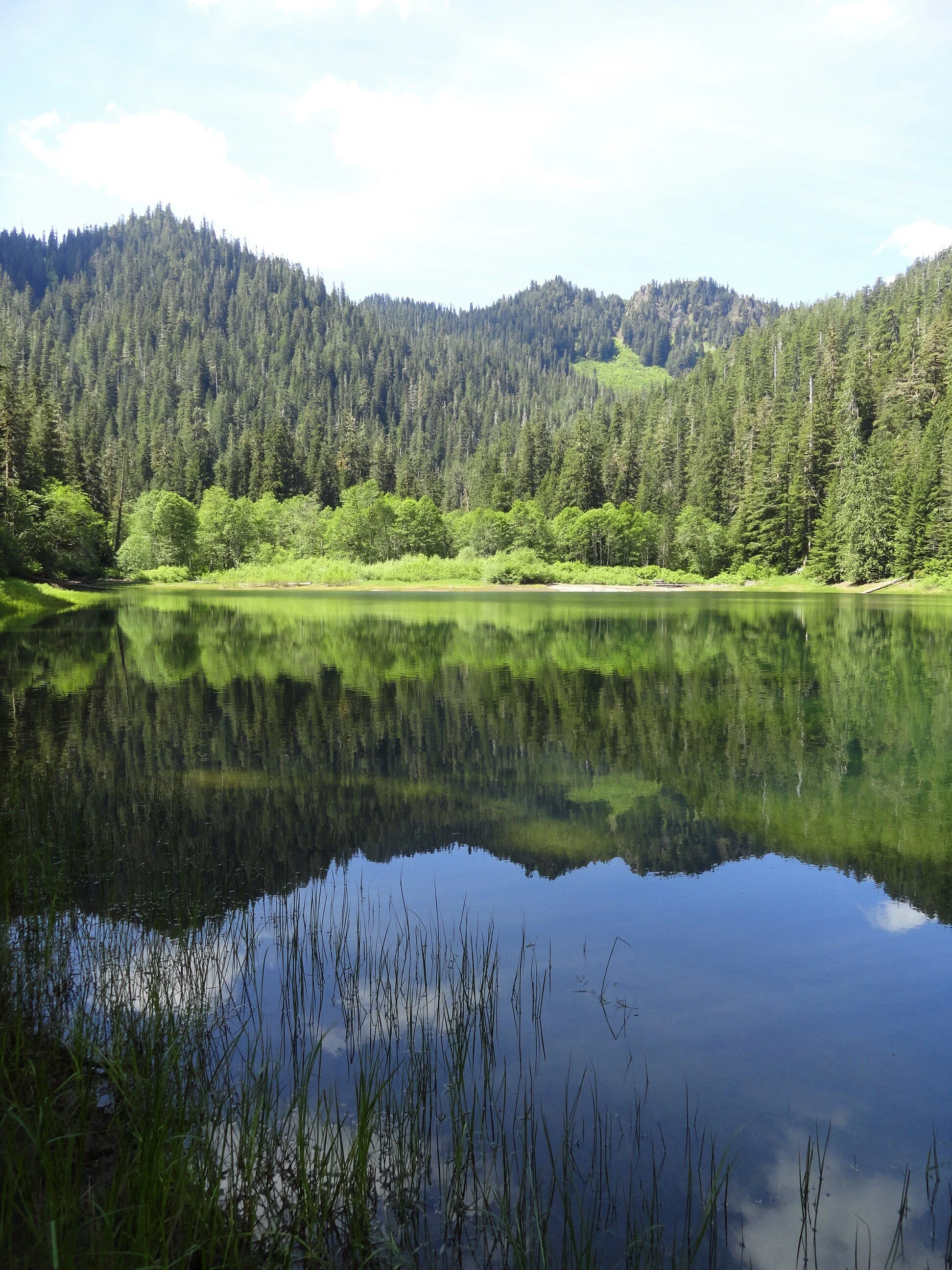
At about two miles the trail enters an attractive grove of old-growth forest. The way then steepens a little breaking stride from its relatively gentle grade to this point. In another .75 mile the trail leaves the old road bed to traverse a grove of big trees and descend to Pine Lake. The lake is pretty shallow and surrounded by grasses, sedges and other small plants—many planted by the Forest Service to help rehabilitate the shoreline from past abuses.
Treat the area with respect by sticking to established paths and not trampling vegetation.
Savor the serenity of the scene. Look for resident waterfowl on the lake’s open waters and in its vegetated coves.
Admire the forested hillsides too and Chapel Peak which often reflects upon the lake’s placid waters. Notice too that among the stately conifers surrounding the lake, there does not appear to be any pines. Western white pines valued for their fine wood, were once abundant in the Olympics and Cascades. But it wasn’t logging that erased them from much of these landscapes—but a Eurasian disease, white pine blister rust that decimated stands of this majestic tree.

It’s possible that is what occurred here at Pine Lake. Then again, early pioneers and explorers were also known for misnaming features. There are no badgers in Olympic National Park’s Badger Valley for example nor black oaks growing anywhere near Black Oak Creek in the North Cascades. Perhaps someone named the lake Pine referring to the area’s evergreens as pines. I have seen this mistake numerous times in travel journals and tourism brochures! Anyhow, Pine Lake’s name origins may remain a mystery. But pine or no pines, the lake is a pretty hiking destination. And if you are intent on seeing some beautiful western white pines, nearby Six Ridge in Olympic National Park harbors some healthy stands of them—but it is no easy hike reaching them.

Pine Lake Hike Resources
Land Agency Contact: Olympic National Forest, Hood Canal Ranger District, Quilcene, http://www.fs.usda.gov/olympic
Recommended Guidebooks: Day Hiking Olympic Peninsula
2nd edition (Romano, Mountaineers Books)
Trailhead directions: From Shelton, travel north on US 101 for 7 miles, turning left at milepost 340 onto the Skokomish Valley Road (signed “Skokomish Recreation Area”). Follow for 5.6 miles, bearing right at a V intersection onto Forest Road 23. Continue for 9.3 miles bearing left at Y-junction with FR 2353. Continuing on FR 23 (pavement ends) follow this good gravel road for 4.3 miles bearing right onto FR 2361. Continue for 1.2 miles and turn left onto unsigned Spur 200. Follow .7 mile to trailhead.
Distance: 5.8 miles roundtrip
Elevation Gain: 700 feet
High Point: 1830 feet
Difficulty: moderate
Snow free: Mar—Dec
Trailhead Pass Needed: None
Notes: Forest Road 2361 is gated and closed from October 1 to April 30th to protect wildlife. You can walk or bike the road (adding 3.8 miles roundtrip) during this time to reach the trailhead.
GPS waypoints: Trailhead: N47 26.270 W123 25.678 | Pine Lake: N47 25.839 W123 28.618
Features: kid and dog friendly, backcountry lake in old-growth forest, chances for solitude and wildlife watching
Safe & healthy hiking during the Covid-19
Avoid crowded hiking destinations. If you arrive and the parking lot is already full, head to another location
Opt for weekdays over weekends and/or early morning to hit the trail
Avoid hiking in large groups outside of your family
Practice Social Distancing while on the trail, giving other hikers lots of room to pass and keeping your distance from them at lakes, summits, etc.
Wear a mask when encountering others on the trail. A buff or bandanna works well, and remember to pack hand sanitizer
Pack it in pack it out (including pet waste) and don’t be a surface pooper. Always using privies first if available-or head at least 200' away from all trails, campsites and water sources and digging a cat hole for your business. Bury your waste and toilet paper.
Our Guide
Craig Romano is an author of more than 20 hiking guidebooks including the bestselling Day Hiking Olympic Peninsula 2nd Edition (Mountaineers Books), which includes descriptions for 136 hikes throughout the Olympic Peninsula.
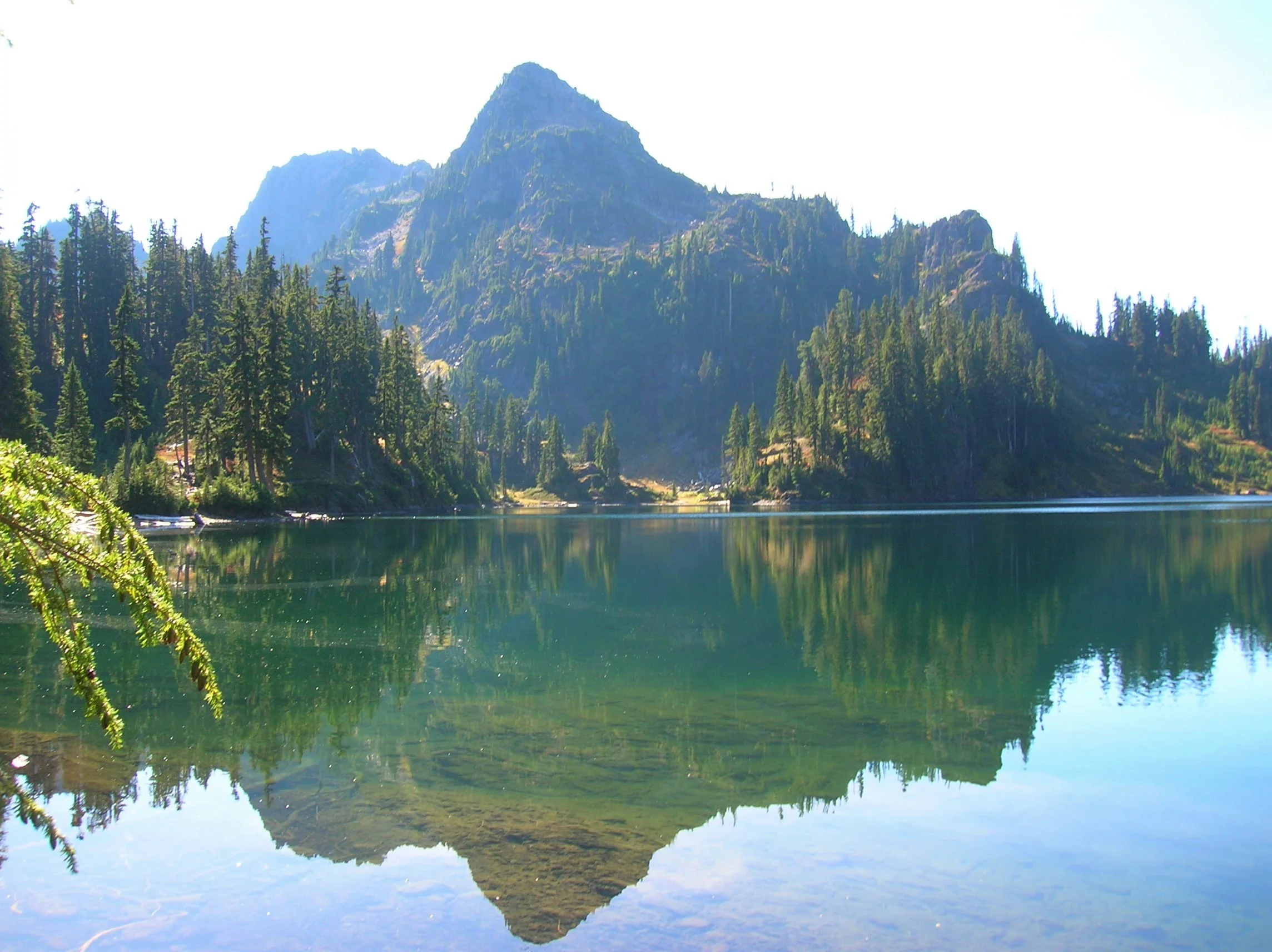
Lena Lakes Hiking Destinations
Gracing the Hamma Hamma Valley are two lakes sharing the name, “Lena.” But aside from the name, they are strikingly different from each other. Renown guidebook writer, Craig Romano, takes us on a trip to visit both these lakes.
Craig Romano | Craigromano.com
Gracing the Hamma Hamma Valley are two lakes sharing the name Lena. But aside from the name, they are strikingly different from each other.
The hike to Lower Lena is an easy kid and dog friendly jaunt through old growth forest. The hike to Upper Lena is a grueling and demanding grunt to a stunning high basin within Olympic National Park. Seasoned backpackers take to the upper lake and often set out afterward to scramble surrounding craggy peaks or head out on a rugged high country route. Lower Lena entertains first time hikers and newbie backpackers often testing their gear and skills for the first time. Expect plenty of company at the lower lake and a good chance for solitude at the Upper Lena.
Hit the Trail
Both lakes use the same approach. On a very well-trodden path head off in second-growth forest. The way immediately climbs, but the grade is gentle. Lena Creek can be heard crashing in the distance.
Lena Lake
Continue up the trail and eventually enter groves of beautiful old growth forest. The trail nears Lena Creek and then crosses it on a solid bridge. You might be dismayed however to be standing on a bridge spanning a dry rocky draw. What happened to the creek? It often makes a subterranean passage beneath all of those mossy rocks.
Now continue hiking working your way around and below a ledge. The trail then continues to climb coming to a junction at 3.0 miles. If you’re lower lake bound, bear right and within no time come to an inviting ledge granting a wonderful view of Lena Lake 100 feet below.
To reach the shoreline continue and descend passing busy campsites. You’ll eventually come to a junction with a trail leading back to the trail heading for the upper lake. Head right and reach the shoreline. The trail crosses Lena Creek and continues towards The Brothers—but that’s more of interest to climbers. You’ll figure out in no time that Lena Lake is one of the most popular hikes in the Olympics. Be sure to treat this heavily visited place with care and to practice Leave No Trace ethics.

Upper Lena Lake
If you’re more interested in a wilder setting, skip the trip to Lower Lena and from that first junction, head left. Immediately notice how much lighter the tread is now. Bear left at the next junction and begin following Lena Creek through spectacular primeval forest. At just over 4.0 miles the trail enters Olympic National Park. Dogs are prohibited from this point on—and if you plan to camp at Upper Lena you must have a backcountry permit (issued at Hoodsport Visitor Center and other Olympic National Park ranger stations). Until this point the climbing has been fairly moderate, but that is all about to radically change.
The trail continues alongside Lena Creek heading up an increasingly tighter valley. After crossing a tributary creek on a log bridge the trail gets downright nasty! Prepare yourself for an insanely steep climb up a rocky, rooty, and at times brushy course. It’s arduous and physically taxing, and when soaked by rainfall it can be treacherous. A good set of trekking poles will come in handy. The climbing eases after you carefully negotiate a ledge and clamber up a steep rocky bed of big rocks,
Once again come to and cross Lena Creek, which may be following a subterranean passage here as well.
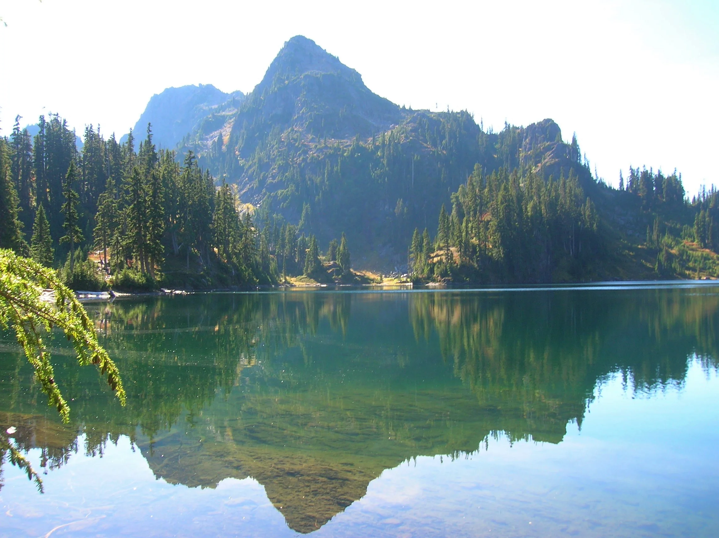
Continue through open attractive old-growth forest groves. Make one more steep climb before cresting a ridge cradling Upper Lena Lake. Before bolting for the lake, turn around and look back at Mount Rainier in the distance. Now charge for the lake. Enjoy a breathtakingly beautiful backdrop view of 5960-foot Mount Bretherton rising above and reflecting in the lake. Camps (permits required) are along the lake’s eastern shore, and by a short path, on the lake’s western shore.

If you’re up for the day, stay awhile and soak up the beauty. In autumn the surrounding hills colorfully reflect in the lake’s placid waters. Look for critters big and small frolicking in those hills looking for berries. Feel free to help yourself to a handful as well. If you have any energy left consider following a half mile side trail to beautiful Milk Lake set beneath a small glacier on Mount Bretherton. Then rest up and prepare your knees for the brutal and jarring descent back to your vehicle. The beauty and solitude are definitely worth the grind.
Craig Romano
Award winning author and outdoors writer who has authored and co-authored of more than 20 books including Day Hiking Olympic Peninsula 2nd Edition (Mountaineers Books), which features 136 hikes on the Olympic Peninsula. craigromano.com
Lena Lakes Details
Distance:
Lower Lake: 6.0 miles roundtrip; Upper Lake: 14.0 miles roundtrip
Elevation Gain: Lower Lake: 1225 feet; Upper Lake: 4100 feet
High Point: Lower Lake: 1900 feet; Upper Lake: 4600 feet
Difficulty: Lower Lake: moderate; Upper Lake: strenuous
Snow free: Lower Lake: March—Dec; Upper Lake: July—November
Trailhead Pass Needed: Northwest Forest Pass or Interagency
GPS waypoints:
Trailhead: N47 35.984 W123 09.055
Lower Lake: N47 36.994 W123 09.789
Upper Lake: N47 38.068 W123 12.329
Dogs are ok at Lower Lena but prohibited at Upper Lena Lake.
Camping (no fires) at Upper Lake requires National Park Wilderness Camping Permit (contact Olympic National Park, Wilderness Information Center (360) 565-3100)
Land Agency Contact: Olympic National Forest, Hood Canal Ranger District, Quilcene, fs.usda.gov/olympic and Olympic National Park, nps.gov/olym
Recommended Map: Green Trails Olympic Mountains East 168S
Recommended Guidebooks: Day Hiking Olympic Peninsula 2nd edition and Backpacking Washington (Romano, Mountaineers Books)
Trailhead directions: From Hoodsport travel north on US 101 north for 13.7 miles turning left at milepost 318 onto FR 25 (Hamma Hamma River Road). Continue for 7.5 paved miles to the trailhead.
Trailhead facilities: privy
Hood Canal Hike: Duckabush River Trail
The Duckabush River starts in the heart of the Olympic Mountains. Fed by glaciers, snowfields, and a myriad of springs and alpine lakes; this major Olympic Peninsula river provides excellent wildlife habitat and makes for some stunning scenery. Explore this valley in the winter for the added bonus of solitude, a chance to observe elk, and to witness a rain-swollen river careening through clefts and over boulders.
Craig Romano | author Day Hiking Olympic Peninsula 2nd Edition

The Duckabush River starts in the heart of the Olympic Mountains. Fed by glaciers, snowfields, and a myriad of springs and alpine lakes; this major Olympic Peninsula river provides excellent wildlife habitat and makes for some stunning scenery. Explore this valley in the winter for the added bonus of solitude, a chance to observe elk, and to witness a rain-swollen river careening through clefts and over boulders.
Hit the Trail
The Duckabush River Trail is a portal into the wild interior of the Olympic Peninsula. A well-maintained trail travels along a good portion of the waterway allowing you to experience its grandeur. The trail travels a verdant valley for more than 20 miles terminating at Marmot Lake in the heart of Olympic National Park.
That’s a long journey primarily reserved for multi-day backpackers who often continue farther from there to cross historic O’Neil Pass. Day hikers however will be content to head up this trail for just a few miles.
An objective for many hikers and one that includes a good day’s worth of mileage and a little climbing too is to an imposing riverside knoll known as the Big Hump.
If the 7.8 mile distance and more than 1400 feet of elevation gain to reach this destination is too much, a satisfying turnaround spot is a nice stretch of river just prior to the climb.
The Duckabush River Trail like many of the trails leading along rivers into the Olympic interior begins as an old roadbed. Park officials, foresters and others once sought to punch roads deeper into the Olympics. However, over time, changing attitudes that emphasized preservation of areas free of roads and dwindling budgets that couldn’t maintain many miles of backcountry byways led to miles of roadway being converted to trails. In almost all of these cases this has meant miles of gentle hiking as the old roadways were often well graded. That is the case for the beginning of this trail.
Head off down the trail gently climbing through a uniform forest of second-growth fir. This part of the Duckabush River valley was logged—but it was many decades ago. The real old and impressive trees are yet to come. At 1.2 miles the trail enters The Brothers Wilderness, a 16,000-plus acre federally protected section of the Olympic National Forest. Wilderness designation means that this rugged and ecologically important tract of land bordering the national park will never be logged, developed or have a road traverse it. Bicycles and machinery are not permitted either, allowing folks who come to explore this area by foot or horseback a true wilderness experience.
The trail continues through a low gap near Little Hump and then begins a descent of 250 feet, following an old logging railroad grade on an almost perfectly level trajectory. Loggers here didn’t take all of the big timber as a few standing giants attest.
While this part of the Olympics is in a rainshadow, receiving around 70-80 inches of rain a year compared to two to three times that on the other sides of the mountains, mossy limbs and a thick understory makes it feel somewhat like a rainforest.
After passing a campsite the trail finally comes upon the Duckabush River. At 2.6 miles, you’ll reach a spectacular spot where giant cedars and firs hang over the churning, crashing river. This is a great spot to turn around and perfect for a good half day hike or one with young adventurers.
Go Farther
If you’re intent on tackling the Big Hump, continue up the trail preparing yourself for a stiff 1,000 foot climb. The way steadily and steeply at times climbs. Old-growth greenery is soon replaced with fire-scarred trees and burnt and downed timber. Here in 2011 a careless camper started a wildfire that scorched a large patch of old-growth on the Big Hump. Hardy fire-scarred trees stand among stands of fire-ravaged timber. While trail crews have since rehabilitated the tread here, avoid this section of trail during periods of high wind, as burnt snags are prone to toppling.

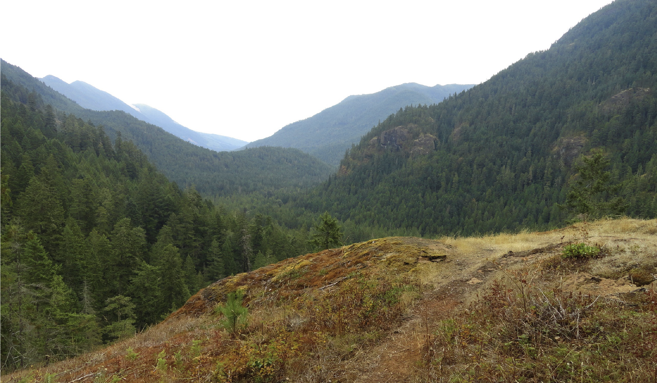
At a little over 3 miles come to a ledge with a spectacular view east down the river valley.
On a clear day you can see all the way to the Cascades. To the south, impressive St. Peters Dome hovers—often catching swirling low clouds. Return to this spot later in the spring and you’ll have an array of wildflowers enhancing the views. Keep hiking and come to another outcropping before finally cresting 1700-foot Big Hump at 3.9 miles.
For most day hikers, this is far enough. But if you still feel like hiking, continue through a mosaic of old growth and fire scorched trees and descend 600 feet back to the river. Here at 5.3 miles from the trailhead is a camping area near a series of impressive rapids. During periods of heavy rain the river can be deafening here. Watch for darting dippers in the rapids as you rest up for your return to your start.

And if you are a strong hiker or are out on a several day backpacking adventure, the trail generally remains snow-free through the winter for many more miles. Note that at 6.7 miles from the trailhead it enters the national park—meaning dogs are not allowed to continue—and if you are planning on camping, you’ll need to secure a backcountry permit beforehand.