
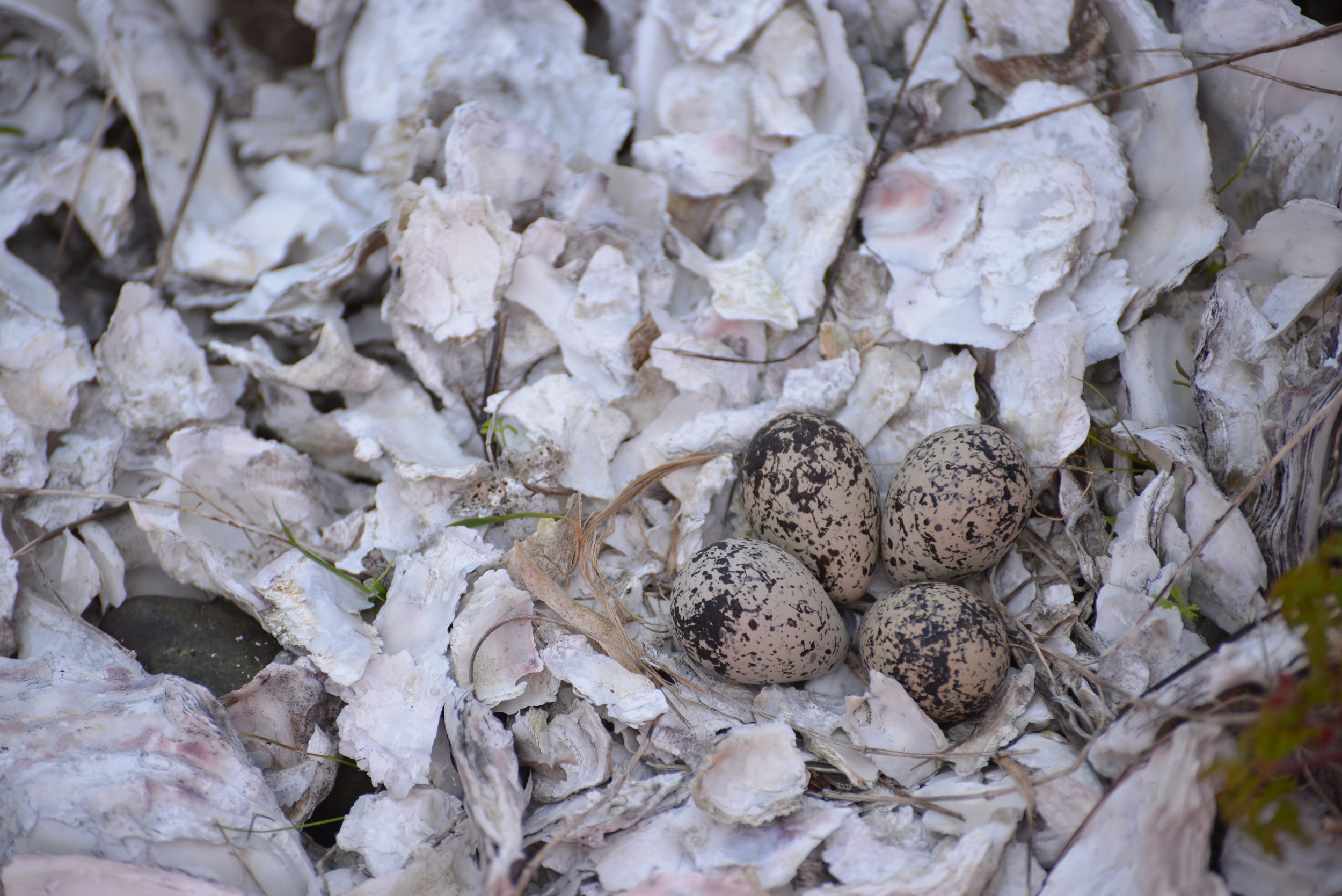

5 amazing hikes around Hood Canal
Craig Romano has outlined 25 great hiking destinations for us on Hood Canal — Here’s five to get you started!
Award winning local guidebook author, Craig Romano, shared 25 of his top area hikes with us in a handy “stuff-in-your-glovebox guide,” here are a few of the many hikes that are open and awaiting your adventure! Welcome to the #wildsideWA.
Tighten your laces!

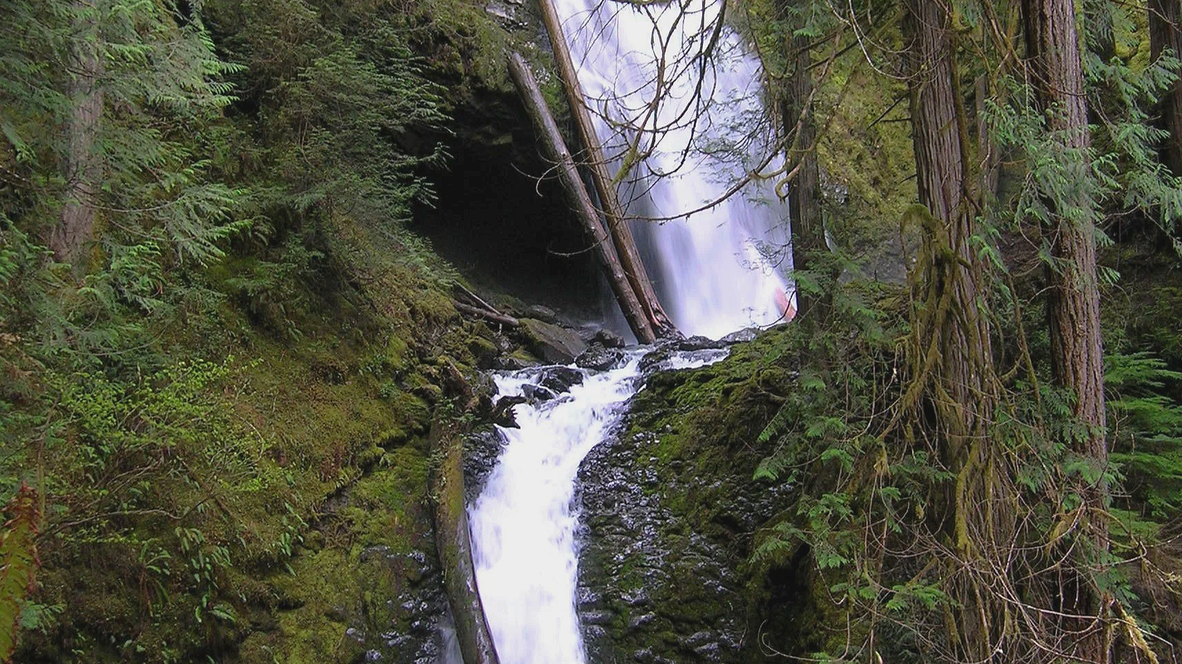
1. Murhut Falls
(Olympic National Forest)
Hidden in a lush narrow ravine, Murhut Falls were long unknown to many in the outside world. But all that changed upon the construction of a well-built and easy to hike trail. This two-tiered waterfall that plummets 130 feet has become a favorite cascade for many Olympic Peninsula hikers. The trail starts by following an old well-graded logging road. As you work your way toward the falls, its roar will signal that you’re getting closer. Reach the trail’s end and behold the impressive falls crashing before you. The upper falls drops more than 100 feet while the lower one crashes about 30 feet.
Difficulty: Easy, 300 feet elevation gain, 1.6 miles
Permits: Not required
Kid and Dog Friendly: Yes
2. DuckabusH River trail
(Olympic National Forest)
The Duckabush River starts in the heart of the Olympic Mountains and flows through a deep verdant valley on its way to Hood Canal. Duckabush River Trail travels near and along the river for more than 20 miles terminating at Marmot Lake in the heart of Olympic National Park. At a little over 3 miles you will come to a ledge with a spectacular view east down the river valley. On a clear day you can see all the way to the Cascades.
Highlights: Old-growth forest, low elevation wilderness valley, backpacking opportunities
Distance: Moderate, 10.6 miles R/T Elevation gain: 2150 feet
Permits: NW Forest Pass /Interagency Pass
Kid & Dog Friendly: Yes

Duckabush River
3. LENA LAKES TRAIL
(OLYMPIC NATIONAL FOREST & PARK)

With all the fire activity this iconic trail system remains far removed from the bustle. The Lena Lakes are located above the Hamma Hamma valley. Despite having the same name, the two lakes have distinct differences. The lower lake is a simple, family and pet-friendly walk through old, tall trees in Olympic National Forest. The upper lake is a tough climb to a beautiful high area in Olympic National Park. The lower lake can be busy with hikers on a summer Saturday while the upper lake offers more solitude. Access to both lakes is the same.
Highlights: Old-growth forest, water!
Distance: Lower: 6 miles R/T; Upper: 14 miles R/T
Elevation gain: Lower: 1225 feet; Upper : 4100 feet
Difficulty: Lower Lake: moderate; Upper Lake: strenuous Permits: Northwest Forest or Interagency Pass
Hiking Season: Lower Lake: March to Dec; Upper Lake: July to November
Notes: Camping (no fires) at Upper Lake requires National Park Wilderness Camping Permit (contact Olympic National Park, Wilderness Information Center (360) 565-3100)
Kid-Friendly: Yes Lower Lake; no Upper Lake Dog-Friendly: yes Lower Lake; prohibited Upper Lake

4. spider lake
(Olympic National Forest)
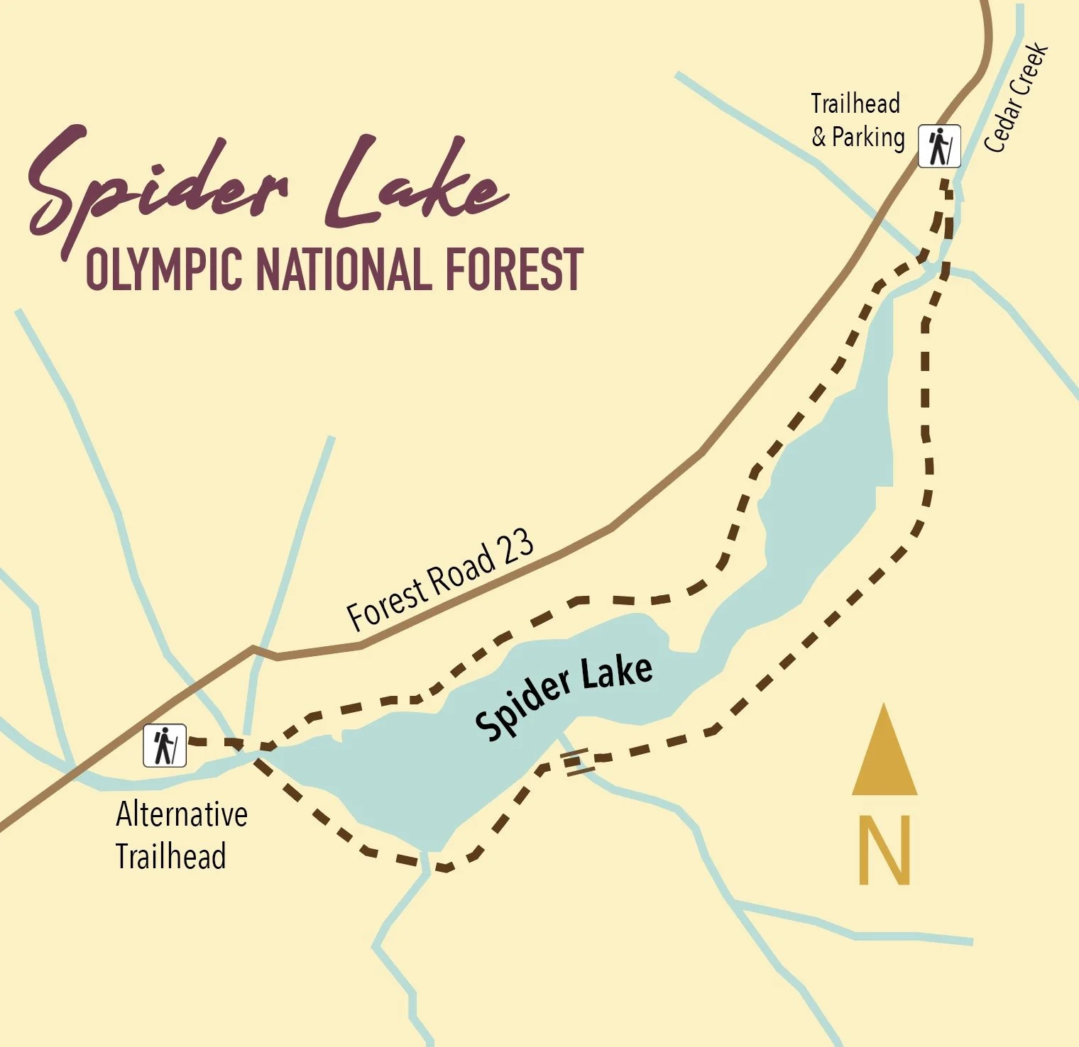
A long slender lake tucked within a narrow valley on the Skokomish–Satsop River divide, Spider is graced with groves of ancient giant old-growth forest. The trail around the lake is a remnant of a longer trail that once traversed miles of primeval trees. Most of those trees have since been logged, and the trail truncated to the lake. The remaining trail has since been restored and the forests on the surrounding hillsides are regenerating nicely.
Highlights: Old-growth forest Distance: 2 mile R/T Difficulty: Easy Elevation gain: 250 feet
Permits: None
Kid and Dog Friendly: Yes

5. Schafer Forest Trail
(Schafer State Park)

Tucked along the East Fork Satsop River in extreme southwestern Mason County, Schafer State Park is off-the-beaten path. While this park is far from population centers, it was a thriving spot for many years. In 1872 the Schafer Family came from Wisconsin to homestead here. Three of their sons, Peter, Albert and Hubert begin logging the homestead in the 1890s. They donated this parcel to the state in 1924, and it continued to host many large company gatherings as well as other groups. Today the park is much quieter, but families still come here to gather. The park’s trails however tend to remain pretty peaceful.
Highlights: Historic homestead; trail along Satsop River; salmon spawning creek and estuary
Distance: 1.3 mile loop Elevation gain: 75 feet
Difficulty: Easy Permits: Discover Pass Kid & Dog Friendly: Yes

This is only a SMALL sampling of the amazing hikes available in the area! Check out the hikes link for a full list of places to explore, visit the waterfalls trail for a comprehensive list of year-round waterfall destinations — or pick up or download a copy of Romano’s Top 25 Hikes!

Tips for taking your dog to The park
For dog families, it’s not a hike, camp out or road trip unless your four-legged trail buddy comes with you. While embarking on the adventure is optional, getting back healthy and whole is mandatory! Washington State Parks has some tips to leave you with only good memories when you visit.

For dog families, it’s not a hike, camp out or road trip unless your four-legged trail buddy comes with you. While embarking on the adventure is optional, getting back healthy and whole is mandatory! Washington State Parks has some tips to leave you with only good memories when you visit.
Trail tips
We know your dog wants to run free, but leash rules are not a punishment – they’re there for everyone’s safety. Your pup may be a big softie, but even saying, “It’s okay, they're friendly,” won’t assuage some peoples’ fear. Keep your dog from approaching people unless someone asks to pet him or her. Conversely, if your dog is not dog or people-friendly, please warn folks – especially children, before they get close.
Predator or prey?

In the natural pecking order, a dog can be seen as prey to some wildlife (raptors, big cats, coyotes, black bears) and a predator to others (deer, rabbits, marmot, turkey, horses). Leashing your pet can be the thing that keeps them from dinner – both eating and becoming.
Keep in mind that most prey will fight back, and getting gored by a deer is not how you want your pup to end their vacation. Also, when dogs chase wildlife – or something they see or smell – they can get lost or into deep water. Even if your dog is behaved at home, parks are abnormal environments that might be tempting for an off-leash dog to ignore. Tricky whales, seals and waterfowl have been known to lure dogs out into the water and exhaust them.
Trail hazard?

On mixed-use trails, heel or pick up your pooch if a horse or a mountain bike comes by. A horse can easily spook and injure itself, its rider or your party. Mountain bikes zip downhill at high speeds, and you don’t want your dog to chase and get in an accident.
Be my neighbor?
Camping with dogs is just fun. Pups provide warm cuddles and a feeling of safety for solo campers. And dogs + kids + snuggles in the tent go together like chocolate, graham crackers and marshmallows around the campfire.
But dogs hear and smell things we don’t, and they often feel the need to alert us. Your neighbors, however, may not appreciate Fido howling a warning at 2 a.m.
Consider booking a campsite on the end and/or outside part of the campground loop. One Parks staffer says she parks her car between her site and her neighbors’ to minimize stimuli.
Most parks welcome dogs, but we do have a few culturally or environmentally sensitive areas where they’re not allowed. Look up your destination on parks.wa.gov to make sure bud can accompany you on all parts of your state park getaway.
6 Tips for Hike Savvy Canines
Like house-bound humans, dogs need a little prep time to get ready for the trail. Here are six tips to help you and Fido have a safe and fun adventure.
#1 Take it Easy : Start with easy trails and slowly build up stamina & strength.
#2 Care for Tender Paws: Make sure your dog's pads are toughened or purchase hiking booties and let him get used to them before heading into the wild.
#3 Yield to oncoming traffic: No matter how sweet Fido appears, its good practice to verbalize how friendly he is. Step off the trail when hikers pass and heel your dog.
#4 Leash Control: If the trail requires leashes or if if your dog might run into other hikers, keep him on a short leash (-6') since a long leash is more likely to get tangled on brush. Your dog should not be allowed to roam freely.
#5 Leave no trace: Bring bags to collect and carry out your dog’s poop. If you’ll be backpacking overnight, bury it at least 6” deep and at least 200 ' from walkways, camps, and water sources.
#6 Command Ready: Hazards in the woods differ than the cul de sac. Don’t let your dog stray. Some plants are poisonous, and some creatures bite and may host diseases. Irressistable smells will lure pooch away in a flash. Make sure your obedience training is on track.
Visit backpacker.com for more ideas on a safe and rewarding journey!

Who Rescued Who?!? Answers from Shelton's Adopt-A-Pet
Adopt-A-Pet in Shelton has been rescuing animals for over 45 years, operating as a volunteer-based organization dedicated to finding homes for dogs. Currently open for adoptions by appointment, they are looking to reconnect with the community through tours and events to showcase their improved facilities. Adopt-A-Pet emphasizes the importance of finding the right match between pets and owners, often involving home visits and dog introductions. They continue to advocate for spaying and neutering to control the pet population and prevent health issues. An open house event is planned for the 28th to invite the public to learn more.
Adopt-A-Pet in Shelton has been rescuing animals for over 45 years, operating as a volunteer-based organization dedicated to finding homes for dogs. Currently open for adoptions by appointment, they are looking to reconnect with the community through tours and events to showcase their improved facilities. Adopt-A-Pet emphasizes the importance of finding the right match between pets and owners, often involving home visits and dog introductions. They continue to advocate for spaying and neutering to control the pet population and prevent health issues. An open house event is planned for the 28th to invite the public to learn more.
Satsop Lakes via Church Creek
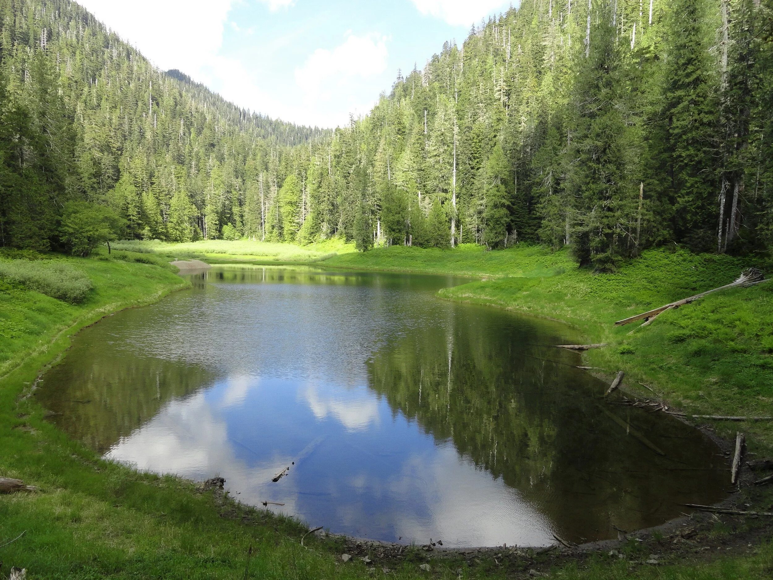
This moderately difficult dog friendly trail offers magnificent old-growth forest, a wildlife rich backcountry lake, and fantastic opportunities for solitude.
Craig Romano | story & pictures
Named not for a house of worship but after Frederic Church, a member of Colonel O’Neil’s 1890 Exploratory Trip across the Olympics; never-the-less this trail is sure to touch your soul. The path winds through an ancient forest of towering cathedral trees where gaps in the lofty canopy shine beams of ethereal sunlight upon the forest floor. And while the forest is heavenly, the way is rough in spots and involves some decent climbing. But your toil will be redeemed upon reaching the Satsop Lakes in a tranquil verdant basin that teems with wildlife.
Features: Dog friendly, magnificent old-growth forest, wildlife rich backcountry lake, and fantastic opportunity for solitude.

Craig Romano photo
Hit the Trail
Like many trails in the southern flanks of the Olympic National Forest, the Church Creek Trail was once much longer than its current 3.5 mile length. It once extended all the way from the South Fork of the Skokomish River to the Wynoochie River. But the Forest Service accelerated logging in this region after World War II with little regard to preserving many of the historic and scenic trails that traversed this lugged landscape.
By the 1990s however due to pressure from conservationists, and concerned citizens and elected officials, the Forest Service shifted its timber harvesting management objectives to protect old-growth forests. Tens of thousands of acres of the primeval forest that shrouded the rugged valleys and mountains of the southern flanks of the Olympic Mountains however had been cut down. But fortunately large pockets still remained including along that 3.5 mile stretch of the Church Creek Trail. But due to budget cuts, the Forest Service abandoned the trail in the early 1990s.
In 2005 the Church Creek Trail was resurrected thanks to the Olympia Mountaineers. They adopted it; restoring it to a top-notch trail. The trail makes for an excellent alternative to the busier trails in the North Fork Skokomish River Valley. And while the Satsop Lakes make for a lovely destination, it’s the forest along this hike that is the prime attraction.
Towering Douglas-firs reaching dizzying heights and wide-girth cedars and hemlocks hundreds of years old line the trail from end to end.

From an unimposing trailhead, start hiking immediately entering a cathedral forest of buttressed cedars and spires of firs. | Craig Romano photo
From an unimposing trailhead, start hiking immediately entering a cathedral forest of buttressed cedars and spires of firs. Cascading Church Creek, audible but not visible, adds a soothing aria to this sanctuary. The creek and a nearby peak were named in honor of Frederic Church of the 1890 O’Neil Expedition. Lieutenant O’Neil and his men explored large portions of the Olympic interior from east to west.
Along his three month cross Peninsula trek he sent out smaller parties to explore and map watersheds. Church was among these explorers.

Lieutenant Joseph P. O'Neil (1862-1938), Courtesy Robert B. Hitchman
The O’Neil Expedition’s findings were invaluable. They mapped, explored and collected specimens from at the time was one of the last major mountain ranges in the Continental United States that had not been explored by Non-native peoples. One of O’Neil’s most important revelations was summed up in his report to the 54th US Congress. He wrote, "I would state that while the country on the outer slope of these mountains is valuable, the interior is useless for all practical purposes. It would, however, serve admirably for a national park. There are numerous elk—that noble animal so fast disappearing from this country—that should be protected.” O’Neil’s recommendations would later lead to the establishment of Olympic National Park.
The trail winds and climbs under a lofty canopy supported by gigantic beams. Hopefully your attention will be diverted upward by staring at these amazing old-growth giants; helping to take your mind off of the stiff climb. The way utilizes a series of switchbacks and comes close to Church Creek on several occasions. But the plummeting waterway remains hidden in a deep lush ravine.
The forest understory is thick and verdant and also commands your attention. In early summer, fawn lilies, calypso orchids, and marsh marigolds add additional colors to this emerald world. Return later in August to harvest some sweet rewards in the form of succulent huckleberries.
The trail crosses several small creeks and after about 1.5 miles it reaches a decommissioned road. This entire basin was once slated for the mills. The forest now remains as it did when O’Neil’s group passed by more than 130 years ago. Turn right and follow the old road bed for about 500 feet before picking up the trail again. Then through a more open forest continue climbing, reaching the 3,150 foot divide between the South Fork Skokomish and Satsop Rivers within another half mile. A humongous hemlock with two pistol-butted limbs stands sentry at the divide.
Now continue hiking through a forest of silver fir, and begin rapidly descending. Pass a pretty cascade fanning into a steep ravine. Giant cedars and Doug-firs are once again encountered as the trail levels out. In 3.2 miles and after losing 1,000 feet of elevation emerge in a grassy opening housing the largest of the five Satsop Lakes. Locate a gravel outwash area which provides for an excellent resting spot. Keep your eyes on the lake for trout and surfacing rough skinned newts. The lake is home to thousands of the latter. Look too along the forest’s edges for bigger critters.

Craig Romano photo
Roam around the lake and notice there is no outlet. Water seeps to the Satsop River via a cavernous basalt basin. Four other lakes are hidden in the surrounding forest if you feel inclined to find them. But while the distance to reach them may not be great, the terrain can be challenging. The trail continues for another .3 mile through more groves of giant trees ending at Forest Road 2372. Yes, you can reach the lakes via a much shorter hike if they are your sole intent. But you’d miss most of the grand forest. But now you get to traverse it one more time as you make the journey back to your vehicle.
Trails notes:
Land Agency Contact: Olympic National Forest, Hood Canal Ranger District, Quilcene, fs.usda.gov/olympic
Distance: 6.4 miles roundtrip
Elevation Gain: 2,350 feet
High Point: 3,150 feet
Difficulty: moderately difficult
Snow free: June--Oct
Trailhead Pass Needed: None
Notes: FR 2361 is gated and closed from October 1 to April 30 to protect wildlife. You can walk or bike the road (adding 11.2 miles roundtrip) during this time to reach the trailhead.
GPS waypoints: Trailhead: N 47 26.928 W 123 29.437; Satsop Lakes N 47 25.818 W 123 30.851
Recommended Guidebooks: Day Hiking Olympic Peninsula 2nd edition (Romano, Mountaineers Books)
Trailhead directions: From Shelton, travel north on US 101 for 7 miles turning left at milepost 340 onto the Skokomish Valley Road (signed Skokomish Recreation Area). Follow this paved road for 5.6 miles bearing right at a V-intersection onto Forest Road 23. Continue for 9.3 miles bearing left at a Y-junction with FR 2353. Continue on FR 23 (pavement ends) for 4.3 miles. Then bear right onto FR 2361 and follow for 3.4 miles. Next turn left onto FR 2361-600 (if you crossed Church Creek you’ve gone too far) and drive 2.2 miles to a hairpin turn. The trailhead is located on your right.
Lena Lakes Hiking Destinations
Gracing the Hamma Hamma Valley are two lakes sharing the name, “Lena.” But aside from the name, they are strikingly different from each other. Renown guidebook writer, Craig Romano, takes us on a trip to visit both these lakes.
Craig Romano | Craigromano.com
Gracing the Hamma Hamma Valley are two lakes sharing the name Lena. But aside from the name, they are strikingly different from each other.
The hike to Lower Lena is an easy kid and dog friendly jaunt through old growth forest. The hike to Upper Lena is a grueling and demanding grunt to a stunning high basin within Olympic National Park. Seasoned backpackers take to the upper lake and often set out afterward to scramble surrounding craggy peaks or head out on a rugged high country route. Lower Lena entertains first time hikers and newbie backpackers often testing their gear and skills for the first time. Expect plenty of company at the lower lake and a good chance for solitude at the Upper Lena.
Hit the Trail
Both lakes use the same approach. On a very well-trodden path head off in second-growth forest. The way immediately climbs, but the grade is gentle. Lena Creek can be heard crashing in the distance.
Lena Lake
Continue up the trail and eventually enter groves of beautiful old growth forest. The trail nears Lena Creek and then crosses it on a solid bridge. You might be dismayed however to be standing on a bridge spanning a dry rocky draw. What happened to the creek? It often makes a subterranean passage beneath all of those mossy rocks.
Now continue hiking working your way around and below a ledge. The trail then continues to climb coming to a junction at 3.0 miles. If you’re lower lake bound, bear right and within no time come to an inviting ledge granting a wonderful view of Lena Lake 100 feet below.
To reach the shoreline continue and descend passing busy campsites. You’ll eventually come to a junction with a trail leading back to the trail heading for the upper lake. Head right and reach the shoreline. The trail crosses Lena Creek and continues towards The Brothers—but that’s more of interest to climbers. You’ll figure out in no time that Lena Lake is one of the most popular hikes in the Olympics. Be sure to treat this heavily visited place with care and to practice Leave No Trace ethics.

Upper Lena Lake
If you’re more interested in a wilder setting, skip the trip to Lower Lena and from that first junction, head left. Immediately notice how much lighter the tread is now. Bear left at the next junction and begin following Lena Creek through spectacular primeval forest. At just over 4.0 miles the trail enters Olympic National Park. Dogs are prohibited from this point on—and if you plan to camp at Upper Lena you must have a backcountry permit (issued at Hoodsport Visitor Center and other Olympic National Park ranger stations). Until this point the climbing has been fairly moderate, but that is all about to radically change.
The trail continues alongside Lena Creek heading up an increasingly tighter valley. After crossing a tributary creek on a log bridge the trail gets downright nasty! Prepare yourself for an insanely steep climb up a rocky, rooty, and at times brushy course. It’s arduous and physically taxing, and when soaked by rainfall it can be treacherous. A good set of trekking poles will come in handy. The climbing eases after you carefully negotiate a ledge and clamber up a steep rocky bed of big rocks,
Once again come to and cross Lena Creek, which may be following a subterranean passage here as well.
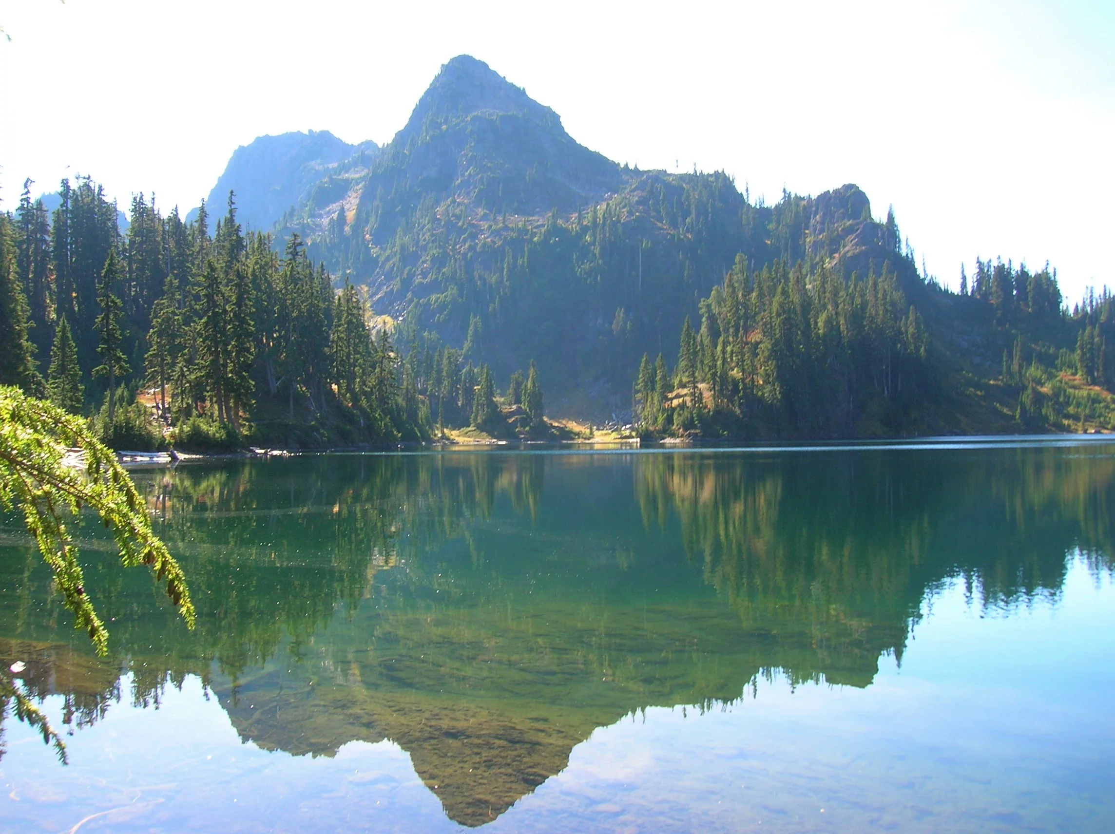
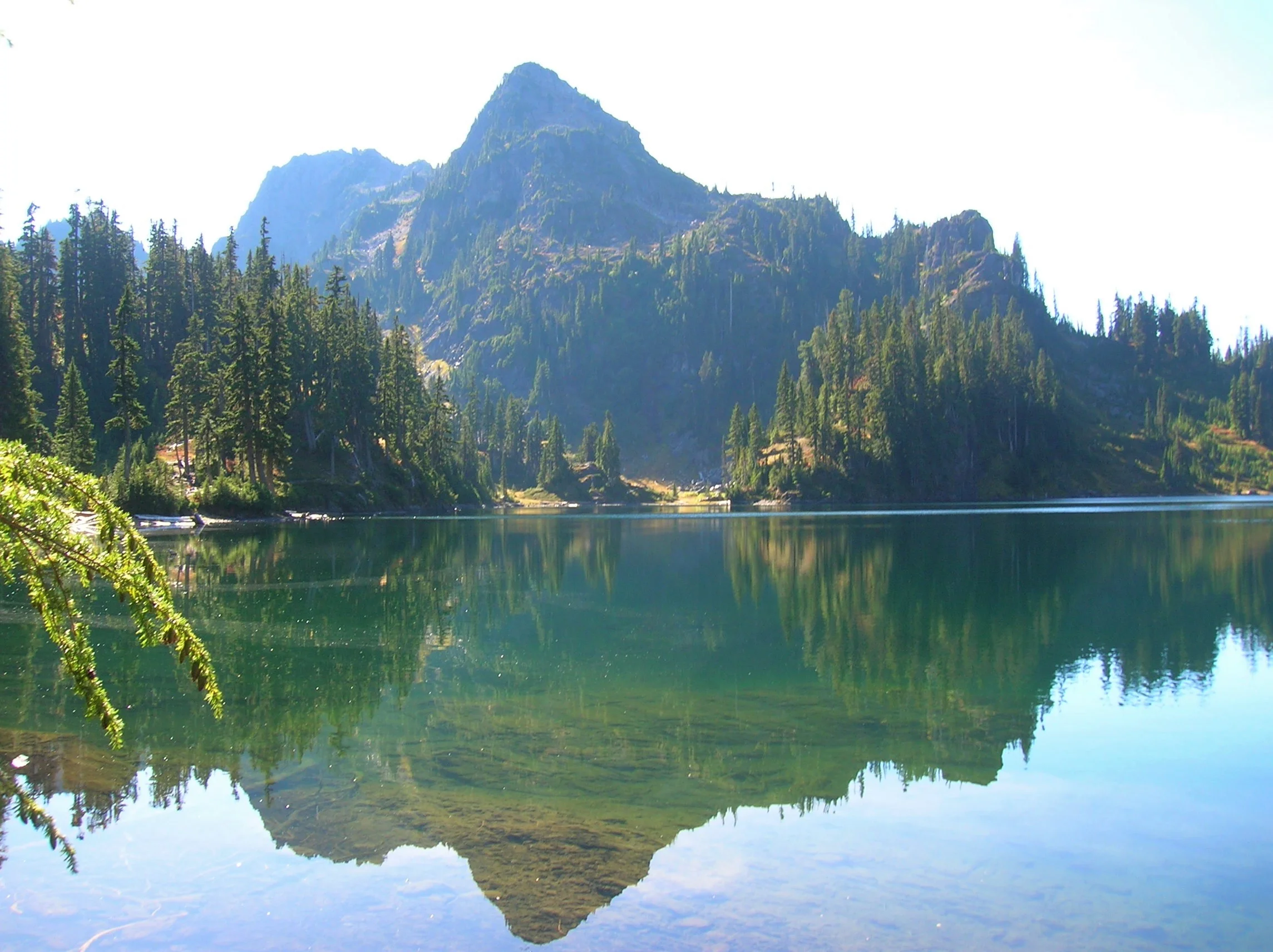
Continue through open attractive old-growth forest groves. Make one more steep climb before cresting a ridge cradling Upper Lena Lake. Before bolting for the lake, turn around and look back at Mount Rainier in the distance. Now charge for the lake. Enjoy a breathtakingly beautiful backdrop view of 5960-foot Mount Bretherton rising above and reflecting in the lake. Camps (permits required) are along the lake’s eastern shore, and by a short path, on the lake’s western shore.

If you’re up for the day, stay awhile and soak up the beauty. In autumn the surrounding hills colorfully reflect in the lake’s placid waters. Look for critters big and small frolicking in those hills looking for berries. Feel free to help yourself to a handful as well. If you have any energy left consider following a half mile side trail to beautiful Milk Lake set beneath a small glacier on Mount Bretherton. Then rest up and prepare your knees for the brutal and jarring descent back to your vehicle. The beauty and solitude are definitely worth the grind.
Craig Romano
Award winning author and outdoors writer who has authored and co-authored of more than 20 books including Day Hiking Olympic Peninsula 2nd Edition (Mountaineers Books), which features 136 hikes on the Olympic Peninsula. craigromano.com
Lena Lakes Details
Distance:
Lower Lake: 6.0 miles roundtrip; Upper Lake: 14.0 miles roundtrip
Elevation Gain: Lower Lake: 1225 feet; Upper Lake: 4100 feet
High Point: Lower Lake: 1900 feet; Upper Lake: 4600 feet
Difficulty: Lower Lake: moderate; Upper Lake: strenuous
Snow free: Lower Lake: March—Dec; Upper Lake: July—November
Trailhead Pass Needed: Northwest Forest Pass or Interagency
GPS waypoints:
Trailhead: N47 35.984 W123 09.055
Lower Lake: N47 36.994 W123 09.789
Upper Lake: N47 38.068 W123 12.329
Dogs are ok at Lower Lena but prohibited at Upper Lena Lake.
Camping (no fires) at Upper Lake requires National Park Wilderness Camping Permit (contact Olympic National Park, Wilderness Information Center (360) 565-3100)
Land Agency Contact: Olympic National Forest, Hood Canal Ranger District, Quilcene, fs.usda.gov/olympic and Olympic National Park, nps.gov/olym
Recommended Map: Green Trails Olympic Mountains East 168S
Recommended Guidebooks: Day Hiking Olympic Peninsula 2nd edition and Backpacking Washington (Romano, Mountaineers Books)
Trailhead directions: From Hoodsport travel north on US 101 north for 13.7 miles turning left at milepost 318 onto FR 25 (Hamma Hamma River Road). Continue for 7.5 paved miles to the trailhead.
Trailhead facilities: privy