
Head to the Mount Walker Summit
The Easternmost peak in the Olympic Mountains, Mount Walker offers a commanding view of Dabob Bay sparkling below and the Seattle skyline shimmering across Puget Sound. The close up of massive Mount Constance, the third highest peak in the Olympic Mountains is pretty darn impressive too. But the real joy to hiking this trail is ambling through its profuse clusters of rhododendrons. Hit the trail to Mount Walker in May or June for an ascent up a purple mountain majesty!
Craig Romano | story
The Easternmost peak in the Olympic Mountains, Mount Walker offers a commanding view of Dabob Bay sparkling below and the Seattle skyline shimmering across Puget Sound. The close up of massive Mount Constance, the third highest peak in the Olympic Mountains is pretty darn impressive too. But the real joy to hiking this trail is ambling through its profuse clusters of rhododendrons. Hit the trail to Mount Walker in May or June for an ascent up a purple mountain majesty!
Hit the Trail
While a dirt road winds four miles up the north and east side of Mount Walker allowing folks to drive to the views—hiking to them is far more rewarding. The trail ascends the mountain’s thickly forested west side far away from the road. But if the thought of busting your rump up a mountain only to be greeted by fresh-smelling folks who just popped out of their vehicle doesn’t appeal to you—then consider a hike up Walker when the road is gated and closed to vehicles. It’s also during that time that you can consider a loop hike by returning on the road.
On the rare occasions that snow accumulates on this low Olympic peak, the road makes for an excellent snowshoe or cross country ski route.
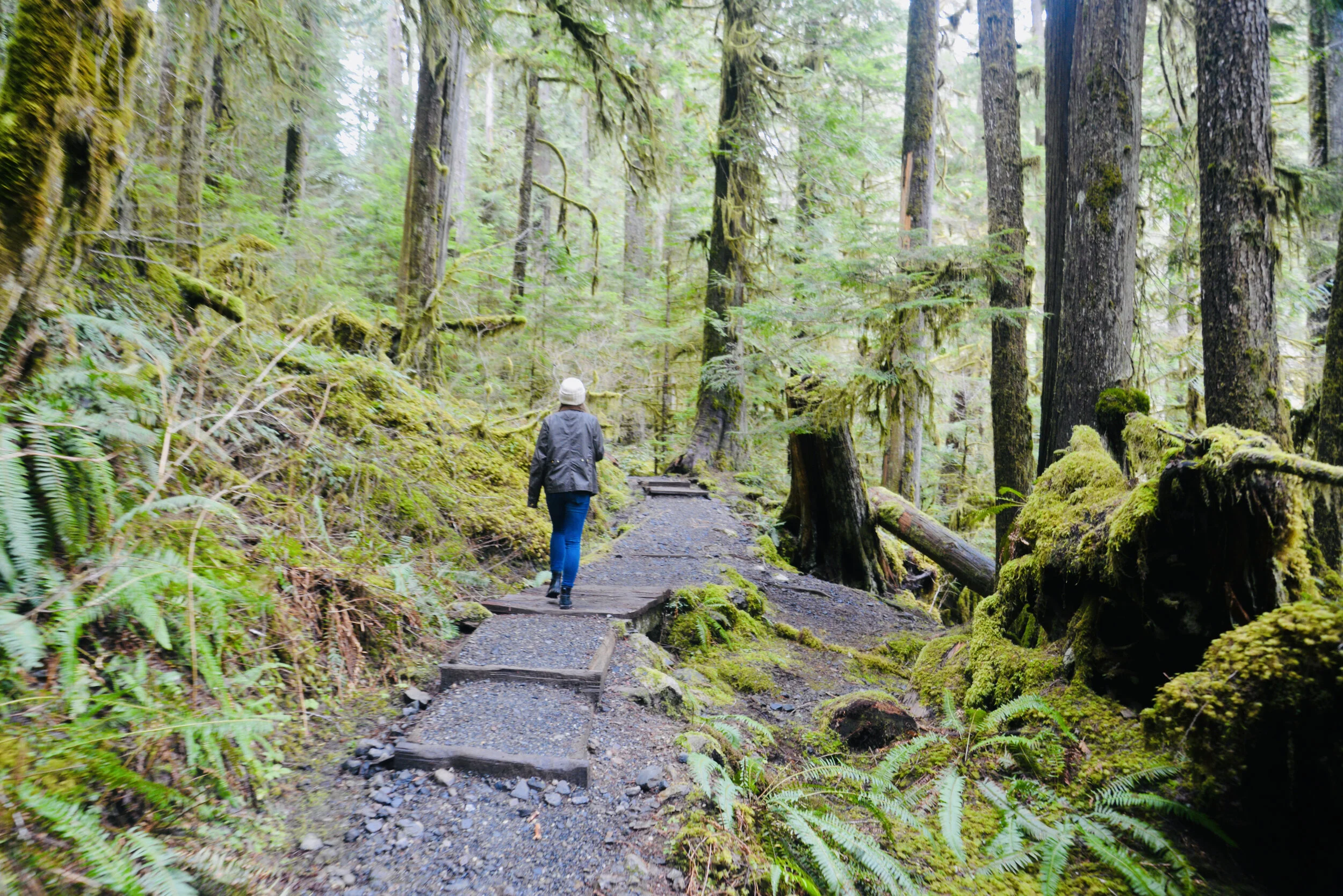
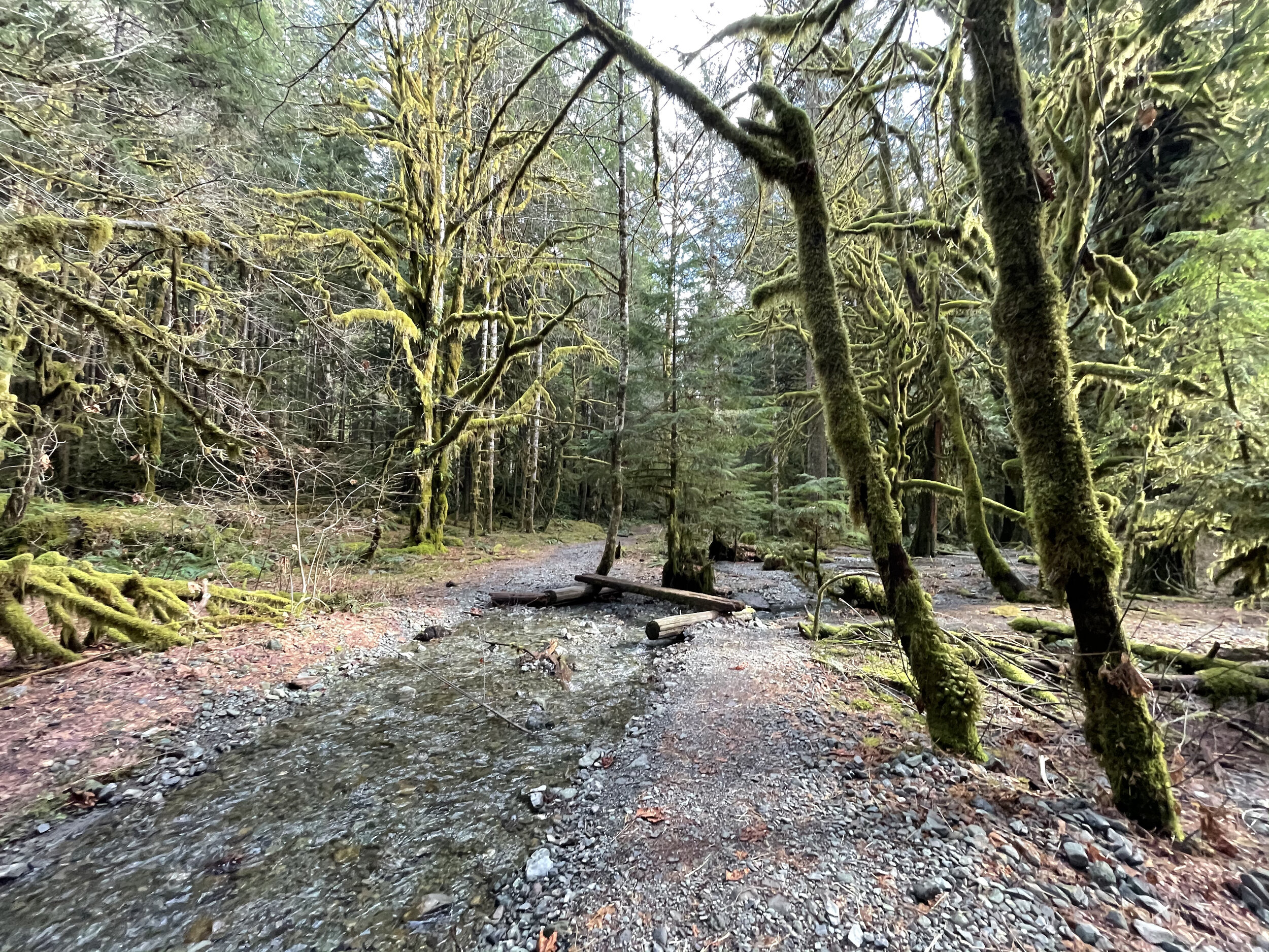
From the unimposing trailhead immediately begin climbing through a tunnel of rhododendrons under a uniform canopy of second-growth cedars and hemlocks. Washington’s state flower, the Pacific (or coast) rhododendron, grows in profusion along the steep dry slopes of Mount Walker. For much of the year the rhodies merely add a layer of dark green to the forest understory.

Pacific Rhododendron
But come late spring this hardy shrub begins to blossom, speckling the surrounding firs and hemlocks with rosy-purple bouquets. By June, vibrant violet bell-shaped blossoms ring throughout the emerald forest.
Interestingly, that although the Pacific Rhododendron is Washington’s state flower, it’s not very widespread in the Evergreen State. It primarily grows along the east slopes of the Olympics near Hood Canal, the Kitsap Peninsula and a few pockets on the western slopes of the Cascades.
It’s far more distributed in Oregon and grows profusely in the state’s southern Coastal Mountains as well as along California’s north coast. A clover, a flower more widespread in Washington, but not nearly as grand and showy as the rhododendron, almost became the state’s official flower back in 1892. But the rhodie overwhelmingly won the vote by thousands to represent Washington in the 1893 Chicago World’s Fair. It wasn’t until 1959 however when the state legislature made the rhodie officially the state’s flower. Mount Walker is one of the best places in Washington to appreciate this beautiful flower.

The trail climbs steeply. Occasionally take a break and look up to see if you can locate any of the old wire and insulators that once serviced a fire tower on the summit. After about 1.5 miles small ledges begin to break the monotony of the forest and tease with limited views. The grade then eases. Finally after 2 miles and nearly 2000 feet of climbing reach the North Summit viewpoint, which was the site of a fire lookout from 1931—1967.

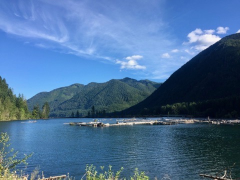
Enjoy good but limited views west and north here. Then head to the South Summit (dogs must be leashed at the summits) by walking the graveled Summit Road for 0.4 mile to a picnic area and then following a 0.1 mile trail to a breathtaking panoramic view of Puget Sound.
Stare straight down to Quilcene Bay, Dabob Bay and the Toanodos Peninsula. Across the sparkling waters Green and Gold Mountains rise on the Kitsap Peninsula. Locate the Seattle skyline east of Kitsap. When clouds are absent or high in the sky, Mount Rainier adds a snowy backdrop to this beautiful scene. And if you’re here in June, the view will be framed with fragrant purple boughs.

Mount Walker
Distance: 5.0 miles roundtrip
Elevation Gain: 2050 feet
High Point: 2805 feet
Difficulty: difficult
Snow free: April—December
Trailhead Pass Needed: None
Notes: From November 1 until March 31 FR 2730 is gated. During this time park away from the gate near US 101 and walk .3 mile to the trailhead. Do not block the gate, park in the road, or block any private driveways.
GPS waypoints: Trailhead: N47 46.554 W122 54.854 | Summit picnic area: N47 47.100 W122 54.077
Features: Exceptional views of Hood Canal; historic fire tower site; one of the finest trails in the Olympics for rhododendron blooms
Land Agency Contact:
Olympic National Forest, Hood Canal Ranger District, Quilcene, (360) 765-2200, http://www.fs.usda.gov/olympic
Recommended Guidebook:
Day Hiking Olympic Peninsula 2nd edition (Romano, Mountaineers Books)
Trailhead directions:
From Shelton follow US 101 north for 47 miles. From Quilcene drive US 101 south for 5 miles) to just north of milepost 300. Turn right onto Mount Walker Road (FR 2730) and proceed 0.3 mile to the trailhead.
Guest Columnist:
Craig Romano
From forest ranger, to history teacher and now a full-time outdoor writer, Romano developed a love of the natural world growing up in rural New Hampshire. Romano has written more than 25 outdoor guide books including "Winter Hikes of Western Washington” (Mountaineers Books, 2009) and "Day Hiking Olympic Peninsula." He lives in Mt. Vernon with his wife and son.
Silver Lake Hike
The Olympic National Forest’s Buckhorn Wilderness contains more than 44,000 acres of some of the finest backcountry on the Olympic Peninsula. Within this rugged corner of the Olympic Mountains you can hike on miles of trails traversing deep valleys of old-growth forests and along high windswept ridges granting stunning views.
Craig Romano | Story and Pictures
The Olympic National Forest’s Buckhorn Wilderness contains more than 44,000 acres of some of the finest backcountry on the Olympic Peninsula. Within this rugged corner of the Olympic Mountains you can hike on miles of trails traversing deep valleys of old-growth forests and along high windswept ridges granting stunning views.
Hit the Trail
Located within the Olympic rain-shadow, the Buckhorn receives ample sunshine and consists of a much drier landscape than points south and west. Lakes are rare in this wilderness. Silver Lake is one of the few gracing the region. It provides an oasis for wildlife and serves as an excellent destination for hikers.
There are two ways to reach Silver Lake. The shorter route is via Silver Creek. This route was never officially built, involving instead from a well-trodden user built boot path. It’s rugged in spots and to reach it involves a long rough dirt road from the north. The official trail starts high on the southern shoulder of Mount Townsend. It involves more effort to hike due to its length and elevation gain—but it’s well-built and highly scenic. And the approach to it is by a primarily good paved road.
Nearby Mount Townsend—one of the most popular hiking destinations in the Olympics keeps most hikers away from these trails, leaving Silver Lake a much quieter destination. In early season wildflowers give an added bonus to the official route—but lingering snow can make it tricky.

"Fall is the perfect time to visit Silver Lake with the added bonus that its resident biting insects have gone the way of the early blossoms."
Start your hike from the upper trailhead for the Mount Townsend Trail. Follow this well-worn & popular path through stately groves of firs and hemlocks adorned with Pacific rhododendrons. In late May and early June, the rhodies add an array of dazzling colors to the surrounding verdant cloak. The trail steadily climbs. Shortly after entering the Buckhorn Wilderness, the forest cover thins and views east emerge. Cross several cascading creeks and continue working your way upward. The trail switchbacks more than two dozen times.
The way crests a small knoll arriving at Camp Windy, which usually lives up to its name. Look below to tiny Windy Lake, not much more than a buggy pool most of the year. Then continue climbing coming to a junction at 3.0 miles.

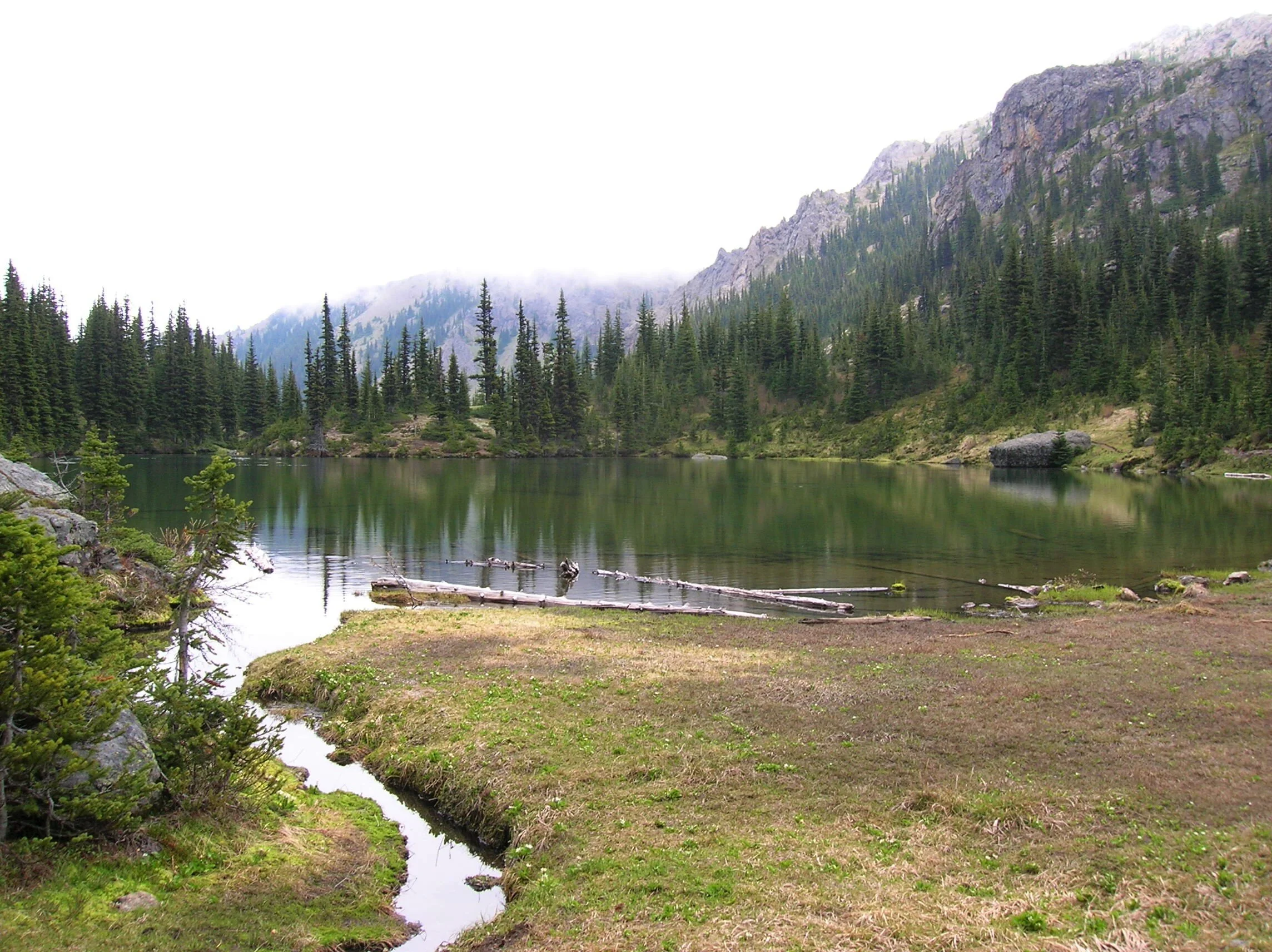
Here most hikers will continue right to ascend the open summit of Mount Townsend. You want to head left on the trail less traveled. Your climbing isn’t yet over however. Muster up a little more energy and reach a small gap on a high ridge separating Mount Townsend from the Welch Peaks. Take a break and look back east for a great view of Windy and Sink Lakes directly below. Then face west and enjoy a sweeping view of the Silver Creek valley. Silver Lake however is not visible. It’s hidden behind a small wooded knob to the south.
Now resume hiking crossing a steep slope that comes alive with blossom in the summer. Via a couple of long switchbacks the way descends more than 600' into the valley. Be sure to save some energy for the return hike, as you’ll need to regain that elevation. At 4.6 miles reach a junction in the forested valley. Here the Silver Lake Way Trail descends northwest following alongside Silver Creek. Continue straight, soon coming to Silver Creek.
Hop across the creek and start climbing again following the creek to its source.

At 5.4 miles reach Silver Lake in a semi-open bowl flanked by craggy peaks and ridges. It’s a tranquil spot where soft breezes often leave rippling signatures on the lake’s surface; and the raucous calls of Clarks nutcrackers (more common east of the Cascade Crest) often break the silence.
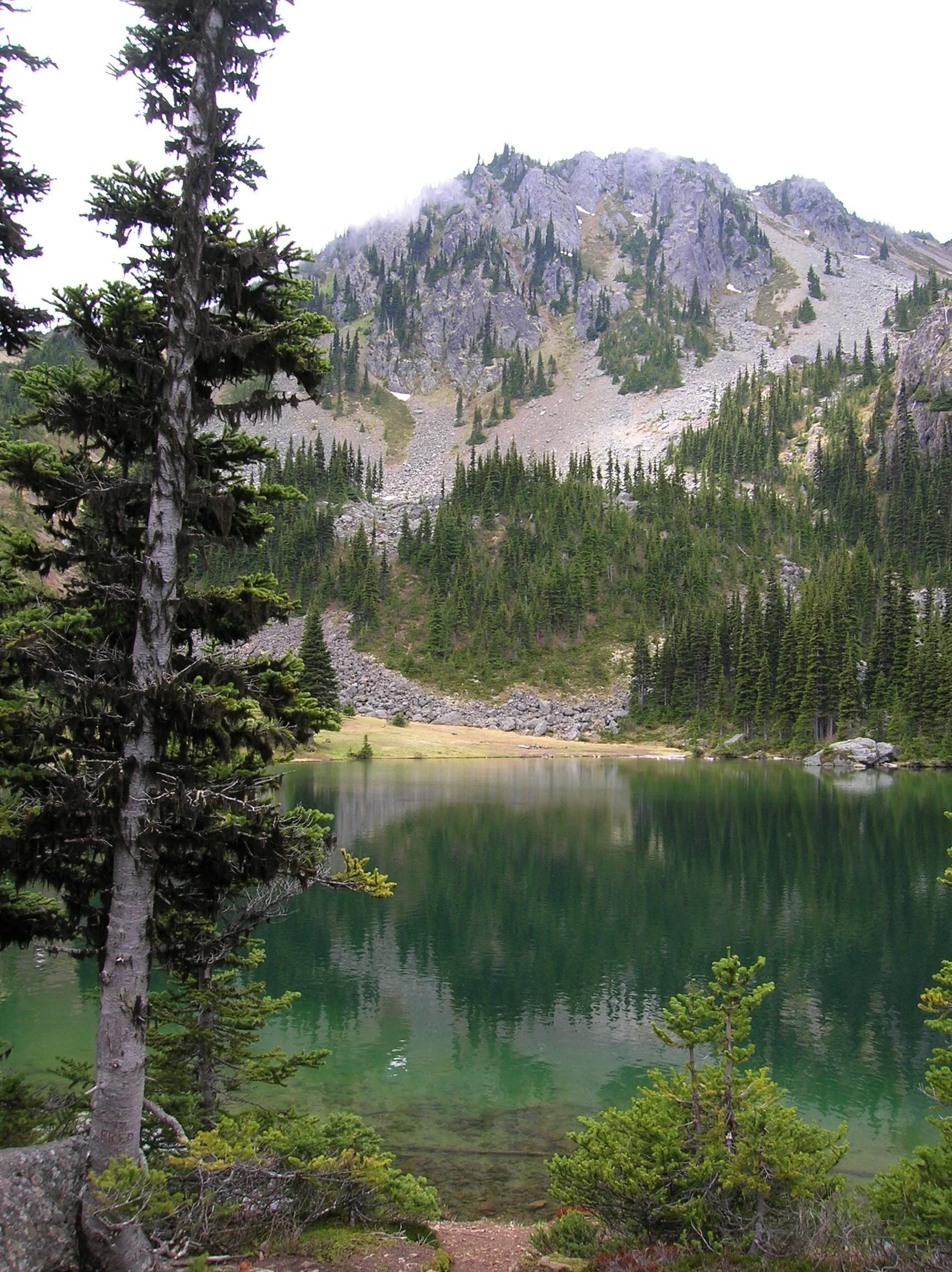
Find a shoreline rock and stay for a while. However, if you have some energy left, a steep half mile path to the south may entice you to follow it. It leads to a gap on a ridge high above the Big Quilcene River where you can stand mouth agape staring out at hulking Mount Constance towering over craggy ridges and deep emerald valleys.

Craig Romano is an author of more than 20 hiking guidebooks including the bestselling Day Hiking Olympic Peninsula 2nd Edition (Mountaineers Books), which includes descriptions for 136 hikes throughout the Olympic Peninsula. He is a regular contributor to Explore Hood Canal. Also check out his list of 25 Olympic Peninsula waterfalls at waterfalltrail.org.
Silver Lakes Notes
Distance: 10.8 miles round-trip
Elevation Gain: 3275 feet (High Point: 5675 feet)
Difficulty Loop: difficult
Snow free: mid-June to early November
Trailhead Pass Needed: Northwest Forest Pass or Interagency Pass
GPS waypoints:
Trailhead: N47 51.385, W123 02.153,
Silver Lake: N47 50.686 W123 04.247NW Forest pass required; Wilderness rules
Land Agency Contact: Olympic National Forest, Hood Canal Ranger District, Quilcene, (360) 765-2200; fs.usda.gov/olympic
Recommended Map:
Green Trails Olympic Mountains East 168SRecommended Guidebooks: Day Hiking Olympic Peninsula 2nd edition (Romano, Mountaineers Books)
Trailhead directions: From Quilcene drive US 101 south for 1.5 miles and turn right onto Penny Creek Road. After 1.5 miles bear left onto Big Quilcene River Road (Forest Road 27); which eventually becomes paved. Continue on FR 27 for 13.7 miles and turn left onto FR 27-190 reaching the trailhead in 0.7 mile.
Tips for safe and healthy hiking during the Covid-19 Pandemic
We all must do what we can to prohibit the continual spread of this disease. We can do that by adhering to the following while we enjoy our trails:
• Avoid crowded hiking destinations. If you arrive and the parking lot is already full, head to another location
• Opt for weekdays over weekends to hit the trail
• Hit the trail early morning before others arrive
• Avoid hiking in large groups outside of family
• Practice Social Distancing while on the trail, giving other hikers room to pass and keeping your distance from them at lakes and summits.
• Wear a mask when encountering others on the trail. A buff or bandanna works well.
• Pack hand sanitizer
• Pack it in pack it out
• Don’t be a surface pooper. Poop properly in the woods by always using privies first if available-or by heading at least 200 feet away from all trails, campsites and water sources and digging a cat hole for your business. Bury waste and TP.
• Pack out all pet waste.
The Top 5 | Camping on and around Hood Canal
Whether you prefer the simplicity of tent camping or the comfort of RVs there are plenty of campgrounds on and around the Hood Canal to choose from. From your campsite you can take day trips to explore surrounding forests, rivers, and beaches or just relax under the trees and listen to the birds.

Whether you prefer the simplicity of tent camping or the comfort of RVs there are plenty of campgrounds on and around the Hood Canal to choose from. From your campsite you can take day trips to explore surrounding forests, rivers, and beaches or just relax under the trees and listen to the birds. For some inspiration to plan your Summer trip to the Hood Canal the staff at Hood Canal Adventures have made up their list of top 5 favorite drive-in campgrounds.
The Top 5
#1 Collins Campground
Collins Campground is located within the U.S. National Forest in the Brinnon area. Nestled under giant Bigleaf Maple trees and directly on the Duckabush River, it contains only 16 sites with no-hook ups: and this is why we love it! From here you are within only a few miles from some of the areas most popular hiking trails including Murhut Falls, Ranger Hole and Duckabush Trail. Shellfish can be gathered nearby at the Duckabush or Dosewallips tidelands when the season is open for clam and oyster recreational harvests. The campground is first come / first served and is open mid-May through September. Visit fs.usda.gov or call the USFS Hood Canal Ranger District (360) 765-2200 for details.
#2 Seal Rock Campground

Seal Rock is another U.S. Forest Service campground in the Brinnon area, however this one is located directly on the Hood Canal with beach access. Forty-one tent and RV campsites are shaded beneath the evergreen trees, some with water views. There are no RV hook-ups but the campground does have fresh water, flush toilets and electricity in the restrooms. Oysters litter the beach at low tide for you to harvest and cook up over your campfire. The campground has an area to walk-in your small boat or kayak for exploring the Hood Canal or harvesting Dungeness and Red Rock crab. Hood Canal Adventures of Brinnon will deliver your kayaks, paddle boards, and crab pots if you choose to rent. Seal Rock Campground is first come / first served and open April through late September. Visit fs.usda.gov for details.
#3 Twanoh State Park
Twanoh State Park really has it all! Located on the southern end of the Hood Canal just outside Belfair, you’ll enjoy 22 full hook-up campsites and 25 tent sites, a pump-out station, boat launches and a dock, showers, covered picnic areas, group sites, a staffed park office and store, and even kayak rentals. Over 3,000 ft. of marine shoreline offers shell fishing opportunities and warm summer waters are perfect for swimming and water play. A few campsites are open all year but the beachfront area is open April through mid-October only. Twanoh State Park is first come / first served. Visit parks.state.wa.us or call 360-275-2222 for details.
#4 Potlatch State Park
Potlatch State Park is a 57-acre camping park with 9,570 feet of saltwater shoreline on Hood Canal. The park's beautiful grounds are home to a variety of activities, from interpretive programs for kids to boating and shellfish harvesting. The park has 19 tent spaces, 18 utility spaces, one dump station, one restroom and two showers. Sites have no hook-ups. Maximum site length is 60 feet (may have limited availability). Two of the tent sites are for primitive use (hikers and bicyclers) only. The Park is divided by Hwy 101 so choose sites that are further away from the road if possible.
#5 Lake Cushman
OK, this isn’t actually a campground but the Lake Cushman area is stunning and well worth exploring. Lake Cushman is located near Hoodsport between the Hood Canal and the Olympic Mountains. Its clear blue waters are framed by beautiful forests and snowy mountain peaks. Popular activities include fishing, hiking, climbing, boating, kayaking, and swimming. There are several campgrounds at the lake but we couldn’t agree as to which is our favorite. Therefore, here's a short list to start you off: Skokomish Park Lake Cushman with 80 RV, tent sites, boat launch, and lake access; Staircase Campground with 49 tent and RV sites on the Skokomish River at the Olympic National Park’s most southern access point; and Big Creek Campground, a 64 site U.S.F.S. Campground which also serves as the trail head to several hiking trails.
The Hood Canal area offers opportunities for camping whether they be county, state, federal, or private campgrounds. There are many back-country and boat-in only camping areas to explore. Come find your favorite! To discover more campgrounds in the area click here.
Christina Maloney is owner of Hood Canal Adventures in Brinnon, a Fisheries and Marine Biologist, and a local outdoor enthusiast.

Head to the Shores
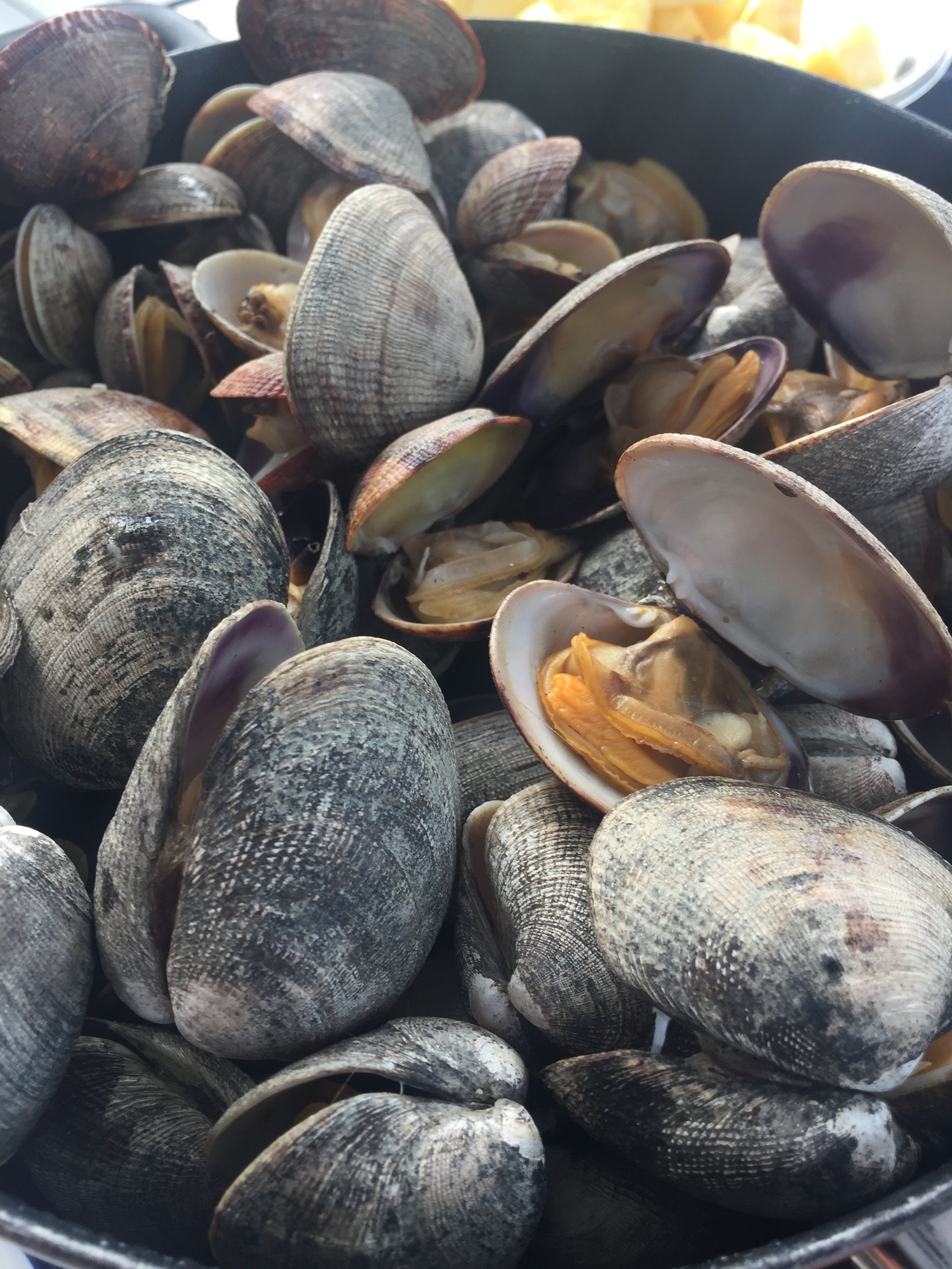
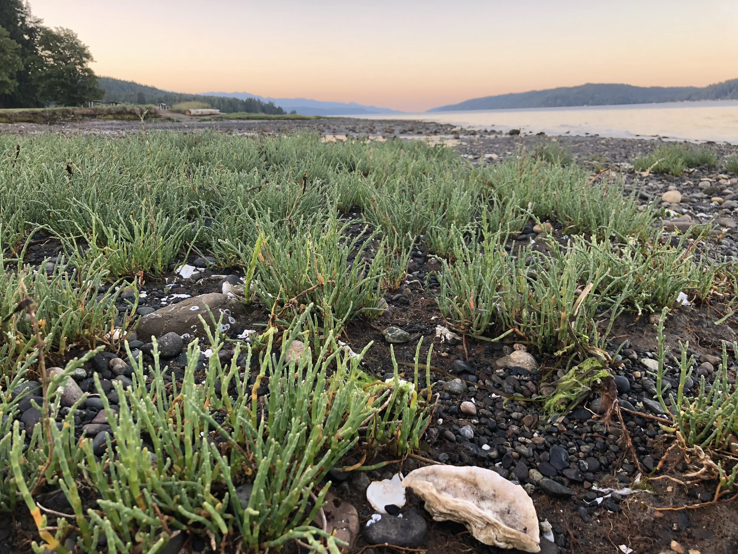
Prepare yourself with buckets, boots, license and check the tides & harvest map. Local State Parks support a healthy stock of clams and oysters for license holders – free for the taking!
Shellfish Gathering
With a salt water canal at its center and a myriad of lakes, waterfalls and streams surrounding the inner fingers of Puget Sound – this area is rich in aquaculture and water related opportunities. It’s time to start planning your outdoor adventures!

Click to download the Mason County Shellfish and Beach guide
If you harvest clams or oysters, make sure to keep them on ice or eat them soon after harvest. DOH advises that shellfish recreationally harvested from June through September, should be cooked thoroughly to avoid illness from Vibriosis. It is best practice to read posted warnings or call the Marine Toxins/PSP Hotline: 1-800-562-5632 for a recorded message that is updated regularly.
Visit the Shellfish Safety Map or the mobile friendly version of the map . Clam and oyster season are beach specific and may change annually. Always Check BEFORE you dig.
“Prepare yourself with buckets, boots, license and check the tides & harvest map. Local State Parks support a healthy stock of clams and oysters for license holders – free for the taking!”
Harvestable Beaches
Some of the following reflect adjustments from original 2020 seasons to make up for opportunity lost during the Stay Home, Stay Healthy-related closure:
South Puget Sound
Hope Island State Park – Boat access only.
Oysters are incidental at this site but clamming can be quite good. This beach is a very popular place to dig for geoducks. A tide lower than -2.0 feet is best for geoducks. Most of the oysters are on the west side of the island near the south end. The season is usually only open for the month of May but in 2020 owing too Covid -19, Hope Island State Park will be open for clams, mussels, and oysters Aug. 1 - 31.
North Bay – Abundant Manila clams and an enhanced oyster bed. The season here is short and locked into May and September under terms of a shoreline agreement.
Oakland Bay Tideland – Open year-round, good shore access with parking. Manila clams and oysters can be found here.
Hood Canal
Belfair State Park – Excellent beach for oysters and Manila clams can be found here. Clams, mussels, and oysters open two weeks early on July 15 and remain open through Dec. 31.
Potlatch State Park – Potlatch State Park and Potlatch DNR: clams, mussels, and oysters open June 8 and seasons are extended for two months to remain open through Sept. 30.
Lilliwaup State Park – Open year-round, excellent for oysters and native clams. Clamming is difficult due to the cobble substrate, but the beach is abundant with butter clams.
Rendsland Creek – Open year-round, excellent for oysters and a variety of clams can be found here although not in great densities.
Twanoh State Park – Open year-round for oysters and seasonally for clams, check season before harvesting. Good beach for Manila clams.
DNR 33, 47 & 48 – Boat access only beaches, open year-round for clams and oysters.
Eagle Creek – This is an excellent oyster beach. Opens June 8 for clam, mussel and oyster harvest. Clam and mussel seasons are extended by two weeks to close on Sept. 15. Oysters remain open through Dec. 31.
Triton Cove State Park – There is very little clam resource on this beach, but there are good numbers of year-round oysters. Opens June 8 for clam, mussel and oyster harvest. Clam and mussel seasons are extended by two weeks to close on Sept. 15. Oysters remain open through December 31.
Dosewallips State Park – This is an excellent beach for clams. The best areas are in the mid-upper tidal zone in mixed sand and gravel substrate. Opens June 8 for clam, mussel and oyster harvest. Clams and mussels close Sept. 30. Oysters remain open through December 31.
Productive digging is also found around and among the oysters, an area often overlooked by harvesters. Please take care not to cover oysters with sand and mud as this will potentially kill the oysters.

Big Loop Creek Hike - for all seasons and abilities
Guidebook writer, Craig Romano, takes us on an illustrated journey around Ellinor. Churning Big Creek and its tributaries will charm you with their frothy displays and soothe you with their flowing melodies.
Craig Romano is an author of more than twenty hiking guidebooks including the bestselling Day Hiking Olympic Peninsula 2nd Edition (Mountaineers Books), which includes detailed descriptions for 136 hikes throughout the Olympic Peninsula. He is a featured columnist for the Fjord and Explore Hood Canal.
Jeff and his mom hiked the Big Creek Trail loop in mid August — check out their review of this hike marked moderate.
“Poets need not go to Niagara to write about the force of falling water,” wrote Robert Frost. Indeed. Amble along this circuitous route within the shadows of Mount Ellinor and see the forces of water all around you. Be continuously captivated by cascading creeks. Churning Big Creek and its tributaries will charm you with their frothy displays and soothe you with their flowing melodies.
Big Creek Loop
Distance: 4.2 miles roundtrip Elevation Gain: 850 feet High Point: 1850 feet Difficulty Loop: moderate Snow free: year round Trailhead Pass Needed: Northwest Forest Pass or Interagency Pass GPS waypoints: Trailhead: N47 29.599, W123 12.66 Features: cascading creeks, attractive bridges, rhododendrons, snow-free winter hike; kid and dog friendly,

photo: Craig Romano
Hit the Trail
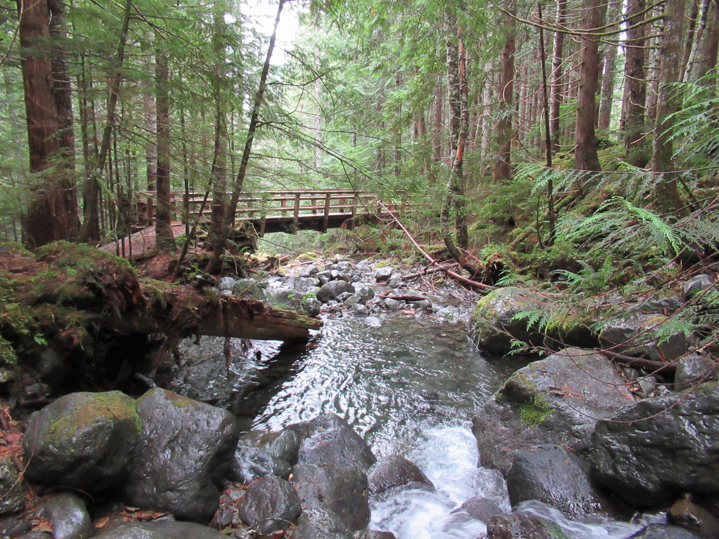
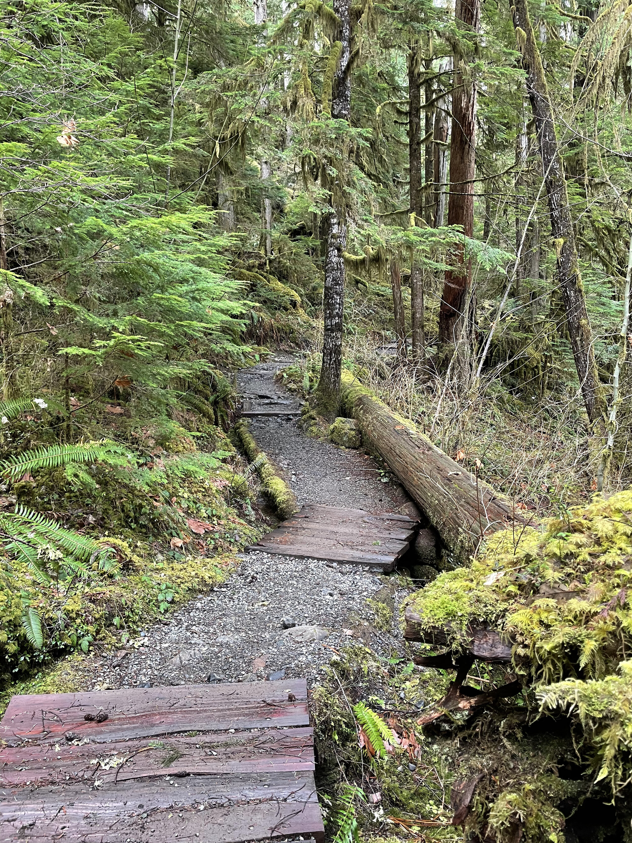
The 4.2 mile Big Creek Loop doesn’t go to a lake, high point, significant landmark or through groves of primeval forest. It just goes around the Big Creek basin crossing that banally named waterway and a handful of its tributaries. This hike is all about the journey—not the destination. The trail winds along forested slopes above Lake Cushman crossing tumbling creeks on a series of beautifully-constructed bridges.
" This hike is all about the journey—not the destination."
A couple of side trails branch off of the main loop to hidden cascades crashing among jumbled boulders. Hike this trail without an agenda—just set your mind free—and pause frequently to admire the show. Generally snow-free in the winter and with easy accessibility, Big Creek can be hiked year round.
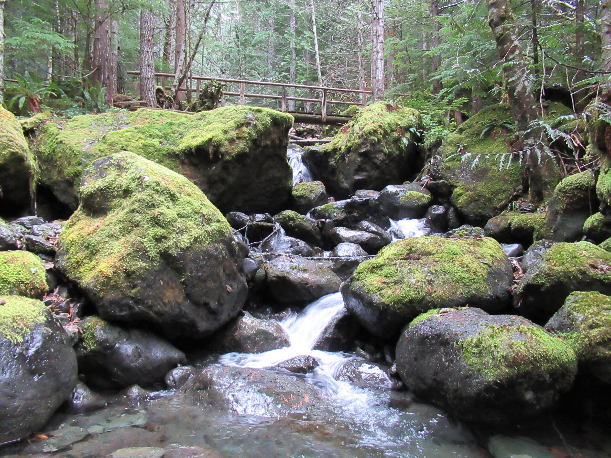
photo: Craig Romano
While it makes for a nice walk on a hot summer day with its shaded glens offering respite from midday rays—autumn through spring are best. Forested all the way, and always within earshot of tumbling water, the Big Creek Trail makes an excellent rainy day hike. Try to plan it after a period of prolonged rainfall for intense water shows that roar through the forest.

photo: Craig Romano
Utilizing old logging roads and newer tread, the all-volunteer Mount Rose Trail Crew built this delightful loop twenty year ago. “We have existed since 1985,” states Mount Rose Trail crewmember John Jurgens. The crew began as a group of Shelton area climbers who grew concerned over the increasing popularity of the old Mount Ellinor Trail. The old trail contained a section known as the “Chute” which was a hazardous rock and snow-filled gully. With the Forest Service’s blessing the crew constructed a new trail bypassing the chute allowing hikers a much safer passage on this popular trail.
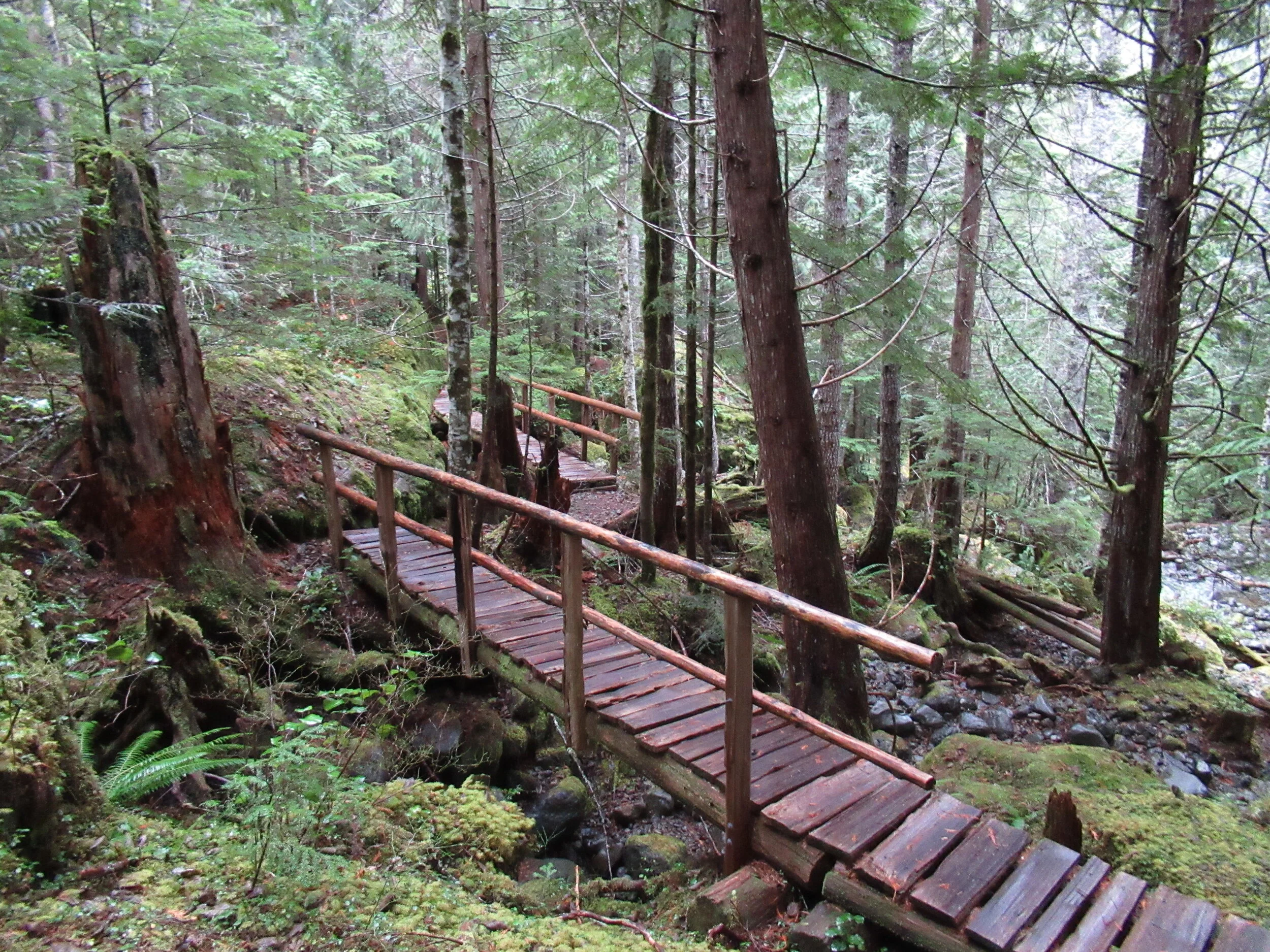
photo: Craig Romano
The crew took their name however from nearby Mount Rose. They worked on re-establishing the upper Mt Rose Trail when snow cover on Mount Ellinor didn’t permit them to work there.
From an original group of about 5, the crew now boast a half dozen members who hail from around the Hood Canal Region. They currently maintain 16 trails in the Olympic National Forest. The Big Creek Loop showcases their topnotch bridge building skills. Robust and built to last as Jurgens puts it, I find the bridges works of art that fit in well with their surrounding natural environment.
"The bridges for many hikers are the highlights of this hike. And children will find them especially appealing."
The trail starts from the recently rebuilt and expanded Big Creek Campground. Here follow what is officially called the Upper Big Creek Loop Trail. Most folks however just refer to it as the Big Creek Loop. The recommended direction is clockwise to take advantage of a gentler descent that will be easier on the knees. The trail immediately crosses Big Creek on a sturdy bridge—one of two provided by contractors and not the trail crew whom built bridges on site with area materials. You’ll immediately recognize the craftsmanship upon reaching them.

photo: Craig Romano
The trail briefly heads down stream along the creek before making a U-turn to begin ascending above it. Signed features and resting benches grace the way. After about a mile the grade gets steeper. Catch glimpses through gaps in the forest canopy of Mount Washington hovering above. At 1.8 miles you’ll come to a junction. You can take an interesting short side trip here on the Creek Confluence Trail which drops to the confluence of Big and Branch Creeks before looping back to the main trail. Here you’ll find good lunch rocks among the two tumbling waterways.
The Big Creek Loop continues straight coming to a junction with the Mount Ellinor Connector Trail just before reaching Branch Creek. The Connector Trail leads left 1.4 miles to the Mount Ellinor Trail and allows for a long and challenging ascent of that popular peak. If you’ve got some energy head one mile up it to a good viewpoint overlooking Lake Cushman,

photo: Craig Romano
The loop continues straight crossing Branch Creek on a good bridge. Just beyond it reaches Big Creek above a gorgeous cascade. Here a new well-constructed bridge spans the tumbling waterway.
The loop now begins descending, skirting some big mossy boulders and passing good views of roaring Big Creek. A short side trail—once part of the Creek Confluence Trail drops back down to where Big and Branch Creeks meet. The main trail now follows an old road, coming to bridged crossings of scenic Skinwood and No Name Creeks. Continue descending passing a few giant firs that loggers forgot. Notice the forest change here. The west half of the loop was dominated by hemlocks—while the eastern half is made up more of Douglas-firs and lodgepole pines. The understory is different too—cloaked here in salal.
Be sure to look up through the trees for a glimpse of Mount Ellinor rising above the watershed. At 4.0 miles come to a junction with the Campground Loop Trail which loops around the campground for 0.8 mile if you want to extend your hike. Otherwise continue right a short distance to return to the trailhead.
Notes:
Land Agency Contact: Olympic National Forest, Hood Canal Ranger District, Quilcene, (360) 765-2200; fs.usda.gov/olympic
Recommended Map: Green Trails Olympic Mountains East 168S
Guidebooks: Day Hiking Olympic Peninsula 2nd edition (Romano, Mountaineers Books)
Trailhead directions: From Shelton, travel north on US 101 for 15 miles to Hoodsport. Turn left onto SR 119, and proceed 9.3 miles west to a T intersection with FR 24. Turn left and then immediately turn right into the Big Creek Campground continuing a short distance to the Day Use Area and trailhead. When campground is closed, park at gate, but do not block it.
Trailhead facilities: privy, picnic area, campground, water.
Dogs welcome but must be leashed.

Squatch Watch
The deep, extensive forests of the Olympic Peninsula hide secrets. For some its the discovery of a new plant that can cure an illness; others seek the solitude of moss laden ancient trees; and, for a select few, the search continues for a hidden creature that makes himself popular on bumper stickers and dangly air fresheners throughout the Northwest – here’s some details behind this northwest favorite character.
The deep, extensive forests of the Olympic Peninsula hide secrets. As the ancient coelacanth, a fish found in fisherman’s nets off of the coast of South Africa in 1938, or the chance discovery of the brilliantly bioluminescent megamouth shark (Megachasma pelagios) hooked upon a US Navy’s ships anchor in 1976, document --- the natural world still holds mysteries.
Before actual specimens of these species were found stories abounded about their existence, but proof was necessary to take these animals from the realm of cryptid to the empirical world. Cryptozoology is a term coined in the 1950s by Bernard Heuvelman, a French-Belgian biologist, used to describe the discipline responsible for documenting cryptids or “animals of unexplained form or size, or unexpected occurrence in time or space.”
The search for these cryptids or “hidden animals” has included research in to the Loch Ness Monster (Nessie) of Scotland, the Abominable Snowman or Yeti of the Himalayas, and the Lake Champlain monster (or Champ). More locally there are reports of sea serpents (often known as the Cadborosaurus) in the waters of the Salish Sea and Puget Sound and the Ogopogo lake monster of British Columbia’s Lake Okanagan. Another famous cryptid found across North America is the Bigfoot, or more locally, the Sasquatch.
"About one-third of all claims of Bigfoot sightings are located in the Pacific Northwest."
Washington State has the highest instance of direct sightings in the United States of creatures meeting the description of Sasquatch or "Bigfoot." Recorded by the Bigfoot Field Researchers Organization (BFRO), Pierce County takes the lead with total number of listings, with Snohomish and Skamania following close behind. After a series of sightings and findings of foot prints and other evidence, Skamania famously passed a law in 1969 that forbade the “willfull and wanton slaying” of a Sasquatch. Such action would be considered a felony and punishable by a hefty fine of $10,000 and jail time. This punishment has since been reduced to $500 and only six months in jail, but the endurance of this legislation demonstrates that the Sasquatch is still considered real enough to protect.
"The endurance of this legislation demonstrates that the Sasquatch is still considered real enough to protect."

Stop by Bear in a Box in Allyn WA for some amazing squatch art.
Sasquatch has been described as a large, hairy, up-right walking, hominid-like creature, often accompanied by a strong stench. The Sasquatch is often identified by strange “eerie” calls such as whoops and screams. Additionally, it is famous for its large footprints. Usually, these encounters are reported as non-aggressive but they often induce incredible fear and a feeling of unease in the witness and there are reports of Sasquatches breaking large branches and throwing rocks.
Indigenous people throughout the Pacific Northwest describe in their oral history and legends various versions of a Sasquatch-like-creature that is often characterized as a malevolent trickster responsible for stealing children and women.
The Kwakwaakaa’wakw of Northern Vancouver Island, British Columbia, tell stories of Dsonoqua—or the Wild Woman of the Woods—who makes the noise of the wind “ooh-ing” through the trees and lures away children. These stories may or may not be cultural traditions documenting the Sasquatch.
Many a campfire is made spookier by tales of the supernatural Sasquatch. Stemming from this, there is a new kind of tourism on the rise—cryptotourism. Professionally led expeditions are orchestrated by organizations such as the Bigfoot Field Researchers Organization (BFRO) and the Olympic Project to systematically search for evidence of the Sasquatch in areas of high reports. Usually, participants on these expeditions are taught in the field how to take accurate casts of footprints, make sound recordings, conduct surveys, as well as how to collect uncontaminated samples of hair and feces.
On the Lookout for Sasquatch
According to David George Gordon, author of The Sasquatch Seeker’s Field Manual (2015), mainstream researchers do not have access to the grants or time needed to properly assess the Sasquatch question, so like the Christmas Bird Count miraculously organized by Cornell every winter, volunteer, amateur scientists, or ‘citizen scientists,’ are the only hope to document evidence of the Sasquatch.
Training citizen scientists through organized expeditions is one way to further research and cover more ground. Additionally, these organizations file reports of Sasquatch sightings, lending us a powerful tool to create your own self-guided, cryptotour of the Olympic Peninsula.
Make sure you pack a good camera in the hopes you spot some unusual wildlife. As well, bring a friend or two as the more witnesses the more credible your evidence will be. Below are two top areas to look for Sasquatch activity in around Hood Canal from the BFRO’s list of Bigfoot reports.
Local Sightings & Reports
Jarell Cove State Park and Harstine Island area
• Report of an actual sighting in 2005
• Recent increase reports of hearing the calls of Sasquatches
Big Creek Campground & Lake Cushman area
• Report from hikers on Big Creek Trail of hearing the calls, smelling the stench and seeing oddly broken branches in 2010
• Multiple reports of hearing calls of Sasquatches in the Lake Cushman area
• Two reports of actual sightings in the Lake Cushman area from 2006.

Union City: Hood Canal town steeped in history
Hosting a rich tradition spanning generations of first people and settlers, Union hosts fantastic views of the Olympics and Canal while embracing the arts and community. It is little wonder it was voted one of the 20 Prettiest Towns in USA by Forbes Traveller.
Stella Wenstob, featured columnist
Descriptions of Union, WA usually run along the lines of "inspired by nature." The first time I encountered that aphorism I took it as artistic whimsy, but by the third website I read about Union, I became curious. Is only one person writing all of this advertising content? Maybe. Or perhaps there is something more here. Perhaps there is something inspirational about Union’s situation near the bend of the Hood Canal with uninterrupted views of Mount Washington, Mount Constance and the iconic Brothers.
Maybe there is a muse in this coastal, Mediterranean microclimate colored by the luscious, green foliage of salal bushes and the imposing Western Red Cedar and the bright red trunks of the Madrona trees. Possibly more is fed than the stomach on Hood Canal seafood. At Union maybe the soul is fed too. When I started to examine the history of the extraordinary people that lived in this area, I began to see this inspired lifestyle stretching back countless generations.

Union, circa 1910; Mason County Historical Society
The members of the Skokomish Tribe are descendants of the Twana people whose traditional territory covered an extensive area along the Hood Canal, inland to the peaks of the Olympic Mountains. The Skokomish River on the Eastern side of the Olympic Peninsula with its productive salmon run and valuable grasses for weaving baskets was especially important to the Skokomish. When their lands were limited to a small section of the Skokomish River by the Treaty of Point No Point in 1855 one elder from the area, S’Hau-at-Seha-uk, voiced his fear of losing his home and way of life, “I do not want to leave the mouth of the River. I do not want to leave my home; and my burying ground; I am afraid I shall die if I do.” Despite losing traditional lands and the damaging effects of colonialism – the Skokomish are a thriving people.
Skokomish Community Centre
Skokomish arts and culture are informed and shaped by nature. Bear grass basket making, though threatened by development of the traditional picking sites on the Skokomish river, is an intricate example of natural resources, ingenuity and art coming together along with cedar carvings, dugout canoes, drum songs and traditional dance. To see a beautiful display of the technique and intricacy of the Skokomish basket makers or the ornate carvings drop in on the newly built Skokomish Community Centre (located just off of Highway 101).
Opened in 2017 and located just outside of Union on the Skokomish Reserve, this intriguing hybrid building is a handsome example of Indigenous informed design – combining traditional plank, big-house style architecture with modern needs and conveniences—such as a gym, a meeting hall and a commercial kitchen. With over 400 solar panels on its roof the Skokomish Community Centre also offers a marvelous example of environment informing design.
The Ultimate Road Trip

If you continue traveling Highway 101 past the Skokomish Salmon Hatchery and take the turn on to Highway 106 you will find yourself on a winding highway following the Skokomish River as it meets up with Hood Canal.
After about twelve minutes of mossy delta and interesting views of cottages clinging to the thin strip of land between the road and the gently eroding riverbank reminiscent of a scene from Ken Kesey’s Sometimes a Great Notion you will head around the headland that opens up until the area we now recognize as Union.
Known as duxWhLu’qWat3d to the Twana people, then called Skokomish by early settlers, in 1889 it was renamed Union City by lumberman, developer and legislator John McReavy to celebrate Washington’s declaration of statehood.
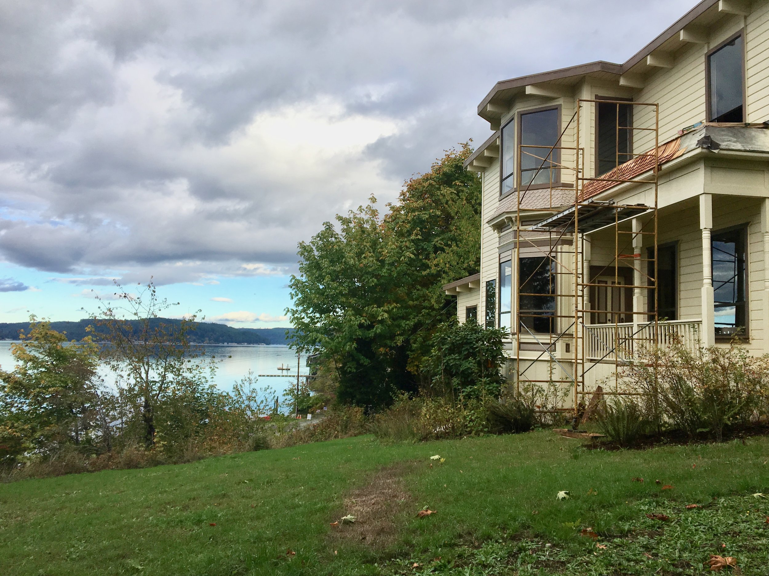
McCreavy was a boom and bust figure who had dreams of creating the “Venice of the Pacific” in Union. His mansion built in 1890 on the bluff overlooking Union is the site of a loving restoration project and is purported to be the oldest pioneer house on Hood Canal–and of course hosts a few ghosts.
As you continue on the East State Route 106 you will pass shops and a general store.
Along the highway you will find the remnants of Olympus Manor, Washington’s first artist’s colony created in the 1920s by the charismatic artist and musician Orre Nobles and his family. Influenced by an Asian -Art Deco aesthetic Olympus Manor was resplendent with a music room enclosed with rescued stain glass, a pipe organ and rich oriental rugs underfoot. The grounds were complete with a Torri gate that was crowned with a Native American dugout canoe.

Orre Nobles sketches in studio - UW Libraries, Special Collections
Although destroyed in a fire in 1952 the glamorous stories of the artists, musicians, actors, and stars that came to partake in the Hood Canal’s delights at Olympus Manor are the stuff of legends.
For a colorful and fascinating account of this early historical era of Union pick up a copy of Michael Fredson’s The Artist Colony on Hood Canal: Pixley, Orre Nobles & Waldo Chase (2011).
Another honorable mention found along this highway is the Robin Hood Village and Restaurant, built in 1934 by Don Beckman. A set designer from Hollywood, Beckman is known for working on the set for the classic Robin Hood starring Errol Flyn. In fact, one of the Robin Hood Village's early visitors was Errol Flyn himself.
The area has retained its reputation as an artsy community and guests of Robin Hood Village have the option of staying in the new cabins or historic cottages, one of which is rumored to be the cottage where Flynn stayed after he finished filming the classic tale and came to visit his old friend Beckham. The Restaurant and Pub carry on the arts tradition in Union with their year-round live entertainment feature local and visiting musicians.
After the sharp bend in the highway you head a bit inland and encounter the refurbished Dalby Waterwheel. Originally built in the 1920s, Edwin J. Dalby created the first source of hydroelectric power on the Hood Canal to provide electricity for his Seattle bride, Ethel. Ed Dalby was raised on the Canal and an adapt linguist speaking Skokomish and the Chinook Trade language. While studying at the University of Washington he worked as a researcher for the photographer Edward S. Curtis on his controversial The North American Indian (1907-1930) which strove to document in twenty volume images of the purported vanishing culture of the Native Americans. Now considered overtly racist in the project’s main philosophy that indigenous culture and identity was slated to be subsumed by Euro-American culture and many of the photographs Curtis produced are criticized for being too contrived, there is however an artistic, romantic quality to many of the pictures that transcends this. Dalby introduced Curtis to the Skokomish Tribe and, with the assistance of Skokomish brothers Frank and Henry Allen, persuaded local tribe members to pose in costumes, in imaginative scenes.

washingtonhistory.org
The misty shot of two women standing near a reed tent and beautiful cedar dugouts is iconic and quintessential. However, it is–like most romantic notions– highly contrived. Skokomish people in 1912 did not wear reed clothing or live in reed tents, being more accustomed at this time to western clothes and plank houses.
Henry Allen continued to assist Curtis and Dalby accompanying them in their work as far as North Dakota. Henry Allen’s voice was also recorded by Curtis on wax discs singing traditional songs. Curtis combined the recorded music of many different Native American voices and their photographs to create a musical slide show which he dubbed a “Picture Opera.” Curtis took his “Picture Opera” on tour across the country and played to a packed audience at Carnegie Hall in NY.
Skokomish music continues to influence Carnegie worthy works. On May 24, 2019 Union’s Great Bend Chorale and Youth Chorale led by Matthew Blegen will be performing at Carnegie Hall as part of the Distinguished Concerts in New York series. They will be performing a commissioned piece by conductor John Muehleisen inspired by early Salish recordings.
The hybrid work titled Borders begins with a Salish song of welcome, then Muehleisen weaves together European, African, Asian, and Latin American folk songs with his own settings of the poetry of Emma Lazarus, Brian Bilston, and Alberto Ríos in a powerful and moving musical journey that explores the historical roots of immigration and the modern relevance of America’s identity. The work takes up the question: How are we to treat the stranger, the foreigner, the outsider, and the “Other” amongst us? The local debut will be June 1 in Shelton and June 2 in Bremerton.
Hosting a rich tradition spanning generations of first people and settlers, Union hosts fantastic views of the Olympics and Canal while embracing the arts and community. It is little wonder it was voted one of the 20 Prettiest Towns in USA by Forbes Traveller. Whether it is the people, the history, the music, the food or the natural beauty, Union has something inspiring for everyone.
Spring day at Staircase
This easy 2-mile trail winds through old growth forest to a bridge over the North Fork Skokomish River with only a 200-foot elevation gain.
During spring the Staircase Entrance of the National Park offers some opportunity for great hikes with virtually no one else on them that early in the season! Take the kids or friends and plan a mountain adventure. Build an igloo, go snowshoeing, or just have a snow ball battle. Although the lower reaches may be drowning in rain, if you head to the hills you might just find a drier, fluffier version.

Last spring we packed up a picnic and headed for the park. On a Sunday, first week of March, we saw about seven cars in the Staircase parking lot and passed about a dozen people on the Loop Trail. With the horror stories from overcrowding last summer during the peak of the lockdown – we were thrilled to have the trail practically to ourselves.
Getting There
The road from Hoodsport to Lake Cushman is narrow and windy. Be prepared to go slow as then you will find it charming and scenic with glimpses of the lake between the trees and driveways. Lake Cushman was originally a straight broadening of the North Fork of the Skokomish River that was naturally dammed by gravel and debris deposited by glacial movement during the last ice age. This small lake was artificially dammed in the 1920s to meet the increased power needs after World War I.
The evidence of the forest that once was is prominent in the incredibly low water of the lake.. This is a natural occurrence in early spring – late winter, but the effect was astonishing. Surrounded by a sea of first growth stumps and rock "islands," the giant boulder renown as ‘The Big Rock’ was perched on smaller rocks creating a magical grotto with reflecting pools magnifying the beauty of the snow dusted treed hillsides plunging sharply into Lake Cushman. We scrambled around the rocks and enjoyed a whole new experience.
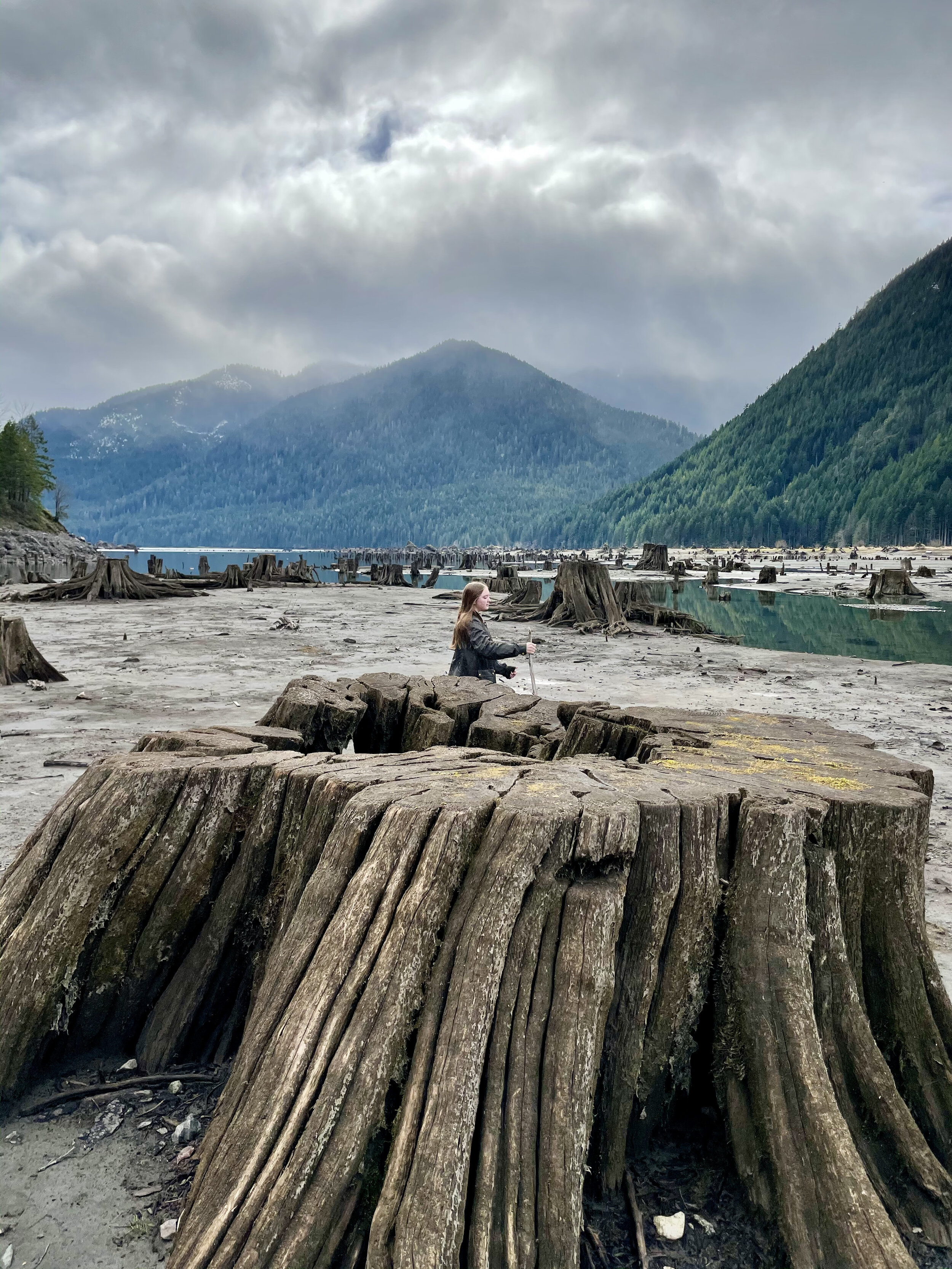
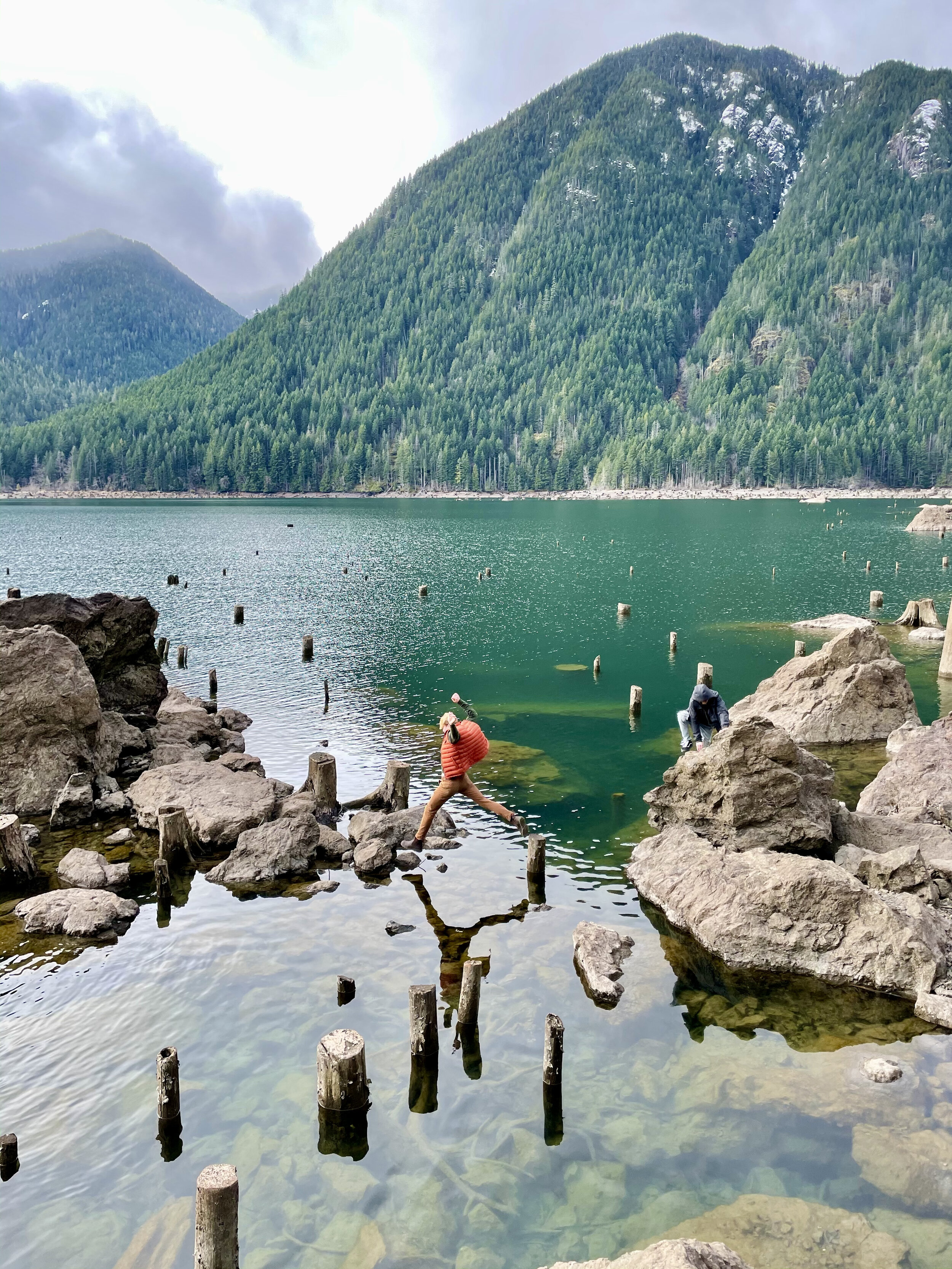
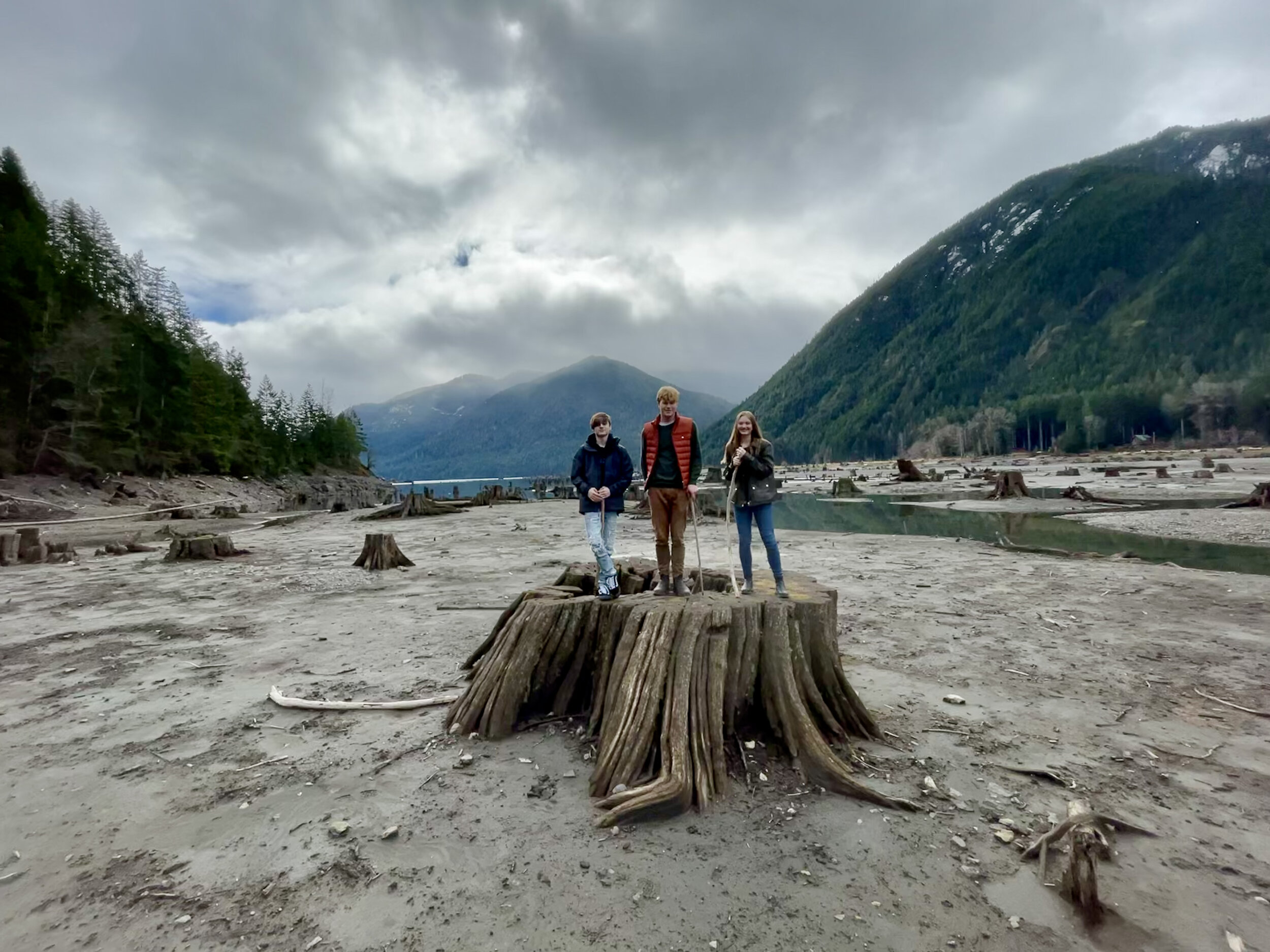
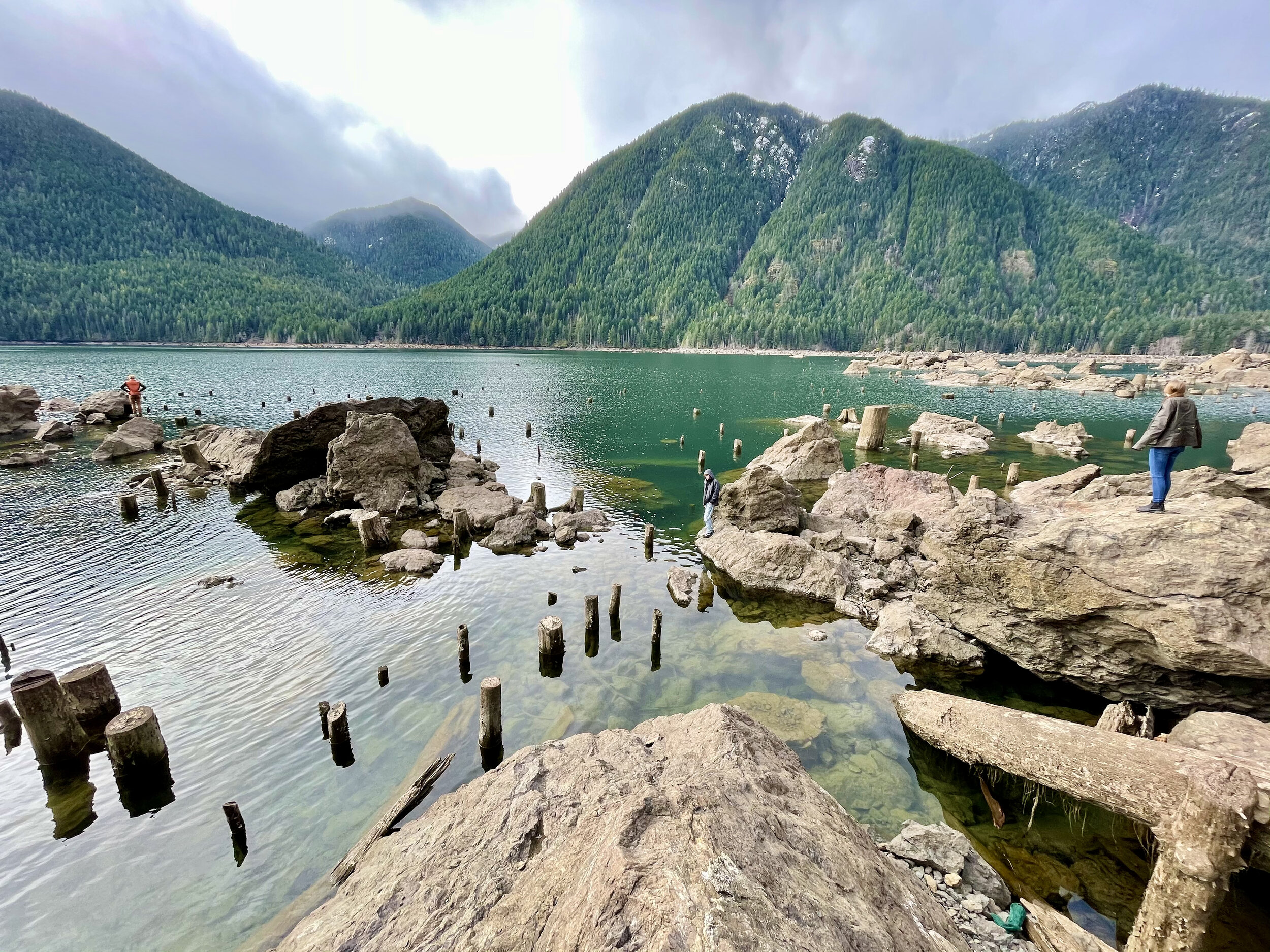
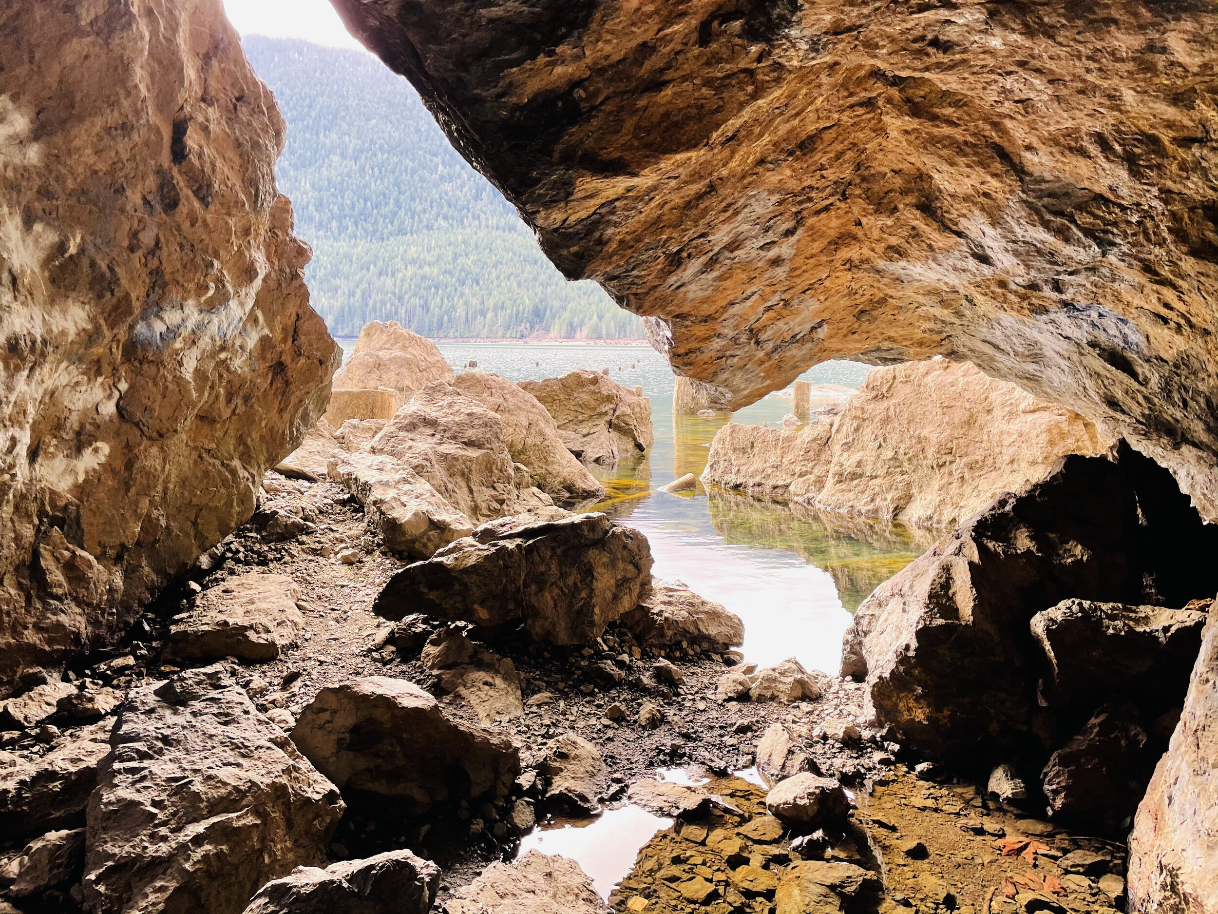
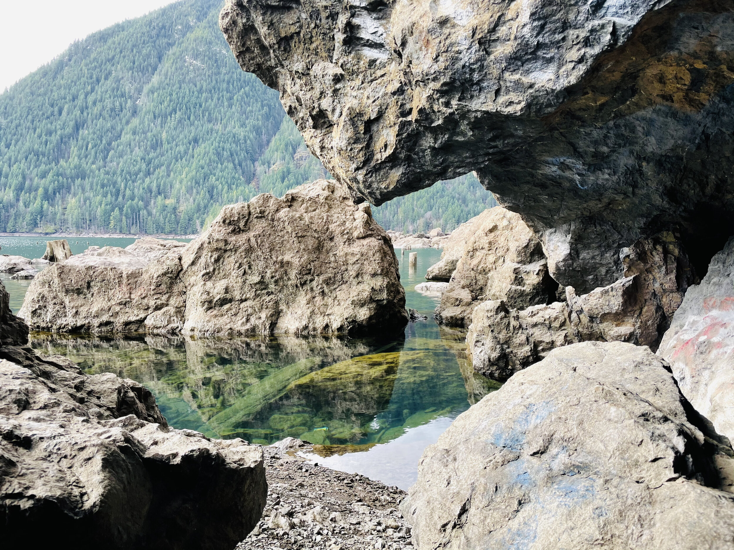
A little further down the road is a pull out at the end of the lake. Here the “sea” of stumps is even more fantastic. The landscape is great for exploring and dramatic photos. The springboard holes used by the early foresters as they cleared the valley are perfectly archived.
Staircase Loop Trail
The entrance to Staircase was un-manned when we arrived. There were just a few cars parked in the lot. You will need to have a pass to park. We recently purchased the America The Beautiful Annual Pass. This pass covers federally managed recreation lands such as National Parks, National Forests, National Wildlife Refuges, and Bureau of Land Management Recreation Areas throughout the country.If you purchase this pass you may use it for both the Olympic National Park and for trailheads requiring a NW Forest Pass. The pass covers all people in your vehicle and covers two pass signers at walk-in locations, so at $80 per year, it’s a pretty good value and takes a lot of guesswork out of what passes needed when exploring the Olympic National Forest and Park.

Near the parking lot there are vault toilets and information boards. The trails go in a multitude of directions but we took the standard Staircase Loop. It’s less than two miles and follows the curves of the North Fork of Skokomish River. We love loops. Something different around every bend and when you drop back in the parking lot you are still wanting more.
There was enough snow on the trail, peeping through the breaks in the dense canopy, to make it perfect contrast for photos against the mossy green – and the odd snowball to break the reflection.
Heads up…you will see no staircase at Staircase today. In 1890, when Lt. O’Neil and his crew blazed their trail through the Skokomish wilderness, the rock bluff across the river from the campground was a major obstacle. To get over it they built a cedar staircase. Until the nearby Shady Lane Trail was built in 1911, the ‘Devil’s Staircase’ was the only path over the bluff. The name, and O’Neil’s legacy, remains. However, as you follow the river with its tumbling force of river over huge basalt boulders – you can kind of imagine the rapids are staircase of sorts.

We stopped off by the river at the “swimming hole” to make lunch on the beach. With a Jetboil and some hot freeze dried meals, it was sublime. They’ve come a long way from what I remember as an instant meal. Having hot tea after in the chill of the forest was magical too.

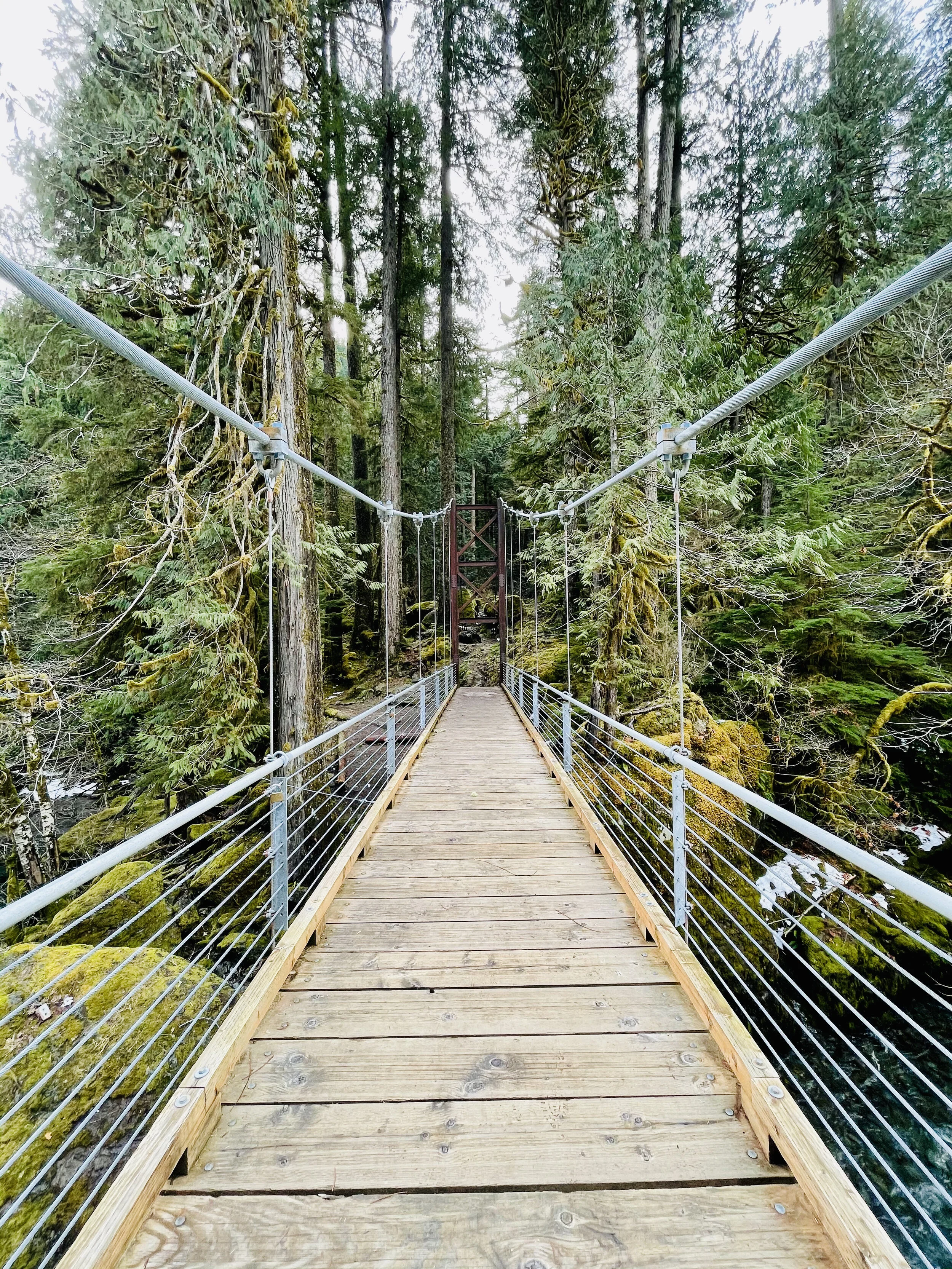
The trail crosses over the river at a dramatic suspension bridge. Here the view opens up and you can see a few snow covered glacial peaks of the Olympics. Despite their jutting appearance, the Olympic Mount Range are not volcanic. This is surprising given the proliferation of volcanic ranges in the Pacific Northwest, for example Mount Baker and Mount Rainer. As evidenced by the marine fossils found in the summits of the range, the Olympic Range once was part of the ocean floor. Approximately 120 million years ago, the Pacific Tectonic Plate crashed into the North American Plate and created the Olympic Range.

Journey Back
The trail back on the opposite shore is a vast contrast to winding hummocks covered in moss and ferns. The path now follows an old road bed peppered by giant cedars, firs and fallen nurse logs. At two points you cross log bridges to ford the gentle streams coming down from the hills above. The trail ascends up a makeshift timber “staircase” and then drops back into the parking lot near the ranger station.

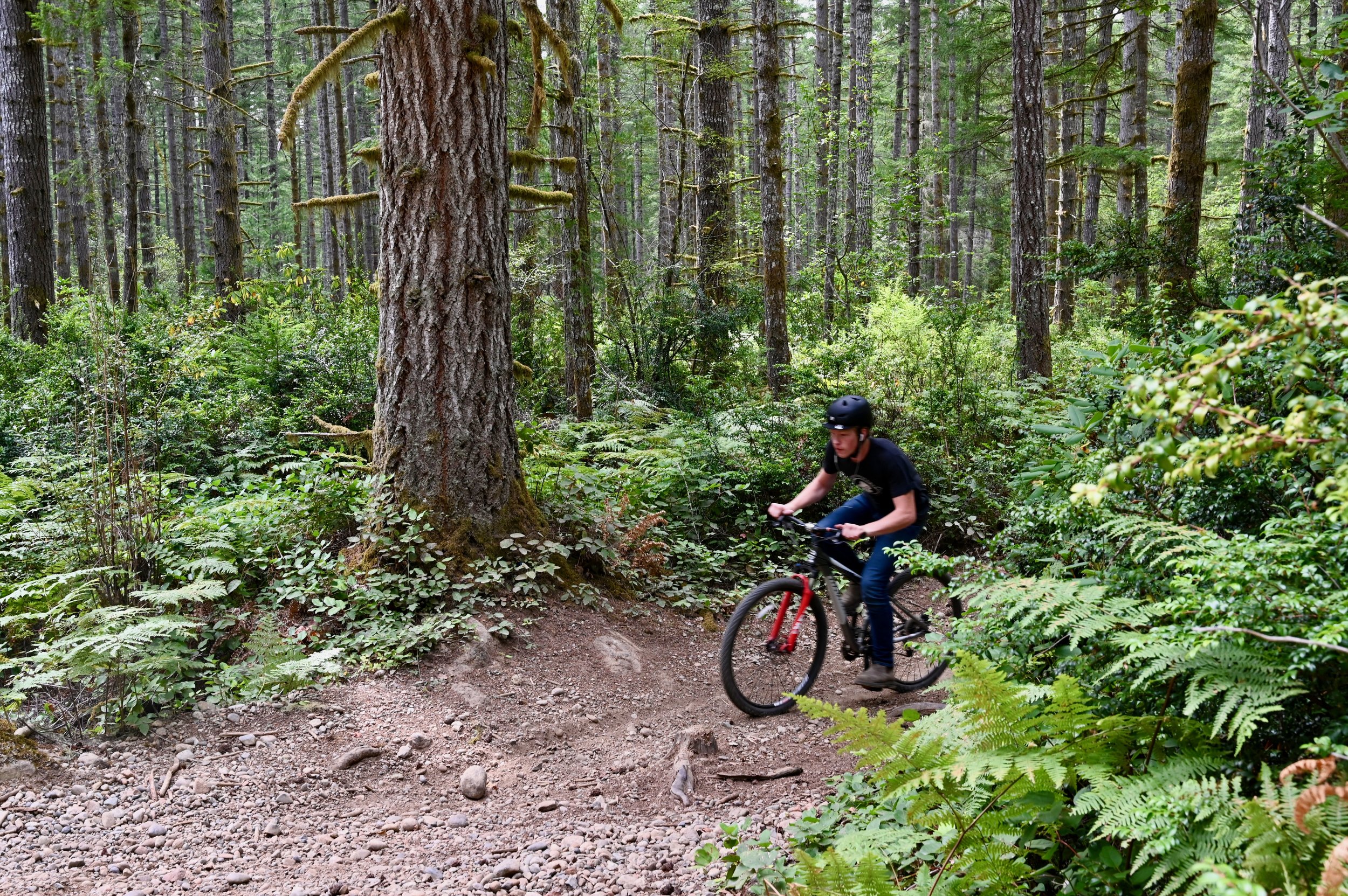
Six Mountain Bike Zones to Check Out Around Hood Canal
While popular mountain biking trail networks like Seattle, Port Angeles, and the Capital Forest network dot the outskirts, a circumnavigation of the Hood Canal will uncover some local favorites and family-friendly riding.
While popular mountain biking trail networks like Seattle, Port Angeles, and the Capital Forest network dot the outskirts, a circumnavigation of the Hood Canal will uncover some local favorites and family-friendly riding.
These zones can be accessed by day trip from a home-base picturesque cabin rental on the water or through more of a nomadic road trip utilizing campsites as you go. Whatever your style of travel, family needs, or riding goals a fully customizable mountain bike-centric trip can be found here.
While these six areas are predominantly beginner and intermediate trails with the occasionally rowdy advanced downhill track, within an hour from any one spot, there is an abundance of variety in both the trails and scenery.
#1. South Fork Skokomish Trail
The South Fork Skokomish Trail wanders beautifully through old-growth forest as it crosses its namesake river and several streams along the way while climbing gently for the first two miles.

Beyond that, it continues up at a steep grade as the trail rises above the river valley. Another five miles along, the trail ends at the Olympic National Park boundary. This is a great spot to catch your breath before enjoying the exciting downhill that you’ve earned.
The Lower South Fork Skokomish Trail heads nine miles in the opposite direction. This section tends to be less maintained but if you’re up for an adventure it is worth the challenge. The trail takes you through more stunning Olympic National Forest old-growth and roughly a mile in from the northern trail entrance, it fords a river that can only safely be crossed between August and early October. Despite the challenge of added brush and fallen trees, this section of South Fork Skokomish Trail has far less elevation to contend with than the upper and it can be shuttled as it has parking at both ends.
For a list of Lodging in this area, click here.
2. West Shelton

The West Shelton trail network has nine miles of cross-country trails that can be accessed from the heart of Shelton. Nearly all the trails are rated green and while there are a few punchy climbs, there is no sustained elevation for beginner riders to worry about.
Flowy trails like Au Natural, She’s a Pitch, Single Track, and Tie In, tend to have flowy sections, pitchy climbs, and some gentle flats. A few, especially the aptly named Sometimes a River, can turn into small streams after a good rain but generally, this area makes for great year-round riding. To view the network of trails available in Shelton, visit trailforks.com/region/shelton.
Both Union and Shelton would be convenient home bases to explore this trail network.

3. Green Mountain
A 22 mile network of mostly beginner and intermediate multi use trails with a couple of advanced downhill routes in the mix. There are two trails heads, Gold Creek and Wildcat, on opposite sides of the mountain that both lead to the Vista Summit and fun descents. Climbing up the sometimes rocky and loose Wildcat Trail will give you a challenging 1100 feet of gain in 4.5 miles and deliver stunning views of Bremerton and Seattle. On particularly clear days, riders will also be treated to Mt. Rainier and Mt. Adams too. While the trails here are primarily categorized as cross-country, there is quite a bit of variety to be had. Wildcat Trail from the summit is loose and fast with flowy berms and plenty of tech available. For those looking for a long and more challenging climb on an out-and-back that delivers a speedy and fun descent on the return, Gold Creek Trail would be the best choice. But with the same elevation gain of 1100 feet, this time in just over 2 miles, riders need to make sure their legs are ready for the challenge.
Camping in the Tahuya State Forest or staying in one of the many lodging around Belfair would be a great option to make a weekend of exploring these trails.

#4. Forest Heritage Park

Port Gamble Forest Heritage Park offers 33.5 miles of everything from beginner to advanced all-mountain trails. The network is linked by non-motorized use logging roads and includes a range of tech and flow with a little something for everyone. Green rated trails like Outer Limits are easy cross-country trails with just enough variation to be great for teaching new riders. Clear Cut and Twisted Sister are other beginner trails that offer some fun corners and mostly flat terrain to learn on.
Intermediate trails include Ankle Biter, the longest climb or descent in the park depending on your direction; Derailed, a relatively new downhill trail with a few tabletop jumps and optional doubles; The Hood, a flow trail with berms and small optional jumps; and Forbidden Forest, a rooty and technical singletrack route.
Drop Tail is one of the few advanced trails here and is a short track that includes a few drops and bridges. The range for all abilities packed into this trail network is impressive making it an easy crowd-pleaser no matter who you’re traveling with.
#5. Lower Big Quilcene

This intermediate 6.2 miles of lowland forested trail offers a scenic pedal along the Big Quilcene River. Lush moss lines an old roadbed through a young forest before winding through massive old-growth cedars. Blooming rhododendrons add bursts of color to the forest greens in spring and summer. For anyone looking for a light bike-packing adventure, there is an established campsite just under 3 miles from the trailhead right on the banks of the river.
This trail can be ridden as a 12.4-mile out-and-back or a shuttle can be arranged with a pick-up at the FS Road 2750 exit.
For a list of Lodging in this area, click here.
#6. Gold Creek-Dungeness
Just a short drive up the forest service road from the Lower Big Quilcene trail is a huge trail network boasting 43 miles of multi-use trails connected by fire roads.


About the Author
Danielle Baker is a freelance writer from Squamish, BC. Her work can be viewed in FreeHub Magazine, Mountain Life, Red Bull Canada, Eskapee, Rocky Mountain Bicycles, Pinkbike.com, and many others.

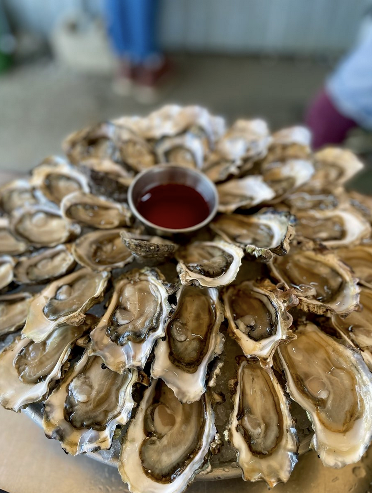
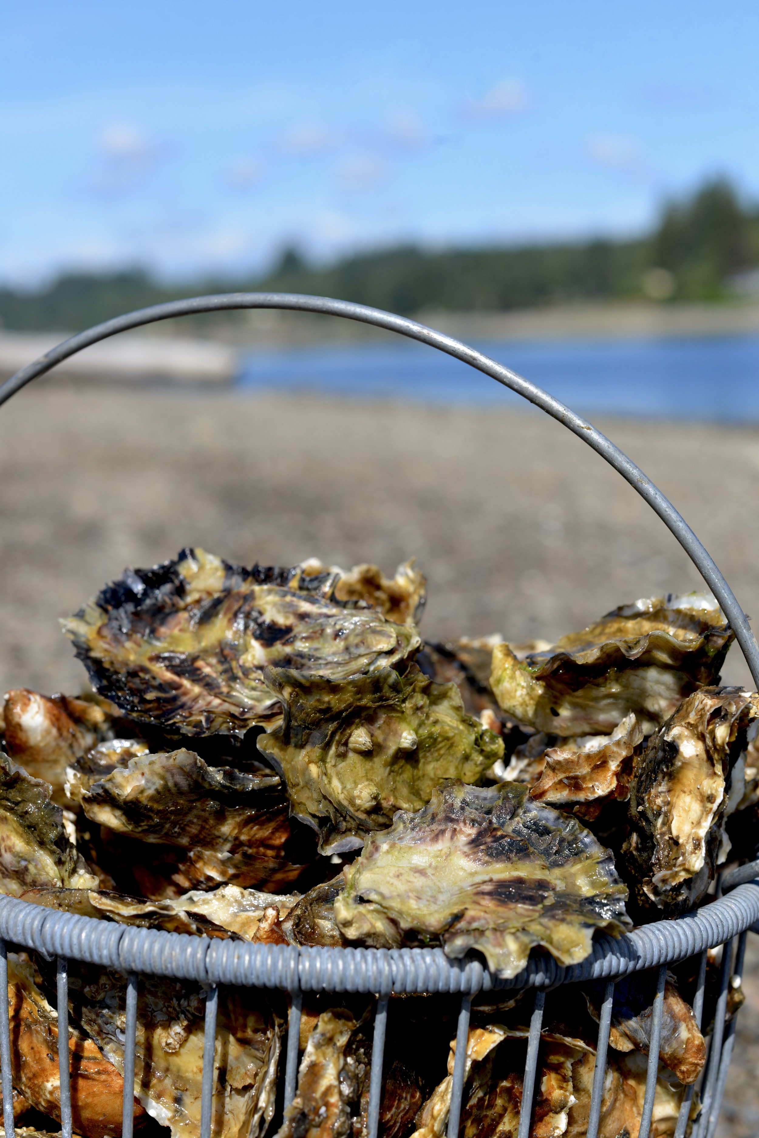
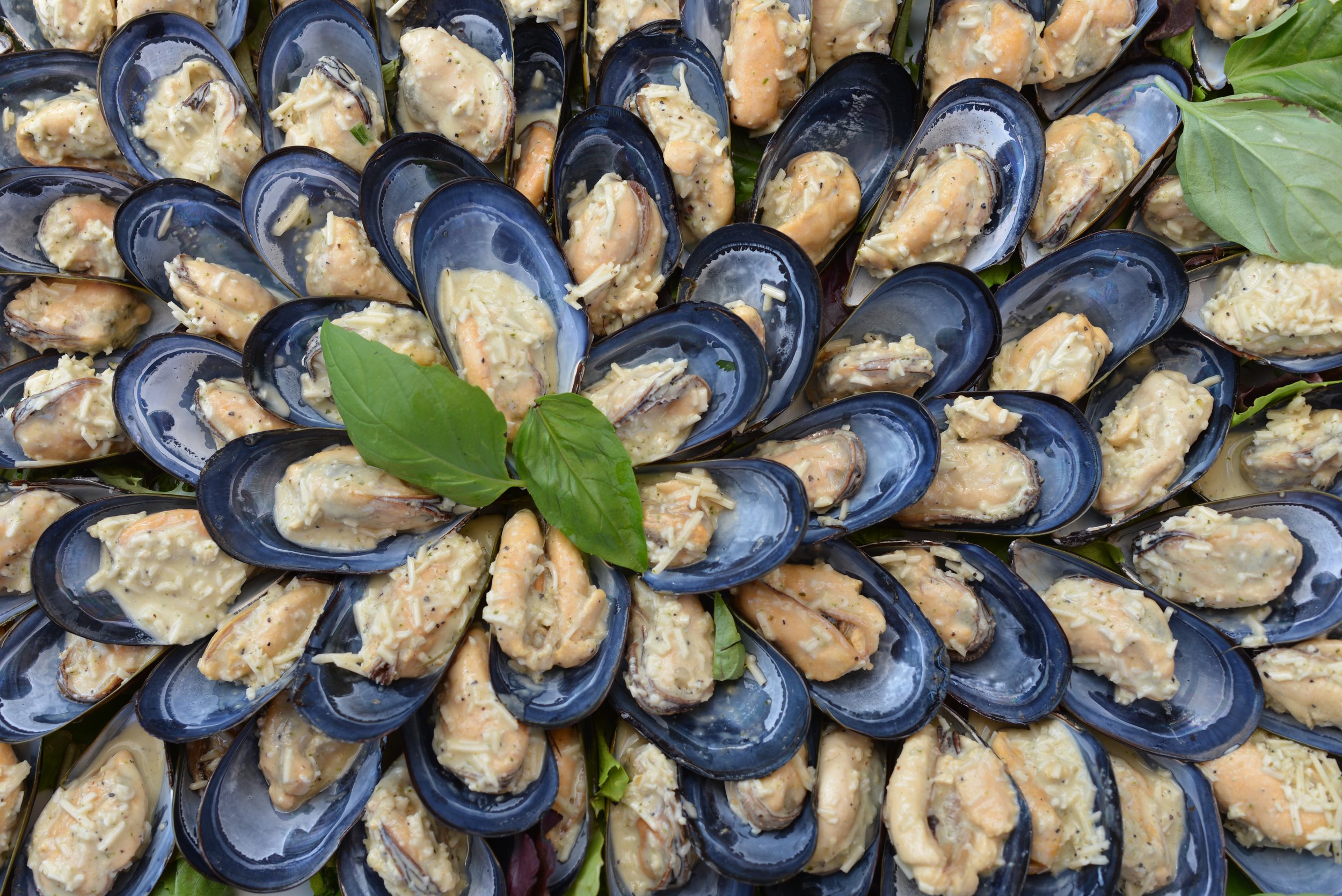
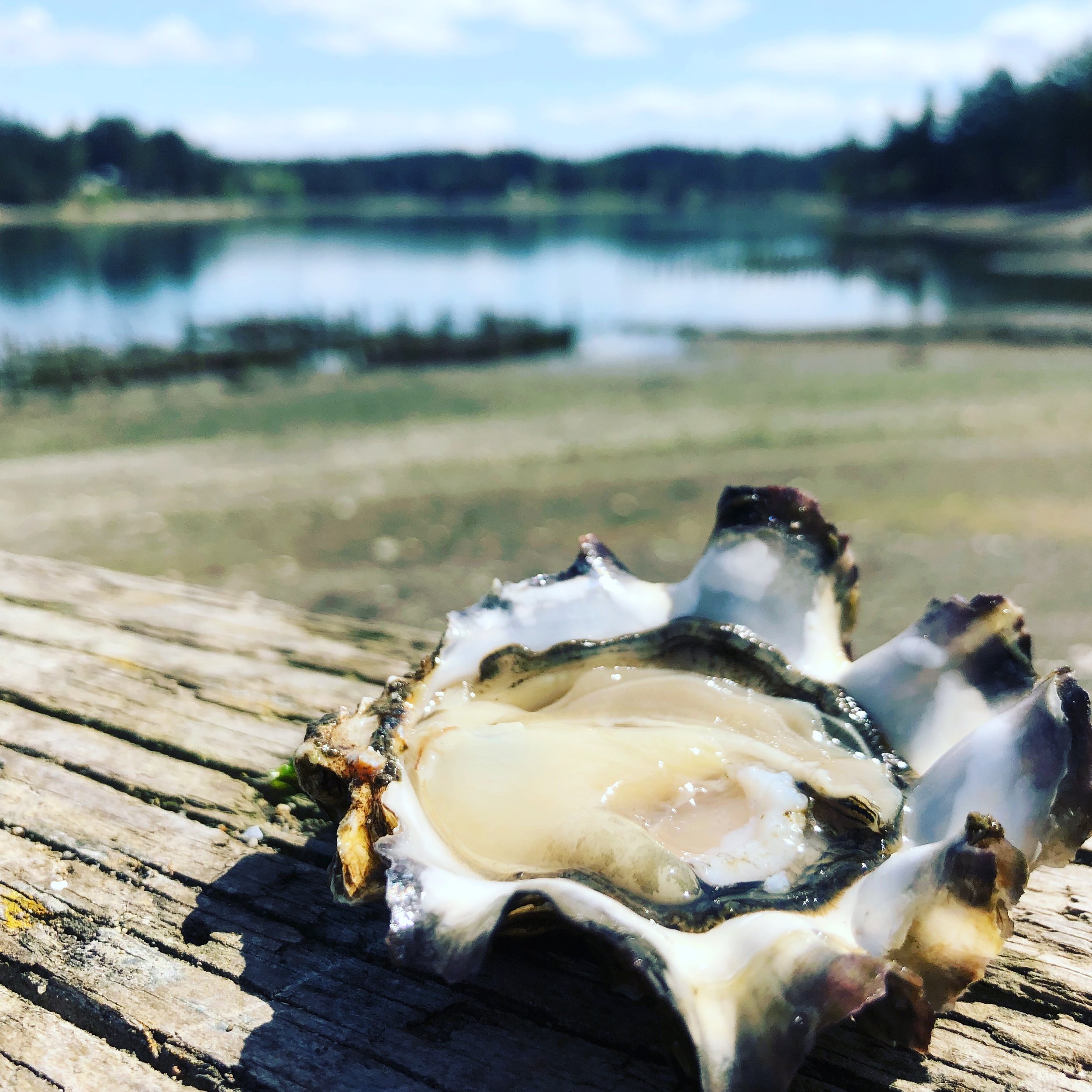
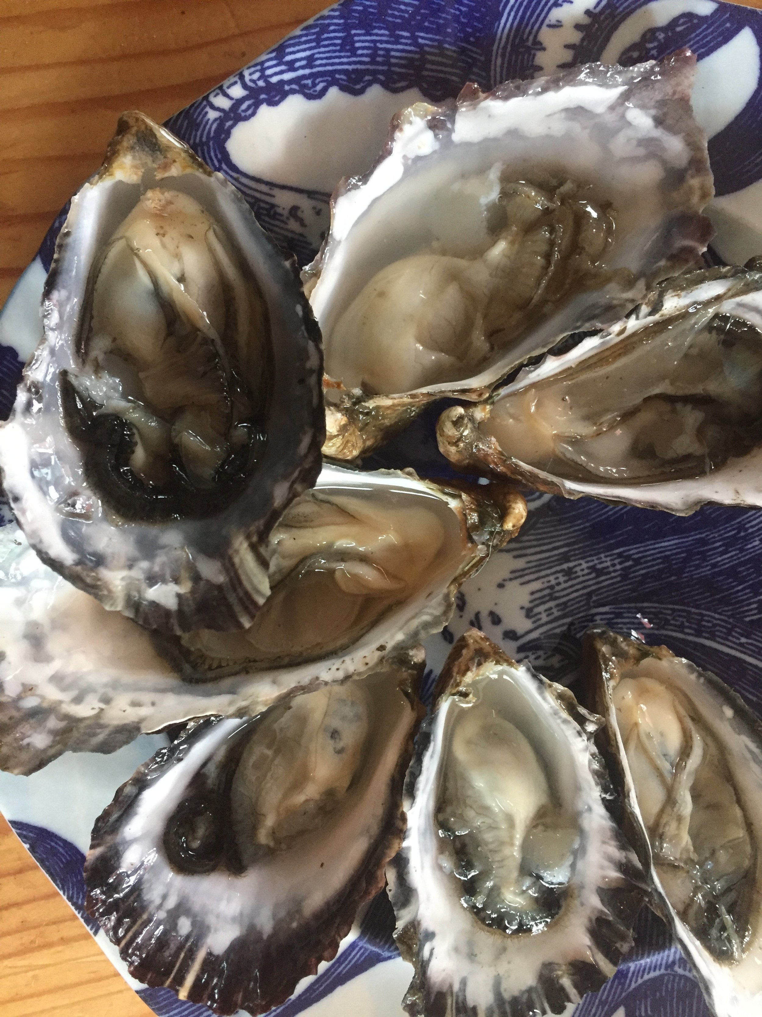
Celebrate Oysters on Hood Canal
It's ok to be "shellfish" when your on Hood Canal. How about waking up to spectacular canal views for days filled with walks and beach treasure hunts? With spring weather on its way and the water warming up -t’s a great time to hit the Hood – and we’ve prepared a jam-packed customizable seafood itinerary for you.
It’s a great time to head to Hood Canal and South Puget Sound and start enjoying fresh oysters on the beach.
We’ve got a few ideas to get you “shell-e-brating” as well as a recipe from Xinh Dwelley to make your mouth water for some oyster love!
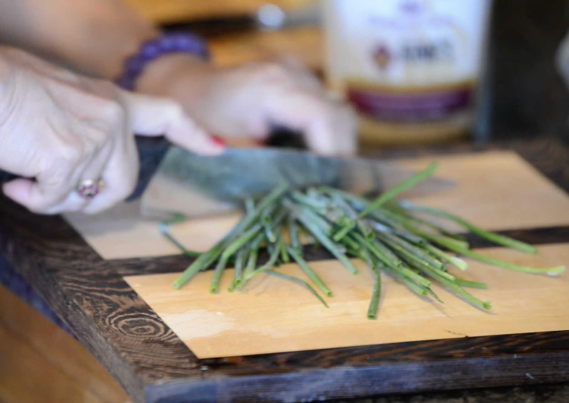
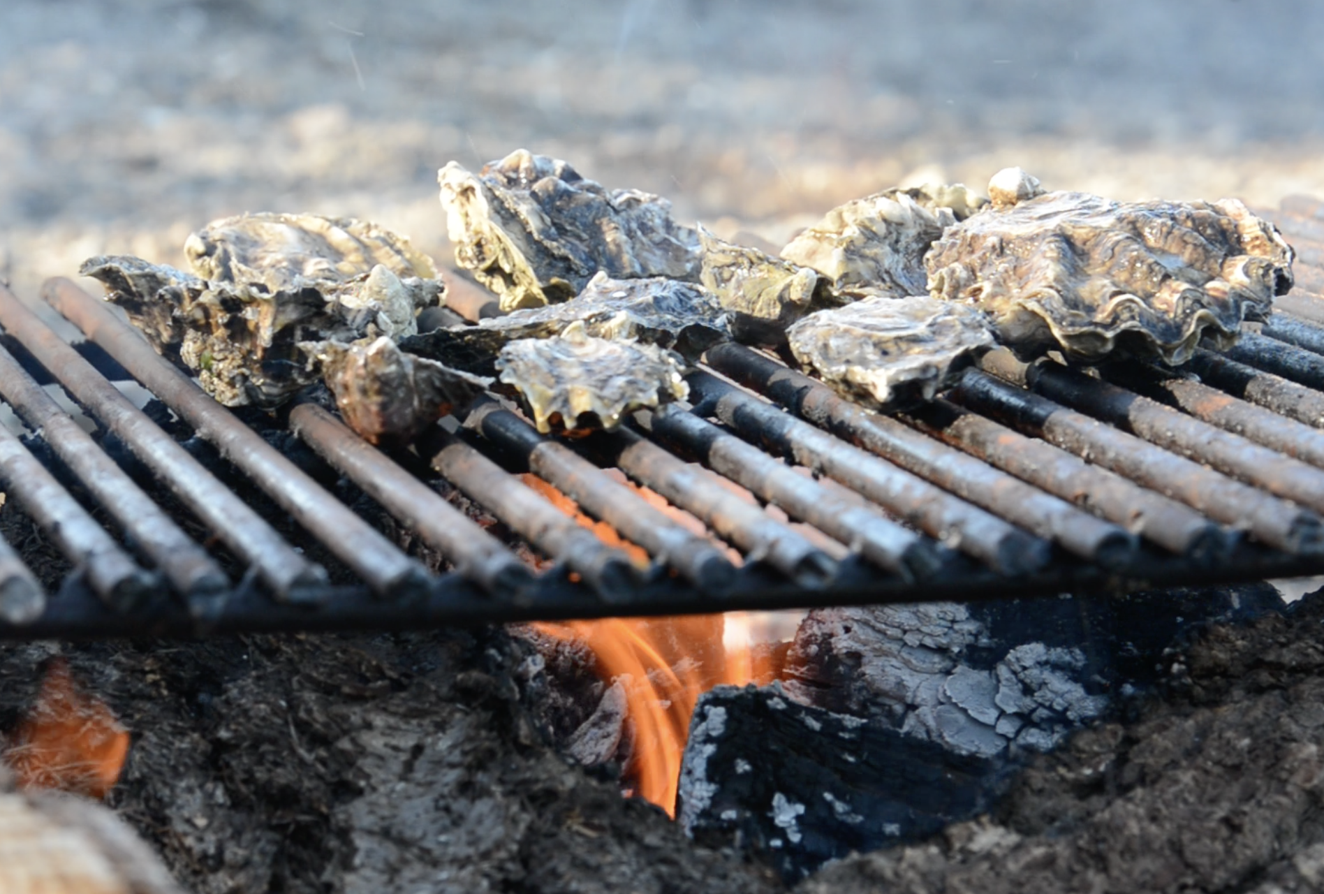
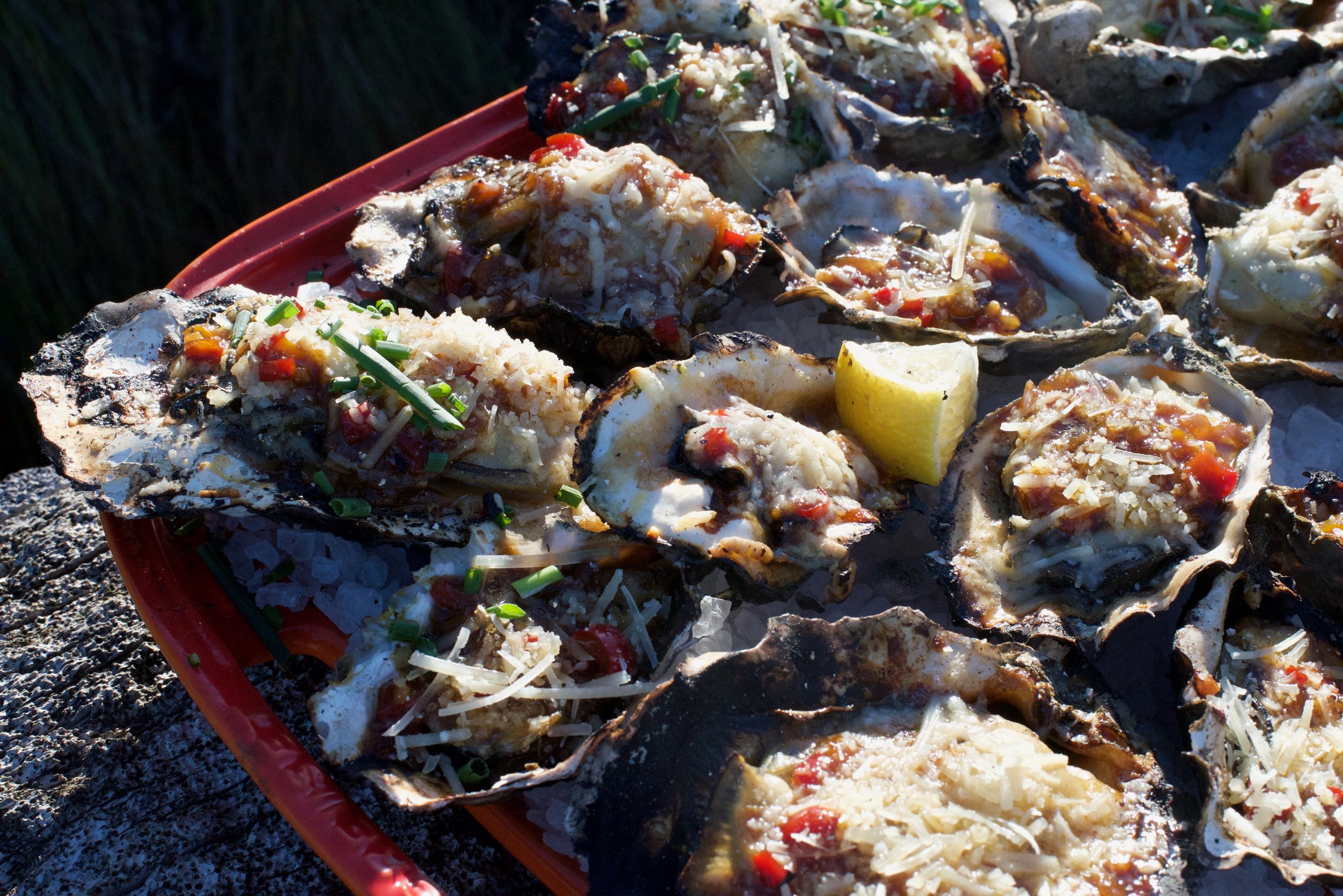
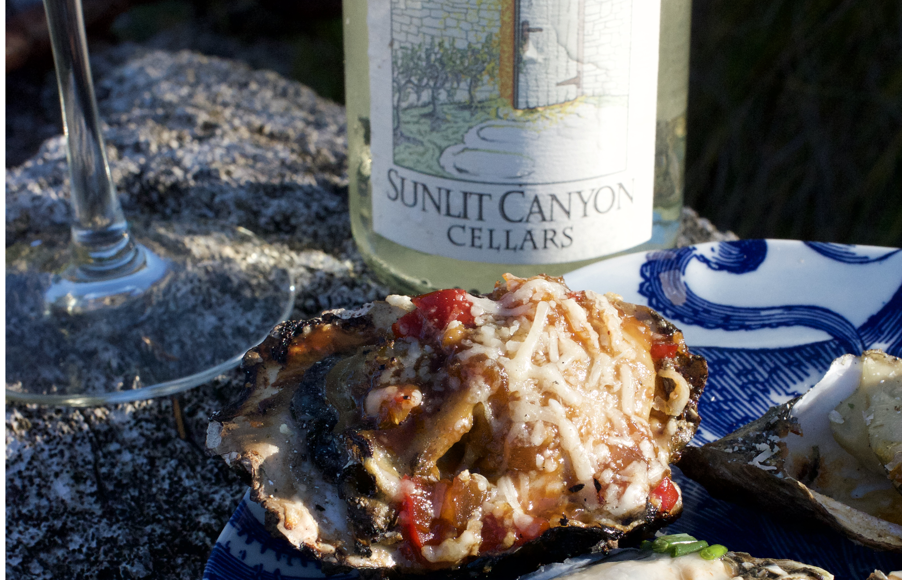
Xinh’s Grilled Oysters on the Half Shell
Recipe courtesy of Xinh Dwelley, celebrated seafood chef, Shelton, WA
(even the non-oyster eaters love these)
Prepare sauce in advance:
1/2 chopped red pepper, chopped
1/4 cup softened butter
1/2 cup chopped onion
Juice of 1 lemon
Salt and pepper to taste
2 tsp garlic, chopped
2 tsp soy sauce
1 tbsp hoisin sauce
1 tsp sugar
1/2 cup chopped chives
1/2 cup grated parmesan cheese
Combine ingredients in a blender and blend. Store in fridge until ready to prepare grilled oysters.
Place oysters on hot grill( 24-36 in shell). When shells begin to “pop” remove top with a heat-safe glove and top each with one teaspoon of mixture. Garnish with sprinkling of grated parmesan cheese ( about ½ cup total). Cook oysters are light brown and cheese has melted, 5-10 minutes. Serve hot.
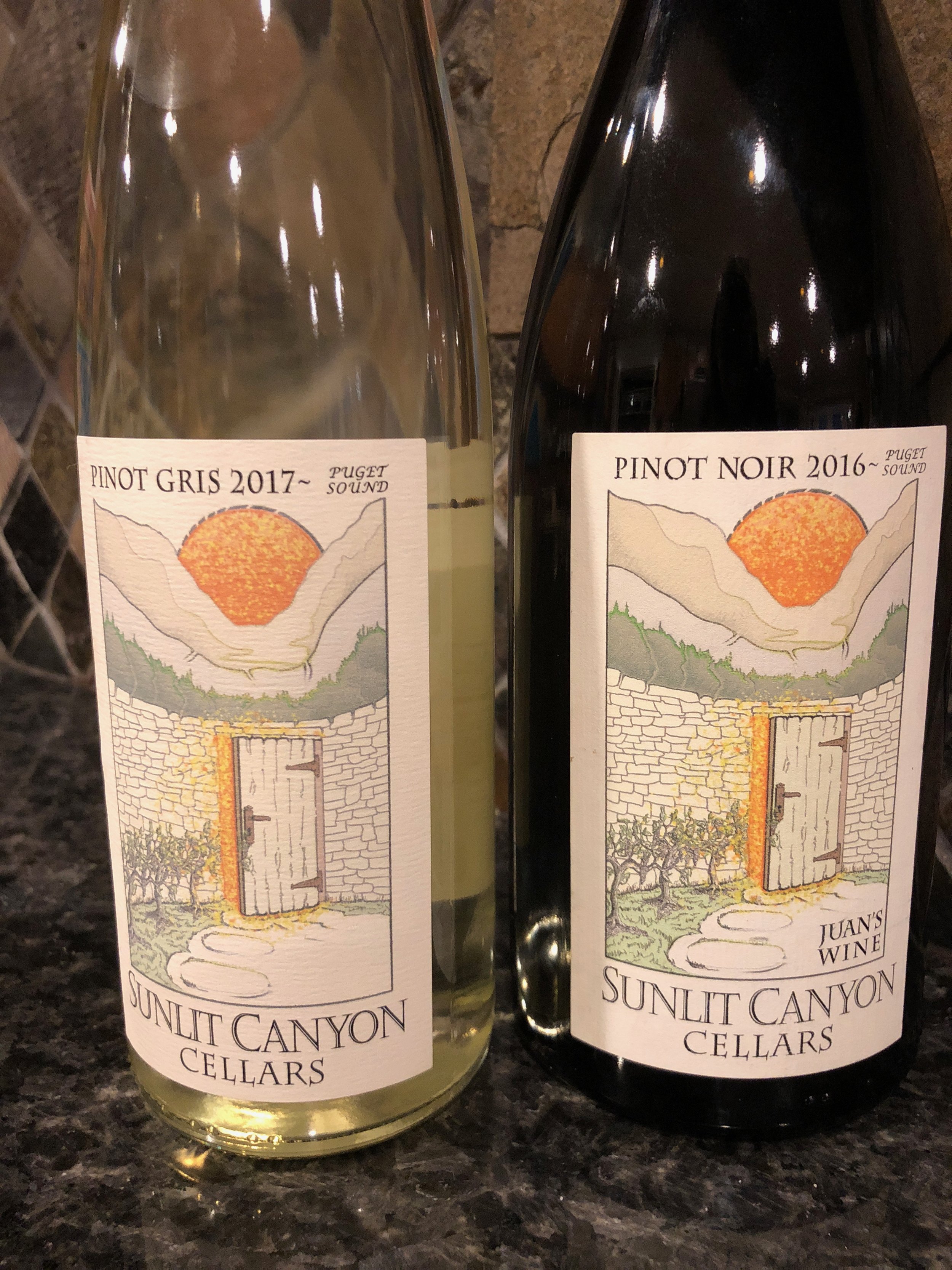
Oyster Pairing: Serve with Sunlit Canyon Cellars’s Pinot Gris ($22) available at Cameo Boutique in Union. Sunlit Canyon small batch wines are grown and bottled in Belfair WA overlooking Hood Canal.
Save some Clams & Visit Mid-week
Perhaps a few oysters will suffer, but who doesn't like to save a little money?
For great deals on lodging, not to mention more selection, consider heading to the Canal mid-week to enjoy activities you will not find anywhere else. Pack up boots, buckets and license and head to parks and DNR beaches that are regularly stocked with shellfish for the taking. Yes, taking! Check the tides before you head out. Another advantage to mid-week shellfish-gathering is you'll have the beach to yourself! Visit the DFO Shellfish Safety Map as seasons are beach specific. Always Check BEFORE you dig. We've prepared a handy list of area harvesting beaches here.
Alderbrook Resort & Spa is a great place to start a Oyster tradition - especially since April is their official Oyster Month! Not only can they harvest oysters right on their beach, serve some great Hood Canal oyster dishes on their daily menu in the restaurant.

Alderbrook Resort, view from the dock (left); view from 2 Margaritas' patio seating (top middle); Robin Hood Village Resort onsite restaurant (top right); Cedar Hill Cottage, Union (bottom middle); Hood Canal Marina & location of the Canal Cookout in Union (bottom right)
Want the house all to yourself? Consider snagging one of the great rentals that pepper coastal communities and woodland oases in the area. One of our favorites is the Cedar Hill Cottage in Union. This spacious shake home (two bedrooms) is perched on the hill above Union, and although it is technically not waterfront and nestled in the woods, there are glimpses of the Canal and the snow laden Olympics. Location is everything here. A short drive to Alderbrook Resort and just a quick walk to the heart of Union with coffee and bakery items at the Union Country Store, boutique shops, and waterfront dining at 2 Margaritas.
Farm visits
Heading into Shelton, stop in off Hwy 101 past Little Creek Casino & Resort at Taylor Shellfish's Retail Facility to take a look at their headquarter facility and visit their retail store. Taylor Shellfish is a huge supporter of the annual West Coast Oyster Shucking Championship (OysterFest) by supplying over 1200 oysters to the competition!

Hama Hama Oyster Company in Lilliwaup serves farm fresh oysters and clams in their streetside Saloon off Hwy 101. Check out the Oyster Saloon, an outdoor farm dining experience, Thursday through Sunday. The retail store is open daily.
One of the area’s most popular oyster growers is located just 30 minutes away in Lilliwaup, WA. Hama Hama Oyster Company's Store and Oyster Saloon (an outdoor restaurant) are located a shell’s-throw from the tideflats. Visit during the week to see the shucking crew in action, and ask for one of their self-guided tour maps to better explore the farm. Stop by the Saloon (Thursday though Sunday) for some great shellfish but don't miss the divine hand-packed Dungeness crab cakes. And we mean PACKED with crab! The crab cakes are also available the farm store where you can buy them to cook at home.
How ever you choose to Shell-e-brate oysters we know that you will have a blast exploring Hood Canal. Be sure to share your adventures with the bivalves with us at #wildsidewa!
See you on the beach!

Dog Friendly Fjord
The dog days of summer are here, and our four legged friends around the region can’t help but wag their tails enthusiastically. After months of rain, wind, and snow, we need little excuse to take our dogs out into the wilds of the Hood Canal.
By Douglas Scott, The Outdoor Society
The dog days of summer are nearly here, and our four legged friends around the region can’t help but wag their tails enthusiastically. After months of rain, wind, and snow, we need little excuse to take our dogs out into the wilds of the Hood Canal.
While we are just as excited as our pets to hit the trails, sometimes it can be difficult to locate a dog-friendly destination. Luckily, the Hood Canal is full of incredible locations for us and our dogs– from an easy day out to a tongue hanging trek!
Location is the easiest way to know if a trail is dog-friendly or not. In Olympic National Park, dogs are not allowed on trails. If the trail is located in Olympic National Forest, DNR Land, or at a State Park, the majority of trails will be dog friendly. Remember that even if a trail is dog friendly, you are still responsible for keeping them on a leash and picking up after them. Not everyone on a trail is used to dogs, so please be conscientious of others. Also, never leave a bag of waste on the side of the trail, carry it with you, even if you are hiking back past it later. Finally, always remember to bring extra water for you and your dog, as water sources are not always readily available.
Easy Access Spots
Dosewallips State Park
Found right off of Highway 101 and along Hood Canal, Dosewallips has a few hiking options, with a favorite being the fantastic Steam Donkey Trail. At just 3.5 miles in length and an elevation gain of 400 ', this trail reveals water cascades, bridge crossings, ferns and river views.Your dog will love visiting with other dogs and the endless sticks to pick up. Yes, this gentle dog-friendly hike will have the whole pack begging for more adventures.

Twanoh State Park and Trail
On the eastern side of Hood Canal, Twanoh State Park is yet another incredible dog-friendly destination. Situated right along the water, between Union and Belfair, Twanoh has a few miles of trails in the woods and along the shore, helping to making this one of the most dog-friendly locations on this stretch of Hood Canal. Your dog will love this for the beach and the water.
Ranger Hole
Twenty-two miles north of Hoodsport, the Duckabush River makes for a fun stop for you and your dog. The Ranger Hole Trail is just two miles in length but feels very remote. Passing through second growth timber, the trail leads to the Duckabush River, where you can watch the raging waters churn in white rapids. Dogs, kids, and families will love this short day hike. Your dog will love this trail for the walk, the trees and the many smells from the local wildlife.
Next Level Destinations
Upper South Fork Skokomish
Here, you and your dog can wander in pristine old-growth forests and enjoy this corner of Olympic National Forest. The trail crosses over bridges and through towering trees for nearly four miles before reaching the Olympic National Park boundary. The road here is closed to motor vehicles between the months of October and April, making it an ideal summer destination. Your dog will love this for the remoteness and the many chances to dip in the water.
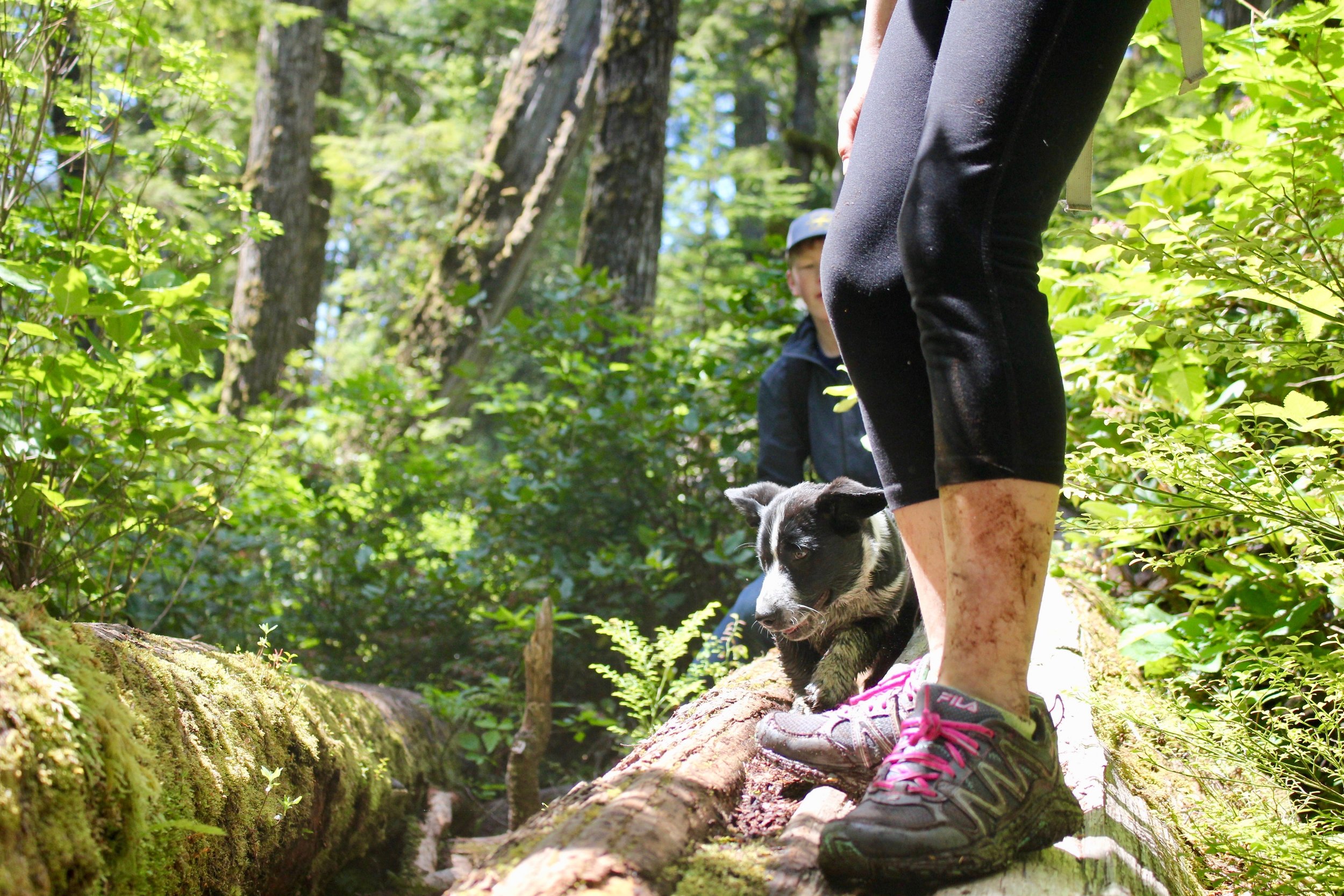
Lena Lake
Found along the Hamma Hamma River in the Olympic National Forest, this trail is for hikers and dogs hoping for a long day of hiking and exploring. At around seven miles round trip and gaining 1,300 ft in elevation, this hike can be hard for many people and pooches. Bring water and treats for all. Take your time while hiking through a mossy forest, over cool bridges and enjoy the stunning lake.
Memorable Canine Adventures
The Valley of Silent Men
Past Lena Lake, those hoping for an even more amazing adventure should hike into the Valley of the Silent Men. You’ll be hiking for 10 miles or so round trip, but this valley is a wonderland. Full of old growth, moss-covered boulders, and cascading creeks, you and your dog will be intoxicated with the beauty of this overlooked section of Olympic National Forest. Your dog will love this for the remoteness and the creeks to wade in.
Marmot Pass
Marmot Pass is a classic hike, and doing it with your dog makes it even better. At 11 miles round trip and gaining 3,500 feet in elevation, this is a trail for dogs and humans able to hike steep trails for miles on end. Starting in a forest, you’ll eventually climb to majestic views of the Olympic interior and even Hood Canal and Puget Sound. Your dog will love this for the varying terrain and seeing you happy!
Olympic Peninsula’s Dog Friendly Map

Check out this fantastic pet friendly map provided by our partners at Olympicpeninsula.org!
Download and pack a copy along with your leash and collapsible water dish!
6 Tips for Hike Savvy Canines
Like house-bound humans, dogs need a little prep time to get ready for the trail. Here are six tips to help you and Fido have a safe and fun adventure.
#1 Take it Easy : Start with easy trails and slowly build up stamina & strength.
#2 Care for Tender Paws: Make sure your dog's pads are toughened or purchase hiking booties and let him get used to them before heading into the wild.
#3 Yield to oncoming traffic: No matter how sweet Fido appears, its good practice to verbalize how friendly he is. Step off the trail when hikers pass and heel your dog.
#4 Leash Control: If the trail requires leashes or if if your dog might run into other hikers, keep him on a short leash (-6') since a long leash is more likely to get tangled on brush. Your dog should not be allowed to roam freely.
#5 Leave no trace: Bring bags to collect and carry out your dog’s poop. If you’ll be backpacking overnight, bury it at least 6” deep and at least 200 ' from walkways, camps, and water sources.
#6 Command Ready: Hazards in the woods differ than the cul de sac. Don’t let your dog stray. Some plants are poisonous, and some creatures bite and may host diseases. Irressistable smells will lure pooch away in a flash. Make sure your obedience training is on track.
Visit backpacker.com for more ideas on a safe and rewarding journey!
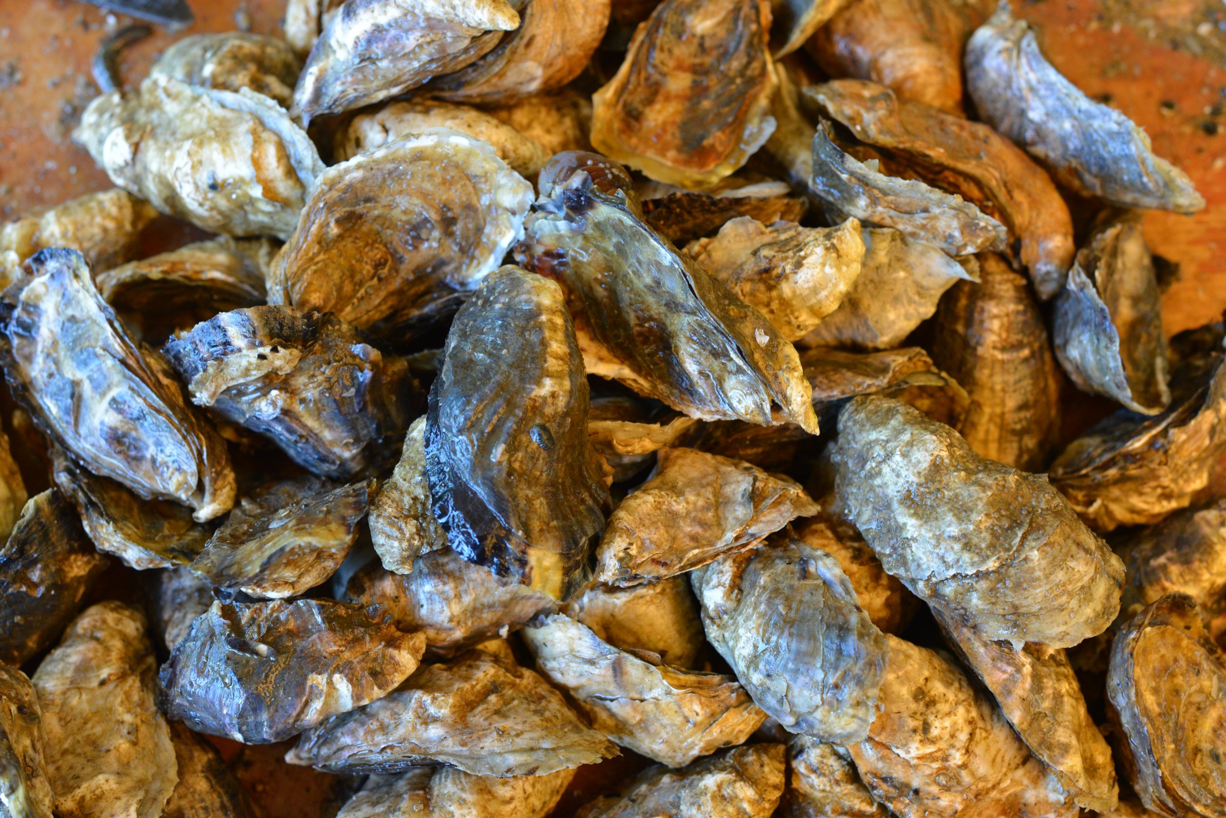
Ten Myths and Facts about Oysters
Ten things you probably never needed to know about oysters, but we are going to tell you anyway.
Ten things you probably never needed to know about oysters – but we're telling you anyway.
1. Myth
Oysters are an aphrodisiac.
The idea of eating oysters for their aphrodisiac qualities is untrue. Sorry – but you can prove science wrong! Dig in.
2. Fact
There are several species of oysters cultivated in North America. The two most common species in this area are the Pacific, from Japan and the Olympia – a small full flavored oyster native to the Northwest.
3. Myth
You can tell male oysters from females by examining their shells.
Oysters change sex one or more times during their life span, you cannot tell by their shell what phase they may be in.
4. Fact
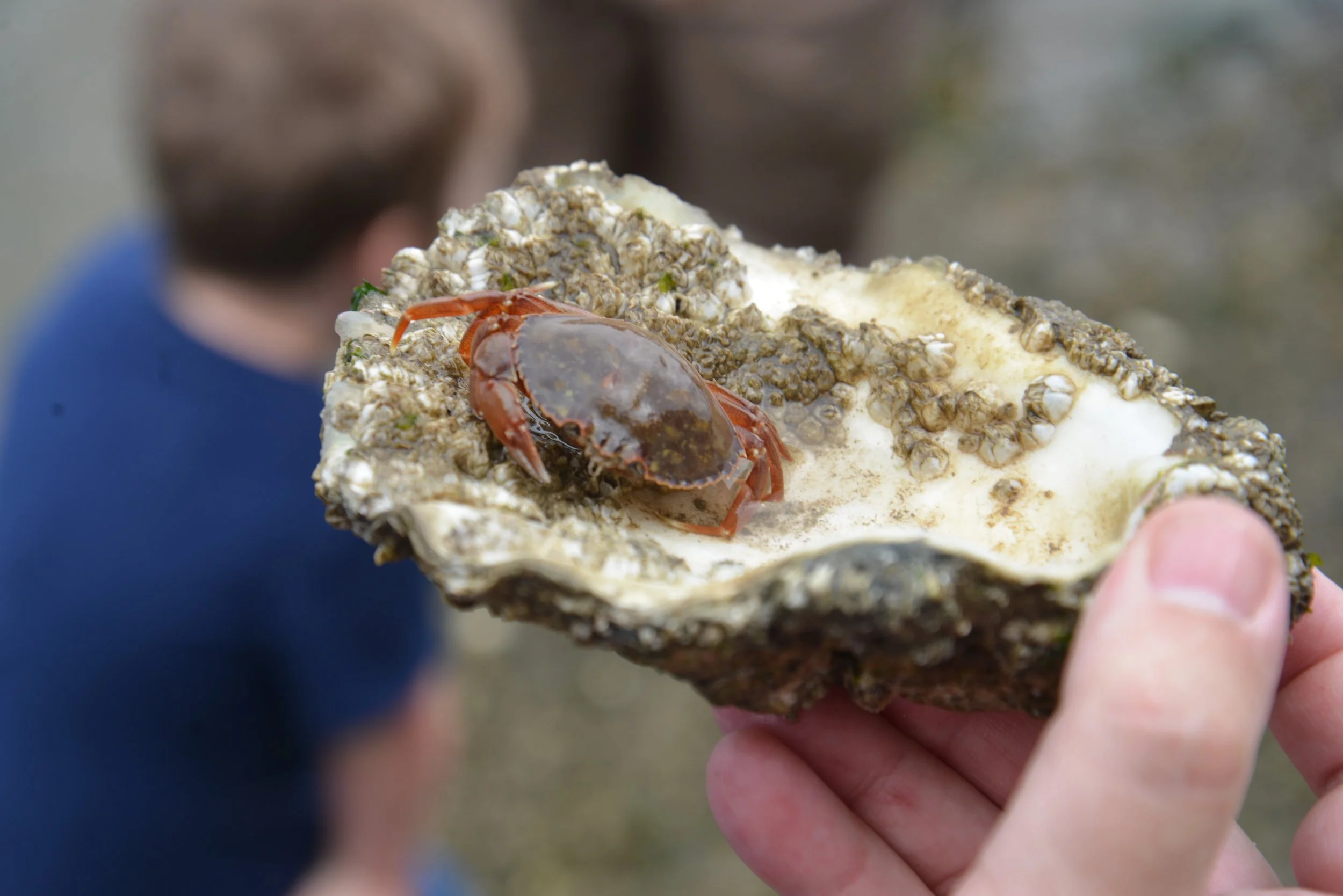
The tiny crab we see in the oyster is a species of crab (Pinnotheres ostreum) that has evolved to live harmoniously inside an oyster’s shell. These dime-sized crabs, much sought after by gourmands, are not abundant.
5. Myth
Shellfish that die before being cooked should not be eaten.
People have been warned not to eat clams, mussels, crabs, lobsters, and other shellfish unless they are alive when cooked. From the standpoint of flavor, this is a good suggestion, but shellfish don’t become toxic when they die.
6. Fact
An oyster produces a pearl when foreign material becomes trapped inside the shell. The oyster responds to the irritation by producing more, a combination of calcium and protein. The nacre coats the foreign material and over time produces a pearl.
7. Myth
Seafood is brainfood.
The myth of fish as a brain food goes back to a 19th century Harvard University scientist who discovered that phosphorus is abundant in the human brain, and from this fact, wrongly concluded that a diet of fish should increase the human IQ. However, as stated below, Fact #10, the vitamins found in oysters do promote a sharper memory –so perhaps this could be considered "intelligence?"
8. Fact
Oysters help waterways by eating algae, filtering out particulates and excess nutrients and creating habitat for other organisms to thrive.
9. Myth
The majority of jewelry pearls come from oysters.
Although pearls ARE cultivated in oysters, many pearls used in jewelry (especially fresh water ones) are produced in clams and mussels, not oysters as commonly believed.
10. Fact
Oysters are rich in vitamins A, C, D and B-12. B-12 is well-known to help people lose weight and is proposed to sharpen their memory. Eating four oysters a day gives you a complete daily supply of copper, iodine, iron, magnesium, manganese, phosphorus and zinc.

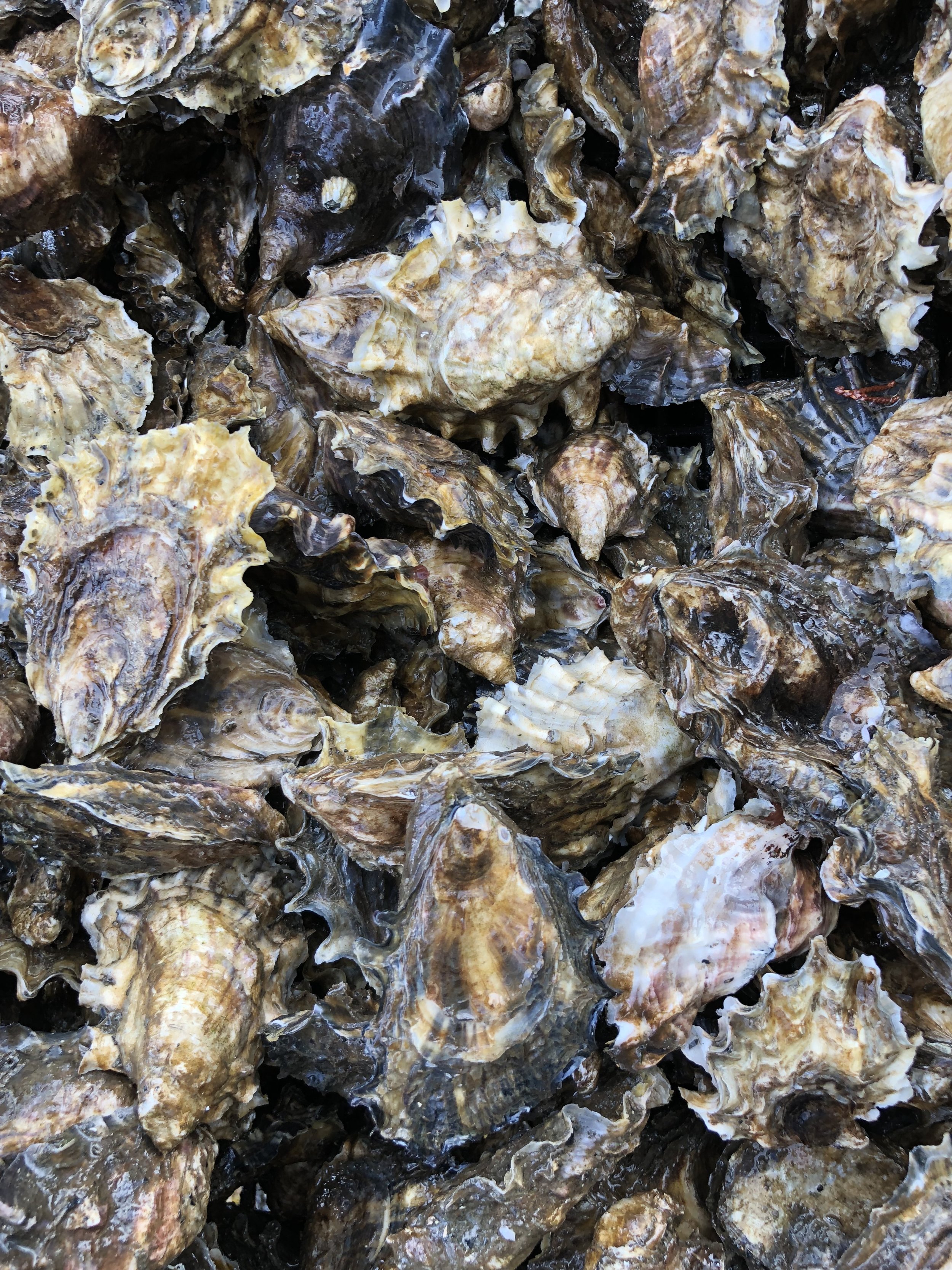
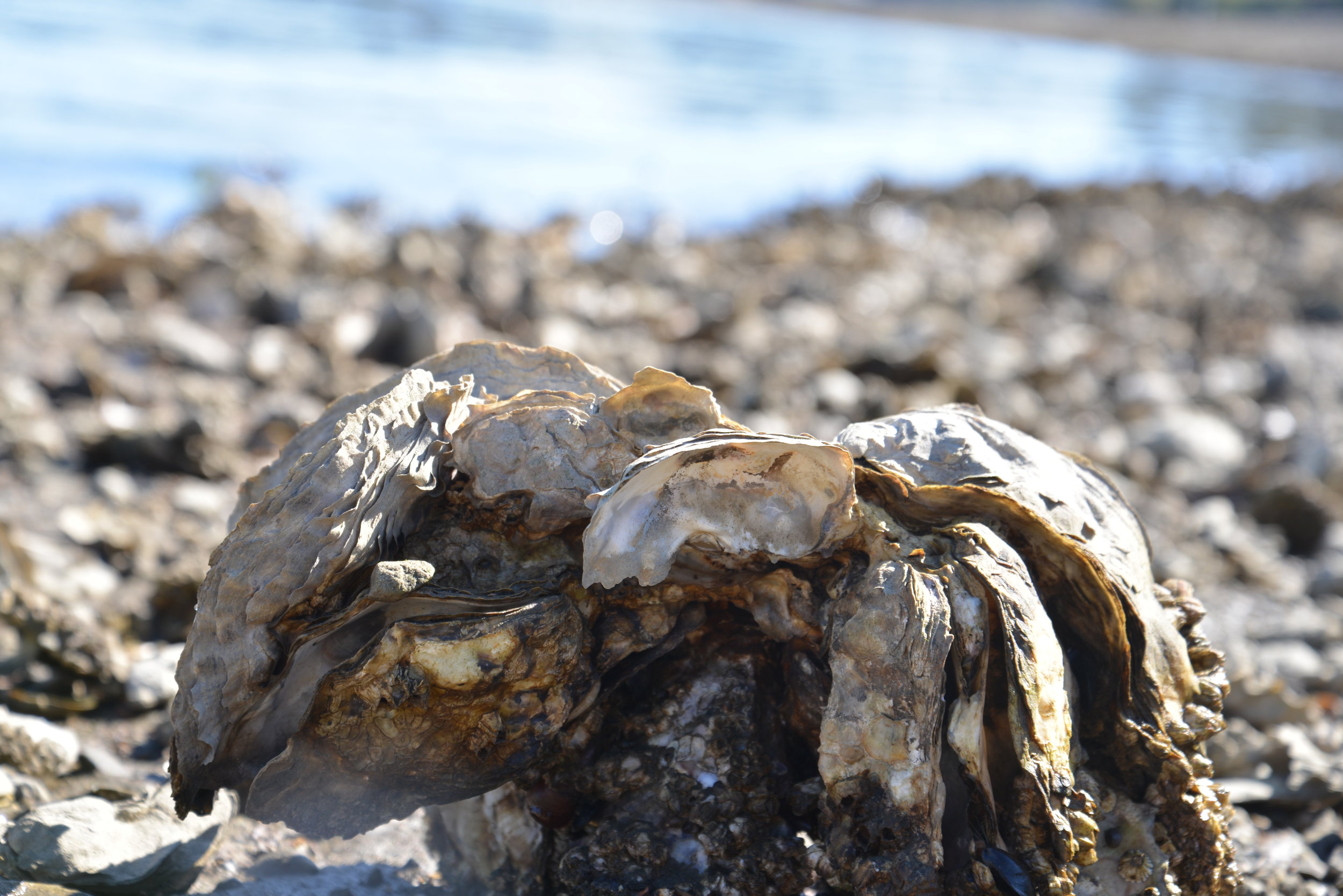
Hundreds of varieties yet only five species | Oysters explained
There are over 150 varieties of oysters harvested and sold in North America, yet they comprise a total of only 5 species of oysters.
How does your Oyster Grow?
Have you ever wondered how the same species of oyster can have such varied flavors or textures? How does an oyster grown on Hood Canal taste brinier than one from South Puget Sound? The word to remember for your next oyster social occasion is “merrior.”
Like different wines with a “terrior,” oysters have a merrior, illustrating the fact that growing area and method make all the difference when it comes to flavor profile for your next Pacific oyster.
Not all beaches are created equal; some are muddy, some sandy, and some rocky. Each type of growing ground has opportunities and limitations for success. Muddy ground can inhibit the oysters’ ability to circulate water and food into their bodies. This had led to the adoption of culture techniques that suspend the oysters above the mud in long lines, stakes, nets or racks, and bags, while firm, sandy, or rocky bays allow for oysters to be grown right on the beach.
In addition to substrate type, location of the oysters on the beach will determine how long the oyster will take to achieve a marketable size. Oysters grown in the intertidal area are exposed to daily tidal inundation will have well developed adductor muscles and thicker shells thus being heartier for shipment. Oysters suspended in the water column for growing will have the benefit of a constant food source and thus grow quickly but will have delicate shells and be susceptible to the elements. Often times, suspended oysters are placed in the high energy intertidal environment for a few weeks prior to market to harden the shells for shipment and condition the oysters to hold their shells shut.
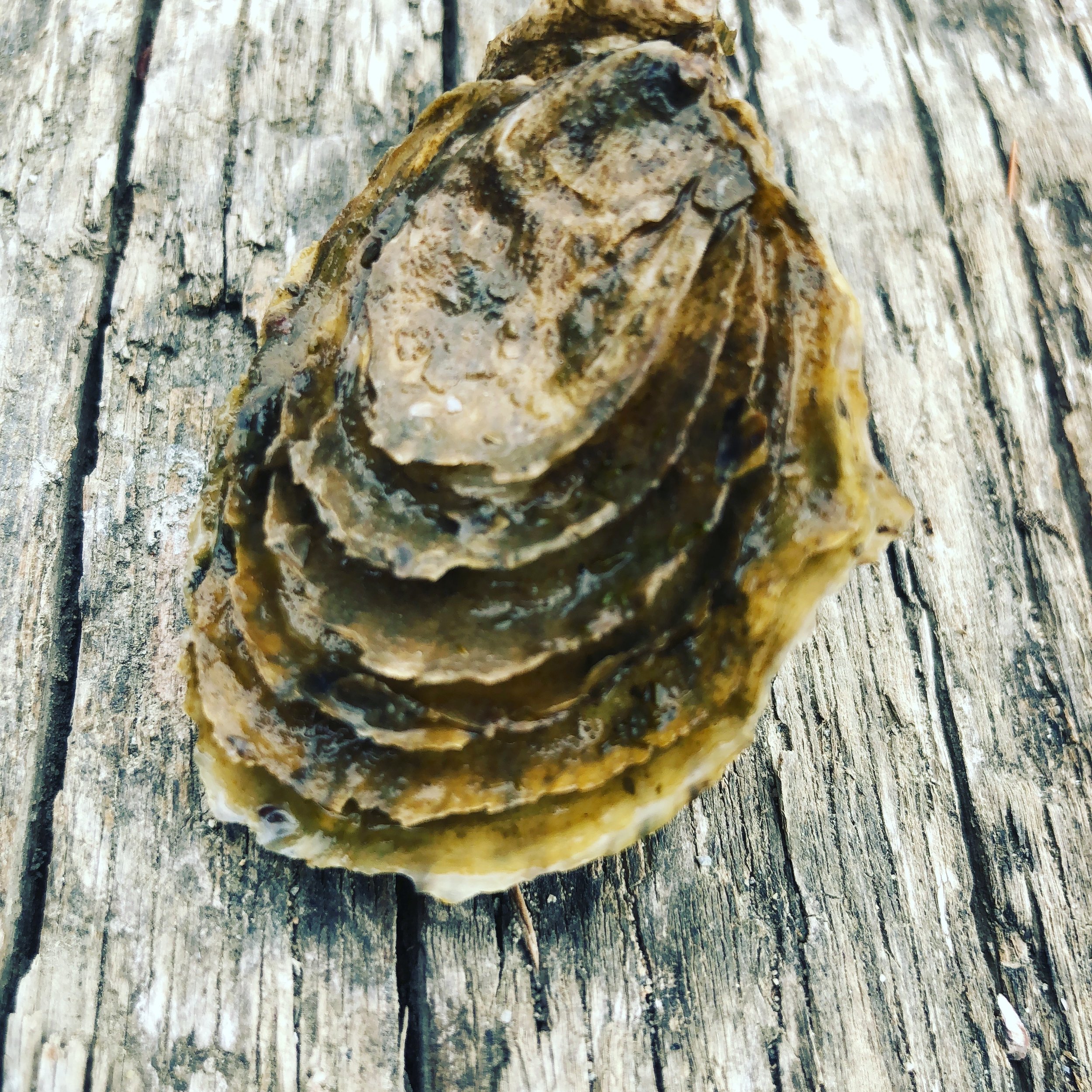
The method of growth can greatly change the shape of the oyster. A Pacific allowed to grow naturally on the beach will have a sturdy irregular shell with a great deal of frills. The regular exposure at low tide strengthens the shell protects the meat from heat and predators like sea stars and crabs. In Europe, where there is very limited tidal change, some farmers manually pull the oysters from the water for periods of time to mimic the tidal action.
The tumble bag creates an altered but very marketable shape for cultured oysters. Oysters are placed in the bag as small seed and the tide does the rest. The tidal flip and roll chip off the fragile lips and force the oyster to curve. The result is a deep cup in its lower shell.
“Eat shellfish to provide a healthy diet. Shellfish are low in saturated fats, containing the essential omega-3 fatty acids; are excellent protein sources; and are good sources of iron, zinc, copper and vitamin B-12.”
wsg.washington.edu
Each bay has its own selection of phytoplankton yielding oysters with different meat colors and flavors. Pacific oysters grown in Willapa Bay have a different merrior from those grown in Samish Bay. Hood Canal oysters are claimed to be more briny than the sweeter cucumber flavored bivalves grown in Hammersley Inlet or South Puget Sound waterways. Just like the well attuned vintners of the Rhone Valley, oyster connoisseurs are able to detect the subtleties of each bay by tasting the meat and observing the shell.

Know your oysters
There are over 150 varieties of oysters harvested and sold in North America, yet they comprise a total of only 5 species of oysters.
1. Olympia
OSTREA LURIDA /OSTREA CONCHAPHILA
The native oyster to Washington State, the Olympia oyster is a half dollar size with a metallic finish. The Olympia oyster fishery ran from the mid-1800s until about 1915 supplying California’s demand for oysters. The oysters were harvested from shallow bays of southern Puget Sound and Willapa Bay until pollution and over harvesting caused a collapse of the wild fishery.
2. Pacific
CRASSOSTREA GIGAS
Native to Japan, farmers began experimenting with the Pacific in 1904. Washington began importing commercial seed in the 1930’s and now it is now the most important commercial species on the West Coast. Beginning in the 1950’s researchers began to study Pacific reproduction to reduce the dependence on seed imports. Since the 1970’s local shellfish growers have relied on hatcheries for the production to meet the demand for Northwest oysters.
3. Virginica
CRASSOSTREA VIRGINICA
The decline of the Olympia oyster opened the door for the import of the Virginica from the east coast in the early 1900’s. The eastern oysters did not adapt well to local waters and experienced large die off when transplanted. There are still beds of Virginicas raised by WA shellfish farmers.
4. European Flats
OSTREA EDULIS
European Flats have smooth, round, saucer-like, flat shells with a shallow cup and seaweed-green color. They have a bold flavor with a meaty, almost crunchy texture, and intense mineral bite with a long-lasting seaweed flavor and gamey finish. There are not many farmers cultivating Flats.
5. Kumamoto
CRASSOSTREA SIKAMEA
The Kumamoto has a small deep cup and a sweet meat. Brought from Japan’s Kumamoto Prefecture, they are unable to reproduce in our cold waters so growers rely on hatchery stock. The prized cup of the Kumamoto and its limited supply has growers working with Pacifics to meet half shell demands. Growers use tumble bags to force the Pacific into a deeper cup. Oysters with names such as Kusshi, Shigoku, Sea Cow, Blue Pools, Chelsea Gems, and Baywater Sweets, are the result.

Why is it required to shuck oysters on the beach at public tidelands?
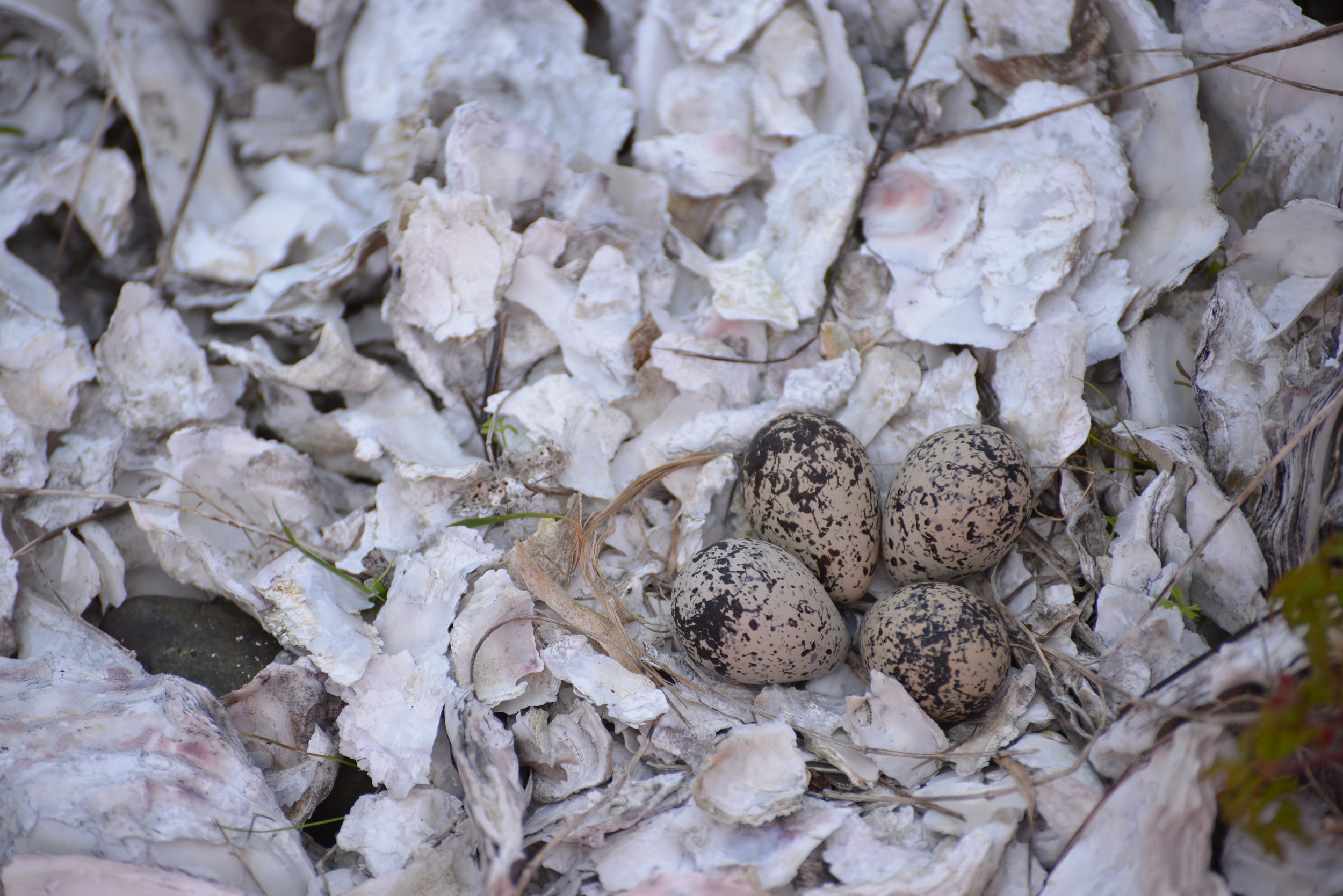
Oysters taken on public tidelands must be shucked on the beach and the shells left behind for the following conservation-based reasons according to the Washington Dept of Fish & Wildlife website, wdfw.wa.gov:
Oyster shells provide the best growing substrate for juvenile oysters. Removing the shells from a beach reduces the overall amount of setting surface. In addition, Pacific oyster shell provides an excellent setting surface for the native Olympia oyster. This is especially true in places like southern Puget Sound where the natural setting surface - Olympia oyster shells - was eliminated years ago by overharvest.
Another concern is that removing large Pacific oyster shells removes tiny oysters which are attached to the larger shells. Thus, removing a legal limit of 18 oysters may actually remove three to five times that number of oysters - young oysters which would otherwise remain on the beach and grow to edible size.
Removing oyster shells from beaches containing Japanese oyster drills (an oyster predator) may result in the inadvertent spread of these predators. Sport harvesters are unlikely to recognize these tiny predatory snails - or their egg cases - which attach to oyster shells and can survive long periods away from water. Once shucked, these shells often end up being returned to a nearby beach by well-meaning harvesters, potentially increasing the spread of the Japanese oyster drill in Washington by depositing the “hitchhikers” on a new beach.
Many public beaches already have these tiny predators, but the goal is to minimize the spread to other uninfected beaches. The surest way to prevent oyster drills or their eggs leaving an infected beach is to require oyster shells to remain on the beach.
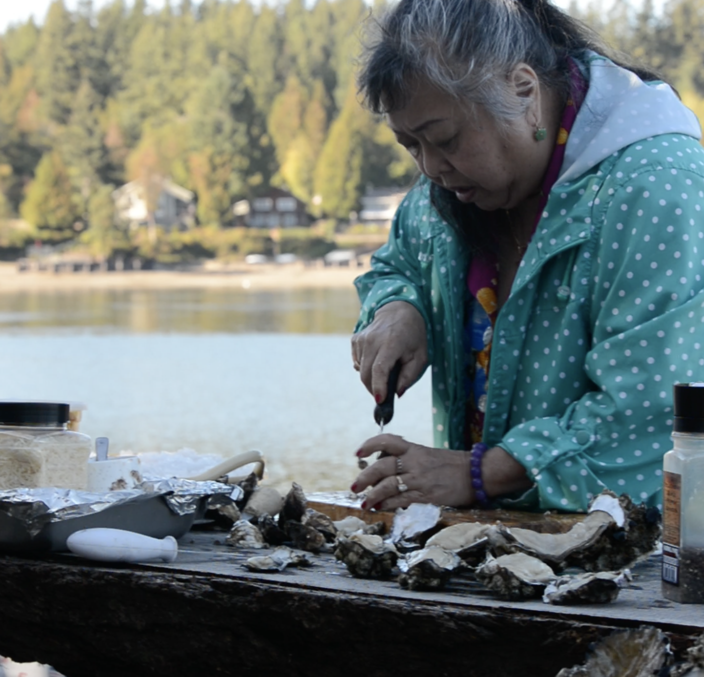
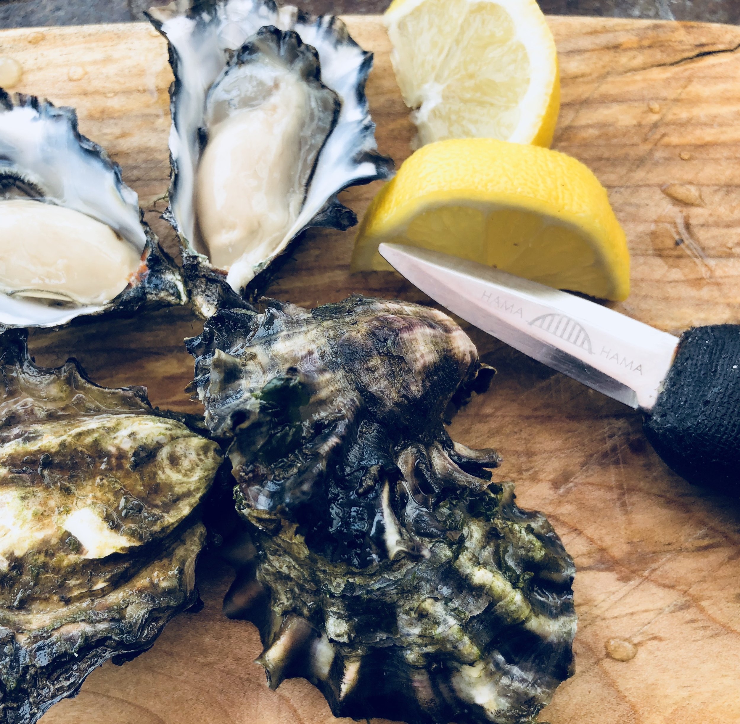
So head to the beach and get shucking! You will need a shellfish license, an oyster knife and gloves. Adults may shuck a child's daily limit so long as the child participates in some way in the gathering. For illustrated details on two popular shucking methods, visit wdfw.wa.gov/fishing/shellfish.

A Case Study of Islands in the Inlet
Case Inlet, at the mariner’s northeastern edge of Mason County, is home to many magical island getaways. Reach Island (AKA Treasure Island), verdant Stretch Island, secretive Herron Island, tiny McMicken Island, and Harstine Island all have interesting histories and unique characters.
Case Inlet, at the mariner’s northeastern edge of Mason County, is home to many magical island getaways. Reach Island (AKA Treasure Island), verdant Stretch Island, secretive Herron Island, tiny McMicken Island, and Harstine Island all have interesting histories and unique characters.
The water access provided by Case Inlet linked the early forestry and settlement farming of this area to Tacoma and Olympia. In the beginning Squaxin dugout canoes, row boats and temperamental sailboats were the main transportation. Small side-wheel freight ships (powered by coal, wood, and later diesel), known as the Mosquito Fleet, came to replace these early methods. They transported freight and passengers, shipped milled lumber, and even towed logs, connecting these remote communities and homesteads.
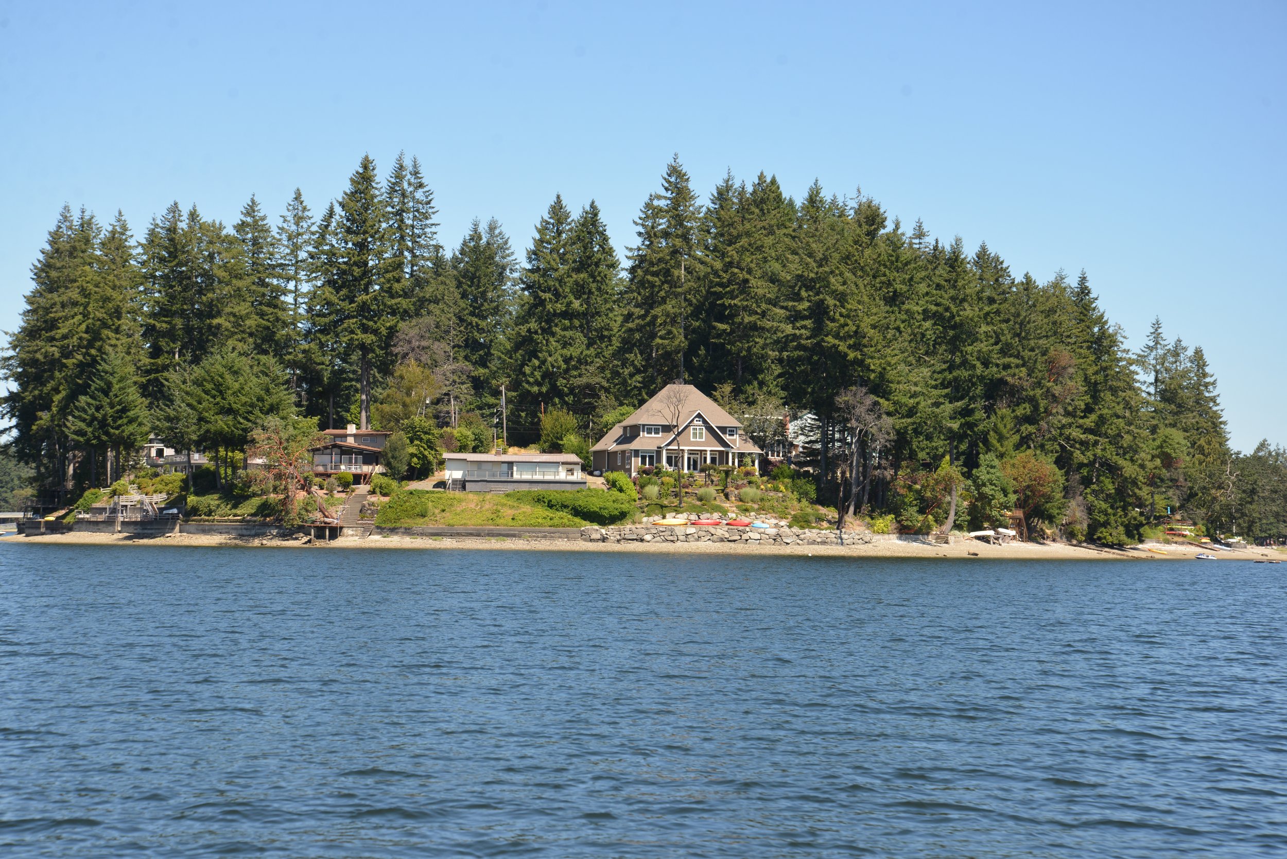
Reach Island
The first island we encounter heading from north to south down Case Inlet is Reach Island. The entirety of Reach Island was pre-empted and homesteaded by Joseph Pickford in 1885. By 1905, it was an established farm run by the Zizz family with cows, chickens, and fruit trees. Little farms like this were a major part of the Washington economy. Grapevines early on became important players in the agricultural scene of Case Inlet, or as it came to be known in the mid-1920s – the “grape belt of Washington.”
Stretch Island
Stretch Island saw the first efforts of grape growing on the inlet. Civil War veteran, Lambert Evans is credited with introducing the first concord grapevines to the island 150 years ago this year. Adam Eckert arriving in 1889 developed these into Washington’s own hybrid the Island Belle. This purply-red variety was hardier and ripened more successfully in the coastal climate.
Freight ships, such as the Skookum Chief would transport the Eckert Fruit Company’s fruit juice and grapes packed in round 6-pound wooden baskets to market in Shelton, Olympia, Tacoma, and Seattle.
After Adam Eckert passed away his lands and extensive grapevines were purchased by Charles Somers in 1918. Somers in partnership with his brother Frank expanded the business and began shipping to San Francisco. In 1922, the town of Detroit changed its name to Grapeview to reflect this growing resource.
In 1933, when the Federal laws known as Prohibition were lifted, Charles Somers was the very first applicant to be granted a winery permit in the 15th District (this included Washington, Oregon, Idaho, and Montana). St. Charles Winery started small with a French vintner overseeing the first casks of the only 3,000 gallons produced. Charles Somers’ sons Charles W. "Bill" Somers and Howard Somers joined the family business and by 1935 they were producing 38,000 gallons. Bill oversaw growing the fruit and harvesting and Howard (who specialized in chemical engineering at UW) took over the fermentation.

Charles Somers Vineyard
Vineyards throughout the area, especially on Harstine Island and along Pickering Passage added to their supply of grapes. In 1955, St. Charles processed over 500 tons of grapes from Mason County and another almost 300 tons from Yakima Valley. Although by 1965, the St. Charles winery had sold and the wine with it, there still exists on the Somers’ property on Stretch Island the original vine planted by Lambert Evans in 1872. Though not as popular, local vineyards still grow Island Belle and u-pick grape yards were a popular fall pastime until the 1980s. Hoodsport Winery still ferments Puget Sound Island Belle grapes. The wine is described as “a red wine bursting with flavors of fresh raspberries and cherries. A perfect wine for picnics and barbecues.”
Harstine Island
Just a little South of Stretch Island is Harstine Island. At over 18 squares miles it is the third largest island in the inland Puget Sound (after Bainbridge and Vashon), yet it is a sleepy wooded island with a population barely touching 1,500. Historically, residents were pioneer loggers (like Robert G. Jarrell of Jarrell Cove State Park fame), farmers, oystermen, fishermen and opportunistic captains (and many residents were all the above). Since the Island was only connected to the mainland in 1969 by bridge, traveling by water was very important to all aspects of life. Many famed Mosquito fleet captains lived here, building business and homes. The historic Community Hall was built in 1914.

According to the Harstine Island Community Club website, easy trees were harvested along the shores for lumber which was towed by Ed Cowan’s Levina and Raymond and John Haskell’s 40-foot launch the Marie to the sawmill at Taylor Bay.
The Community Hall held many popular dances and events with people coming by boat all the way from Agate, Stadium and Vaughn to attend. To this day it is a popular gathering spot for the Harstine community.
In 1922, the county established a ferry service crossing Pickering Passage. The 40-foot scow, the Island Belle (named for the popular grape) was their first ferry. She was built by Ira Libby of Hammersley Inlet with the help of Earl Harriman. She was designed from a ferry in operation on Lake Crescent.
With two load aprons she could carry three cars at a time, which would drive through on one end and unload on the other. She made the crossing in 30 minutes with her Fairbanks-Morse 10-horsepower engine, which drove by belt two side-paddle wheels.

She was replaced in 1929 by Earl Harriman who built his own log ferry to increase the capacity. Donette Glaser remembers that “ Earl was a pioneer of ferries. In those days, whenever we needed a new ferry Earl would tow a few logs and start building a new conveyance.” (Shelton Mason County Journal, March 26, 1959). This was soon replaced by the County’s Harstine I , and then the Harstine II in 1945 (eight car capacity).
Earl Harriman and his wife Mabel (daughter of Captain John Haskell above) were a staple of the community. Earl drove the ferry for 27 years and Mabel assisted him deck-handing when necessary. Mabel was also the chief local correspondent of Harstine Island, Pickering and Agate for the Shelton Mason County Journal for many years.
Captain Glenn Yates ran the Harstine II on her last crossing on Sunday, June 22, 1969 at 2 PM as the new Harstine bridge opening was celebrated with a parade, boat flotilla, and punch at the Harstine Community Hall. The traffic lined up on the mainland side of the bridge was further than any local had ever seen at a ferry wait. As the Captain’s wife, Carmen Yates, remarked at the time:
“The Island… saw its first major traffic jam that day. If anyone would have told me 25 years ago when I came to the island that one day I’d be involved in a traffic snarl that would take three deputies to unravel I would have just laughed at such an idea….And talk about waiting in line for a ferry How about that line that formed to go across the bridge? It extended from the bridge all the way past the ferry-landing as far as any of the longest ferry lines ever reached.” (Shelton Mason County Journal June 26, 1969).
With the new bridge, development on the island picked up as new residents and vacationers were attracted to the island life. This coincided with a popular developmental trend during the late 50s to 60s for logging companies such as Talbot & Sons Ltd. and Weyerhaeuser to revitalize their unique land holdings into private residential gated communities.
The entirety of Reach and Herron Island and the northern tip of Harstine Island experienced such development. Herron Island is only accessible by a private ferry from the Kitsap Peninsula, and you must be endorsed by a community member to visit. The development on Treasure (Reach) and Harstine Islands, however, are much more public as both are connected to the mainland by bridge and many cabins and houses in the community are available for short term rental. Much of Harstine Island offer excellent island diversions for a dat trip.
A Day on the Islands
Harstine Island is home to the Wild Felid Advocacy Center. Scheduled tours gets you right you right up close with about 50 wild cats from 13 species including a pair of tigers named Suri and Tabbi, a cougar, different leopards, and many others from five continents around the world. Visit wildfelids.org for more information on the different tours you can reserve.
On Harstine Island Jarrell Cove State Park is popular with boaters and campers alike; less developed Harstine Island Park offers tranquil beach time; and McMicken Island Marine Park offers a unique low tide hike across a tidal land bridge.
Not to be forgotten, Stretch Island has one state park which is accessible only by water. Community, history, great enterprises, and the importance of bridges all make up the waters of this meandering "Case" study on an Inlet’s islands.
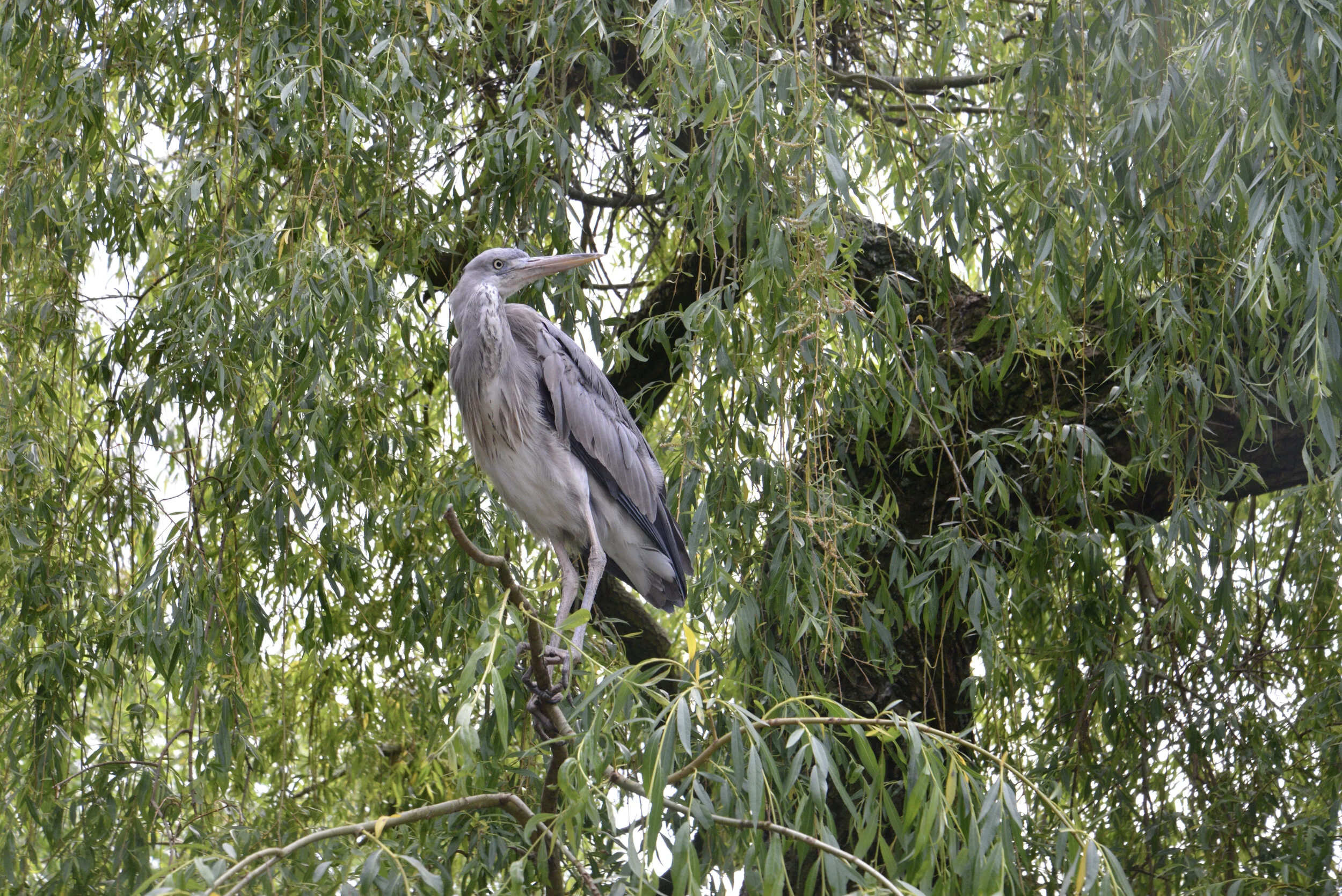
10 Myths & Facts about Great Blue Herons
It’s a common sight to see the “lucky” great blue heron patiently hunting on the shores of Hood Canal and South Puget Sound. Largest of the heron species, up to 4’ in height, they actually only weigh between 5-6 pounds. Here are a few things you may not have known about these iconic Northwest birds.
It’s a common sight to see the “lucky” great blue heron patiently hunting on the shores of Hood Canal and South Puget Sound. Largest of the heron species, up to 4’ in height, they actually only weigh between 5-6 pounds. Here are a few things you may not have known about these iconic Northwest birds.
MYTH
Great blue herons only eat fish.
Great blue herons dine mostly on fish but they will also stalk everything from insects to small mammals and even other birds. In Washington, mice and voles making up a major portion of their winter diet when they choose to hunt on land.
2. FACT
Herons spend about 90 percent of waking time stalking prey.
Great blue herons grab prey in their strong beaks or use their dagger-like bills to impale. This action is known simply as a ‘bill stab’. They shake the prey to break spines before gulping them down. Great blue herons can swallow fish that are much wider than their narrow neck and have even been know to catch small birds in flight. Patience and speed are the keys to their hunting success.
3. MYTH
Great Blue Herons are cranes.
A crane is totally different type of bird. You can tell them apart by looking at the beaks and the way they fly. Cranes have shorter beaks and hold their necks straight when in flight, whereas herons curve necks into an S-shape. Herons are able to do this because of specially shaped vertebra. Great blues also fly with their legs ‘hanging” which is unique from most birds.
4. FACT
Herons are often called “Dinosaur Birds.”
Fossil records date them back 1.8 million years ago, but they are thought to have existed about 25 million years ago during the Cenozoic age. Maybe it’s also because of the prehistoric sounds they make as they take off with the giant 6’ wingspan flapping!

5. MYTH
Great Blue Herons can’t swim.
The great blue does many things that other herons choose not to do, including swimming in deep water with apparent grace and comfort. A quick search on the internet will show multiple accredited images of herons happily swimming in deep water. It’s not a common occurrence though, so consider yourself lucky if you catch sight of this phenomena. Swimming is a testament to the great blue heron’s incredible adaptability.
6. FACT
Great blue herons have adapted “bib” feathers to keep them clean.
Specialized feathers on their chest grow continuously and fray into a fine cleaning powder. This powder is used to help groom their entire body and clean off fish slime.

7. MYTH
Great Blue Herons are monogamous.❤️
Not technically. Great blues are known to be ‘serial monogamous’ — they have one partner for a year but choose a different one each mating season. Despite being territorial with other herons, they typically breed in nesting colonies at the tops of trees containing up to 500 breeding pairs. These colonies are called “heronries.” They obviously do not have any social distancing issues. Great blue herons generally return to the same breeding grounds each year although with different partner choices.
8. FACT
Mates work to build the nest, as well as incubate and feed their young –together.
When the mating pair is chosen, the male gathers sticks while the female weaves them into a platform nest lined with moss, grass, and small branches. She lays 2-6 blue eggs, and both parents take turns incubating them for 4 weeks until the young hatch. They also take turns feeding regurgitated prey to the young chicks.
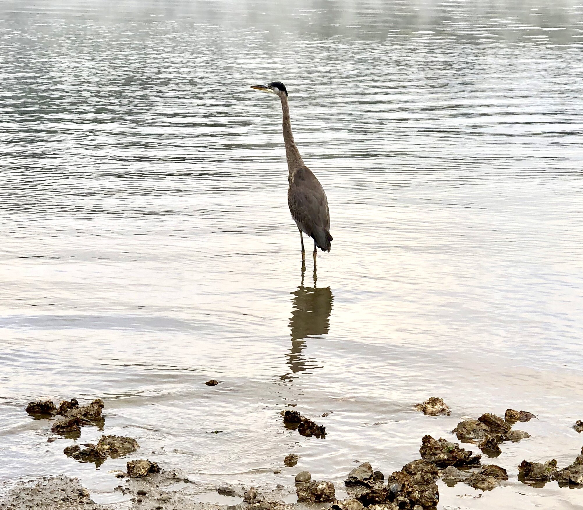
9. Myth
Heron chicks have yellow eyes when they are born.
Heron chicks have gray eyes when born that become bright yellow when they are adults. The parents continue feeding the nestlings for a few weeks after fledging (leaving) the nest. Young herons will fledge at around two months.
10. FACT
Great blue herons’ colors can demonstrate age, sex, and mating season.
Adult males are larger and generally have brighter orange legs than a female. During breeding season, the lore (the lore is the region between the eye and bill) will turn a bright blue, the iris will turn reddish, and the yellow bill will take on an orange hue.

A couple other things you didn’t need to know about great blue herons:
To keep cool they flutter their throat muscles to increase evaporation.
It can take up to two weeks to build a nest.
Life expectancy of a great blue heron is 15-23 years
Despite their size they can fly as fast as 30 MPH.
An adult heron consumes up to one pound of fish per day.
Learn more
The Cornell Lab - all about birds
Audubon - Great Blue Heron guide
Olympic Bird Trail - Top birding locations on Hood Canal, South Puget Sound, Pacific Coast, and Olympic Peninsula


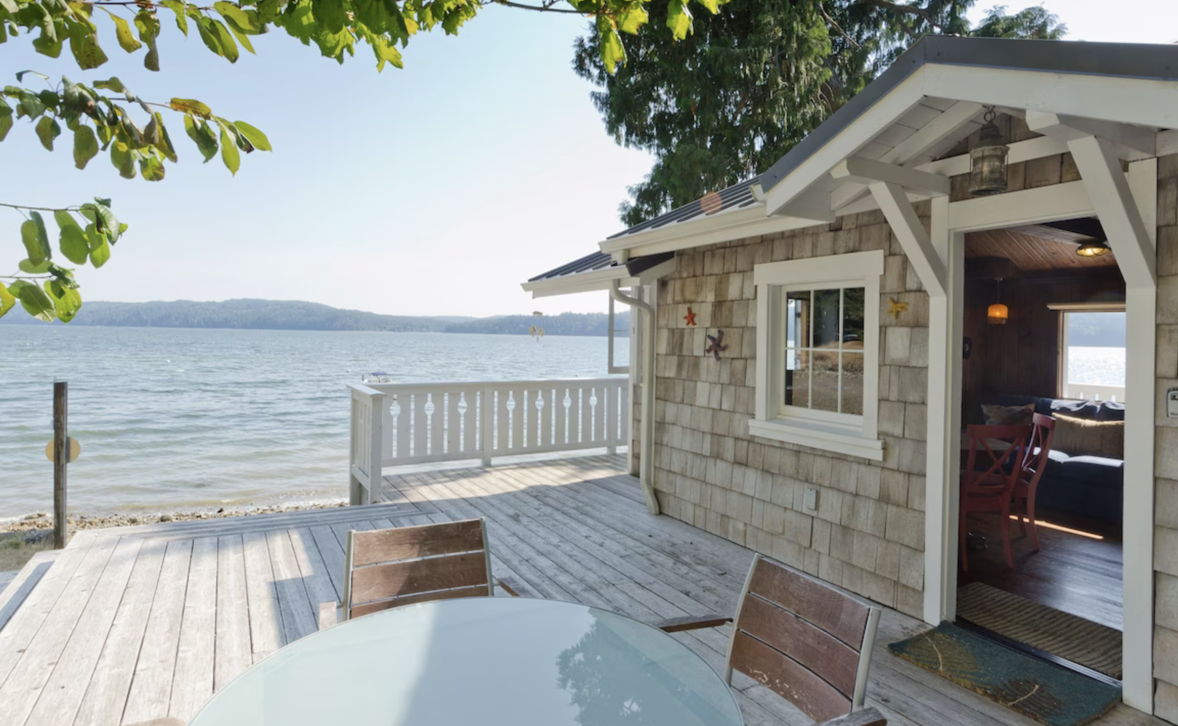


Dive into the Fjord
Just below the surface of the waters of the Hood Canal, a whole new world exists waiting to be explored. It is carpeted with sponges and seaweed, populated by wolf eels and octopus and visited by the occasional seal and even (rarely) a six-gilled shark.
Just below the surface of the waters of the Hood Canal, a whole new world exists waiting to be explored. It is carpeted with sponges and seaweed, populated by wolf eels and octopus and visited by the occasional seal and even (rarely) a six-gilled shark. The cold water of the Pacific is daunting, but the variety of marine life it holds is well worth the chilly SCUBA dive. With its comparably slower currents (to the rest of Puget Sound), the Hood Canal offers many opportunities for shore dives and boat dives of various experience levels. Winter to early spring offer clearer visibility as the cooler weather means less algae blooms. Check with local dive operators on current visibility.
Following is a list of the top dive sites of the Hood Canal as rated by Betty Pratt-Johnson’s 141 Dives in the Protected Waters of Washington and British Columbia (1977); Stephen Fischnaller’s Northwest Shore Dives (2000); as well as diver’s blog reviews, including Scott Boyd's Emerald Sea Scuba and Nicolle Prat's Pacific Northwest Scuba.
1. East of Hood Canal Bridge
This is a more intermediate shore dive requires you time the swim out to the dive area right before the beginning of slack tide, so that the current pulls you out to the bridge, then you can save your energy for the swim back. On your swim out to the bridge you pass through eelgrass beds, which are teeming with perch, soles, shiners and other sea creatures. When you reach the concrete bridge supports you are greeted by a fantastic display of plumose anemones and many different types of nudibranchs. Be careful of boat traffic and pace yourself for the long swim to and from the bridge.
2. Flag Pole Point
Outside of Lilliwaup, just to the South of Mike’s Beach Resort (360) 877-5324, is a dive site more comfortably accessed by boat (but you can free swim to it also). Called “the knuckle,” this dive site consists of a series of rock formations, rising like a mini range of mountains from the ocean floor. Since this formation is farther out and more exposed to currents, this site usually has excellent visibility and there are lots to see. Ling cod lay their eggs at this protected site, and there are resident wolf eel and octopus populations. Since the rise of “the knuckle” is so rapid, the site can be difficult to locate — visit Hood Sport ‘N Dive in Hoodsport, (360) 877-6818 for more information as well as air and lodging!

3. Potlatch Park
While the diving at Potlatch is less dramatic than those sites already described, if you are just getting your flippers wet, this is a great place to start out. This shore diving spot is easy to get to, has showers to wash off gear, and it is a great place to get comfortable with equipment and techniques.
4. Scenic Beach State Park
Like Potlatch, this site is accessible from the beach and rewarding for all experience levels. There is plenty of marine life to observe on this sandy-cobble beach, which shifts after 15 ft into a large eelgrass bed, likewise teaming with all the creatures that are heir to this environment.
5. Octopus Hole
Although parking is limited, this wall site is easy to access from shore and gratifying for all experience levels, but it is a popular spot! Bring a flashlight, there are plenty of friendly octopuses and wolf eels. This is a protected site, no harvesting or disturbing the inhabitants (and no taking of the glass bottles that octopuses like to hide in).
6. Sund Rock Marine Preserve
Easy beach access to this site is available through Hoodsport ’N Dive for $20 per diver. This is an iconic dive spot of the area. Hoodsport ’N Dive even offers classes at this site. From the beach you swim out through eelgrass environs filled with perch, crabs and other types of sea life. At Sund you are greeted by wolf eels, octopuses, sea stars, and giant cod. As a marine preserve, it too is closed to harvesting.
7. Twanoh State Park
This full service park has a gentle current, which gives divers the freedom to dive whenever— independent of slack tides. You will find a large eelgrass bed filled with fish, such as tube-snouts, black eye gobies and sticklebacks. After about 40' depth you can find tube-dwelling anemones. These anemones are entertaining to watch as they feed with their long graceful tentacles. Use a dive flag and submerge when you pass the roped swimming area.
For information on these and dives and more; or to book certification, classes,and a Hood Canal trip visit explorehoodcanal.com and check out the "Scuba" link.

A Guide to 25 Waterfalls from Canal to Coast and points between
Receiving hundreds of inches of rain annually, the Hoh, Quinault and Queets Rainforests are located on the coastal foothills of the Olympics, receiving 21+’ of snow and rain at its peaks! It’s no wonder there is a myriad of spectacular waterfalls lacing the area. Explore this sampling curated by celebrated guidebook author and avid hiker, Craig Romano. Some are small, secret, and unique, others are popular but magnificent. All are worth the journey!
When Craig Romano agreed to share with us a few of his favorite waterfalls in the Pacific Coastal region of Washington, we were frankly thrilled. If you’re looking for straight details on Northwest hikes and wilderness destinations — and fun facts - Craig is the guy to call.
Craig has written more than 20 hiking guidebooks including Day Hiking Olympic Peninsula 2nd Edition which includes details for popular and little known hikes across the Peninsula. An avid hiker, runner, paddler, and cyclist, Craig is currently working on Urban Trails Vancouver USA (2020); Backpacking Washington 2nd Edition (2021); and Day Hiking Central Cascades 2nd Edition (2022). He is also a featured columnist for the Fjord and Explore Hood Canal.

Enchanted Valley | Craig Romano photo
Why we are so keen about our falls?
As storms from the Pacific Ocean move across the peninsula, they crash into the Olympics and are forced to release moisture in the impact. Consequentially, the clouds release massive amounts of moisture (up to 170 inches annually) in the coastal side of the range – creating the “rain shadow effect.”
The massive rainfall has given life blood to the hanging mosses of the perpetually wet Northwest rainforests – Hoh and Quinault. On top the Olympic Mountains this moisture lands as snow frosting the peaks with as much as 35 feet each year.
Each spring the snow melts and creates icy run-off. Mix in a little more rainfall and the result is a spectacular waterfalls ring envelops the base of Olympic range.
Pacific coastal waterfalls are gorgeous year round but tend to be most spectacular in early spring or during the autumn rainy season.
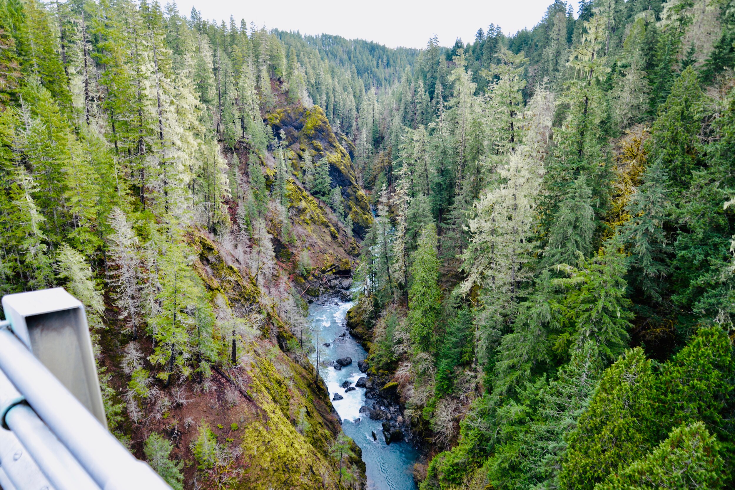
Let’s go Chasing Waterfalls
1. Tumwater Falls
Olympia Metro | Located minutes from Olympia, Tumwater Falls is an iconic landmark near the state capital. These thundering multi-tiered showy falls along the Deschutes River are located within a 15-acre park created on land donated by the Olympia Brewing Company. Meander along manicured paths and saunter over foot bridges and under historic road bridges taking in a little history along with the sensational scenery.
At the base of the upper falls admire a replica of the famous bridge that once appeared on the labels of Olympia beer spanning the river above the lower falls. Walk trails along the gorge between the falls and admire deep pools, eddies and jumbled boulders. Take time to read the informative panels on Tumwater—Washington’s oldest permanent non-Native settlement on Puget Sound. Let’s Go!
2. Kennedy Creek Falls
Kamilche, South of Shelton | From its origin at Summit Lake in the Black Hills, Kennedy Creek flows just shy of 10 miles to Oyster Bay tumbling over a two-tiered waterfall along the way. Reaching these pretty falls involves a half day hike on a closed-to-vehicles logging road through patches of cuts and mature standing timber. Start walking across a recent cut. In about a mile reach a grove of mature timber and the Kennedy Creek Salmon Trail which opens in the fall for salmon viewing and field trips. Keep walking on the main road avoiding diverting roads. The route leaves state land for private timberland and rolls along. Take in decent views of the surrounding foothills. At 2.8 miles (just before crossing a creek) follow an obvious but unmarked trail to the right. This path can be muddy and slick during periods of heavy rainfall. The trail descends to a grove of big cedars, firs and yews—and the falls. Here Kennedy Creek tumbles over an ancient basalt flow. The upper falls are small but quite pretty. The lower falls are difficult to see as they tumble into a narrow chasm of columnar basalt. Let’s Go!
3. Vincent Creek Falls
South Hood Canal, Skokomish Valley | While Vincent Creek Falls are quite stunning crashing 250 feet into the South Fork Skokomish River in a deep narrow canyon; the High Steel Bridge which allows for their viewing is even more spectacular. The 685-foot long bridge spans 375 feet above the canyon. Walk across the bridge but use caution along its north side where the guardrail is only 3 feet tall. The arched truss steel bridge was built in 1929 originally for a logging railroad. In 1950 it was converted for road use. It is the 14th highest bridge in the country. Your heart is sure to pound as you walk upon its airy span. Eventually Vincent Creek Falls comes into view. Through a series of falls, Vincent Creek drops 250 feet down a canyon wall into the roaring South Fork Skokomish River. Walk all the way across the bridge if you plan on capturing the falls in their entirety in a photo. Let’s Go!

Big Creek | Craig Romano Photo
4. Big Creek Cascades
Lake Cushman Area, Hood Canal | Amble on a circuitous route in the Big Creek drainage within the shadows of Mount Ellinor; and delight in a series of small tumbling cascades. This wonderful loop utilizes old logging roads, new trails and a series of beautifully built bridges. It was constructed by an all-volunteer crew that continues to improve and maintain this excellent family and dog-friendly loop. Starting from the Big Creek Campground, follow the Upper Big Creek Loop Trail to Big Creek and the first of several sturdy bridges along the way. After a short climb you’ll reach the Creek Confluence Trail which drops to the confluence of the tumbling Big and North Branch Creeks. The main loop continues to cross North Branch Creek on a good bridge. Just beyond it crosses Big Creek on a new bridge above a gorgeous cascade. The loop then descends skirting big boulders and passing good views of roaring Big Creek. It crosses a couple more cascading creeks before traversing attractive forest and returning to the campground. Let’s Go!
5. Staircase Rapids
Lake Cushman Area, Hood Canal — Currently Closed until mid-September
This loop involves a section of an historic route across the Olympic Mountains to a suspension bridge spanning the North Fork Skokomish River near a series of thundering rapids. Cross the North Fork Skokomish on a solid bridge and follow a trail that was once part of the original O’Neil Mule Trail. In 1890 Lieutenant Joseph O’Neil accompanied by a group of scientists led an Army expedition across the Olympic Peninsula. Among his party’s many findings was a realization that this wild area deserved to be protected as a national park. March up alongside the roiling river, passing big boulders and a series of roaring rapids. The rapids’ name come from a cedar staircase O’Neil built over a rocky bluff to get past them. Follow the bellowing river from one mesmerizing spot to another before reaching a sturdy suspension bridge spanning the wild waterway. Cross the river and complete this delightful loop by now heading downriver following the North Fork Skokomish River Trail back to the Ranger Station. Let’s Go!
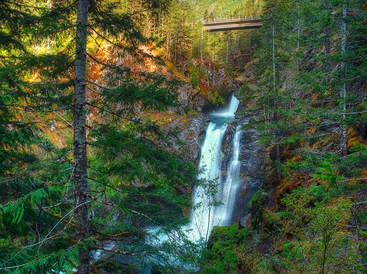
Hamma Hamma | George Stenberg photo
6. Hamma Hamma Falls
Hamma Hamma River Valley, Hood Canal | Talk about a bridge over troubled waters. From the Mildred Lakes Trailhead walk across the high concrete bridge at the road’s end. You no doubt heard the roar of the falls when you drove across it. Now peer over the bridge and witness the cataracts responsible for the racket.
Directly below, the Hamma Hamma River careens through a tight rocky chasm. These impressive falls are two-tiered crashing more than 80 vertical feet. The road spans directly above the upper and smaller of the falls. The overhead view is pretty decent, but the lower and larger falls are more difficult to fully see. A very rudimentary path leads along cliff edges for better viewing, but it’s slick, exposed and treacherous.It’s best to experience the falls from the safety of the bridge. During periods of high water flow you’ll get the added bonus of feeling the falls too thanks to a rising mist. On the drive back look for a couple of pull-offs providing views of secondary falls along the Hamma Hamma, Let’s Go!
7. Murhut Falls
Duckabush River Valley, Hood Canal | Hidden in a lush narrow ravine and once accessed by a treacherous path, Murhut Falls were long unknown to many in the outside world. But now a well-built trail allows hikers of all ages and abilities to admire this beautiful 130-foot two-tiered waterfall. The trail starts by following an old well-graded logging road. It was past logging in this area that led to the discovery of these falls. The old road ends after a short climb of about 250 feet to a low ridge. The trail then continues on a good single track slightly descending into a damp, dark, cedar-lined ravine. As you work your way toward the falls, its roar will signal you’re getting closer. Reach the trail’s end and behold the impressive falls crashing before you. The upper falls drops more than 100 feet while the lower one crashes about 30 feet. Blossoming Pacific rhododendrons lining the trail in May and June make the hike even more delightful. Let’s Go!
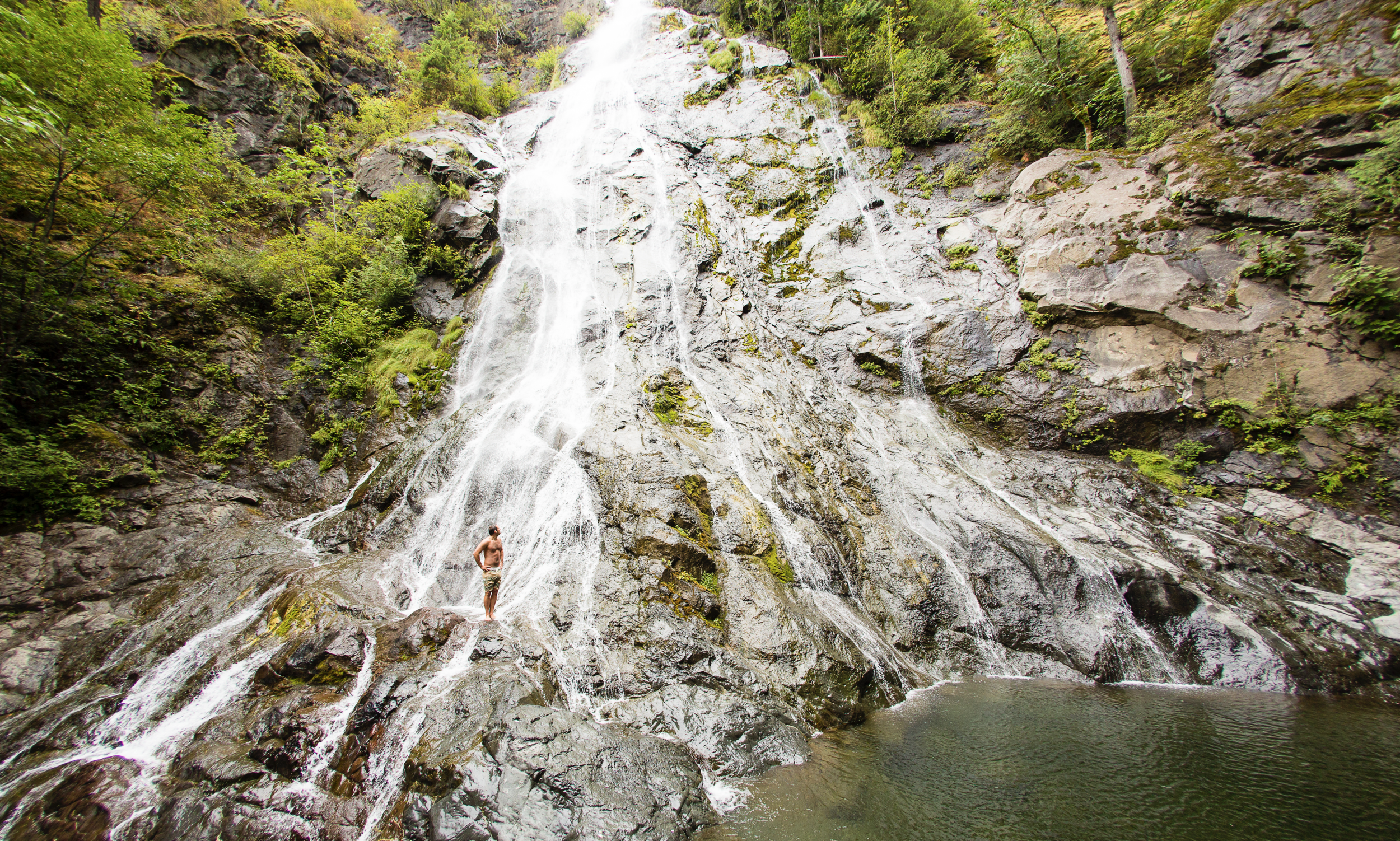
Rocky Brook Falls
8. Rocky Brook Falls
Dosewallips River Valley, Hood Canal | One of the tallest waterfalls on the Peninsula, Rocky Brook Falls is also among the prettiest. Follow the trail past a small hydroelectric generating building and come to the base of the stunning towering falls fanning over ledges into a large splash pool surrounded by boulders. This classic horsetail waterfall crashes more than 200 feet from a small hanging valley above. While a penstock diverts water from the brook for electricity production, the flow over the falls is almost always pretty strong. Like all waterfalls, these too are especially impressive during periods of heavy rainfall. On warm summer days the falls become a popular destination for folks seeking some heat relief. And while many waterways east of the Mississippi River are called brooks, creek is the preferred name in the west. There are only a few waterways on the Peninsula called brooks, and they were more than likely named by someone who hailed from back east. Let’s Go!
9. Dosewallips Falls
Dosewallips River Valley, Hood Canal | This spectacular waterfall used to be easily reached by vehicle. But the upper Dosewallips Road has been closed to vehicles since 2002 after winter storms created a huge washout that has yet to be repaired. Now to reach this waterfall you must hike or mountain bike the closed road. Walk past the road barrier and immediately come to the washout and a bypass trail. Steeply climb on the riverbank above the slide. Then descend back to the road and walk along the churning river. The road then pulls away from the river, passes a campground and climbs. The river now far below in a canyon is out of sight, but not out of sound. Pass beneath ledges and cross cascading Bull Elk Creek on a bridge. At 3.9 miles in a recent burn zone enter Olympic National Park. Cross tumbling Constance Creek on a bridge and continue climbing passing a big overhanging boulder. Then descend and skirt beneath a big ledge coming to the base of dramatic 100-foot plus Dosewallips Falls. Admire the raging cascade’s hydrological force—it’s mesmerizing. Let’s Go!
10. Fallsview Falls
Big Quilcene River Valley | As far as cascades go, Fallsview Falls lacks the “Wow factor.” However the canyon these falls tumble into is pretty impressive. And if you plan your visit for late spring, blossoming rhododendrons line the trail and frame the view with brilliant pinks and purples. The trail to the falls is short, easy and ADA accessible. Follow the 0.2 mile loop to a fenced promontory above a tight canyon embracing the Big Quilcene River. Gaze straight down to the roiling river. Then cast your glance directly across the canyon to an unnamed creek cascading 100 feet into it. By late summer it just trickles—but during the rainy season the falls put on a little show. If you want to stretch your legs some more afterward, you can follow a trail into the little canyon and hike along the frothing river. Let’s Go!

And 15 more…
For a day trip, weekend, or a month-long adventure – the Olympic Peninsula is a fantastic place to get away and enjoy nature – and waterfalls! It’s not just 1000’s of waterfalls, there are countless lakes, rivers, streams and trails to suit every ability level. Embraced by the Pacific Ocean on the west, the Strait of Juan de Fuca on the north, and the Hood Canal on the east, it is famed for being home to Olympic National Park, more than 600 miles of hiking trails and 73 miles of pristine ocean wilderness beaches.
The Olympic Peninsula hosts activities for families and outdoor enthusiasts alike, attracting visitors from near and far. Start planning your next adventure!
Click here for a complete list of all 25 waterfalls on the Olympic Peninsula curated by Craig!

Fresh Shellfish from the Source
Want to visit the farmers that wake up on the night tides to bring you the perfect oyster, clam or geoduck? Check out these farms on and around Hood Canal!
You’ve heard it before – those dang months with the “r.” Well, technically local oyster farmers don’t agree, bivalves have a much longer season, Some of the best shucks are in May – but there is something to be said for a fall or spring oyster over a “peak of the summer” one. That’s why fall IS the perfect time to follow the shellfish trail and visit local farms that grow the food you love. Let’s meet a few local growers that wake up on the night tides to deliver you the perfect oyster, clam or geoduck.
In Search of Perfection
Want to meet the farmers that wake up on the night tides to bring you the perfect oyster, clam or geoduck? Check out these farms on and around Hood Canal!
Capital Oysters & Seattle Shellfish
South Puget Sound | capitaloyster.com
5th generation oyster farmer, Tom Bloomfield, tide tumbles Capital oysters that are suspended off the ground. The growing process results in a smooth, super deep shell as each oyster captures the essence of the beautiful ocean waters, free of sand and zero muddy tastes.

Chelsea Farms & Olympia Oyster Bar
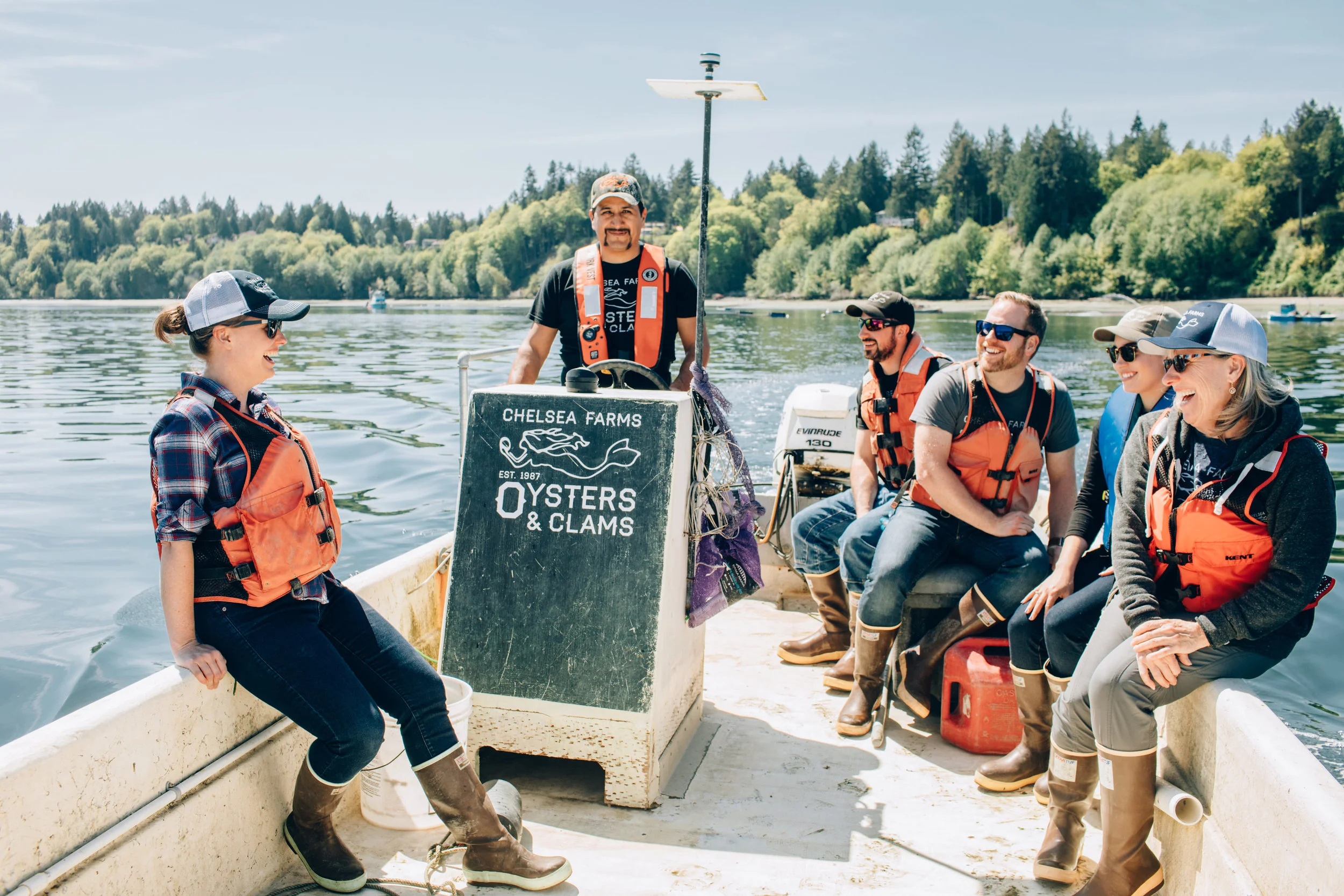
Chelsea Farms | photo:poppi photography
Eld & Totten Inlet
Chelsea Farms is a current working model of environmental sustainability. They have made a priority of farming the Olympia Oyster, a native oyster to Olympia, that was on it’s way to extinction. Specialties include their Chelsea Gem, Bonita, and Olympia Oysters, along with fresh clams and geoduck. Visit their Oyster bar in downtown Olympia to get the ultimate local seafood experience!
Let’s Go:
CHELSEA FARMS OYSTER BAR
222 CAPITOL WAY N, OLYMPIA, WA 98501
Phone: (360) 915-7784
Hours: TUES-FRI 11AM-9PM, SAT 10AM - 10PM | SUN 10AM - 9PM
menu
The Fjord Oyster Bank
Sea Nymph Oysters
Hoodsport & Hammersley | southsoundoysters.com
24341 N Hwy 101 Hoodsport | (360) 877-2102
For the last decade and a half the Hansen family has been raising oysters and clams on South Puget Sound's nutrient rich waterway, Hammersley Inlet. Through a tumble bag and a bag to beach process these oysters have distinct merrior as well as shape profiles resulting from their growth process despite being in the geographic. The tumble bag Hemingways have a sweet cucumber finish while the beach finished Sea Nymphs have a kelpy taste. Hemingway Sweets roll in deeper water and have a deep cup, sweet flavor and a full-body crunch. Hemingways (coined from Ernest Heminway's famous oyster quote) as well as Sea Nymphs, are available for raw and grilled preparation at their Hoodsport café and Oyster Bar, Fjord Oyster Bank.
Let’s Go:
Fjord Oyster Bank Oyster Bar
24341 N Hwy 101, Hoodsport
Phone: (360) 877-2102
Hours: THUR-SAT 8AM-7PM, SUN 8AM - 6PM | Closed MON-WED
menu
Hama Hama Oyster Farm

Lilliwaup, Hood Canal
A few years ago the Hama Hama Oyster Co opened their Oyster Saloon in Liliwaup. This high energy destination serves oysters pulled from the last tide and prepared to order with an ever changing menu of seasonal local ingredients. In their retail shop you can purchase a variety of their Hood Canal product including salmon and oysters smoked on site. Hama Hama is a 5th generation family run farm with a reputation for quality and environmental mindfulness.
Let’s Go:
HAMA HAMA OYSTER CO
35846 US-101, Lilliwaup, WA 98555
PHONE: (360) 877-5811
FALL Hours: Farm Store Daily 9:30 to 5:30
Oyster Saloon Check website for details
Shellfish is available in their retail store, Saloon and at parent restaurants throughout the Northwest. Product also available online and shipped directly to your home.
Olympic Oyster Co. & Mike’s Beach Resort

Eldon, Hood Canal
Third-generation farmers, Matthew and Sara are serious about producing some award winning oysters on site for market and available at restaurants as far away as New York. Guests staying on the active farm aka Mike’s Beach Resort have first dibs on some of the freshest oysters on the fjord!
Let’s Go:
Mike’s Beach Resort
38470 N US Highway 101, Lilliwaup, WA 98555
Phone (360) 877-5324
Waterfront cabins and rooms, with view of the canal.
Taylor Shellfish
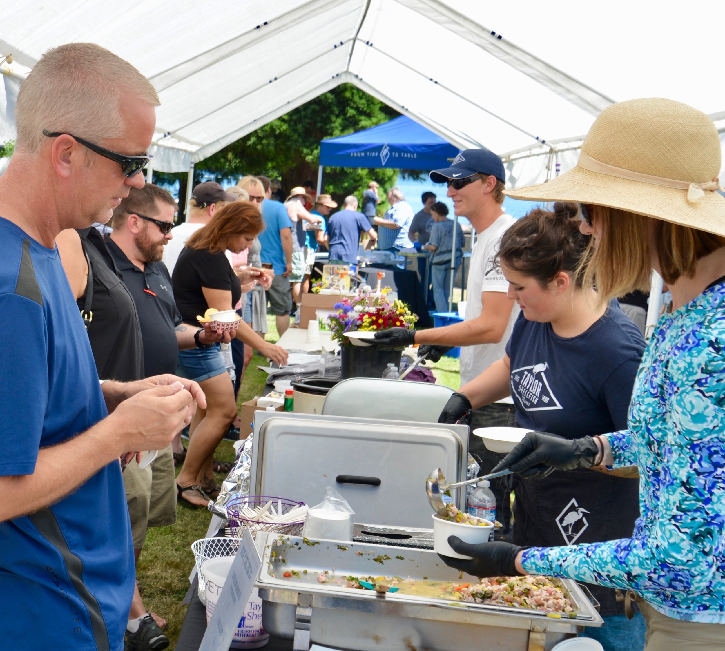
South Puget Sound and British Columbia
Stop in at Taylor Shellfish’s headquarters and visit their market near Shelton. Taylor’s specialties include the famed Kumamoto (sweet fruity flavor) and the Virginica (Crisp, briny, and buttery). The company has been farming oysters on Puget Sound since the 1890’s when great-grandfather Justin Taylor began farming Olympias. Five generations later, the company’s product line includes worldwide export of geoduck, clams, and mussels along with oysters.
Let’s Go:
TAYLOR SHELLFISH RETAIL STORE
130 SE Lynch RD Shelton WA, 98584
PHONE: (360) 432-3300
Hours: Open for curbside pick up Monday - Sunday: 10am - 6:00pm; Closed all major holidays
Shellfish is also available at one of their many locations throughout NW Washington. Product also available online and shipped directly to your home.
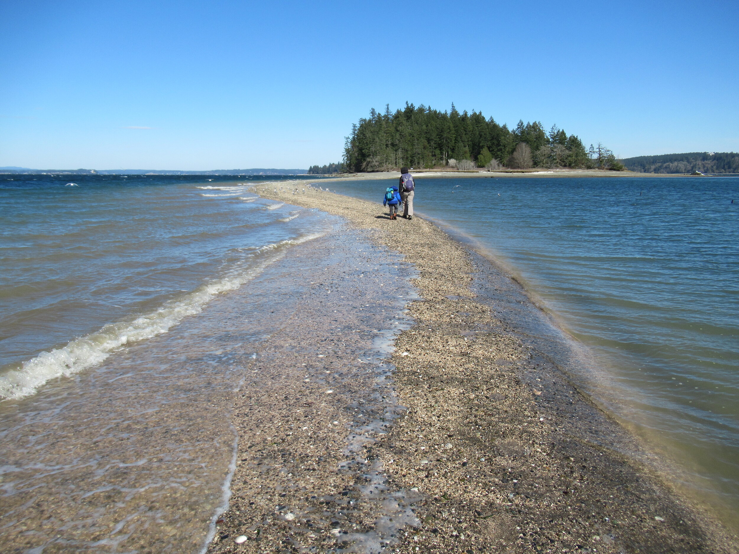
Crossing the Bar - McMicken Island
There are no bridges or causeways to little McMicken Island in Case Inlet. No ferry service either. But you don’t need a kayak or boat to visit. You can easily hike to this island which lies about 0.2 mile off of the eastern shore of Harstine Island. It’s all in the timing.
Craig Romano | Story & images
There are no bridges or causeways to little McMicken Island in Case Inlet. No ferry service either. But you don’t need a kayak or boat to visit. You can easily hike to this island which lies about 0.2 mile off of the eastern shore of Harstine Island. It’s all in the timing.

When the tide is low, a tombolo (a sandbar connecting the island to the mainland—or in this case another island) is exposed allowing you dry foot access to the island. You then can hike the island’s small half mile trail, picnic in its small meadow, or explore big barnacle-encrusted rocks in its intertidal zone. Just mind the incoming tide lest you make a big splash on your island exodus.
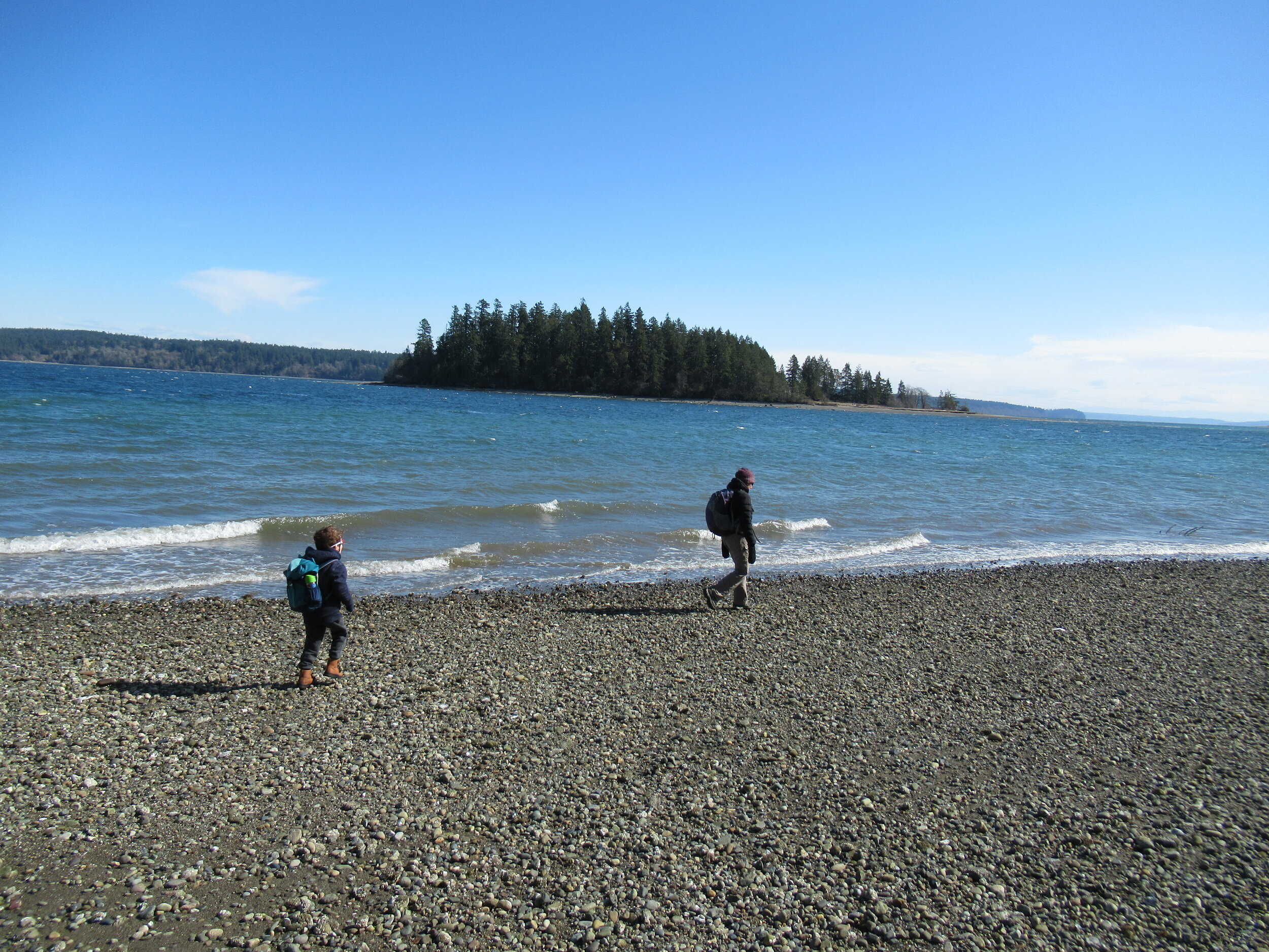
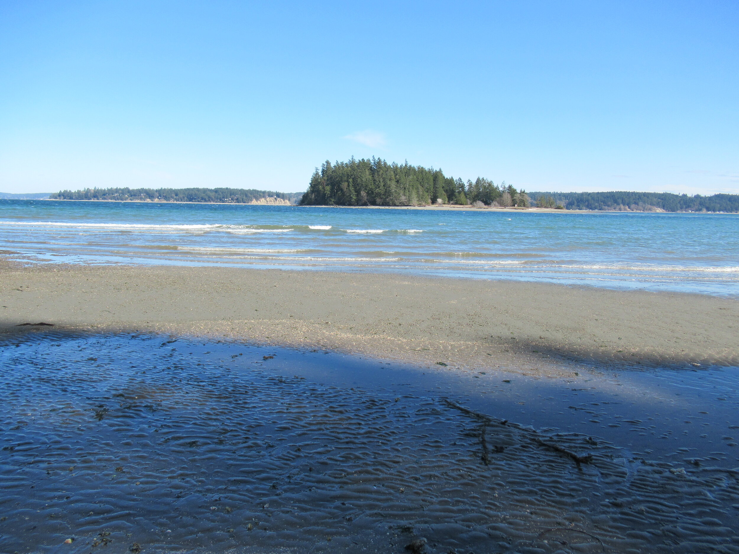
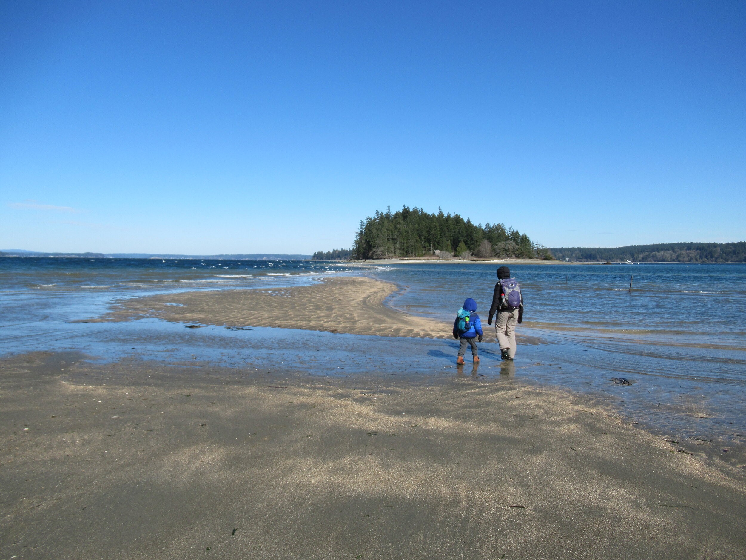
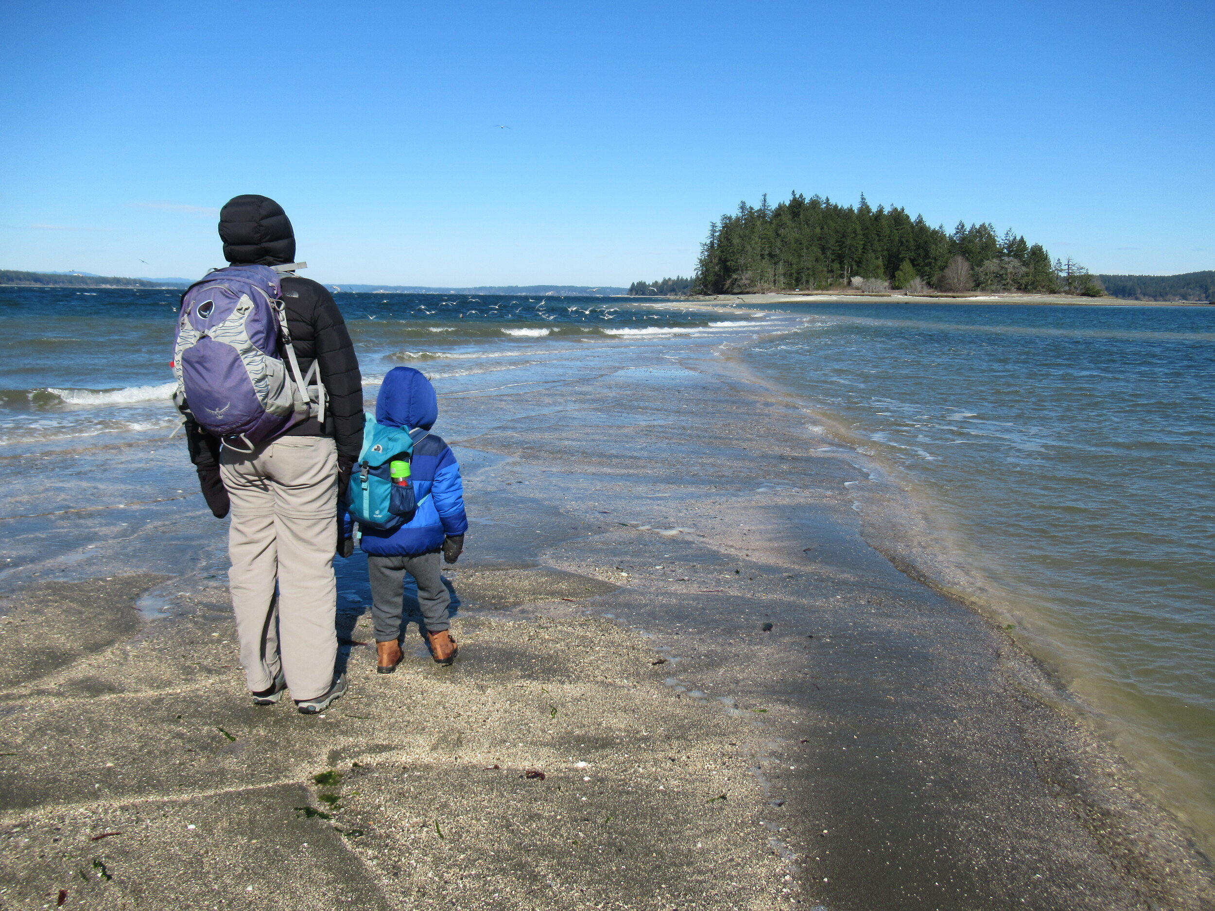
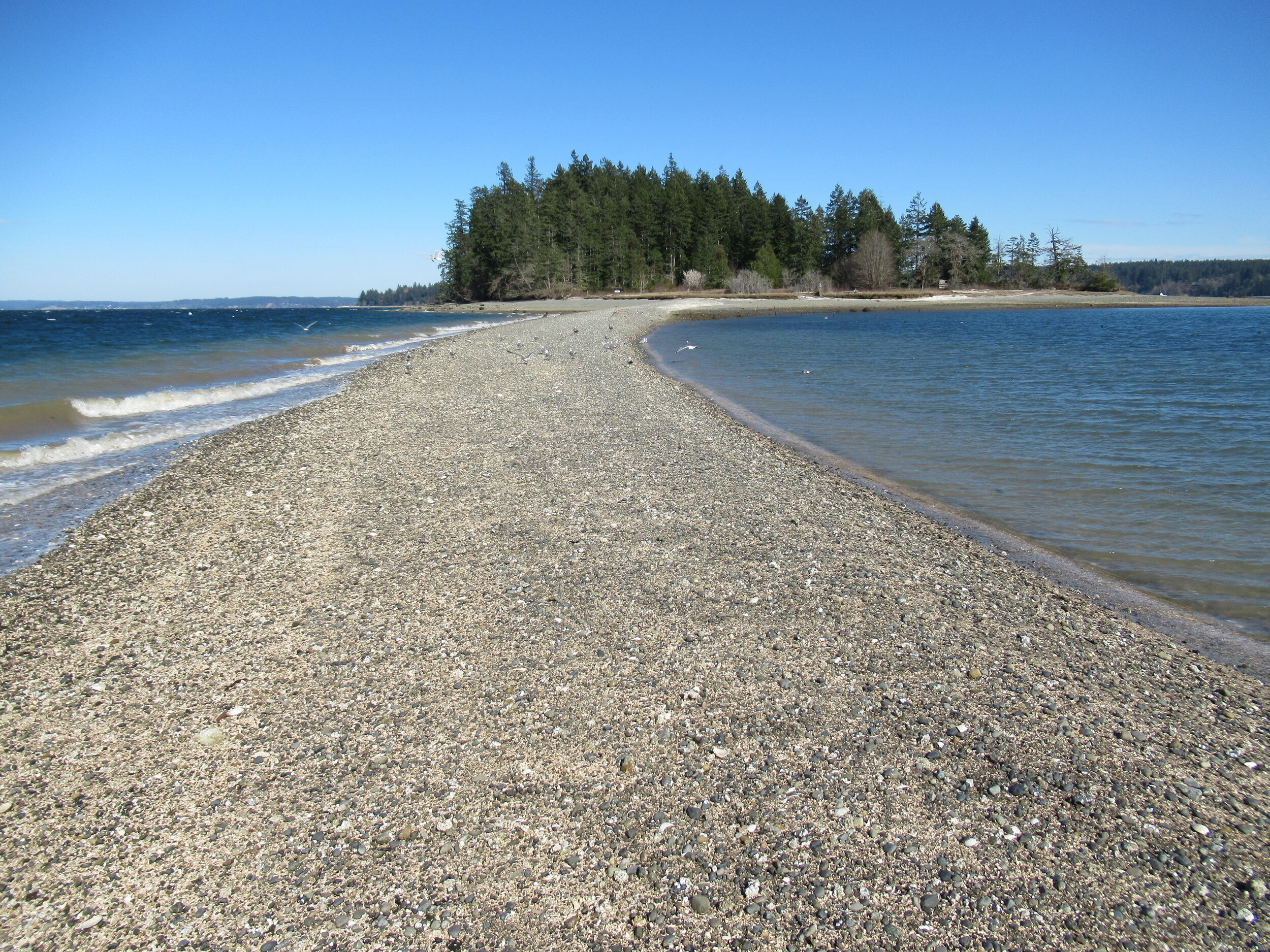
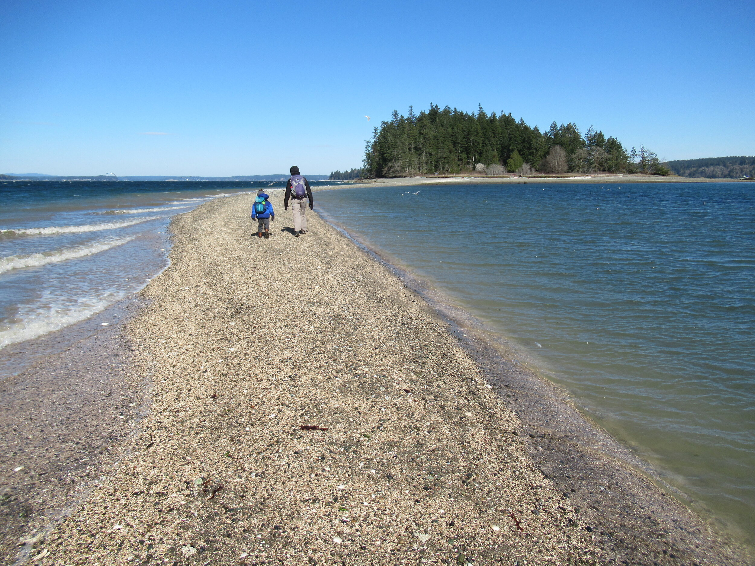

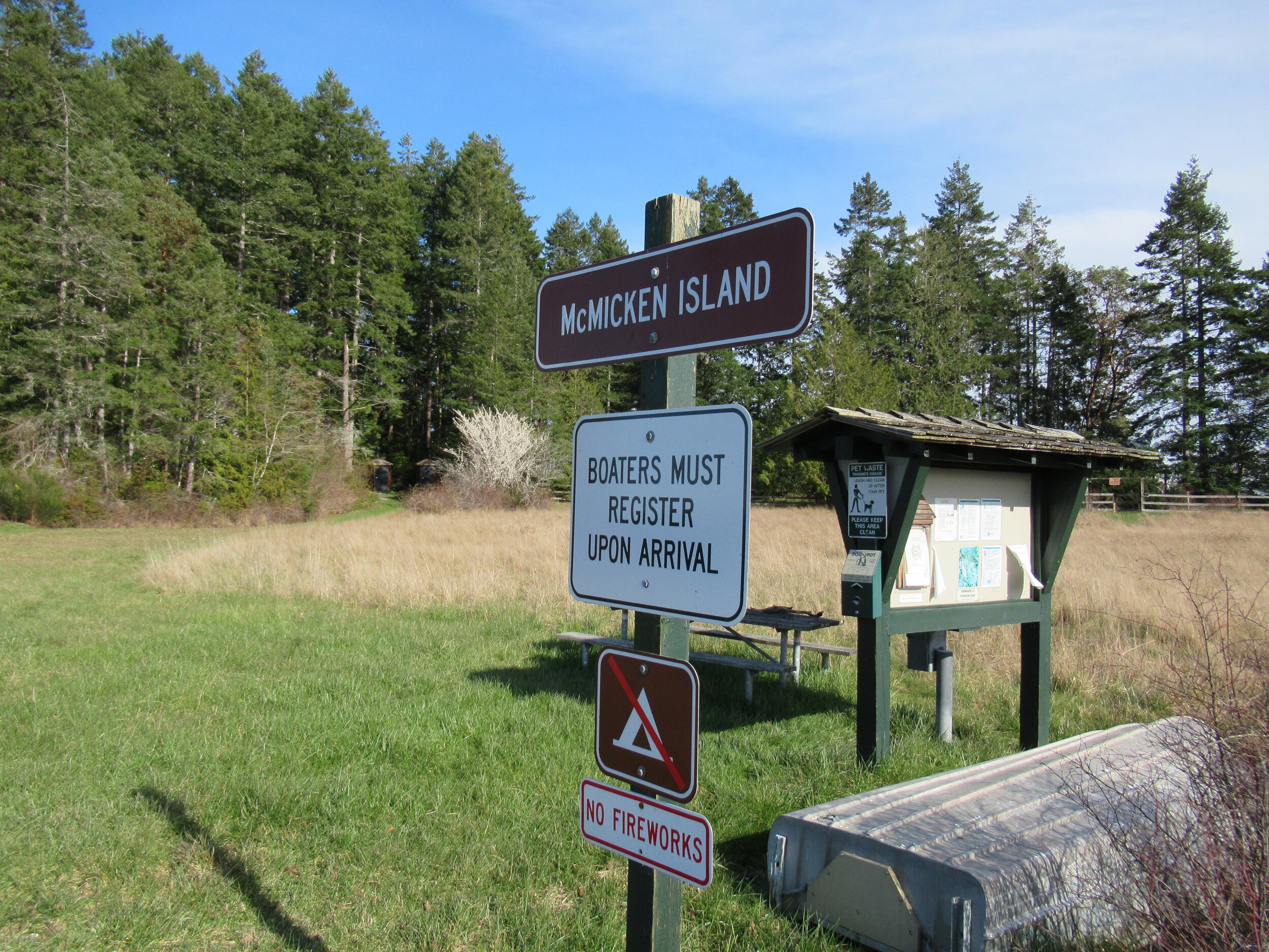

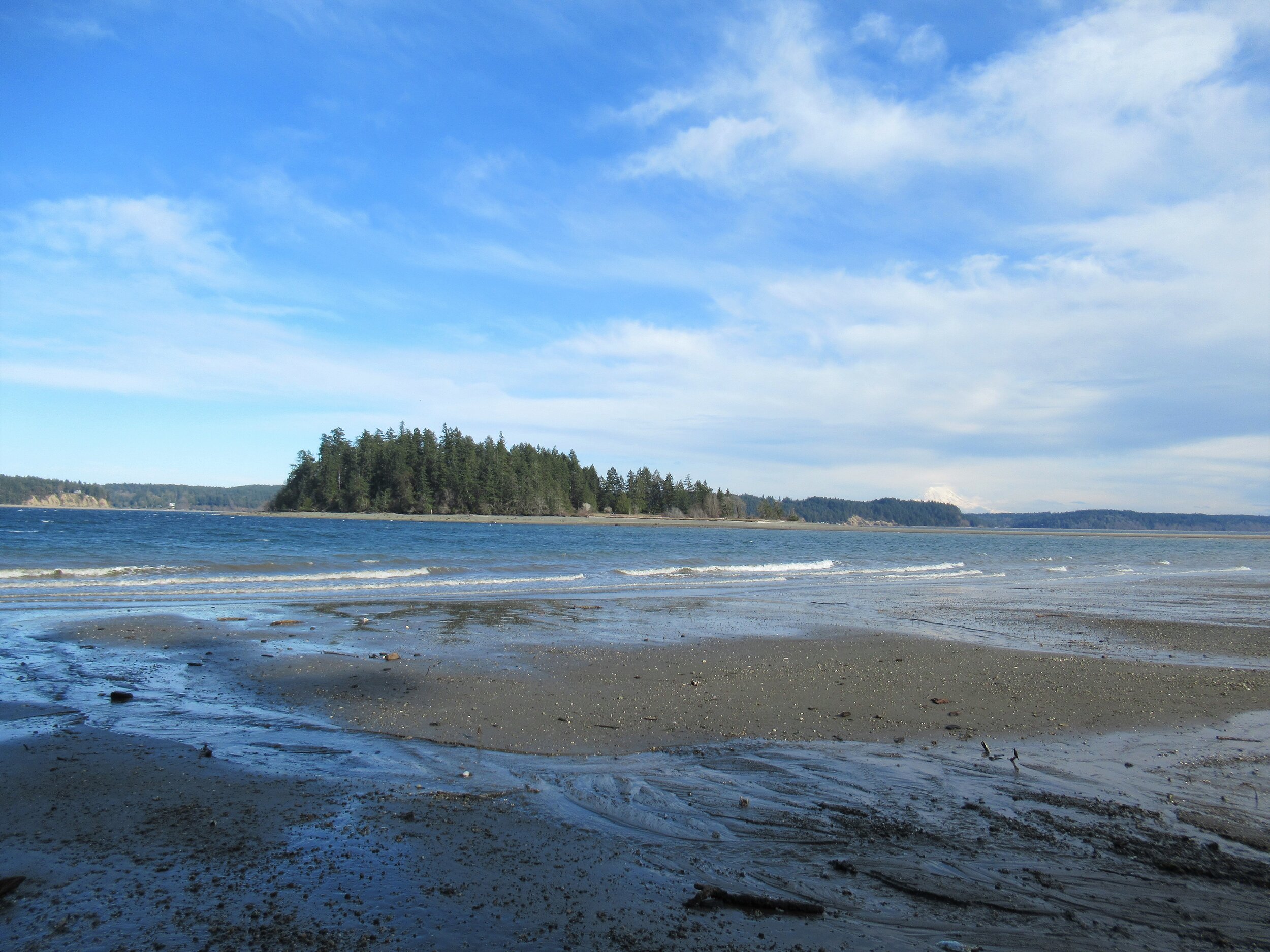
Hit the Trail
The hike to little 11.5 acre McMicken Island begins from the 300-acre Harstine Island State Park. A former Washington DNR property, most of the old timber was logged off, but small groves of old-growth remains on the property.
You want to head to the park’s beach reachable by the two trails taking off south from the parking lot. Take the one on the eastern end of the lot (away from the kiosk) for the more direct route.
The trail heads towards Case Inlet soon reaching the edge of a 100 foot high forested bluff. Continue along the bluff taking in glimpses of the remote beach below. The way then descends into a cool and dark ravine graced with big cedars and firs and reaches a junction.
The trail to the right loops back to the other main trail leaving the parking lot. Consider taking it upon your return from McMicken Island.
Head left through a row of big cedars and via a series of steps descend deeper into the ravine. After crossing a little creek the way emerges on a deserted beach. Look directly across Case Inlet to Herron Island and the Key Peninsula. Then look south and spot McMicken Island set against a backdrop of big beautiful Mount Rainier. If the tide is high, you’ll have to wait to hike the beach as overhanging trees prohibit passage. But in a low tide, a big wide easy to walk beach awaits your footprints.
Walk for more than a mile undulating between cobbles, mud and sand. Watch for sand dollars scatted across the tide flats. Look too for eagles, herons and a myriad of seabirds. Harstine is a wet place and plenty of side creeks fan out on the beach. You should be able to keep your shoes dry, but a pair of waterproof boots is not a bad idea. The entire way to the tombolo is on public tidelands. But there is a parcel of private property located between two large state park properties abutting the shoreline. Respect posted private property.
The tombolo is pretty distinctive in low tides—fairly wide and several feet raised above inlet waters. In high tides it’s completely submerged, although breakers will help you locate its position. It’s really fun to hike it when a receding tide first reveals it. Tap your inner Moses and part the seas watching the land bridge emerge as you amble along it.
Reaching the island
Once across the .2 mile sandy strip, reach McMicken Island. All of the little island except for a small fenced parcel with a couple of cabins is state park property. The private holding belongs to the family that once owned the entire island. They sold the island to the state withholding this small lot. Please keep out of it. The rest of the island however you are free to explore.
At the island’s western end is a small picnic area in a grassy opening. Here find some rare Garry oaks growing on a low bluff above the surf. Near a composting toilet at the eastern edge of the field is a small nature trail. Hike it! It weaves a half mile through towering firs and madronas to blufftop views on the eastern end of the island.
Be sure to explore the rocky tide flats surrounding the island too, and check out the large erratics scattered about. There is a particularly large one on the south side of the island. Enjoy your island wanderings and explorations—more than likely sharing it with no more than just a couple of other happy hikers. And be sure to keep track of the time and incoming tide so you don’t get trapped on the island.

Places to Stay
Waterfront cabin located on Harstine Is with beach access and a panoramic view of the Puget Sound, Mt. Rainier and McMicken island. Check availability
Hike back to Harstine Island State Park and call it a day or consider walking some more. The park contains three miles of trails. They traverse thick fir forests and swampy cedar groves and are family and dog-friendly.
McMicken Island Notes:

Forest Setting with Beach Access
Cross the bridge to Harstine Is. and enjoy a beautiful and quiet retreat in the woods. Relax in the comfortably furnished cabin or enjoy exploring the 5 acre property with meandering trails through a lovely forest. Check availability
Distance: 4.0 miles round trip
Difficulty: easy, pay attention to tides! Hike is only possible in low tides. Consult tide tables and plan accordingly. Dogs permitted on leash.
Trailhead Pass Needed: Discover Pass
GPS Waypoints: Harstine Island State Park Trailhead: N47 15.737 W122 52.236 McMicken Island Trailhead: N47 14.865 W122 51.780
Features: Kid and dog friendly, beach hiking, undeveloped coastline, small island reached via a sandbar, good bird watching, sublime views of Mount Rainier over Case Inlet.
Trailhead directions: From Olympia, head north on US 101 to Olympic Highway (SR 3) Exit in Shelton. Then turn and follow SR 3 east for 11.0 miles. Turn right onto Pickering Road (Signed for Harstine Island) and drive 3.3 miles. Then bear left onto Harstine Bridge Road and come to a T-junction upon entering Harstine Island. Go left on North Island Drive and after 3.0 miles turn right at the island community hall onto East Harstine Island Road. Proceed for one mile and turn left onto Yates Road. Continue 0.9 mile and turn right into Harstine Island State Park. Reach trailhead parking in 0.2 mile.
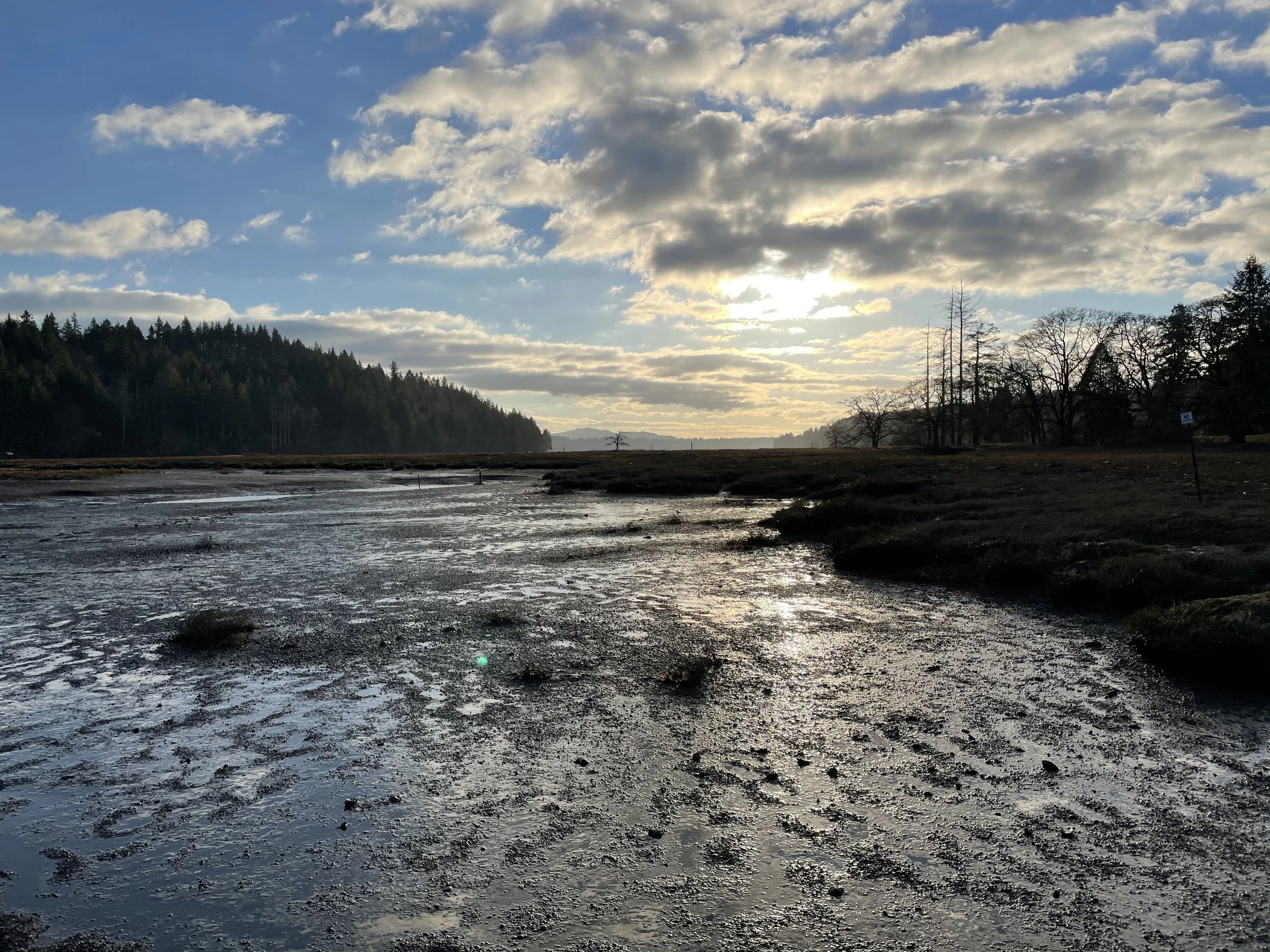
Exploring Bayshore Preserve Near Shelton
Occupying a peninsula on Oakland Bay at the mouth of Johns Creek, Bayshore Preserve provides exceptional wildlife habitat and several short delightful hiking trails. Once a golf course, this 74-acre parcel has been restored to a natural state on par with the state’s finest natural shoreline preserves.
Craig Romano
Occupying a peninsula on Oakland Bay at the mouth of Johns Creek, Bayshore Preserve provides exceptional wildlife habitat and several short delightful hiking trails. Once a golf course that heavily drew water from the salmon-spawning Johns and leached pesticides and fertilizers into the important shellfish rearing bay; now thanks to the Capitol Land Trust, Squaxin Island Tribe and a handful of other partners, this 74-acre parcel has been restored to a natural state on par with the state’s finest natural shoreline preserves.

Hit the Trail
From the trailhead immediately come to a kiosk with a map displaying the preserve’s interconnected short trails. There are about 1.5 miles of marked well developed paths traversing the property and they can easily be covered shortly in a brisk walk. However, Bayshore, with its salmon-spawning creek, salt marshes and mud flats, bird-flourishing prairie, and more than 4,000 feet of shoreline, calls out to be sauntered.
A quick inspection of the landscape before you reveals a land in flux. One that not too long ago sported well-manicured greenways fed by an irrigation system, a clubhouse and other structures, and a series of service roads. Those roads have since been converted into trails. The buildings have been removed, but a few vestiges of the irrigation system that is slowly being dismantled remain. And the greenways have been restored to native prairie grasses that wave golden in late summer.
Now sans golf clubs, putt along Bayshore’s trails watching for birds instead of scoring birdies. The Bayshore Peninsula located along the narrowest stretch of the slender and shallow Oakland Bay is far more important as wildlife habitat than as an altered manicured landscape for golfing.

The peninsula too is a special place to the Squaxin Island Tribe. It once housed one of their villages and according to several elders and historians, one of the largest longhouses on Puget Sound.
In 2014 the Capitol Land Trust purchased the Bayshore Golf Course and commenced with the Squaxin Island Tribe and other partners to restore this property to a natural state.

Restoring the peninsula was another albeit very important stage in the greater effort currently being employed to protect Oakland Bay—one of the least developed inlets and most important shellfisheries on Puget Sound. Oakland Bay’s preservation is not only important for wildlife, but also for sustaining the area’s fisheries and shellfish beds.
The Main Loop Trail travels triangularly through the property for 0.8 mile. It utilizes some of the old golf course’s service roads. Walk the path through native grasses and along colonnades of gigantic old Douglas firs and Garry (Oregon White) Oaks. The latter, the only native oak to Washington State once flourished in the area’s prairies. Washington’s First Peoples regularly set those prairies on fire to stimulate camas growth and favor other plants like oaks that thrive in savannas and other grassy environments. But as those prairies no longer saw regular burns, were overtaken by developments and invasive and hardier plants, the state’s Garry Oaks have become increasingly rare. These elegant hardwoods provide forage for a myriad of species. Bayshore contains some exceptionally large ones.

As you walk the loop be sure to deviate from it onto numerous spur trails. The 0.2 mile Lookout Trail crosses Johns Creek on a sturdy bridge and proceeds through a nice forest grove before skirting a prairie and ending along the creek bank. It’s an excellent trail to check out in November for its chum run.
The Johns Creek Trail is another fine choice for salmon watching. This path meanders along the edge of a riparian forest for .25 mile to link back up with the main loop.
The Johns Creek Estuary Trail leads a short distance to extensive tidal flats at a small estuary where Johns Creek flows into Oakland Bay. The trail leads to a fishing point on public tidelands.
Bayshore Preserve

Features: exceptional wildlife habitat on Oakland Bay, restored prairie, tall old Garry oaks and Douglas firs,
tidal mud flats, salmon-spawning creek and estuary.
Distance: 1.5 miles of trails
Elevation Gain: minimal; High Point: 40 feet
Difficulty: easy Snow free: year round
Trailhead Pass Needed: None
Notes: Dogs permitted on leash. Please stay on trails and respect all closed areas. Open from dawn to dusk. No removal of plants or fungi from the preserve.
GPS waypoints: Trailhead: N47 14.939 W123 02.655
Fishing Point: N47 14.707 W123 02.513
Contact: Capitol Land Trust, (360) 943-3012
Trail Map and Interpretive Guide available online

Trailhead: From Shelton, travel east on SR 3 for 3.8 miles to trailhead located on your right (directly across road from Bayshore General Store). Parking limited. More parking in adjacent WA Department of Fish and Wildlife’s Oakland Bay Recreational Area (Discover Pass required).
Traditional Mexican along with views of the Hood Canal