
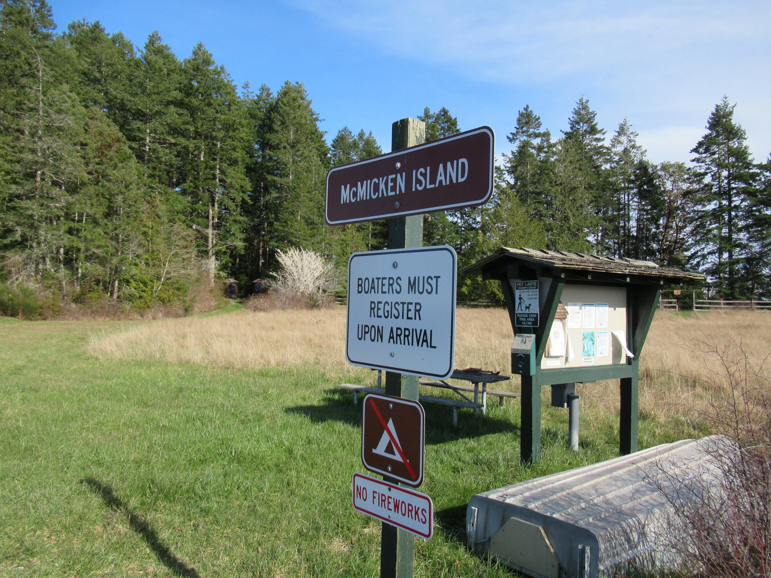
Crossing the Bar - McMicken Island
There are no bridges or causeways to little McMicken Island in Case Inlet. No ferry service either. But you don’t need a kayak or boat to visit. You can easily hike to this island which lies about 0.2 mile off of the eastern shore of Harstine Island. It’s all in the timing.
Craig Romano | Story & images
There are no bridges or causeways to little McMicken Island in Case Inlet. No ferry service either. But you don’t need a kayak or boat to visit. You can easily hike to this island which lies about 0.2 mile off of the eastern shore of Harstine Island. It’s all in the timing.

When the tide is low, a tombolo (a sandbar connecting the island to the mainland—or in this case another island) is exposed allowing you dry foot access to the island. You then can hike the island’s small half mile trail, picnic in its small meadow, or explore big barnacle-encrusted rocks in its intertidal zone. Just mind the incoming tide lest you make a big splash on your island exodus.


Hit the Trail
The hike to little 11.5 acre McMicken Island begins from the 300-acre Harstine Island State Park. A former Washington DNR property, most of the old timber was logged off, but small groves of old-growth remains on the property.
You want to head to the park’s beach reachable by the two trails taking off south from the parking lot. Take the one on the eastern end of the lot (away from the kiosk) for the more direct route.
The trail heads towards Case Inlet soon reaching the edge of a 100 foot high forested bluff. Continue along the bluff taking in glimpses of the remote beach below. The way then descends into a cool and dark ravine graced with big cedars and firs and reaches a junction.
The trail to the right loops back to the other main trail leaving the parking lot. Consider taking it upon your return from McMicken Island.
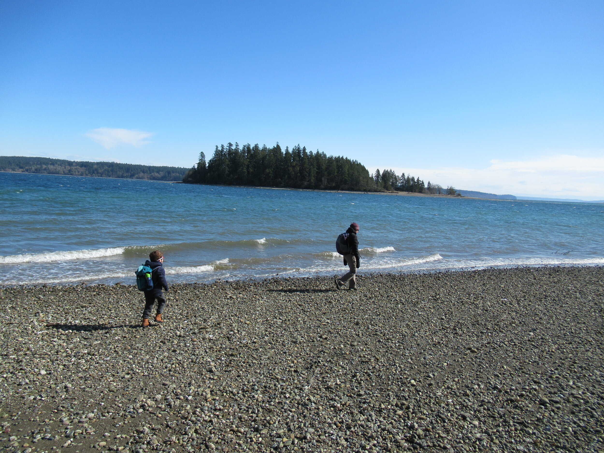
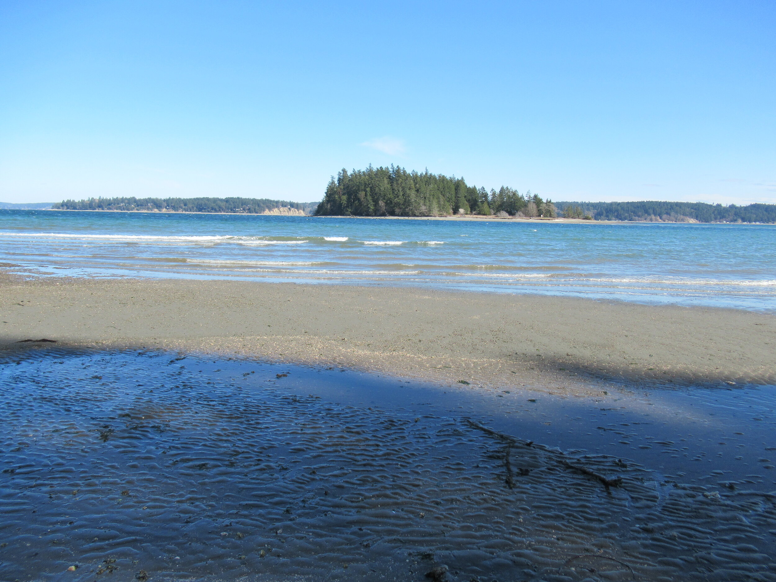
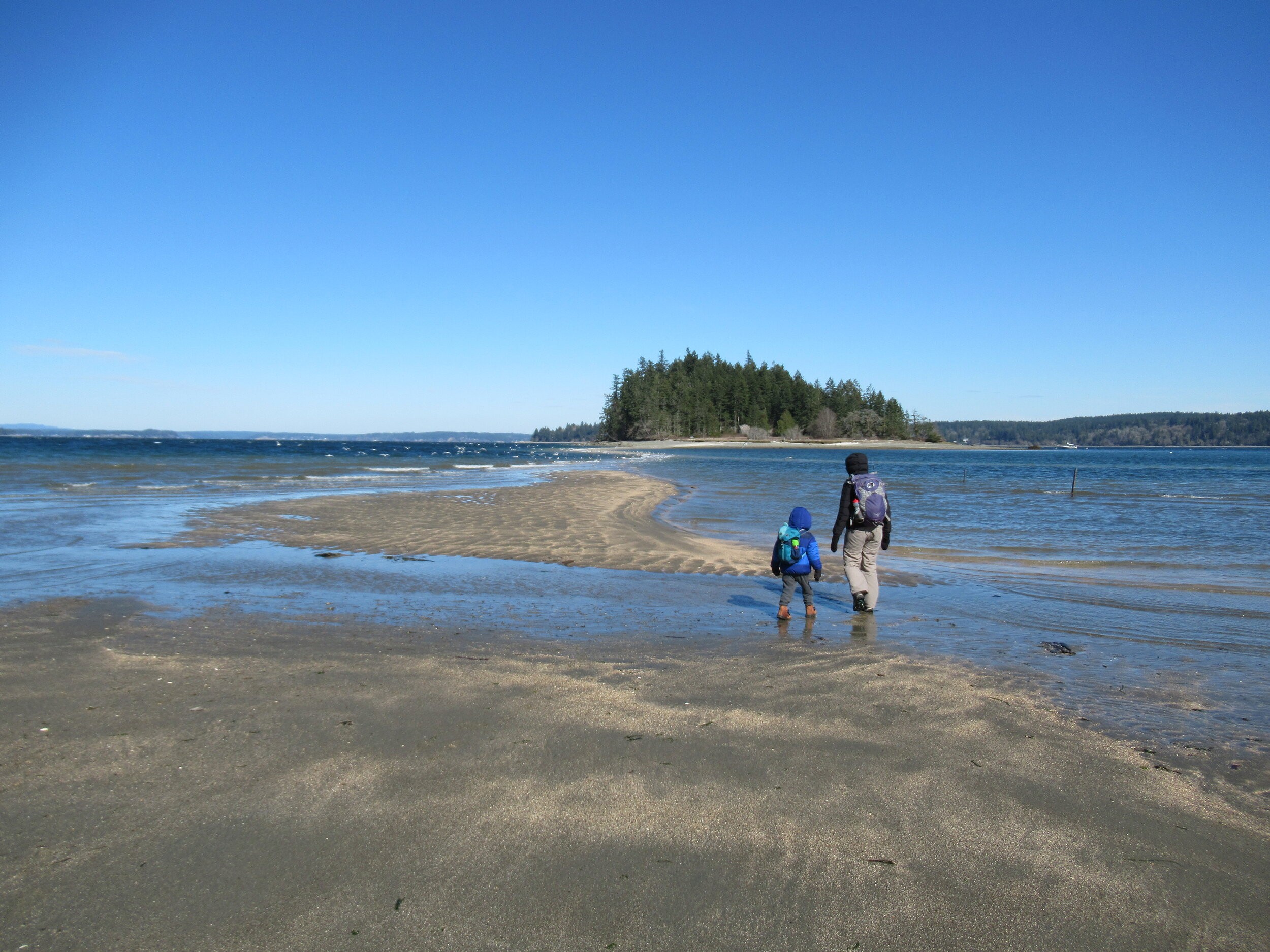
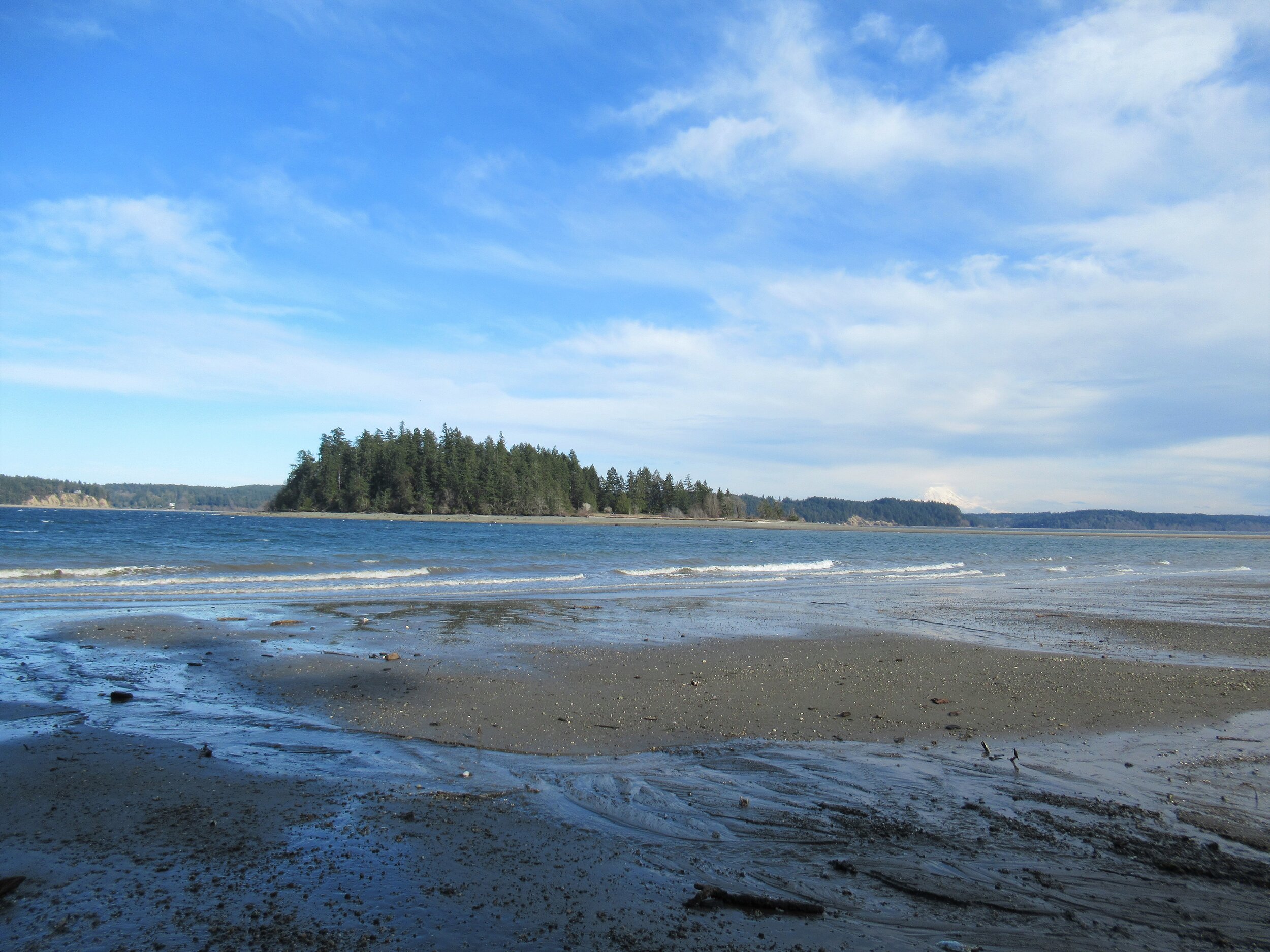
Head left through a row of big cedars and via a series of steps descend deeper into the ravine. After crossing a little creek the way emerges on a deserted beach. Look directly across Case Inlet to Herron Island and the Key Peninsula. Then look south and spot McMicken Island set against a backdrop of big beautiful Mount Rainier. If the tide is high, you’ll have to wait to hike the beach as overhanging trees prohibit passage. But in a low tide, a big wide easy to walk beach awaits your footprints.
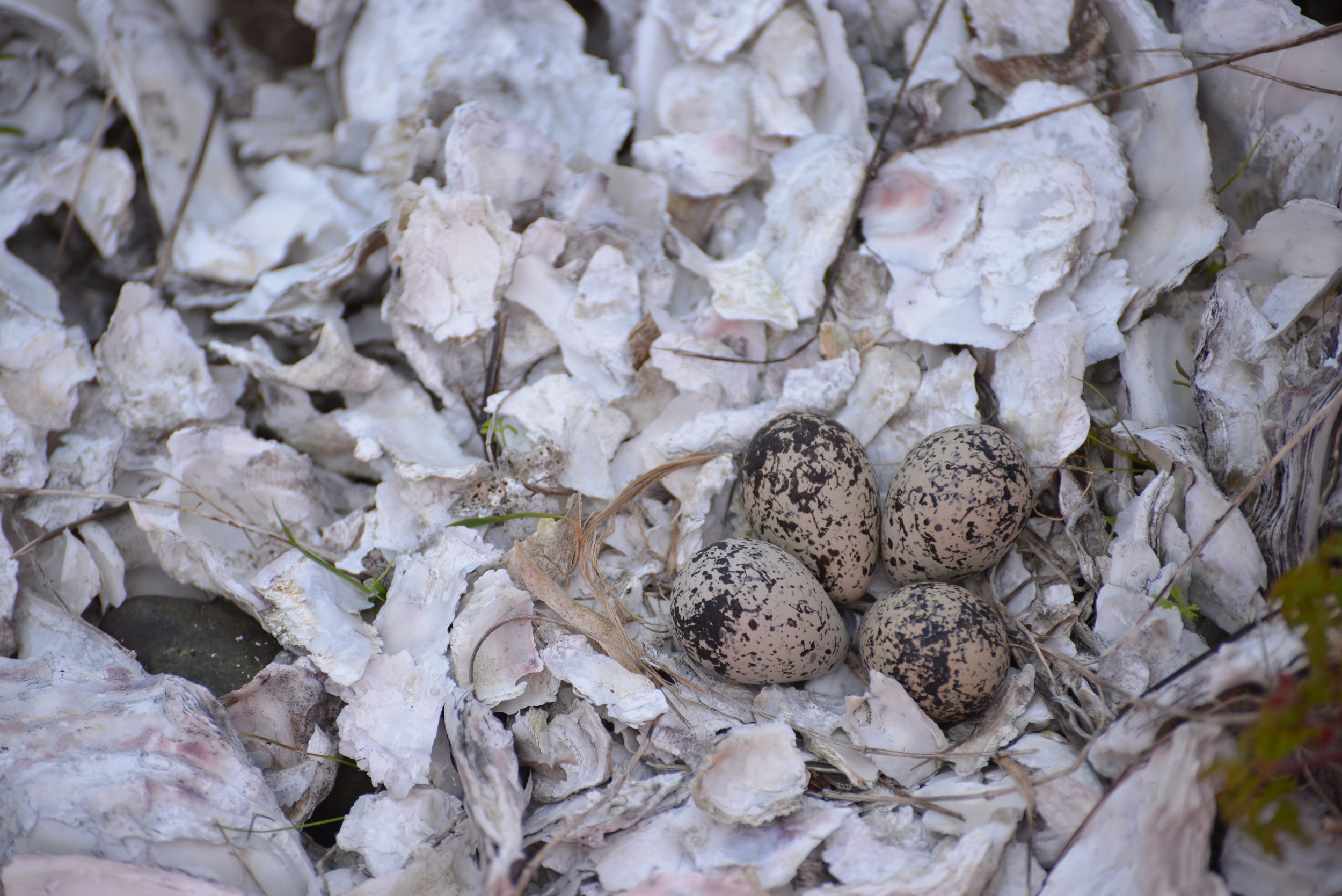
Walk for more than a mile undulating between cobbles, mud and sand. Watch for sand dollars scatted across the tide flats. Look too for eagles, herons and a myriad of seabirds. Harstine is a wet place and plenty of side creeks fan out on the beach. You should be able to keep your shoes dry, but a pair of waterproof boots is not a bad idea. The entire way to the tombolo is on public tidelands. But there is a parcel of private property located between two large state park properties abutting the shoreline. Respect posted private property.
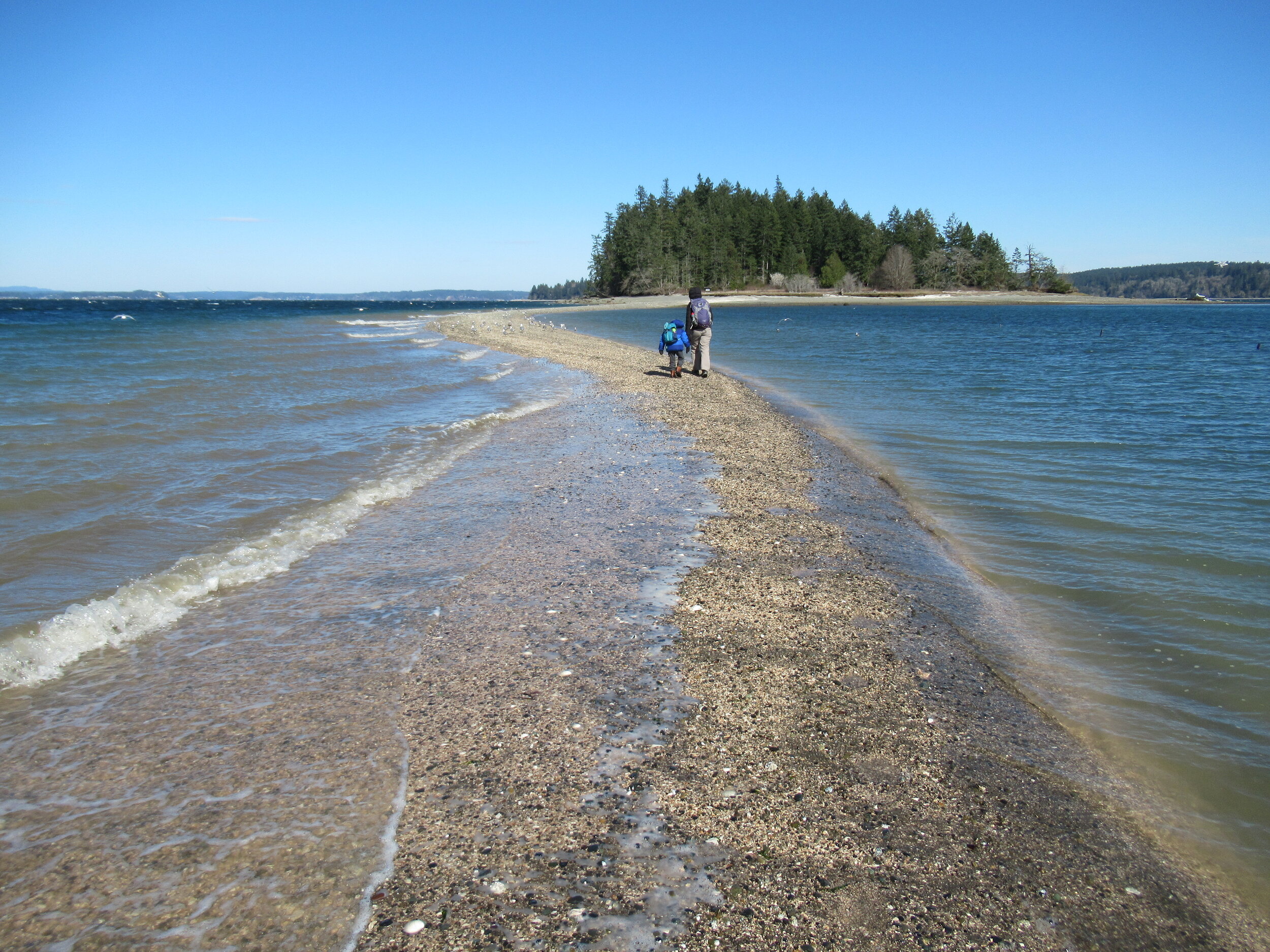
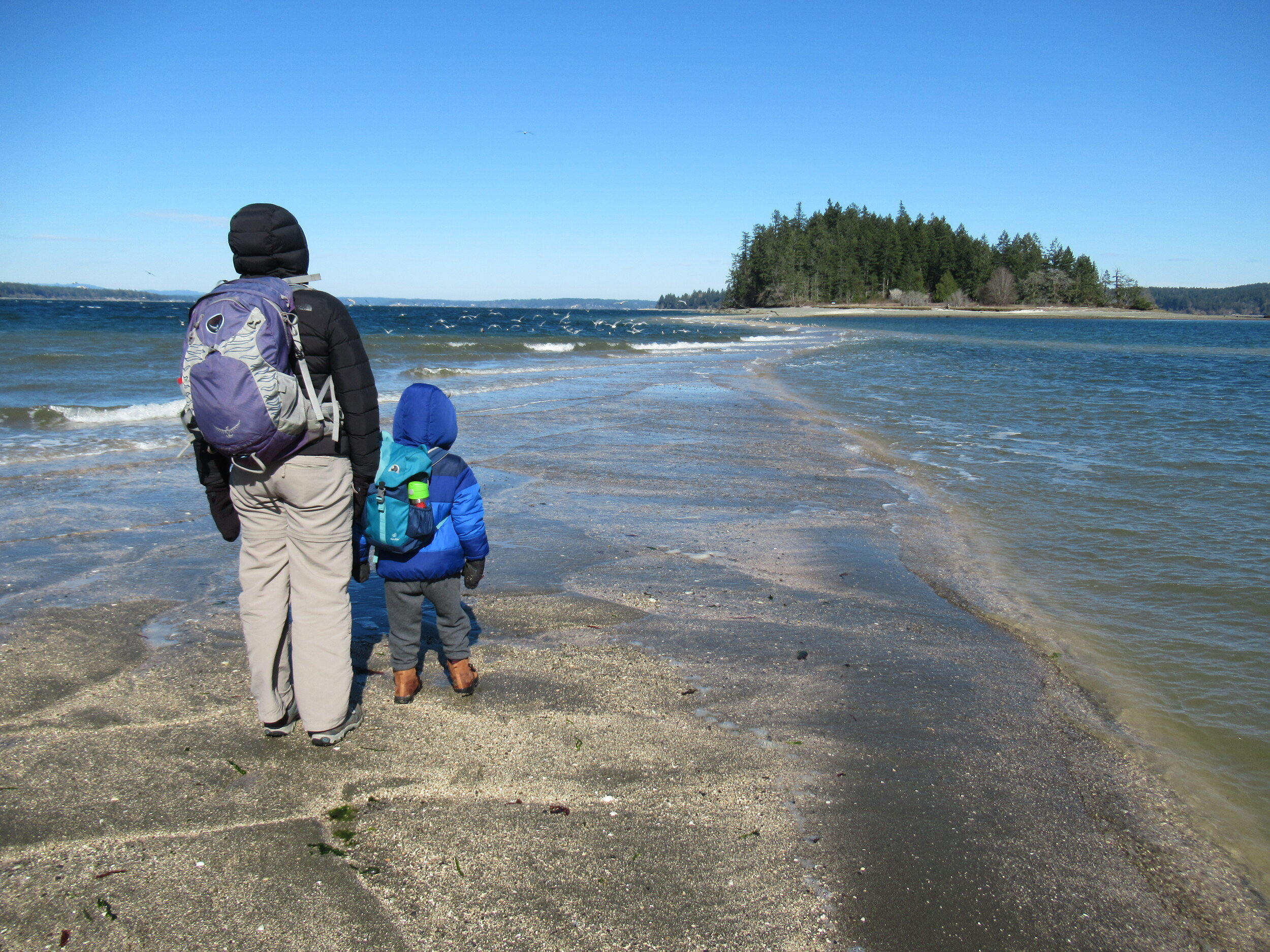
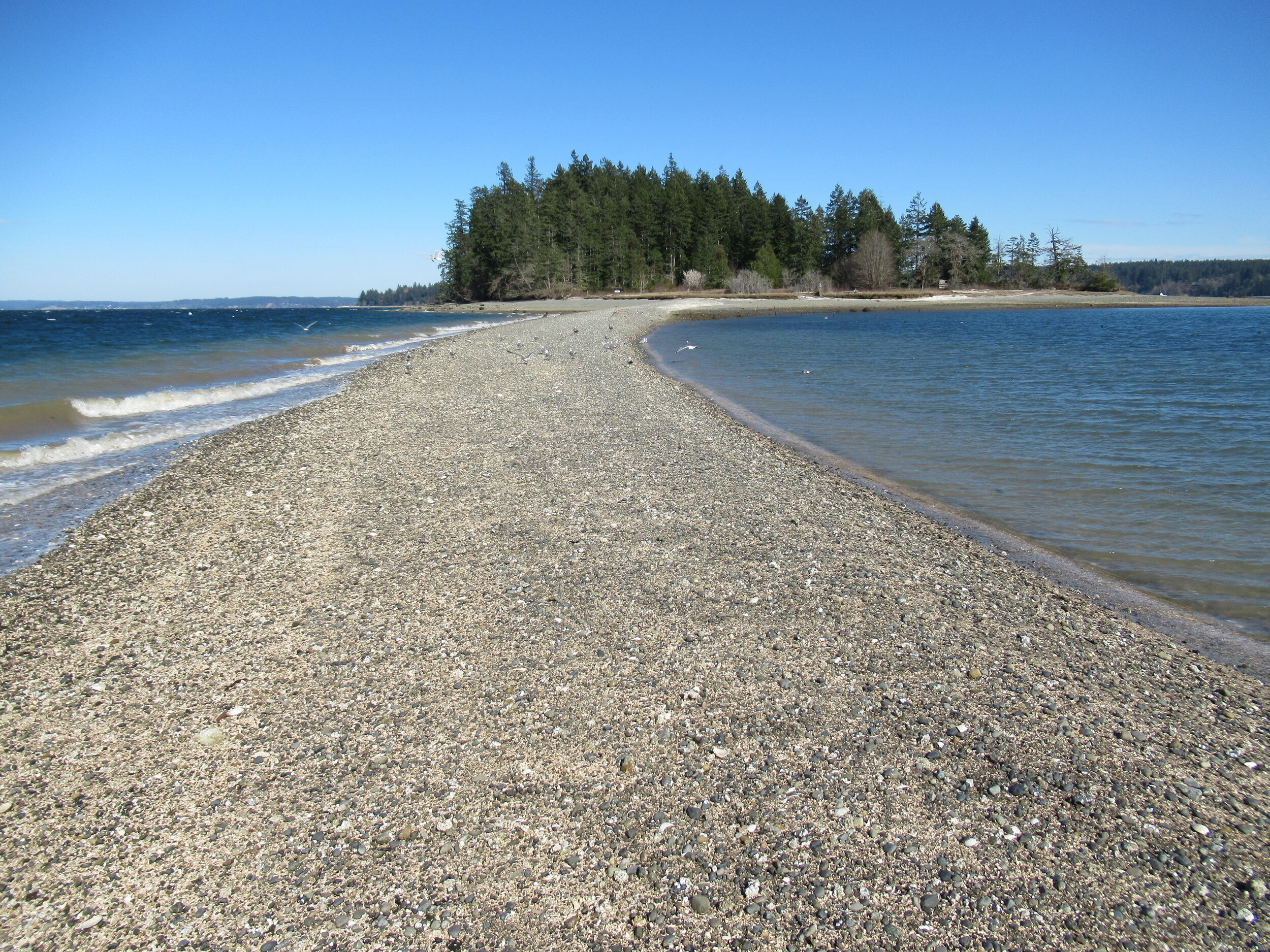
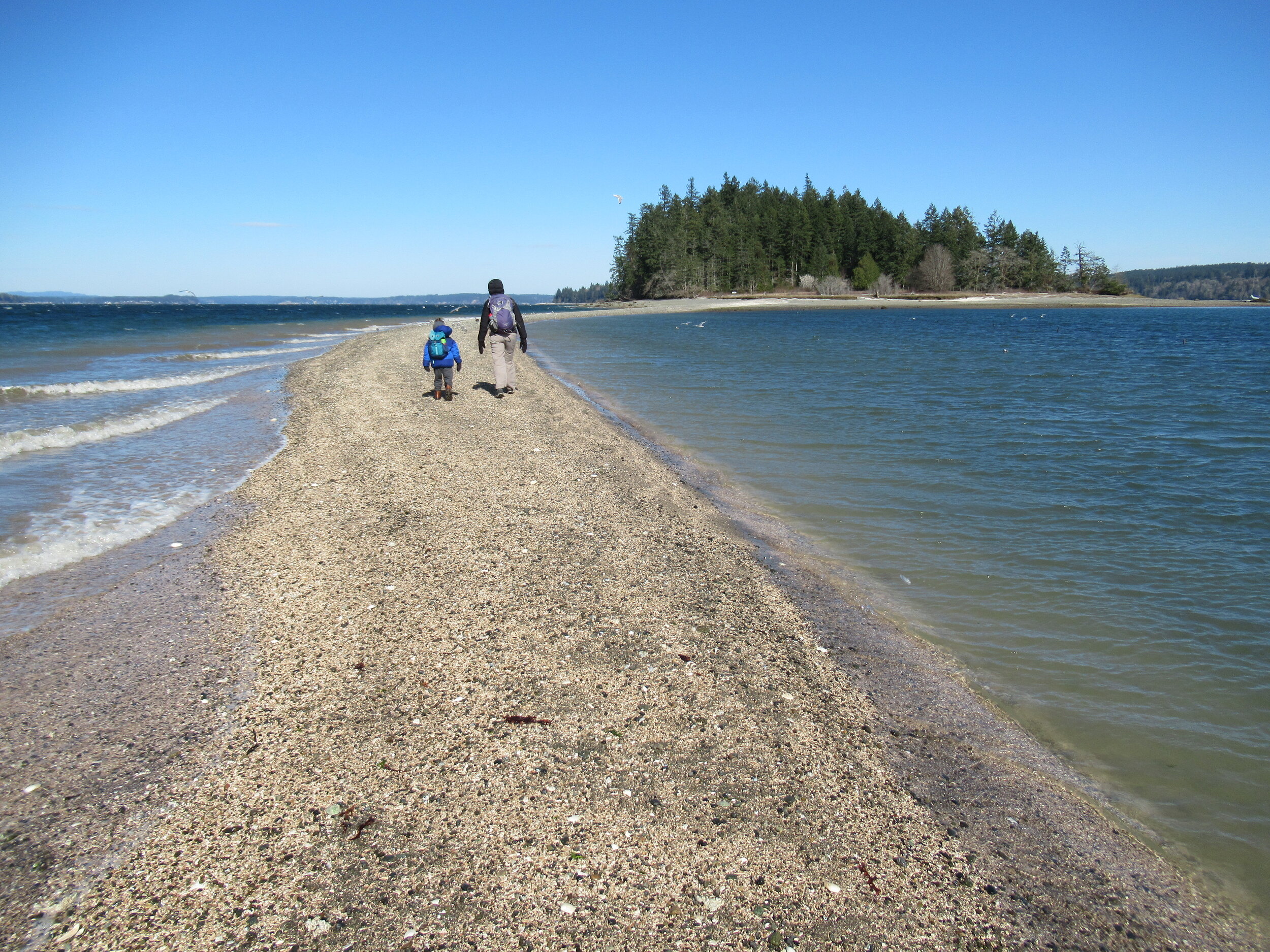
The tombolo is pretty distinctive in low tides—fairly wide and several feet raised above inlet waters. In high tides it’s completely submerged, although breakers will help you locate its position. It’s really fun to hike it when a receding tide first reveals it. Tap your inner Moses and part the seas watching the land bridge emerge as you amble along it.
Reaching the island
Once across the .2 mile sandy strip, reach McMicken Island. All of the little island except for a small fenced parcel with a couple of cabins is state park property. The private holding belongs to the family that once owned the entire island. They sold the island to the state withholding this small lot. Please keep out of it. The rest of the island however you are free to explore.
At the island’s western end is a small picnic area in a grassy opening. Here find some rare Garry oaks growing on a low bluff above the surf. Near a composting toilet at the eastern edge of the field is a small nature trail. Hike it! It weaves a half mile through towering firs and madronas to blufftop views on the eastern end of the island.
Be sure to explore the rocky tide flats surrounding the island too, and check out the large erratics scattered about. There is a particularly large one on the south side of the island. Enjoy your island wanderings and explorations—more than likely sharing it with no more than just a couple of other happy hikers. And be sure to keep track of the time and incoming tide so you don’t get trapped on the island.

Places to Stay
Waterfront cabin located on Harstine Is with beach access and a panoramic view of the Puget Sound, Mt. Rainier and McMicken island. Check availability
Hike back to Harstine Island State Park and call it a day or consider walking some more. The park contains three miles of trails. They traverse thick fir forests and swampy cedar groves and are family and dog-friendly.
McMicken Island Notes:

Forest Setting with Beach Access
Cross the bridge to Harstine Is. and enjoy a beautiful and quiet retreat in the woods. Relax in the comfortably furnished cabin or enjoy exploring the 5 acre property with meandering trails through a lovely forest. Check availability
Distance: 4.0 miles round trip
Difficulty: easy, pay attention to tides! Hike is only possible in low tides. Consult tide tables and plan accordingly. Dogs permitted on leash.
Trailhead Pass Needed: Discover Pass
GPS Waypoints: Harstine Island State Park Trailhead: N47 15.737 W122 52.236 McMicken Island Trailhead: N47 14.865 W122 51.780
Features: Kid and dog friendly, beach hiking, undeveloped coastline, small island reached via a sandbar, good bird watching, sublime views of Mount Rainier over Case Inlet.
Trailhead directions: From Olympia, head north on US 101 to Olympic Highway (SR 3) Exit in Shelton. Then turn and follow SR 3 east for 11.0 miles. Turn right onto Pickering Road (Signed for Harstine Island) and drive 3.3 miles. Then bear left onto Harstine Bridge Road and come to a T-junction upon entering Harstine Island. Go left on North Island Drive and after 3.0 miles turn right at the island community hall onto East Harstine Island Road. Proceed for one mile and turn left onto Yates Road. Continue 0.9 mile and turn right into Harstine Island State Park. Reach trailhead parking in 0.2 mile.

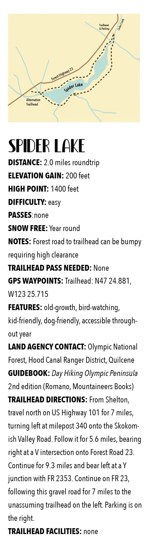
Spider Lake: Perfect year round hiking destination
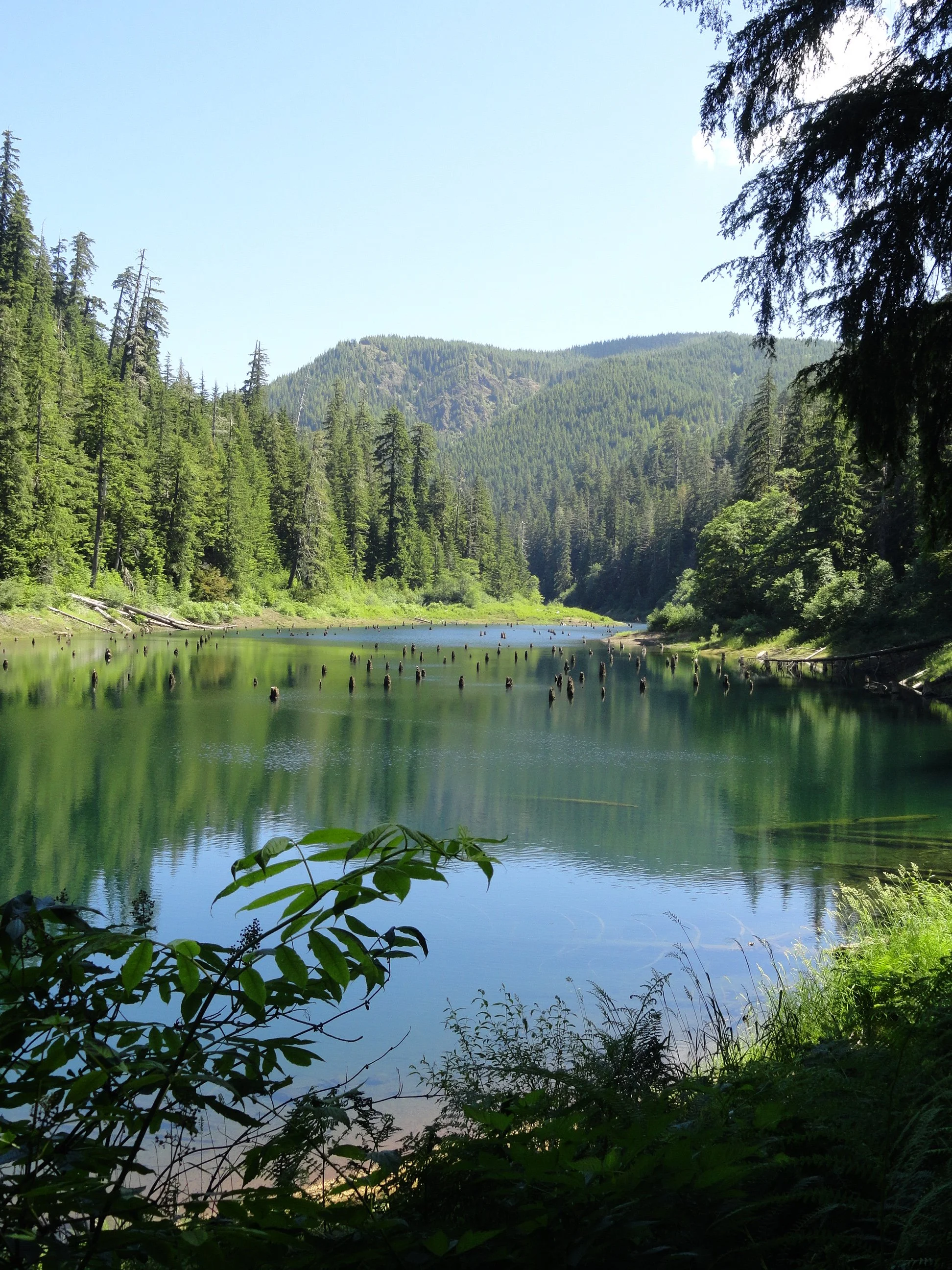
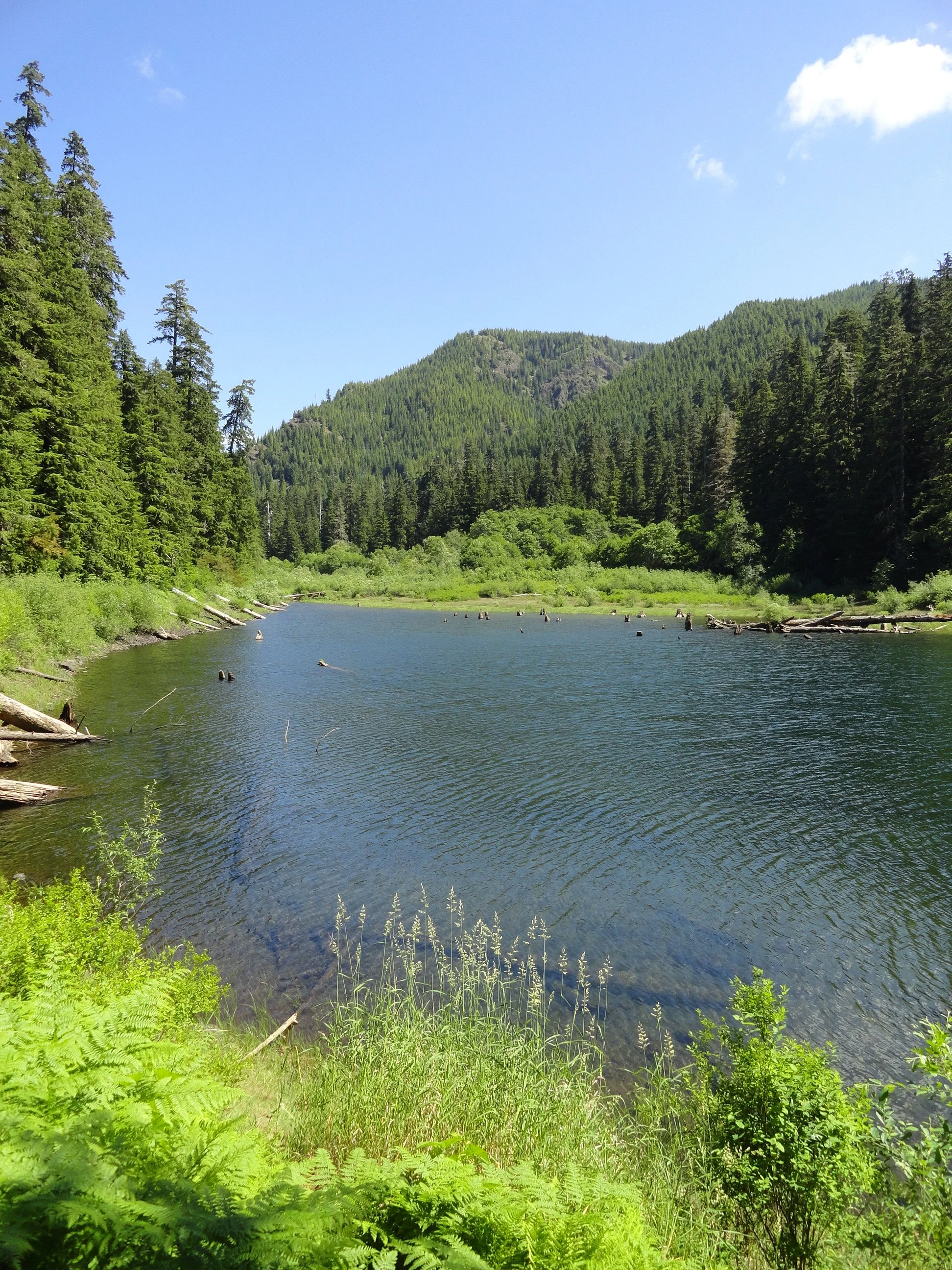
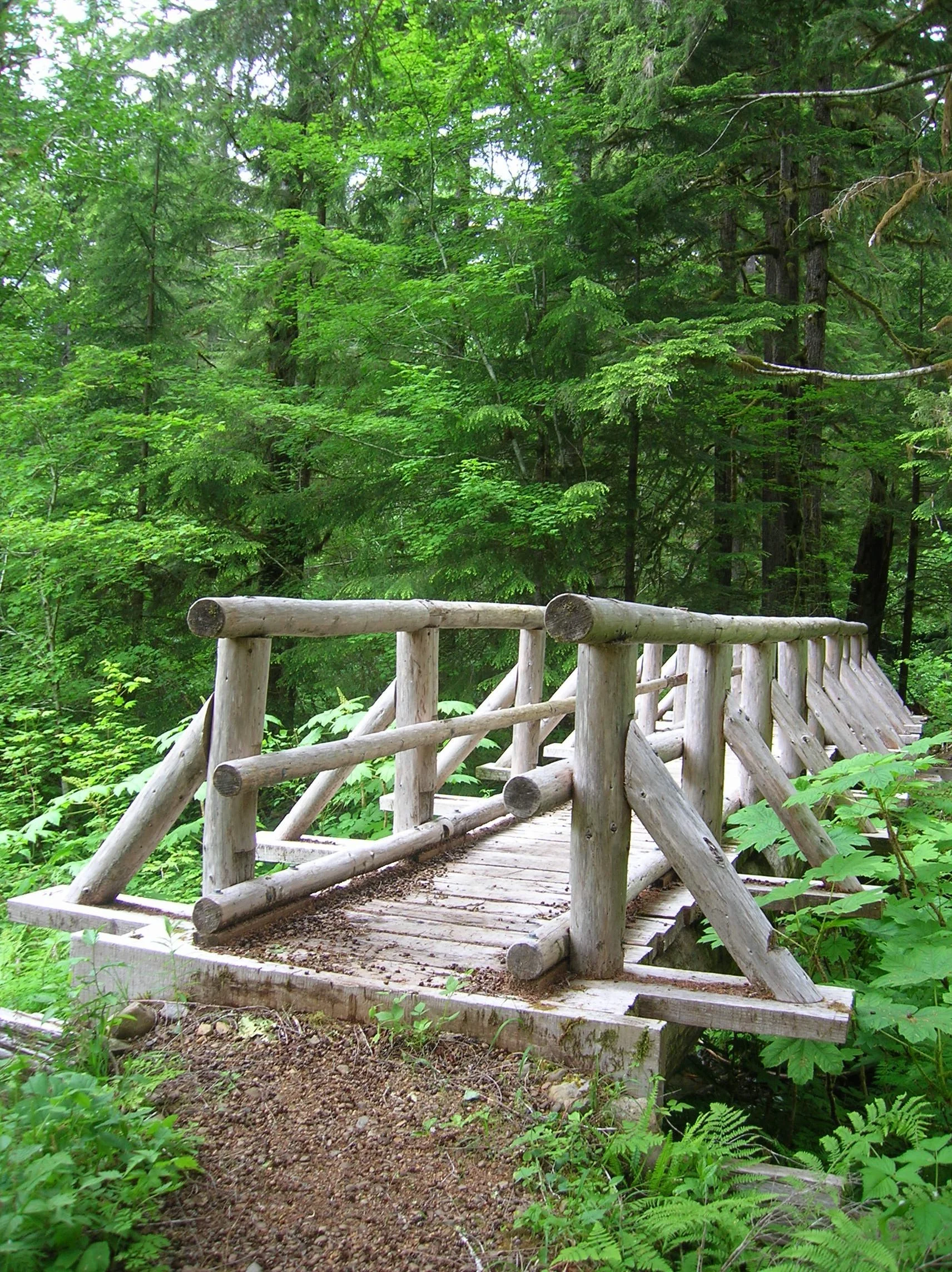
With a name that may instill a chill if you’re prone to arachnophobia, fear not a visit to Spider Lake. Children will love hiking along its shores looking for birds, fish, amphibians and other critters. They’ll also appreciate the well-built bridges spanning the lake’s inlet and outlet streams. And the trail with its gentle course around the lake is ideal for hikers of all ages and abilities.
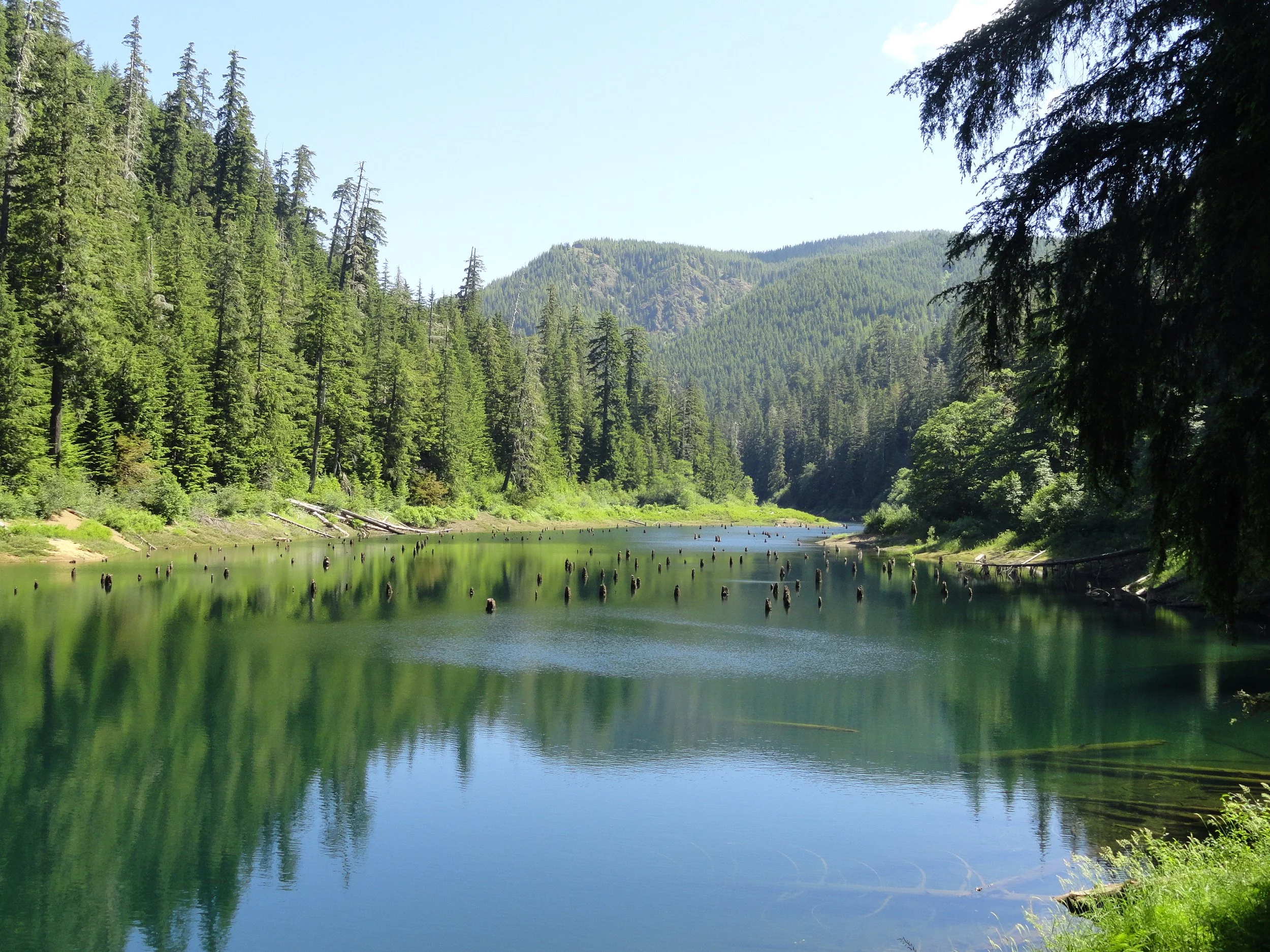
With a name that may instill a chill if you’re prone to arachnophobia, fear not a visit to Spider Lake. The small lake on the South Fork Skokomish River—Satsop River divide is actually an inviting place. Surrounded by towering ancient conifers and fed by cascading creeks, Spider Lake is quite tranquil. Children will love hiking along its shores looking for birds, fish, amphibians and other critters. They’ll also appreciate the well-built bridges spanning the lake’s inlet and outlet streams. And the trail with its gentle course around the lake is ideal for hikers of all ages and abilities.
Hit the Trail
Hikers of a certain age may start humming the Jim Stafford classic Spiders and Snakes upon beginning their jaunt to this lake. And if you’re in agreement to the chorus of “I don’t like spiders and snakes…” take solace. There are only three species of snakes that call the Olympic Peninsula home, and none of them are venomous. However there are more than 900 species of spiders that reside on the peninsula! Yet, the majority of them you’ll never encounter. And the common ones, crab spiders, jumping spiders, and orbweavers are nothing to be afraid of. You’re more likely to run into their webs (especially if you’re the first one on the trail that day) than into them. Voracious eaters of insects, spiders help keep the population of those hiking nuisances down.


So is there an abundance of spiders at Spider Lake? No—no more than pretty much anywhere else in the Olympics. So what’s with the name? No one’s quite sure, as any record to how this lake got its name can’t be easily found. Spider Meadow in the Cascades Mountains is named after a mine, so that’s a possibility. Spyder Lake in Quebec and Spider Lake in Minnesota are named for their shapes resembling the arachnid. Is this lake shaped like a spider? No, it’s shaped more like a flatworm. Perhaps an early explorer simply named the lake after the arachnid because he had a spider encounter there—who knows?
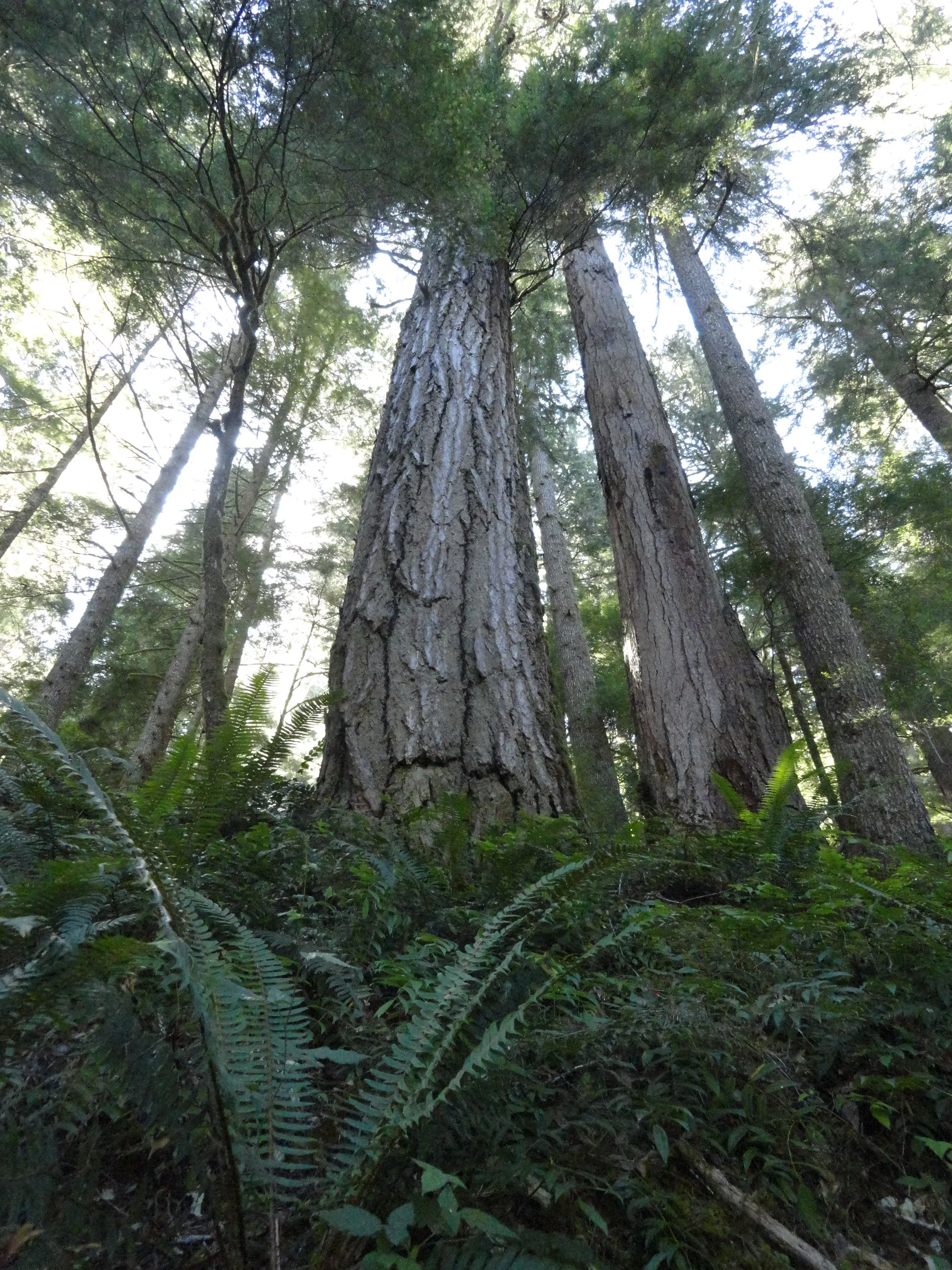
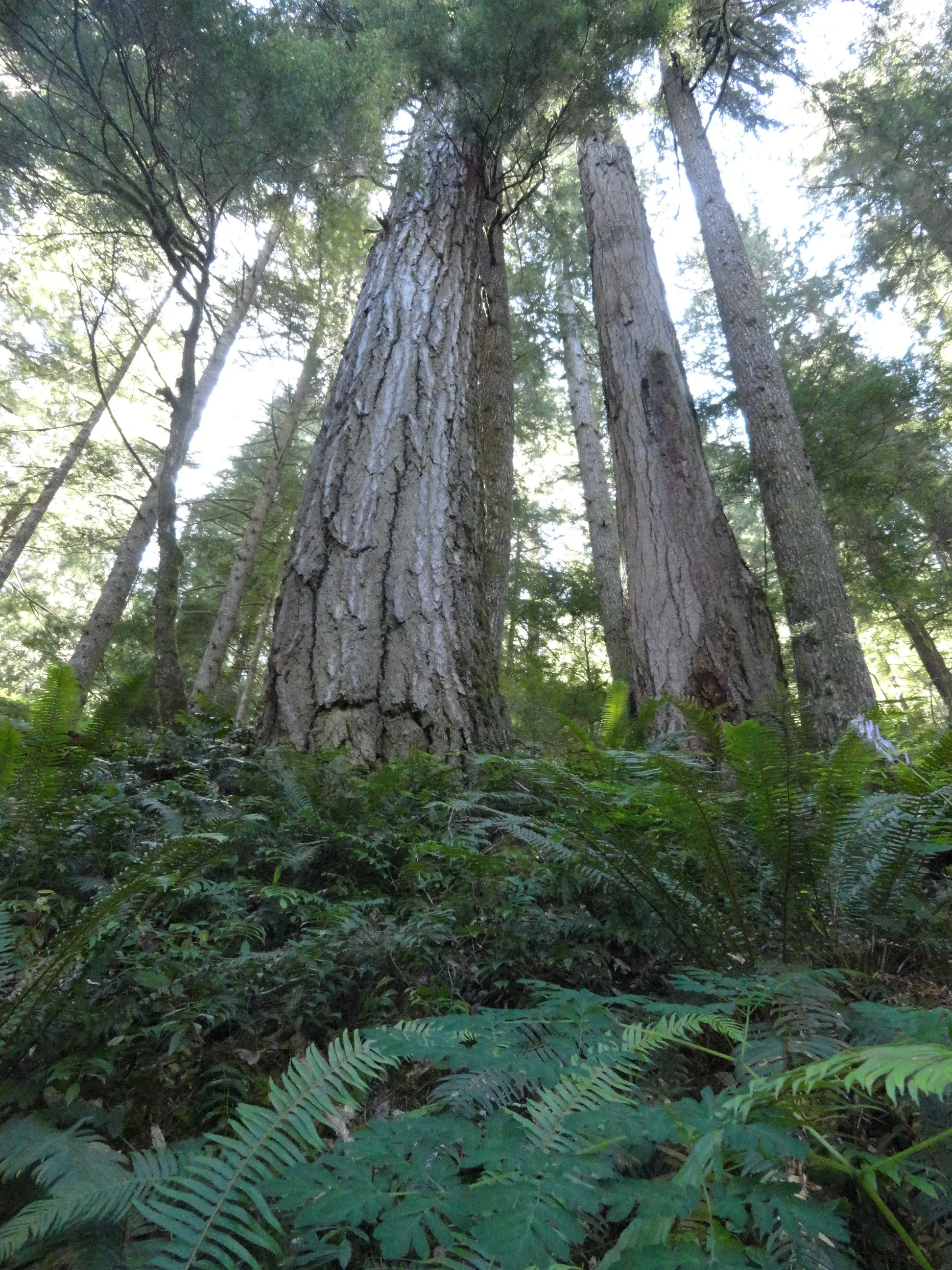
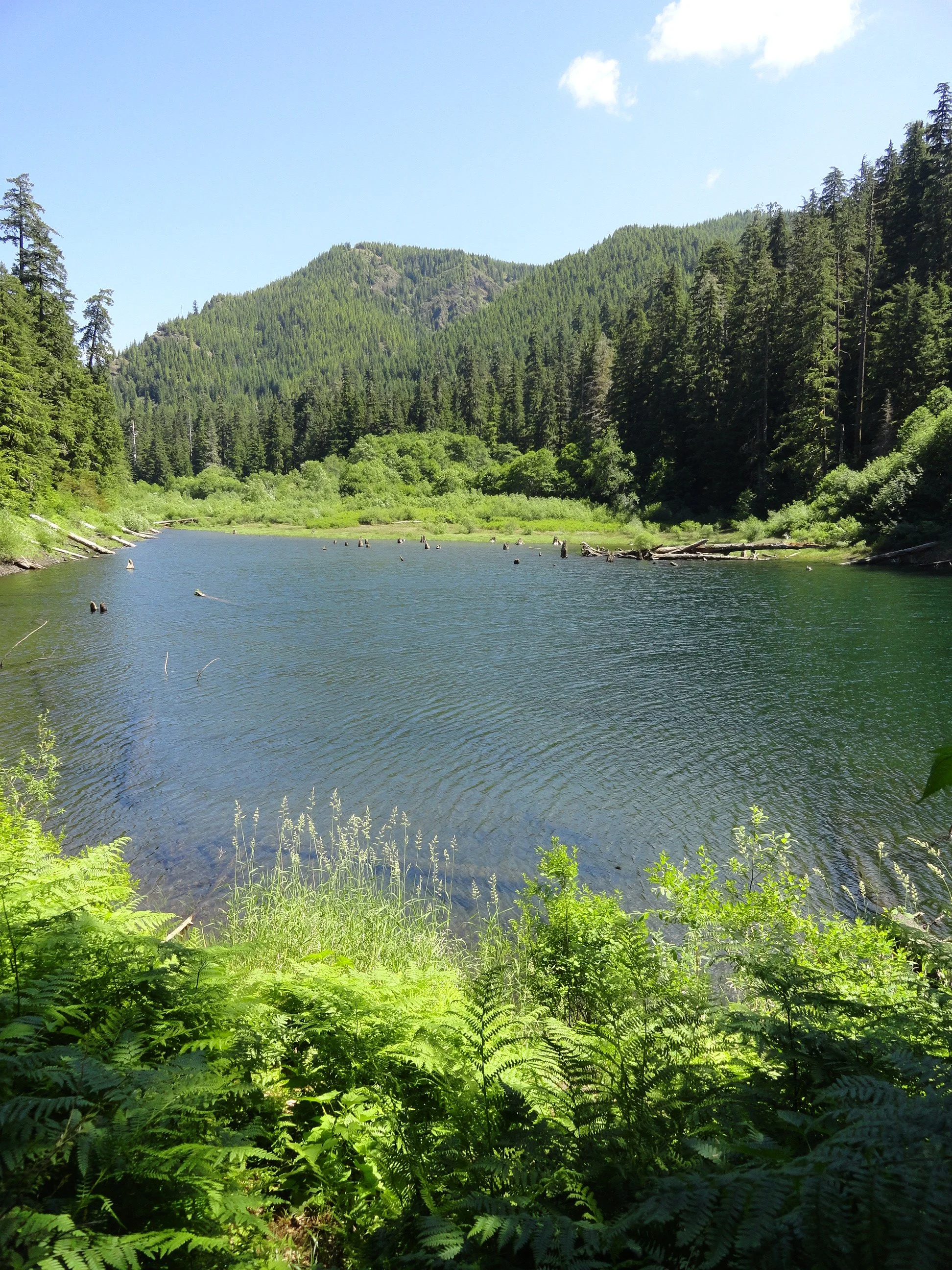
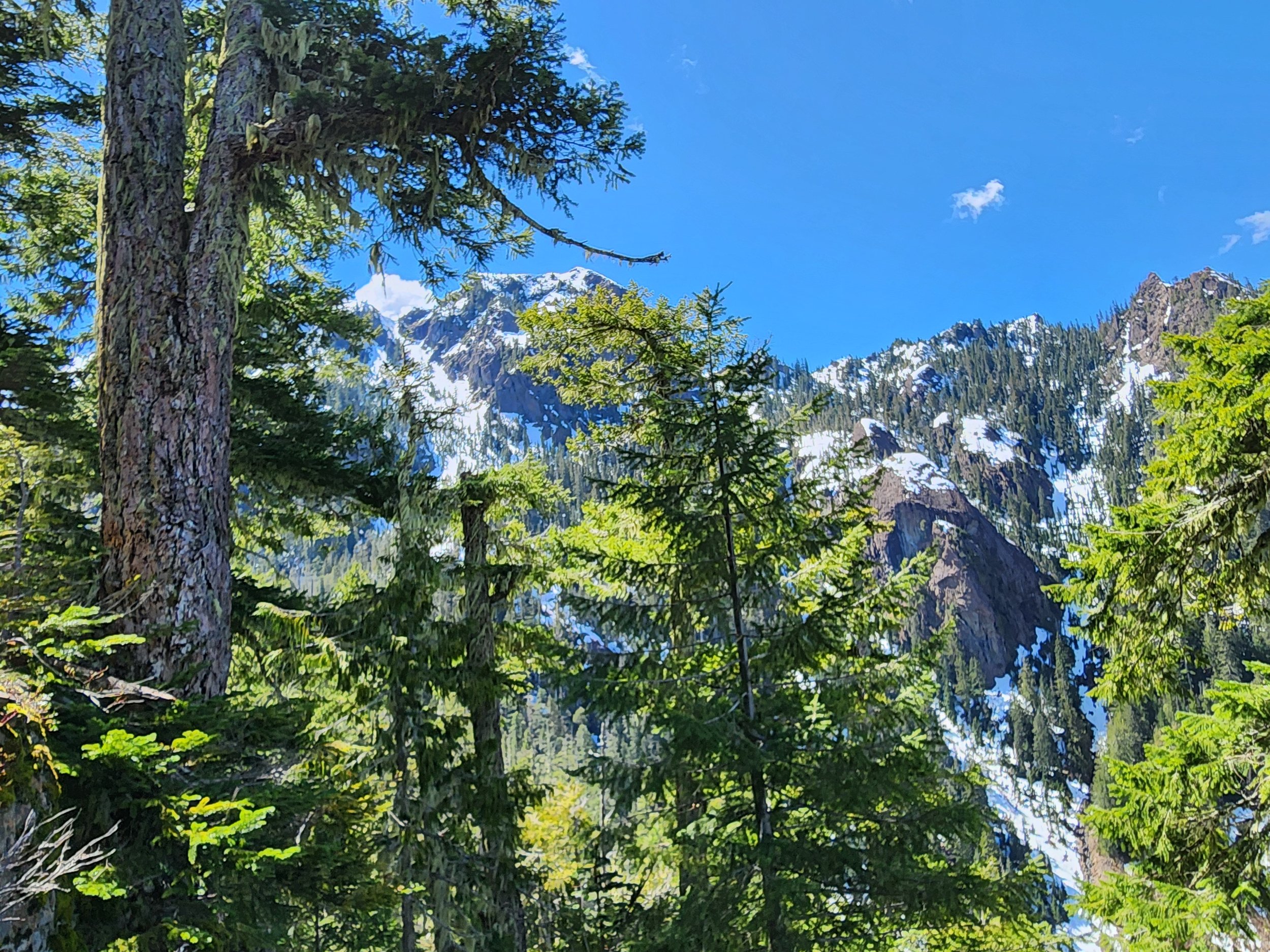
In any case Spider Lake isn’t grand in any sense, this hike’s main draw is its trees. The lake is surrounded by gorgeous ancient forest—a tiny fragment of the grand forest that once shrouded the hills and ridges along this entire divide. The trail too is a fragment—once a much longer route connecting the South Fork Skokomish River Valley to the Satsop River Valley. Decades of intensive logging in this corner of Olympic National Forest not only obliterated the area’s primeval forest but also much of its extensive trail system.
With the cut now a fraction of what it once was and with trail usage at record numbers, it would be a great time to bring folks together to start rebuilding trails in the southern Olympic flank.
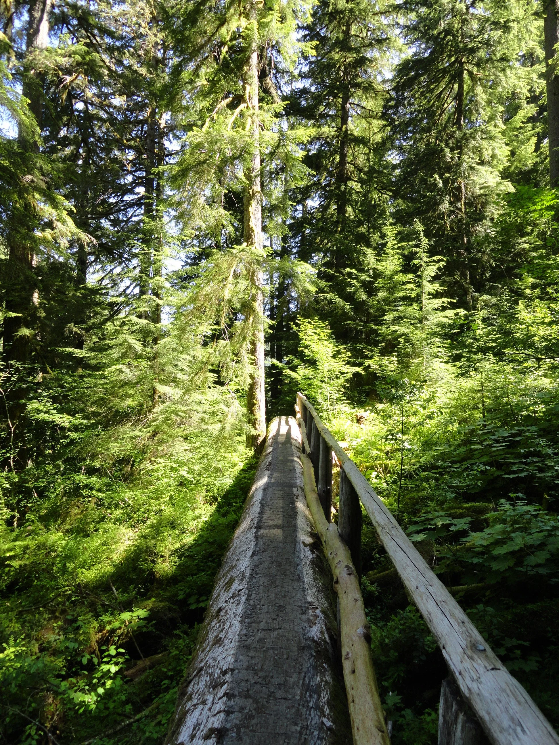
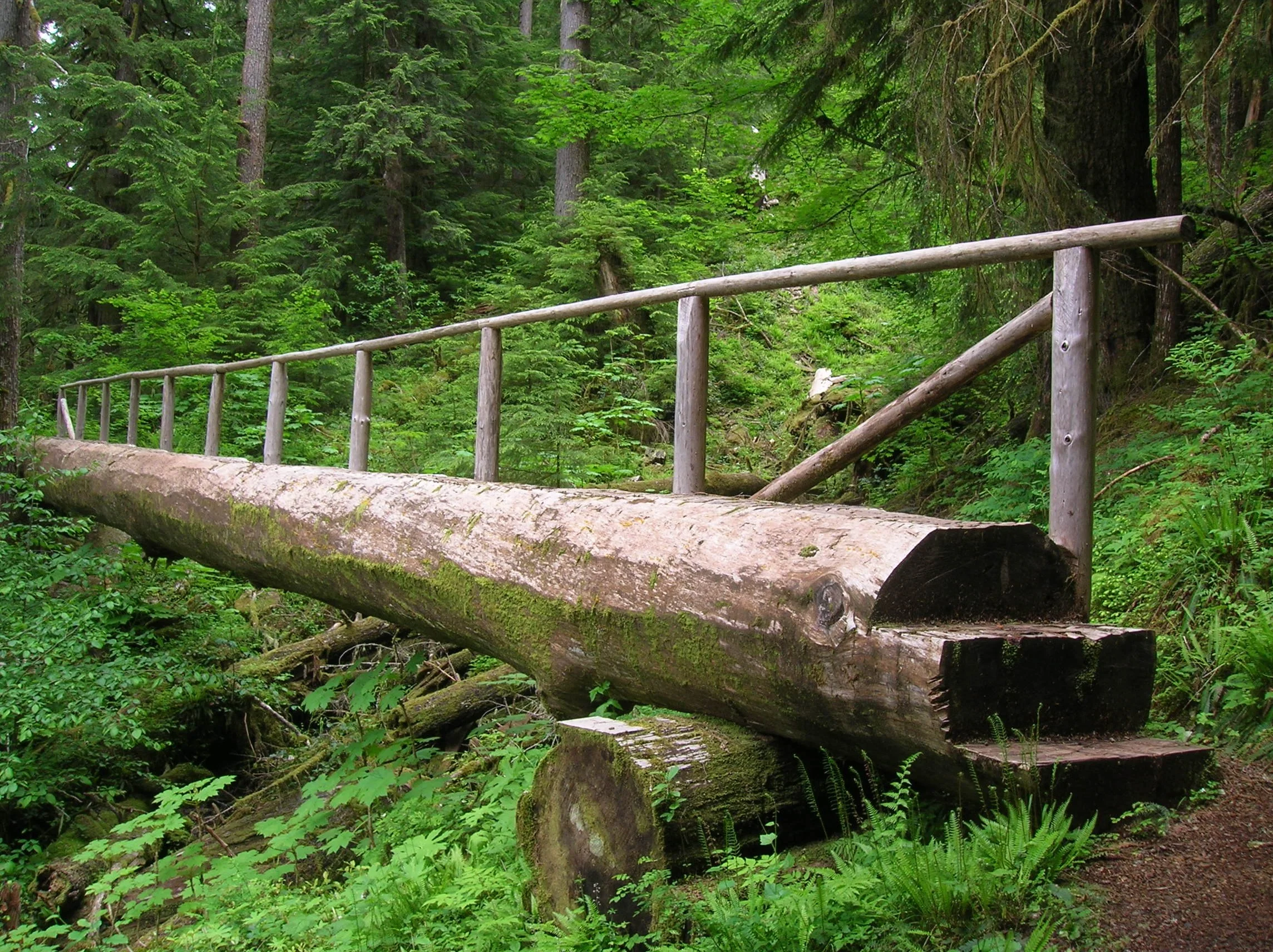
In the mid-1990s, trail builders resurrected a portion of the old trail that once traveled up the Cedar Creek valley and constructed adjoining new tread to build a two-mile loop around little Spider Lake. Trail-building aficionados will probably find the loop’s three large bridges noteworthy for their durability and aesthetics. Kids will love crossing them—probably doing a few repeats on the spans.
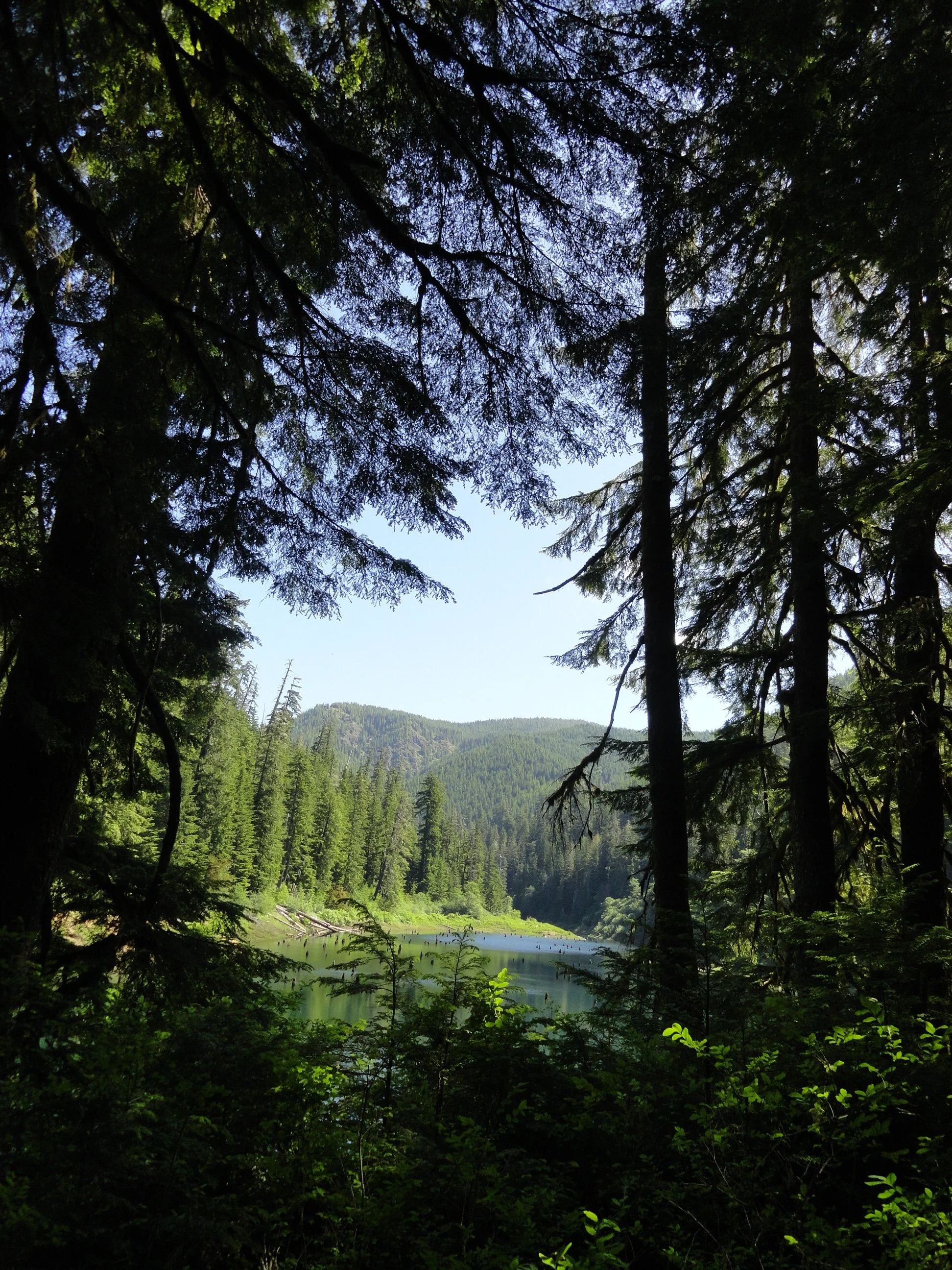
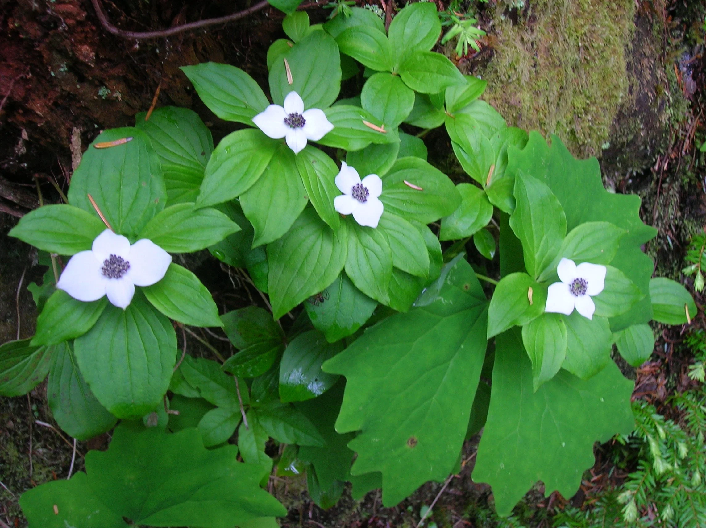
This trail is a joy to hike anytime of the year, but it glows pearly white in early summer when blossoming dwarf dogwood and queen’s cup blanket the forest floor. A few shrubs and sedges will add some golden touches in autumn. From the trail’s unassuming trailhead (there’s another unassuming trailhead to the south) immediately enter cool old-growth forest and come to a junction. Turn right (although either direction will work), crossing the outlet stream and soon reaching Spider’s western shoreline. Now saunter past towering trees, good fishing spots, and excellent viewpoints of the placid lake. Look for avian and amphibious residents. Cast your glances upward at the surrounding ridges. These intensively logged hillsides offer quite a contrast to the virgin groves cradling the lake.
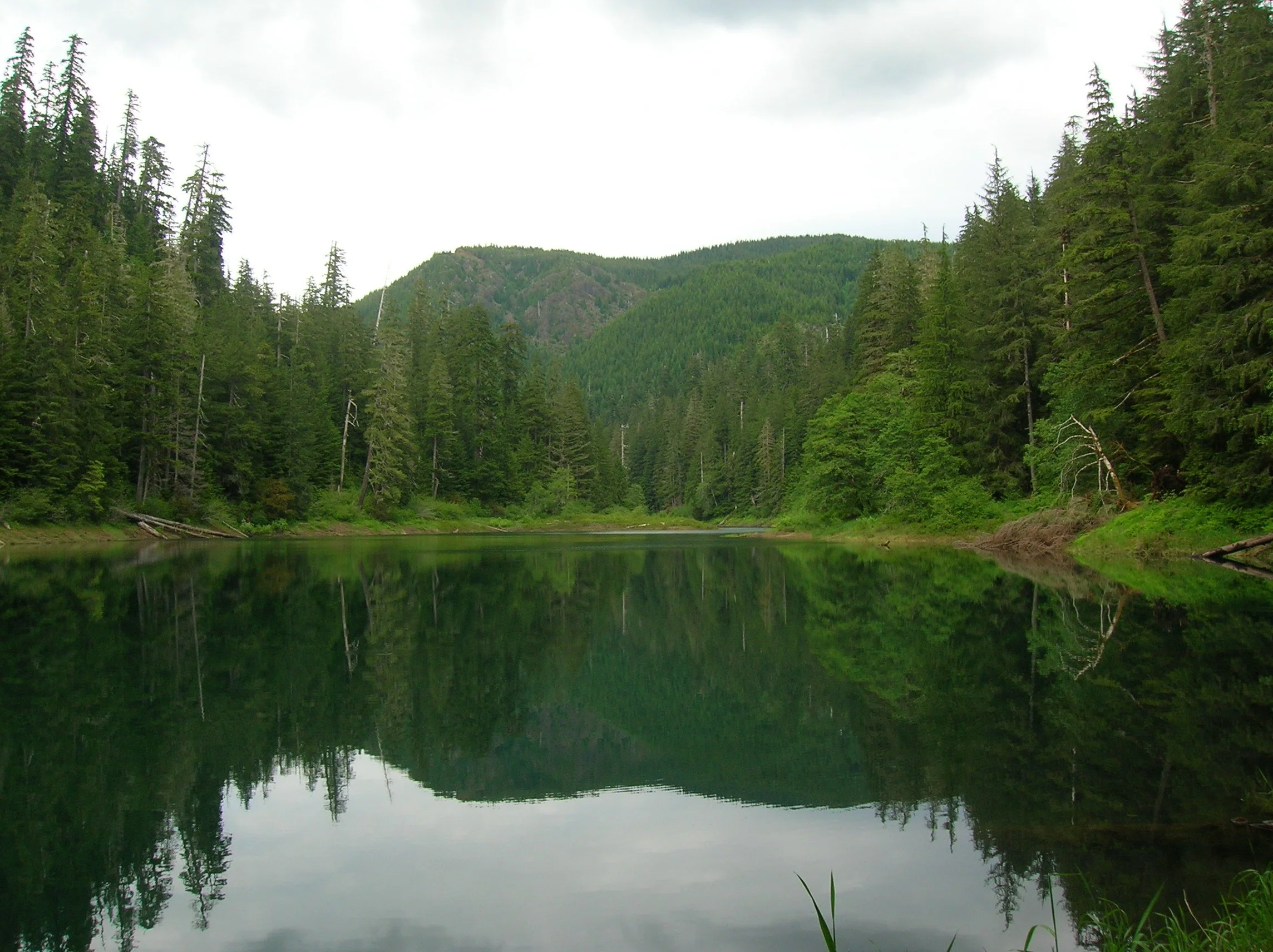
After about a mile, cross a small creek and reach a junction. The trail heading right steeply climbs a short distance to an alternative trailhead. Continue left climbing a little above the green waters of the lake while being shaded by ancient behemoths. Now continue along the eastern shoreline climbing a bit more to traverse a steep slope.
After crossing a high log bridge, the trail begins its descent back to lake level. It then crosses an inlet stream in a marshy area before returning to the junction where you started your trip around the lake.
The hike is short, but the surroundings beckon you to slow down and enjoy the natural beauty of this small lake and its big trees. Perhaps you’ll be fortunate to see some wildlife along the way—and more than likely you probably won’t recall if you encountered a spider or two!
contributor
Craig Romano is an award-winning guidebook author whose deep connection to Washington trails, dedication to accuracy, and passion for conservation have made him a trusted name in the outdoor community. His contributions to Tracing the Fjord magazine bring rich, informed outdoor narratives to a readership that lives and loves the Hood Canal region. Craig's guidebooks stand out for their thorough research. He physically scouts trails, GPS-tracks routes, and includes lesser-known—and at-risk—options to offer diverse, accurate, and reliable resources for hikers. He incorporates sidebars with natural or cultural history and conservation insights in his writing. He emphasizes responsible use and stewardship of trails, challenging readers to be “good conservation and trail stewards.” Craig has written more than 25 guidebooks, including celebrated “Day Hiking” and “Urban Trails” series published by Mountaineers Books—featuring areas like the Olympic Peninsula, Vancouver BC, and beyond.
Copper Creek trail
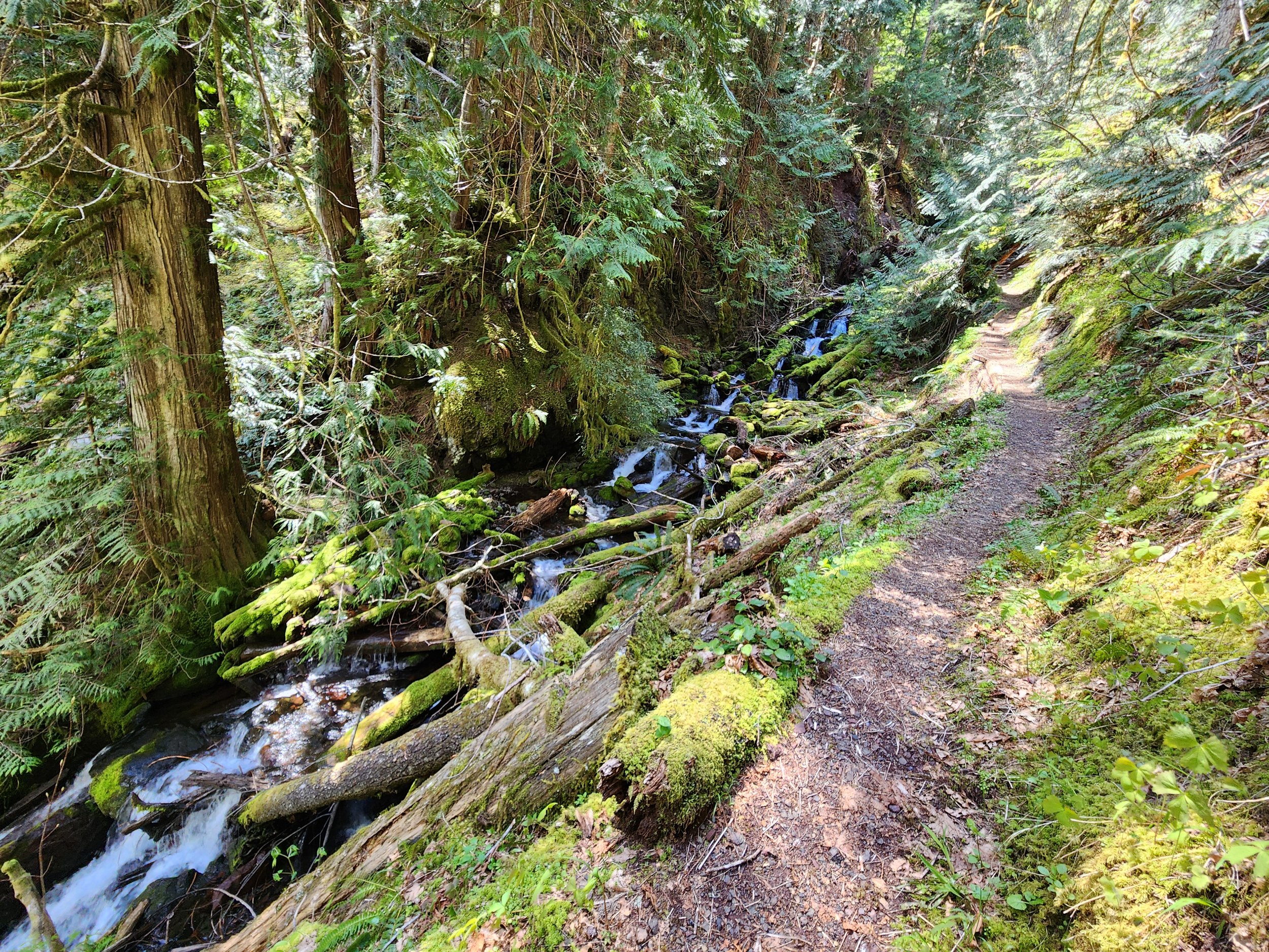
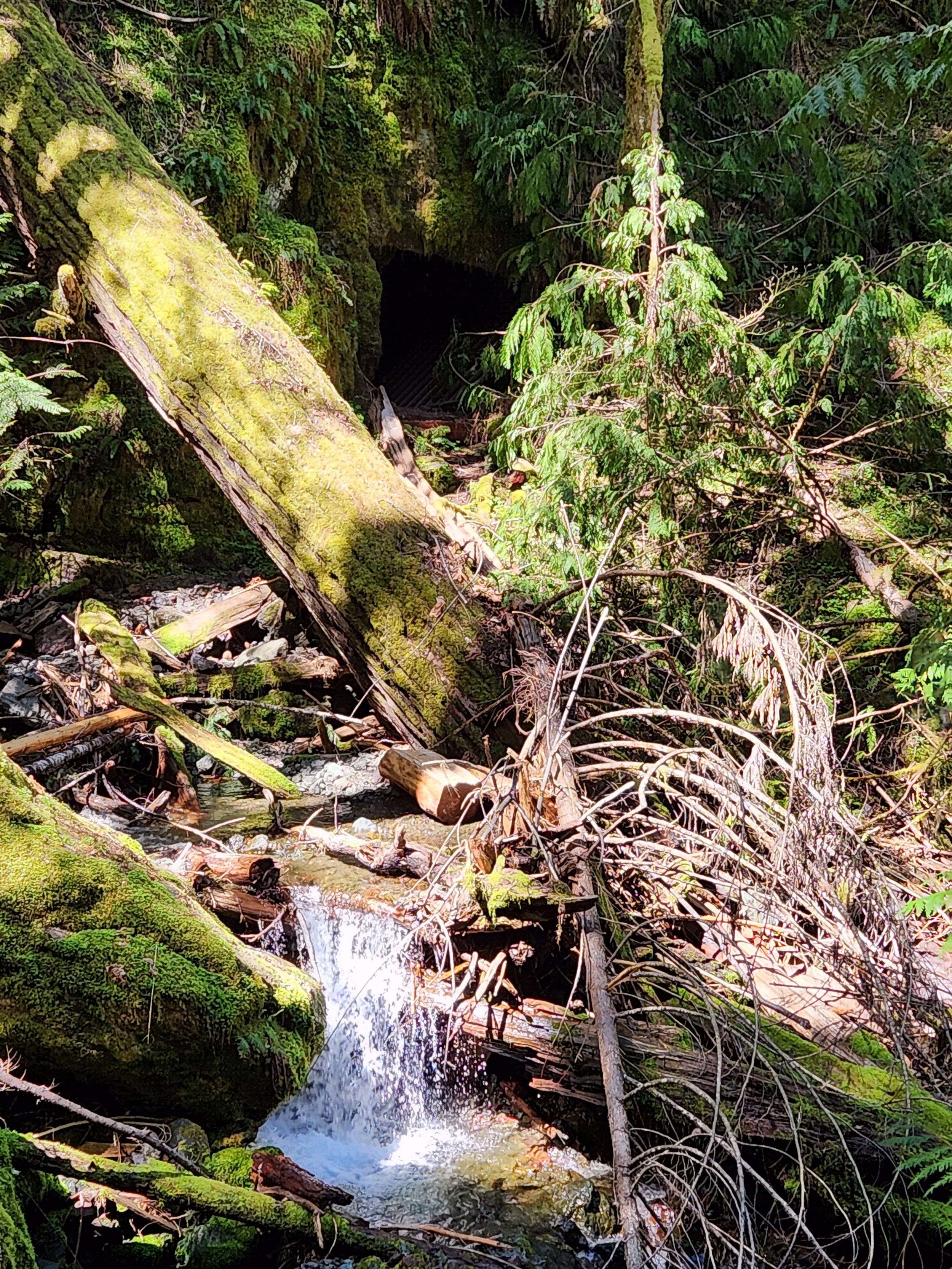
Tenacious hikers toil up steep slopes past the mines to a high shoulder on Lightning Peak. Views are limited, but the trailside cascading creek and surrounding towering primeval forest is striking. And if its solitude you seek, ye shall be rewarded.
Text and images Craig Romano
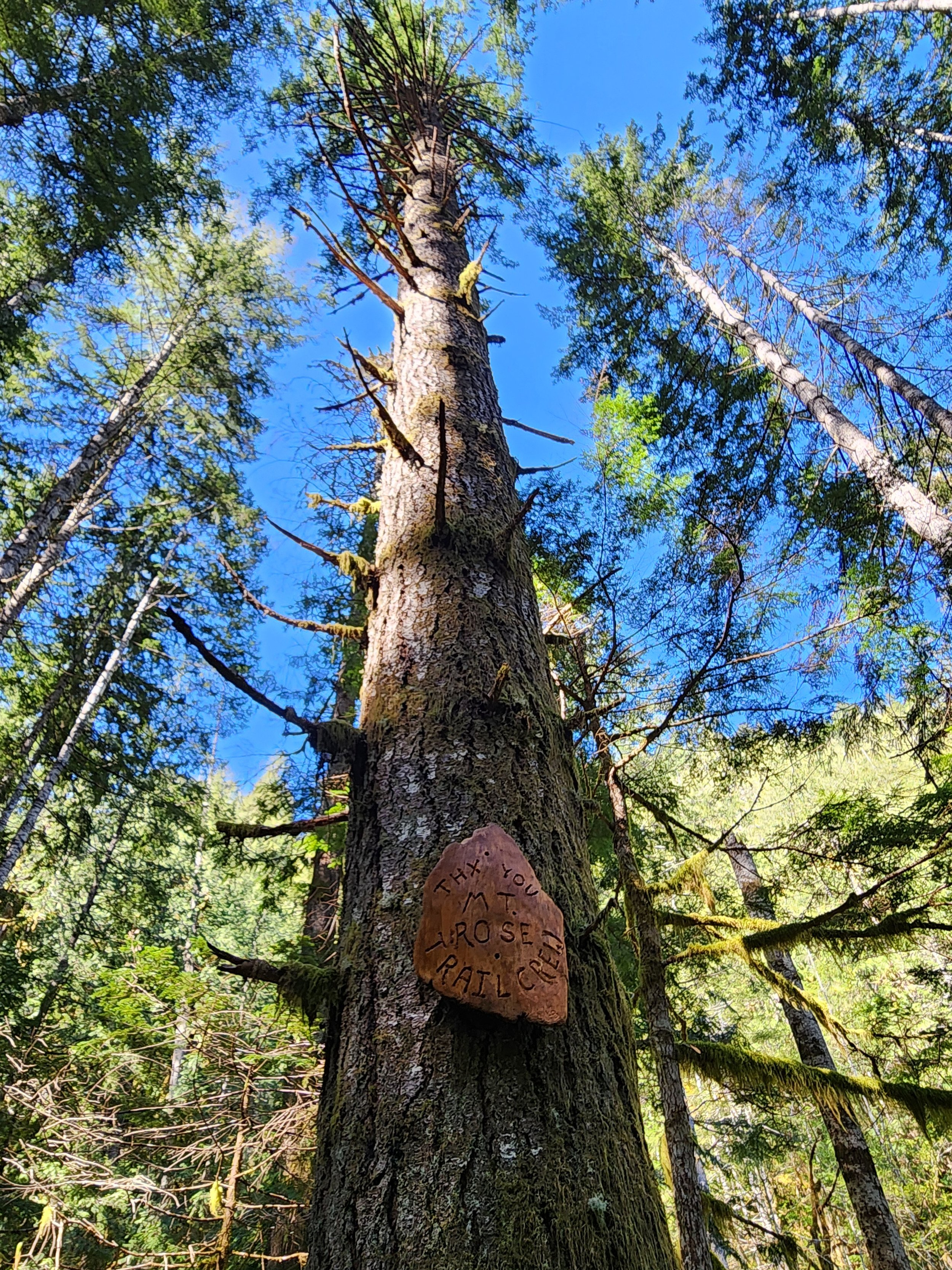
Copper Creek tumbles through a rugged area harboring several old mines. But it was mostly manganese, not copper that lured hardscrabble miners up this rough and tumble trail along Copper Creek to work several mines. After World War II the mines ceased operation and the trail to them was abandoned. But after the turn of the last century the volunteer Mount Rose Trail Crew reopened—reinforced—and extended this trail. Now tenacious hikers can toil up steep slopes past the mines to a high shoulder on Lightning Peak. Views are limited, but the trailside cascading creek and surrounding towering primeval forest is striking. And if its solitude you seek, ye shall be rewarded.


Hit the Trail
The Copper Creek Trail begins a short distance from where the North Fork Skokomish River flows into Lake Cushman. The lake which was once much smaller was dammed in 1924 to provide power to a booming Tacoma. Today the lake continues to provide hydro-electric energy and is well-known for its outdoor recreation offerings. But from 1880 until the 1940s this region was an active mining district with over 400 claims.

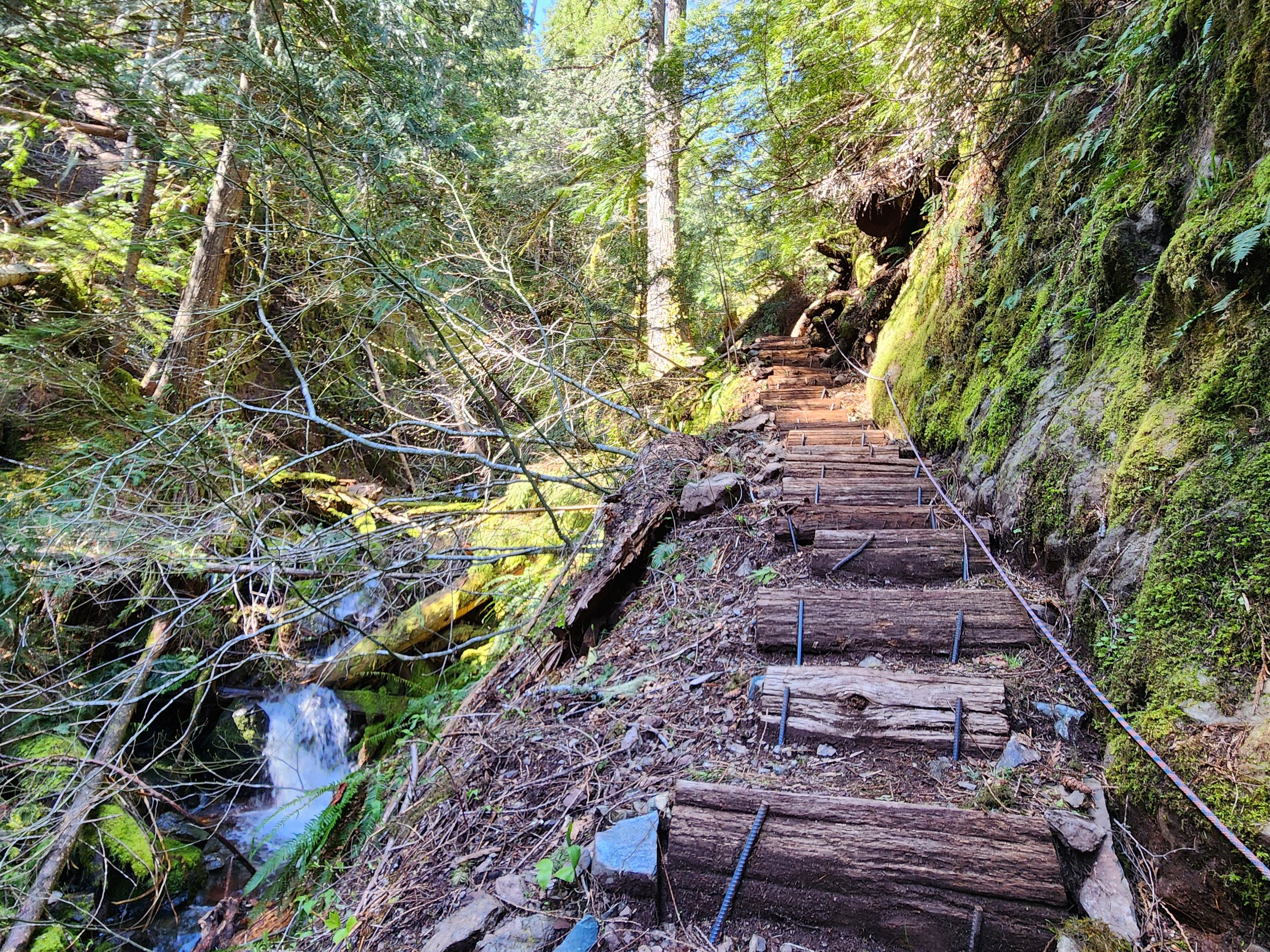
The Copper Creek Trail was originally built in 1915 by prospectors. After decades of abandonment, volunteers from the Mount Rose Trail Crew reopened it. They restored parts of the original tread as well as constructed new tread and pushed the trail beyond the old mines to a shoulder high on Lightening Peak. Like the original trail, this trail is steep—brutally steep in spots. And while it’s been greatly improved, it still contains some rough patches. It’s guaranteed to get your heart rate up and give your quads and hamstrings a good workout. The trail’s steepness, relative obscurity, and lack of sweeping views guarantees an uncrowded experience.Start climbing, entering a narrow and dark ravine.
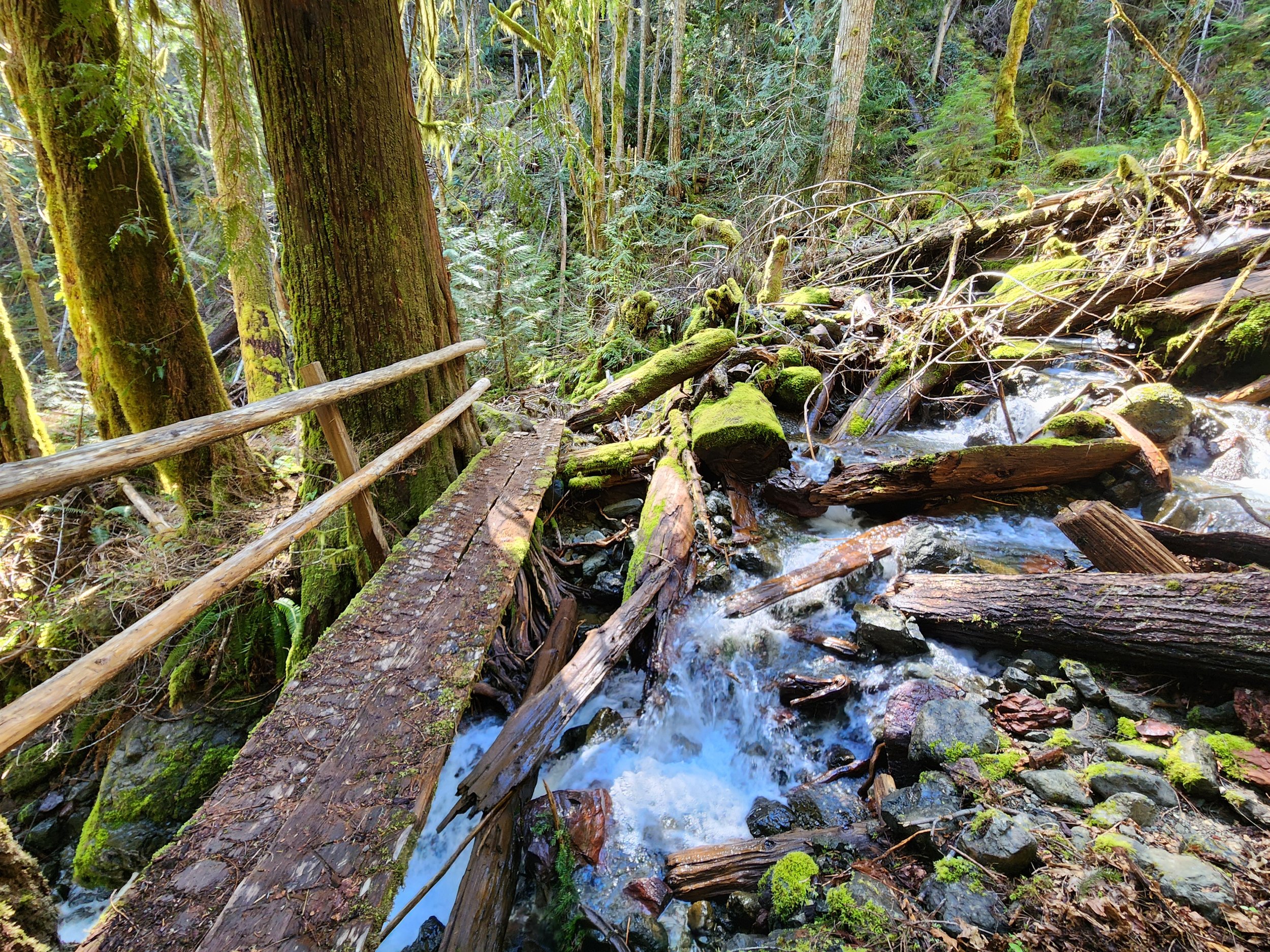
Witness large stumps, testaments of the primeval giants that grew here before loggers sent them off to the mills. The area’s steep and rugged terrain made logging difficult higher up the surrounding slopes. Impressive old-growth cedars and firs will greet you as you ascend higher. Cross the crashing waterway on a good bridge. Just downstream from the bridge scan the west side of the ravine wall to spot a shaft from the Brown Mule Mine. Another shaft is located farther downstream. Use caution if you wish to explore them. The mine began operation in 1915 and produced mainly manganese and silica. The mines were busy during World War I and then slowly ceased production.
The trail now gets steeper and traverses a stretch prone to slides. Take a break at one of the trailside benches and admire a cascading tributary plummeting steep ravine walls from high above. Then continue working your way up an increasingly narrow ravine. Copper Creek crashes below your feet. The trail then gets insanely steep climbing above the creek via a series of tight switchbacks and steps.
The way eases in grade as it enters a grand forest of giant ancient cedars and Douglas-firs. At 1.4 miles, reach an easy to miss junction. Here a short trail leads left to the site of the Apex Mine. Manganese was the main metal mined here. A small amount of jacobsite was also extracted from this mine. The Apex Mine is the only known site in the country where this rare metal was mined. By and large though it was manganese, attracting most of the attention.
The entire Lake Cushman Mining District contains large concentrations of this metal which is important in steel production. During World War II operations were ramped up and pressure was put on Olympic National Park to allow access to many of the claims within the park. Attempts were made by business interests to allow for unrestricted mining within the national park. Several existing claims were allowed to continue years after the park was established. But park administrators held strong on the park’s original enabling act which didn’t allow for expanded and extended mining.
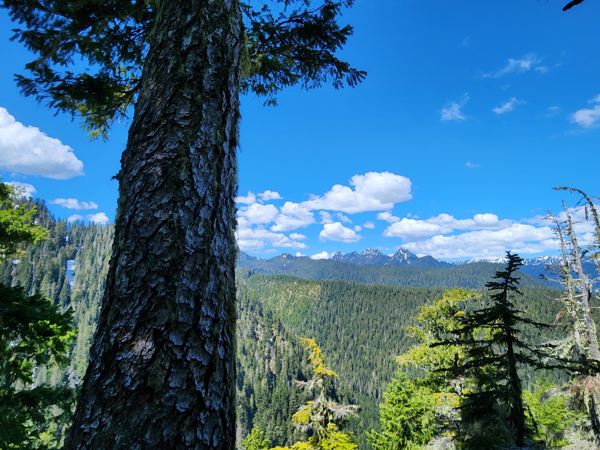
After checking out the old Apex site return to the main trail and continue steeply climbing, soon reaching another junction. Here the trail forms a loop. Head in either direction through primeval forest to attain a 3280-foot narrow shoulder of Lightning Peak. Views are limited on forested ridge, but you’ll be able get glimpses of the rugged Lightning Peak towering above and of shimmering Lake Cushman and the Elk Creek basin below. You’ll also be able to catch a decent view west to the Five Ridge Peaks and Wonder Mountain—some of the loneliest summits in the Olympics.
After closing the loop brace yourself for one knee-jarring descent. Trekking poles will definitely come in handy!
Feature author
Craig Romano
An award-winning author, photographer, ardent conservationist, Craig is also a NW trails and hiking expert. He hikes, runs, paddles, and bikes and has written about these passions for more than two dozen publications, including; Seattle Met, Backpacker, Paddler, Northwest Runner, AMC Outdoors, and Northwest Travel and Life. Craig writes weekly content for Hikeoftheweek.com and is the author of more than 25 books. Craig has been a regular columnist in Tracing the Fjord since 2019.

Bird’s Eye View from Mount Townsend
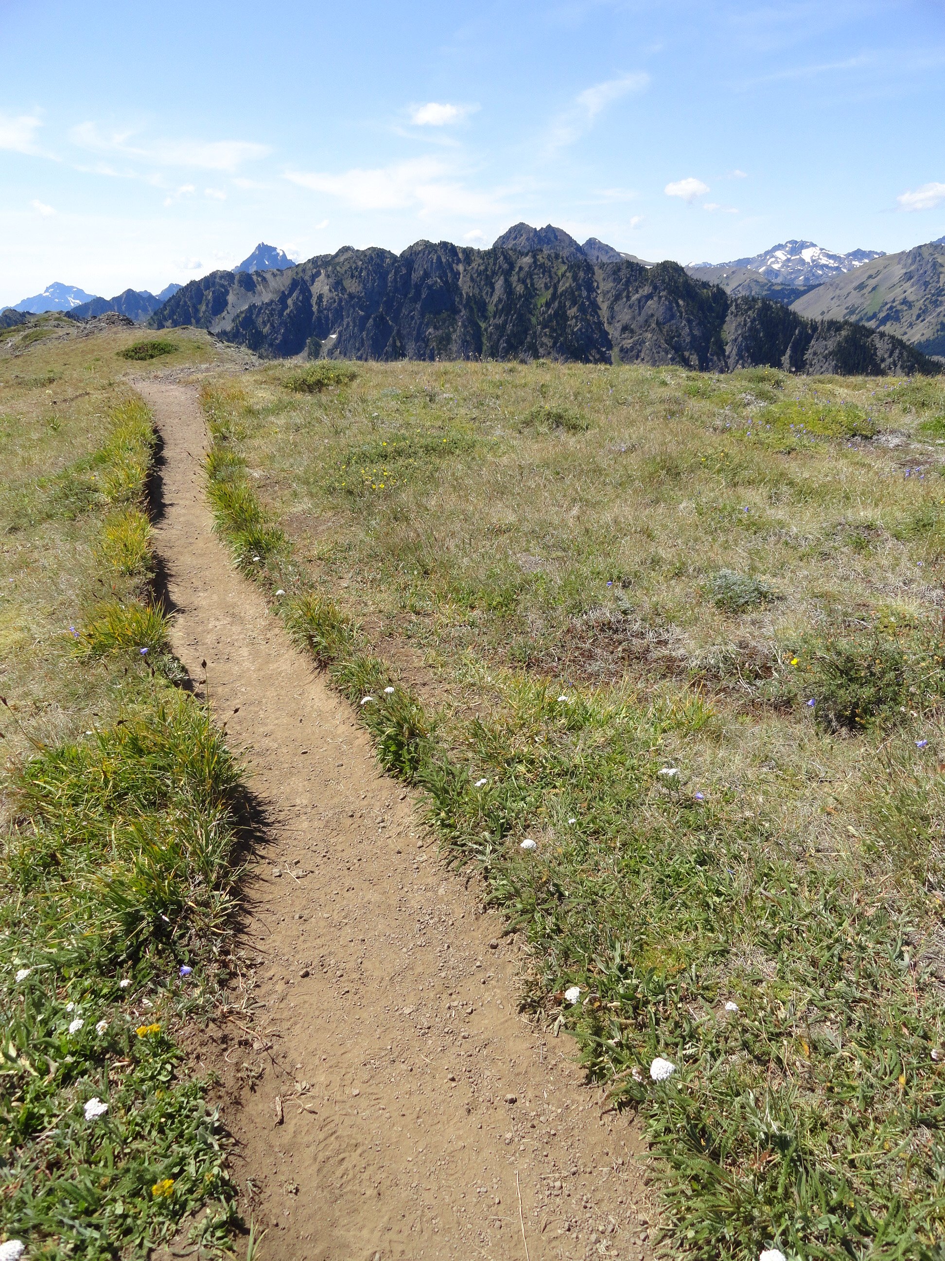
Mount Townsend is a prominent landmark — and one of the region’s most hiked peaks. Its broad open summit affords sweeping views of some of the highest and craggiest peaks in the Olympics and a myriad of islands, straits, bays and peninsulas below.
Story & Photos: Craig Romano

Mount Townsend | photo credit Craig Romano
Rising more than 6200' at the northeast edge of the Olympic Mountains, Mount Townsend is a prominent landmark — and one of the region’s most hiked peaks. Its broad open summit affords sweeping views of some of the highest and craggiest peaks in the Olympics and a myriad of islands, straits, bays and peninsulas below. Stand atop this mountain on a clear day and watch ferries and vessels ply the shimmering waters below. Marvel at the Seattle skyline against a backdrop of snowy Cascade Mountains dominated by big, beautiful Mount Rainier. Ascend Townsend in the summer and be greeted by a brilliant array of wildflowers swaying in the alpine breezes.
Hit the Trail

There are four ways you can hike to get to the summit of Mount Townsend and all of them offer great views and a good workout. The most popular route to the mountain is the Mount Townsend Trail from its upper trailhead. An out and back via this route clocks in at 8.2 miles with just shy of 3000 feet of elevation gain. But if you don’t mind a slightly longer hike with a little more elevation gain, consider starting from the Lower Trailhead.
Throughout much of this hiking season you just may have to start from the Lower Trailhead as the Forest Service works on the upper trailhead access road rendering it off limits while under construction.
The Lower Trailhead start will add two more miles to your total roundtrip and another 500 feet of elevation gain. But it’s worth it. The way traverses a beautiful grove of primeval forest and passes by tiny Sink Lake where Townsend Creek performs a disappearing act. After one mile of pleasant walking you’ll emerge at the upper trailhead. As you approach the trailhead what may be an unsightly situation. The lack of an outhouse at such a popular trailhead as led many to violate leave no trace principles with some bad bathroom etiquette. Perhaps a note to the Forest Service in support of a trailhead privy can help rectify this situation.

From the Upper Trailhead, follow a well-beaten path and steadily ascend. The trail weaves through a stately grove of Douglas-fir and western hemlock adorned with Pacific rhododendrons. Time your hike for late May through June and enjoy brilliant blossoms. After a half mile enter the Buckhorn Wilderness protecting more than 44,000 acres of spectacular terrain in the Olympic Mountain’s northeastern rain shadow. Continue climbing transitioning into more open forest and start catching views that will only improve in magnitude as you carry on.
Cross several cascading creeks as you follow copious switchbacks upward.

At just past 2.5 miles reach a small pine and fir grove nestled on a small knoll just above tiny Windy Lake. And do hope the lake lives up to its name or its resident bugs may force you to move quickly through the area. In another half mile reach the scenic trail to the Silver Lakes. Bear right and soon leave the trees behind as you attain Townsend’s summit plateau.
Now traverse the subalpine tundra that upon a quick glance may appear barren. But it’s full of life and in summer beaming with color thanks to a myriad of wildflowers; cinquefoil, phlox, paintbrush, and harebells among them.

Look too in the rocky areas for Piper’s bellflower, a campanula that is endemic to the Olympic Mountains. Owing to its drier aspects, junipers hug the ground throughout Townsend’s summit.
At 4.0 miles from the upper trailhead reach a junction. The main trail continues left descending to the Little Quilcene Trail offering two more approaches to the summit—one from the Northwest and one from the Northeast. Head right for 0.1 mile to the mountain’s highest point, its 6280-feet south summit. Consider continuing on the trail a short distance to Townsend’s northern 6212-foot summit too. It was on this point from 1933 until 1962 that a fire lookout once sat.
The views are great from anywhere along the open peak. Gaze out to the Salish Sea with its sprawling labyrinth of islands, bays, and channels. Watch ferries ply azure waters. Marvel at the Seattle skyline sparkling in the afternoon sunlight. And admire a fortress of Cascade peaks, punctuated by the snowy volcanoes. Look north to Dungeness Spit, Discovery Bay, the San Juan Islands, and Vancouver Island. And to the west, it’s nothing but pure Olympic wilderness—jagged peaks and deep green valleys.
And if you’re wondering if Townsend (as well as the nearby city and port) takes its name after the 19th century naturalist who named Townsend’s chipmunk, Townsend’s ground squirrel, Townsend’s solitaire and many other species—it is not!
Captain George Vancouver in 1792 bestowed the name Townsend—originally Townshend for the Marquess of Townshend. The father of Thomas Mamby, one of Vancouver’s crew members was an aide-de-camp to the Marquess at the time. The S’Klallam Tribe which had a community on the bay at the time originally called it Kah Tai which translates to pass through. You’ll probably want to pass through Mount Townsend on a return trip by perhaps ascending it via one of the other routes.
Mount Townsend Details
Distance: 8.2 miles roundtrip
Elevation Gain: 2980 feet
High Point: 6280 feet
Difficulty: moderately difficult
Snow free: June to November
Trailhead Pass Needed: None
Notes: trail also open to horses, wilderness rules apply
GPS waypoints: Trailhead: N 47 51.385, W 123 02.153
Land Agency Contact: Olympic National Forest, Hood Canal Ranger District, Quilcene; http://www.fs.usda.gov/olympic
Recommended Guidebook: Day Hiking Olympic Peninsula 2ed (Romano, Mountaineers Books)
Trailhead facilities: none
Trailhead directions: From Shelton, drive US 101 north for 50.5 miles. Upon crossing the Big Quilcene River just shy of the community of Quilcene turn left onto Penny Creek Road. The drive 1.5 miles and bear left onto Big Quilcene River Road (Forest Road 27). Follow this generally good road for 12.5 miles for the lower trailhead turnoff; or 13.7 miles for the upper turnoff. Then reach the lower trailhead in 0.8 mile or the upper trailhead in 0.7 mile.