
15. MOUNT ELLINOR in OLYMPIC NATIONAL PARK
Mount Ellinor is an Olympic classic delivering iconic views of Lake Cushman, Hood Canal and the eastern Olympic front.
Location: Lake Cushman and Hood Canal
Distance: 6.6 miles round trip
Elevation Gain: 3270 feet
Difficulty: Strenuous
Permits: Required (Northwest Forest Pass or Interagency Pass)
Hiking Season: July to October
Kid & Dog Friendly: Not recommended
Trailhead Amenities: Restroom available
Notes: Trail prone to avalanches; very dangerous early in the season
Trailhead GPS Waypoint: N47 30.397 W123 13.928
Maps: Green Trails Oly Mountains E 168S
Contact: Olympic National Forest, Hood Canal Ranger District in Quilcene
Trailhead Directions from Shelton: Travel north on US 101 for 15 miles to Hoodsport. Turn left onto SR 119 and continue for 9.3 miles to a T-intersection. Turn right onto gravel FR 24, go 1.6 miles and then turn left onto FR 2419. After 4.6 miles, you'll reach the lower trailhead. The upper trailhead is reached by continuing on FR 2419 for 1.6 miles, then turning left onto rough FR 2419-014 for one mile.
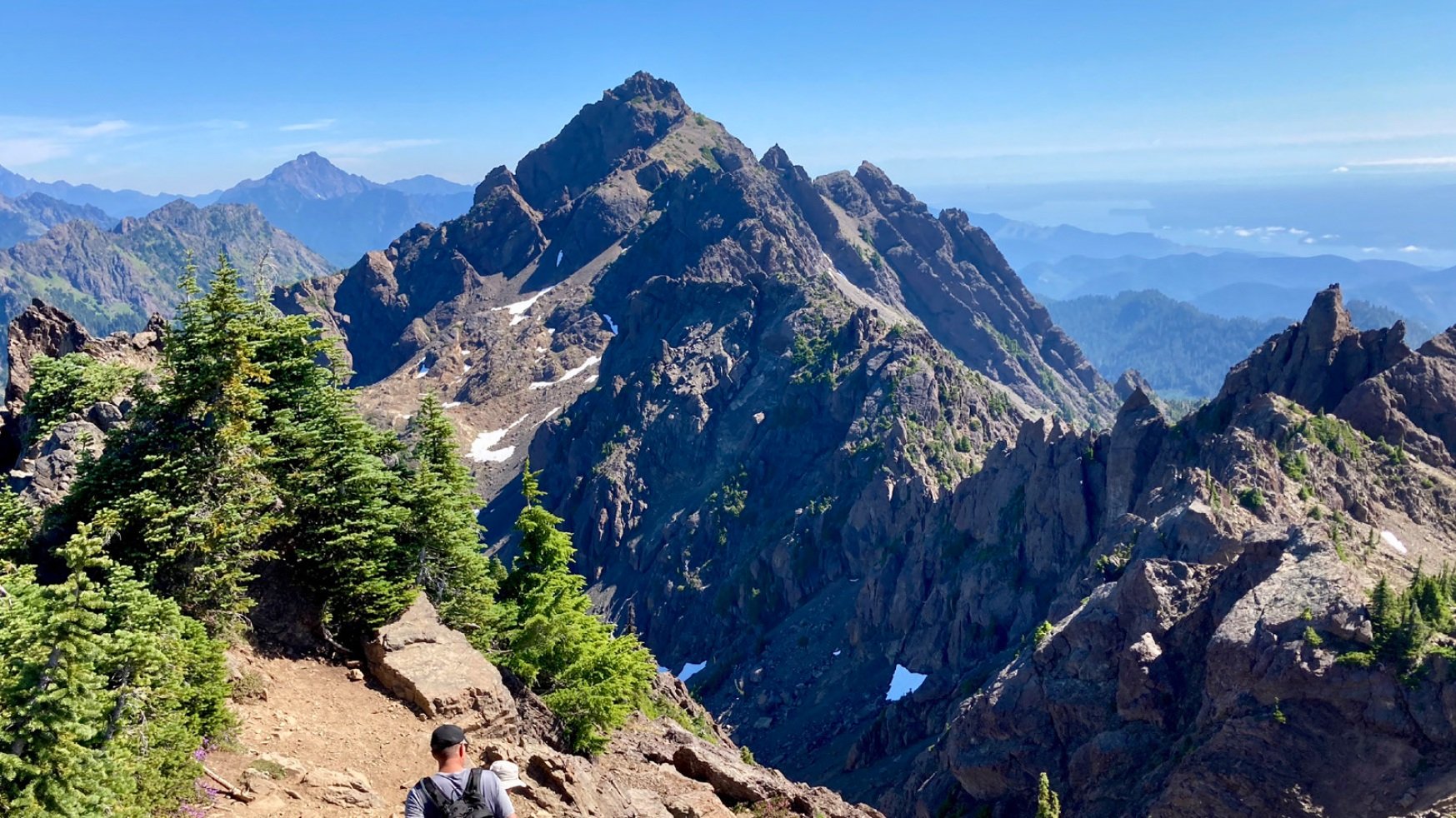
Ellinor is a popular but challenging hike in the Olympics. Many hikers tackle this steep trail each year for its stunning views, but it can be dangerous during bad weather or when snow is present.
There are two starting points for this hike. If you just want to reach the summit quickly, use the upper trailhead to cut both distance and elevation. For a more leisurely hike through beautiful forest areas, start at the lower trailhead. The trail from the lower trailhead takes you through old, tall trees like hemlock and Douglas-fir, with rhododendrons underneath. At 0.2 miles, take the right path at a junction to stay on track. As you hike alongside an old clear-cut area, catch glimpses of the peak in the distance. The trail then goes uphill along a densely wooded ridge, reaching a junction at 1.6 miles. Keep left to continue towards the summit or go right for the upper trailhead. Another junction appears soon after, providing another path to the upper trailhead.
Join hikers, climb left steeply, bear left at 2.4mi, meadows and rocky gardens, thank Mount Rose Trail Crew, ascend steep slope with steps, admire flowers and view, traverse beneath summit block, climb rocky ridge to Ellinor's 5944ft summit.
Nearly a mile below, you can see Lake Cushman sparkling. Look further to see Hood Canal, Puget Sound, and the Cascade Mountains with Mount Rainier and Mount St. Helens. To the north and west, you'll see the rugged Olympic Peaks, including distant views of Mount Olympus. Don't forget to look down to spot a small pond in the Jefferson Creek Valley.