
Do the Dosewallips
Craig Romano, author
Dosewallips State Park consists of more than 1000 acres of prime wildlife habitat along the Dosewallips River at its delta on Hood Canal. Well-known for its year-round family-friendly campground (complete with yurts) and excellent fishing and shell fishing opportunities, the park also contains a wonderful network of hiking trails. Saunter out to wildlife rich tidal wetlands on Hood Canal or explore quiet groves of mature forest graced with thickets of rhododendrons and cascading creeks. Hike along the glacier-fed Dosewallips River too. And retrace the route of an old railroad grade while sleuthing for relics of the area’s bygone logging days.
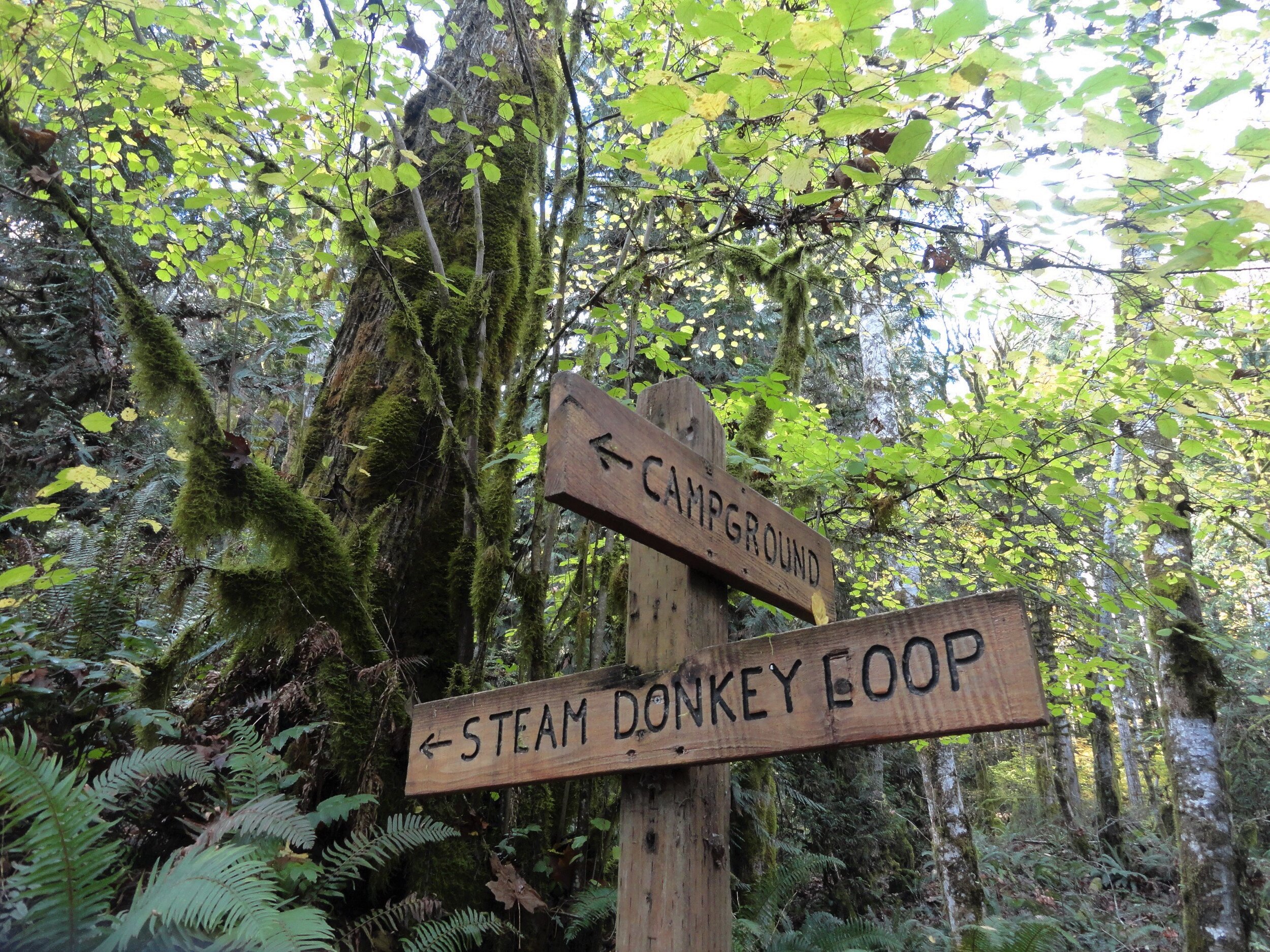
Photo credit: Craig Romano
Hit the Trail
There are nearly five miles of trails in Dosewallips Park to explore with your family. Most of them are interconnected allowing for some loop options. An excellent 3.6 mile loop around a good portion of the park’s periphery can be made by following the Maple Valley and Steam Donkey Trails.

Start this loop hike from the ranger station by walking a short distance northwest up the dirt road signed for the Maple Valley Trail. After passing through the Meadow Group Camp, reach the Maple Valley Trailhead. Now head up the trail and soon come along the Dosewallips River.
Legend has it that Dos-wail-opsh was a Twana Indian who was turned into a mountain, forming the source of the Dosewallips River. From his lofty position in the Olympic Mountain wilderness, this transformed Native American did well by creating one of the peninsula’s most wild and scenic rivers.
The Twana once had a village at the mouth of the river on Hood Canal. In 1855 the Treaty of Point No Point resulted in many of the Twana people being relocated to the small Skokomish Reservation located at the mouth of the South Fork of the Skokomish River.
Hike along the river through a forest of cedars, cottonwoods and of course—maples, both bigleaf and vine. In fall the maples add touches of gold to the forest. Scan the forest for elk. They are prolific in this area and are frequently sighted in the state park. If you don’t see any of this hike, you’ll probably see plenty of signs of their presence.

Photo Credit: Craig Romano
Continue along the trail hugging a steep slope above a river channel. The way then reaches a junction with the Rhody Cut-off Trail. You’ll be returning on that trail for this loop—so continue right. The way now gently descends to a bridged crossing of cascading Phantom Creek.
Then it’s time to climb again as the trail ascends a steep bluff and moves away from the river. Washington State Parks has been working with several agencies to greatly increase the size of this park to protect more riverfront. Once public access can be secured, there are plans to construct a trail along the river from the state park to national forest land about five miles upriver. Much of the new protected river corridor will be included in the state park.
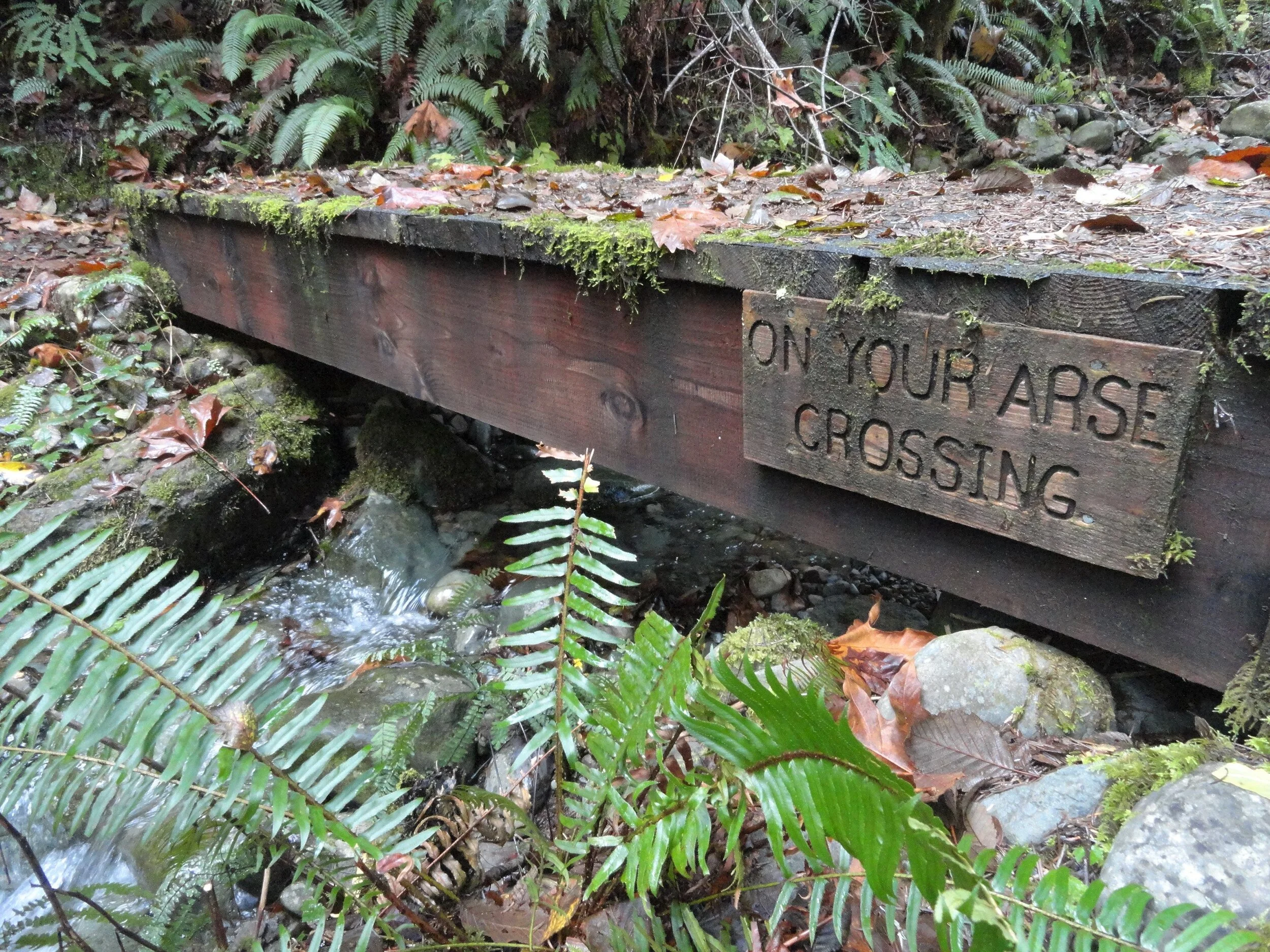
Photo Credit: Craig Romano
The Maple Valley Trail now bends southward skirting an old cut along the park’s current boundary. At about one mile from your start it reaches a fire road. The road can be used as a short-cut back to the campground.
To continue the loop proceed straight on the Steam Donkey Trail. Steam donkeys were steam powered winches used by loggers in the early twentieth century for yarding and loading downed timber.
Here as well as throughout much of the region timber was transported by rail to sawmills or to docks where it was floated to mills
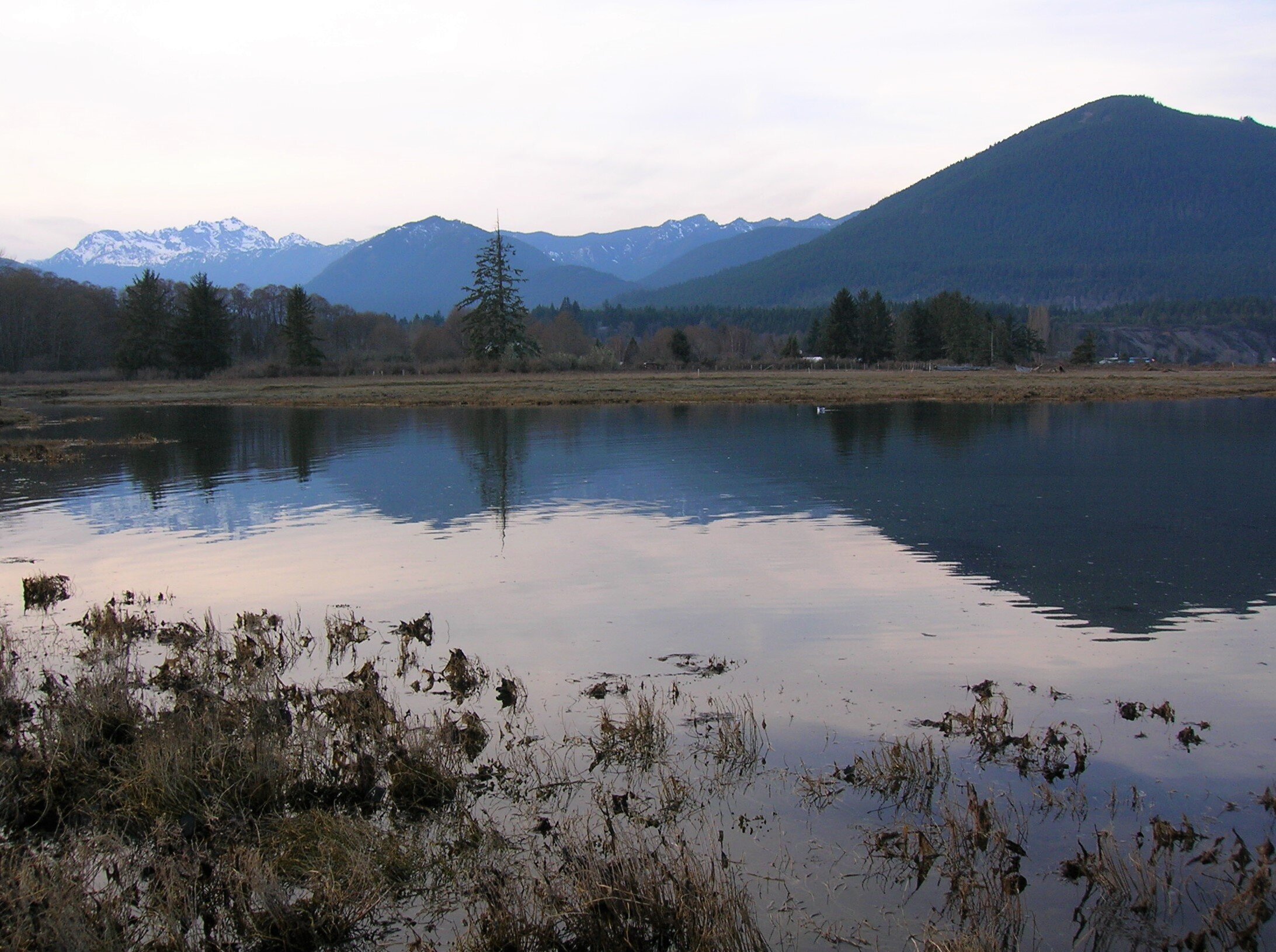
Photo Credit: Craig Romano
Running parallel to the Steam Donkey Trail and reached by walking just a short distance east on the Fire Road is the Izett Grade Trail. This trail follows a half mile stretch of an old railroad grade. The Izett Logging Company had constructed five miles of railroad in this area in the late 1890s. Logs were then transported to Hood Canal and floated to a mill in Seabeck. The Izett Grade Trail eventually reconnects with the Steam Donkey Trail and shortens the loop by only 0.1 mile.
The Steam Donkey trail continues south along the state park boundary gently climbing through maturing second growth. The trail passes a large fir struck by lightning in 2001 before crossing Phantom Creek. It then comes to a small bridge whimsically named the On Your Arse Crossing. The way then spans another cascading creek before cresting a ridge. It then begins a long gentle descent following an old road grade through maturing timber. After passing the southern end of the Izett Grade Trail the loop reaches a small dammed pool that once provided water to power the Izett Logging Company’s steam donkeys.

Photo Credit: Craig Romano
The trail then once again comes to the Fire Road. Cross the road and continue straight passing part of another stretch of old railroad bed. The logging railroads here were decommissioned in 1913 shortly after the logging company’s founder James Izett passed away. The trail next descends into a gulch coming to a junction. You can shorten the loop by heading right reaching the park road after crossing the short metal bridge
The recommended loop heads left now following the Rhody Cut-off Trail. It soon makes a bridged crossing of a creek shaded by attractive cedars; then veers left at a junction where a spur trail heads to a group camp. The trail then climbs a low ridge draped with rhododendrons. You’ll want to return to this stretch of trail in May or June. The Rhody-Cut-off Trail then loses elevation returning to the Maple Valley Trail. Return to your start by retracing a short stretch of trail to your right.
If you’ve got time and energy leftover, head over to the park’s North Tidal Trail. Follow this 0.3 mile trail to an observation deck near where the Dosewallips River drains into Hood Canal, creating a productive delta and estuary. Scan this ecologically rich ecosystem for seals and a wide array of birds.
Additional Details
Dog welcome but must be leashed while on the trail.
Land Agency Contact:
Dosewallips State Park
Recommended Map: Green Trails Olympic Mountains East 168S; State park map available at park ranger station.
Recommended Guidebooks: Day Hiking Olympic Peninsula 2nd edition (Romano, Mountaineers Books)
Trailhead Directions: From Shelton, drive US 101 north for 40 miles (From Quilcene drive US 101 south for 12 miles) to Dosewallips State Park entrance at milepost 307. Turn left (west) into camping entrance and proceed .3 mile to parking near ranger station.
Day-use parking is also available at picnic area and North Tidal Area Trailhead, trailhead facilities here include: privy, picnic area, ranger station, campground, and potable water.
