

Union City: Hood Canal town steeped in history
Hosting a rich tradition spanning generations of first people and settlers, Union hosts fantastic views of the Olympics and Canal while embracing the arts and community. It is little wonder it was voted one of the 20 Prettiest Towns in USA by Forbes Traveller.
Stella Wenstob, featured columnist
Descriptions of Union, WA usually run along the lines of "inspired by nature." The first time I encountered that aphorism I took it as artistic whimsy, but by the third website I read about Union, I became curious. Is only one person writing all of this advertising content? Maybe. Or perhaps there is something more here. Perhaps there is something inspirational about Union’s situation near the bend of the Hood Canal with uninterrupted views of Mount Washington, Mount Constance and the iconic Brothers.
Maybe there is a muse in this coastal, Mediterranean microclimate colored by the luscious, green foliage of salal bushes and the imposing Western Red Cedar and the bright red trunks of the Madrona trees. Possibly more is fed than the stomach on Hood Canal seafood. At Union maybe the soul is fed too. When I started to examine the history of the extraordinary people that lived in this area, I began to see this inspired lifestyle stretching back countless generations.

Union, circa 1910; Mason County Historical Society
The members of the Skokomish Tribe are descendants of the Twana people whose traditional territory covered an extensive area along the Hood Canal, inland to the peaks of the Olympic Mountains. The Skokomish River on the Eastern side of the Olympic Peninsula with its productive salmon run and valuable grasses for weaving baskets was especially important to the Skokomish. When their lands were limited to a small section of the Skokomish River by the Treaty of Point No Point in 1855 one elder from the area, S’Hau-at-Seha-uk, voiced his fear of losing his home and way of life, “I do not want to leave the mouth of the River. I do not want to leave my home; and my burying ground; I am afraid I shall die if I do.” Despite losing traditional lands and the damaging effects of colonialism – the Skokomish are a thriving people.
Skokomish Community Centre
Skokomish arts and culture are informed and shaped by nature. Bear grass basket making, though threatened by development of the traditional picking sites on the Skokomish river, is an intricate example of natural resources, ingenuity and art coming together along with cedar carvings, dugout canoes, drum songs and traditional dance. To see a beautiful display of the technique and intricacy of the Skokomish basket makers or the ornate carvings drop in on the newly built Skokomish Community Centre (located just off of Highway 101).
Opened in 2017 and located just outside of Union on the Skokomish Reserve, this intriguing hybrid building is a handsome example of Indigenous informed design – combining traditional plank, big-house style architecture with modern needs and conveniences—such as a gym, a meeting hall and a commercial kitchen. With over 400 solar panels on its roof the Skokomish Community Centre also offers a marvelous example of environment informing design.
The Ultimate Road Trip

If you continue traveling Highway 101 past the Skokomish Salmon Hatchery and take the turn on to Highway 106 you will find yourself on a winding highway following the Skokomish River as it meets up with Hood Canal.
After about twelve minutes of mossy delta and interesting views of cottages clinging to the thin strip of land between the road and the gently eroding riverbank reminiscent of a scene from Ken Kesey’s Sometimes a Great Notion you will head around the headland that opens up until the area we now recognize as Union.
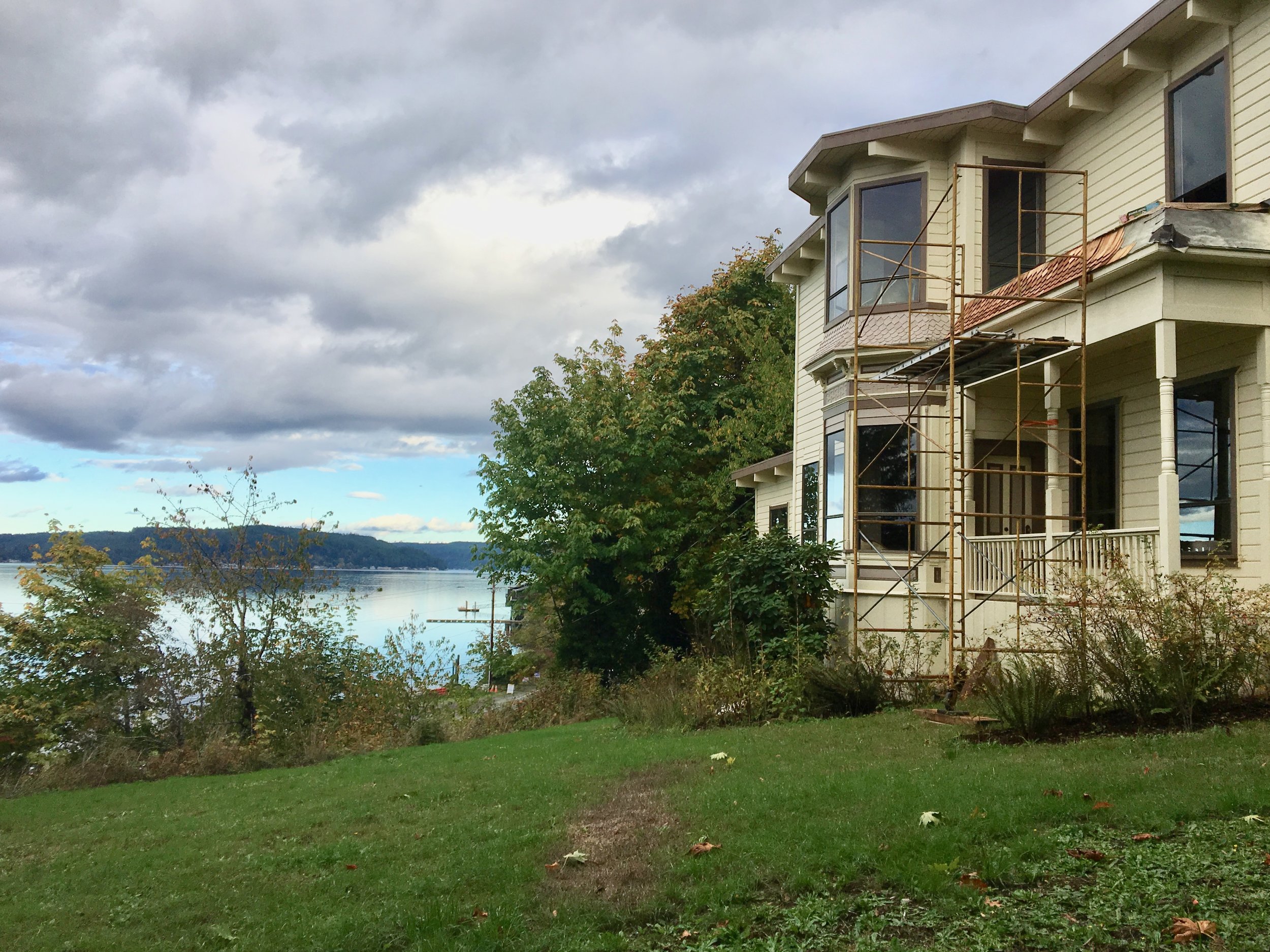
Known as duxWhLu’qWat3d to the Twana people, then called Skokomish by early settlers, in 1889 it was renamed Union City by lumberman, developer and legislator John McReavy to celebrate Washington’s declaration of statehood.
McCreavy was a boom and bust figure who had dreams of creating the “Venice of the Pacific” in Union. His mansion built in 1890 on the bluff overlooking Union is the site of a loving restoration project and is purported to be the oldest pioneer house on Hood Canal–and of course hosts a few ghosts.
As you continue on the East State Route 106 you will pass shops and a general store.
Along the highway you will find the remnants of Olympus Manor, Washington’s first artist’s colony created in the 1920s by the charismatic artist and musician Orre Nobles and his family. Influenced by an Asian -Art Deco aesthetic Olympus Manor was resplendent with a music room enclosed with rescued stain glass, a pipe organ and rich oriental rugs underfoot. The grounds were complete with a Torri gate that was crowned with a Native American dugout canoe.

Orre Nobles sketches in studio - UW Libraries, Special Collections
Although destroyed in a fire in 1952 the glamorous stories of the artists, musicians, actors, and stars that came to partake in the Hood Canal’s delights at Olympus Manor are the stuff of legends.
For a colorful and fascinating account of this early historical era of Union pick up a copy of Michael Fredson’s The Artist Colony on Hood Canal: Pixley, Orre Nobles & Waldo Chase (2011).
Another honorable mention found along this highway is the Robin Hood Village and Restaurant, built in 1934 by Don Beckman. A set designer from Hollywood, Beckman is known for working on the set for the classic Robin Hood starring Errol Flyn. In fact, one of the Robin Hood Village's early visitors was Errol Flyn himself.
The area has retained its reputation as an artsy community and guests of Robin Hood Village have the option of staying in the new cabins or historic cottages, one of which is rumored to be the cottage where Flynn stayed after he finished filming the classic tale and came to visit his old friend Beckham. The Restaurant and Pub carry on the arts tradition in Union with their year-round live entertainment feature local and visiting musicians.
After the sharp bend in the highway you head a bit inland and encounter the refurbished Dalby Waterwheel. Originally built in the 1920s, Edwin J. Dalby created the first source of hydroelectric power on the Hood Canal to provide electricity for his Seattle bride, Ethel. Ed Dalby was raised on the Canal and an adapt linguist speaking Skokomish and the Chinook Trade language. While studying at the University of Washington he worked as a researcher for the photographer Edward S. Curtis on his controversial The North American Indian (1907-1930) which strove to document in twenty volume images of the purported vanishing culture of the Native Americans. Now considered overtly racist in the project’s main philosophy that indigenous culture and identity was slated to be subsumed by Euro-American culture and many of the photographs Curtis produced are criticized for being too contrived, there is however an artistic, romantic quality to many of the pictures that transcends this. Dalby introduced Curtis to the Skokomish Tribe and, with the assistance of Skokomish brothers Frank and Henry Allen, persuaded local tribe members to pose in costumes, in imaginative scenes.

washingtonhistory.org
The misty shot of two women standing near a reed tent and beautiful cedar dugouts is iconic and quintessential. However, it is–like most romantic notions– highly contrived. Skokomish people in 1912 did not wear reed clothing or live in reed tents, being more accustomed at this time to western clothes and plank houses.
Henry Allen continued to assist Curtis and Dalby accompanying them in their work as far as North Dakota. Henry Allen’s voice was also recorded by Curtis on wax discs singing traditional songs. Curtis combined the recorded music of many different Native American voices and their photographs to create a musical slide show which he dubbed a “Picture Opera.” Curtis took his “Picture Opera” on tour across the country and played to a packed audience at Carnegie Hall in NY.
Skokomish music continues to influence Carnegie worthy works. On May 24, 2019 Union’s Great Bend Chorale and Youth Chorale led by Matthew Blegen will be performing at Carnegie Hall as part of the Distinguished Concerts in New York series. They will be performing a commissioned piece by conductor John Muehleisen inspired by early Salish recordings.
The hybrid work titled Borders begins with a Salish song of welcome, then Muehleisen weaves together European, African, Asian, and Latin American folk songs with his own settings of the poetry of Emma Lazarus, Brian Bilston, and Alberto Ríos in a powerful and moving musical journey that explores the historical roots of immigration and the modern relevance of America’s identity. The work takes up the question: How are we to treat the stranger, the foreigner, the outsider, and the “Other” amongst us? The local debut will be June 1 in Shelton and June 2 in Bremerton.
Hosting a rich tradition spanning generations of first people and settlers, Union hosts fantastic views of the Olympics and Canal while embracing the arts and community. It is little wonder it was voted one of the 20 Prettiest Towns in USA by Forbes Traveller. Whether it is the people, the history, the music, the food or the natural beauty, Union has something inspiring for everyone.

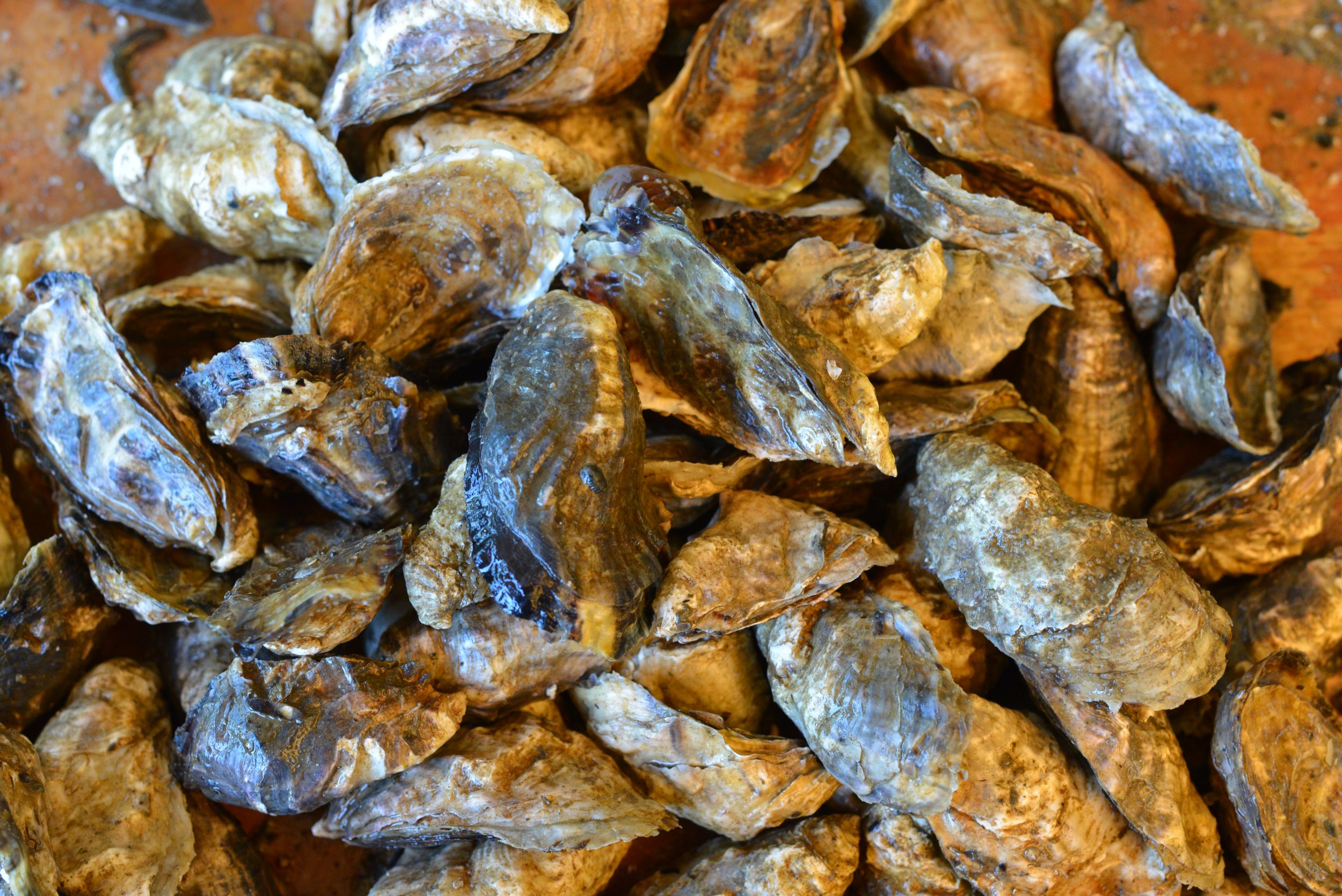
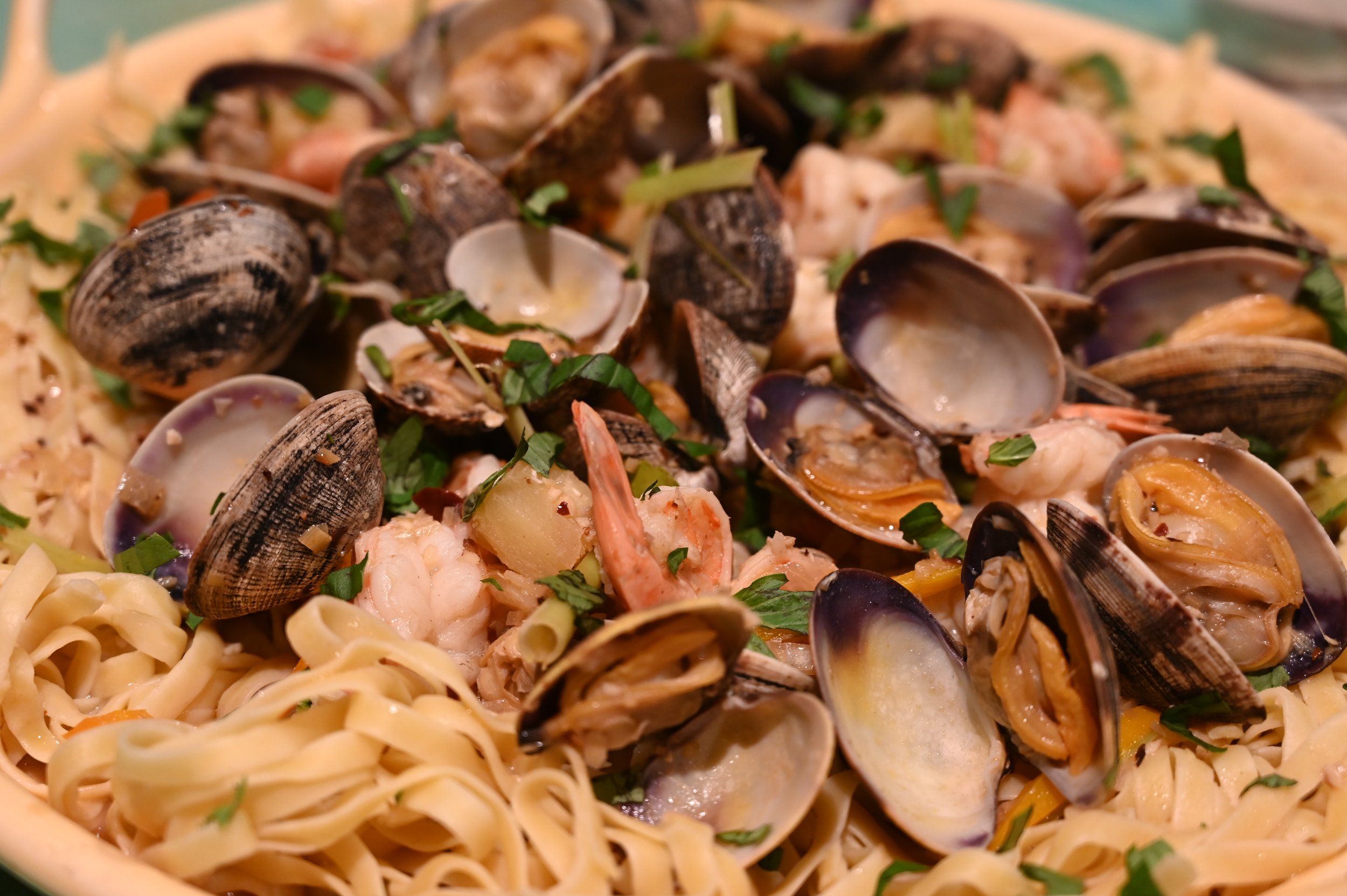
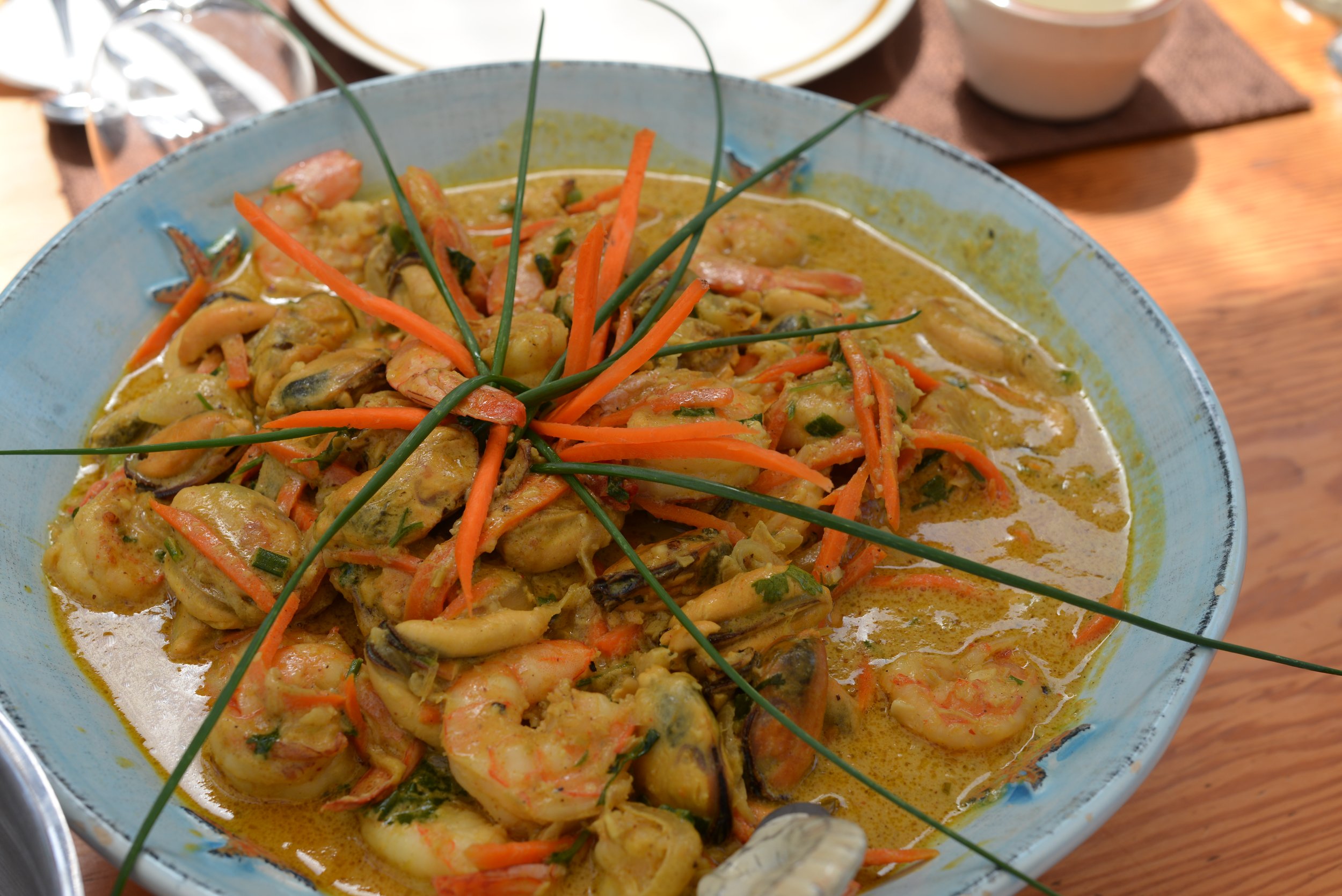
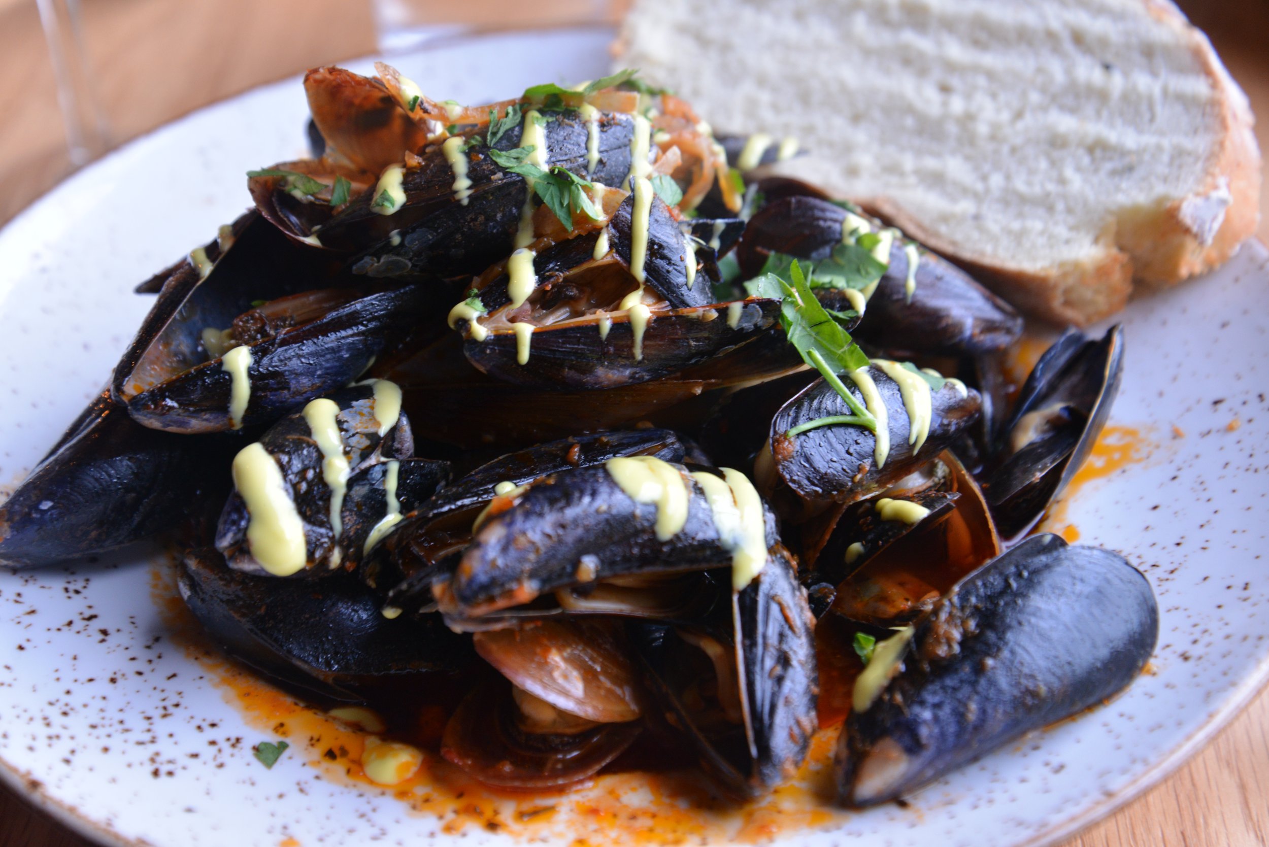
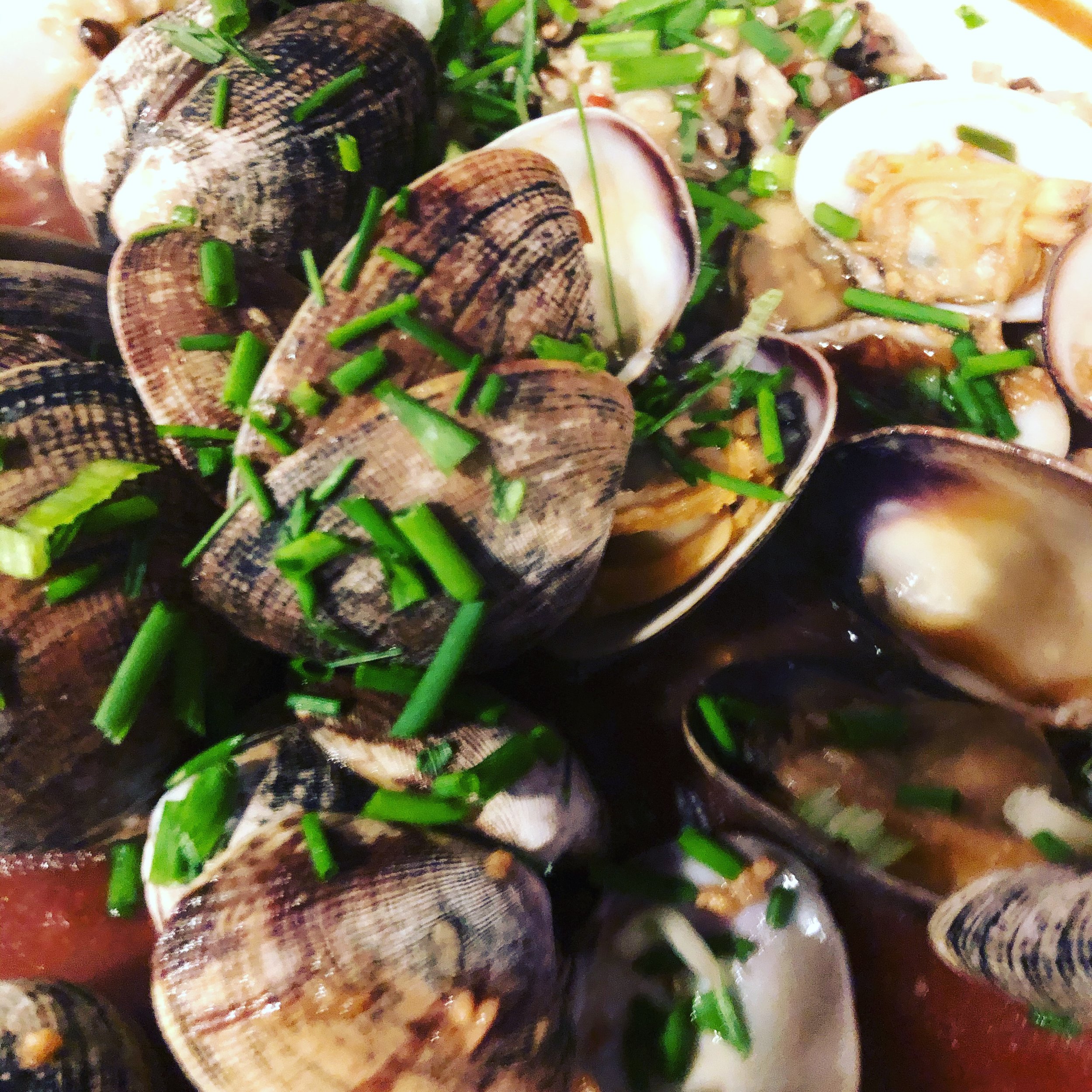
Celebrate Oysters on Hood Canal
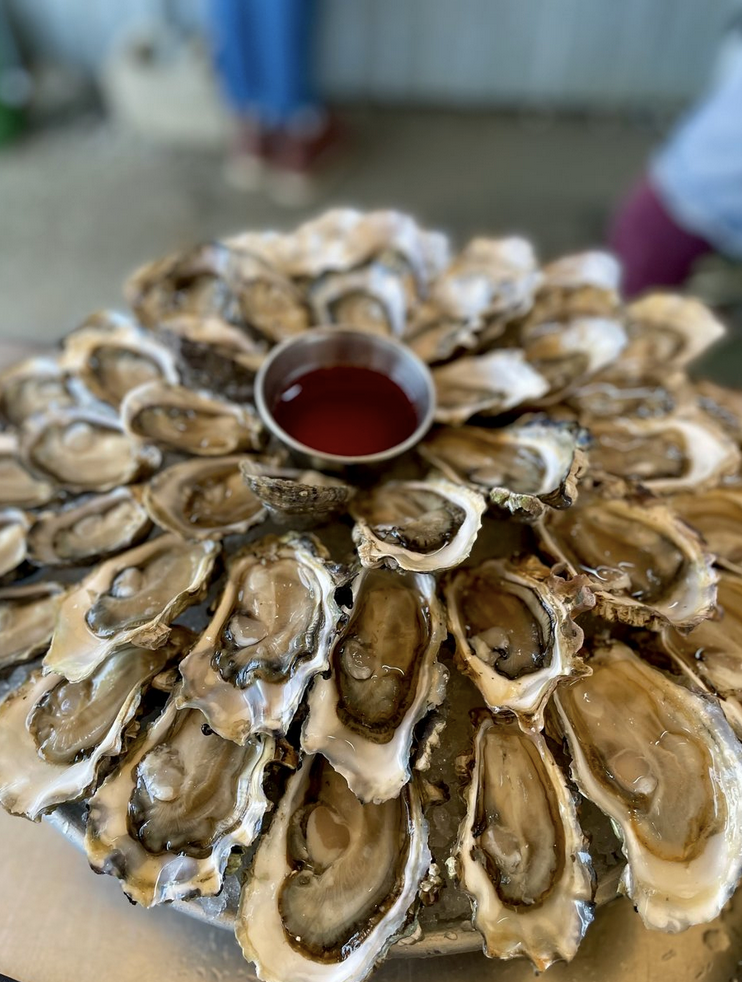
It's ok to be "shellfish" when your on Hood Canal. How about waking up to spectacular canal views for days filled with walks and beach treasure hunts? With spring weather on its way and the water warming up -t’s a great time to hit the Hood – and we’ve prepared a jam-packed customizable seafood itinerary for you.
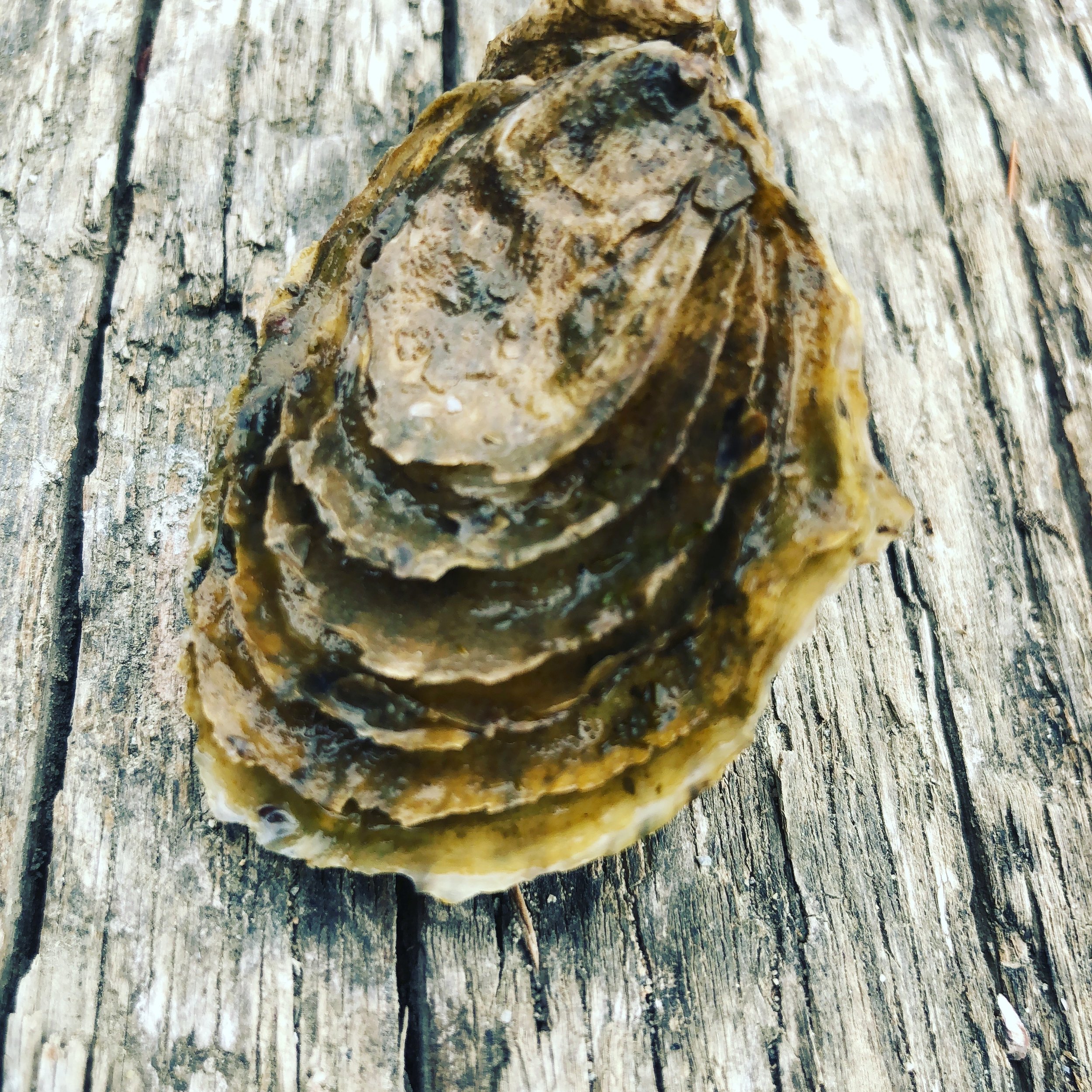
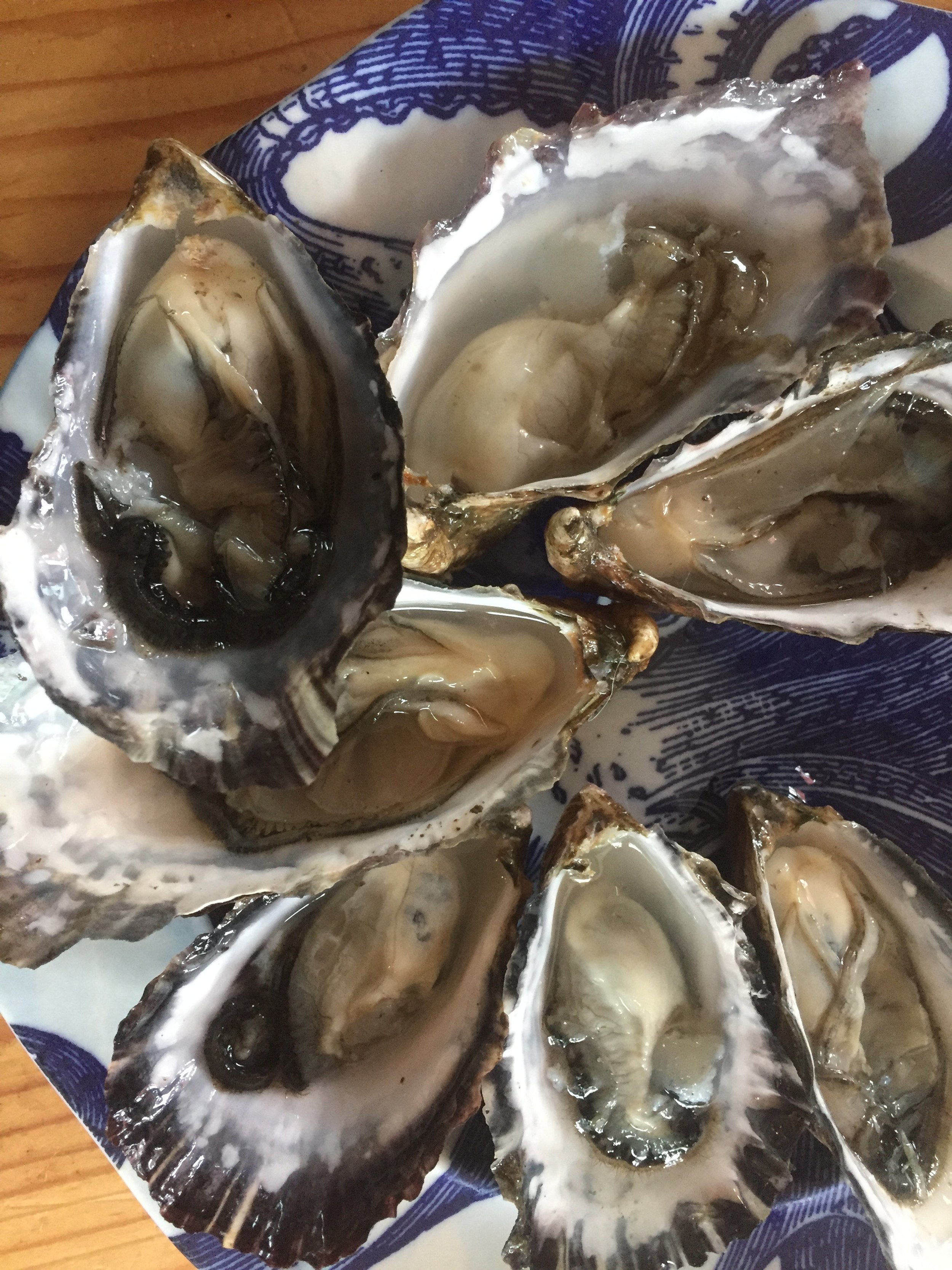
It’s a great time to head to Hood Canal and South Puget Sound and start enjoying fresh oysters on the beach.
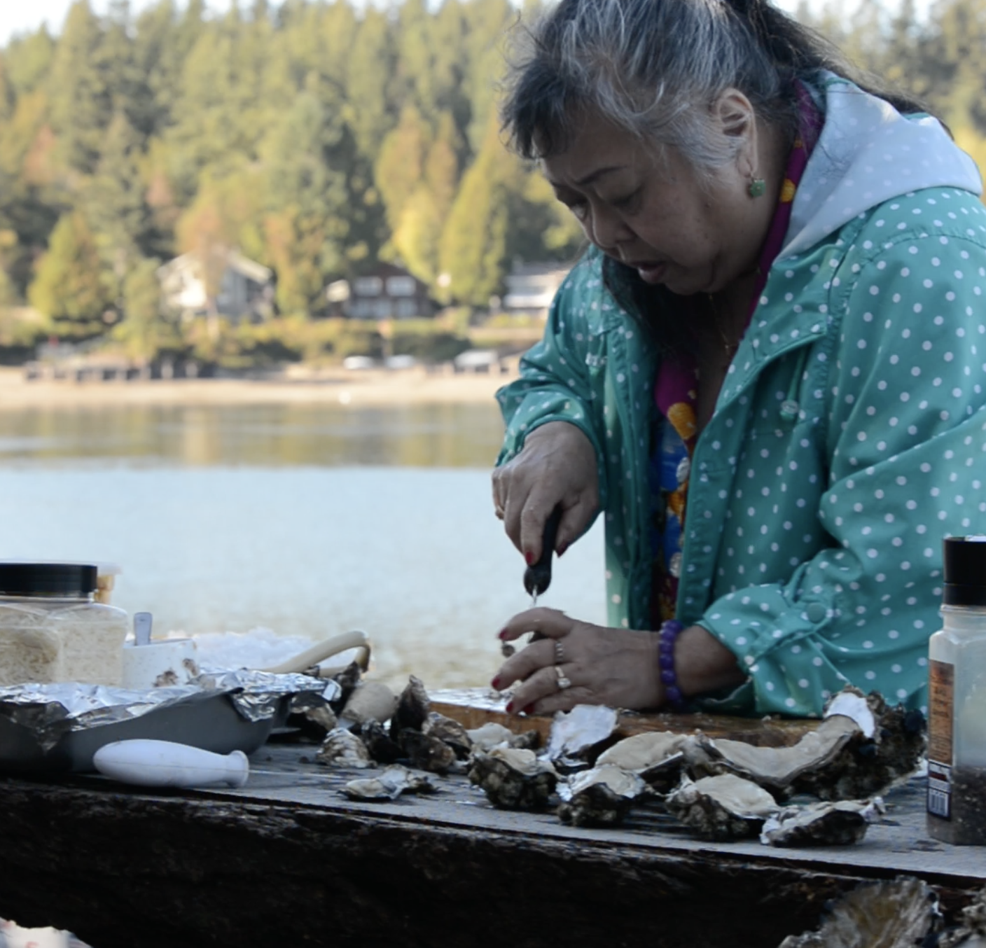
We’ve got a few ideas to get you “shell-e-brating” as well as a recipe from Xinh Dwelley to make your mouth water for some oyster love!
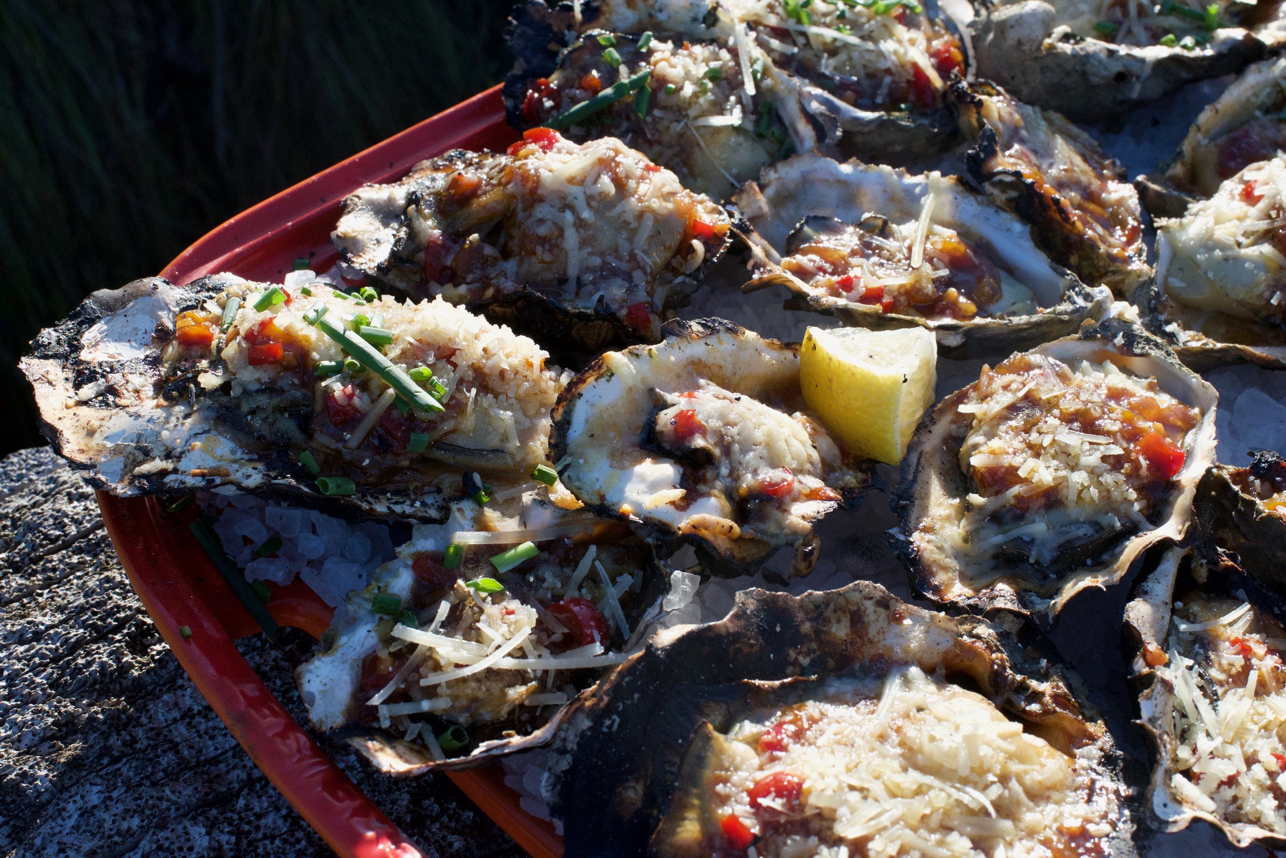
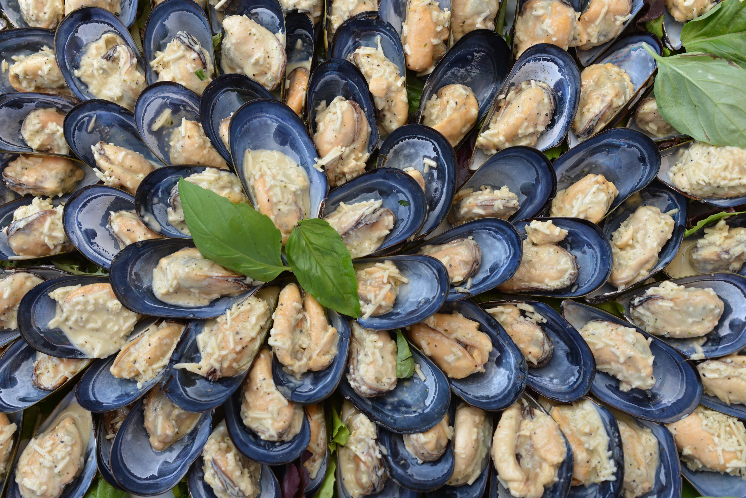
Xinh’s Grilled Oysters on the Half Shell
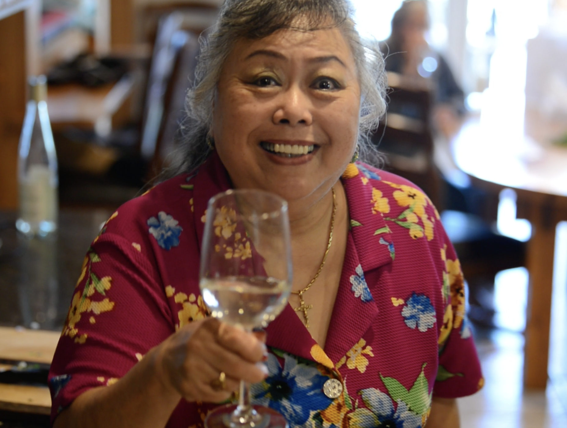
Recipe courtesy of Xinh Dwelley, celebrated seafood chef, Shelton, WA
(even the non-oyster eaters love these)
Prepare sauce in advance:
1/2 chopped red pepper, chopped
1/4 cup softened butter
1/2 cup chopped onion
Juice of 1 lemon
Salt and pepper to taste
2 tsp garlic, chopped
2 tsp soy sauce
1 tbsp hoisin sauce
1 tsp sugar
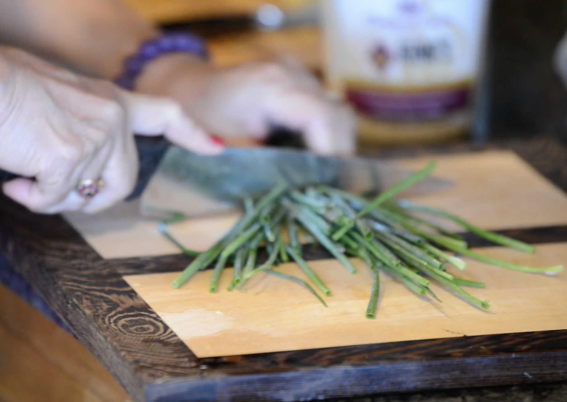
1/2 cup chopped chives
1/2 cup grated parmesan cheese
Combine ingredients in a blender and blend. Store in fridge until ready to prepare grilled oysters.
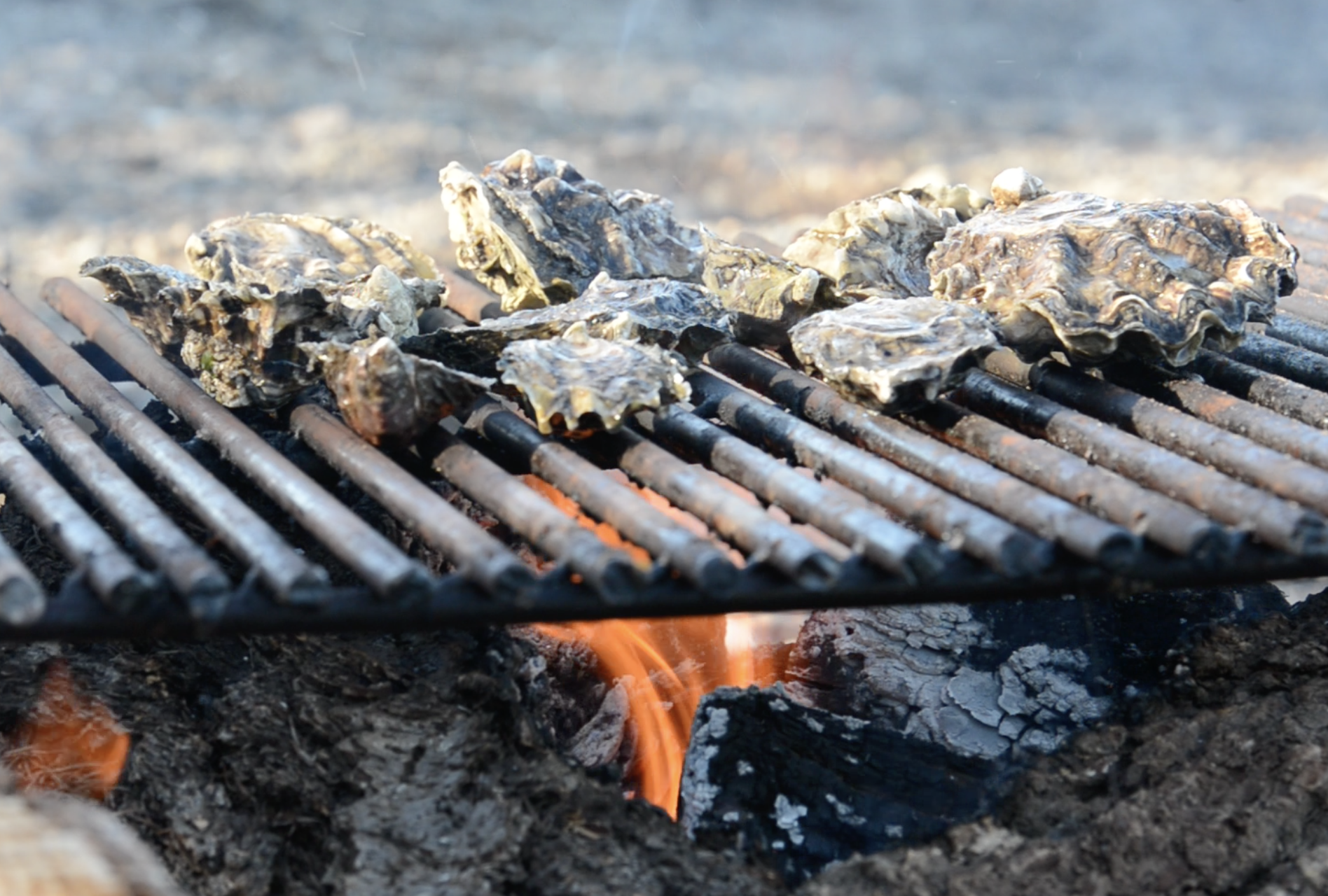
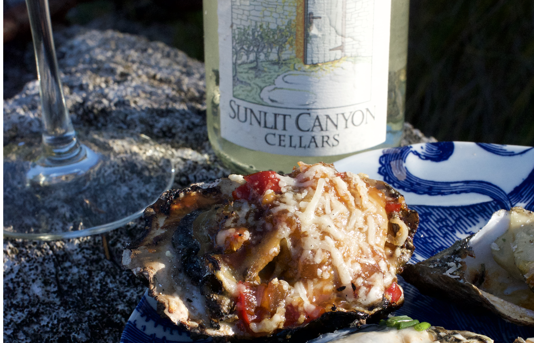
Place oysters on hot grill( 24-36 in shell). When shells begin to “pop” remove top with a heat-safe glove and top each with one teaspoon of mixture. Garnish with sprinkling of grated parmesan cheese ( about ½ cup total). Cook oysters are light brown and cheese has melted, 5-10 minutes. Serve hot.
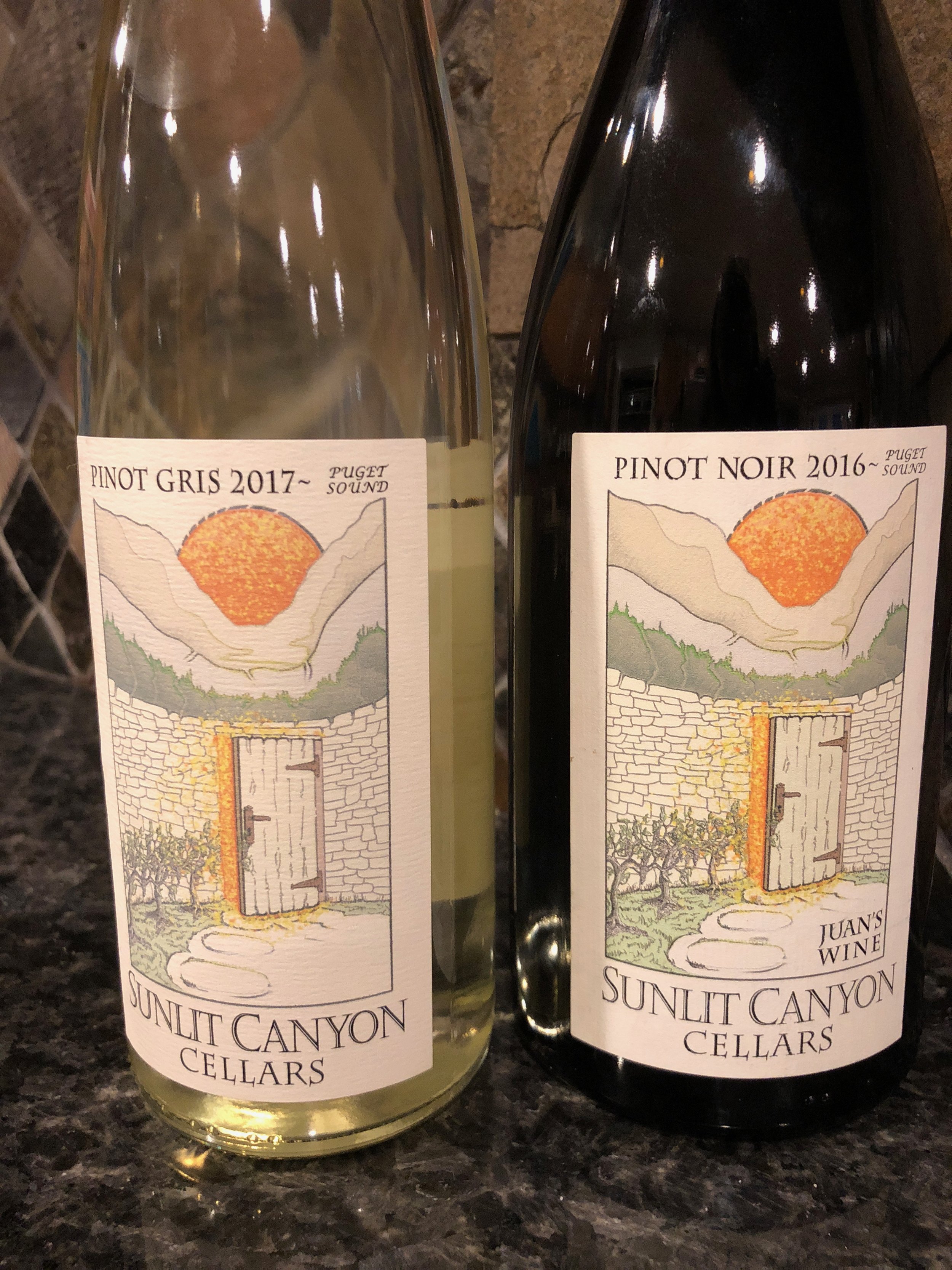
Oyster Pairing: Serve with Sunlit Canyon Cellars’s Pinot Gris ($22) available at Cameo Boutique in Union. Sunlit Canyon small batch wines are grown and bottled in Belfair WA overlooking Hood Canal.
Save some Clams & Visit Mid-week
Perhaps a few oysters will suffer, but who doesn't like to save a little money?
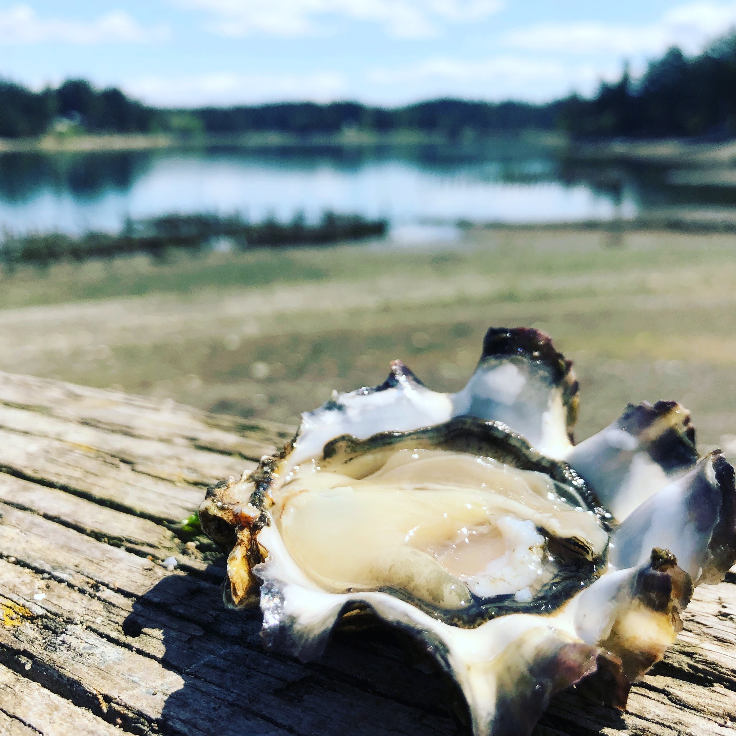
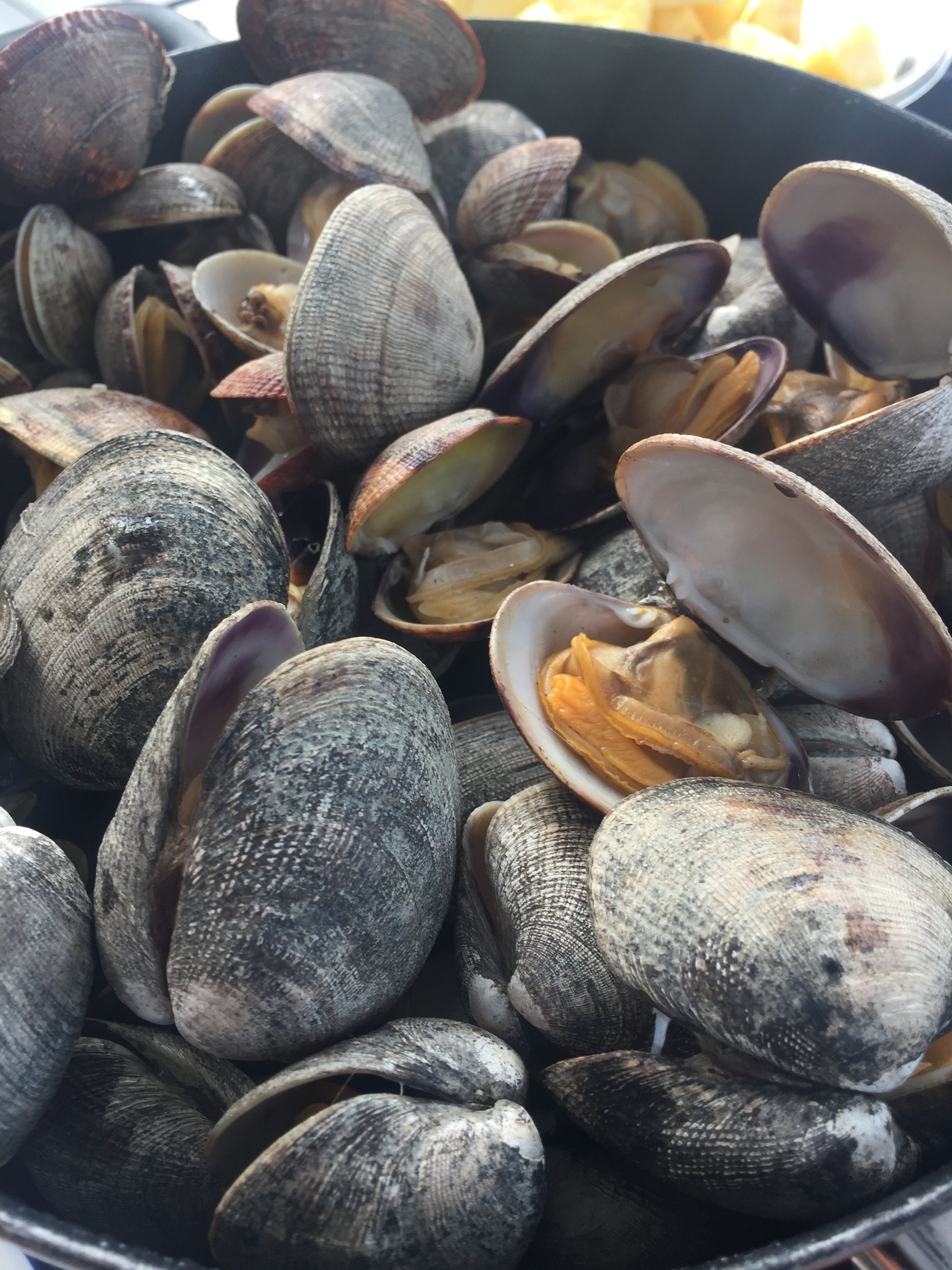
For great deals on lodging, not to mention more selection, consider heading to the Canal mid-week to enjoy activities you will not find anywhere else. Pack up boots, buckets and license and head to parks and DNR beaches that are regularly stocked with shellfish for the taking. Yes, taking! Check the tides before you head out. Another advantage to mid-week shellfish-gathering is you'll have the beach to yourself! Visit the DFO Shellfish Safety Map as seasons are beach specific. Always Check BEFORE you dig. We've prepared a handy list of area harvesting beaches here.
Alderbrook Resort & Spa is a great place to start a Oyster tradition - especially since April is their official Oyster Month! Not only can they harvest oysters right on their beach, serve some great Hood Canal oyster dishes on their daily menu in the restaurant.

Alderbrook Resort, view from the dock (left); view from 2 Margaritas' patio seating (top middle); Robin Hood Village Resort onsite restaurant (top right); Cedar Hill Cottage, Union (bottom middle); Hood Canal Marina & location of the Canal Cookout in Union (bottom right)
Want the house all to yourself? Consider snagging one of the great rentals that pepper coastal communities and woodland oases in the area. One of our favorites is the Cedar Hill Cottage in Union. This spacious shake home (two bedrooms) is perched on the hill above Union, and although it is technically not waterfront and nestled in the woods, there are glimpses of the Canal and the snow laden Olympics. Location is everything here. A short drive to Alderbrook Resort and just a quick walk to the heart of Union with coffee and bakery items at the Union Country Store, boutique shops, and waterfront dining at 2 Margaritas.
Farm visits
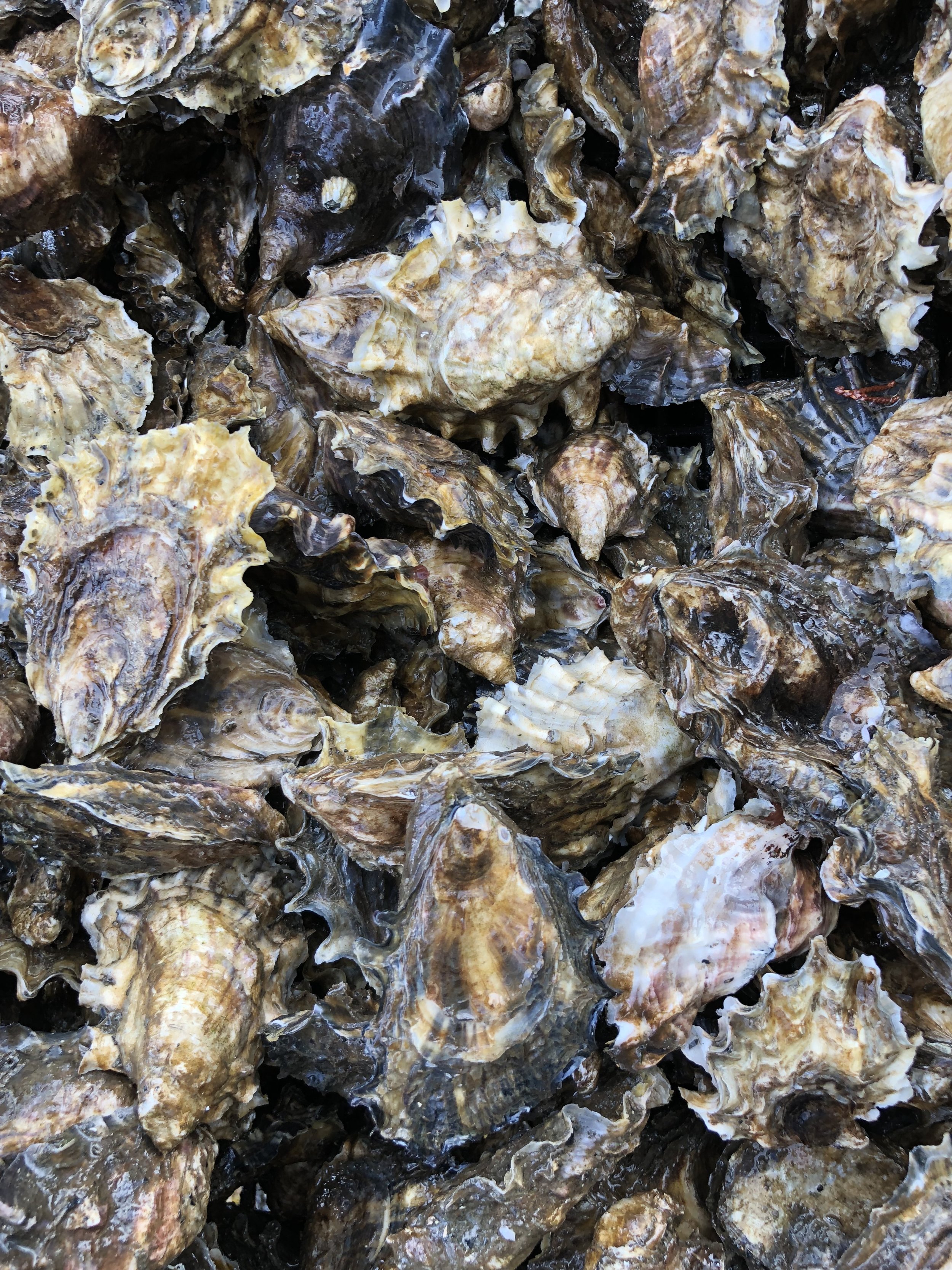
Heading into Shelton, stop in off Hwy 101 past Little Creek Casino & Resort at Taylor Shellfish's Retail Facility to take a look at their headquarter facility and visit their retail store. Taylor Shellfish is a huge supporter of the annual West Coast Oyster Shucking Championship (OysterFest) by supplying over 1200 oysters to the competition!

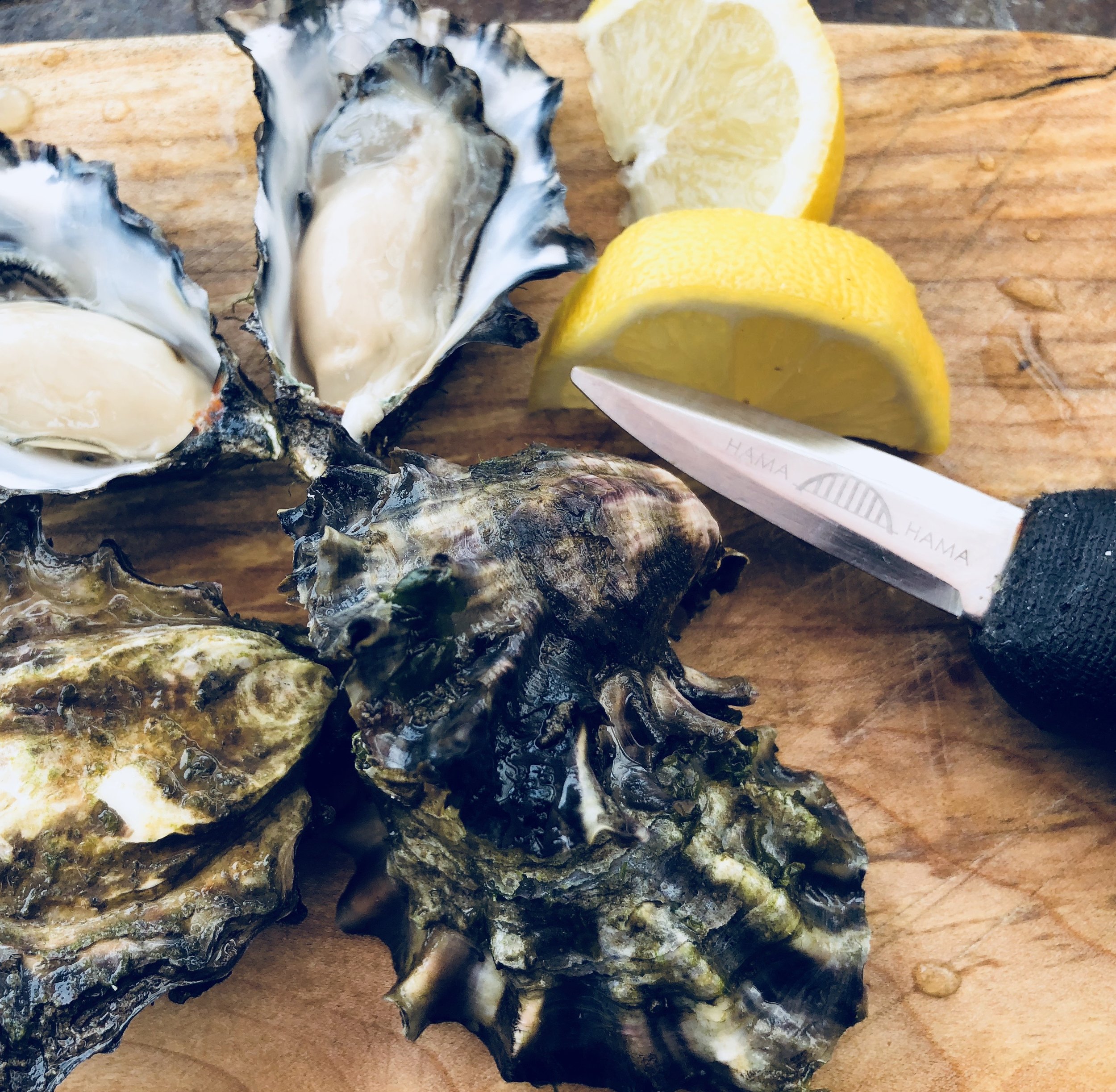
Hama Hama Oyster Company in Lilliwaup serves farm fresh oysters and clams in their streetside Saloon off Hwy 101. Check out the Oyster Saloon, an outdoor farm dining experience, Thursday through Sunday. The retail store is open daily.
One of the area’s most popular oyster growers is located just 30 minutes away in Lilliwaup, WA. Hama Hama Oyster Company's Store and Oyster Saloon (an outdoor restaurant) are located a shell’s-throw from the tideflats. Visit during the week to see the shucking crew in action, and ask for one of their self-guided tour maps to better explore the farm. Stop by the Saloon (Thursday though Sunday) for some great shellfish but don't miss the divine hand-packed Dungeness crab cakes. And we mean PACKED with crab! The crab cakes are also available the farm store where you can buy them to cook at home.
How ever you choose to Shell-e-brate oysters we know that you will have a blast exploring Hood Canal. Be sure to share your adventures with the bivalves with us at #wildsidewa!
See you on the beach!


A Guide to 25 Waterfalls from Canal to Coast and points between
Receiving hundreds of inches of rain annually, the Hoh, Quinault and Queets Rainforests are located on the coastal foothills of the Olympics, receiving 21+’ of snow and rain at its peaks! It’s no wonder there is a myriad of spectacular waterfalls lacing the area. Explore this sampling curated by celebrated guidebook author and avid hiker, Craig Romano. Some are small, secret, and unique, others are popular but magnificent. All are worth the journey!
When Craig Romano agreed to share with us a few of his favorite waterfalls in the Pacific Coastal region of Washington, we were frankly thrilled. If you’re looking for straight details on Northwest hikes and wilderness destinations — and fun facts - Craig is the guy to call.
Craig has written more than 20 hiking guidebooks including Day Hiking Olympic Peninsula 2nd Edition which includes details for popular and little known hikes across the Peninsula. An avid hiker, runner, paddler, and cyclist, Craig is currently working on Urban Trails Vancouver USA (2020); Backpacking Washington 2nd Edition (2021); and Day Hiking Central Cascades 2nd Edition (2022). He is also a featured columnist for the Fjord and Explore Hood Canal.

Enchanted Valley | Craig Romano photo
Why we are so keen about our falls?
As storms from the Pacific Ocean move across the peninsula, they crash into the Olympics and are forced to release moisture in the impact. Consequentially, the clouds release massive amounts of moisture (up to 170 inches annually) in the coastal side of the range – creating the “rain shadow effect.”
The massive rainfall has given life blood to the hanging mosses of the perpetually wet Northwest rainforests – Hoh and Quinault. On top the Olympic Mountains this moisture lands as snow frosting the peaks with as much as 35 feet each year.
Each spring the snow melts and creates icy run-off. Mix in a little more rainfall and the result is a spectacular waterfalls ring envelops the base of Olympic range.
Pacific coastal waterfalls are gorgeous year round but tend to be most spectacular in early spring or during the autumn rainy season.
Let’s go Chasing Waterfalls
1. Tumwater Falls
Olympia Metro | Located minutes from Olympia, Tumwater Falls is an iconic landmark near the state capital. These thundering multi-tiered showy falls along the Deschutes River are located within a 15-acre park created on land donated by the Olympia Brewing Company. Meander along manicured paths and saunter over foot bridges and under historic road bridges taking in a little history along with the sensational scenery.
At the base of the upper falls admire a replica of the famous bridge that once appeared on the labels of Olympia beer spanning the river above the lower falls. Walk trails along the gorge between the falls and admire deep pools, eddies and jumbled boulders. Take time to read the informative panels on Tumwater—Washington’s oldest permanent non-Native settlement on Puget Sound. Let’s Go!
2. Kennedy Creek Falls
Kamilche, South of Shelton | From its origin at Summit Lake in the Black Hills, Kennedy Creek flows just shy of 10 miles to Oyster Bay tumbling over a two-tiered waterfall along the way. Reaching these pretty falls involves a half day hike on a closed-to-vehicles logging road through patches of cuts and mature standing timber. Start walking across a recent cut. In about a mile reach a grove of mature timber and the Kennedy Creek Salmon Trail which opens in the fall for salmon viewing and field trips. Keep walking on the main road avoiding diverting roads. The route leaves state land for private timberland and rolls along. Take in decent views of the surrounding foothills. At 2.8 miles (just before crossing a creek) follow an obvious but unmarked trail to the right. This path can be muddy and slick during periods of heavy rainfall. The trail descends to a grove of big cedars, firs and yews—and the falls. Here Kennedy Creek tumbles over an ancient basalt flow. The upper falls are small but quite pretty. The lower falls are difficult to see as they tumble into a narrow chasm of columnar basalt. Let’s Go!
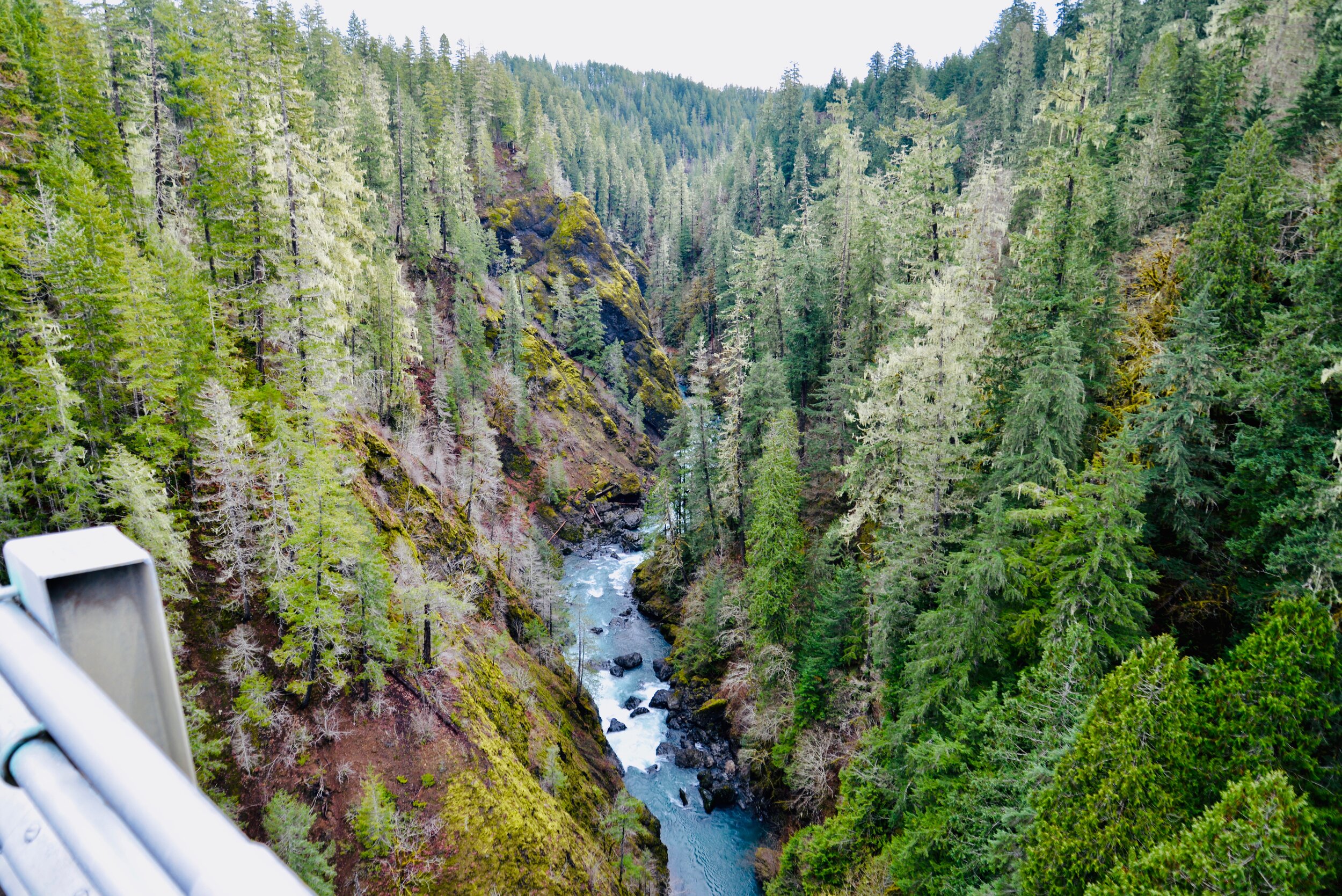
3. Vincent Creek Falls
South Hood Canal, Skokomish Valley | While Vincent Creek Falls are quite stunning crashing 250 feet into the South Fork Skokomish River in a deep narrow canyon; the High Steel Bridge which allows for their viewing is even more spectacular. The 685-foot long bridge spans 375 feet above the canyon. Walk across the bridge but use caution along its north side where the guardrail is only 3 feet tall. The arched truss steel bridge was built in 1929 originally for a logging railroad. In 1950 it was converted for road use. It is the 14th highest bridge in the country. Your heart is sure to pound as you walk upon its airy span. Eventually Vincent Creek Falls comes into view. Through a series of falls, Vincent Creek drops 250 feet down a canyon wall into the roaring South Fork Skokomish River. Walk all the way across the bridge if you plan on capturing the falls in their entirety in a photo. Let’s Go!

Big Creek | Craig Romano Photo
4. Big Creek Cascades
Lake Cushman Area, Hood Canal | Amble on a circuitous route in the Big Creek drainage within the shadows of Mount Ellinor; and delight in a series of small tumbling cascades. This wonderful loop utilizes old logging roads, new trails and a series of beautifully built bridges. It was constructed by an all-volunteer crew that continues to improve and maintain this excellent family and dog-friendly loop. Starting from the Big Creek Campground, follow the Upper Big Creek Loop Trail to Big Creek and the first of several sturdy bridges along the way. After a short climb you’ll reach the Creek Confluence Trail which drops to the confluence of the tumbling Big and North Branch Creeks. The main loop continues to cross North Branch Creek on a good bridge. Just beyond it crosses Big Creek on a new bridge above a gorgeous cascade. The loop then descends skirting big boulders and passing good views of roaring Big Creek. It crosses a couple more cascading creeks before traversing attractive forest and returning to the campground. Let’s Go!
5. Staircase Rapids
Lake Cushman Area, Hood Canal — Currently Closed until mid-September
This loop involves a section of an historic route across the Olympic Mountains to a suspension bridge spanning the North Fork Skokomish River near a series of thundering rapids. Cross the North Fork Skokomish on a solid bridge and follow a trail that was once part of the original O’Neil Mule Trail. In 1890 Lieutenant Joseph O’Neil accompanied by a group of scientists led an Army expedition across the Olympic Peninsula. Among his party’s many findings was a realization that this wild area deserved to be protected as a national park. March up alongside the roiling river, passing big boulders and a series of roaring rapids. The rapids’ name come from a cedar staircase O’Neil built over a rocky bluff to get past them. Follow the bellowing river from one mesmerizing spot to another before reaching a sturdy suspension bridge spanning the wild waterway. Cross the river and complete this delightful loop by now heading downriver following the North Fork Skokomish River Trail back to the Ranger Station. Let’s Go!
Hamma Hamma | George Stenberg photo
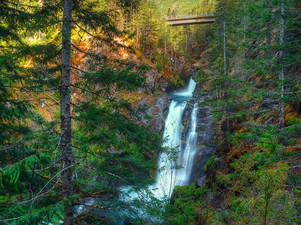
6. Hamma Hamma Falls
Hamma Hamma River Valley, Hood Canal | Talk about a bridge over troubled waters. From the Mildred Lakes Trailhead walk across the high concrete bridge at the road’s end. You no doubt heard the roar of the falls when you drove across it. Now peer over the bridge and witness the cataracts responsible for the racket.
Directly below, the Hamma Hamma River careens through a tight rocky chasm. These impressive falls are two-tiered crashing more than 80 vertical feet. The road spans directly above the upper and smaller of the falls. The overhead view is pretty decent, but the lower and larger falls are more difficult to fully see. A very rudimentary path leads along cliff edges for better viewing, but it’s slick, exposed and treacherous.It’s best to experience the falls from the safety of the bridge. During periods of high water flow you’ll get the added bonus of feeling the falls too thanks to a rising mist. On the drive back look for a couple of pull-offs providing views of secondary falls along the Hamma Hamma, Let’s Go!
7. Murhut Falls
Duckabush River Valley, Hood Canal | Hidden in a lush narrow ravine and once accessed by a treacherous path, Murhut Falls were long unknown to many in the outside world. But now a well-built trail allows hikers of all ages and abilities to admire this beautiful 130-foot two-tiered waterfall. The trail starts by following an old well-graded logging road. It was past logging in this area that led to the discovery of these falls. The old road ends after a short climb of about 250 feet to a low ridge. The trail then continues on a good single track slightly descending into a damp, dark, cedar-lined ravine. As you work your way toward the falls, its roar will signal you’re getting closer. Reach the trail’s end and behold the impressive falls crashing before you. The upper falls drops more than 100 feet while the lower one crashes about 30 feet. Blossoming Pacific rhododendrons lining the trail in May and June make the hike even more delightful. Let’s Go!
Rocky Brook Falls
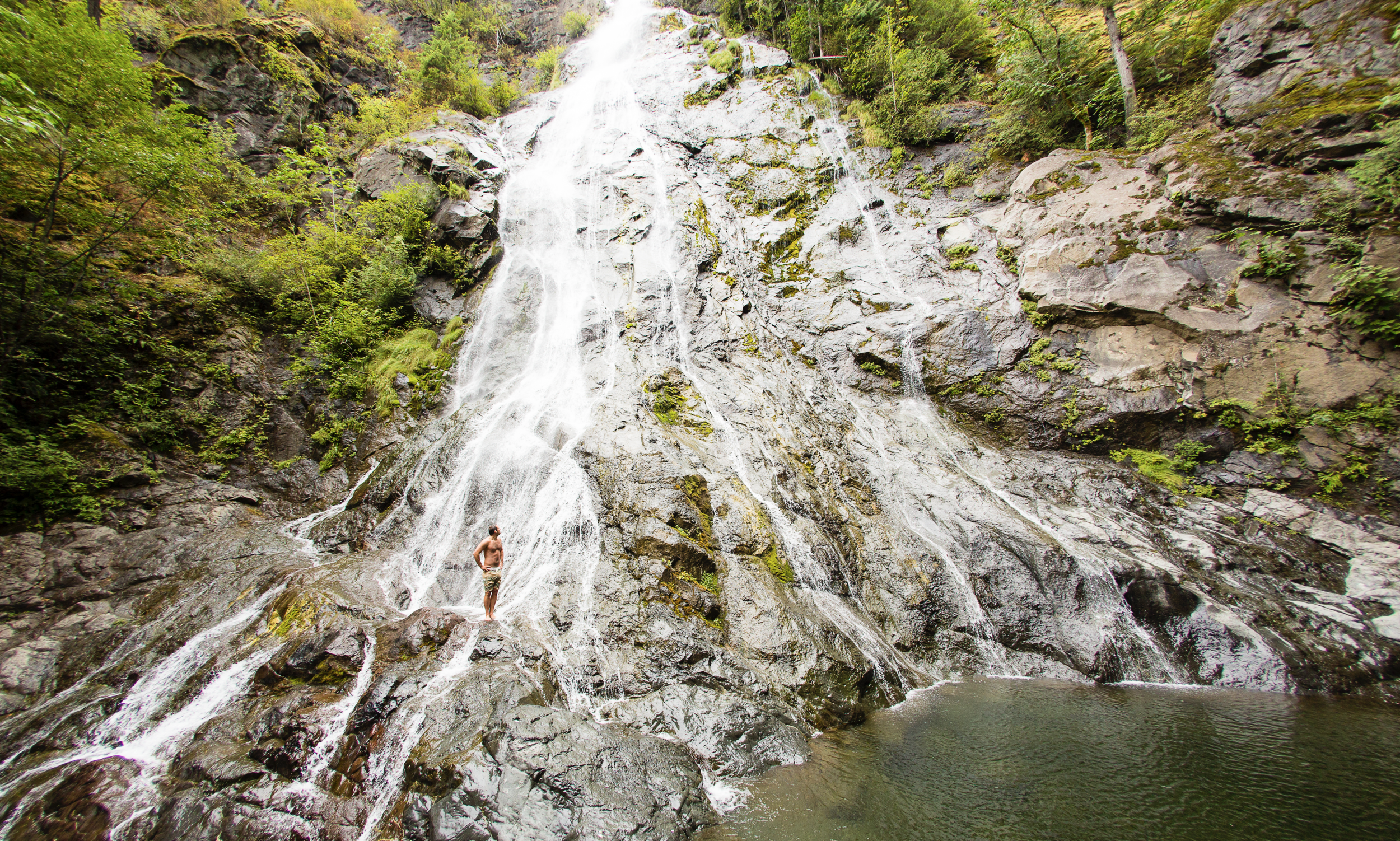
8. Rocky Brook Falls
Dosewallips River Valley, Hood Canal | One of the tallest waterfalls on the Peninsula, Rocky Brook Falls is also among the prettiest. Follow the trail past a small hydroelectric generating building and come to the base of the stunning towering falls fanning over ledges into a large splash pool surrounded by boulders. This classic horsetail waterfall crashes more than 200 feet from a small hanging valley above. While a penstock diverts water from the brook for electricity production, the flow over the falls is almost always pretty strong. Like all waterfalls, these too are especially impressive during periods of heavy rainfall. On warm summer days the falls become a popular destination for folks seeking some heat relief. And while many waterways east of the Mississippi River are called brooks, creek is the preferred name in the west. There are only a few waterways on the Peninsula called brooks, and they were more than likely named by someone who hailed from back east. Let’s Go!
9. Dosewallips Falls
Dosewallips River Valley, Hood Canal | This spectacular waterfall used to be easily reached by vehicle. But the upper Dosewallips Road has been closed to vehicles since 2002 after winter storms created a huge washout that has yet to be repaired. Now to reach this waterfall you must hike or mountain bike the closed road. Walk past the road barrier and immediately come to the washout and a bypass trail. Steeply climb on the riverbank above the slide. Then descend back to the road and walk along the churning river. The road then pulls away from the river, passes a campground and climbs. The river now far below in a canyon is out of sight, but not out of sound. Pass beneath ledges and cross cascading Bull Elk Creek on a bridge. At 3.9 miles in a recent burn zone enter Olympic National Park. Cross tumbling Constance Creek on a bridge and continue climbing passing a big overhanging boulder. Then descend and skirt beneath a big ledge coming to the base of dramatic 100-foot plus Dosewallips Falls. Admire the raging cascade’s hydrological force—it’s mesmerizing. Let’s Go!
10. Fallsview Falls
Big Quilcene River Valley | As far as cascades go, Fallsview Falls lacks the “Wow factor.” However the canyon these falls tumble into is pretty impressive. And if you plan your visit for late spring, blossoming rhododendrons line the trail and frame the view with brilliant pinks and purples. The trail to the falls is short, easy and ADA accessible. Follow the 0.2 mile loop to a fenced promontory above a tight canyon embracing the Big Quilcene River. Gaze straight down to the roiling river. Then cast your glance directly across the canyon to an unnamed creek cascading 100 feet into it. By late summer it just trickles—but during the rainy season the falls put on a little show. If you want to stretch your legs some more afterward, you can follow a trail into the little canyon and hike along the frothing river. Let’s Go!

And 15 more…
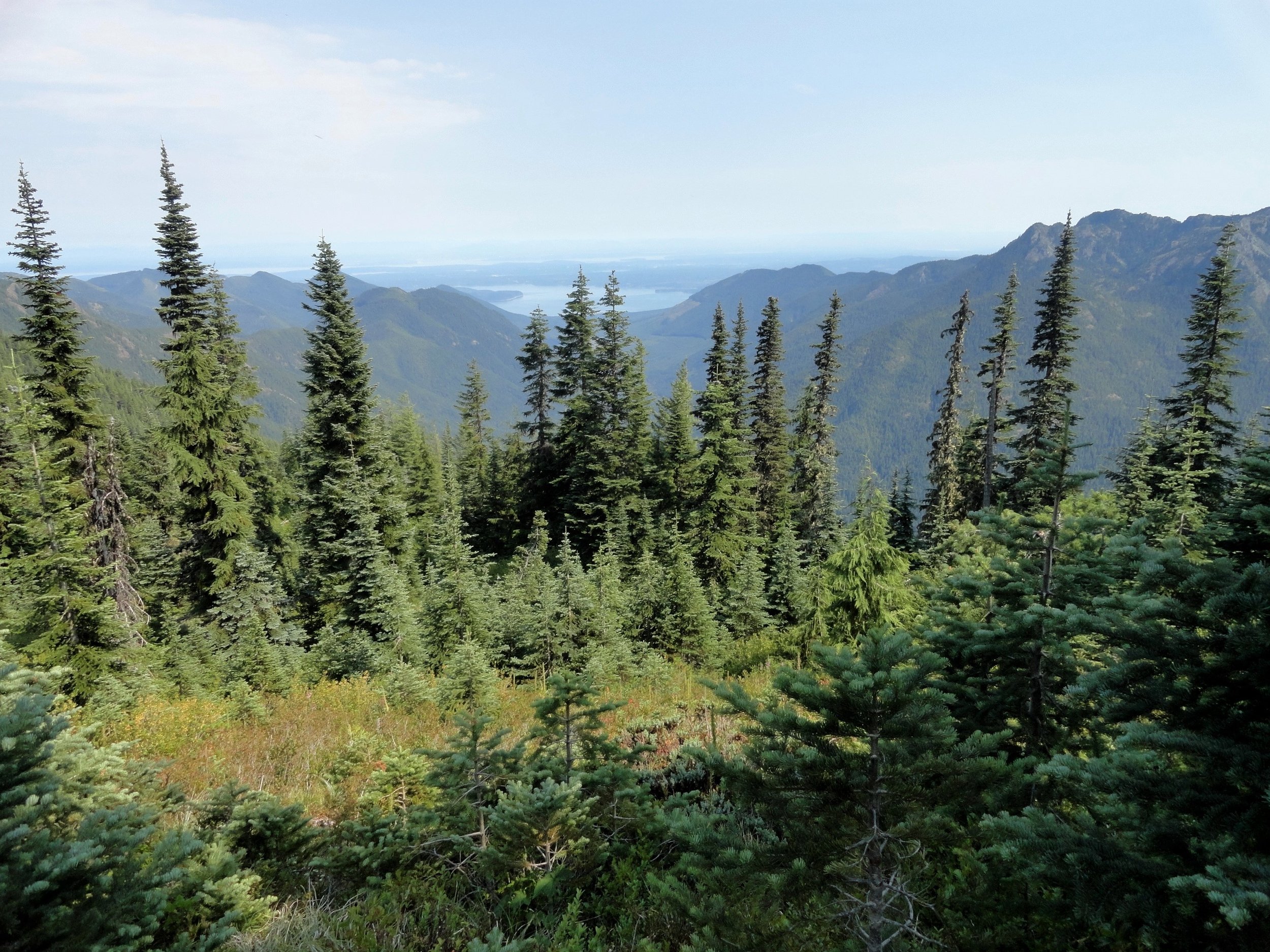
For a day trip, weekend, or a month-long adventure – the Olympic Peninsula is a fantastic place to get away and enjoy nature – and waterfalls! It’s not just 1000’s of waterfalls, there are countless lakes, rivers, streams and trails to suit every ability level. Embraced by the Pacific Ocean on the west, the Strait of Juan de Fuca on the north, and the Hood Canal on the east, it is famed for being home to Olympic National Park, more than 600 miles of hiking trails and 73 miles of pristine ocean wilderness beaches.
The Olympic Peninsula hosts activities for families and outdoor enthusiasts alike, attracting visitors from near and far. Start planning your next adventure!
Click here for a complete list of all 25 waterfalls on the Olympic Peninsula curated by Craig!
Tunnel Creek Trail Hike
Olympic National Forest’s Tunnel Creek Trail lies just a few miles south of the popular Big Quilcene Trail. But unlike the Big Quil which leads to Marmot Pass, a high windswept wildflower-rich gap providing sweeping views—the Tunnel Creek trail travels mainly beneath a thick canopy of primeval forest.
Craig Romano | author
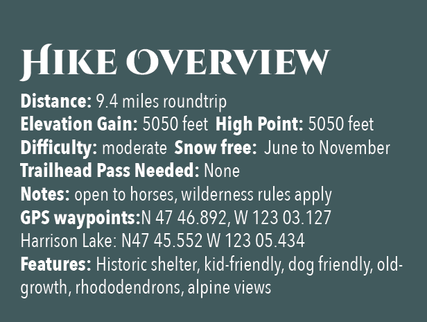
Olympic National Forest’s Tunnel Creek Trail lies just a few miles south of the popular Big Quilcene Trail. But unlike the Big Quil which leads to Marmot Pass, a high windswept wildflower-rich gap providing sweeping views—the Tunnel Creek trail travels mainly beneath a thick canopy of primeval forest. Lacking the wow factor of Marmot Pass, Tunnel Creek gets passed over by many a hiker. However, those who take to this trail less taken soon discover; Tunnel Creek offers plenty of delightful spots and some pretty decent views as well. And all without the crowds of Marmot Pass.
Hit the Trail

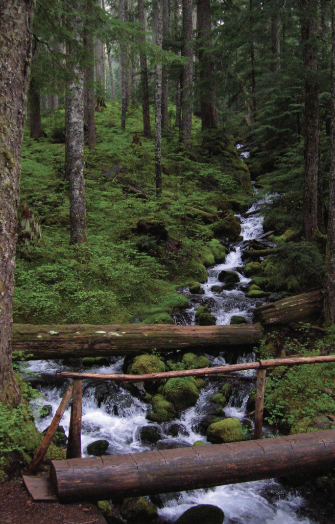
The Tunnel Creek Trail immediately enters the 44,258-acre Buckhorn Wilderness, the largest roadless area in Olympic National Forest. Much of the wilderness lies within the Olympic rain shadow encompassing some of the driest mountainous terrain in the Olympics. But here at the wilderness’s southern reaches, precipitation increases. And it’s noticeable immediately upon starting up the trail. The surroundings are verdant—draped in mosses and lichens. The trees are grand. And the valley is alive with the sound of cascading water.
Work your way up a tight valley following alongside tumbling South Fork Tunnel Creek through a tunnel of towering old-growth western hemlocks and Douglas-fir. The hike is magical, almost ethereal on a misty morning. And it’s welcoming on a sweltering summer day, as the ancient trees do an excellent job of regulating the temperature, providing some much appreciated air-conditioning.
After 3.3 miles and gaining a modest 1500 feet of elevation, reach the still intact Tunnel Creek Shelter. A remnant from when this trail was much longer (before logging and roads obliterated much of it). In the early days of Olympic National Forest and Olympic National Park there were more than 90 trailside shelters in the Olympics. Many were developed through the guidance of Frederick William Cleator, who became one of the nascent US Forest Service’s first recreational specialists. Along with calling for trails, shelters, and fire lookouts, Cleator also advocated for a large portion of the Olympics to be left as wilderness, free from any developments.
The early shelters were meant to help administer the forest by providing rangers, trail workers and foresters a place to overnight while traversing the vast wild lands of the Olympics. But they were also welcomed by the few backpackers who plodded into the Olympic backcountry at the time. Through the years many of the shelters succumbed to fire, collapse and disrepair. And as recreational use increased and attitudes changed regarding land management, many hikers and land managers began to question the role of these structures in the wilderness. Under new directives many of the shelters were allowed to fall in disuse or were intentionally dismantled.
Many recreationists however continued to argue for the need of these shelters to provide emergency cover for backcountry users caught in severe weather. Many other recreationists including this author have argued to maintain the remaining shelters now numbering only around 20 as historically significant and preserve them as historic structures.
The Tunnel Creek Shelter is one of the last remaining in Olympic National Forest. Perhaps use it for a lunch break. Reflect on its long history and the role it has played providing refuge to many a wanderer on a cold and wet day. And help protect it from misuse. Beyond the shelter, the trail crosses via a log bridge the South Fork of Tunnel Creek and then gets down to business. They way now steadily and steeply climbs out of the valley ascending a thickly forested ridge. Eventually reach a small saddle in the ridge harboring two small bodies of water. The first is a small grassy pond known as Karnes Lake. Just beyond and a little higher up at 4.3 miles from the trailhead and at an elevation of 4300 feet is the more appealing Harrison Lake.
You don’t want to call it quits yet however. Conjure up a little more energy and continue hiking, ascending through open forest and over ledge coming to the 5050-foot ridge crest at 4.7 miles. Now take in an exceptional view of 7,743-foot (third highest peak in the Olympics) Mount Constance’s impressive sheer vertical east face.
You can scramble along the rocky ridge a little higher to better appreciate Constance’s towering presence, less than two miles away to the northwest.
For most hikers this is the turning around spot. But the trail continues from here making an insanely steep drop of more than 4300 feet in 3.6 miles to the Dosewallips River Road. It’s brushy in spots and easy to lose along the ridge. Otherwise it’s in decent shape down steep slopes and through old growth and past a small waterfall at Gamm Creek.
f you can arrange a car shuttle consider hiking out this route. There are some good views down to the Dosewallips River valley and out to Hood Canal during the initial descent if you want to just wander a little way down the trail. Otherwise start heading back to the cool forests of South Fork Tunnel Creek on the much more agreeable trail back to your start.
The details
Land Agency Contact: Olympic National Forest, Hood Canal Ranger District, Quilcene, (360) 765-2200,fs.usda.gov/olympic
Recommended Guidebook: Day Hiking Olympic Peninsula 2nd edition (Romano, Mountaineers Books)
Trailhead directions: From Shelton follow US 101 north for 50.5 miles. (From Quilcene, drive US 101 south for 1.5 miles). Turn left (west) onto Penny Creek Rd. After 1.5 miles bear left onto Big Quilcene River Rd (Forest Rd 27); which eventually becomes paved. At 3.0 miles bear left onto graveled FR 2740 and follow for 6.9 miles