

A Guide to 25 Waterfalls from Canal to Coast and points between
Receiving hundreds of inches of rain annually, the Hoh, Quinault and Queets Rainforests are located on the coastal foothills of the Olympics, receiving 21+’ of snow and rain at its peaks! It’s no wonder there is a myriad of spectacular waterfalls lacing the area. Explore this sampling curated by celebrated guidebook author and avid hiker, Craig Romano. Some are small, secret, and unique, others are popular but magnificent. All are worth the journey!
When Craig Romano agreed to share with us a few of his favorite waterfalls in the Pacific Coastal region of Washington, we were frankly thrilled. If you’re looking for straight details on Northwest hikes and wilderness destinations — and fun facts - Craig is the guy to call.
Craig has written more than 20 hiking guidebooks including Day Hiking Olympic Peninsula 2nd Edition which includes details for popular and little known hikes across the Peninsula. An avid hiker, runner, paddler, and cyclist, Craig is currently working on Urban Trails Vancouver USA (2020); Backpacking Washington 2nd Edition (2021); and Day Hiking Central Cascades 2nd Edition (2022). He is also a featured columnist for the Fjord and Explore Hood Canal.

Enchanted Valley | Craig Romano photo
Why we are so keen about our falls?
As storms from the Pacific Ocean move across the peninsula, they crash into the Olympics and are forced to release moisture in the impact. Consequentially, the clouds release massive amounts of moisture (up to 170 inches annually) in the coastal side of the range – creating the “rain shadow effect.”
The massive rainfall has given life blood to the hanging mosses of the perpetually wet Northwest rainforests – Hoh and Quinault. On top the Olympic Mountains this moisture lands as snow frosting the peaks with as much as 35 feet each year.
Each spring the snow melts and creates icy run-off. Mix in a little more rainfall and the result is a spectacular waterfalls ring envelops the base of Olympic range.
Pacific coastal waterfalls are gorgeous year round but tend to be most spectacular in early spring or during the autumn rainy season.
Let’s go Chasing Waterfalls
1. Tumwater Falls
Olympia Metro | Located minutes from Olympia, Tumwater Falls is an iconic landmark near the state capital. These thundering multi-tiered showy falls along the Deschutes River are located within a 15-acre park created on land donated by the Olympia Brewing Company. Meander along manicured paths and saunter over foot bridges and under historic road bridges taking in a little history along with the sensational scenery.
At the base of the upper falls admire a replica of the famous bridge that once appeared on the labels of Olympia beer spanning the river above the lower falls. Walk trails along the gorge between the falls and admire deep pools, eddies and jumbled boulders. Take time to read the informative panels on Tumwater—Washington’s oldest permanent non-Native settlement on Puget Sound. Let’s Go!
2. Kennedy Creek Falls
Kamilche, South of Shelton | From its origin at Summit Lake in the Black Hills, Kennedy Creek flows just shy of 10 miles to Oyster Bay tumbling over a two-tiered waterfall along the way. Reaching these pretty falls involves a half day hike on a closed-to-vehicles logging road through patches of cuts and mature standing timber. Start walking across a recent cut. In about a mile reach a grove of mature timber and the Kennedy Creek Salmon Trail which opens in the fall for salmon viewing and field trips. Keep walking on the main road avoiding diverting roads. The route leaves state land for private timberland and rolls along. Take in decent views of the surrounding foothills. At 2.8 miles (just before crossing a creek) follow an obvious but unmarked trail to the right. This path can be muddy and slick during periods of heavy rainfall. The trail descends to a grove of big cedars, firs and yews—and the falls. Here Kennedy Creek tumbles over an ancient basalt flow. The upper falls are small but quite pretty. The lower falls are difficult to see as they tumble into a narrow chasm of columnar basalt. Let’s Go!
3. Vincent Creek Falls
South Hood Canal, Skokomish Valley | While Vincent Creek Falls are quite stunning crashing 250 feet into the South Fork Skokomish River in a deep narrow canyon; the High Steel Bridge which allows for their viewing is even more spectacular. The 685-foot long bridge spans 375 feet above the canyon. Walk across the bridge but use caution along its north side where the guardrail is only 3 feet tall. The arched truss steel bridge was built in 1929 originally for a logging railroad. In 1950 it was converted for road use. It is the 14th highest bridge in the country. Your heart is sure to pound as you walk upon its airy span. Eventually Vincent Creek Falls comes into view. Through a series of falls, Vincent Creek drops 250 feet down a canyon wall into the roaring South Fork Skokomish River. Walk all the way across the bridge if you plan on capturing the falls in their entirety in a photo. Let’s Go!

Big Creek | Craig Romano Photo
4. Big Creek Cascades
Lake Cushman Area, Hood Canal | Amble on a circuitous route in the Big Creek drainage within the shadows of Mount Ellinor; and delight in a series of small tumbling cascades. This wonderful loop utilizes old logging roads, new trails and a series of beautifully built bridges. It was constructed by an all-volunteer crew that continues to improve and maintain this excellent family and dog-friendly loop. Starting from the Big Creek Campground, follow the Upper Big Creek Loop Trail to Big Creek and the first of several sturdy bridges along the way. After a short climb you’ll reach the Creek Confluence Trail which drops to the confluence of the tumbling Big and North Branch Creeks. The main loop continues to cross North Branch Creek on a good bridge. Just beyond it crosses Big Creek on a new bridge above a gorgeous cascade. The loop then descends skirting big boulders and passing good views of roaring Big Creek. It crosses a couple more cascading creeks before traversing attractive forest and returning to the campground. Let’s Go!
5. Staircase Rapids
Lake Cushman Area, Hood Canal — Currently Closed until mid-September
This loop involves a section of an historic route across the Olympic Mountains to a suspension bridge spanning the North Fork Skokomish River near a series of thundering rapids. Cross the North Fork Skokomish on a solid bridge and follow a trail that was once part of the original O’Neil Mule Trail. In 1890 Lieutenant Joseph O’Neil accompanied by a group of scientists led an Army expedition across the Olympic Peninsula. Among his party’s many findings was a realization that this wild area deserved to be protected as a national park. March up alongside the roiling river, passing big boulders and a series of roaring rapids. The rapids’ name come from a cedar staircase O’Neil built over a rocky bluff to get past them. Follow the bellowing river from one mesmerizing spot to another before reaching a sturdy suspension bridge spanning the wild waterway. Cross the river and complete this delightful loop by now heading downriver following the North Fork Skokomish River Trail back to the Ranger Station. Let’s Go!
Hamma Hamma | George Stenberg photo
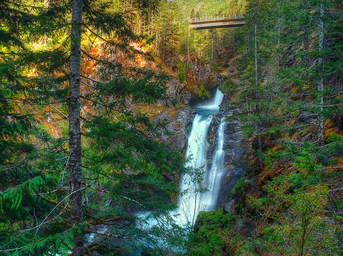
6. Hamma Hamma Falls
Hamma Hamma River Valley, Hood Canal | Talk about a bridge over troubled waters. From the Mildred Lakes Trailhead walk across the high concrete bridge at the road’s end. You no doubt heard the roar of the falls when you drove across it. Now peer over the bridge and witness the cataracts responsible for the racket.
Directly below, the Hamma Hamma River careens through a tight rocky chasm. These impressive falls are two-tiered crashing more than 80 vertical feet. The road spans directly above the upper and smaller of the falls. The overhead view is pretty decent, but the lower and larger falls are more difficult to fully see. A very rudimentary path leads along cliff edges for better viewing, but it’s slick, exposed and treacherous.It’s best to experience the falls from the safety of the bridge. During periods of high water flow you’ll get the added bonus of feeling the falls too thanks to a rising mist. On the drive back look for a couple of pull-offs providing views of secondary falls along the Hamma Hamma, Let’s Go!
7. Murhut Falls
Duckabush River Valley, Hood Canal | Hidden in a lush narrow ravine and once accessed by a treacherous path, Murhut Falls were long unknown to many in the outside world. But now a well-built trail allows hikers of all ages and abilities to admire this beautiful 130-foot two-tiered waterfall. The trail starts by following an old well-graded logging road. It was past logging in this area that led to the discovery of these falls. The old road ends after a short climb of about 250 feet to a low ridge. The trail then continues on a good single track slightly descending into a damp, dark, cedar-lined ravine. As you work your way toward the falls, its roar will signal you’re getting closer. Reach the trail’s end and behold the impressive falls crashing before you. The upper falls drops more than 100 feet while the lower one crashes about 30 feet. Blossoming Pacific rhododendrons lining the trail in May and June make the hike even more delightful. Let’s Go!
Rocky Brook Falls
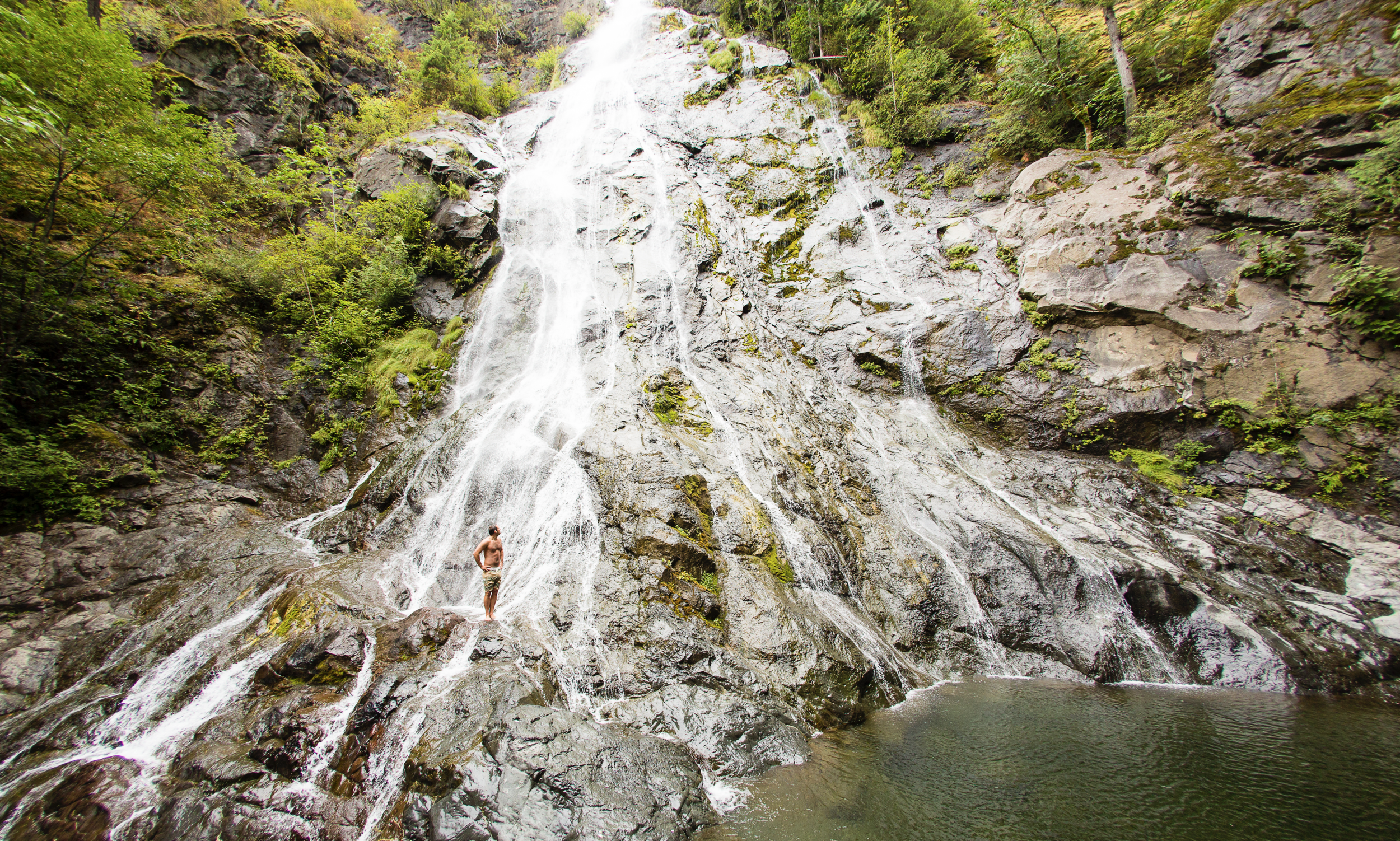
8. Rocky Brook Falls
Dosewallips River Valley, Hood Canal | One of the tallest waterfalls on the Peninsula, Rocky Brook Falls is also among the prettiest. Follow the trail past a small hydroelectric generating building and come to the base of the stunning towering falls fanning over ledges into a large splash pool surrounded by boulders. This classic horsetail waterfall crashes more than 200 feet from a small hanging valley above. While a penstock diverts water from the brook for electricity production, the flow over the falls is almost always pretty strong. Like all waterfalls, these too are especially impressive during periods of heavy rainfall. On warm summer days the falls become a popular destination for folks seeking some heat relief. And while many waterways east of the Mississippi River are called brooks, creek is the preferred name in the west. There are only a few waterways on the Peninsula called brooks, and they were more than likely named by someone who hailed from back east. Let’s Go!
9. Dosewallips Falls
Dosewallips River Valley, Hood Canal | This spectacular waterfall used to be easily reached by vehicle. But the upper Dosewallips Road has been closed to vehicles since 2002 after winter storms created a huge washout that has yet to be repaired. Now to reach this waterfall you must hike or mountain bike the closed road. Walk past the road barrier and immediately come to the washout and a bypass trail. Steeply climb on the riverbank above the slide. Then descend back to the road and walk along the churning river. The road then pulls away from the river, passes a campground and climbs. The river now far below in a canyon is out of sight, but not out of sound. Pass beneath ledges and cross cascading Bull Elk Creek on a bridge. At 3.9 miles in a recent burn zone enter Olympic National Park. Cross tumbling Constance Creek on a bridge and continue climbing passing a big overhanging boulder. Then descend and skirt beneath a big ledge coming to the base of dramatic 100-foot plus Dosewallips Falls. Admire the raging cascade’s hydrological force—it’s mesmerizing. Let’s Go!
10. Fallsview Falls
Big Quilcene River Valley | As far as cascades go, Fallsview Falls lacks the “Wow factor.” However the canyon these falls tumble into is pretty impressive. And if you plan your visit for late spring, blossoming rhododendrons line the trail and frame the view with brilliant pinks and purples. The trail to the falls is short, easy and ADA accessible. Follow the 0.2 mile loop to a fenced promontory above a tight canyon embracing the Big Quilcene River. Gaze straight down to the roiling river. Then cast your glance directly across the canyon to an unnamed creek cascading 100 feet into it. By late summer it just trickles—but during the rainy season the falls put on a little show. If you want to stretch your legs some more afterward, you can follow a trail into the little canyon and hike along the frothing river. Let’s Go!

And 15 more…
For a day trip, weekend, or a month-long adventure – the Olympic Peninsula is a fantastic place to get away and enjoy nature – and waterfalls! It’s not just 1000’s of waterfalls, there are countless lakes, rivers, streams and trails to suit every ability level. Embraced by the Pacific Ocean on the west, the Strait of Juan de Fuca on the north, and the Hood Canal on the east, it is famed for being home to Olympic National Park, more than 600 miles of hiking trails and 73 miles of pristine ocean wilderness beaches.
The Olympic Peninsula hosts activities for families and outdoor enthusiasts alike, attracting visitors from near and far. Start planning your next adventure!
Click here for a complete list of all 25 waterfalls on the Olympic Peninsula curated by Craig!
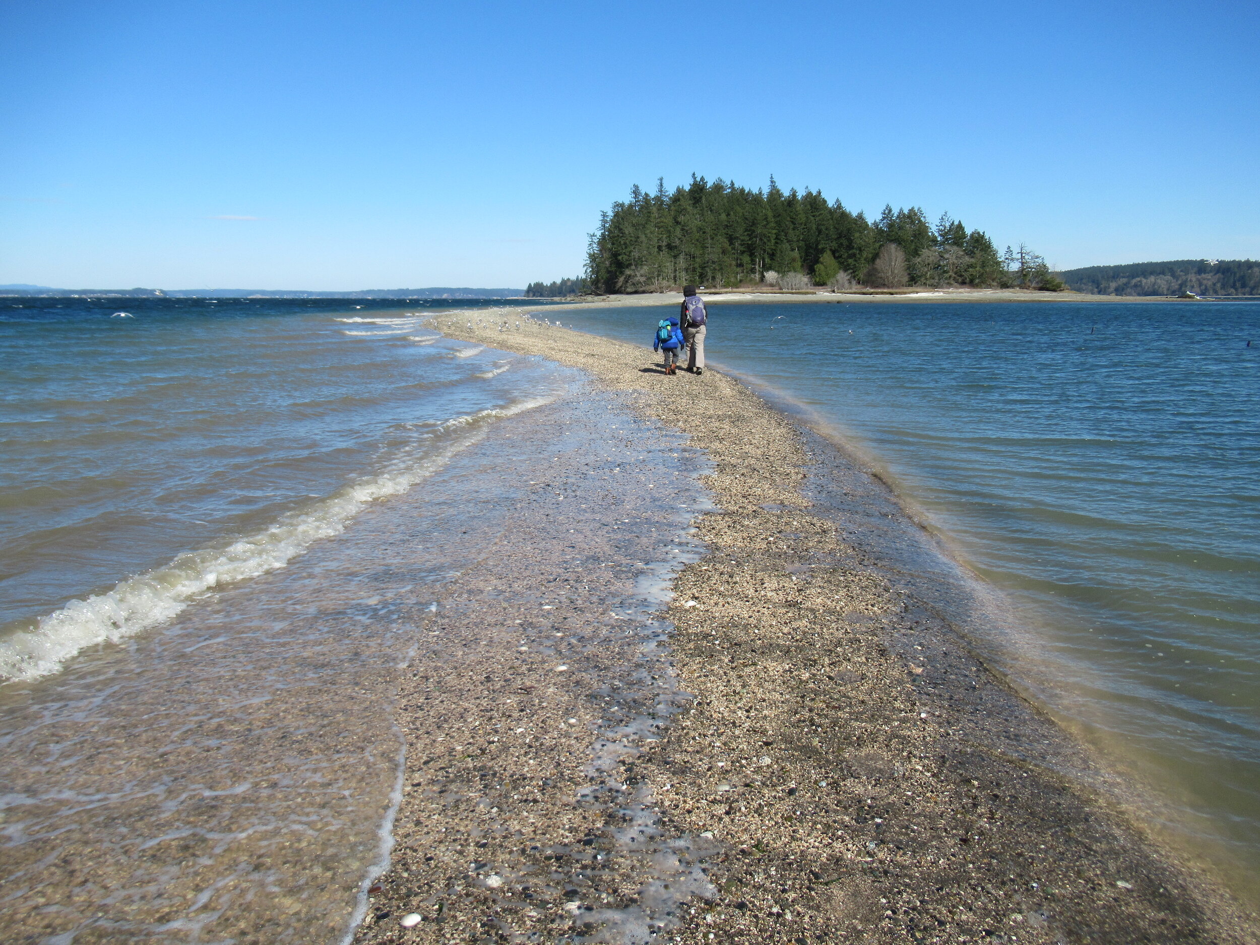
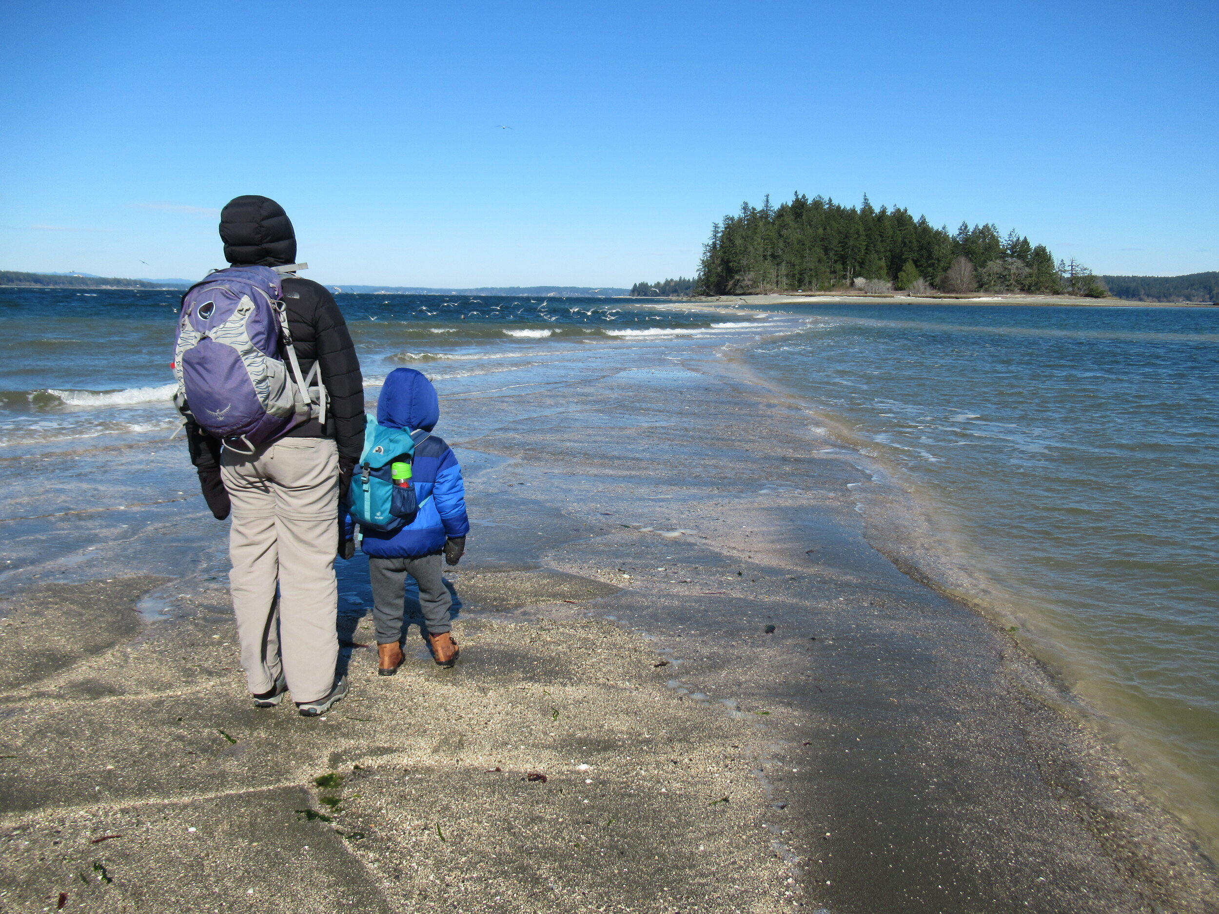
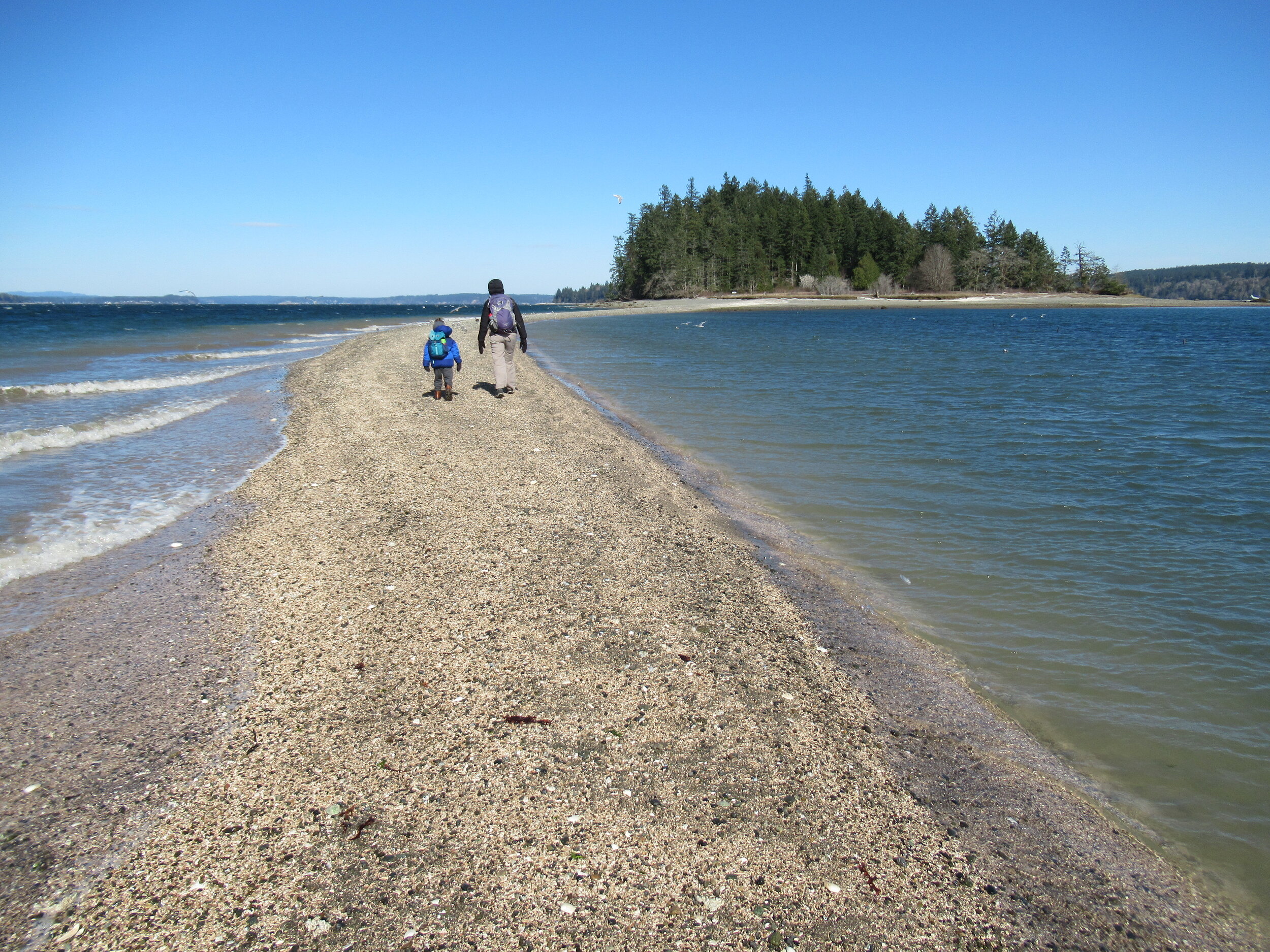
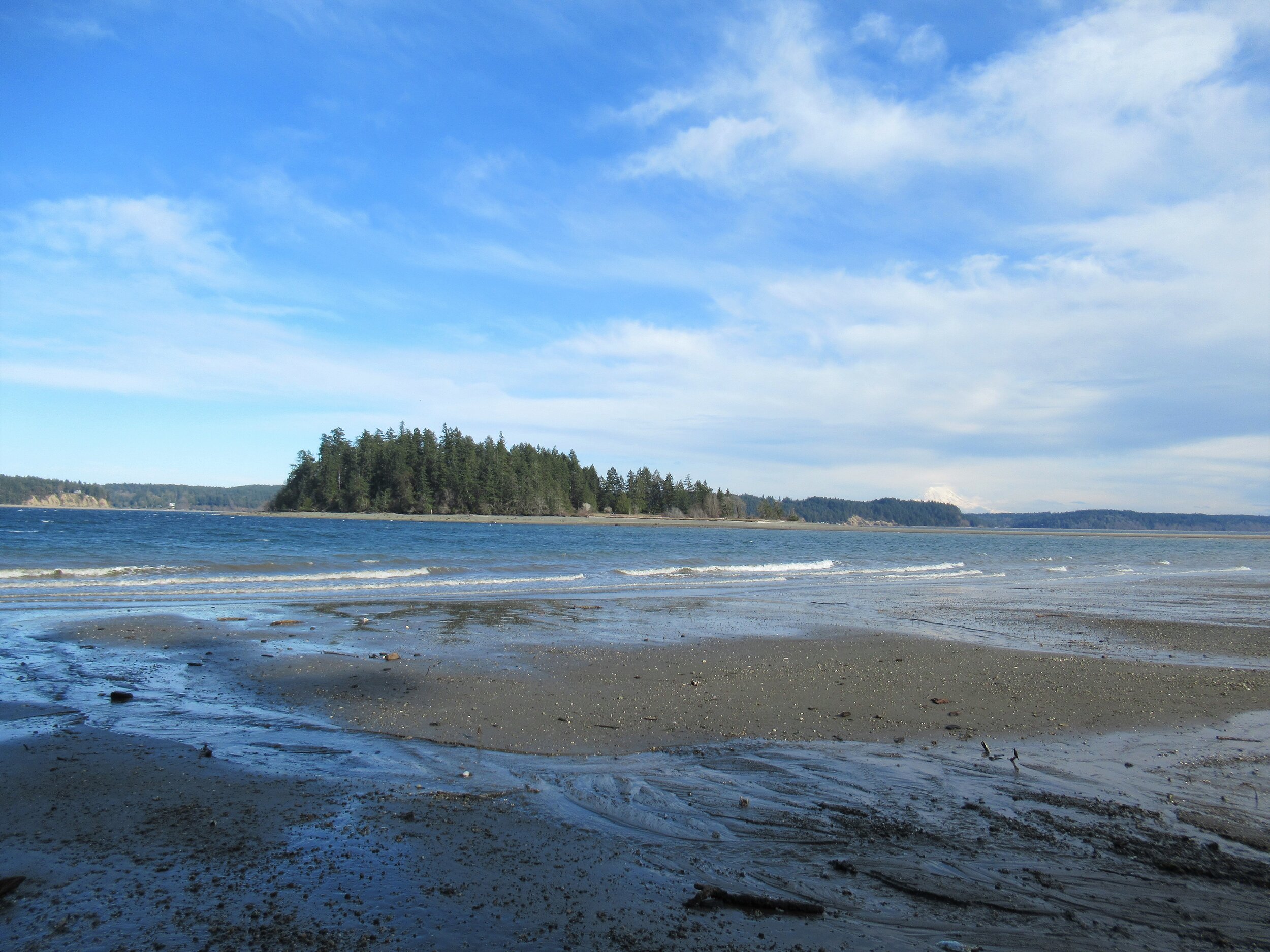
Crossing the Bar - McMicken Island
There are no bridges or causeways to little McMicken Island in Case Inlet. No ferry service either. But you don’t need a kayak or boat to visit. You can easily hike to this island which lies about 0.2 mile off of the eastern shore of Harstine Island. It’s all in the timing.
Craig Romano | Story & images
There are no bridges or causeways to little McMicken Island in Case Inlet. No ferry service either. But you don’t need a kayak or boat to visit. You can easily hike to this island which lies about 0.2 mile off of the eastern shore of Harstine Island. It’s all in the timing.

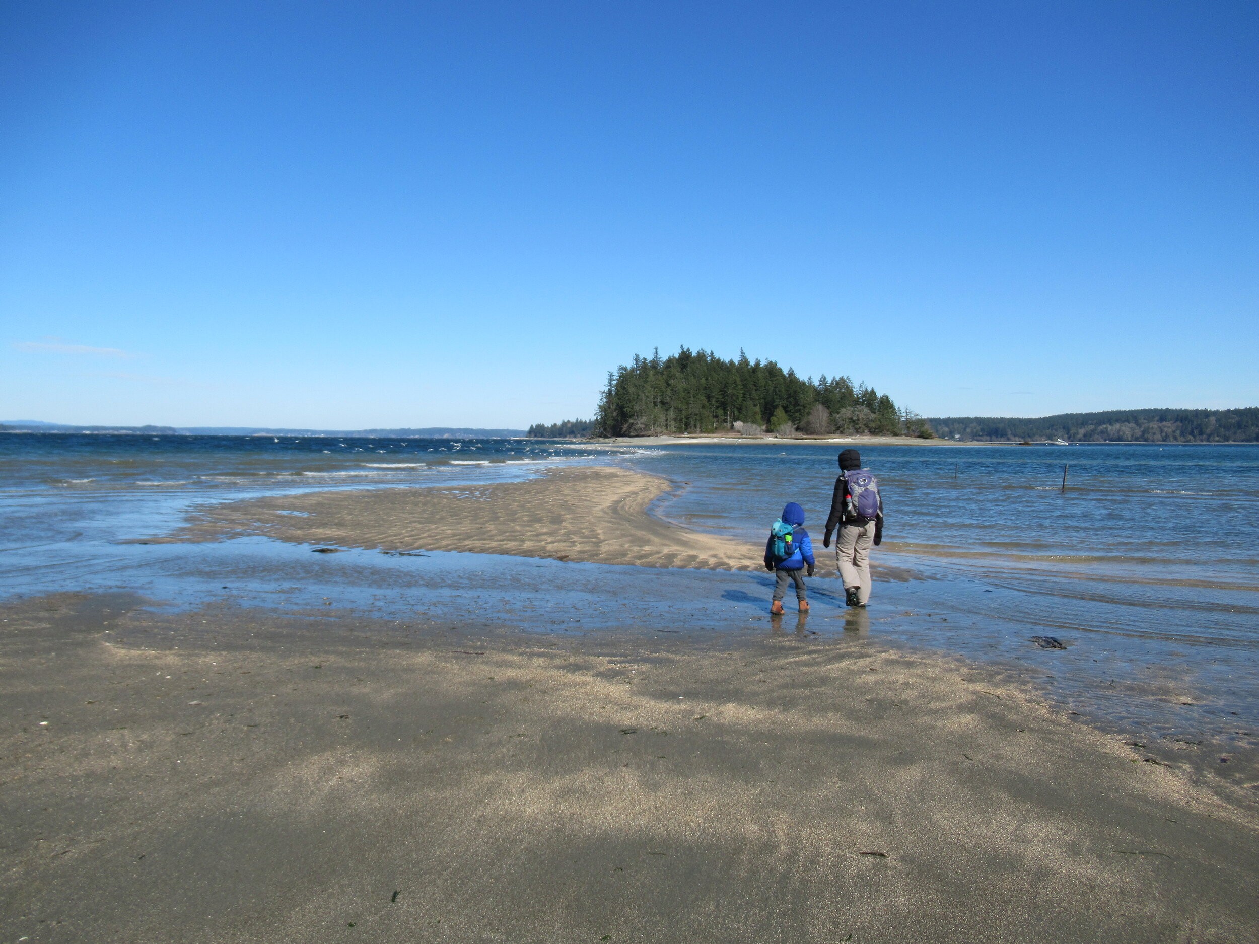
When the tide is low, a tombolo (a sandbar connecting the island to the mainland—or in this case another island) is exposed allowing you dry foot access to the island. You then can hike the island’s small half mile trail, picnic in its small meadow, or explore big barnacle-encrusted rocks in its intertidal zone. Just mind the incoming tide lest you make a big splash on your island exodus.


Hit the Trail
The hike to little 11.5 acre McMicken Island begins from the 300-acre Harstine Island State Park. A former Washington DNR property, most of the old timber was logged off, but small groves of old-growth remains on the property.
You want to head to the park’s beach reachable by the two trails taking off south from the parking lot. Take the one on the eastern end of the lot (away from the kiosk) for the more direct route.
The trail heads towards Case Inlet soon reaching the edge of a 100 foot high forested bluff. Continue along the bluff taking in glimpses of the remote beach below. The way then descends into a cool and dark ravine graced with big cedars and firs and reaches a junction.
The trail to the right loops back to the other main trail leaving the parking lot. Consider taking it upon your return from McMicken Island.
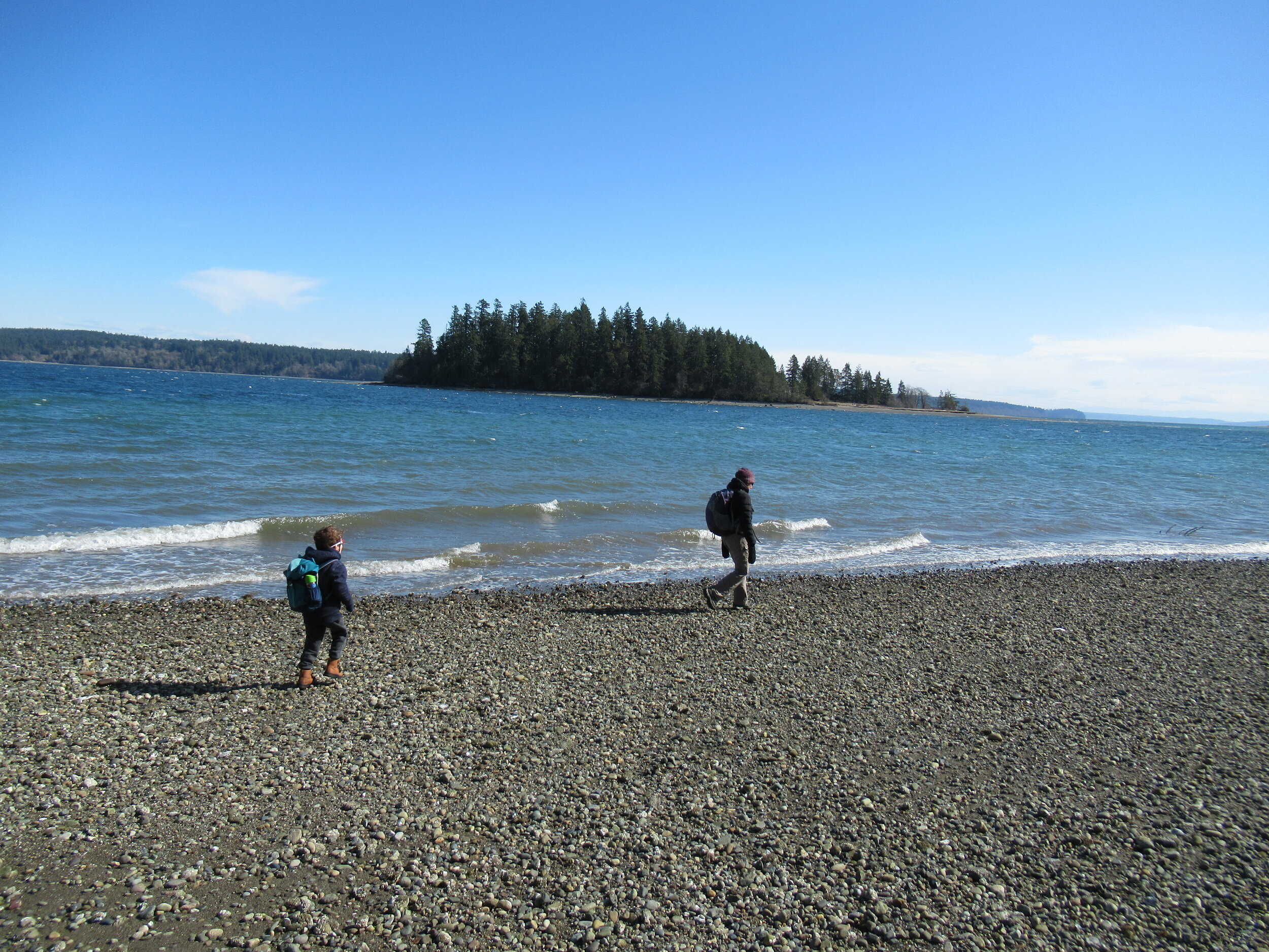
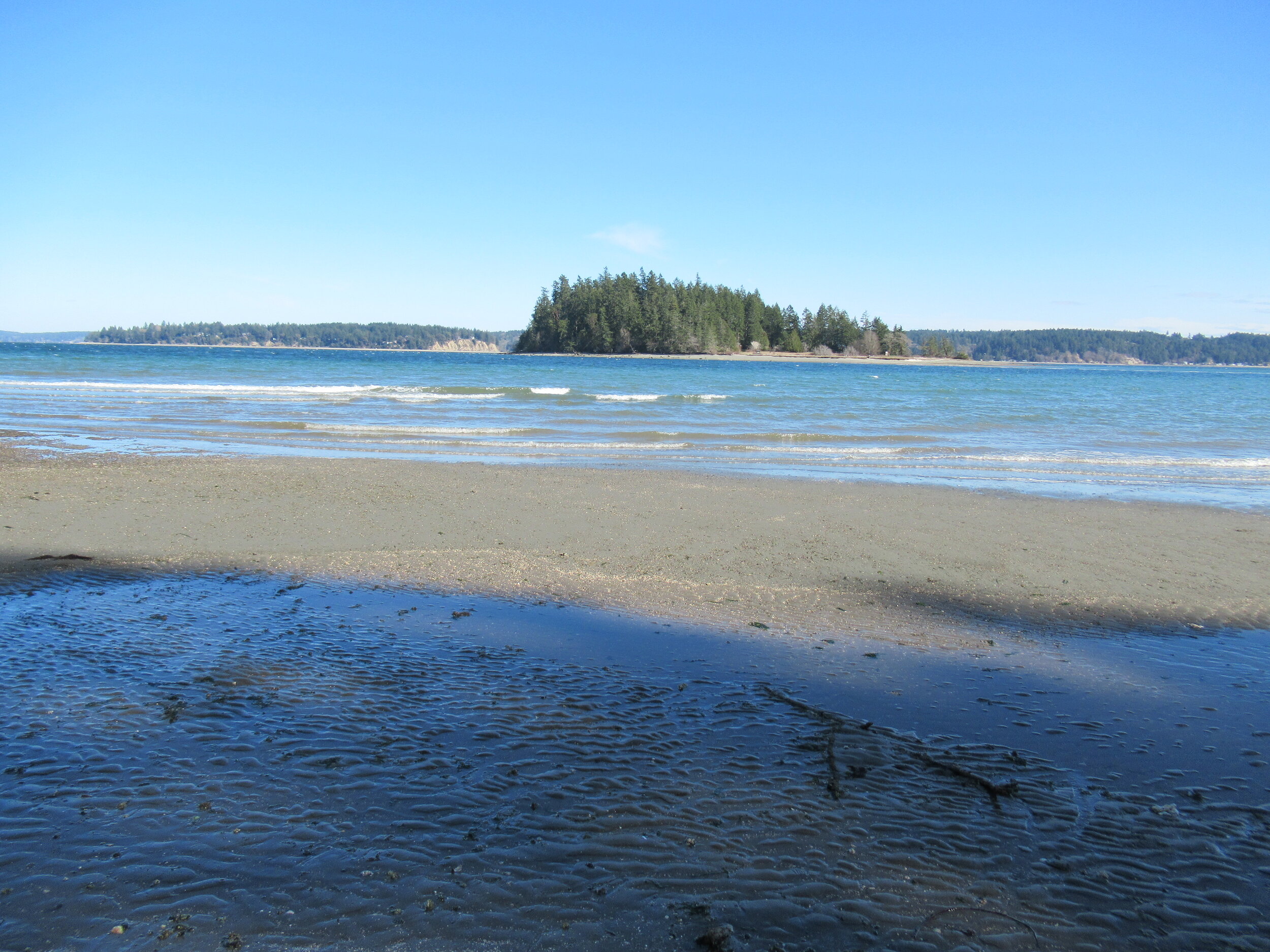
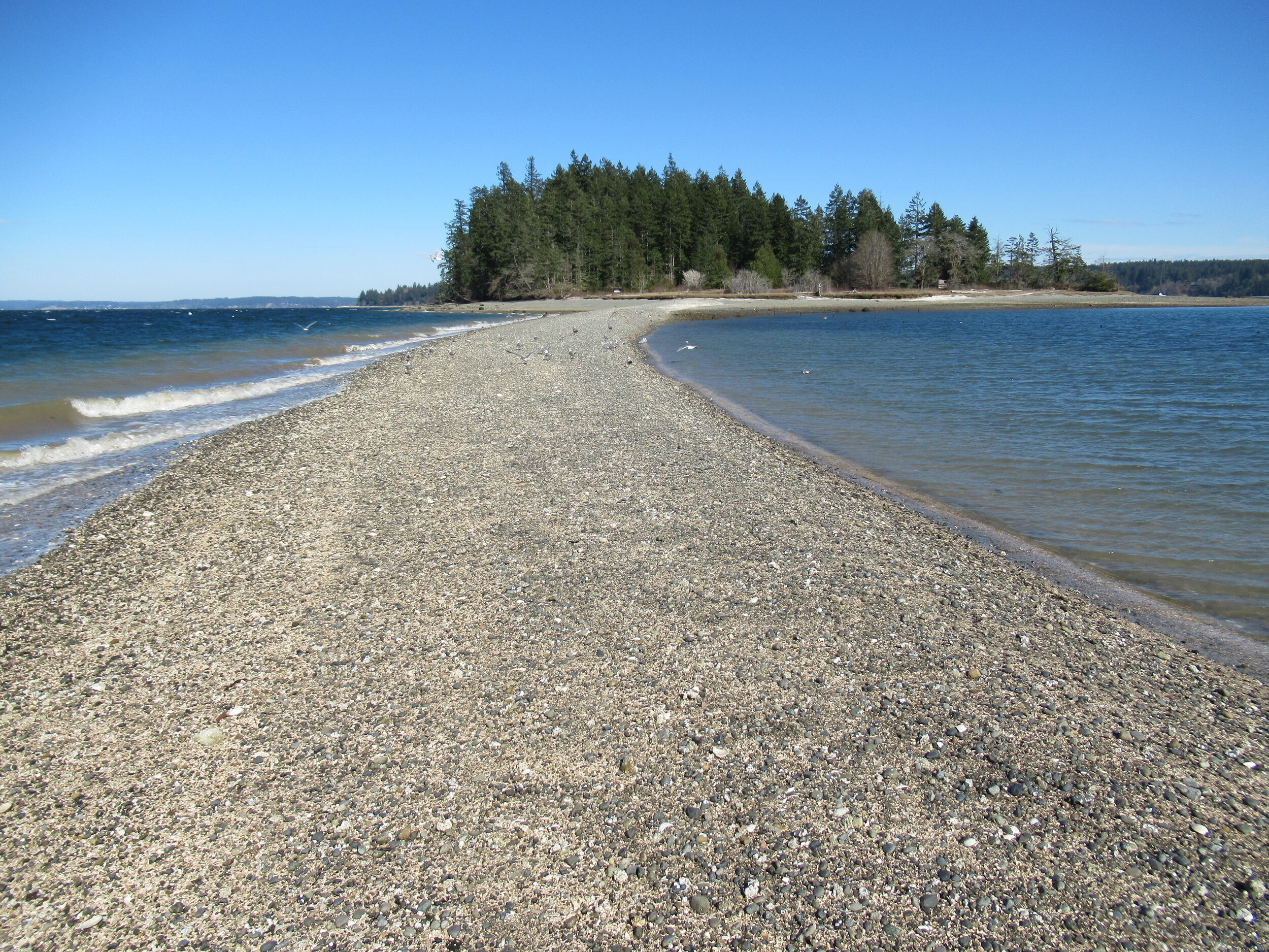
Head left through a row of big cedars and via a series of steps descend deeper into the ravine. After crossing a little creek the way emerges on a deserted beach. Look directly across Case Inlet to Herron Island and the Key Peninsula. Then look south and spot McMicken Island set against a backdrop of big beautiful Mount Rainier. If the tide is high, you’ll have to wait to hike the beach as overhanging trees prohibit passage. But in a low tide, a big wide easy to walk beach awaits your footprints.
Walk for more than a mile undulating between cobbles, mud and sand. Watch for sand dollars scatted across the tide flats. Look too for eagles, herons and a myriad of seabirds. Harstine is a wet place and plenty of side creeks fan out on the beach. You should be able to keep your shoes dry, but a pair of waterproof boots is not a bad idea. The entire way to the tombolo is on public tidelands. But there is a parcel of private property located between two large state park properties abutting the shoreline. Respect posted private property.
The tombolo is pretty distinctive in low tides—fairly wide and several feet raised above inlet waters. In high tides it’s completely submerged, although breakers will help you locate its position. It’s really fun to hike it when a receding tide first reveals it. Tap your inner Moses and part the seas watching the land bridge emerge as you amble along it.
Reaching the island
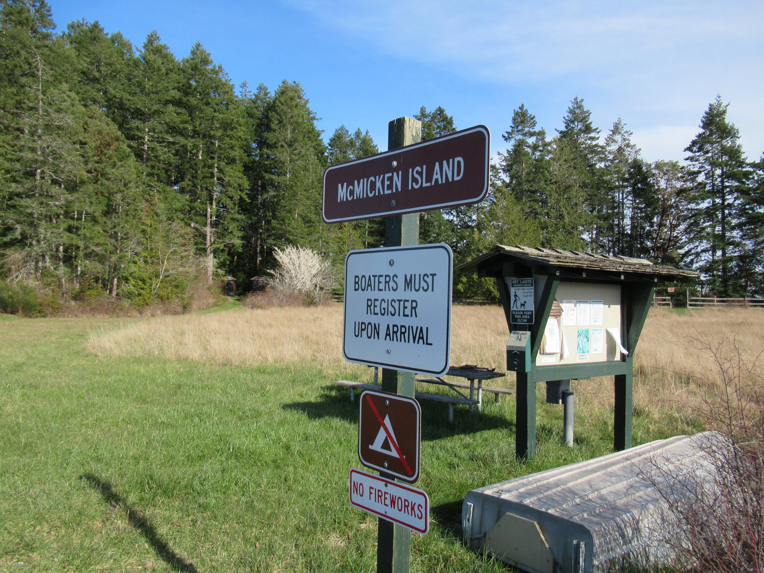
Once across the .2 mile sandy strip, reach McMicken Island. All of the little island except for a small fenced parcel with a couple of cabins is state park property. The private holding belongs to the family that once owned the entire island. They sold the island to the state withholding this small lot. Please keep out of it. The rest of the island however you are free to explore.
At the island’s western end is a small picnic area in a grassy opening. Here find some rare Garry oaks growing on a low bluff above the surf. Near a composting toilet at the eastern edge of the field is a small nature trail. Hike it! It weaves a half mile through towering firs and madronas to blufftop views on the eastern end of the island.
Be sure to explore the rocky tide flats surrounding the island too, and check out the large erratics scattered about. There is a particularly large one on the south side of the island. Enjoy your island wanderings and explorations—more than likely sharing it with no more than just a couple of other happy hikers. And be sure to keep track of the time and incoming tide so you don’t get trapped on the island.

Places to Stay
Waterfront cabin located on Harstine Is with beach access and a panoramic view of the Puget Sound, Mt. Rainier and McMicken island. Check availability
Hike back to Harstine Island State Park and call it a day or consider walking some more. The park contains three miles of trails. They traverse thick fir forests and swampy cedar groves and are family and dog-friendly.
McMicken Island Notes:

Forest Setting with Beach Access
Cross the bridge to Harstine Is. and enjoy a beautiful and quiet retreat in the woods. Relax in the comfortably furnished cabin or enjoy exploring the 5 acre property with meandering trails through a lovely forest. Check availability
Distance: 4.0 miles round trip
Difficulty: easy, pay attention to tides! Hike is only possible in low tides. Consult tide tables and plan accordingly. Dogs permitted on leash.
Trailhead Pass Needed: Discover Pass
GPS Waypoints: Harstine Island State Park Trailhead: N47 15.737 W122 52.236 McMicken Island Trailhead: N47 14.865 W122 51.780
Features: Kid and dog friendly, beach hiking, undeveloped coastline, small island reached via a sandbar, good bird watching, sublime views of Mount Rainier over Case Inlet.
Trailhead directions: From Olympia, head north on US 101 to Olympic Highway (SR 3) Exit in Shelton. Then turn and follow SR 3 east for 11.0 miles. Turn right onto Pickering Road (Signed for Harstine Island) and drive 3.3 miles. Then bear left onto Harstine Bridge Road and come to a T-junction upon entering Harstine Island. Go left on North Island Drive and after 3.0 miles turn right at the island community hall onto East Harstine Island Road. Proceed for one mile and turn left onto Yates Road. Continue 0.9 mile and turn right into Harstine Island State Park. Reach trailhead parking in 0.2 mile.

Hamma Hamma's Living Legacy Trail
Take a leisurely hike back into time on this delightful trail along the Hamma Hamma River to the historic Hamma Hamma Cabin.
By Craig Romano, feature columnist
Craig Romano, is an author of more than twenty hiking guidebooks including the bestselling Day Hiking Olympic Peninsula 2nd Edition (Mountaineers Books), which includes detailed descriptions for 136 hikes throughout the Olympic Peninsula. Visit CraigRomano.com for more information.
Take a leisurely hike back into time on this delightful trail along the Hamma Hamma River to the historic Hamma Hamma Cabin. Constructed by the Depression-era Civilian Conservation Corp (CCC), the cabin was used as a guard station in Olympic National Forest. Today it stands as a testament to the craftsmanship and hard work of the CCC. Learn more about “Roosevelt’s Tree Army” and their legacy on this family friendly interpretive trail.

Photo: Craig Romano
In April of 1933 in the midst of the Great Depression, newly inaugurated president Franklin D Roosevelt established the CCC through an executive order. Roosevelt’s aim was more than just putting young men to work and allowing them to provide for their families.
"Roosevelt strongly believed in the spiritual and physical values of working in nature, and in the importance of conservation of our natural resources for the nation’s health and prosperity."
At its height in 1935, more than 500,000 young men were stationed in more than 2900 CCC camps in every state as well as Puerto Rico and the Virgin Islands. At the program’s close in 1942, more than 3 million men (nearly 5% of the country’s male population) had served in the CCC. This trail sheds some light on what life was like for these men during their time in the Corp—and highlight some of their achievements and legacy.

Photo: Craig Romano
Among their many projects, CCC recruits were responsible for building vast amounts of infrastructure within parks and forests throughout the country—including both the Olympic National Park and Forest.
They also fought fires, reforested large tracts of land and worked on flood control projects. There were camps established right within Olympic National Park and Olympic National Forest, including one in the nearby Staircase Region. Nearby Twanoh State Park on Hood Canal also was the site of a large CCC camp.
Hit the Trail
Start your hike east on a wide and level path through a riparian forest of large mossy maples and speckled barked alders. The first quarter mile of this recently refurbished trail is ADA compliant. While this trail emphasizes the historic role the CCC played in this corner of Olympic National Forest, there is plenty of natural beauty to be enjoyed long the way as well. It is the only trail (albeit just for a short stretch) that runs along the Hamma Hamma River.

Photo: Craig Romano
The river’s name come from the Twana (whose ancestral lands included much of the Hood Canal region) word Hab’hab, which refers to a reed along the river’s banks. The name means big stink, or literally stinky, stinky in reference to the aroma the reeds emitted. The trail hugs a bank above the river allowing for some excellent views of the pretty waterway.
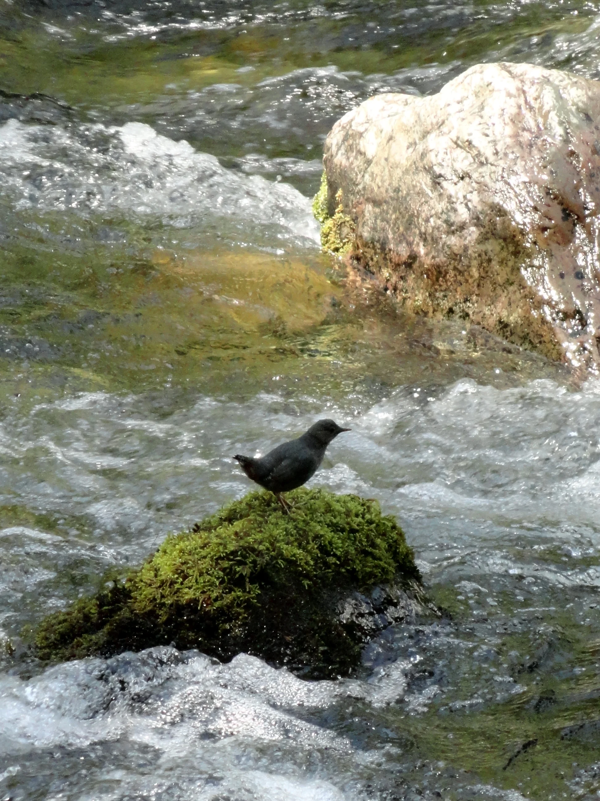
Photo: Craig Romano
Stop and look for dippers—robin sized birds that feed on aquatic insects and nest along the shorelines of rushing water. In spring look for Harlequin ducks returning from the Salish Sea. One of the prettiest sea ducks, they build hidden nests along rapid moving creeks and rivers.
The trail climbs a small bluff granting an excellent view of the pretty waterway, before leaving the river for forest. At 0.5 mile the trail turns north to cross Forest Road 25. Now walk along cascading Watson Creek climbing about 100 feet to a wooden bench on a perch overlooking the creek. It’s a great spot to sit and enjoy the sound of nature’s water music. By late spring nesting thrushes and other songbirds add a wide range of melodies.
The trail now turns west to soon reach the historic Hamma Hamma Guard Station. Built by the CCC from 1936 to 1937, it was used for administrative purposes for forest fire and trail crews. Today this eloquently rustic structure with its hexagonal bay window can be rented out for an overnight stay recreation.gov. Please respect the privacy of any guests staying at the cabin by not walking on the grounds. Otherwise wander around the structure. Note the landscaping too, especially the rhododendrons which will be in bloom come May.
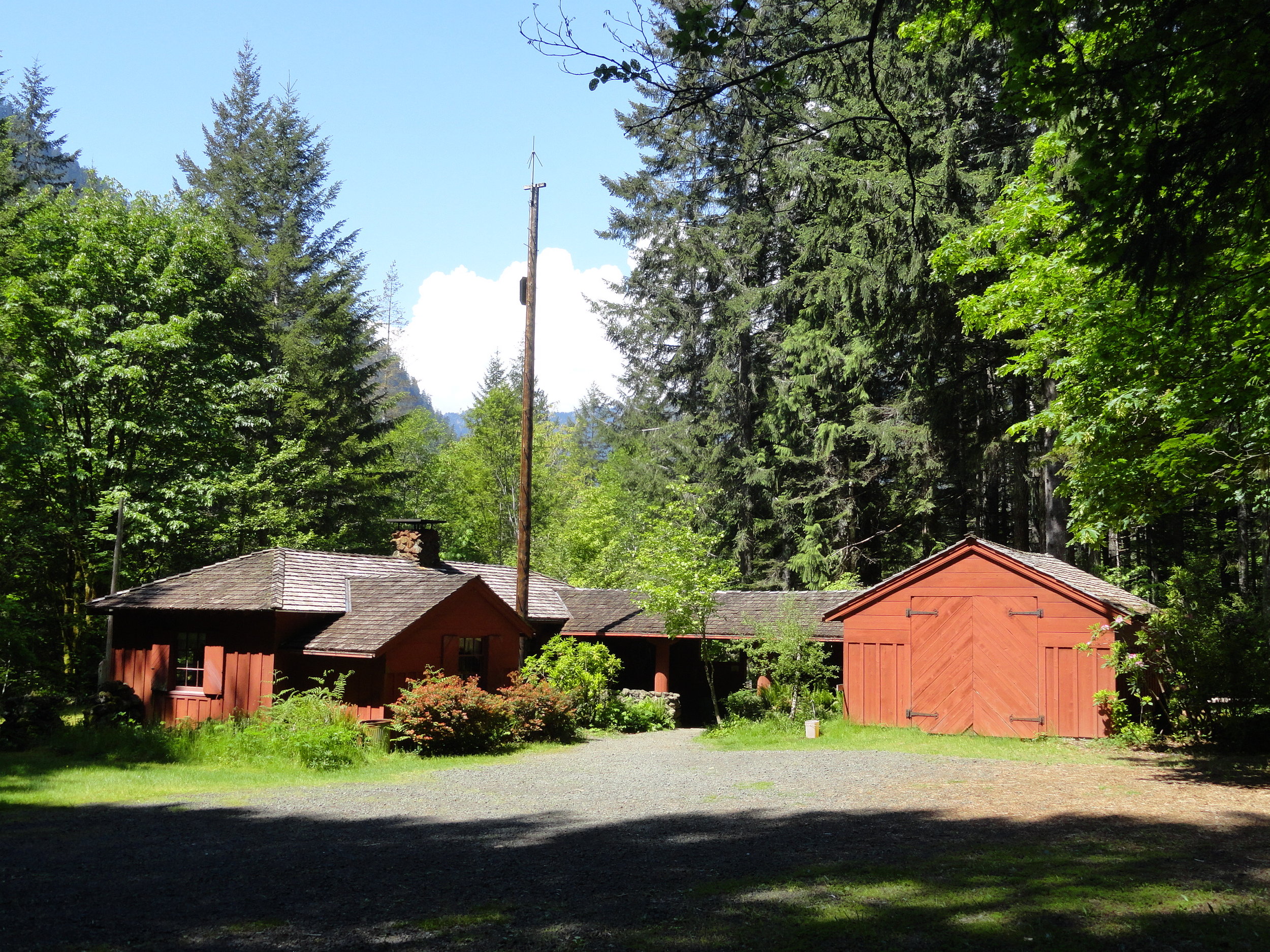
Photo: Craig Romano
After admiring the historic structure continue west on the loop crossing a small creek and traversing a grove of mature second growth firs. The way then descends into a ravine before re-crossing FR 25. Continue hiking passing some big beautiful old trees before reaching the campground loop road near campsite no. 6. Now turn right and walk the loop road a short distance back to your start closing your loop hike at 1.8 miles. Reflect on some of the achievements of the Corp including the thousands of miles of trails they built, more than 3400 fire towers constructed, nearly 3 billion trees planted, and the development of amenities and infrastructure in more than 800 parks across the nation. Many of their works are still standing and in use in Olympic National Park and Olympic National Forest as well as at several nearby state parks. The Corp’s legacy continues to live on for the next generation of outdoorsmen and women.

Getting Here
First .25 mile ADA; Leave No Trace Principles
Land Agency Contact: Olympic National Forest, Hood Canal Ranger District, www.fs.usda.gov/olympic
Recommended Map: Green Trails Olympic Mountains East 168S
Trailhead directions: From Hoodsport travel north on US 101 north for 13.7 miles turning left at milepost 318 turn onto FR 25 (Hamma Hamma River Road). Then continue west for 6.0 miles turning left into the Hamma Hamma Campground. Proceed for 0.1 mile to trailhead located near site no. 12.
Trailhead facilities: campsites (fee), privy

Hood Canal "Glamping"
If your idea of a camping excursion is freeze dried food and dry shampoo – and luxury to you is a bed of moss under your sleep sack or a solar-powered lamp – "glamping" may not hold much interest for you. Glamping or "glamor-camping" as the name suggest, goes WAY beyond the coleman stove and solar shower upgrade. If you crave a star-studded forest canopy while enjoying gourmet camp cuisine and all the comforts of home – bed, pillows, duvet, light switches– glamping may be a great compromise to get outdoors!
If your idea of a camping excursion is freeze dried food and dry shampoo – and luxury to you is a bed of moss under your sleep sack or a solar-powered lamp – "glamping" may not hold much interest for you. Glamping or "glamor-camping" as the name suggest, goes WAY beyond the coleman stove and solar shower upgrade. If you crave a star-studded forest canopy while enjoying gourmet camp cuisine and all the comforts of home – bed, pillows, duvet, light switches– glamping may be a great compromise to get outdoors!
Header Image credit: Poppi Photo
One of the best thing about "camping" is relaxing with a final roasted marshmallow and a steaming mug of hot chocolate. Wrapped in a cozy blanket, the tall trees keep you close in the inky darkness beyond the glow of the fire. Far from the glow and clatter of the city, the sky displays a covering of unrealistically bright stars. Good conversation and the people you love surrounding you. Who wants to consider the uncomfortable night ahead? Rocks in your lumbar. Slick "high performance" sleeping cocoons that tangle and suffocate. Never mind the 3:00 AM Call of Nature. Stumbling through the dark stubbing toes and tripping over roots.

Trailer camping is technically considered in the "glamping" category, above the waterfront view and tall trees at Twanoh State Park, Hood Canal definitely set the standards high.
Enter glamping. A purist would say if you want the experience of camping you need to embrace the whole experience, not cherry-pick the best parts. Galen Patterson, a journalist with Arcadia Weekly, remarks in a recent article, "in its luxury, comfortable camping (glamping) loses what makes the experience worth the discomfort in the first place." He goes on to say that, "instead of connecting with nature and all of its uncomfortable facets, people are bringing the comforts of home with them, and, in doing so, are sapping the spirit of what it means to connect to the outdoors." Patterson advocates that through discomfort and deprivation, he "finds appreciation and, with it, follows a new zest for life."
Hmmmm. So unless you are suffering you will not appreciate the wilderness? Good riddance. Rough camping has its place – when space is limited in your kayak or you are pack/wilderness camping and every extra ounce needs to be "weighed" in necessity. However, if you can enhance the joy of spending time outdoors by increasing the comfort level – there is no shame in that!
There are plenty of definitions of glamping. Some feel that cooking on anything beyond an open campfire is glamping. Others consider having cell service a mark of glamor camping. Perhaps it's sleeping in a bed off the ground, in a cabin or RV. Whatever the case, glamping is a more glamorous spin on camping and it is bringing a whole new level of interest to the camping scene. Love it or hate it, glamping is a thriving trend that continues to grow.
Give it A Try....
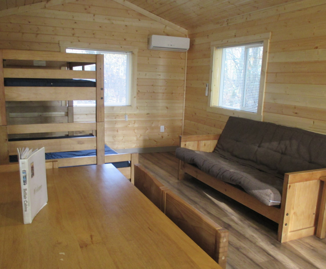
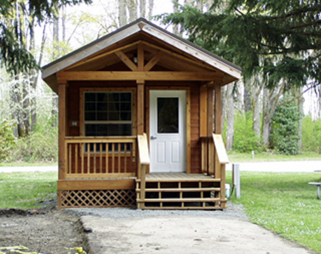
Belfair State Park is a 65 acre, year-round camping park on 3,720 feet of saltwater at the southern end of Hood Canal. It is noted for its saltwater tide flats, wetlands with wind-blown grasses and pleasant beach walking and swimming. Cabins sleep five and are furnished with tables and chairs. Outside is a picnic table and fire pit. Bathrooms and showers are nearby. All cabins are heated, but visitors should take along blankets and warm clothing as evenings can be cool. Belfair cabin rates range from $40 (off-season) to $69(peak). Reserve
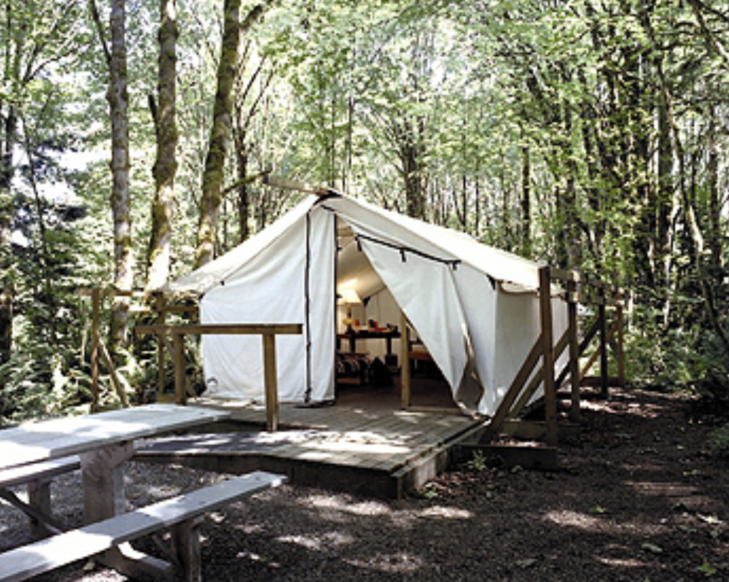
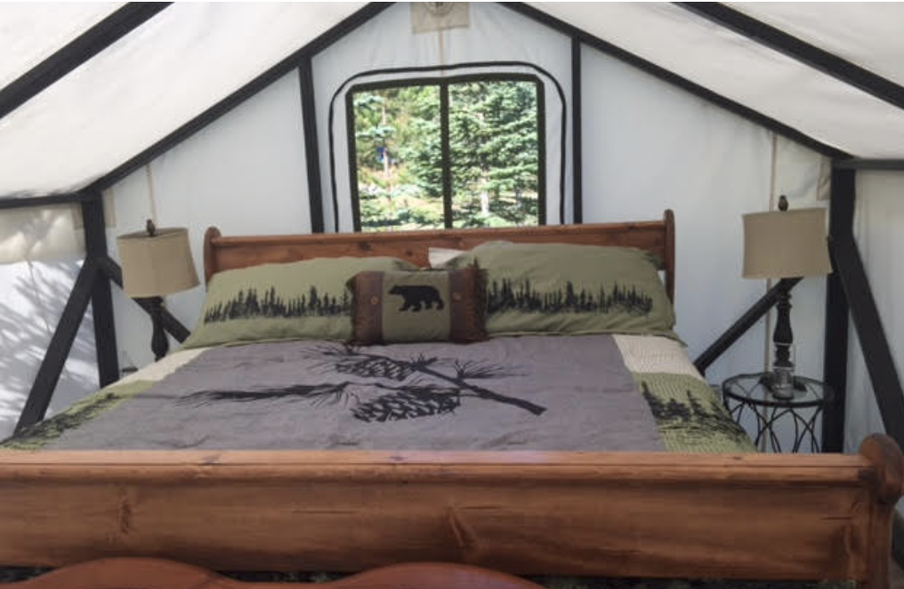
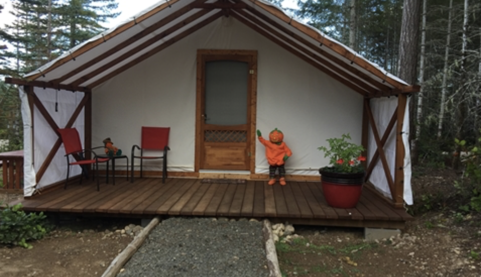
Dosewallips State Park offers canvas platform tents for rent. Situated in a maple forest near the Dosewallips River, the tent sleeps up to five people. Made of white canvas on wooden platforms, they are light inside, even on cloudy days. Each tent has three bunks, a futon, lights, table and heater. Outside is a deck, picnic table, fire grill and utility hookup. Bathrooms nearby. All platform tents are heated but campers must bring their own bed linens. Cabins at Dosewallips are situated among evergreen trees looking towards the Olympic Mountains. Each cabin features a covered porch, electric heat, lights and locking doors. Bathrooms are nearby. Tent and cabin rates range from $40 (off-season) to $69 (peak). Reserve

Hamma Hamma cabin is available through the Olympic National Forest
The Hamma Hamma Cabin in the Olympic National Forest is a historic cabin that offers guests a tranquil setting. Formerly a guard station, the cabin was built in 1937 by the Civilian Conservation Corps. The site is nominated to the National Register of Historic Places for the skill and craftsmanship that went into its construction and architecture. The cabin is open year-round. Accommodating up to six guests, the single-story cabin features a living room with a hexagonal bay window overlooking the Hamma Hamma River drainage. There are two bedrooms, one with a double bed and one with bunk beds. The bathroom has a flush toilet. The cabin is equipped with a propane heater and propane lights. An outdoor picnic table, fire ring and pedestal barbecue grill are available for cooking and campfires. Guests provide their own bedding, linens, towels, dish soap, matches, first aid kit, toilet paper and garbage bags. Reserve
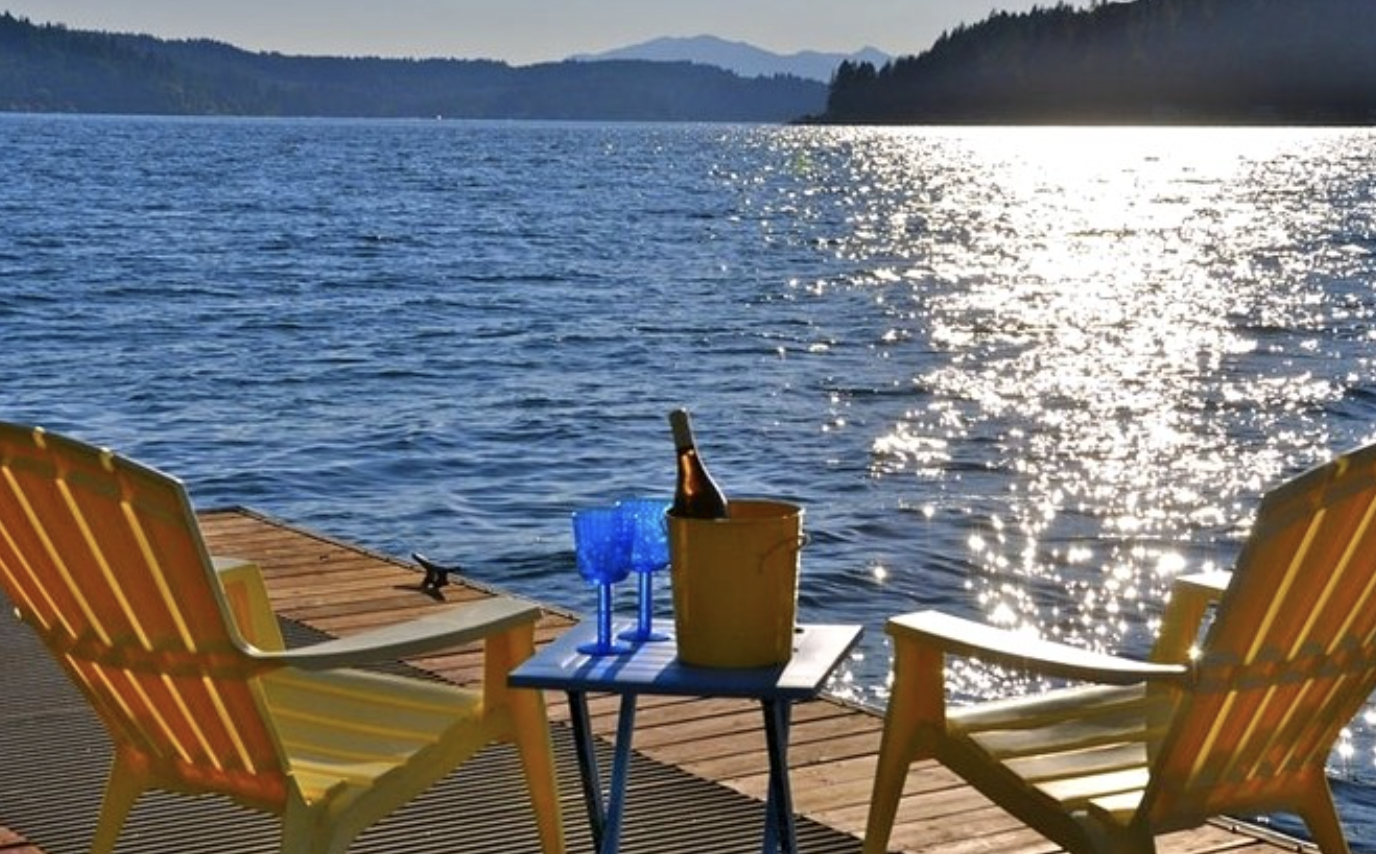
Located in Union, the Pebble Beach Cottage has two beds, one bathroom and can sleep up to 5-6 guests. Sitting approx. 75 feet from the water it has a beautiful view of the canal, and surrounded by a cedar forest. This carriage house is a bed and breakfast style stay with a part-time caretaker on sight. Guests enjoy privacy of a vacation home, (as this property is completely separate from the main house), yet access to concierge services. (Rate $195) Reserve at glampinghub.com.
The Tahuya Adventure Resort is located in the heart of the Tahuya Forest past Belfair. Featuring campsites with hook-ups and luxury platform tents, this is glamping heaven! The Log Cabin tent features a king size log bed, bunk-beds, oversized chairs and tables, pellet stove, carpet, refrigerator, microwave, and a coffee pot. Each site has an outdoor picnic table and fire ring or you are welcome to use their covered kitchen. (Rate $500/2 nights) Reserve at tahuyaresort.com.

The ultimate "glamping" experience can be provided by Hood Canal Events located in Union, WA. For a fee they can arrange the perfect getaway for you and your signifigant other – or the whole family. From setting up the camp & tent (pictured above) in a spectacular location, arranging tours, hikes or kayaking expeditions, to chef prepared gourmet meals in your camp – Jeff and Kerry can take care of it all for you. Call them directly at (360) 710-7452 or visit hoodcanalevents.org. Photo Poppi Photography
Hood Canal Events, based in Union, can provide unique glamping experiences. Offering everything from a Hood Canal beach glamor picnic (great for intimate gatherings, family picnicking, lounging, or celebrations) to a fully catered overnight trip, they can arrange special requests your group may have. Hood Canal Event's packages include furnishings, amenities, activities (kayaking to mushroom foraging or live music) and a chef for locally prepared food and beverages. Overnight glamping packages are available. For information on rates or customizing an experience, call (360) 710-7452, or visit hoodcanalevents.org.
Above are just a few ways you can elevate your "glamping" experience on Hood Canal. There is no wrong way to do it. If you prefer backcountry camping, with your home on your back and no connection to civilization, the Olympic National Park has that too. Camp for days and never see another soul in the backcountry areas. Talk about "finding appreciation."
If camping or glamping is not your thing thats cool too. Hood Canal and South Puget Sound have wonderful guest lodging and rentals right on the beach – with power and flush toilets. Visit explorehoodcanal.com/lodging for a complete list that is updated weekly.
Whatever you choose, just get out there and create some great memories – stubbed toes or not!